Antique Naval Maps
4
to
11
45
20
29
29
16
9
9
8
7
7
4
4
4
3
3
3
2
2
2
2
2
2
2
2
1
1
1
1
1
1
1
1
1
1
2
1
1
1
1
Sort By
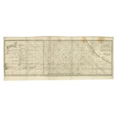
Antique Map of the Pacific Ocean by Anson, 1765
Located in Langweer, NL
Antique map titled 'Carte de la Mer du Sud ou Mer Pacifique - Kaart van de Zuyd-Zee of stille
Category
18th Century Antique Naval Maps
Materials
Paper
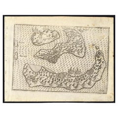
Antique Map of the Banda Islands by Commelin, 1646
Located in Langweer, NL
Corneliszoon van Neck (1564-1638) was a Dutch naval officer and explorer, who led the second Dutch expedition
Category
17th Century Antique Naval Maps
Materials
Paper
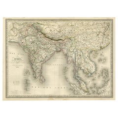
Superb, Large Map of British India, Chinese Empire, Indochina, Malaysia, 1860
Located in Langweer, NL
'Graveur du Depot de la Marine' and in this position engraved numerous French naval and military maps
Category
1860s Antique Naval Maps
Materials
Paper
H 22.8 in W 31.07 in D 0 in
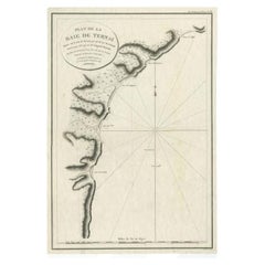
Antique Map of the Bay of Terney by La Pérouse, 1797
Located in Langweer, NL
Antique map titled 'Plan de la Baie de Ternai'. Old map of the north eastern coast of Russia. This
Category
18th Century Antique Naval Maps
Materials
Paper
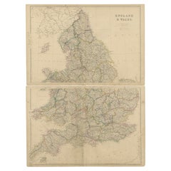
1859 Vintage Maps of England and Wales: Blackie's Imperial Geographic Detail
Located in Langweer, NL
. **Coastal and Maritime Features**: Given the importance of maritime trade and naval power, the map likely
Category
Mid-19th Century Antique Naval Maps
Materials
Paper
H 14.57 in W 21.26 in D 0.02 in
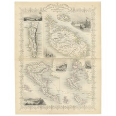
Old Map of British Mediterranean Territories with Images of Historic Sites, 1851
Located in Langweer, NL
this map were crucial naval bases and points of control that allowed the British Empire to exert
Category
1850s Antique Naval Maps
Materials
Paper
H 14.26 in W 10.71 in D 0 in
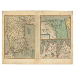
Three Antique Maps on One Folio: Turkey, Northern Egypt, and Ancient Carthage
Located in Langweer, NL
was a prominent ancient city known for its naval prowess, and this map may reflect its historical
Category
16th Century Antique Naval Maps
Materials
Paper
H 12.72 in W 19.49 in D 0 in
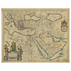
Imperial Splendor: Antique Map of the Ottoman Empire by Blaeu, circa 1640
Located in Langweer, NL
The antique map titled 'Turcicum Imperium' is an original old map of the Ottoman Empire
Category
Mid-17th Century Antique Naval Maps
Materials
Paper
No Reserve
H 17.33 in W 21.54 in D 0.02 in
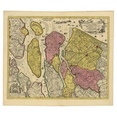
Detailed Map of Southern Holland, Incl the Hague, Rotterdam, Delft, Gouda, c1680
Located in Langweer, NL
Antique map titled 'Delflandia, Schielandia et circumjacentes Insulae ut Voorna, Overflackea
Category
1680s Antique Naval Maps
Materials
Paper
H 20.79 in W 24.14 in D 0 in
Map of Sevilla Province, 1901: A Depiction of The Spanish Cultural Heartland
Located in Langweer, NL
The print for sale here depicts a historical map of the province of Sevilla (Seville) from the year
Category
Early 1900s Antique Naval Maps
Materials
Paper
Free Shipping
H 14.77 in W 20.08 in D 0 in
Italy, Sicily, Sardinia, Corsica and Dalmatian Coast: A 17th Century Dutch Map
By Theodorus Danckerts
Located in Alamo, CA
be seen sailing in the waters as a naval battle rages in the Tyrrhenian Sea.
The map is presented
Category
Late 17th Century Dutch Antique Naval Maps
Materials
Paper
H 18.13 in W 31.25 in D 1.38 in
Antique Map of New Ireland Island in the Bismarck Archipelago, New Guinea, 1772
Located in Langweer, NL
Antique map titled 'Nova Hibernia'. Antique map of New Ireland, an island in the Bismarck
Category
18th Century Antique Naval Maps
Materials
Paper
H 17.52 in W 11.03 in D 0 in
Original Engraved Map of Saint Lucia in the West Indies by Bellin, 1758
Located in Langweer, NL
Hydrographer and engineer of the French Navy, is a remarkable antique map showcasing the intricate details of
Category
1750s Antique Naval Maps
Materials
Paper
Antique Map of Asia Minor, showing Turkey, Cyprus and the Islands in the Aegean
Located in Langweer, NL
Antique map titled 'Natolia, quae olim Asia Minor'. Decorative map of Asia Minor, showing Turkey
Category
Mid-17th Century Antique Naval Maps
Materials
Paper
H 20.99 in W 24.81 in D 0.02 in
17th Century Topographical Map of Cote D'azur, Avignon, Frejus by Iohan Peeters
Located in New York, NY
Fine topographical 17th century map by Iohan Peeters of the towns of Avignon and Frejus in the Cote
Category
17th Century Dutch Antique Naval Maps
Materials
Paper
H 12.5 in W 15 in D 0 in
Antique Map of Mar del Sur, Chile, Peru, New Guinea and Tierra del Fuego, 1621
Located in Langweer, NL
Uncommon and rare map of Mar del Sur and the coast of Peru. With inset maps of part of New Guinea
Category
17th Century Antique Naval Maps
Materials
Paper
H 17.33 in W 6.7 in D 0 in
Large Antique Chart of The White Sea, Russa 1854
Located in Langweer, NL
Antique map titled 'The White Sea Index Chart'. Large uncommon map of the White Sea with a smaller
Category
19th Century Antique Naval Maps
Materials
Paper
Original circa 1900 Graves & Sons Naval Military Campaign Parter Desk Map Drawer
Located in GB
We are delighted to offer this very rare original Graves & Son’s stamped Naval Military Campaign
Category
Early 1900s English Campaign Antique Naval Maps
Materials
Leather, Hardwood
H 29.73 in W 44.3 in D 23.23 in
Antique Portrait of Bentinck, a Dutch Naval Hero by Vinkeles
Located in Langweer, NL
Antique portrait titled 'Wolter Jan Gerrit Baron Bentinck (..)'. Portrait of the Dutch naval hero
Category
18th Century Antique Naval Maps
Materials
Paper
Original Georgian / Regency Military Campaign Desk with Large Map Drawer
Located in GB
Military campaign desk with large top map drawer
A very well made piece in fine mahogany with all the
Category
Early 1800s English Georgian Antique Naval Maps
Materials
Hardwood
H 35.44 in W 50.2 in D 23.63 in
17th Century Dutch Map of Italy, Sicily, Sardinia, Corsica and Dalmatian Coast
By Theodorus Danckerts
Located in Alamo, CA
seen sailing in the waters as a naval battle rages in the Tyrrhenian Sea.
The map is presented in a
Category
1690s Antique Naval Maps
Materials
Engraving
H 18.13 in W 31.25 in D 1.38 in
Antique Portrait of Captain Van Kinsbergen, Proof
Located in Langweer, NL
Antique portrait titled 'De Ridder van Kinsbergen, Kapitein ter Zee'. Portrait of the Dutch naval
Category
18th Century Antique Naval Maps
Materials
Paper
Antique Print of an Ancient Bireme, 1802
Located in Langweer, NL
history of naval ships from ancient times onwards.
Condition: Fair, general age-related toning. Shows
Category
19th Century Antique Naval Maps
Materials
Paper
Antique Print of an Ancient Bireme from Basius, 1802
Located in Langweer, NL
and Engravers: John Charnock's 'History of Marine Architecture' was an important history of naval
Category
19th Century Antique Naval Maps
Materials
Paper
Antique Print of Ambon Island, Indonesia, by Dumont d'Urville, 1833
Located in Langweer, NL
Dumont D'Urville.
Artists and Engravers: Published by J. Tastu. Dumont was a French explorer and naval
Category
19th Century Antique Naval Maps
Materials
Paper
Antique Print of Gibraltar, c.1720
Located in Langweer, NL
an Anglo–Dutch naval force led by Sir George Rooke and Prince George of Hesse-Darmstadt. Originates
Category
18th Century Antique Naval Maps
Materials
Paper
William IV Terrestrial And Celestial Floor Globes By J. W. Cary
By John & William Cary
Located in New Orleans, LA
, these precisely detailed maps of the earth and skies were also crucial instruments of learning and
Category
19th Century English Regency Antique Naval Maps
Materials
Mahogany
Carte d'une Partie de l'Amerique Septentrionale
By Francois Soules
Located in Florham Park, NJ
).
________________________________________
DATE OF PUBLICATION : R1787 (1781MS)
PLACE OF PUBLICATION : PARIS
DESCRIPTION : THIS MAP SHOWING
Category
18th Century and Earlier Academic Antique Naval Maps
Materials
Engraving
Antique Print of Two Japanese Vessels, 1799
Located in Langweer, NL
Galaup de La Pérouse (1741-1788) was a French Naval officer and explorer whose expedition vanished in
Category
1790s Antique Naval Maps
Materials
Paper
Original Antique WWI Poster Reality Of War At Sea Ship Submarine Guerre Sur Mer
Located in London, GB
Mer - depicting images of military ships and submarines with a maritime map of the war / Carte
Category
1910s French Antique Naval Maps
Materials
Paper
H 24.81 in W 19.69 in D 0.04 in
Antoine Lafrery Set of 6 Engraving "Speculun Romanae Magnificen" 16th Century
Located in Beuzevillette, FR
monument was made to commemorate a naval victory or victorious sea campaigns. The one in the picture was
Category
16th Century Italian Renaissance Antique Naval Maps
Materials
Paper
H 19.3 in W 13.78 in D 0.4 in
Our Fathers, To The Memory of the nameless Killed and Wounded.
By William Lionel Wyllie
Located in Storrs, CT
during the naval manoeuvres of 1913 and which first appeared in the Journal, The Naval & Military Record
Category
Early 20th Century Antique Naval Maps
Materials
Etching
H 20 in W 16 in D 0.5 in
Old Antique Print showing a Rostral Column in Rome, Italy, 1704
Located in Langweer, NL
where they were erected to commemorate a naval military victory. This original old antique print / plate
Category
18th Century Antique Naval Maps
Materials
Paper
Captain James Cook: 18th C. Portrait by William Hodges After Cook's 2nd Voyage
By William Hodges
Located in Alamo, CA
border. Captain Cook is dressed in his naval dress uniform, with a topcoat over a lace shirt. The
Category
1770s Antique Naval Maps
Materials
Engraving
Original Antique WWI Poster Reality Of War At Sea Ship Submarine Guerre Sur Mer
Located in London, GB
Mer - depicting images of military ships and submarines with a maritime map of the war / Carte
Category
1910s Antique Naval Maps
Materials
Paper
Rare Map 1710 Johann Homann Regnorum Hispaniae et Portugalliae Taula Generalis
By Johann Baptist Homann
Located in Drottningholm, SE
cartouche, and elaborate naval scene.
Of the three general maps of Spain engraved by Johann Baptiste
Category
1710s Dutch Antique Naval Maps
Materials
Paper
H 25.2 in W 28.35 in D 0.79 in
Map of the American Revolution Siege of Yorktown
By Julius Bien
Located in New York, NY
Rare, original 1863 map by famous American lithographer Julius Bien entitled "A Plan of Yorktown
Category
1860s Realist Antique Naval Maps
Materials
Lithograph
Cased Station Pointer
Located in Salisbury, GB
A cased Victorian naval station pointer or three arm protractor by Henry Hughes of 59 Fenchurch
Category
Late 19th Century Antique Naval Maps
T Admiraliteytshof - View of the Admiralty-Court in Rotterdam.
By Johannes de Vou
Located in Zeeland, Noord-Brabant
de Vou (c. 1655/65-1707) was active in Rotterdam as a etcher and naval architect around 1680-1700
Category
1690s Antique Naval Maps
Materials
Etching
1855 Pictorial Map of the United States, Pub by Ensign, Bridgman & Fanning
Located in Colorado Springs, CO
This is a large and highly decorative 1855 wall map of the United States. Issued by Ensign
Category
1850s American Antique Naval Maps
Materials
Paper
Very Old Engraving of Casablanca (Anfa), Azemmour (Azamor) and Diu, 1574
Located in Langweer, NL
miles square. The struggle for dominion over it culminated in a fierce naval battle in 1509 which pitted
Category
16th Century Antique Naval Maps
Materials
Paper
Antique Original circa 1880 Naval Military Campaign Parter Desk Map Drawer
Located in GB
We are delighted to offer this very rare original Naval Military Campaign officers desk
This is
Category
1880s English Campaign Antique Naval Maps
Materials
Leather, Mahogany
H 31.3 in W 41.15 in D 24.02 in
The Dardanelles Strait: A Strategic Passage in a Colored Lithograph, 1853
Located in Langweer, NL
Strait's enduring importance in naval history and international relations.
More info of the publication in
Category
1850s Antique Naval Maps
Materials
Paper
Free Shipping
H 18.39 in W 6.7 in D 0 in
Narrative of Travels and Discoveries in Northern and Central Africa, 1826
Located in Langweer, NL
portrait frontispiece, folding map, 36 engraved plates and maps, including one hand-coloured aquatint
Category
Mid-19th Century Antique Naval Maps
Materials
Paper
H 11.03 in W 8.86 in D 1.97 in
“The Solider in our Civil War” A Pictorial History of the Conflict 1861-1865
Located in Colorado Springs, CO
illustrated with numerous maps and portraits, and many double-page wood engravings after sketches by various
Category
1890s American Antique Naval Maps
Materials
Paper
H 17 in W 12 in D 3.5 in
"The Soldier in Our Civil War" a Pictorial History of the Conflict
Located in Colorado Springs, CO
soldier, profusely illustrated with numerous maps and portraits, and many double-page wood engravings
Category
1880s Antique Naval Maps
"Battles of America by Sea and Land" by Robert Tomes and John Laird Wilson, 1878
Located in Colorado Springs, CO
engraved plates of naval and military scenes, maps, and portraits of commanders. Several of the engravings
Category
1870s American Antique Naval Maps
Materials
Leather, Paper
H 11.5 in W 9.25 in D 3 in
Patek Philippe Yellow Gold Imperial Russian Chronometro Gondolo Pocket Watch
By Patek Philippe
Located in New Orleans, LA
and naval history.
An intricately rendered engraving of the Russian Imperial Standard surmounts the
Category
Early 20th Century Swiss Antique Naval Maps
Materials
18k Gold
Oil Painting Portrait of Lord Edward Grenfell, 1st Baron St Just (1870-1941)
By Oswald Birley
Located in London, GB
Battle of the Somme). Birley focussed on making maps and models of positions to be assaulted by First
Category
Early 20th Century Victorian Antique Naval Maps
Materials
Oil
Original Hand-Colored Antique Map Illustrating Routes of Naval Explorers, C.1740
Located in Langweer, NL
Antique map titled 'Mappe-Monde dresse sur les Observations de mrs. de l'Academie Royale des
Category
1740s Antique Naval Maps
Materials
Paper
Free Shipping
H 21.15 in W 26.3 in D 0 in
Map of Greece, Macedonia, Thrace from the time of the Peloponnesian War, 1880
Located in Langweer, NL
The map titled "GRAECIA, MACEDONIA, THRACIA et inde a bello Peloponnesiaco tempore," translates to
Category
1880s Antique Naval Maps
Materials
Paper
No Reserve
H 15.56 in W 18.51 in D 0 in
Engraved Map by Bellin of Saint Lucia or Sainte Lucie in the West Indies, 1764
Located in Langweer, NL
Hydrographer and engineer of the French Navy, is a remarkable antique map showcasing the intricate details of
Category
Late 19th Century Antique Naval Maps
Materials
Paper
1 bid
No Reserve
H 9.65 in W 14.57 in D 0 in
Antique Chart Showing the Track of an American Squadron by Perry, 1855
Located in Langweer, NL
Antique map titled 'Chart showing the track of the Flagships (..)'. Original antique map of Africa
Category
19th Century Antique Naval Maps
Materials
Paper
Free Shipping
H 11.42 in W 17.72 in D 0 in
Naval and Military Memoirs of Great Britain, from 1727 to 1783, circa 1804
Located in Colorado Springs, CO
include a folding map and facsimile plate. Bound in later period three-quarter blue calf and cloth binding
Category
Early 1800s Antique Naval Maps
Antique Print of a Venetian Galleon and Ship of the Spanish Armada
Located in Langweer, NL
an important history of naval ships from ancient times onwards.
Condition: Fair, general age-related
Category
19th Century Antique Naval Maps
Materials
Paper
Antique Ship Print of a Venetian Galleas and Venetian Galley, 1802
Located in Langweer, NL
important history of naval ships from ancient times onwards.
Condition: Fair, general age-related toning
Category
19th Century Antique Naval Maps
Materials
Paper
History of the Flag of the United States of America
Located in New York, NY
History of the Flag of the United States of America, and of the Naval and Yacht-Club Signals, Seals
Category
1880s Antique Naval Maps
Materials
Engraving
H 10 in W 7.5 in D 2.25 in
Antique Hand Colored Steel Engraving of the Commodore of the Navy under Napoleon
Located in Alamo, CA
) was Admiral of France, a Peer of France and a Naval Minister. Napoléon made him a Capitaine de
Category
Mid-19th Century Other Art Style Antique Naval Maps
Materials
Engraving
Antique English Chart of The Mediterranean Sea, 1795
Located in Langweer, NL
Antique map titled 'A Correct Chart of the Mediterranean Sea'. Engraved for Malham's Naval
Category
18th Century Antique Naval Maps
Materials
Paper
Early View of HAVANA HARBOR, Cuba
By Elias Durnford
Located in Santa Monica, CA
. England’s naval supremacy had already given her the upper hand in the West Indies, and in June a large
Category
1760s Old Masters Antique Naval Maps
Materials
Engraving
- 1
Get Updated with New Arrivals
Save "Antique Naval Maps", and we’ll notify you when there are new listings in this category.
Antique Naval Maps For Sale on 1stDibs
Find a variety of antique naval maps available on 1stDibs. Frequently made of paper, hardwood and wood, all antique naval maps available were constructed with great care. There are all kinds of antique naval maps available, from those produced as long ago as the 18th Century to those made as recently as the 20th Century. Antique naval maps are generally popular furniture pieces, but Georgian style is often sought at 1stDibs. Antique naval maps have been a part of the life’s work for many furniture makers, but those produced by Theodorus Danckerts are consistently popular.
How Much are Antique Naval Maps?
Prices for antique naval maps can differ depending upon size, time period and other attributes — at 1stDibs, antique naval maps begin at $73 and can go as high as $4,955, while the average can fetch as much as $713.
More Ways To Browse
Patek Philippe Russia
Patek Split Second Chronograph
Patek Philippe Chronometro Gondolo Pocket Watch
Patek Philippe Split Second
Patek Gondolo Pocket Watch
Patek Philippe Gondolo Pocket Watch
Imperial Swiss Pocket Watch
Patek Philippe Chronometro Gondolo
John Leone
Patek Philippe Homage
Rocky Mountain Hardware
Patek Philippe Facts
Largest Patek Philippe Watch
Largest Patek Philippe
Patek Philippe Split Seconds Chronograph
Patek Philippe Masterpiece
Winfield China
Baltic Watch
