Indian Ocean Map
to
7
18
3
12
7
7
4
4
3
3
2
2
2
2
2
2
1
1
1
1
1
1
1
2
1
1
1
Sort By
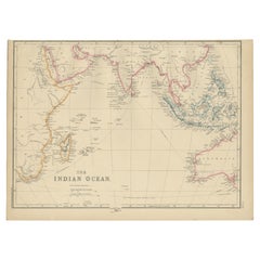
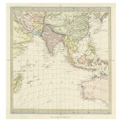
Antique Map of the Indian Ocean by W. G. Blackie, 1859
Located in Langweer, NL
Antique map titled 'The Indian Ocean'. Original antique map of the Indian Ocean. This map
Category
Antique Mid-19th Century Maps
Materials
Paper
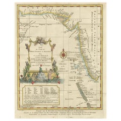
1773 Map of Persia, Gujarat & Malabar Coasts – Arabia to India, Hand-Colored
Located in Langweer, NL
, Persia coast map, Gujarat map, Malabar map, Arabian Sea chart, antique Indian Ocean map, E. van Harrevelt
Category
Antique 1780s Maps
Materials
Paper
H 11.23 in W 9.26 in D 0.01 in
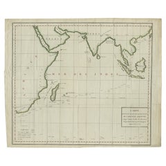
Antique Map of South East Asia, Australia and the Indian Ocean, 1726
By F. Valentijn
Located in Langweer, NL
Asia and the Indian Ocean. The map features a fine depiction of the outlines of the western two-thirds
Category
Antique Mid-18th Century Dutch Maps
Materials
Paper
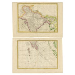
Old Map of Indian Ocean & Sumatra, Java, Borneo, India, Arabia, Africa, c.1783
Located in Langweer, NL
depicting the Indian Ocean and surroundings including Sumatra, Java, Borneo, India, Arabia, Africa and
Category
Antique 1780s Maps
Materials
Paper
H 20.87 in W 25.4 in D 0 in
Charting the Course of Empire: Bonne's 1770 Masterpiece Maps of the Indian Ocean
Located in Langweer, NL
of land and sea across the Indian subcontinent and its surrounding waters. These are not mere maps
Category
Antique 1770s Maps
Materials
Paper
H 14.18 in W 20.28 in D 0 in
Antique Map of Southern Asia, the East Indies and the Indian Ocean, ca.1840
Located in Langweer, NL
Original antique map of Southern Asia, the East Indies and the Indian Ocean. Also shows part of
Category
Antique 1840s Maps
Materials
Paper
H 13.39 in W 16.15 in D 0 in
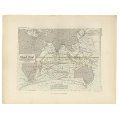
Antique Physical Chart of the Indian Ocean by Johnston '1850'
Located in Langweer, NL
Antique map titled 'Physical Chart of the Indian Ocean showing the temperature of the water
Category
Antique Mid-19th Century Maps
Materials
Paper
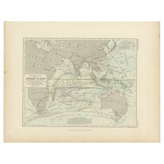
Antique Physical Chart of the Indian Ocean by Johnston, 1850
Located in Langweer, NL
Antique map titled 'Physical Chart of the Indian Ocean'. This map shows the temperature of the
Category
Antique 19th Century Maps
Materials
Paper
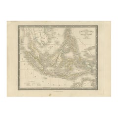
Antique Map of the East Indies by Wyld '1845'
Located in Langweer, NL
Antique map titled 'Archipelago of the Indian Ocean'. Original antique map of the East Indies. This
Category
Antique Mid-19th Century Maps
Materials
Paper
Antique Map of the Empire of the Great Mogul
Located in Langweer, NL
beasts, including lions, tigers and elephants roam the interior, while a ship sails in the Indian Ocean
Category
Antique Late 17th Century Maps
Materials
Paper
1817 Large Northern Hindostan Map by J. Thomson – New General Atlas
Located in Langweer, NL
the Indian Ocean are well-represented. The map also contains an inset showing the Isle of Ceylon
Category
Antique 1810s Maps
Materials
Paper
Original Antique Ptolemaic Map of the Region of Thailand and Malaysia
Located in Langweer, NL
the east of that. This depiction embodies the legacy of Ptolemy's idea of a landlocked Indian Ocean
Category
Antique 16th Century Maps
Materials
Paper
Original 1806 Engraved Map of Asia and Surrounding Regions by John Cary
Located in Langweer, NL
to parts of New Holland (Australia) and the Indian Ocean in the south.
The map is finely engraved
Category
Antique Early 1800s Maps
Materials
Paper
H 19.41 in W 21.46 in D 0.01 in
Antique Map of Kerguelens Island Coast in the Indian Ocean by Cook, 1785
By James Cook
Located in Langweer, NL
Antique print titled 'Kerguelen's Land (..)'. Antique map of Kerguelens island coast, known today
Category
Antique 18th Century Prints
Materials
Paper
Map of the World: An Original 18th Century Hand-colored Map by E. Bowen
Located in Alamo, CA
, Pacific, and Indian Oceans. The map is laid out according to the Mercator projection, a type of
Category
Mid-18th Century Old Masters Landscape Prints
Materials
Engraving
Persiae, Armeniae, Natoliae et Arabiae Descriptio per Frederick deWit 1666 map
Located in Paonia, CO
Indian Ocean. Unlike in many antique maps of the area, a great amount of geographic information is shown
Category
1660s Realist Landscape Prints
Materials
Engraving
Map of Kerguelen’s Land: The Island of Desolation Explored by Captain Cook
Located in Langweer, NL
those of Marc-Joseph Marion du Fresne, who explored parts of the Indian and Pacific Oceans.
This map
Category
Antique 1780s Prints
Materials
Paper
H 9.45 in W 15.04 in D 0 in
Map Tabula Asiae IX Pakistan Afghanistan Iran Indian Ocean
Located in Florham Park, NJ
edition. The work was illustrated with 64 double page engraved maps. Twenty-seven were Ptolemaic and
Category
16th Century Realist Prints and Multiples
Materials
Copper
H 16.75 in W 19 in D 2 in
Antique Map of the East Indies by De Wit, 1662
By Frederick de Wit
Located in Langweer, NL
, extending from China and the Philippines in the east, to the Indian Ocean in the west. This map served as
Category
Antique 17th Century Maps
Materials
Paper
Original Vintage Poster By L.M. Gill - A Great Industry Where Our Tea Comes From
By "Leslie MacDonald ""Max"" Gill"
Located in London, GB
general smaller map showing the countries with the Indian Ocean on the right, the maps featuring the city
Category
Vintage 1920s British Posters
Materials
Paper
H 39.97 in W 25.01 in D 0.04 in
Original Vintage Poster By L.M. Gill - A Great Industry Where Our Tea Comes From
By "Leslie MacDonald ""Max"" Gill"
Located in London, GB
general smaller map showing the countries with the Indian Ocean on the right, the maps featuring the city
Category
1920s More Prints
Materials
Paper
Get Updated with New Arrivals
Save "Indian Ocean Map", and we’ll notify you when there are new listings in this category.
Indian Ocean Map For Sale on 1stDibs
Find many varieties of an authentic Indian ocean map available at 1stDibs. Each Indian ocean map for sale was constructed with extraordinary care, often using paper, wood and animal skin. There are many kinds of the Indian ocean map you’re looking for, from those produced as long ago as the 18th Century to those made as recently as the 20th Century. When you’re browsing for the right Indian ocean map, those designed in Georgian, Art Deco and Baroque styles are of considerable interest. A well-made Indian ocean map has long been a part of the offerings for many furniture designers and manufacturers, but those produced by Leslie MacDonald Gill, Ottomar Anton and Jacques-Nicolas Bellin are consistently popular.
How Much is an Indian Ocean Map?
Prices for an Indian ocean map start at $81 and top out at $135,000 with the average selling for $1,150.
