Map Monsters
1
to
9
46
22
56
43
22
12
10
9
8
8
7
4
4
3
2
2
2
2
1
1
1
1
1
1
1
15
3
3
2
2
Sort By
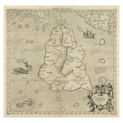
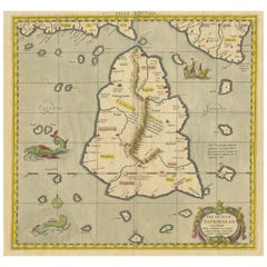
Mercator's Ptolemaic map of Taprobana, (Ceylon) Sri Lanka
Located in Langweer, NL
Antique map titled 'Asiae XII Tab'. Mercator's Ptolemaic map of Taprobana. The map shows Ptolemy's
Category
Antique 16th Century Maps
Materials
Paper
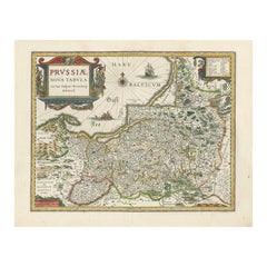
Antique Map of Prussia by Blaeu, circa 1635
By Willem Blaeu
Located in Langweer, NL
Antique map titled 'Prussiae Nova Tabula'. Rare early edition of Blaeu's map of Prussia
Category
Antique Mid-17th Century Maps
Materials
Paper
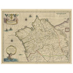
Antique Map of the Northwestern Coast of Spain
Located in Langweer, NL
Antique map titled 'Gallaecia Regnum'. Original old map of the northwestern coast of Spain
Category
Antique Mid-17th Century Maps
Materials
Paper
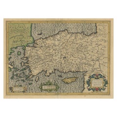
Original Antique Map of Turkey, Asia Minor and Cyprus
By Gerard Mercator
Located in Langweer, NL
Antique map titled 'Natoliae sive Asia Minor'. Original old map of Turkey, Asia Minor and Cyprus
Category
Antique Early 17th Century Maps
Materials
Paper
Antique Ptolemaic Map of Ceylon or nowadays Sri Lanka
Located in Langweer, NL
stipple engraved sea is filled with an oriental ship and two great sea monsters. The handsome map is
Category
Antique Mid-18th Century Maps
Materials
Paper
Cartographic Tapestry: Antique Map of Asia Minor, circa 1640
Located in Langweer, NL
Title: "Historical Tapestry: Antique Map of Asia Minor, circa 1640"
Description:
This authentic
Category
Antique Mid-17th Century Maps
Materials
Paper
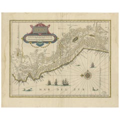
Antique Map of Peru in South America by Blaeu, circa 1645
Located in Langweer, NL
Antique map titled 'Peru'. Original antique map of Peru. With cartouche, compass rose, ships and
Category
Antique Mid-17th Century Maps
Materials
Paper
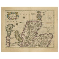
Original Antique Map of the Northern Part of Scotland, circa 1640
Located in Langweer, NL
The antique map, titled 'Scotiae pars septentrionalis,' depicts the northern part of Scotland
Category
Antique Mid-17th Century Maps
Materials
Paper
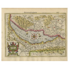
Beautiful Original Copper Engraved Map of Lake Geneva in Switzerland, 1613
Located in Langweer, NL
Description: Antique map titled 'Lacus Lemanus'.
Old map of Lake Geneva with good detail of
Category
Antique 1610s Maps
Materials
Paper
Rare Original Antique Ptolemy Map of Ceylon, Present Day Sri Lanka
Located in Langweer, NL
Original antique map titled 'Tab XII Asiae Taprobanam (..)'. For this map of Toprobana (Sri Lanka
Category
Antique Late 17th Century Maps
Materials
Paper
Antique Map of the Moluccas in Indonesia by Janssonius, C.1650
By Johannes Janssonius
Located in Langweer, NL
Antique map titled 'Insularum Moluccarum Nova Descriptio.' Old map of the Moluccas. The famous
Category
Antique 17th Century Maps
Materials
Paper
Hampshire County, Britain/England: A Map from Camden's" Britannia" in 1607
By John Norden
Located in Alamo, CA
An early hand-colored map of Britain's Hampshire county, published in the 1607 edition of William
Category
Antique Early 17th Century English Maps
Materials
Paper
H 17.13 in W 18.75 in D 0.88 in
Orignal Hand-Colored Antique Map of Chili by W. Blaeu, 1658
By Willem Blaeu
Located in Langweer, NL
Copiapo southward to the island of Chiloé with ships and sea monsters adorning the sea. The map is
Category
Antique Mid-17th Century Maps
Materials
Paper
Free Shipping
H 21.86 in W 25.99 in D 0.02 in
Greece, "Graeciae Antiquae"" A 17th Century Hand-colored Map by Sanson
By Nicolas Sanson
Located in Alamo, CA
Tavernier (1594–1665) in 1636 in Paris. The map is embellished by seven sailing ships and seven sea monsters
Category
Antique Mid-17th Century French Maps
Materials
Paper
H 24.75 in W 29.75 in D 0.13 in
17th Century Hand-Colored Map of West Africa by Mercator/Hondius
Located in Alamo, CA
A 17th century hand-colored map entitled "Guineae Nova Descriptio" by Gerard Mercator and Jodocus
Category
Antique Mid-17th Century Dutch Maps
Materials
Paper
Beautiful Antique Map of the Moluccas or Spice Islands, Indonesia, ca.1650
Located in Langweer, NL
Antique map titled 'Insularum Moluccarum Nova Descriptio.'
Beautiful map of the Moluccas. The
Category
Antique 1650s Maps
Materials
Paper
H 20.87 in W 22.64 in D 0 in
Antique Map of Ceylon or Sri Lanka by Ptolemy/Mercator, circa 1695
Located in Langweer, NL
corner of the map. The stipple engraved sea is filled with an oriental ship and two great sea monsters
Category
Antique Late 17th Century Maps
Materials
Paper
No Reserve
H 17.72 in W 21.07 in D 0.02 in
Antique Map of Denmark and Oldenburg ‘Germany’ by A. Ortelius, circa 1598
Located in Langweer, NL
Antique map titled 'Daniae Regni Typus' and 'Oldenburg Comit'. A nice example of Ortelius maps of
Category
Antique 16th Century Maps
Materials
Paper
H 18.12 in W 21.74 in D 0.02 in
Antique Map of the Spice Islands 'Moluccas', Indonesia by W. Blaeu, circa 1640
By Willem Blaeu
Located in Langweer, NL
Antique map titled 'Moluccae Insulae Celeberrimae'. Highly decorative antique map of the Spice
Category
Antique Mid-17th Century Maps
Materials
Paper
H 19.69 in W 23.04 in D 0.02 in
17th Century Hand-Colored Map of Valencia and Murcia, Spain by Mercator/Hondius
By Gerard Mercator
Located in Alamo, CA
lower part of the map. It is embellished with a sea monster and a sailing ship in the Mediterranean and
Category
Antique Mid-17th Century Dutch Maps
Materials
Paper
H 12 in W 16 in D 0.13 in
Old Map of the Moluccas, Known as the Famous Spice Islands, Indonesia, ca.1730
Located in Langweer, NL
Antique map titled 'Insularum Moluccarum Nova Descriptio.'
Old map of the Moluccas. The famous
Category
Antique 1730s Maps
Materials
Paper
H 17.33 in W 23 in D 0 in
Old Color Engraving of Blaeu's first Map of Brazil, North Oriented to the Right
By Willem Blaeu
Located in Langweer, NL
within a decorative border is a small map of "Baya de todos Sanctos". In the sea are monsters, a galleon
Category
Antique Mid-17th Century Maps
Materials
Paper
H 19.3 in W 22.84 in D 0.02 in
Striking Antique View of Kozhikode, also known as Calicut, in Kerala, India
Located in Langweer, NL
very cheerful looking sea monster in the important trading center of Calicut harbor. The Latin title at
Category
Antique Mid-17th Century Maps
Materials
Paper
H 5.71 in W 6.89 in D 0.02 in
16th c. woodcut map - Tabula Asiae Vlll
By Sebastian Münster
Located in Santa Monica, CA
14 7/8 inches.
The map is enhanced by Wonderful decorative monsters from medieval legends. One of
Category
16th Century Old Masters Landscape Prints
Materials
Woodcut
Map of Hampshire County, Britain/England, from Camden's" Britannia" in 1607
By John Norden
Located in Alamo, CA
An early hand-colored map of Britain's Hampshire county, published in the 1607 edition of William
Category
Early 1600s Prints and Multiples
Materials
Engraving
H 17.13 in W 18.75 in D 0.88 in
Ireland: A Framed 17th Century Hand-colored Map by Jan Jannson
By Johannes Janssonius
Located in Alamo, CA
, augmented with two putti. The map is embellished with three sailing ships and a sea monster. Western
Category
Mid-17th Century Old Masters Landscape Prints
Materials
Engraving
H 17.88 in W 22 in D 0.75 in
West Africa: A 17th Century Hand-Colored Map by Mercator/Hondius
By Gerard Mercator
Located in Alamo, CA
A 17th century hand-colored map entitled "Guineae Nova Descriptio" by Gerard Mercator and Jodocus
Category
1630s Landscape Prints
Materials
Engraving
Framed World Map print showing double hemisphere dating to 1642 originally, New
Located in Lincoln, Lincolnshire
This is a digitally remastered World Map Conjuring up the golden age of exploration, from an
Category
2010s British Charles II Prints
Materials
Glass, Wood, Paper
H 19.69 in W 27.56 in D 1.58 in
Untitled Geneviève Seillé Contemporary art outsider art drawing animal color map
By Geneviève Seillé
Located in Paris, FR
.
“We will lead to a world where human bodies can become birds, or fish, or even monsters with
Category
2010s Outsider Art Figurative Drawings and Watercolors
Materials
Paper, Color Pencil, Graphite
Untitled Geneviève Seillé Contemporary art outsider art drawing animal color map
By Geneviève Seillé
Located in Paris, FR
.
“We will lead to a world where human bodies can become birds, or fish, or even monsters with
Category
Early 2000s Outsider Art Figurative Drawings and Watercolors
Materials
Paper, Color Pencil, Graphite
Rugen Island, Germany: An Early 17th Century Map by Mercator and Hondius
By Gerard Mercator
Located in Alamo, CA
to today's characteristics. The map is decorated with two galleons, several sea monsters, two large
Category
Early 17th Century Old Masters Landscape Prints
Materials
Engraving
Italian Ancient Marble Sculpture Fountain, Late 16th Century
Located in Milano, IT
element linked to water (on this theme see: Chet Van Duzer, Sea Monsters on Medieval and Renaissance Maps
Category
Antique 16th Century Italian Renaissance Animal Sculptures
Materials
Carrara Marble
Ptolemaic map of ancient Spain and Portugal by Mercator - Engraving - 17th c.
By Gerard Mercator
Located in Zeeland, Noord-Brabant
Ptolemaic map covering ancient Spain and Portugal. Wit sean monsters and a gallion ship.
Description: From
Category
1690s Old Masters More Prints
Materials
Engraving
Ptolemaic map of ancient Tunesia, Malta, Lybia by Mercator - Engraving - 17th c.
By Gerard Mercator
Located in Zeeland, Noord-Brabant
Ptolemaic map covering ancient Tunesia with Malta and parts of Lybia. Embellished with sea monsters, wild
Category
1690s Old Masters More Prints
Materials
Engraving
Ptolemaic map of Balkan coast extending north by Mercator - Engraving - 17th c.
By Gerard Mercator
Located in Zeeland, Noord-Brabant
Italy. The map is embellished with a strapwork cartouche and a sea monster.
Description: From the 1698
Category
1690s Old Masters More Prints
Materials
Engraving
Old map of Georgia, Armenia and Azerbaijan by Mercator - Engraving - 17th c.
By Gerard Mercator
Located in Zeeland, Noord-Brabant
. (…).' - A beautiful Ptolemaic map of the Caucasus region and what is now Georgia, Armenia, Azerbaijan
Category
1690s Old Masters More Prints
Materials
Engraving
Old map of Himalayas, N. India and Afghanistan by Mercator - Engraving - 17th c.
By Gerard Mercator
Located in Zeeland, Noord-Brabant
India run across the bottom of the map. Embellished with a sea monster, and nomadic figures with
Category
1690s Old Masters More Prints
Materials
Engraving
Map of Sardinia, Sicily and part of Corsica by Mercator - Engraving - 17th c.
By Gerard Mercator
Located in Zeeland, Noord-Brabant
(…)' - Very decorative map of Sardinia, Sicily and part of Corsica. With two war ships, and sea monsters in
Category
1690s Old Masters More Prints
Materials
Engraving
Ptolemaic map of Turkey and Cyprus - Tab I - by Mercator - Engraving - 17th c.
By Gerard Mercator
Located in Zeeland, Noord-Brabant
Minor, Pamphylia, Lycia ac Cilicia, (…).' - A beautiful Ptolemaic map of Turkey and Cyprus showing its
Category
1690s Old Masters More Prints
Materials
Engraving
Ptolemaic map of east Libya, Egypt and the Nile by Mercator - Engraving - 17th c
By Gerard Mercator
Located in Zeeland, Noord-Brabant
(…).' - A beautiful Ptolemaic map covering ancient eastern Libya and Egypt with numerous ancient place names
Category
1690s Old Masters More Prints
Materials
Engraving
Hic Sunt Dracones l, pastel & gold leaf painting, abstract landscape, coastline
By KC PAILLARD
Located in Stockholm, SE
medieval practice of putting illustrations of dragons, sea monsters and other mythological creatures on
Category
2010s Abstract Abstract Paintings
Materials
Gold Leaf
H 19.69 in W 19.69 in D 1.58 in
Hic Sunt Dracones ll, pastel & gold leaf painting, abstract landscape, coastline
By KC PAILLARD
Located in Stockholm, SE
medieval practice of putting illustrations of dragons, sea monsters and other mythological creatures on
Category
2010s Abstract Abstract Paintings
Materials
Gold Leaf
H 19.69 in W 19.69 in D 1.58 in
Hic Sunt Dracones 1-4, pastel & gold leaf, abstract landscape, coastline
By Kerstin Paillard
Located in Stockholm, SE
practice of putting illustrations of dragons, sea monsters and other mythological creatures on uncharted
Category
2010s Abstract Mixed Media
Materials
Gold Leaf
H 39.38 in W 39.38 in D 1.58 in
West Indies, 1606
By Gerard Mercator
Located in Houston, TX
of Havana, sailing ships and sea monsters. Mercator was a renowned Flemish cartographer whose most
Category
Antique Early 1600s Belgian Prints
Hand-Colored Map of Southern Italy, circa 1720
Located in Colorado Springs, CO
This elegantly engraved, hand-colored map focuses on the Italian peninsula from Abruzzo down to the
Category
Antique 1720s European Maps
Antique Map of Southern Italy, Hand-Colored, circa 1720
Located in Colorado Springs, CO
Presented is an original map of the Eastern Part of Italy, circa 1720. The map displays the
Category
Antique 1720s European Maps
Materials
Paper
17th Century Hand-Colored Map of Bordeaux Region of France by Mercator/Hondius
Located in Alamo, CA
the name of the region and a scale, as well as a sea monster and a sailing ship. The map is
Category
Antique Mid-17th Century Dutch Maps
Materials
Paper
H 10.75 in W 13.5 in D 0.13 in
Vintage Framed Print of Italian Map of Italy by Hondius H
Located in Van Nuys, CA
cardinal directions.
One of the most richly decorative, early maps of Italy in a vibrant color of the
Category
Vintage 1960s Prints
Materials
Paper
Americae Pars Magis Cognita.
By Johann Theodor De Bry
Located in New York, NY
, a sea monster, and Spanish galleon. This is a scarce and desirable map. The first state of two.
Category
16th Century Other Art Style More Prints
Materials
Engraving
AMERICA BOREALIS (California As An Island)
Located in Santa Monica, CA
it is one of the earliest maps to show the Rocky Mountains
In generally good condition. with some
Category
1690s Old Masters Landscape Prints
Materials
Engraving
Antique Map of Iceland by Blaeu, circa 1640
By Willem Blaeu
Located in Langweer, NL
Antique map titled 'Tabula Islandiae'. Beautiful map of Iceland, including an erupting volcano, sea
Category
Antique Mid-17th Century Maps
Materials
Paper
Antique Map of Portugal by W. Blaeu, 1650
Located in Langweer, NL
Antique map titled 'Portugallia et Algarbia quae olim Lusitania'. Decorative map of Portugal. Fine
Category
Antique Mid-17th Century Maps
Materials
Paper
Antique Map of Lake Geneva by Mercator/Hondius '1610'
Located in Langweer, NL
Antique map titled 'Lacus Lemanus'. Old map of Lake Geneva with good detail of surrounding towns
Category
Antique Early 17th Century Maps
Materials
Paper
Antique Map of Europe by N. Visscher, circa 1660
Located in Langweer, NL
ships, monsters and compass roses adorning the seas. In the lower right hand corner of the map a
Category
Antique Mid-17th Century Maps
Antique Map of Ceylon 'Sri Lanka' by Ruscelli, 1574
Located in Langweer, NL
Antique map titled 'Tabula Asiae XII'. Very decorative map of Sri Lanka. In ancient times, Sri
Category
Antique 16th Century Maps
Materials
Paper
Antique Map of Ireland in Original Handcoloring by Mercator 'circa 1610'
Located in Langweer, NL
map features an oval title cartouche with a scale below, a sailing ship and a solitary sea monster.
Category
Antique Early 1600s Maps
Materials
Paper
H 18.12 in W 22.45 in D 0.02 in
Early Map of Puerto Rico Printed in Venice by G. F. Camocio in 1571
Located in Langweer, NL
Porcacchi's map of the Island of Puerto Rico. One of the earliest obtainable maps of the Island and one of the
Category
Antique 16th Century Maps
Materials
Paper
Free Shipping
H 4.34 in W 5.91 in D 0.01 in
Antique Map of Cuba, Haïti, Jamaica, Puerto Rico and St Margareta, Havanna, 1630
Located in Langweer, NL
Title: "Cuba Insula" - "Hispaniola Insula".
2 old colors copper engraved maps of Cuba and Haïti
Category
Antique 1630s Maps
Materials
Paper
H 18.51 in W 22.45 in D 0 in
Antique Map of Early Egypt and the Nile Delta, Published in c.1598
Located in Langweer, NL
the map, where a sea monster and a sailing boat has been added.
Title: Egitto Nuova Tavola
Date
Category
Antique 16th Century Maps
Materials
Paper
- 1
Get Updated with New Arrivals
Save "Map Monsters", and we’ll notify you when there are new listings in this category.
Map Monsters For Sale on 1stDibs
There is a range of map monsters for sale on 1stDibs. The range of distinct map monsters — often made from paper, wood and carrara marble — can elevate any home. There are all kinds of map monsters available, from those produced as long ago as the 18th Century to those made as recently as the 21st Century. Map monsters made by neoclassical designers — are very popular at 1stDibs. Many map monsters are appealing in their simplicity, but Gerard Mercator, Abraham Ortelius and Henry Loveridge & Co. produced popular map monsters that are worth a look.
How Much are Map Monsters?
Prices for map monsters start at $322 and top out at $13,273 with the average selling for $834.
