Map Of Corsica
to
16
33
1
21
9
6
5
5
4
4
3
3
3
2
2
2
2
1
1
1
1
1
1
1
Sort By
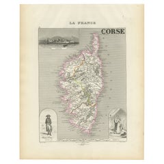
Map of Corsica France with Ajaccio and Napoleon Portraits, 19th Century
Located in Langweer, NL
Map of Corsica France with Ajaccio and Napoleon Portraits, 19th Century
Description:
This finely
Category
Antique Mid-19th Century French Maps
Materials
Paper
$166
H 12.8 in W 10.28 in D 0.01 in
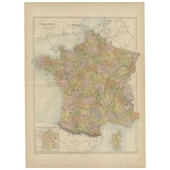
Antique Map of France, Spain and Portugal by Johnson, 1872
Located in Langweer, NL
inset maps of Corsica and Gibraltar Rock. This map originates from 'Johnson's New Illustrated Family
Category
Antique Late 19th Century Maps
Materials
Paper
$238 Sale Price
20% Off
H 26.38 in W 18.12 in D 0.02 in
Antique Map of France by A & C. Black, 1870
Located in Langweer, NL
into provinces, before the revolution of 1789 and map of Corsica. This map originates from ‘Black's
Category
Antique Late 19th Century Maps
Materials
Paper
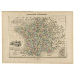
Antique Map of the Departments of France by Migeon, 1880
By J. Migeon
Located in Langweer, NL
Strasbourg and an inset map of Corsica. This map originates from 'Géographie Universelle Atlas-Migeon' by J
Category
Antique 19th Century Maps
Materials
Paper
$114 Sale Price
20% Off
H 13.59 in W 18.71 in D 0 in
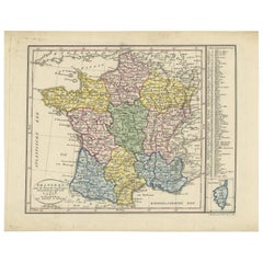
Antique Map of France by Van Baarsel (c.1820)
Located in Langweer, NL
with an inset map of the island of Corsica. Includes a table with reference to the departments
Category
Antique Early 19th Century Dutch Maps
Materials
Paper
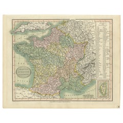
Antique Map of France Showing Post-Napoleonic Departments, 1816
Located in Langweer, NL
post-Napoleonic Departments. With an inset map of Corsica.
Artists and Engravers: John Cary (1755
Category
Antique 19th Century Maps
Materials
Paper
$266 Sale Price
20% Off
H 10.44 in W 13 in D 0 in
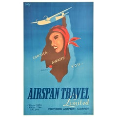
Original Vintage Travel Advertising Poster Airspan Travel Corsica Awaits You
Located in London, GB
... featuring an image of a plane flying above a map of Corsica island with a smiling lady in a red headscarf
Category
Vintage 1940s French Posters
Materials
Paper
$7,886
H 39.77 in W 24.41 in D 0.04 in
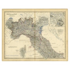
Antique Map of Italy and Corsica, c.1860
Located in Langweer, NL
Antique map titled 'North & Central Italy and the Island of Corsica'.
Old map of North and
Category
Antique 19th Century Maps
Materials
Paper
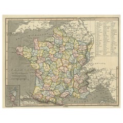
Antique Map of France with Inset Map of the Island of Corsica, 1820
Located in Langweer, NL
Antique map titled 'France in Departments'. Old map of France, with small inset map of the island
Category
Antique 19th Century Maps
Materials
Paper
$247 Sale Price
20% Off
H 8.27 in W 10.44 in D 0 in
Antique Map of France, 1903, with Inset of Paris and Corsica
Located in Langweer, NL
Title: Antique Map of France, 1903, with Inset of Paris and Corsica
Description:
This antique map
Category
Early 20th Century Maps
Materials
Paper
1882 Map of France Highlighting Political Boundaries, Cities, Insets of Corsica
Located in Langweer, NL
This 1882 map of France, published by Blackie and Son as part of the 'Comprehensive Atlas and
Category
Antique 1880s Maps
Materials
Paper
$297
H 22.45 in W 15.36 in D 0 in
Antique Map of France with an Inset Map of the Island of Corsica, c.1820
Located in Langweer, NL
'. Beautiful map of France with an inset map of the island of Corsica. Includes a table with reference to the
Category
Antique 19th Century Dutch Maps
Materials
Paper
$171 Sale Price
20% Off
H 9.45 in W 12.21 in D 0 in
Antique Map of Italy, Corsica, Sardinia and Sicily, ca.1780
Located in Langweer, NL
Description: Antique map titled 'L'Italie.'
Map of Italy, Corsica, Sardinia and Sicily. Highly
Category
Antique 1780s Maps
Materials
Paper
$305 Sale Price
20% Off
H 15.16 in W 10.24 in D 0 in
Map of The Italian Peninsula with the islands of Sicily, Sardinia, Corsica, 1880
Located in Langweer, NL
This map, titled "ITALIA, Sicilia, Sardinia, Corsica," represents the Italian Peninsula along with
Category
Antique 1880s Maps
Materials
Paper
$352 Sale Price
20% Off
H 15.56 in W 18.51 in D 0 in
Antique Map of North and Central Italy and the Island of Corsica, c.1860
Located in Langweer, NL
Antique map titled 'North & Central Italy and the Island of Corsica'.
Old map of North and
Category
Antique 19th Century Maps
Materials
Paper
$295 Sale Price
20% Off
H 24.41 in W 19.3 in D 0 in
Antique Map of Italy, Showing Corsica, Sardinia, Croatia, Malta and More, C.1740
Located in Langweer, NL
.'
Attractive detailed map showing Italy as well as Corsica, Sardinia, Minorca, Croatia, Albania, Dalmatia, a
Category
Antique 18th Century Maps
Materials
Paper
$655
H 21.78 in W 17.13 in D 0 in
Old Coloure Map of North & Central Italy & Corsica with an Inset of Rome, c.1860
Located in Langweer, NL
Antique map titled 'North & Central Italy and the Island of Corsica'.
Old map of North and
Category
Antique 1860s Maps
Materials
Paper
$276 Sale Price
20% Off
H 19.38 in W 24.41 in D 0 in
Antique Map of Italy by R. Bonne, circa 1780
Located in Langweer, NL
Beautiful map of Italy, Corsica, Sardinia and Sicily. Highly detailed, showing towns, rivers, some
Category
Antique Late 18th Century Maps
Materials
Paper
Antique Map of Italy and Corse in Ancient Times, 1848
Located in Langweer, NL
Antique map titled 'Italia Superior et Corsica'.
Old map of northern Italy and Corse
Category
Antique 19th Century Maps
Materials
Paper
$247 Sale Price
20% Off
H 12.49 in W 9.77 in D 0 in
Antique Map of The Regions of Italy and Sicily during the Roman Empire, 1880
Located in Langweer, NL
buried by the eruption of Mount Vesuvius in 79 AD.
- **Corsica and Sardinia**: Smaller maps of the
Category
Antique 1880s Maps
Materials
Paper
$352 Sale Price
20% Off
H 18.51 in W 15.56 in D 0 in
17th Century Dutch Map of Italy, Sicily, Sardinia, Corsica and Dalmatian Coast
By Theodorus Danckerts
Located in Alamo, CA
islands of Corsica and Sardinia and part of Sicily are also represented. At the time this map was made
Category
1690s Prints and Multiples
Materials
Engraving
$1,475
H 28 in W 31.25 in D 1.38 in
Original Vintage Travel Advertising Poster Airspan Travel Corsica Awaits You
Located in London, GB
... featuring an image of a plane flying above a map of Corsica island with a smiling lady in a red headscarf
Category
1940s More Prints
Materials
Paper
$7,886
H 39.77 in W 24.41 in
Map of Sardinia, Sicily and part of Corsica by Mercator - Engraving - 17th c.
By Gerard Mercator
Located in Zeeland, Noord-Brabant
(…)' - Very decorative map of Sardinia, Sicily and part of Corsica. With two war ships, and sea monsters in
Category
1690s Old Masters More Prints
Materials
Engraving
$1,781
H 17.33 in W 20.87 in
Original map of Corsica by Carriat-Rolant - Travel poster - Tourism
Located in PARIS, FR
Beautiful and unusual poster showing a pictorial geographical representation of Corsica animated by
Category
Mid-20th Century Prints and Multiples
Materials
Paper, Lithograph
$2,263
H 29.53 in W 21.26 in
Antique Map of France and the Island of Corsica, c.1825
Located in Langweer, NL
Antique map titled 'Royaume de France divisé en 86 Départemens'. Old map of France, revised in 1825
Category
Antique 19th Century Maps
Materials
Paper
Large Original Antique Map of Corsica and Sardinia. John Dower, 1861
Located in St Annes, Lancashire
Great map of Corsica and Sardinia
Lithograph engraving by John Dower
Original colour
Published
Category
Antique 1860s English Victorian Maps
Materials
Paper
Antique Map of Corsica and Sardini, 1729
Located in Langweer, NL
Detailed map of the Islands of Corsica and Sardinia, showing towns, rivers, lakes, mountains, bays
Category
Antique Early 18th Century Maps
Materials
Paper
Antique Map of Italy, with Sardinia and Corsica
Located in Langweer, NL
. Also includes the islands of Sardinia and Corsica. This map originates from Maison Basset's 1852
Category
Antique Mid-19th Century Maps
Materials
Paper
Antique Map of the Islands of Corsica and Sardinia, 1685
Located in Langweer, NL
maps on one sheet, showing the islands Corsica and Sardinia from the pocket atlas 'Introductionis in
Category
Antique 17th Century Maps
Materials
Paper
Antique Map of Italy, Sardinia and Corsica by Lowry, '1852'
Located in Langweer, NL
Antique map titled 'Italy, Sardinia and Corsica'. Four individual sheets of Italy, Sardinia and
Category
Antique Mid-19th Century Maps
Materials
Paper
Antique Map of Switzerland, Italy, Sardinia and Corsica by Lowry, '1852'
Located in Langweer, NL
Antique map titled 'Switzerland, Italy, Sardinia & Corsica'. Original map of Switzerland, Italy
Category
Antique Mid-19th Century Maps
Materials
Paper
$119
H 12.21 in W 9.65 in D 0.02 in
Antique Map of the Island of Corsica by D.C. Jolly, 1757
Located in Langweer, NL
Rare antique map of the Island of Corsica. This map has great detail and shows for example the City
Category
Antique Mid-18th Century Maps
Large Antique Map of Italy with Corsica, Sardinia, Sicily & Malta, 1854
Located in Langweer, NL
Antique map titled 'The States of Italy, with their islands, Corsica, Sardinia, Sicily & Malta
Category
Antique 19th Century Maps
Materials
Paper
$755
H 23.04 in W 28.55 in D 0 in
Antique Map of Italy 'Sardinia and Corsica' by P. Cluverus, circa 1672
Located in Langweer, NL
Antique map titled 'Italiae Antiquae novissima tabula auctore P. Cluvero'. Very decorative map of
Category
Antique Late 17th Century Maps
Materials
Paper
$1,167
H 20.79 in W 23.82 in D 0.02 in
Get Updated with New Arrivals
Save "Map Of Corsica", and we’ll notify you when there are new listings in this category.
Map Of Corsica For Sale on 1stDibs
On 1stDibs, you can find the most appropriate map of corsica for your needs in our varied inventory. In our selection of items, you can find modern examples as well as an abstract version. You’re likely to find the perfect map of corsica among the distinctive items we have available, which includes versions made as long ago as the 18th Century as well as those made as recently as the 20th Century. When looking for the right map of corsica for your space, you can search on 1stDibs by color — popular works were created in bold and neutral palettes with elements of gray, blue, white and purple. A map of corsica from (after) Henri Matisse, Henri Matisse, Gerard Mercator, Sebastian Münster and Theodorus Danckerts — each of whom created distinctive versions of this kind of work — is worth considering. Frequently made by artists working in lithograph, linocut and paper, these artworks are unique and have attracted attention over the years.
How Much is a Map Of Corsica?
The average selling price for a map of corsica we offer is $1,465, while they’re typically $85 on the low end and $7,887 for the highest priced.
More Ways To Browse
Antique Wooden Lunch Box
Cosmographia Universalis
English Pitchers Blue Orange
Moroccan Bed King
Persian Silver Large Vessel
Antique Exam Table
Antique Cast Iron Bed Parts
Granddaughter Clocks Antique Clocks
Brandy Pan
Cera Presidential
Dedar Hermes Fabrics
Drexel Esperanto
Fancher Furniture
Frosted Martini Glass
G H Laurent Bronzes
G H Laurent Objects
G Plan Blofeld Chair
Gaddi Bust Sculpture
