Map Of Southern Italy
1
to
10
113
31
91
84
34
26
19
15
12
11
11
9
8
7
5
4
4
4
4
4
4
3
3
3
2
2
2
2
2
1
1
1
1
1
1
1
42
42
6
3
3
Sort By
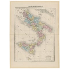
Antique Map of Southern Italy by Migeon, 1880
Located in Langweer, NL
"Antique map titled 'Italie Méridionale'. Old map of southern Italy including Sicily/Sicilia. This
Category
Antique 19th Century Maps
Materials
Paper
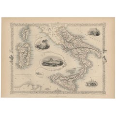
Antique Map of Southern Italy by J. Tallis, circa 1851
Located in Langweer, NL
Decorative and detailed mid-19th century map of Southern Italy which was drawn and engraved by John
Category
Antique Mid-19th Century Maps
Materials
Paper
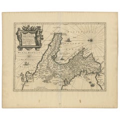
Antique Map of Southern Italy by Janssonius, C.1650
Located in Langweer, NL
primum de prica aerugine est abstersa (..)'. Beautiful map of Southern Italy, viewed from south to north
Category
Antique 17th Century Maps
Materials
Paper
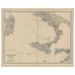
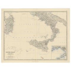
Antique Map of Southern Italy and Sardinia by Johnston, 1882
Located in Langweer, NL
"Antique map titled 'South Italy and the Island of Sardinia'. Old map of Southern Italy and the
Category
Antique 19th Century Maps
Materials
Paper
Map of Southern Italy inlcluding Sardinia and Inset of the Bay of Naples, c.1860
Located in Langweer, NL
Antique map titled 'South Italy and the Island of Sardinia'.
Old map of Southern Italy and the
Category
Antique 1860s Maps
Materials
Paper
H 19.3 in W 24.41 in D 0 in
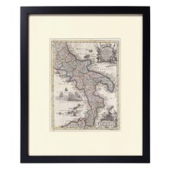
Hand-Colored Map of Southern Italy, circa 1744
By Matthew Seutter
Located in New York, NY
Seutter, Matthew.
Neapolis Regnum...
From Atlas minor praecipua Terrarum Imperia...
Augsburg, circa 1744.
Original engraving with old hand-coloring.
Image size: 10 3/16 x 7 11...
Materials
Paper
H 16.5 in W 13.75 in D 0.75 in
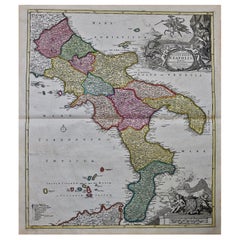
The Kingdom of Naples and Southern Italy: A Hand-Colored 18th Century Homann Map
By Johann Baptist Homann
Located in Alamo, CA
hand colored map of southern Italy and the ancient Kingdom of Naples created by Johann Baptist Homann
Category
Antique Early 18th Century German Maps
Materials
Paper
H 20 in W 23.88 in D 0.07 in
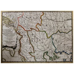
18th Century Map of the Southern Balkans by Giovanni Maria Cassini
By Giovanni Maria Cassini
Located in Hamilton, Ontario
18th century map by Italian engraver Giovanni Maria Cassini (Italy 1745-1824).
Map of the Southern
Category
Antique 18th Century Italian Maps
Materials
Paper
Antique Map of Southern England and Wales by Zatta, 1784
Located in Langweer, NL
. Zatta. Artists and Engravers: Antonio Zatta (active 1757-1797) was the most prominent Italian map
Category
Antique 18th Century Maps
Materials
Paper
Antique Map of the Northern Coast of Africa and Southern Europe, circa 1745
By Covens & Mortier
Located in Langweer, NL
-colored map of the northern coast of Africa, Spain, Italy and the Mediterranean with the islands of
Category
Antique Mid-18th Century Maps
Materials
Paper
H 21.07 in W 25.4 in D 0.02 in
Southern & Eastern Europe: A Large 17th C. Hand-colored Map by Sanson & Jaillot
By Nicolas Sanson
Located in Alamo, CA
This large hand-colored map entitled "Estats de L'Empire des Turqs en Europe, ou sont les
Category
Antique 1690s French Maps
Materials
Paper
H 24.88 in W 38 in D 0.13 in
Original Antique Map of the South Part of Italy with an Inset of Malta, 1882
Located in Langweer, NL
Embark on a captivating journey through the southern part of Italy with an original Antique Map
Category
Antique 1880s Maps
Materials
Paper
H 22.45 in W 14.97 in D 0 in
Antique Map of North Africa by Ortelius, c.1580
Located in Langweer, NL
Antique map titled 'Barbariae et Biledulgerid Nova Descriptio'. Original antique map of North
Category
Antique 16th Century Maps
Materials
Paper
Rare and Interesting Small Antique Woodcut Map of the Mediterranean
Located in Langweer, NL
Paul. It shows the Mediterranean with Greece, Asia Minor (Turkey), Northern Africa, Southern Italy and
Category
Antique 16th Century Maps
Materials
Paper
Antique Map of Greece and Its Colonies, with Frame Style Border
Located in Langweer, NL
southern part of Italy, including Sicily, to the western parts of Asia Minor and from Macedonia to Crete
Category
Antique Mid-19th Century Maps
Materials
Paper
Mediterranean Tapestry: A 19th Century Map of the Mediterranean Shores, 1882
Located in Langweer, NL
This map, titled "The Shores of the Mediterranean," is part of the 1882 atlas by Blackie & Son, and
Category
Antique 1880s Maps
Materials
Paper
H 11.03 in W 14.97 in D 0 in
Original Old Composite of Several Maps of the Ancient World on One Sheet, 1880
Located in Langweer, NL
This original antique map is from Karl Spruner von Merz's "Atlas Antiquus", later edited by
Category
Antique 1880s Maps
Materials
Paper
Free Shipping
H 15.56 in W 18.51 in D 0 in
"Nova Barbariae Descriptio", a 17th Century Hand-Colored Map of North Africa
By Johannes Janssonius
Located in Alamo, CA
adjacent countries in southern Europe, including Portugal, Spain, Italy, Greece and Asia Minor. The map is
Category
Antique Mid-17th Century Dutch Maps
Materials
Paper
H 22.38 in W 29 in D 0.13 in
"Africae Accurata", a Hand-Colored 17th Century Map of Africa by Visscher
By Nicolaes Visscher II
Located in Alamo, CA
Mediterranean Sea and adjacent portions of Portugal, Spain, Italy, Greece and Asia Minor. The map perpetuates
Category
Antique Late 17th Century Dutch Maps
Materials
Paper
H 23.75 in W 28.13 in D 0.13 in
16th Century Map of Saudi Arabia, the Persian Gulf and Red Sea, ca. 1574
Located in Langweer, NL
than earlier Ptolemaic maps although the southern part of the peninsula is still too wide. A large
Category
Antique 16th Century Maps
Materials
Paper
No Reserve
H 7.1 in W 9.8 in D 0.002 in
Four 18th Century Engraved and Hand-Colored Maps by Weigel
By Christoph Weigel
Located in Copenhagen, K
Small collection of four engraved maps of Italy, Balkan and of Central Asia.
Two are of Italy
Category
Antique 18th Century German Maps
Materials
Paper
Original Antique Sea Chart of the Northern Part of Hispaniola, Western Cuba
Located in Langweer, NL
northern part of Hispaniola, western Cuba. The map includes the Turks & Caicos Islands and southern part of
Category
Antique Late 17th Century Maps
Materials
Paper
H 21.26 in W 24.02 in D 0.02 in
Italy, Central and Southern Part. Century Atlas antique map
Located in Melbourne, Victoria
'The Century Atlas. Italy, Central and Southern Part.'
Original antique map, 1903.
Inset maps of
Category
Early 20th Century Victorian More Prints
Materials
Lithograph
Southern & Eastern Europe: A Large 17th C. Hand-colored Map by Sanson & Jaillot
By Nicholas Sanson d'Abbeville
Located in Alamo, CA
This large hand-colored map entitled "Estats de L'Empire des Turqs en Europe, ou sont les
Category
1690s Landscape Prints
Materials
Engraving
Travelers Mind Map
Located in New Orleans, LA
painters producing in the South today” by Bradley Sumrall, curator of the Ogden Museum of Southern Art
Category
2010s Contemporary Paintings
Materials
Fabric, Oil, Acrylic
Topographical Map of Pompeii, 1785, by Francesco Piranesi, Reprint
By Francesco Piranesi
Located in Larchmont, NY
Francesco Piranesi (Italian, 1758-1810)
Topographical Map of Pompeii
Originally executed 1785
Category
1780s Realist More Art
Materials
Engraving
H 48.25 in W 26.325 in D 1.5 in
Naples and S. Italy: A Large 17th C. Hand-colored Map by Sanson and Jaillot
By Nicholas Sanson d'Abbeville
Located in Alamo, CA
southern Italy, as well as Corfu, Albania, Mediterranean Sea and the Adriatic Sea. Naples, Sorrento, the
Category
1690s Landscape Prints
Materials
Engraving
Geobond - Colorful Authentic Urban Map Currency Painting
By Fabio Coruzzi
Located in Los Angeles, CA
Foggia, Italy in 1975, and now resides in Southern California, USA. Remarking on his work in conjunction
Category
21st Century and Contemporary Pop Art Figurative Paintings
Materials
Canvas, Oil Pastel, Mixed Media, Acrylic, Ink, Graphite
[World War Two map] - Dunkirk to Berlin June 1940.
Located in London, GB
illustrates Churchill's 1944 tours of the beaches of Normandy and the invasion coasts of Italy and Southern
Category
1940s Other Art Style More Art
Materials
Color
Broke - Mixed Media Credit Card Map Original Artwork
By Fabio Coruzzi
Located in Los Angeles, CA
Italian artist Fabio Coruzzi merges painting and photography into one imaginative image that offers
Category
21st Century and Contemporary Pop Art Mixed Media
Materials
Mixed Media, Spray Paint, Panel
Broke 2 - Mixed Media Credit Card Map Original Artwork
By Fabio Coruzzi
Located in Los Angeles, CA
Italian artist Fabio Coruzzi merges painting and photography into one imaginative image that offers
Category
21st Century and Contemporary Pop Art Mixed Media
Materials
Mixed Media, Spray Paint, Panel
Stade, Antique Map from "Civitates Orbis Terrarum" - by F.Hogenberg - 1572-1617
By Franz Hogenberg
Located in Roma, IT
city in Southern Saxony. Good conditions, with some visible stains.
Civitates Orbis Terrarum (Atlas of
Category
16th Century Figurative Prints
Materials
Etching, Aquatint
H 5.91 in W 10.24 in D 0.04 in
Giant Egg of the Extinct 'Elephant Bird'
Located in London, GB
a raffia palm. In the fifteenth century, Italian cartographer Fra Mauro mentioned the roc on his map
Category
Antique 15th Century and Earlier Malagasy Natural Specimens
Materials
Eggshell
Antique Engraving of Circus Flaminius, a Circular Area in Ancient Rome, 1704
Located in Langweer, NL
southern end of the Campus Martius near the Tiber River, Rome, Italy. Below another view of Rome. This
Category
Antique Early 1700s Prints
Materials
Paper
H 14.18 in W 9.22 in D 0 in
A beautiful Celestial Table Globe produced by Gerard & Leonard Valk
By Gerard and Leonard Valk
Located in ZWIJNDRECHT, NL
Gerard began his publishing firm producing maps and atlases in co-operation with Petrus Schenk about 1680
Category
Antique Early 18th Century Dutch Dutch Colonial Globes
Materials
Other
A truly delightful miniature terrestrial pocket globe
By Nathaniel Mills
Located in ZWIJNDRECHT, NL
turning overhead. In line with its counterpart, the terrestrial globe, celestial globes are mapped by a
Category
Antique Mid-18th Century British Dutch Colonial Globes
Materials
Other
Circus Flaminius (..), Anonymous, 1704
Located in Langweer, NL
reconstruction of Circus Flaminius, a large, circular area in ancient Rome, located in the southern end of the
Category
Antique 18th Century Prints
Materials
Paper
Rare Judaica Jewish Folk Art Sukkot Papercut Jerusalem Mizrach Archie Granot
By Archie Granot
Located in Surfside, FL
Francisco, California, USA
2008-9 "Envisioning Maps", Hebrew Union College", New York, New York, USA
2008
Category
1980s Folk Art Mixed Media
Materials
Mixed Media
Mid Century Abstracted Landscape -- South from Puertecitos
By Edgar Dorsey Taylor
Located in Soquel, CA
of Arts Degree in 1928 and a Master of Arts Degree in 1932. He then studied in Italy and France, and
Category
1960s Abstract Impressionist Landscape Prints
Materials
Archival Paper, Woodcut
H 25 in W 21 in D 1 in
Specifically Nowhere, Yellow (Abstract Geometric Painting with Grids on Yellow)
By Donise English
Located in Hudson, NY
that refer abstractly to maps, architectural drawings and blueprints or patterns and structures found
Category
2010s Abstract Geometric Abstract Paintings
Materials
Canvas, Gouache, Archival Paper, Color Pencil, Graphite
Blue & Grey Green Plan: Abstract Geometric Framed Painting in Cool Toned Palette
By Donise English
Located in Hudson, NY
information that refer abstractly to maps, architectural drawings and blueprints or patterns and structures
Category
2010s Abstract Geometric Abstract Paintings
Materials
Canvas, Gouache, Archival Paper, Color Pencil, Graphite
Black, Gold & Beige Plan (Abstract Geometric Framed Painting in Neutral Palette)
By Donise English
Located in Hudson, NY
refer abstractly to maps, architectural drawings and blueprints or patterns and structures found in such
Category
2010s Abstract Geometric Abstract Paintings
Materials
Canvas, Gouache, Archival Paper, Color Pencil, Graphite
Grey, Orange & Blue Plan (Bold Abstract Geometric Framed Painting)
By Donise English
Located in Hudson, NY
interested in drawing and collaging multiple layers of information that refer abstractly to maps
Category
2010s Abstract Geometric Abstract Paintings
Materials
Canvas, Gouache, Archival Paper, Color Pencil, Graphite
H 31 in W 25 in D 1.5 in
Lithograph - Flowers
By (after) Henri Matisse
Located in Collonge Bellerive, Geneve, CH
ways unchanged since Roman times. The coming of the railway had put Bohain on the industrial map, but
Category
1940s Modern Still-life Prints
Materials
Lithograph
Henri Matisse (After) - Lithograph - Pumpkin and Flowers
By (after) Henri Matisse
Located in Collonge Bellerive, Geneve, CH
ways unchanged since Roman times. The coming of the railway had put Bohain on the industrial map, but
Category
1940s Modern Still-life Prints
Materials
Lithograph
H 9.45 in W 12.6 in D 0.04 in
Henri Matisse (After) - Lithograph - Flowers
By (after) Henri Matisse
Located in Collonge Bellerive, Geneve, CH
ways unchanged since Roman times. The coming of the railway had put Bohain on the industrial map, but
Category
1940s Modern Still-life Prints
Materials
Lithograph
H 9.45 in W 12.6 in D 0.04 in
Henri Matisse (After) - Lithograph - Pumpkin and Flowers
By (after) Henri Matisse
Located in Collonge Bellerive, Geneve, CH
ways unchanged since Roman times. The coming of the railway had put Bohain on the industrial map, but
Category
1940s Modern Figurative Prints
Materials
Lithograph
H 12.6 in W 9.45 in D 0.04 in
Henri Matisse (After) - Lithograph - Flowers
By (after) Henri Matisse
Located in Collonge Bellerive, Geneve, CH
railway had put Bohain on the industrial map, but people still traveled everywhere on foot or horseback
Category
1940s Modern Figurative Prints
Materials
Lithograph
H 12.6 in W 9.45 in D 0.04 in
Henri Matisse (After) - Lithograph - Woman with Flowers in Her Hair
By (after) Henri Matisse
Located in Collonge Bellerive, Geneve, CH
railway had put Bohain on the industrial map, but people still traveled everywhere on foot or horseback
Category
1940s Modern Portrait Prints
Materials
Lithograph
H 12.6 in W 9.45 in D 0.04 in
Original Lithograph - Henri Matisse - Apollinaire
By Henri Matisse
Located in Collonge Bellerive, Geneve, CH
Roman times. The coming of the railway had put Bohain on the industrial map, but people still traveled
Category
1930s Modern Portrait Prints
Materials
Linocut
Guillaume Apollinaire
By Henri Matisse
Located in Collonge Bellerive, Geneve, CH
Roman times. The coming of the railway had put Bohain on the industrial map, but people still traveled
Category
1930s Modern Portrait Prints
Materials
Lithograph
Original Lithograph - Henri Matisse - Apollinaire
By Henri Matisse
Located in Collonge Bellerive, Geneve, CH
Roman times. The coming of the railway had put Bohain on the industrial map, but people still traveled
Category
1930s Modern Portrait Prints
Materials
Linocut
Original Lithograph - Henri Matisse - Apollinaire
By Henri Matisse
Located in Collonge Bellerive, Geneve, CH
Roman times. The coming of the railway had put Bohain on the industrial map, but people still traveled
Category
1930s Modern Portrait Prints
Materials
Linocut
Creole Dancer
By (after) Henri Matisse
Located in Collonge Bellerive, Geneve, CH
railway had put Bohain on the industrial map, but people still traveled everywhere on foot or horseback
Category
Mid-20th Century Modern Still-life Prints
Materials
Lithograph
Hand-Colored Map of Southern Italy, circa 1744
By Matthew Seutter
Located in New York, NY
Seutter, Matthew.
Neapolis Regnum...
From Atlas minor praecipua Terrarum Imperia...
Augsburg, circa 1744.
Original engraving with old hand-coloring.
Image size: 10 3/16 x 7 11...
Category
Antique 1740s German Maps
Materials
Paper
Ptolemaic map of Balkan coast extending north by Mercator - Engraving - 17th c.
By Gerard Mercator
Located in Zeeland, Noord-Brabant
, Dalmatia, cum Italiae parte. (…).' - A beautiful Ptolemaic map of the Balkan coast and northern Italy along
Category
1690s Old Masters More Prints
Materials
Engraving
Set of Six Johann Bayer Celestial Engravings
By Johann Bayer
Located in New York, NY
celestial maps that were not only highly appealing on a visual level, but also significant in the history
Category
Antique 18th Century and Earlier Prints
Dog Star #2; Henry (canis major)
Located in Charlottesville, VA
-trained in Italy and became quite mellow with a "green card" to the states. The imagery through maps
Category
2010s Contemporary Mixed Media
Materials
Mixed Media, Digital
Star Chart from the Early Seventeenth Century by German Astronomer Johann Bayer
By Johann Bayer
Located in New York, NY
1603, the Uranometria included celestial maps that were not only highly appealing on a visual level
Category
Antique 18th Century and Earlier German Prints
Star Chart from the Early Seventeenth Century by German Astronomer Johann Bayer
By Johann Bayer
Located in New York, NY
published in Augsburg in 1603, the Uranometria included celestial maps that were not only highly appealing
Category
Antique 18th Century and Earlier Prints
- 1
Get Updated with New Arrivals
Save "Map Of Southern Italy", and we’ll notify you when there are new listings in this category.
Map Of Southern Italy For Sale on 1stDibs
On 1stDibs, you can find the most appropriate map of southern italy for your needs in our varied inventory. Find abstract versions now, or shop for abstract creations for a more modern example of these cherished works. You’re likely to find the perfect map of southern italy among the distinctive items we have available, which includes versions made as long ago as the 18th Century as well as those made as recently as the 21st Century. When looking for the right map of southern italy for your space, you can search on 1stDibs by color — popular works were created in bold and neutral palettes with elements of gray, blue, beige and white. A map of southern italy from (after) Henri Matisse, Henri Matisse, Donise English, Archie Granot and Nicholas Sanson d'Abbeville — each of whom created distinctive versions of this kind of work — is worth considering. These artworks were handmade with extraordinary care, with artists most often working in lithograph, linocut and paint.
How Much is a Map Of Southern Italy?
The price for an artwork of this kind can differ depending upon size, time period and other attributes — a map of southern italy in our inventory may begin at $71 and can go as high as $155,000, while the average can fetch as much as $1,420.
More Ways To Browse
Men Scorpion
Ruscelli Map
Green Oran
Tab X Of Antique Print
Serbia Antique Map
Albania Map
Bahamas Map
Map Of The Bahamas
Old Israel Map
Saudi Arabia Antique Map
Cape Cod Vintage Map
Vintage Map Of Cape Cod
Antique Map Bahamas
Map Of Majorca
Antique Navy Buttons
East Coast Australia Charts
Retro Cast Iron Flower Pots
Antique English King Bed
