Old American Maps
to
10
35
5
25
11
11
7
4
4
3
3
2
2
2
2
2
2
1
1
1
1
1
1
1
1
4
1
1
Sort By
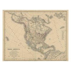
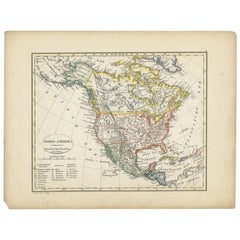
Old Original Antique German Map of North America, ca.1870
Located in Langweer, NL
Antique map titled 'Nord-America'.
Old map of North America. This map originates from 'H
Category
Antique 1870s Maps
Materials
Paper
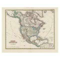
Old German Map of Northern America with Attractive Hand Colouring, 1864
Located in Langweer, NL
Interesting German map of Northern America in a handsome coloring.
Genuine antique hand colored map
Category
Antique 1860s Maps
Materials
Paper
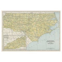
Colourful Old Detailed Map of Northern Carolina, United States of America
Located in Langweer, NL
Vintage map titled 'The Geographical Publishing Company's Premier Map of North Carolina'. Beautiful
Category
Early 20th Century Maps
Materials
Paper
H 15.56 in W 21.46 in D 0.02 in
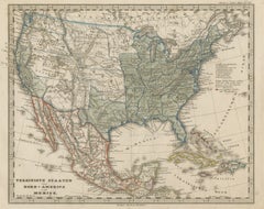
Old Map the United States and Central America, Including Mexico, ca.1860
Located in Langweer, NL
Antique map titled 'Vereinigte Staaten von Nord America und Mexico'.
Old map the United States
Category
Antique 1860s Maps
Materials
Paper
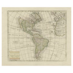
Original Antique Map of North and South America in Attractive Old Coloring
By Isaak Tirion
Located in Langweer, NL
Antique map titled 'Nieuwe Kaart van America'. Beautiful map of America. The fabled Quivira is used
Category
Antique Mid-18th Century Maps
Materials
Paper
H 16.15 in W 19.69 in D 0.02 in
Antique Map of North America from an Old Dutch School Atlas, 1852
Located in Langweer, NL
Antique map titled 'Noord-Amerika'. Map of North America. This map originates from 'School-Atlas
Category
Antique 19th Century Maps
Materials
Paper
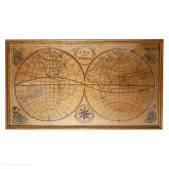
Map Silk Embroidered Western Eastern Hemisphere New Old World Asia America Afri
Located in BUNGAY, SUFFOLK
A rare, late-18th century, silk, embroidered, double hemisphere, world map, blackwork, sampler
Category
Antique 18th Century British Georgian Maps
Materials
Silk
H 0.4 in W 0.4 in D 0.4 in
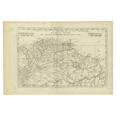
Old Map Guiana, Columbia Venezuela, Andalusia in South America by Bonne, c.1780
Located in Langweer, NL
les pays Limitrophes qui en sont au sud'.
Detailed map covering part of South America including
Category
Antique 18th Century Maps
Materials
Paper
H 10.24 in W 15.16 in D 0 in
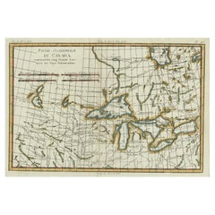
Old Map of the Great Lakes and Upper Mississippi Valley, Northern America, c1780
Located in Langweer, NL
Antique map titled 'Partie Occidentale du Canada'.
A fine example of Rigobert Bonne and
Category
Antique 1780s Maps
Materials
Paper
H 10.32 in W 14.85 in D 0 in
Old Map of the American Railroad Network and All Weather Roads on Verso, 1931
Located in Langweer, NL
This is the “New Census Edition” of Clason’s United States Green Guide. It features two large maps
Category
Vintage 1930s Maps
Materials
Paper
H 20.71 in W 32.8 in D 0 in
Old Map Showing the Tracks of Cook Between North America and Asia's Coast, 1803
Located in Langweer, NL
Description: Antique map titled 'Kaart van de Noord-West kust van Amerika en de Noord-Oost kust van
Category
Antique Early 1800s Maps
Materials
Paper
H 20.87 in W 29.14 in D 0 in
Old German Map of the United States, Central America and the West Indies, c.1870
Located in Langweer, NL
Antique map titled 'Westindien, Mittelamerica und Vereinigte Staten'. Old map of the United States
Category
Antique 19th Century Maps
Materials
Paper
H 13.78 in W 17.68 in D 0 in
Antique Map of South America by Migeon '1880'
By J. Migeon
Located in Langweer, NL
Antique map titled 'Amérique Méridionale'. Old map of South America. With an inset map of the
Category
Antique Late 19th Century French Maps
Materials
Paper
Antique Map of South America by Walker, 1816
By Thomas Kitchin
Located in Langweer, NL
Antique map titled 'South America'. Old map of South America. This map originates from 'Walker's
Category
Antique 19th Century Maps
Materials
Paper
Antique Map of North America by Johnston, 1882
By Alexander Keith Johnston
Located in Langweer, NL
Antique map titled 'North America'.
Old map of North America. This map originates from 'The Royal
Category
Antique 19th Century Maps
Materials
Paper
Antique Map of South America by Kelly, 1835
Located in Langweer, NL
Antique map titled 'South America'. Old map of South America engraved by A. Findley. With
Category
Antique 19th Century Maps
Materials
Paper
Antique Map of South America by Johnston, 1861
Located in Langweer, NL
Antique map titled 'South America'.
Old map of South America, with an inset map of the Galapagos
Category
Antique 19th Century Maps
Materials
Paper
Antique Map of South America by Johnston, 1882
Located in Langweer, NL
Antique map titled 'South America'. Old map of South America, with an inset map of the Galapagos
Category
Antique 19th Century Maps
Materials
Paper
Antique Map of South America, Southern Part, 1882
Located in Langweer, NL
Antique map titled 'South America'. Old map of South America. This map originates from 'The Royal
Category
Antique 19th Century Maps
Materials
Paper
Interesting Old Map of the Nw Coast of America and the Ne Coast of Asia, ca.1772
Located in Langweer, NL
. Interesting map of the NW Coast of America and the NE Coast of Asia, based upon Jefferys' map of 1768. Prior
Category
Antique 1770s Maps
Materials
Paper
H 13.78 in W 17.13 in D 0 in
Antique Map of South America by Dower, ‘circa 1845’
Located in Langweer, NL
Antique map titled 'South America'. Old map of South America. Published by Orr & Company, Amen
Category
Antique Mid-19th Century Maps
Materials
Paper
Antique Map of South America by Philip & Son, 1875
Located in Langweer, NL
Antique map titled 'South America'. Old map of South America. Source unknown, to be determined
Category
Antique 19th Century Maps
Materials
Paper
Antique Map of North America Including the West Indies
Located in Langweer, NL
Original antique map titled 'Nord-America'. Old map of North America and the West Indies. Also
Category
Antique Mid-19th Century Maps
Materials
Paper
Antique Map of South America by Petri, c.1873
By Thomas Kitchin
Located in Langweer, NL
Antique map titled 'Zuid-Amerika'. Old map depicting South America, with an inset map of the
Category
Antique 19th Century Maps
Materials
Paper
Antique German Map of South America by Kiepert, c.1870
Located in Langweer, NL
Antique map titled 'Süd-America'. Old map of South America. This map originates from 'H. Kiepert's
Category
Antique 19th Century Maps
Materials
Paper
Antique Map of South America with Many Details, ca.1859
Located in Langweer, NL
Original antique map titled 'Süd-America'. Beautiful old map of South America, with many details
Category
Antique Mid-19th Century Maps
Materials
Paper
Antique Map of Central America and the West Indies, 1882
Located in Langweer, NL
Antique map titled 'West India Islands and Central America'. Old map of Central America and the
Category
Antique 19th Century Maps
Materials
Paper
Antique Map of the United States of North America, c.1882
Located in Langweer, NL
Antique map titled 'United States of North America'. Old map of the United States of North America
Category
Antique 1880s Maps
Materials
Paper
Antique Map with Hand Coloring of North America and the West Indies
Located in Langweer, NL
Original antique map titled 'Nord-America'. Old map of North America and the West Indies.
This
Category
Antique Late 19th Century Maps
Materials
Paper
Antique Map of North America and the West Indies by Stieler, circa 1865
Located in Langweer, NL
Antique map titled 'Nord-America und West-Indien'. Old map of North America and the West Indies
Category
Antique Mid-19th Century Maps
Materials
Paper
H 9.45 in W 12.21 in D 0.02 in
Italian Contemporary Handcolored Old Map Printed on Canvas "The Americas"
Located in Scandicci, Florence
Beautiful reproduction of an antique map showing th Planisfere, with continets, lands and their
Category
21st Century and Contemporary Italian Prints
Materials
Cotton, Paper
H 31.5 in W 44.49 in D 0.12 in
Old Vintage Look Pull Down Map Wall Chart Poster South America
Located in Berghuelen, DE
The wall map shows South America in a combination of physical and political map with the emphasis
Category
Mid-20th Century German Country Prints
Materials
Canvas, Wood, Paper
North and South America: An 18th Century Hand-colored Map by Johann Homann
By Johann Baptist Homann
Located in Alamo, CA
This early 18th century hand-colored copperplate map of North and South America entitled "Totius
Category
Early 18th Century Old Masters Landscape Prints
Materials
Engraving
1762 Map of North America
By Thomas Kitchin
Located in New York, NY
"An Accurate Map of the British Empire in North America as settled by the Prelimmnaries in 1762" by
Category
1760s Realist Landscape Prints
Materials
Engraving
Louisiana Purchase Map, 1804
Located in Houston, TX
Over 200 year old engraved map of Americas from 1804. Original hand color. Shows American
Category
Early 1800s More Prints
Materials
Ink, Watercolor, Handmade Paper
Old Map of the Coast of Guyana and Surinam, South America, 1783
Located in Langweer, NL
Parts (..)'.
Old map of the coast of Guyana with four inset maps of the entrances to the Berbice
Category
Antique 1780s Maps
Materials
Paper
An Old Illustrated Tallis Map of Central America with Volcanic Vignettes, 1851
Located in Langweer, NL
This map of Central America, part of John Tallis & Company's series from "The British Colonies" by
Category
Antique 1850s Maps
Materials
Paper
H 10.71 in W 14.26 in D 0 in
Old Map the Gulf of Mexico, the Caribbean and Northern South America, ca.1765
Located in Langweer, NL
West-Indien'. Detailed map of Mexico, the Gulf of Mexico, the Caribbean and northern South America
Category
Antique 18th Century Maps
Materials
Paper
H 20.28 in W 17.33 in D 0 in
The Atlantic Ocean, Americas, Africa and Europe: Hand-colored 18th C. Bowen Map
Located in Alamo, CA
Collection of Voyages and Travels". The map depicts the eastern coast of North America from northern Canada
Category
Mid-18th Century Old Masters Landscape Prints
Materials
Engraving
1762 Map of North America
By Thomas Kitchin
Located in New York, NY
"An Accurate Map of the British Empire in North America as settled by the Prelimmnaries in 1762" by
Category
1760s Realist Landscape Prints
Materials
Engraving
Get Updated with New Arrivals
Save "Old American Maps", and we’ll notify you when there are new listings in this category.
Old American Maps For Sale on 1stDibs
Find a variety of old american maps available on 1stDibs. The range of distinct old american maps — often made from paper, canvas and fabric — can elevate any home. Old american maps have been produced for many years, with earlier versions available from the 18th Century and newer variations made as recently as the 20th Century.
How Much are Old American Maps?
Prices for old american maps start at $175 and top out at $1,028 with the average selling for $514.
