Retro Map Prints

4
to
36
490
415
923
544
379
241
165
159
79
58
59
39
36
25
25
Sort By
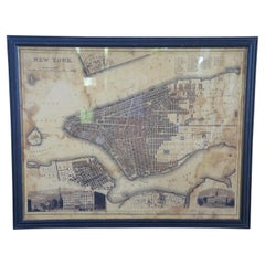
Vintage Oversized New York City Lower Manhattan 1840s Map Print
Located in Dayton, OH
Vintage late 20th century reproduction print of New York City featuring lower Manhattan in 1840.
Category

Late 20th Century Victorian Retro Map Prints

Materials

Paper

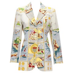
rare HERMES Vintage 100% silk Ancient French Map print blazer jacket FR38 M
By Hermès
Located in Hong Kong, NT
rare HERMES Vintage 100% silk Ancient French Map print blazer jacket FR38 M Reference: TGAS/D00119
Category

1990s Retro Map Prints

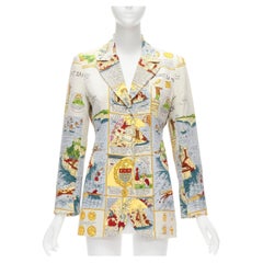
rare HERMES Vintage 100% silk Ancient French Map print blazer jacket FR38 M
By Hermès
Located in Hong Kong, NT
rare HERMES Vintage 100% silk Ancient French Map print blazer jacket FR38 M Reference: TGAS/D00119
Category

1990s Retro Map Prints

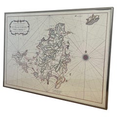
Vintage Map Print of Saint Martin Island in the Caribbean Sea, Written in Dutch.
Located in Seattle, WA
The Saint Martin island was originally St.Marthyn to the Dutch. This is a map of the island and
Category

1970s Mid-Century Modern Retro Map Prints

Materials

Metal

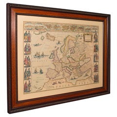
Vintage Reproduction 17th Century Map of Europe, American, Cartography, Blaeuw
Located in Hele, Devon, GB
This is a vintage reproduction map of Europe. An American, paper stock cartography print in frame
Category

Late 20th Century Central American Mid-Century Modern Retro Map Prints

Materials

Glass, Wood, Paper

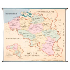
XL Old School Map of Belgium 'Printed by Procure', 1950s
Located in Oostende, BE
XL Old school map of Belgium (Printed by Procure). Presumably from around 1950-1960.
Category

1950s Belgian Mid-Century Modern Retro Map Prints

Materials

Metal

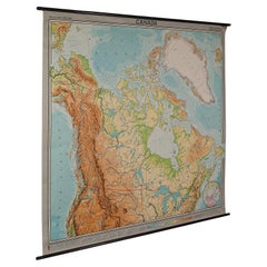
Very Large Vintage Map of Canada, German, Education, Institution, Cartography
Located in Hele, Devon, GB
This is a very large vintage map of Canada. A German, quality printed educational or institution
Category

Mid-20th Century German Retro Map Prints

Materials

Paper

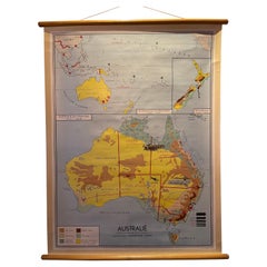
Decorative Vintage Print, Dutch Chart of Australia, 1st Edition, 1952
Located in Langweer, NL
educational materials, and printed by J. van Boekhoven in Utrecht, The Netherlands, ensuring its high printing
Category

Mid-20th Century European Retro Map Prints

Materials

Canvas

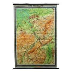
Vintage German Map Rhineland Rollable Wall Chart Poster Print
Located in Berghuelen, DE
A country core vintage pull-down map illustrating the popular German region of the Rhineland
Category

1960s German Country Retro Map Prints

Materials

Canvas, Wood, Paper

North America Vintage Map Pull-Down Wall Chart Poster Countrycore Print
Located in Berghuelen, DE
A traditional vintage pull-down school map illustrating North America, published by Westermann
Category

Late 20th Century German Country Retro Map Prints

Materials

Wood, Paper, Canvas

Vintage Rollable Mural Map Wall Chart Print Scandinavia Norway Sweden Finland
Located in Berghuelen, DE
A great impressive cottagecore map illustrating Scandinavia (Norway, Sweden, Finland, Denmark and
Category

Mid-20th Century German Country Retro Map Prints

Materials

Canvas, Wood, Paper

1960s Canvas Wall School Chart with Sheep by Jung-Koch-Quentell
By Jung Koch Quentell 1
Located in Antwerp, BE
the animal in it's natural environment as well as some anatomical details. This Pull down map theme
Category

Mid-20th Century German Mid-Century Modern Retro Map Prints

Materials

Wood, Canvas, Paper

Antique Linen Anatomical School Poster from the Cow, 1950s
Located in HEVERLEE, BE
aspect of a cow to the pupils. Printed on linen. Cool curio item to decorate a restaurant, butcher
Category

1950s Belgian Retro Map Prints

Materials

Linen

Vintage Mural World Map Earth Poster Pull-Down Wall Chart Poster Print
Located in Berghuelen, DE
A large decorative world map – named our earth, impressive wall chart decoration, published by
Category

1970s German Country Retro Map Prints

Materials

Canvas, Wood, Paper

Schumacher Paris Natural Cork La Cité 1734 Wallpaper French Photograph Mural
By Schumacher
Located in Brooklyn, NY
. This set of wallcoverings consists of the map printed in blue-black ink on natural cork with paper
Category

Late 20th Century American Belle Époque Retro Map Prints

Materials

Cork, Paper

Limbus Fatu Orum Map of a Mechanical Opera by Jay Bolotin Woodcut Print, 1992
Located in Dayton, OH
Artist: Jay Bolotin, Georgia Nold, Mark Patsfall Graphics Title: Limbus Fatu’ orum: Map of a
Category

1990s Expressionist Retro Map Prints

Materials

Paper

Large French Paris Metro Map 1960s
Located in North Hollywood, CA
Large French Paris Metro Map 1960s. A large Vintage French framed map of the Parisian Metro from
Category

Mid-20th Century French Industrial Retro Map Prints

Materials

Wood, Paper

Large French Paris Metro Map 1960s
H 30.5 in W 37.75 in D 1 in
Section of Word Map-A Puzzle
By Oyvind Fahlstrom
Located in New York, NY
This lithograph by Oyvind Fahlstrom, produced in an edition of 100, is offered by CLAMP in New York City.
Category

1970s Contemporary Retro Map Prints

Materials

Lithograph

Jacques Liozu's 1951 illustrated map of Asia
By Jacques Liozu
Located in PARIS, FR
Jacques Liozu's 1951 illustrated map of Asia is an exceptional work of cartography that combines
Category

1950s Retro Map Prints

Materials

Paper, Lithograph

Griffin's 1955 Northern Ireland original map - Tourism - Geography
Located in PARIS, FR
geography and features. Printed by James Upton Limited in Birmingham, this map is not just a navigational
Category

1950s Retro Map Prints

Materials

Linen, Lithograph, Paper

Jacques Liozu's 1951 illustrated map of South America
By Jacques Liozu
Located in PARIS, FR
Jacques Liozu's 1951 illustrated map of South America is an exceptional work of cartography that
Category

1950s Retro Map Prints

Materials

Paper, Lithograph

Vintage School Map Of Czech State, Czechoslovakia 1960s
Located in Zohor, SK
This is a great vintage school map of "Czech State1526-1648". The map was produced by a National
Category

1960s Czech Mid-Century Modern Retro Map Prints

Materials

Wood, Paper

The Dole Map of the Hawaiian Islands.
Located in New York, NY
Original color lithograph. Honolulu. Hawaiian Pineapple Company, 1950.
Category

1950s Retro Map Prints

Materials

Paper

Late 20th Century Gold Foil World Map Double Hemisphere
Located in Chula Vista, CA
Late 20th Century Gold Foil Ancient World Map Double Hemisphere Gold Foil Old World Framed Map
Category

Late 20th Century English Mid-Century Modern Retro Map Prints

Materials

Gold

Union Pacific West vintage fun map railroad travel poster
Located in Spokane, WA
Original “The Union Pacific West fun map, archivally linen backed in very good condition. Ready to
Category

1960s American Modern Retro Map Prints

Materials

Offset

illustrated map of Morocco created in 1950 by Delaye
Located in PARIS, FR
are represented. This illustrated map is printed by Perceval in Rabat. Map - North Africa
Category

1950s Retro Map Prints

Materials

Paper, Lithograph

Original Southern California Home Federal Fun Map vintage poster
Located in Spokane, WA
Original California Fun Map vintage poster from 1973. Archival linen backed in fine condition
Category

1970s American Modern Retro Map Prints

Materials

Offset

1953 Coronation Map for London Transport
Located in London, GB
." Coronation Arrangements – Map of London (1953) Lithograph 45 x 60 cm (unfolded) Published by London
Category

1950s Retro Map Prints

Materials

Lithograph

1937 Coronation Map for London Transport
Located in London, GB
." Coronation Arrangements – Map of London (1937) Lithograph 45 x 60 cm (unfolded) Published by London
Category

1950s Retro Map Prints

Materials

Lithograph

Jacques Liozu's 1951 illustrated map of Australia and Oceania
By Jacques Liozu
Located in PARIS, FR
Jacques Liozu's 1951 illustrated map of Australia and Oceania is a remarkable cartographic work
Category

1950s Retro Map Prints

Materials

Paper, Lithograph

Original Los Angeles, California Funny Funny World vintage fun map
Located in Spokane, WA
Original Los Angeles, California vintage fun map, Funny Funny World. Archival linen backed in
Category

1970s American Modern Retro Map Prints

Materials

Offset

Original poster made by Monique Cras - Map - New Caledonia
Located in PARIS, FR
Caledonia, and Overseas. This magnificent map introduces us to New Caledonia as well as to all the great
Category

Mid-20th Century Retro Map Prints

Materials

Linen, Paper, Lithograph

Europe Map Vintage Rollable Mural Countrystyle Wall Chart Decoration
Located in Berghuelen, DE
The vintage pull-down map shows the European continent / Europe. Published by Haack-Painke, Justus
Category

1970s German Country Retro Map Prints

Materials

Canvas, Wood, Paper

Vintage Rollable Map Mediterranean Countries Wall Chart Mural Poster
Located in Berghuelen, DE
A decorative countrycore pull-down map depiciting countries surrounding the Mediterranean sea
Category

1970s German Country Retro Map Prints

Materials

Canvas, Wood, Paper

Large Vintage France Map, Continental, Historical Cartography, Late 20th Century
Located in Hele, Devon, GB
This is a large vintage map of France. A Continental, framed example of historical cartography
Category

Late 20th Century European Mid-Century Modern Retro Map Prints

Materials

Glass, Wood, Paper

Vintage Rollable Map Southeast Asia China Japan Wall Chart
Located in Berghuelen, DE
A classical pull-down school map showing the popular region of Southeast Asia with China and Japan
Category

Late 20th Century German Country Retro Map Prints

Materials

Canvas, Wood, Paper

Antique Map of The City of Rome by Sebastian Münster, 1549
By Sebastian Münster
Located in Larchmont, NY
Sebastian Münster (German, 1488-1552) LA SITUATION DE LA VILLE DE ROME Antique Map of Rome, 1549
Category

1960s Realist Retro Map Prints

Materials

Woodcut

Jacques Liozu's 1951 illustrated map of North and Central America
By Jacques Liozu
Located in PARIS, FR
Jacques Liozu's 1951 illustrated map of North and Central America is an exceptional work of
Category

1950s Retro Map Prints

Materials

Paper, Lithograph

Original San Francisco, California vintage fun map poster Henry Hinton
Located in Spokane, WA
Original San Francisco, California fun map vintage poster 1970. Archival linen backed in very
Category

1970s American Impressionist Retro Map Prints

Materials

Offset

Jacques Liozu's 1951 illustrated map of Central and Eastern Europe
By Jacques Liozu
Located in PARIS, FR
Jacques Liozu's 1951 illustrated map of Central and Eastern Europe is a cartographic work of great
Category

1950s Retro Map Prints

Materials

Paper, Lithograph

Original map of Corsica by Carriat-Rolant - Travel poster - Tourism
Located in PARIS, FR
dynamism. Drawn by Gabriel Carriat-Roland, the map presents the urban agglomerations in the form of small
Category

Mid-20th Century Retro Map Prints

Materials

Paper, Lithograph

Novissima Totius Terrarum Orbis Tabula Map After Nicolaes Visscher Burled Frame
By Nicolaes Visscher II
Located in Dayton, OH
A stately print after Nicolaes Visscher's Novissima Totius Terrarum Orbis Tabula Map. Neatly
Category

Late 20th Century Retro Map Prints

Materials

Paper

North America Map Economy Wall Chart Rollable Poster Vintage Mural
Located in Berghuelen, DE
A vintage pull-down map showing the economy of North America, published by Harms. Colorful print on
Category

Late 20th Century German Country Retro Map Prints

Materials

Canvas, Wood, Paper

Southern Hemisphere of the Earth Rollable Map Vintage Wall Chart
Located in Berghuelen, DE
A great pull-down map or vintage wall chart illustrating the southern hemisphere of the earth
Category

Mid-20th Century German Country Retro Map Prints

Materials

Canvas, Wood, Paper

Cottagecore Wall Chart Spain Landscape Culture Souvenir Rollable Map Poster
Located in Berghuelen, DE
A countrycore vintage pull-down wall chart depicting Spain with a map and coloful pictures of
Category

1960s German Country Retro Map Prints

Materials

Canvas, Wood, Paper

Jacques Liozu's 1951 illustrated map of the region of Franche-Comté
By Jacques Liozu
Located in PARIS, FR
Jacques Liozu's 1951 illustrated map of Franche-Comté is a cartographic work of great beauty and
Category

1950s Retro Map Prints

Materials

Paper, Lithograph

Vintage Rollable Map Northern Germany Poland Seaside Wallchart Baltic Sea
Located in Berghuelen, DE
The large impressive cottagecore pull-down map illustrates Northern Germany, Poland and parts of
Category

Late 20th Century German Country Retro Map Prints

Materials

Canvas, Wood, Paper

Jacques Liozu's 1951 illustrated map of Alsace and Lorraine in France
By Jacques Liozu
Located in PARIS, FR
Jacques Liozu's 1951 illustrated map of Alsace and Lorraine is a remarkable work of cartography
Category

1950s Retro Map Prints

Materials

Paper, Lithograph

Vintage Pull-Down Map Germany BRD / DDR History Wall Chart
Located in Berghuelen, DE
A classical rollable vintage wall chart illustrating a map of Germany (Federal Republic of Germany
Category

Mid-20th Century German Country Retro Map Prints

Materials

Canvas, Wood, Paper

Original poster of Thurnher Weiss representing an illustrated map of Vorarlberg
Located in PARIS, FR
Original poster of Thurnher Weiss representing an illustrated map of Vorarlberg which is a region
Category

Mid-20th Century Retro Map Prints

Materials

Paper, Lithograph

An original poster featuring an illustrated map of Tenerife - La Lucha
Located in PARIS, FR
A beautiful poster featuring an illustrated map of Tenerife or Tenerife, an island in Spain that
Category

1950s Retro Map Prints

Materials

Paper, Lithograph

Vintage Wall Chart of a Landscape and Geographic Map, circa 1955
Located in Langweer, NL
geographic map. Published by J.B. Wolters, circa 1955.
Category

Mid-20th Century Retro Map Prints

Materials

Paper

Vintage Mural Map Mediterranean Sea Near East Countries Rollable Wall Chart
Located in Berghuelen, DE
A large countrycore pull-down map showing the countries surrounding the Mediterranean Sea
Category

1970s German Country Retro Map Prints

Materials

Canvas, Wood, Paper

Old Vintage Look Pull Down Map Wall Chart Poster South America
Located in Berghuelen, DE
The wall map shows South America in a combination of physical and political map with the emphasis
Category

Mid-20th Century German Country Retro Map Prints

Materials

Canvas, Wood, Paper

Vintage Map Wall Chart Countries of North America Rollable Mural Poster
Located in Berghuelen, DE
The vintage pull-down school map illustrates the countries / states of North America. Published by
Category

Late 20th Century German Country Retro Map Prints

Materials

Canvas, Wood, Paper

Illustrated Map of Madagascar by D. J. Allonsius 1953 Original Poster Africa
Located in PARIS, FR
Nice illustrated Map of Madagascar by D. J. Allonsius. This original poster was printed by
Category

1950s Retro Map Prints

Materials

Linen, Paper, Lithograph

Jacques Liozu's 1951 illustrated map of the region of Pays d'Ouest
By Jacques Liozu
Located in PARIS, FR
Jacques Liozu's 1951 illustrated map of the Pays d'Ouest is a remarkable cartographic work that
Category

1950s Retro Map Prints

Materials

Paper, Lithograph

Vintage Rollable Map Wall Chart South America Brasilia and Neighbour States
Located in Berghuelen, DE
A classical pull-down school map showing South America with Brasilia and its neighbor states
Category

Mid-20th Century German Country Retro Map Prints

Materials

Canvas, Wood, Paper

Vintage Mural Map of North Africa Countrycore African Wall Chart Decoration
Located in Berghuelen, DE
The wall map shows North Africa. It was published by Westermann-Schulwandkarten. Used as teaching
Category

Late 20th Century German Country Retro Map Prints

Materials

Canvas, Wood, Paper

Vintage Rollable Map Asia Japan Korea Wall Chart Poster Countrycore Decoration
Located in Berghuelen, DE
A decorative country core pull-down map depicting Japan and Korea. Published by Haack-Paincke
Category

Late 20th Century German Country Retro Map Prints

Materials

Canvas, Wood, Paper

  • 1
  • ...
Get Updated with New Arrivals
Save "Retro Map Prints", and we’ll notify you when there are new listings in this category.

Retro Map Prints For Sale on 1stDibs

On 1stDibs, there are several options of retro map prints available for sale. A selection of these works in the modern, contemporary and Impressionist styles can be found today in our inventory. These items have long been popular, with older editions for sale from the 20th Century and newer versions made as recently as the 20th Century. If you’re looking to add retro map prints that pop against an otherwise neutral space in your home, the works available on 1stDibs include that feature elements of gray, black, beige, blue and more. There have been many well-done artworks of this subject over the years, but those made by Uwe Ommer, Helmut Newton, William Gropper, (after) Henri Matisse and Henri Matisse are often thought to be among the most beautiful. The range of these distinct pieces — often created in paper, lithograph and pigment print — can elevate any room of your home.

How Much are Retro Map Prints?

Prices for art of this kind can differ depending upon size, time period and other attributes — retro map prints in our inventory begin at $59 and can go as high as $218,400, while the average can fetch as much as $1,423.