Washington Map
6
to
22
426
30
220
149
125
111
85
55
34
32
25
24
18
16
12
12
12
11
10
10
9
9
6
6
6
6
6
5
5
4
4
4
4
4
4
2
1
45
28
20
19
14
Sort By
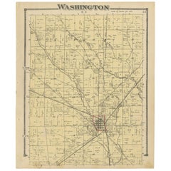
Antique Map of Washington County 'Ohio' by Titus, 1871
Located in Langweer, NL
Antique map titled 'Washington'. Original antique map of Washington, Ohio. This map originates from
Category
Antique Late 19th Century Maps
Materials
Paper
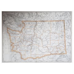
Large Original Antique Map of Washington, 'State', USA, 1894
By Rand McNally & Co.
Located in St Annes, Lancashire
Fabulous map of Washington.
Original color.
By Rand, McNally & Co.
Published, 1894
Category
Antique 1890s American Maps
Materials
Paper
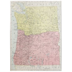
Original Antique Map of the American State of Washington, 1889
Located in St Annes, Lancashire
Great map of Washington
Drawn and Engraved by W. & A.K. Johnston
Published By A & C Black
Category
Antique 1880s Scottish Victorian Maps
Materials
Paper
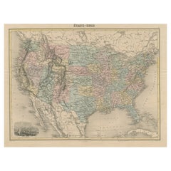
Antique Map of the United States with Vignette of Washington
Located in Langweer, NL
Antique map titled 'États-Unis'. A very attractive and detailed late 19th century map of the United
Category
Antique Late 19th Century Maps
Materials
Paper
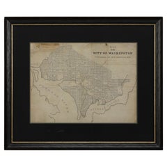
1840 Map of the City of Washington Published by William M. Morrison
Located in Colorado Springs, CO
This map, printed in 1840, is a detailed representation of Washington, D.C. in the mid-19th century
Category
Antique 1840s American Federal Maps
Materials
Paper
1864 Map of North America, Antique Hand-Colored Map, by Adolphe Hippolyte Dufour
Located in Colorado Springs, CO
Offered is a map of North America entitled Amerique du Nord from 1864. This rare, separately
Category
Antique 1860s French Maps
Materials
Paper
H 44.5 in W 33 in D 1.5 in
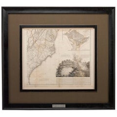
1812 United States Map, by Pierre Tardieu, Antique French Map Depicting the U.S.
By Pierre François Tardieu
Located in Colorado Springs, CO
Map by Tardieu
This attractive map, published in Paris in 1812, is one of the most rare large
Category
Antique 1810s French Maps
Materials
Paper
H 43.5 in W 48 in D 2.25 in
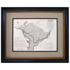
Plan for the City of Washington by Andrew Ellicott, Antique Print, 19th Century
Located in Colorado Springs, CO
Washington. Published by Thackara & Vallance, Philadelphia, 1792. Later impression printed on 19th century
Category
Antique Late 19th Century American Maps
Materials
Paper
H 36 in W 43.75 in D 3 in
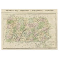
French Geographical, Statistical and Historical Map of Pensylvania, 1825
Located in Langweer, NL
and bottom. Prime meridians: Washington and Paris.
A very interesting 1825 French hand-colored map
Category
Antique 1820s Maps
Materials
Paper
H 20.08 in W 25.99 in D 0 in
Cortesi's Masterpiece: A Comprehensive and Authoritative Map of Uruguay, 1903
Located in Langweer, NL
Antique map titled 'Mapa de la Republica Oriental del Uruguay'. Large and detailed folding map of
Category
Early 20th Century Maps
Materials
Paper
Free Shipping
H 72.84 in W 50.79 in D 0.02 in
America "Amérique Septentrionale": A 19th Century French Map by Delamarche
By Maison Delamarche 1
Located in Alamo, CA
This framed mid 19th century map of North America entitled "Amérique Septentrionale" by Felix
Category
Antique Mid-19th Century American Other Maps
Materials
Paper
H 20 in W 22.63 in D 0.88 in
Antique Map of the United States ' South East ' by Johnston '1909'
Located in Langweer, NL
America ( South East Sheet ). With inset maps of New York, Washington and Cuba. This map originates from
Category
Early 20th Century Maps
Materials
Paper
Pictorial Vintage Map of New York City Showing Numerous Landmarks, 1939
Located in Langweer, NL
This pictorial souvenir map focuses on New York City and the site of the 1939 World's Fair. It was
Category
Vintage 1930s Maps
Materials
Paper
"The United States from the Latest Authorities" Antique Wall Map, 1835
Located in Colorado Springs, CO
This is a 1835 map of “The United States from the Latest Authorities” by Ezra Strong. A hand
Category
Antique 1830s American Maps
Materials
Paper
1847 Ornamental Map of the United States & Mexico by H. Phelps
Located in Colorado Springs, CO
Offered is an original 1847 ornamental map of the U.S. entitled "Ornamental Map of the United
Category
Antique 1840s American Maps
Materials
Paper
Antique Map of The United States of North America, Pacific States, 1882
Located in Langweer, NL
The map is from the same 1882 Blackie Atlas and focuses on the Pacific States of the United States
Category
Antique 1880s Maps
Materials
Paper
No Reserve
H 14.97 in W 11.03 in D 0 in
1859 "Map of the United States of America..." by J. H. Colton
By J.H. Colton
Located in Colorado Springs, CO
includes the Washington Territory, Kansas Territory, and the new state of Minnesota. The map was updated
Category
Antique 1850s American Maps
Materials
Paper
1948 "A Hysterical Map of Yellowstone National Park" by Jolly Lindgren, 2nd Ed.
Located in Colorado Springs, CO
Presented is a second edition printing of Jolly Lindgren’s “Hysterical Map of Yellowstone National
Category
Vintage 1940s American Maps
Materials
Paper
H 20 in W 20 in D 0.75 in
1847 “World at One View” Antique Hand-Colored Wall Map of the World
Located in Colorado Springs, CO
This is a highly desirable hanging wall map of the "World at One View", published in 1847 by Ensign
Category
Antique 19th Century American Maps
Materials
Paper
1842 Wall Map of the United States by J. H. Young, Published by S. A. Mitchell
Located in Colorado Springs, CO
city map insets of the vicinities around Boston, New York, Philadelphia, Baltimore and Washington
Category
Antique 1840s American Maps
Materials
Paper
H 45 in W 38 in D 1 in
1889 "The Pacific States and Territories"
Located in Colorado Springs, CO
Territories.” The vertical map depicts the Western states at the time: Washington, Oregon, California, Montana
Category
Antique 1880s American Maps
Materials
Paper
1879 "United States of America, Western Part" by O. J. Stuart
Located in Colorado Springs, CO
This colorful original map, titled “United States of America, Western Part,” was issued in Volume
Category
Antique 1870s American Maps
Materials
Paper
Mariners Chart of Quicks Hole and Tarpaulin Cove by George Eldridge 1901
Located in Norwell, MA
Washington Eldridge (1845-1912) were leading sea chart and sailing guide publishers from the mid 19th to the
Category
Antique Early 1900s North American Maps
Materials
Paper
Civil War Panorama of the Seat of War by John Bachmann, Antique Print circa 1864
Located in Colorado Springs, CO
of the Confederacy, and the southernmost areas of the Union, including Washington. This third issue
Category
Antique 1860s American Maps
Materials
Paper
H 33.5 in W 41.5 in D 2 in
Original 1917 Railroad Map of Washington State railway map
Located in Spokane, WA
This is an Original Lithograph Vintage Railroad Map of Washington State; it is not a reproduction
Category
1910s Academic Landscape Prints
Materials
Lithograph
Washington. USA. Century Atlas state antique vintage map
Located in Melbourne, Victoria
'The Century Atlas. Washington'
Original antique map, 1903.
Central fold as issued. Map name and
Category
Early 20th Century Victorian More Prints
Materials
Lithograph
Original 'The Evergreen Playground' Easter Washington State map
Located in Spokane, WA
…
There is a border around the entire map with small pictures representing Washington State. In the 4
Category
1940s American Realist Landscape Prints
Materials
Lithograph
H 33.25 in W 20.75 in D 0.04 in
American Revolution Map Drawn For John Marshall's "Life Of Washington" First Acc
Located in Bristol, CT
antique map from Marshall's Life of Washington, published 1846. Includes Cape Ann, the St. Lawrence River
Category
Early 1800s Prints and Multiples
Materials
Paper, Engraving
Women and Hokusai's Maps
By Bastienne Schmidt
Located in Fairfield, CT
International Center of Photography, the Brooklyn Museum, the Corcoran Gallery in Washington D.C. the Victoria
Category
21st Century and Contemporary Mixed Media
Materials
Paper, Mixed Media
1861 Topographical Map of the District of Columbia, by Boschke, Antique Map
Located in Colorado Springs, CO
Washington D.C. by D. McClelland, Blanchard and Mohun. Boschke’s map is known for its highly accurate details
Category
Antique 1860s American Historical Memorabilia
Materials
Paper
H 53.25 in W 53.75 in D 3.5 in
Jones 11, cutouts, maps, sports basketball
Located in Brooklyn, NY
image embedded in layered glass. Created with cutouts, maps
maps, cuutout, cutout art, football
Category
2010s Contemporary Mixed Media
Materials
Glass, Mixed Media
George Washington after the Painting by Rembrandt Peale, circa 1856
Located in Colorado Springs, CO
Presented is an original lithograph of George Washington, shown in three-quarter pose with formal
Category
Antique 1850s Prints
Materials
Paper
Panorama of Washington Hand- Colored Engraving pub. by Charles Magnum 1860
Located in Paonia, CO
1860 Hand -colored engraving "Panorama of Washington D. C. published by Charles Magnus This is a
Category
1860s Other Art Style Landscape Prints
Materials
Engraving
The Catch, cutouts, maps, dancers, silhouetted figures
Located in Brooklyn, NY
image embedded in layered glass. Created with cutouts, maps
dancers, dancing art, maps, cutouts
Category
2010s Contemporary Mixed Media
Materials
Glass, Mixed Media
"The Story Map Of The West Indies" 1936
Located in Bristol, CT
Framed colour map of the West Indies published 1936 w/ border design motif adapted from native West
Category
1930s More Prints
Materials
Paper
Watercolour Drawing by Kenneth Stevens MacIntire of a Nautical Map
By Kenneth Stevens MacIntire
Located in Norwich, GB
A watercolour drawing of a three-fold screen design, depicting a nautical map of the Atlantic
Category
20th Century American American Classical Paintings
Materials
Paper
China (gorgeous silkscreen on lanaquarelle from renowned artist's map series)
By Paula Scher
Located in New York, NY
designer and artist Paula Scher's silkscreen China, from her map series, represents a subjective take on
Category
2010s Pop Art Abstract Prints
Materials
Screen, Graphite
New France and Labrador - Graphite Drawing, Landscape, On Antiqued Map
By Don Pollack
Located in Chicago, IL
Coeur d’Alenes trail in Northern Idaho. It is a place of rugged and stark beauty barely on the old maps
Category
21st Century and Contemporary Contemporary Landscape Paintings
Materials
Canvas, Oil
Afternoon in Summertime, unique, work on paper, bears, plants, maps, yellow
By Melanie Yazzie
Located in Santa Fe, NM
unframed work on paper
Maps of New Mexico, Washington, Nevada
As a printmaker, painter, and sculptor, my
Category
2010s Contemporary Animal Drawings and Watercolors
Materials
Charcoal, Gouache, Monotype, Screen
North America: A Framed Hand-colored 19th Century German Map by Adolph Stieler
By Adolf Stieler
Located in Alamo, CA
This framed early 19th century map of North America entitled "Nord-Amerika" is plate No. LIV (No
Category
1830s Landscape Prints
Materials
Engraving
H 19.5 in W 22 in D 0.88 in
Plan Of The Northern Part Of New Jersey Showing The Positions Of The American &
By Richard Phillips
Located in Bristol, CT
After Crossing The North River in 1776
Map Sz: 9 7/8"H x 7 1/4"W
Frame Sz: 18 5/8"H x 15 3/4"W
Category
Early 1800s Prints and Multiples
Materials
Lithograph
"Inside the Machine", Abstract Oil Painting on Canvas Mounted on Wood Panel
By Nancy Newman Rice
Located in St. Louis, MO
Washington University, where she earned a BFA with honors and an MFA. She has received awards that include a
Category
2010s Contemporary Abstract Paintings
Materials
Canvas, Oil, Panel
H 24 in W 24 in D 2.25 in
"Fire Remains", Abstract Oil Painting on Canvas Mounted on Wood Panel, Framed
By Nancy Newman Rice
Located in St. Louis, MO
Washington University, where she earned a BFA with honors and an MFA. She has received awards that include a
Category
2010s Contemporary Abstract Paintings
Materials
Canvas, Oil, Panel
Nancy Newman Rice"Fire Remains", Abstract Oil Painting on Canvas Mounted on Wood Panel, Framed, 2023
H 24 in W 24 in D 2.25 in
"City of Echos", Geometric Abstract Oil Painting on Canvas Mounted on Wood Panel
By Nancy Newman Rice
Located in St. Louis, MO
Washington University, where she earned a BFA with honors and an MFA. She has received awards that include a
Category
2010s Contemporary Abstract Paintings
Materials
Canvas, Oil, Panel
"Cozumel Channel" abstract sediment landscape oil painting of a rolling current
By Chase Langford
Located in Edgartown, MA
environment while embarking into uncharted territory. His impactful depictions recall maps and aerial
Category
2010s Abstract Abstract Paintings
Materials
Canvas, Oil
"Positano", a vivid horizontal view of mostly white sediment with blues underlay
By Chase Langford
Located in Edgartown, MA
environment while embarking into uncharted territory. His impactful depictions recall maps and aerial
Category
2010s Abstract Abstract Paintings
Materials
Canvas, Oil
"Tanzania 5" abstract sedimentary landscape oil painting calm blues & bold reds
By Chase Langford
Located in Edgartown, MA
environment while embarking into uncharted territory. His impactful depictions recall maps and aerial
Category
2010s Abstract Abstract Paintings
Materials
Oil, Canvas
"Sea Fair" abstract sedimentary landscape oil painting greys and blues
By Chase Langford
Located in Edgartown, MA
environment while embarking into uncharted territory. His impactful depictions recall maps and aerial
Category
2010s Abstract Mixed Media
Materials
Mixed Media, Oil
"Ribbons and Ruins", Contemporary, Abstract, Oil Painting, on Canvas, Framed
By Nancy Newman Rice
Located in St. Louis, MO
Washington University, where she earned a BFA with honors and an MFA. She has received awards that include a
Category
2010s Contemporary Abstract Paintings
Materials
Canvas, Wood, Oil
Free Shipping
H 20 in W 20 in D 2 in
Antique Print of the World's Time Zones by Johnson, 1872
Located in Langweer, NL
& Washington'. Original print of the World's time zones. This map originates from 'Johnson's New Illustrated
Category
Antique Late 19th Century Prints
Materials
Paper
"Windows 02", Abstract Oil Painting on Canvas Mounted on Panel, Framed
By Nancy Newman Rice
Located in St. Louis, MO
Washington University, where she earned a BFA with honors and an MFA. She has received awards that include a
Category
2010s Contemporary Abstract Paintings
Materials
Canvas, Oil, Panel
H 31.5 in W 31.5 in D 2.25 in
"Blue 1", Abstract Oil Painting on Panel, Framed, Dark Colors, Geometric
By Nancy Newman Rice
Located in St. Louis, MO
Washington University, where she earned a BFA with honors and an MFA. She has received awards that include a
Category
2010s Contemporary Abstract Paintings
Materials
Oil, Panel
H 25.5 in W 25.5 in D 2.25 in
"Metropolis 5" pink abstract
By Chase Langford
Located in Edgartown, MA
environment while embarking into uncharted territory. His impactful depictions recall maps and aerial
Category
2010s Mixed Media
Materials
Mixed Media, Oil
"Catalina Point" abstract of ocean
By Chase Langford
Located in Edgartown, MA
environment while embarking into uncharted territory. His impactful depictions recall maps and aerial
Category
2010s Figurative Paintings
Materials
Oil
"Sonoma Fields" napa california inspired
By Chase Langford
Located in Edgartown, MA
environment while embarking into uncharted territory. His impactful depictions recall maps and aerial
Category
2010s Figurative Paintings
Materials
Oil
"Vineyard Current" abstract of ocean
By Chase Langford
Located in Edgartown, MA
environment while embarking into uncharted territory. His impactful depictions recall maps and aerial
Category
2010s Figurative Paintings
Materials
Oil
Highway 26, Shoshoni, Wyoming; June 9, 2021, color photograph, signed
By Steve Fitch
Located in Sante Fe, NM
expanses throughout the West.
The delightful photographs in this series, map out Fitch’s extensive journey
Category
2010s Contemporary Color Photography
Materials
Archival Pigment
19th Century Nautical Chart of Martinique
Located in Norwell, MA
Original map of Martinique from 1887 with chartered waters around the island. Prepared from a
Category
Antique 19th Century Nautical Objects
Warm Beach (#108)
By Joyce Kozloff
Located in Austin, TX
examined bodies of water and the inaccuracies of early maps from the so-called “Age of Discovery.” In 1999
Category
1970s Post-War Abstract Paintings
Materials
Canvas, Acrylic, Graphite
"Amalfi 4" abstract oil painting in shades of blue, green, red and white
By Chase Langford
Located in Edgartown, MA
environment while embarking into uncharted territory. His impactful depictions recall maps and aerial
Category
2010s Abstract Abstract Paintings
Materials
Canvas, Oil
- 1
Get Updated with New Arrivals
Save "Washington Map", and we’ll notify you when there are new listings in this category.
Washington Map For Sale on 1stDibs
With a vast inventory of beautiful furniture at 1stDibs, we’ve got just the washington map you’re looking for. A washington map — often made from paper, animal skin and leather — can elevate any home. Your living room may not be complete without a washington map — find older editions for sale from the 18th Century and newer versions made as recently as the 20th Century. You’ll likely find more than one washington map that is appealing in its simplicity, but Rand McNally & Co. produced versions that are worth a look.
How Much is a Washington Map?
Prices for a washington map start at $195 and top out at $49,500 with the average selling for $2,583.
More Ways To Browse
2 Tone Watches Mens
Mens 2 Tone Watch
Dual Time Watch Gold
Panel Kyoto
Drexel Painted
Chinese Ceramic 15th
1930s Vintage Clothes
Vintage Film Studio Light
Engraved Steel Table
1840 Empire Antique Furniture
Art Glass Bowl Japan
Mens Large Gold Watches
Transit Antique
Antique Transits
Antique Transit
Zenith Mid Century
Vintage Aesthetic Watch
3 Chinese Figures
