John Cary More Furniture and Collectibles
British, 1755-1835
John Cary was an English cartographer. He was born in February of 1755 and died in August of 1835. His career started with his apprenticeship in London, and he opened up his own shop in the Strand in 1783. His atlas New and Correct English Atlas became the standard reference work in England. He was commissioned in 1794 by the Postmaster General to survey England's roads. Out of this commission, he published Cary's New Itinerary in 1798. He later produced Ordnance Survey maps before 1805. His business was eventually taken over by G.F. Cruchley.
to
4
9
9
2
1
8
8
1
5
5
3
9
9
9
6
1,024
217
194
176
Creator: John Cary
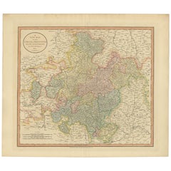
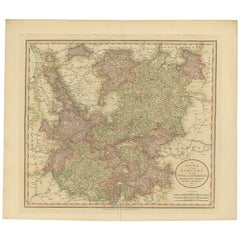
Antique Map of Franconia, a region of Germany, '1811'
By John Cary
Located in Langweer, NL
Antique map titled 'A New Map of the Circle of Franconia'. Detailed map of Franconia in Northwestern Germany. Covers from Upper Saxony south to Swabia, west to the Lower Rhine and we...
Category
Early 19th Century Antique John Cary More Furniture and Collectibles
Materials
Paper
$238 Sale Price
20% Off
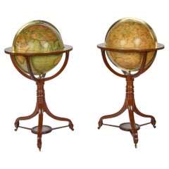
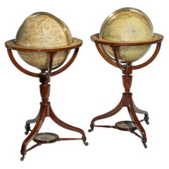
A Fine Pair of Cary Globes, Retailed by Kirk and Mercein of New York c.1816-1820
By John Cary
Located in Lymington, Hampshire
Of American Interest-A Fine Pair of Cary Globes, Retailed by Kirk and Mercein of New York c.1816-1820
The globes of celestial and terrestrial form with their original Cary of Lond...
Category
Early 19th Century English Antique John Cary More Furniture and Collectibles
Materials
Wood
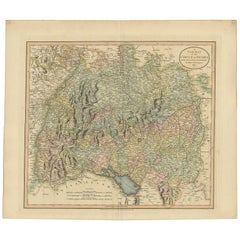
Antique Map of the Swabia Region of Germany by Cary, '1811'
By John Cary
Located in Langweer, NL
Antique map titled 'A New Map of the Circle of Swabia'. Antique map of Swabia in Southwestern Germany. Covers from the Upper Rhine region south as far as Switzerland, Lake Constance ...
Category
Early 19th Century Antique John Cary More Furniture and Collectibles
Materials
Paper
$238 Sale Price
20% Off
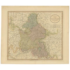
Antique Map of Bavaria and Salzburg by Cary, 1811
By John Cary
Located in Langweer, NL
Antique map titled 'A New Map of the Circle of Bavaria'. Antique map of Bavaria and Salzburg, Germany. Covers the Duchy of Bavaria and the mountainous A...
Category
Early 19th Century Antique John Cary More Furniture and Collectibles
Materials
Paper
$238 Sale Price
20% Off
Antique Map of the Upper and Lower Rhine by Cary '1811'
By John Cary
Located in Langweer, NL
Antique map titled 'A New Map of the Circles of the Upper and Lower Rhine'. Antique map covering an area from Westphalia and Lower Saxony in the north to France and Swabia in the south.
Category
Early 19th Century Antique John Cary More Furniture and Collectibles
Materials
Paper
$238 Sale Price
20% Off
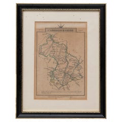
Cambridgeshire J Cary
By John Cary
Located in BUNGAY, SUFFOLK
Cambridgeshire published may 1 1814 engraver no 181 strand
Maker John Cary c. 1754 – 1835.
Category
19th Century English Georgian Antique John Cary More Furniture and Collectibles
Materials
Paper
Essex John Cary 1787 Cary's New & Correct English Atlas 40cm 16" long gilt frame
By John Cary
Located in BUNGAY, SUFFOLK
Map of Essex by John Cary Engraver
London published as the act directs Sept 1st 1787 by J Cary Engraver Map & Printseller no 188 the corner of Arundel Str...
Category
18th Century English Georgian Antique John Cary More Furniture and Collectibles
Materials
Paper
19th Century John Cary Map of South Part of West Riding of Yorkshire, circa 1805
By John Cary
Located in Royal Tunbridge Wells, Kent
Antique 19th century British original John Cary sr (1755-1835) map of South part of the West Riding of Yorkshire, From the beft Authorities. Engraved J Car...
Category
19th Century British Antique John Cary More Furniture and Collectibles
Materials
Paper
19th Century John Cary Map of North Part of West Riding of Yorkshire, C.1805
By John Cary
Located in Royal Tunbridge Wells, Kent
Antique 19th century British original John Cary sr (1755-1835) map of North part of the West Riding of Yorkshire, From the beft Authorities. Engraved J Car...
Category
19th Century British Antique John Cary More Furniture and Collectibles
Materials
Paper
Related Items
Antique Map of Principality of Monaco
By Antonio Vallardi Editore
Located in Alessandria, Piemonte
ST/619 - "Old Geographical Atlas of Italy - Topographic map of ex-Principality of Monaco" -
ediz Vallardi - Milano -
A somewhat special edition ---
Category
Late 19th Century Italian Other Antique John Cary More Furniture and Collectibles
Materials
Paper
Fine Pair of Floor Globes by J & G Cary, Dated 1820 and 1833
By George & John Cary
Located in Lymington, Hampshire
A fine pair of 15 inch floor globes by J & G Cary, dated 1820 and 1833, each set into a mahogany stand with a vase shaped support and three legs centred on a compass, one with a labe...
Category
Early 19th Century English Regency Antique John Cary More Furniture and Collectibles
Materials
Mahogany
18-inch Globe, Cary's, London, 1840
By Cary’s
Located in Milano, IT
John and William Cary
Updated by George and John Cary
Terrestrial Globe
London, 1840
lb 22 (kg 10)
Slight surface abrasions due to use. A small crack on the horizon circle.
The globe rests in its original Dutch style stand with four supporting turned wood columns.
It measures 26 in in height x 23.6 in in diameter with the diameter of the sphere measuring 18 in; 66 cm in height x 60 cm in diameter with the diameter of the sphere measuring 45.72 cm.
The 18 inch...
Category
1840s English Early Victorian Antique John Cary More Furniture and Collectibles
Materials
Paper, Wood
Pair of English 12-inch Globes by William Harris, London, 1832 and 1835
By William Harris
Located in Milano, IT
Pair of 12-inch table globes
William Harris
London, 1832 and 1835
Slight abrasions from use; few cracks
lb 11 each (kg 5)
The two terrestrial and celestial globes rest in their original Dutch style stands with four supporting turned wood columns.
Each one measures 12 in in height x 16.5 in in diameter with the diameter of the spheres measuring approximately 12 in; 48 cm in height x 42 cm in diameter x 31 cm diameter of the spheres.
The 12 inch measure was the most frequently used by British manufacturers of globes of this period.
Each globe is composed of two series of twelve printed paper gores, aligned and glued onto plaster spheres.
The brass circle of the meridian bears engravings...
Category
1830s English William IV Antique John Cary More Furniture and Collectibles
Materials
Paper, Wood
$21,453 / set
H 18.9 in Dm 16.54 in
Pair of 19th Century English J & W Cary Celestial/Terrestrial Table Model Globes
By John & William Cary
Located in Milford, NH
A fine assembled pair of 12-inch English table model globes on stands manufactured by J & W. Cary, the left globe with cartouche labeled “The New Celestial Globe, on which are correc...
Category
Early 19th Century English Antique John Cary More Furniture and Collectibles
Materials
Brass
$18,900 / set
H 25 in Dm 16.5 in
Fine Pair Of Fine 18th C. Painted European Screens
Located in Bridgeport, CT
A pair of 18th Century Scene Painted Screens with very good color and excellent form. All with scenes with men in capes and plumed hats, some on h...
Category
18th Century European Baroque Antique John Cary More Furniture and Collectibles
Materials
Wood
1855 Astronomical Plate of Distance of the Planets by FJ Huntington New York
Located in Milan, IT
Plate of the distance of the planets “Entered according to Act of Congress in the year 1855 by F.J. Huntington in the Clerk's Office of the District Court of the United States for th...
Category
1850s American Antique John Cary More Furniture and Collectibles
Materials
Glass, Wood, Paper
$1,430
H 19.61 in W 32.21 in D 0.6 in
Pair of Early 19th C Cary Celestial & Terrestrial Tabletop Globes
By John & William Cary, George & John Cary
Located in Milford, NH
A fine pair of tabletop globes on stands, the left hand colored Celestial globe with cartouche which reads “Cary's New Celestial Globe on which are corr...
Category
Early 19th Century English Antique John Cary More Furniture and Collectibles
Materials
Mahogany
Original Antique Map of Ancient Greece, Achaia, Corinth, 1786
Located in St Annes, Lancashire
Great map of Ancient Greece. Showing the region of Thessaly, including Mount Olympus
Drawn by J.D. Barbie Du Bocage
Copper plate engraving by P.F Tardieu
Original hand color...
Category
1780s French Other Antique John Cary More Furniture and Collectibles
Materials
Paper
Pair of Antique Tiffany Studio New York Bronze Buddha Bookends No. 1025
By Tiffany Studios, Tiffany & Co.
Located in Philadelphia, PA
A fine pair of antique signed bronze bookends.
By Tiffany Studios of New York, NY.
In bronze.
Pattern no. 1025.
Each with a Buddha design.
Simply a wonderful Tiffany design!
Da...
Category
Early 20th Century American Art Deco John Cary More Furniture and Collectibles
Materials
Bronze
$1,500 / set
H 5.88 in W 4.88 in D 5.88 in
Extremely Rare Copy of the Venezuelan Declaration of Independance, 1811
Located in Amsterdam, NL
Extremely rare copy of the Venezuelan Declaration of Independance 'Declaracion de Independencia de las Siete Provincias Unidas de Venezuela en Congreso de 5 de Julio de 1811'
By Lorenzo Lüthy (c. 1811-1877), printed in Philadelphia, Peter S. Duval, 1841.
Lithograph on laid paper, mounted in passepartout, H. 84 x W. 64.5 cm (with mount H. 96,5 x W. 77 cm.)
Large and extremely rare lithographed broadside Declaration of Independence of Venezuela by American immigrant...
Category
Early 19th Century Venezuelan Antique John Cary More Furniture and Collectibles
Materials
Paper
$13,706
H 33.08 in W 25.4 in D 0.04 in
A huge pair of 21 inches Cruchley Library Globes
By G.F. Cruchley
Located in ZWIJNDRECHT, NL
G.F. Cruchley (UK, 1796-1880)
London ca 1850
A magnificent pair of terrestrial and celestial globes. Equatorial table engraved with the signs of the zodiac and resting on 3 mahogany molded feet held by a compass at the spacer. With graduated brass meridian circles and time clocks. The terrestrial globe is inscribed in a cartouche: Cruchley's new terrestrial globe from the most recent and best authorities. Exhibiting the discoveries in equatorial Africa, north pole. And the new settlements and divisions in Australia, New Zealand, Californa, Texas, &c. London. Sold by Gould and Porter opticians 181 strand WC. The celestial globe is inscribed in a cartouche: Cruchleys new celestial globe on which is accurately laid down the whole of the stars and nebule contained in the astronomical catalogue of the Reverend Mr. Wollaston F.R.S. Also from the authorities Flamstead, De La Caille, Hevellus, Bradley, Herschel, Maskelyne, &c. Ands the limits of each constellation determined by a boundary line. London, published by G.F. Cruchley, map-seller & globe maker, 81 Fleet street.
Signed: CRUCHLEY in London England, circa 1850 H. 125 cm Diam. 53 cm (21 inches) Diam. 25 cm compasses The two spheres are in a perfect state of freshness and are perfectly legible.
The condition of both the globes is very good. There have been some professional repairs to some damaged gores. The Terrestrial globe in good conserved and legible condition, it has areas of rubbing, retouching, and slight discoloration. The Celestial globe is also in good conserved and legible condition with areas of rubbing, retouching and slight discoloration. The gores themselves have been cleaned and revarnished. The splendid mahogany legs and moulded feet are in first class condition. Each globe consists of 12 hand coloured copper engraved gores over a paper-maché hollow core, made up of two hemispheres joined at the equator and covered with a layer of plaster. There are paper horizon rings, made up of a series of concentric circles, displaying the months of the year, the signs of the zodiac and wind directions.
THE TERRESTRIAL GLOBE.
The globe provides much detailed information, and was accurate up to the date of production, which in this case is the mid-19th century. It shows the latest discoveries and developments that had taken place. It displays names and territories that were once familiar to the people of the age, 150 years into the future! In Asia for example, there are places like ‘Little Bucharia’, ‘Little and Greater Tartary’, ‘Russia in Asia.’ Undoubtedly, the continent that has changed more than any other is Africa. So many African countries that we know and recognise now, had different, perhaps more ‘Colonial’ names more than a century and a half ago. There was ‘Nubia’ (Sudan/Egypt), ‘Abbyssinia’ (Ethiopia), ‘Cape Colony’ (South Africa), ‘Dahomey’ (Benin) but to name a few. Australia was a little over 50 years away from its union via ‘Federation’ in 1901. This brought about the Commonwealth of Australia. However, in 1850 they were six separate British selfserving colonies, ruled directly from England.
In North America, both Los Angeles and San Francisco are incorporated as cities into California - as it becomes the 31st U.S. state. Much of mid-western and western USA were known as ‘The Western Territory’ & ‘The Missouri Territory’, Florida was still refered to as ‘East & West Florida’. Canada was split into ‘Canada East’ & ‘Canada West.’ Canada East was primarily (for historical reasons) French-speaking, and Canada West primarily Englishspeaking. Much of Western Canada remained unexplored and undeveloped. In Europe, there was still the ‘Russian Empire’, the ‘Ottoman Empire’, the ‘AustroHungarian Empire’, and the German ‘Prussian Empire.’
THE CELESTIAL GLOBE.
The Celestial Globe displays the stars, the constellations, clusters and nebulae in a beautiful and well thought out manner. Mythical figures and signs of the zodiac are seen. The equinoctial and solistitial colures are graduated in degrees. Although the colour is somewhat muted, it takes nothing away from the overall beauty and the undoubted aesthetic qualities of the globe.
Historically, globes are among the most ancient scientific instruments known to man. They can be dated back over two millennia, and are still manufactured to this day. The earliest tradition of globe making is mainly concerned with celestial globes – man...
Category
1850s British Victorian Antique John Cary More Furniture and Collectibles
Materials
Other
Previously Available Items
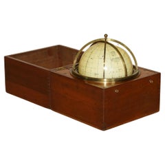
John Cary Travel Celestial Globe in Box Marked Cary & Co London, No. 21540
By John Cary
Located in West Sussex, Pulborough
We are delighted to offer for sale this lovely John Cary Travel Celestial Globe in Box marked Cary & Co London, No. 21540
This globe I believe is classed as a 14 inch which is the...
Category
19th Century English Victorian Antique John Cary More Furniture and Collectibles
Materials
Brass
H 8.47 in W 8.08 in D 8.08 in
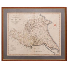
19th Century John Cary Map of the East Riding of Yorkshire, C.1800
By John Cary
Located in Royal Tunbridge Wells, Kent
Antique 19th century British original John Cary sr (1755-1835) map of the East Riding of Yorkshire, with ainsty liberty, From the beft Authorities. Engraved J Cary, mounted in solid ...
Category
19th Century British Antique John Cary More Furniture and Collectibles
Materials
Paper
18th Century John Cary Map of Kent, c.1769
By John Cary
Located in Royal Tunbridge Wells, Kent
Antique 18th century British very rare and original John Cary sr (1755-1835) map of Kent, publication 1769, A Map of the County of Kent taken from an actua...
Category
18th Century British Antique John Cary More Furniture and Collectibles
Materials
Paper
John Cary more furniture and collectibles for sale on 1stDibs.
John Cary more furniture and collectibles are available for sale on 1stDibs. These distinctive items are frequently made of paper and are designed with extraordinary care. There are many options to choose from in our collection of John Cary more furniture and collectibles, although beige editions of this piece are particularly popular. Many of the original more furniture and collectibles by John Cary were created in the Georgian style in united kingdom during the 19th century. If you’re looking for additional options, many customers also consider more furniture and collectibles by and Cary’s. Prices for John Cary more furniture and collectibles can differ depending upon size, time period and other attributes — on 1stDibs, these items begin at $176 and can go as high as $2,526, while a piece like these, on average, fetch $376.
