1820 World Map
to
4
44
6
34
15
15
10
7
3
3
2
1
1
1
1
1
1
1
1
1
1
Sort By
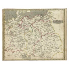
Antique Map of Germany by Walker, 1820
By R. Walker
Located in Langweer, NL
decorators all over the world. Our collection includes a wide range of authentic antique maps from the 16th
Category
Antique 19th Century Maps
Materials
Paper
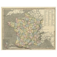
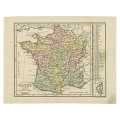
Antique Map of France with Inset Map of the Island of Corsica, 1820
Located in Langweer, NL
Antique map titled 'France in Departments'. Old map of France, with small inset map of the island
Category
Antique 19th Century Maps
Materials
Paper
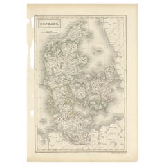
Antique Map of Denmark by Hall, circa 1820
Located in Langweer, NL
atlases containing maps of the United Kingdom and of the ancient world.
Condition: Very good, given age
Category
Antique 19th Century Maps
Materials
Paper
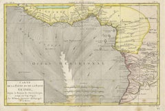
Antique Map of the Coast of Guinea, Africa, 1820
Located in Langweer, NL
Antique map Africa titled 'Carte de la Haute et de la Basse Guinée'. Map of the Coast of Guinea
Category
Antique 19th Century Maps
Materials
Paper
Antique Map of France with an Inset Map of the Island of Corsica, c.1820
Located in Langweer, NL
.
Date: c.1820
Overall size: 31 x 24 cm.
Image size: 25 x 20.5 cm.
We sell original antique maps to
Category
Antique 19th Century Maps
Materials
Paper
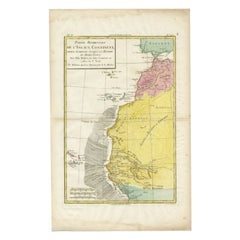
Antique Map of the Coast of Northwest Africa by Dien, 1820
Located in Langweer, NL
the world. Our collection includes a wide range of authentic antique maps from the 16th to the 20th
Category
Antique 19th Century Maps
Materials
Paper
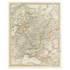
Original Antique German Map of the Russian Empire in Europe, ca.1825
Located in Langweer, NL
Antique map titled 'Des Russischen Reichs - Europäische Theil'.
Original antique map of the
Category
Antique 1820s Maps
Materials
Paper
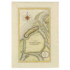
Antique Map of the Wadden Islands, 1792
Located in Langweer, NL
Antique map titled 'Der Vlie Strom'. Map of the Wadden islands with Vlieland in the middle (The
Category
Antique 18th Century Maps
Materials
Paper
Antique Map of Westergo in Friesland, 1791
Located in Langweer, NL
Reilly (1766-1820) was a Vienna based art dealer. He is also known as the author of two atlases. The maps
Category
Antique 18th Century Maps
Materials
Paper
Antique Map of Russia in Europe on Two Sheets from an Old German Atlas, Ca.1825
Located in Langweer, NL
Description: Antique map titled 'Europäisches Russland'.
Two individuel sheets, joined together
Category
Antique 1820s Maps
Materials
Paper
H 13.39 in W 16.54 in D 0 in
Antique Map of Friesland by Von Reilly, 1791
Located in Langweer, NL
(1766-1820) was a Vienna based art dealer. He is also known as the author of two atlases. The maps were
Category
Antique 18th Century Maps
Materials
Paper
Antique Map of Southern Zeeland by Von Reilly, 1790
Located in Langweer, NL
' (Wien: Reilly, 1791-1806), a world atlas in 830 maps by Franz Joseph Johann von Reilly. Artists and
Category
Antique 18th Century Maps
Materials
Paper
Antique Map of the Westerkwartier Region, a Region in Groningen, 1791
Located in Langweer, NL
Antique map titled 'Das Wester Quartier'. Original antique map of Westerkwartier, a region in the
Category
Antique 18th Century Maps
Materials
Paper
Antique Map of Overijssel and Drenthe by Von Reilly, c.1795
Located in Langweer, NL
Netherlands. This map originates from 'Schauplatz Der Funf Theile der Welt' (Wien: Reilly, 1791-1806), a world
Category
Antique 18th Century Maps
Materials
Paper
Map of the World - Original Etching - 1820
Located in Roma, IT
Map of the World is an Original Etching realized by an unknown artist of 19th century in 1820
Category
1820s Modern Figurative Prints
Materials
Etching
Antique Map of Overijssel and Drenthe by Von Reilly, c.1795
Located in Langweer, NL
Netherlands. From 'Schauplatz Der Funf Theile der Welt' (Wien: Reilly, 1791-1806), a world atlas in 830 maps
Category
Antique 18th Century Maps
Materials
Paper
Antique Map of the Region of Gaasterland, Friesland, The Netherlands, 1791
Located in Langweer, NL
the world. Our collection includes a wide range of authentic antique maps from the 16th to the 20th
Category
Antique 18th Century Maps
Materials
Paper
H 11.42 in W 12.41 in D 0 in
Antique Map of the Region of Bolsward and Sneek by Von Reilly, 1791
Located in Langweer, NL
Antique map titled 'Der Provinz Westergo drey mittlere Grietenyen mit der Stadt Bolsward und Sneek
Category
Antique 18th Century Maps
Materials
Paper
Antique Map of the Region of Leeuwarden and Dokkum in The Netherlands, 1791
Located in Langweer, NL
original antique maps to collectors, historians, educators and interior decorators all over the world. Our
Category
Antique 18th Century Maps
Materials
Paper
H 11.42 in W 15.56 in D 0 in
Antique Map of the Region of Franeker and Harlingen by Von Reilly, 1791
Located in Langweer, NL
world. Our collection includes a wide range of authentic antique maps from the 16th to the 20th
Category
Antique 18th Century Maps
Materials
Paper
Antique Map of the Region of Bolsward and Sneek by Von Reilly, 1791
Located in Langweer, NL
antique maps to collectors, historians, educators and interior decorators all over the world. Our
Category
Antique 18th Century Maps
Materials
Paper
Maps of the Ancient World and the Posterity of Noah, 1820
Located in Langweer, NL
Two maps on one sheet. Hhand colored engraved lithograph, depicting the world as known to the
Category
Antique 19th Century Prints
Materials
Paper
Vintage Mural World Map Earth Poster Pull-Down Wall Chart Poster Print
Located in Berghuelen, DE
A large decorative world map – named our earth, impressive wall chart decoration, published by
Category
Vintage 1970s German Country Prints
Materials
Canvas, Wood, Paper
H 50.01 in W 82.68 in D 0.79 in
Northern Hemisphere of the Earth Rollable Map Vintage Wall Chart World Mural
Located in Berghuelen, DE
A great pull-down map or vintage wall chart illustrating the northern hemisphere of the earth
Category
Mid-20th Century German Country Prints
Materials
Canvas, Wood, Paper
H 70.48 in W 66.93 in D 0.79 in
"The World" Published by Cummings & Hilliard, No. 1, Cornhill, Boston
Located in Soquel, CA
double hemisphere Atlas Map, titled "The World." Hand colored original outlines. Published by Cummings
Category
1820s American Realist Landscape Prints
Materials
Paper, Printer's Ink, Etching
H 20 in W 24 in D 0.5 in
Antique Print of a Male Chinese Servant, circa 1820
Located in Langweer, NL
decorators all over the world. Our collection includes a wide range of authentic antique maps from the 16th
Category
Antique 19th Century Prints
Materials
Paper
Antique Print of a Servant of the Wife of Louis XIII, 1820
Located in Langweer, NL
maps to collectors, historians, educators and interior decorators all over the world. Our collection
Category
Antique 19th Century Prints
Materials
Paper
Antique Print of a Mandarin in Court dress, circa 1820
Located in Langweer, NL
interior decorators all over the world. Our collection includes a wide range of authentic antique maps from
Category
Antique 19th Century Prints
Materials
Paper
Antique Print of a Mandarin in Traditional Dress, circa 1820
Located in Langweer, NL
, general age-related toning. Blank verso, please study image carefully.
Date: circa 1820
Overall size: 17
Category
Antique 19th Century Prints
Materials
Paper
Antique Print of Chinese Children Having Their Meal, c.1820
Located in Langweer, NL
, general age-related toning. Blank verso, please study image carefully.
Date: c.1820
Overall size: 26 x
Category
Antique 19th Century Prints
Materials
Paper
Antique Print of a Chinese Maid and Two Children, circa 1820
Located in Langweer, NL
, general age-related toning. Blank verso, please study image carefully.
Date: c.1820
Overall Size: 17 x
Category
Antique 19th Century Prints
Materials
Paper
Antique Portrait of Louis Philippe I, Last King of France, circa 1820
Located in Langweer, NL
carefully.
Date: c.1820
Overall size: 11 x 17 cm.
Image size: 4 x 7 cm.
We sell original antique maps
Category
Antique 19th Century Prints
Materials
Paper
Antique Hand-Colored Print of Chinese Workers Having Their Meal, c.1820
Located in Langweer, NL
interior decorators all over the world. Our collection includes a wide range of authentic antique maps from
Category
Antique 19th Century Prints
Materials
Paper
Antique Print of Batavia, Capital of the Dutch East Indies 'Indonesia', c.1820
Located in Langweer, NL
: c.1820
Overall size: 23 x 20 cm.
Image size: 20 x 14.5 cm.
We sell original antique maps to
Category
Antique 19th Century Prints
Materials
Paper
H 7.88 in W 9.06 in D 0 in
Antique Portrait of Louis Philippe i, Last King of France, 1859
Located in Langweer, NL
soiling, blank verso. Partly mounted to grey paper. Please study image carefully.
Date: circa 1820
Category
Antique 19th Century Prints
Materials
Paper
Pair of George III 3 inch pocket globes by J & W Cary, one dated 1791
Located in Lymington, Hampshire
engraved map of the ‘world as known in CÆSAR’s Time agreeable to D’Anville’ and ‘A Table of Latitudes
Category
Antique 1790s English Globes
Materials
Shagreen
Early 19th Century Belfast Chippendale Longcase by Robert Neill, circa 1820
By Robert Neill
Located in Dublin, IE
full sail and maps of the world. Elegant Arabic numerals on the dial.
Robert Neill - 1775-1857
Category
Antique 1810s Northern Irish Grandfather Clocks and Longcase Clocks
Materials
Mahogany
6, 19th Century hand-colored maps printed by Anthony Finley of Philadelphia 1824
Located in San Antonio, TX
nascent American cartographic world.
Maps in series: Maryland, Vermont, Maine, Massachusetts, Ohio and
Category
Early 19th Century Academic Prints and Multiples
Materials
Lithograph, Pastel
H 13 in W 10.38 in D 0.07 in
Group of 5 Aquatint Engravings of the Ancient Italian City of Pompei
By Paolo Fumagalli
Located in New York, NY
Produced between 1824 -1827, this group of aquatint engravings offer an impressive display of maps
Category
1820s Realist Landscape Prints
Materials
Engraving
Das Unterquartier Kempenland. Nro. 662.
By Franz Joseph Johann von Reilly
Located in Zeeland, Noord-Brabant
' (Wien: Reilly, 1791-1806), a world atlas in 830 maps by Franz Joseph Johann von Reilly.
Made by Franz
Category
1790s More Prints
Materials
Engraving, Etching
Antique Map of the Federate States of Germany, c.1820
Located in Langweer, NL
'.
Original antique map of Germany. Source unknown, to be determined. Published circa 1820.
Artist
Category
Antique 19th Century Maps
Materials
Paper
Rare Antique Print of a Firework Display, c.1820
Located in Langweer, NL
image carefully.
Date: c.1820
Overall size: 18 x 14 cm.
We sell original antique maps to collectors
Category
Antique 19th Century Prints
Materials
Paper
12" Table Globes by J. & W. Cary Globes
Located in New Orleans, LA
depicts the whole of the known world, as well as tracks indicating the voyages of Captain Cook and other
Category
Antique 19th Century English Globes
Materials
Mahogany
English Regency Mahogany 1820s Era Map Cabinet with Antique Maps of the World
Located in Swedesboro, NJ
This is a highly unique item. This antique 1820s mahogany map cabinet comes complete with sleeves
Category
Antique 1820s English Regency Maps
Materials
Mahogany
H 38.25 in W 40 in D 12 in
Antique Map of South-West Canada incl Quebec, New Brunswick & Nova Scotia, c1820
Located in Langweer, NL
century atlases containing maps of the United Kingdom and of the ancient world.
Condition: Excellent
Category
Antique 1820s Maps
Materials
Paper
H 11.97 in W 17.33 in D 0 in
A view of Bullpitts, Bourton and the Hindley factory
By Samuel Colman
Located in Stoke, Hampshire
Kip’s map of 1610 is not very detailed but even so shows Longlane Myll approximately on the site of the
Category
19th Century Landscape Paintings
Materials
Oil
Antique Map of the Southern United States with Inset Map of New Orleans
Located in Langweer, NL
Antique map titled 'Die Staaten von Arkansas Mississippi, Louisiana & Alabama'. Detailed map of the
Category
Antique Mid-19th Century Maps
Materials
Paper
H 9.06 in W 12.21 in D 0.02 in
Early 19th Century Embroidered Silkwork Map Picture of England, circa 1800-1820
Located in Bedford, Bedfordshire
The George III/Regency period silkwork map of England of good size, in unrestored order, presented
Category
Antique Early 19th Century English George III Tapestries
Materials
Silk
H 23.5 in W 19.5 in D 1 in
A Collection Of Classical Plaster Gems Circa 1820
By Bartolomeo and Pietro Paolétti
Located in London, GB
curiosities, where t hey added a temporal dimension to the cabinets’ encyclopedic desire to map out the world
Category
Antique 19th Century More Furniture and Collectibles
George III Pocket Globe and Case by John and William Cary
By John & William Cary
Located in Sutton Coldfield, GB
map publishers.’ (‘The World In Your Hands’, Tom Lamb and Jeremy P. Collins (ed.) London, 1994
Category
Antique 1790s English Globes
Materials
Copper
Monumental Pair of Cary's Library Globes
Located in New York, NY
, ending in spade feet on brass casters.
The terrestrial globe is mapped with detailed
Category
Antique 19th Century English Globes
Materials
Mahogany
Get Updated with New Arrivals
Save "1820 World Map", and we’ll notify you when there are new listings in this category.
1820 World Map For Sale on 1stDibs
Find many varieties of an authentic 1820 world map available at 1stDibs. Frequently made of paper, canvas and fabric, every 1820 world map was constructed with great care. You’ve searched high and low for the perfect 1820 world map — we have versions that date back to the 18th Century alongside those produced as recently as the 20th Century are available. You’ll likely find more than one 1820 world map that is appealing in its simplicity, but R. Walker produced versions that are worth a look.
How Much is a 1820 World Map?
A 1820 world map can differ in price owing to various characteristics — the average selling price 1stDibs is $197, while the lowest priced sells for $71 and the highest can go for as much as $875.
More Ways To Browse
Antique Quebec
Antique Louisiana Map
Antique Maps Of Louisiana
Antique Mill Wheel
Mexican Wooden Plates
Louisiana Antique Map
Antique Pocket Globe
Antique Railway Maps
Used Furniture Harlingen
Antique Constellation Map
Antique Copper Australia
Large Floor World Globe
Constellation Map
Map Central Asia
Antique Dairy Milk
Cluster Rings 1780
Lewis And Clark
Antique Maps Massachusetts
