
Antique Map of Austria 'Tirol' with Parts of Italy by J. Janssonius, 1649
View Similar Items


Want more images or videos?
Request additional images or videos from the seller
1 of 8
Antique Map of Austria 'Tirol' with Parts of Italy by J. Janssonius, 1649
About the Item
- Dimensions:Height: 20.79 in (52.8 cm)Width: 25.2 in (64 cm)Depth: 0.02 in (0.5 mm)
- Materials and Techniques:
- Period:Mid-17th Century
- Date of Manufacture:1649
- Condition:Please study image carefully.
- Seller Location:Langweer, NL
- Reference Number:Seller: BG-091561stDibs: LU305439931191
About the Seller
5.0
Platinum Seller
These expertly vetted sellers are 1stDibs' most experienced sellers and are rated highest by our customers.
Established in 2009
1stDibs seller since 2017
1,916 sales on 1stDibs
More From This SellerView All
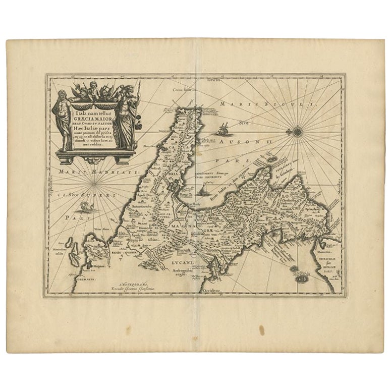
- Antique Map of Southern Italy by Janssonius, C.1650Located in Langweer, NL"Antique map titled 'Itala nam tellus Graecia Maior erat Ovid. IV. Fastor. Haec Italiae pars nunc primum de prica aerugine est abstersa (..)'. Beautiful map of Southern Italy...Category
Antique 17th Century Maps
MaterialsPaper
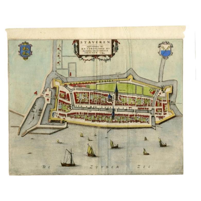
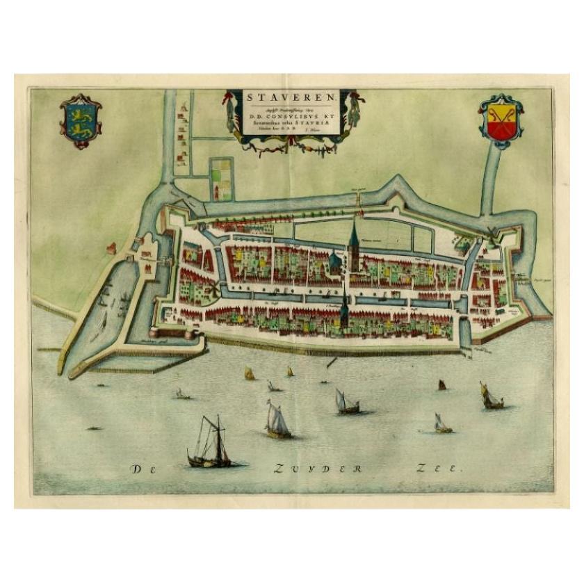
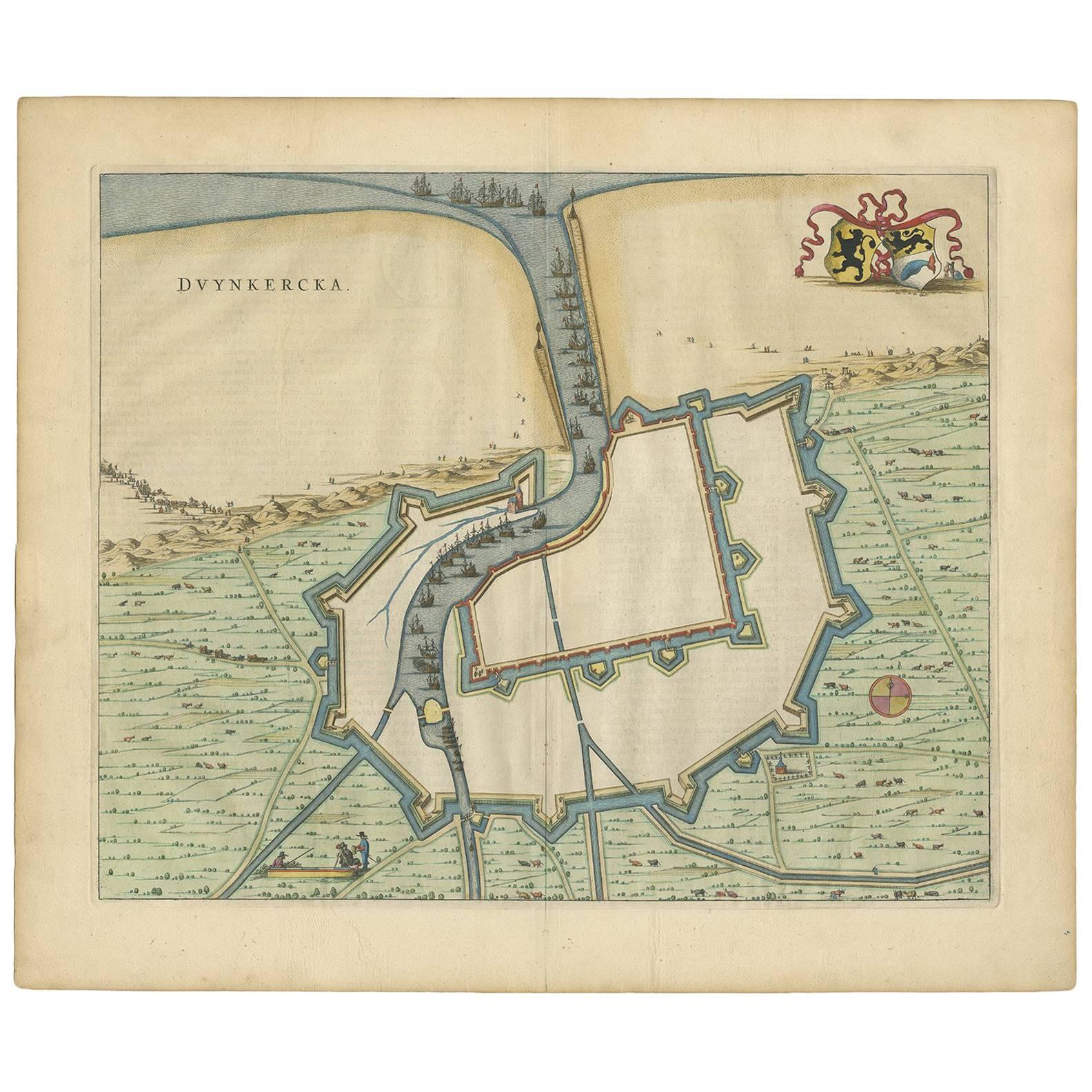
- Antique Map of Stavoren by Blaeu, 1649Located in Langweer, NLAntique map titled 'Staveren'. Original antique map of the city of Stavoren, Friesland, The Netherlands. This map originates from 'Toonneel der Steden van de Vereenighde Nederlanden'...Category
Antique 17th Century Maps
MaterialsPaper
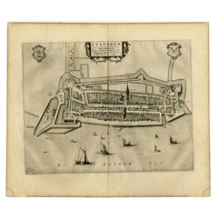
- Antique Map of Stavoren by Blaeu, 1649Located in Langweer, NLAntique map titled 'Staveren'. Original antique map of the city of Stavoren, Friesland, The Netherlands. This map originates from 'Toonneel der Steden van de Vereenighde Nederlanden'...Category
Antique 17th Century Maps
MaterialsPaper
- Antique Map of Stavoren by Blaeu, 1649Located in Langweer, NLAntique map titled 'Staveren'. Original antique map of the city of Stavoren, Friesland, The Netherlands. This map originates from 'Toonneel der Steden van de Vereenighde Nederlanden'...Category
Antique 17th Century Maps
MaterialsPaper
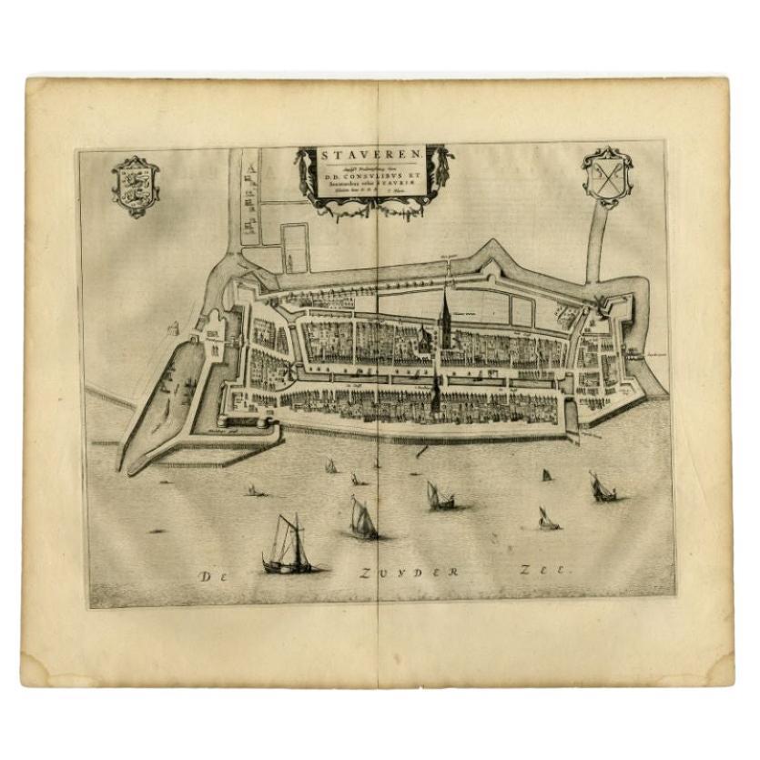
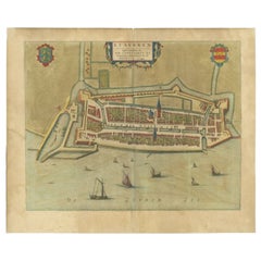
- Antique Map of Stavoren by Blaeu, 1649Located in Langweer, NLAntique map titled 'Staveren'. Original antique map of the city of Stavoren, Friesland, The Netherlands. This map originates from 'Novum Ac Magnum Theatrum Urbium Belgicae Liberae Ac...Category
Antique 17th Century Maps
MaterialsPaper
- Antique Map of Beauce by Janssonius, 1657By Johannes JanssoniusLocated in Langweer, NLAntique map 'Belsia vulgo la Beausse'. Decorative map of the region of Beauce, a natural region in northern France, located between the Seine and Loire rivers. This map originates fr...Category
Antique Mid-17th Century Maps
MaterialsPaper
 $437 Sale Price20% Off


You May Also Like
- 1657 Janssonius Map of Vermandois and Cappelle, Ric. A-004Located in Norton, MA1657 Janssonius map of Vermandois and Cappelle Ric.a004 Description: Antique map of France titled 'Descriptio Veromanduorum - Gouvernement de la Cappelle'. Two detailed maps o...Category
Antique 17th Century Unknown Maps
MaterialsPaper
- Antique Map of Italy by Andriveau-Goujon, 1843By Andriveau-GoujonLocated in New York, NYAntique Map of Italy by Andriveau-Goujon, 1843. Map of Italy in two parts by Andriveau-Goujon for the Library of Prince Carini at Palazzo Carini i...Category
Antique 1840s French Maps
MaterialsLinen, Paper
 $3,350 / set
 - 17th Century Hand-Colored Map of a Region in West Germany by JanssoniusBy Johannes JanssoniusLocated in Alamo, CAThis attractive highly detailed 17th century original hand-colored map is entitled "Archiepiscopatus Maghdeburgensis et Anhaltinus Ducatus cum terris adjacentibus". It was published ...Category
Antique Mid-17th Century Dutch Maps
MaterialsPaper
- Original Antique Map of Italy. C.1780Located in St Annes, LancashireGreat map of Italy Copper-plate engraving Published C.1780 Unframed.Category
Antique Early 1800s English Georgian Maps
MaterialsPaper

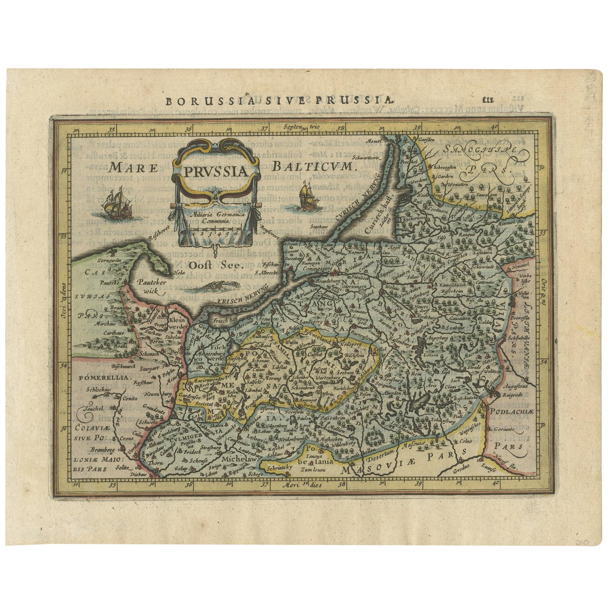
- Prussia, Poland, N. Germany, Etc: A Hand-colored 17th Century Map by JanssoniusBy Johannes JanssoniusLocated in Alamo, CAThis is an attractive hand-colored copperplate engraved 17th century map of Prussia entitled "Prussia Accurate Descripta a Gasparo Henneberg Erlichensi", published in Amsterdam by Joannes Janssonius in 1664. This very detailed map from the golden age of Dutch cartography includes present-day Poland, Latvia, Lithuania, Estonia and portions of Germany. This highly detailed map is embellished by three ornate pink, red, mint green and gold...Category
Antique Mid-17th Century Dutch Maps
MaterialsPaper
- Original Antique Map of Italy. Arrowsmith. 1820Located in St Annes, LancashireGreat map of Italy Drawn under the direction of Arrowsmith Copper-plate engraving Published by Longman, Hurst, Rees, Orme and Brown, 1820 Unframed.Category
Antique 1820s English Maps
MaterialsPaper


