Atlas Map Relief

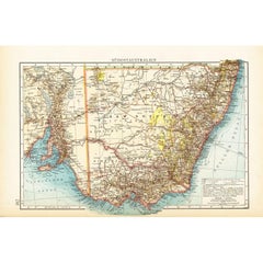
German Antique Map of Southeastern Australia, 1904
Located in Langweer, NL
relief (just like letterpress printing), V & K was able to offer detailed maps at a much lower price than
Category

20th Century Maps

Materials

Paper

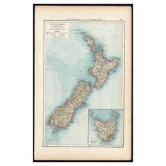
Antique Map of New Zealand and Tasmania, 1904
Located in Langweer, NL
relief (just like letterpress printing), V & K was able to offer detailed maps at a much lower price than
Category

20th Century Maps

Materials

Paper

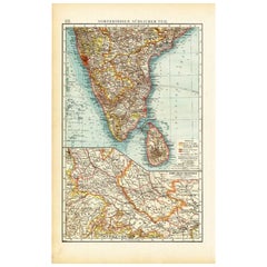
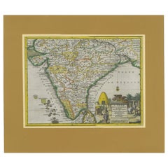
Antique Map of Southern India by Andree, 1904
Located in Langweer, NL
engraving, but reproducing the maps from zinc plates that were etched in relief (just like letterpress
Category

20th Century Maps

Materials

Paper

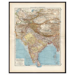
Antique Map of Central Asia and India, 1904
Located in Langweer, NL
plate engraving, but reproducing the maps from zinc plates that were etched in relief (just like
Category

20th Century Maps

Materials

Paper

Antique Map of Central Asia and India, 1904
H 22.09 in W 17.45 in D 0.01 in
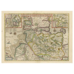
Original Antique Map of the Duchy of Holstein
By Willem Blaeu
Located in Langweer, NL
Antique map titled 'Ducatus Holsatiae Nova Tabula'. Original old map of the Duchy of Holstein, the
Category

Antique Mid-17th Century Maps

Materials

Paper

Original Antique Map of the Duchy of Holstein
H 20.48 in W 24.53 in D 0.02 in
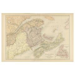
Decorative Antique Map of Eastern Canada, Published in 1882
Located in Langweer, NL
This is a historical map from the 1882 Blackie Atlas, focused on eastern Canada and the maritime
Category

Antique 1880s Maps

Materials

Paper

Decorative Antique Map of Eastern Canada, Published in 1882
Free Shipping
H 14.97 in W 22.45 in D 0 in
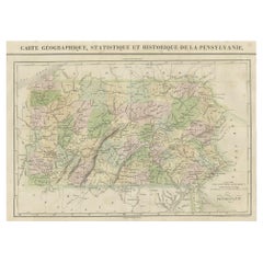
French Geographical, Statistical and Historical Map of Pensylvania, 1825
Located in Langweer, NL
. Carez in Paris. (1825) Hand colored engraved map. Relief shown by hachures. Text and tables at sides
Category

Antique 1820s Maps

Materials

Paper

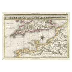
Decorative Hand-Colored French Map of the English Channel, 1827
Located in Langweer, NL
Antique map titled 'Carte et Coupe du Canal de la Manche'. Original antique map of the English
Category

Antique Mid-19th Century Maps

Materials

Paper

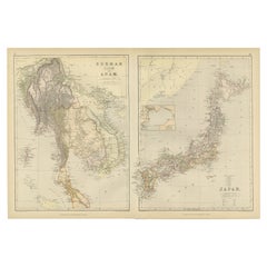
Antique Map Depicting Burma, Siam, Annam (Vietnam) and Japan, 1882
Located in Langweer, NL
The image shows two maps side by side from the 1882 atlas by Blackie & Son. On the left, the map is
Category

Antique 1880s Maps

Materials

Paper

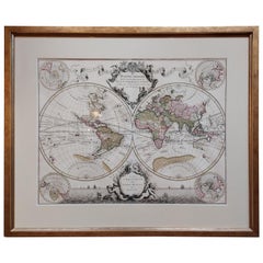
Original Antique Hand-colored World Map with or without Frame, '1696'
Located in Langweer, NL
Sciences (..)'. Beautiful original antique world map. Relief shown pictorially. Includes illustrations and
Category

Antique Late 17th Century Maps

Materials

Paper

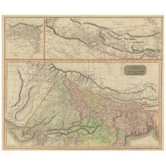
Antique Map of British India with Insets of Kabul and Nepal
Located in Langweer, NL
the 19th century, a style which reduced maps’ decorative elements to a minimum. Relief is shown by
Category

Antique Early 19th Century Maps

Materials

Paper

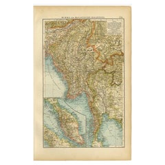
Antique Map of Burma and the Malayan Peninsula by Andree, 1904
Located in Langweer, NL
, rather than copper plate engraving, but reproducing the maps from zinc plates that were etched in relief
Category

20th Century Maps

Materials

Paper

Fabulous Original Antique two-sheet Map of the Caspian Sea, ca.1723
Located in Langweer, NL
maps are beautifully engraved with relief along the shoreline shown pictorially, and the sea is crossed
Category

Antique 1720s Maps

Materials

Paper

An Insightful 19th Century Map of Syria and the Surrounding Regions, 1882
Located in Langweer, NL
This map, titled "SYRIA (SOUTH DIVISION) including PALESTINE & THE HAUARAN," is a historical
Category

Antique 1880s Maps

Materials

Paper

Empire's Crossroads: An 1882 Map of Turkey in Asia by Blackie & Son
Located in Langweer, NL
This map, titled "Turkey in Asia," is another detailed illustration from the 1882 atlas by Blackie
Category

Antique 1880s Maps

Materials

Paper

Antique Map of Canada, The Province of Ontario and Part of Quebec, 1882
Located in Langweer, NL
This is a historical map from the 1882 Blackie Atlas, this time detailing "The Province of Ontario
Category

Antique 1880s Maps

Materials

Paper

Imperial Frontiers: A 19th Century Map of Southern Russia and the Caucasus, 1882
Located in Langweer, NL
This map, sourced from the comprehensive 1882 atlas by Blackie & Son, delineates the southern part
Category

Antique 1880s Maps

Materials

Paper

Antique Map of the Santa Cruz Islands with Inset of Carteret and Gower Islands
Located in Langweer, NL
Antique map titled 'Isles de la Reine Charlotte (..)'. A detailed chart of the Santa Cruz islands
Category

Antique Late 18th Century Maps

Materials

Paper

Original Antique Engrving of Chinese Tartary in the 18th Century, 1737
Located in Langweer, NL
time. Source; Map of the Chinese Tartary. Relief shown pictorially. D'Anville's map showcases the
Category

Antique 1730s Maps

Materials

Paper

Ancient Italy: Regions and Rome in the Roman Empire, Published in 1880
Located in Langweer, NL
divisions and the grandeur of Rome itself. The map is from the "Spruner-Menke Atlas Antiquus," which is a
Category

Antique 1880s Maps

Materials

Paper

18th Century Antique Engraving of the Southern Hemisphere by G. de L'Isle
By Guillaume De L'Isle
Located in Langweer, NL
Antique map titled 'Hemisphere Meridional pour voir plus distinctement Les Terres Australes
Category

Antique Late 18th Century Maps

Materials

Paper

Original Antique Engraving of the Eastern Hemisphere, c.1700
Located in Langweer, NL
Antique map titled 'Proiectio Optica Aequinoctia lis Hemishaerii Orientalis' - Map of the Eastern
Category

Antique 17th Century Maps

Materials

Paper

"Honoring Henry Agard Wallace", Art Deco Bronze by Chambellan for B'nai B'rith
By René Paul Chambellan
Located in Philadelphia, PA
of the panel features a map of the Western hemisphere in low relief, with symbols of each continent's
Category

Vintage 1940s American Art Deco Wall-mounted Sculptures

Materials

Bronze

People Also Browsed

Antique Map of India during the height of the Mughal Imperial Expansion, 1713
Located in Langweer, NL
Antique map titled 'L'Inde de ca le Gange (..)'. Beautiful original antique map embracing most of India, made during the height of the Mughal imperial expansion. The map encompasses ...
Category

Antique Early 18th Century Maps

Materials

Paper

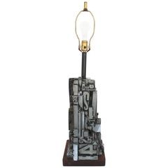
Industrial Faux Letterpress "AlphaSculpt" Sculpture by Sheldon Rose
Located in East Hampton, NY
Silver painted faux printing block resin lamp with wood base... "AlphaSculpt" bySheldon Rose New York, 1968.
Category

Vintage 1960s Table Lamps

Materials

Wood

Original Wood Carved Carnival Midway Poster Letterpress
Located in Santa Monica, CA
Set of three original hand-carved letterpress made by the Neal Walters Poster Company. Fantastic carnival midway scene. Games, carnival rides and acrobats. Carved with incredible det...
Category

Vintage 1930s American Folk Art Carnival Art

Materials

Wood, Paint

Large Antique Embroidered Panel with Floral Pattern from India
Located in North Hollywood, CA
Antique embroidered mirrored horse blanket throw used in India for the wedding ceremonies. Large antique embroidered panel with floral pattern. Indian colorful wall hanging from Guja...
Category

Antique Late 19th Century Indian Agra Textiles

Materials

Linen, Silk, Sequins

Framed World Map print showing double hemisphere dating to 1642 originally, New
Located in Lincoln, Lincolnshire
This is a digitally remastered World Map Conjuring up the golden age of exploration, from an original 1642 double hemisphere map of the world. It includes pictorial relief illustrat...
Category

2010s British Charles II Prints

Materials

Glass, Wood, Paper

Two Antique Dresden Hand-Painted Reticulated Cabinet Plates
By Dresden Porcelain
Located in Philadelphia, PA
A finely worked pair of antique Dresden reticulated cabinet plates. Each with hand-painted decoration. Diameter: ca. 9 1/2 in.   
Category

Antique Late 19th Century German Porcelain

Materials

Porcelain

Antique Print of the Fortress Cranganor near Kodungallur in India, 1757
Located in Langweer, NL
Antique print of the Fortress Cranganor, nowadays known by the name Kodungallor. French and Dutch title including scale and compass rose. This print originates from 'L'Histoire génér...
Category

Antique Mid-18th Century Prints

Materials

Paper

Antique Plan of the City of Calcutta 'India' by Letts, 1883
Located in Langweer, NL
Beautiful colored plan showing buildings (with key), Fort William, race ground, canals, railroads, etc. This plan originates from Letts's Popular Atlas.
Category

Antique Late 19th Century Maps

Materials

Paper

Antique Print of the City of Hukoen 'China' by J. Nieuhof, 1666
Located in Langweer, NL
Antique print titled 'Hukoen of Hukeu'. This plate shows a view on the Chinese city of Hukoen with its ramparts. Also depicted are ships. This print originates from a German edition ...
Category

Antique Mid-17th Century Prints

Materials

Paper

Antique Print of the City of Tonglou 'China' by J. Nieuhof, 1666
Located in Langweer, NL
Antique print titled 'Tonglou'. This plate shows a view on the Chinese city of Tonglou with its ramparts. Also depicted are ships. This print originates from a German edition of : 'G...
Category

Antique Mid-17th Century Prints

Materials

Paper

Antique Print of the City of Hoaigan 'China' by J. Nieuhof, 1666
Located in Langweer, NL
Antique print titled 'Hoaigan'. This plate shows a view on the Chinese city of Hoaigan with its rampartss. Several ships are depicted. Behind the city wall a pagoda and palm trees ca...
Category

Antique Mid-17th Century Prints

Materials

Paper

Antique Print of the City of Vannungam ‘China’ by J. Nieuhof, 1666
Located in Langweer, NL
Antique print titled 'Vannungam'. This plate shows a view on the Chinese city of Vannungam with its rampartss. Several ships are depicted. Behind the city wall palm trees can be seen...
Category

Antique Mid-17th Century Prints

Materials

Paper

Antique Print of the City of Kiangsi China by J. Nieuhof, 1666
Located in Langweer, NL
Antique print titled 'Kiangsi'. This plate shows a view on the Chinese city of Kiangsi with its ramparts. Behind the city wall a pagoda can be seen. On the foreground several ships a...
Category

Antique Mid-17th Century Prints

Materials

Paper

Antique Print of the City of Tiencienwey ‘Tientsin, China’ by J. Nieuhof, 1666
Located in Langweer, NL
Antique print titled 'Tiencienwey'. This plate shows a view on the Chinese city of Tiencienwey or Tientsin. Also depicted are many ships. This print originates from a German edition ...
Category

Antique Mid-17th Century Prints

Materials

Paper

19th century Antique pottery Radha and Krishna statue from India
Located in DEVENTER, NL
Material: Pottery 17,2 cm high 28,5 cm wide and 9,8 cm deep 19th century Weight: 2,02 kgs Originating from India Nr: 3733-70
Category

Antique 19th Century Indian Sculptures and Carvings

Materials

Pottery

19th century Antique pottery Radha and Krishna statue from India
Free Shipping
H 6.78 in W 11.23 in D 3.86 in
Antique 1930s Photos of a Tiger Hunt in Colonial India
Located in Wilton, CT
During the rule by the British Crown in India between 1858 and 1947, tiger-hunting was regarded as a royal sport. In the 19th century, tigers were plentiful throughout all the forest...
Category

Vintage 1930s Indian Anglo Raj Photography

Materials

Glass, Wood, Paper

Recent Sales

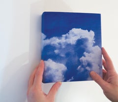
Cloud Atlas, artist book, 13 fold out maps, diazo cyantotype photo prints
By Penelope Stewart
Located in Toronto, Ontario
, the artist looks up from earth to a space of relief and possibility. " Cloud Atlas is a collection of
Category

2010s Contemporary Color Photography

Materials

Photographic Paper

Cloud Atlas #14
By Penelope Stewart
Located in Toronto, Ontario
Cloud Atlas # 14 is part of Penelope Stewart’s exhibition Botanique. This exhibition and body of
Category

2010s Contemporary Landscape Photography

Materials

Photogram

Cloud Atlas #2
By Penelope Stewart
Located in Toronto, Ontario
of clouds, the artist looks up from earth to a space of relief and possibility. " Cloud Atlas is a
Category

2010s Contemporary Landscape Photography

Materials

Photographic Paper

Cloud Atlas #10
By Penelope Stewart
Located in Toronto, Ontario
of clouds, the artist looks up from earth to a space of relief and possibility. " Cloud Atlas is a
Category

2010s Contemporary Landscape Photography

Materials

Photographic Paper

Cloud Atlas #6
By Penelope Stewart
Located in Toronto, Ontario
of clouds, the artist looks up from earth to a space of relief and possibility. " Cloud Atlas is a
Category

2010s Contemporary Landscape Photography

Materials

Photographic Paper

Cloud Atlas #13
By Penelope Stewart
Located in Toronto, Ontario
of clouds, the artist looks up from earth to a space of relief and possibility. Cloud Atlas is a
Category

2010s Contemporary Landscape Photography

Materials

Photographic Paper

Cloud Atlas #3
By Penelope Stewart
Located in Toronto, Ontario
of clouds, the artist looks up from earth to a space of relief and possibility. Cloud Atlas is a
Category

2010s Contemporary Landscape Photography

Materials

Photographic Paper

Cloud Atlas # 1
By Penelope Stewart
Located in Toronto, Ontario
, the artist looks up from earth to a space of relief and possibility." Cloud Atlas is a collection of
Category

2010s Contemporary Landscape Photography

Materials

Photographic Paper

1764 Map "Carte Reduite Du Globe Terrestre"
By Jacques-Nicolas Bellin
Located in New York, NY
Reduite Du Globe Terrestre" from "Le Petit Atlas Maritime Recueil De Cartes et Plans Des Quatre. The map
Category

1760s Landscape Prints

Materials

Engraving

Set of 6 Maps the United States
By A. Steiler
Located in Florham Park, NJ
reliefs. Many of these features would normally be common only to much larger maps. This can be
Category

Antique 19th Century German Prints

Atlas Over Arteries #05 - Riccardo Bandiera - Fine Art Color Print
By Riccardo Bandiera
Located in Fiesole, Florence
Title: Her heavy wings will warp your mind Collection: Atlas Over Arteries Author: Riccardo
Category

2010s Conceptual Color Photography

Materials

Archival Paper, Color, Giclée

Atlas Over Arteries #07 - Riccardo Bandiera - Fine Art Color Print
By Riccardo Bandiera
Located in Fiesole, Florence
Title: I'm the shape of the hole inside your heart Collection: Atlas Over Arteries Author: Riccardo
Category

2010s Conceptual Color Photography

Materials

Archival Paper, Color, Giclée

Atlas Over Arteries #03 - Riccardo Bandiera - Fine Art Color Print
By Riccardo Bandiera
Located in Fiesole, Florence
Title: Bones Collection: Atlas Over Arteries Author: Riccardo Bandiera Paper fine art Hahnemuhle
Category

2010s Conceptual Color Photography

Materials

Archival Paper, Color, Giclée

Atlas Over Arteries #08 - Riccardo Bandiera - Fine Art Color Print
By Riccardo Bandiera
Located in Fiesole, Florence
Title: Learning to fly Collection: Atlas Over Arteries Author: Riccardo Bandiera Paper fine art
Category

2010s Conceptual Color Photography

Materials

Archival Paper, Color, Giclée

Atlas Over Arteries #10 - Riccardo Bandiera - Fine Art Color Print
By Riccardo Bandiera
Located in Fiesole, Florence
and an "Atlas of Human Geography" in which the body turns into a map on which to project the routes of
Category

2010s Conceptual Color Photography

Materials

Archival Paper, Color, Giclée

Atlas Over Arteries #11 - Riccardo Bandiera - Fine Art Color Print
By Riccardo Bandiera
Located in Fiesole, Florence
Title: His mortail coil Collection: Atlas Over Arteries Author: Riccardo Bandiera Paper fine art
Category

2010s Conceptual Color Photography

Materials

Archival Paper, Color, Giclée

Atlas Over Arteries #04 - Riccardo Bandiera - Fine Art Color Print
By Riccardo Bandiera
Located in Fiesole, Florence
Title: Oreseen unseen Collection: Atlas Over Arteries Author: Riccardo Bandiera Paper fine art
Category

2010s Conceptual Color Photography

Materials

Archival Paper, Color, Giclée

Atlas Over Arteries #12 - Riccardo Bandiera - Fine Art Color Print
By Riccardo Bandiera
Located in Fiesole, Florence
Title: We'll leave this world just as we found it Collection: Atlas Over Arteries Author: Riccardo
Category

2010s Conceptual Color Photography

Materials

Archival Paper, Color, Giclée

Atlas Over Arteries #06 - Riccardo Bandiera - Fine Art Color Print
By Riccardo Bandiera
Located in Fiesole, Florence
Title: Dream myself above the rest Collection: Atlas Over Arteries Author: Riccardo Bandiera Paper
Category

2010s Conceptual Color Photography

Materials

Giclée, Archival Paper, Color

Atlas Over Arteries #01 - Riccardo Bandiera - Fine Art Color Print
By Riccardo Bandiera
Located in Fiesole, Florence
entomological manual and an "Atlas of Human Geography" in which the body turns into a map on which to project
Category

2010s Conceptual Color Photography

Materials

Archival Paper, Color, Giclée

Atlas Over Arteries #016 - Riccardo Bandiera - Fine Art Nudes Color Print
By Riccardo Bandiera
Located in Fiesole, Florence
manual and an "Atlas of Human Geography" in which the body turns into a map on which to project the
Category

2010s Conceptual Color Photography

Materials

Archival Paper, Color, Giclée

Atlas Over Arteries #017 - Riccardo Bandiera - Fine Art Nudes Color Print
By Riccardo Bandiera
Located in Fiesole, Florence
Title: MAY AS WELL JUST BE ME Collection: Atlas Over Arteries Author: Riccardo Bandiera Paper fine
Category

2010s Conceptual Color Photography

Materials

Archival Paper, Color, Giclée

Atlas Over Arteries "Nectar" #013 - Riccardo Bandiera - Fine Art Color Print
By Riccardo Bandiera
Located in Fiesole, Florence
Title: NECTAR Collection: Atlas Over Arteries Author: Riccardo Bandiera Paper fine art Hahnemuhle
Category

2010s Conceptual Color Photography

Materials

Archival Paper, Color, Giclée

Atlas Over Arteries #014 - Riccardo Bandiera - Fine Art Nudes Color Print
By Riccardo Bandiera
Located in Fiesole, Florence
Title: WE MOVE CAN SEEM FITFUL Collection: Atlas Over Arteries Author: Riccardo Bandiera Paper fine
Category

2010s Conceptual Color Photography

Materials

Archival Paper, Color, Giclée

Atlas Over Arteries #09 - Riccardo Bandiera - Fine Art Nudes Color Print
By Riccardo Bandiera
Located in Fiesole, Florence
Title: Silent mutation Collection: Atlas Over Arteries Author: Riccardo Bandiera Paper fine art
Category

2010s Conceptual Color Photography

Materials

Archival Paper, Color, Giclée

Atlas Over Arteries The Kiss #015 - Riccardo Bandiera - Fine Art Color Print
By Riccardo Bandiera
Located in Fiesole, Florence
Title: THE KISS Collection: Atlas Over Arteries Author: Riccardo Bandiera Paper fine art Hahnemuhle
Category

2010s Conceptual Color Photography

Materials

Archival Paper, Color, Giclée

Antique map of the south of England by Thomson - Handcol. engraving - 19th c.
By John Thomson
Located in Zeeland, Noord-Brabant
Description: This original antique map was published in 'Thonson's New General Atlas.' in Edinburgh
Category

1810s Old Masters More Prints

Materials

Engraving

Pair of Topographical Portraits of the Pavillion and Village of Vaux-Sur-Seine
Located in London, Middlesex
. He would have known Jacques Fayolle as an Ingénieur du Roi. The Atlas de Trudaine The
Category

Antique Early 18th Century French Louis XIV Paintings

Materials

Canvas

Antique Map of Mexico by G. Mercator, 1637
Located in Langweer, NL
two cartouches. Mexico City located on the banks of a lake. Relief shown pictorially. This map
Category

Antique Mid-17th Century Maps

Materials

Paper

Antique Map of Mexico by G. Mercator, 1637
H 11.03 in W 6.93 in D 0.02 in
Set of 6 Maps Showing the United States
By Adolf Stieler
Located in Florham Park, NJ
monthly. Publishing wall maps and atlases, Perthes created hundreds of maps and over 20 atlases. The
Category

Late 19th Century Academic Prints and Multiples

Materials

Engraving

Important giant Map of Africa, for the King of France, 1698
By Nicolas de Fer
Located in Amsterdam, NL
Kings of France and Spain. He published more than six hundred maps and many atlases, documenting
Category

Late 17th Century Old Masters More Prints

Materials

Watercolor, Engraving

Important giant Map of Asia, for the King of France, 1696
By Nicolas de Fer
Located in Amsterdam, NL
le Quay de l’Horloge, à la Sphere Royal. Avec le Privilege du Roy, 1696 (See also his Giant Map of
Category

Late 17th Century Old Masters More Prints

Materials

Watercolor, Engraving

Framed Hand Colored Map of Asia by Nicolas de Fer for Le Dauphine
Located in Amsterdam, NL
in relief printing, later hand coloring, 109.5 x 163 cm Note: The map is surrounded by richly
Category

Antique Late 17th Century French Decorative Art

Materials

Other

Large 1907 Vintage Relief Map of World by Atlas School Supply of Chicago
By Atlas School Supply
Located in Lafayette, IN
Remarkably original, 1907 relief map of world by the Atlas School Supply Co. of Chicago, Illinois
Category

Early 20th Century American Industrial Maps

Materials

Oak, Paper

Large 1907 Vintage Relief Map of Europe by Atlas School Supply of Chicago
By Atlas School Supply
Located in Lafayette, IN
Remarkably original, 1907 Relief map of Europe by the Atlas School Supply Co. of Chicago, Illinois
Category

Early 20th Century American Industrial Maps

Materials

Oak, Paper

Large 1907 Vintage Relief Map of Africa by Atlas School Supply of Chicago
By Atlas School Supply
Located in Lafayette, IN
Remarkably original, 1907 Relief map of Africa by the Atlas School Supply Co. of Chicago, Illinois
Category

Early 20th Century American Industrial Maps

Materials

Paper, Oak

Large 1907 Vintage Relief Map of Asia by Atlas School Supply of Chicago
By Atlas School Supply
Located in Lafayette, IN
Remarkably original, 1907 Relief map of Asia by the Atlas School Supply Co. of Chicago, Illinois
Category

Early 20th Century American Industrial Maps

Materials

Paper, Oak

Large 1907 Vintage Relief Map of United States by Atlas School Supply of Chicago
By Atlas School Supply
Located in Lafayette, IN
Remarkably original, 1907 Relief map of the United States by the Atlas School Supply Co. of Chicago
Category

Early 20th Century American Industrial Maps

Materials

Oak, Paper

1906 Framed Relief Map of North America
By Atlas School Supply
Located in Rio Vista, CA
Early 1900s relief map of North America including Canada, Greenland, Mexico and Central America
Category

20th Century American Maps

Materials

Paper, Wood

1906 Framed Relief Map of North America
H 48 in W 34.5 in D 1.5 in
Antique Map of Austria 'Tirol' with Parts of Italy by J. Janssonius, 1649
Located in Langweer, NL
Antique map titled 'Comitatus Tirolensis'. Relief shown pictorially, decorative cartouche, figures
Category

Antique Mid-17th Century Maps

Materials

Paper

Large Early 1900's Raised Relief Map Of California & Nevada
Located in Chicago, IL
Large early 1900's raised relief map of California & Nevada by Atlas Relief Map Company.
Category

Early 20th Century American Maps

Materials

Wood, Cardboard

1900s Relief Map of North America
Located in Chicago, IL
1900s relief map of North America by Atlas School Supply Chicago Il.
Category

Early 20th Century American Maps

Materials

Oak, Paper

1900s Relief Map of North America
H 48 in W 34 in D 1.25 in
Get Updated with New Arrivals
Save "Atlas Map Relief", and we’ll notify you when there are new listings in this category.