Items Similar to Antique Map of Dunkirk 'France' by J. Blaeu, 1649

Want more images or videos?
Request additional images or videos from the seller
1 of 8
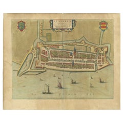
Antique Map of Dunkirk 'France' by J. Blaeu, 1649
About the Item
Antique map titled 'Duynkercka'. Published by J. Blaeu, 1649. Dutch text on verso.
- Dimensions:Height: 19.93 in (50.6 cm)Width: 23.55 in (59.8 cm)Depth: 0.02 in (0.5 mm)
- Materials and Techniques:
- Period:Mid-17th Century
- Date of Manufacture:1649
- Condition:Great condition. Please study image carefully.
- Seller Location:Langweer, NL
- Reference Number:
About the Seller
5.0
Platinum Seller
These expertly vetted sellers are 1stDibs' most experienced sellers and are rated highest by our customers.
Established in 2009
1stDibs seller since 2017
1,916 sales on 1stDibs
Typical response time: <1 hour
- ShippingRetrieving quote...Ships From: Langweer, Netherlands
- Return PolicyA return for this item may be initiated within 14 days of delivery.
More From This SellerView All
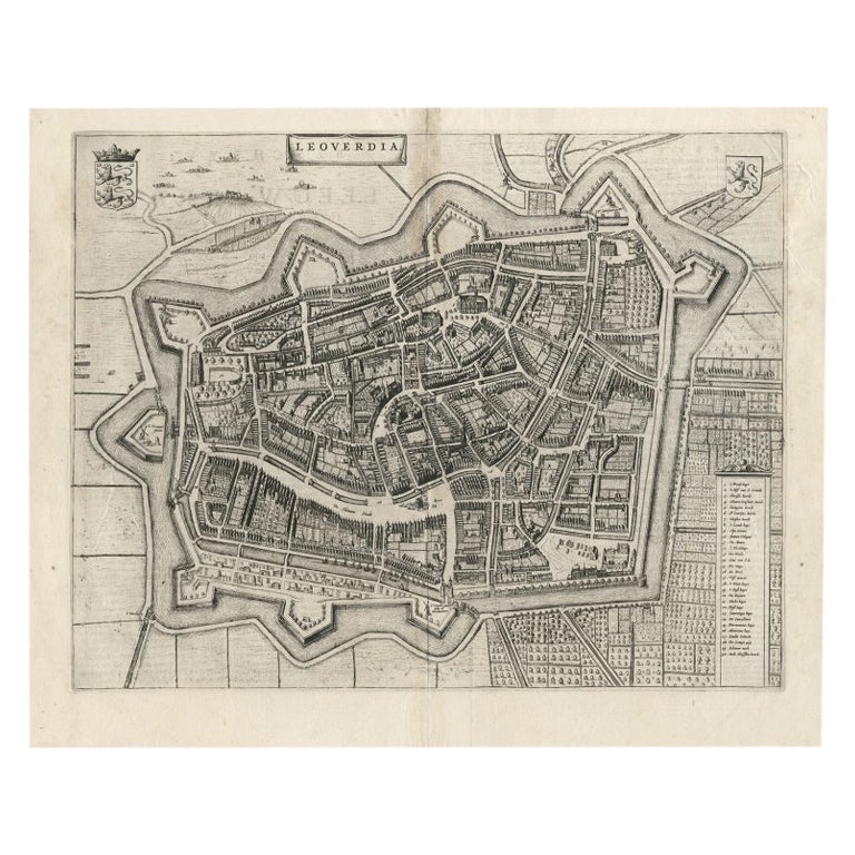
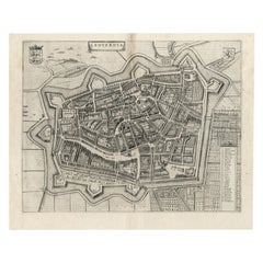
- Antique Map of Leeuwarden, Capital of Friesland, the Netherlands, by Blaeu, 1649Located in Langweer, NLAntique map titled 'Leoverdia.' Bird's-eye view plan of Leeuwarden, Friesland, the Netherlands. With key to locations and coats of arms. Text in Dutch on verso. This plan origina...Category
Antique 17th Century Maps
MaterialsPaper
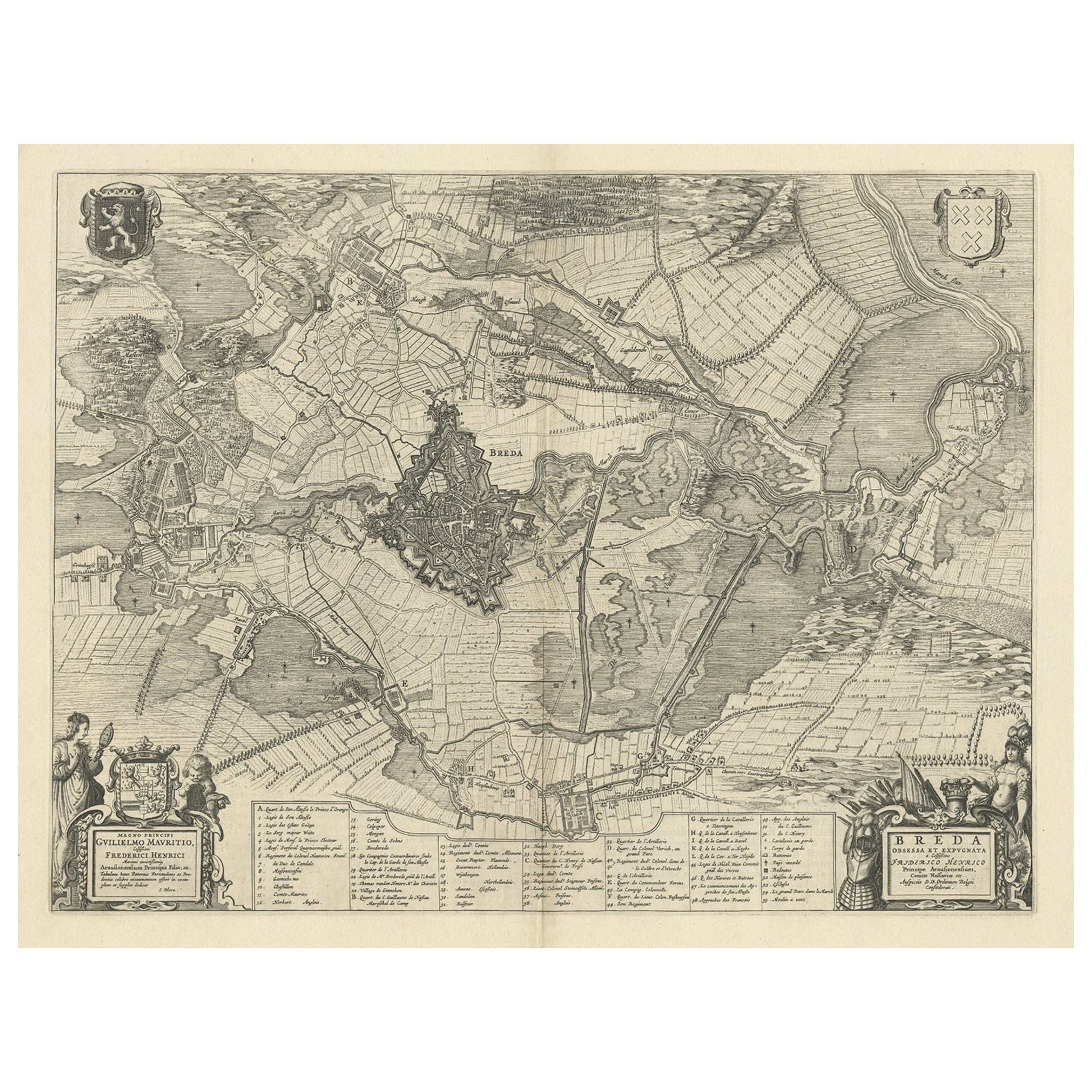
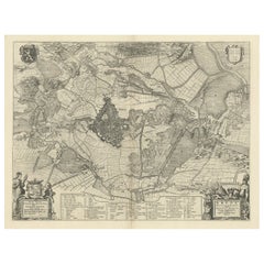
- Antique Map of the Siege of Breda, City in the Netherlands by Blaeu, 1649Located in Langweer, NLAntique map titled 'Breda obsessa et expugnata a Celsissimo Frederico Henrico'. Old map of the city of Breda, the Netherlands. It shows the Siege of Breda in 1637. Originates fro...Category
Antique 17th Century Maps
MaterialsPaper
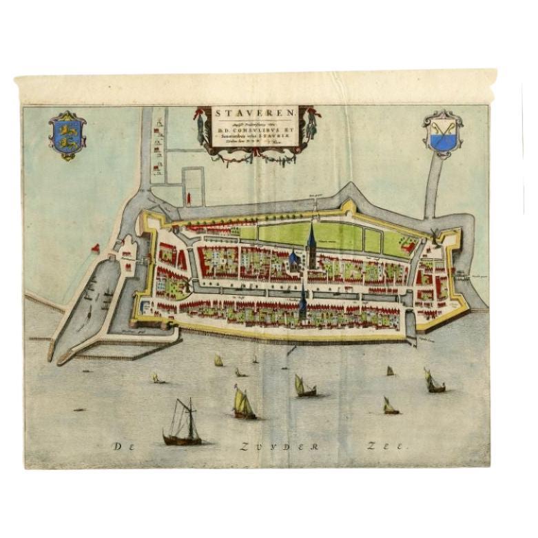
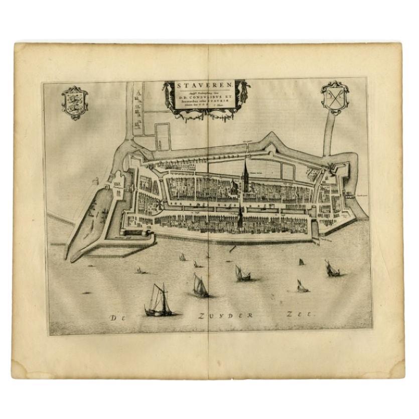
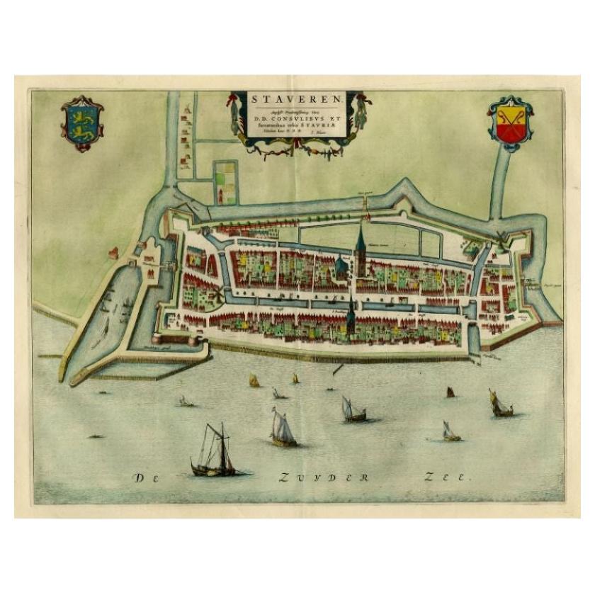
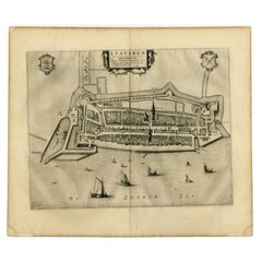
- Antique Map of Stavoren by Blaeu, 1649Located in Langweer, NLAntique map titled 'Staveren'. Original antique map of the city of Stavoren, Friesland, The Netherlands. This map originates from 'Toonneel der Steden van de Vereenighde Nederlanden'...Category
Antique 17th Century Maps
MaterialsPaper
- Antique Map of Stavoren by Blaeu, 1649Located in Langweer, NLAntique map titled 'Staveren'. Original antique map of the city of Stavoren, Friesland, The Netherlands. This map originates from 'Toonneel der Steden van de Vereenighde Nederlanden'...Category
Antique 17th Century Maps
MaterialsPaper
- Antique Map of Stavoren by Blaeu, 1649Located in Langweer, NLAntique map titled 'Staveren'. Original antique map of the city of Stavoren, Friesland, The Netherlands. This map originates from 'Toonneel der Steden van de Vereenighde Nederlanden'...Category
Antique 17th Century Maps
MaterialsPaper
- Antique Map of Stavoren by Blaeu, 1649Located in Langweer, NLAntique map titled 'Staveren'. Original antique map of the city of Stavoren, Friesland, The Netherlands. This map originates from 'Novum Ac Magnum Theatrum Urbium Belgicae Liberae Ac...Category
Antique 17th Century Maps
MaterialsPaper


You May Also Like
- Original Antique Map of France, Arrowsmith, 1820Located in St Annes, LancashireGreat map of France Drawn under the direction of Arrowsmith. Copper-plate engraving. Published by Longman, Hurst, Rees, Orme and Brown, 1820 Unframed.Category
Antique 1820s English Maps
MaterialsPaper
- Antique Map of Italy by Andriveau-Goujon, 1843By Andriveau-GoujonLocated in New York, NYAntique Map of Italy by Andriveau-Goujon, 1843. Map of Italy in two parts by Andriveau-Goujon for the Library of Prince Carini at Palazzo Carini i...Category
Antique 1840s French Maps
MaterialsLinen, Paper
- Antique Map of Principality of MonacoBy Antonio Vallardi EditoreLocated in Alessandria, PiemonteST/619 - "Old Geographical Atlas of Italy - Topographic map of ex-Principality of Monaco" - ediz Vallardi - Milano - A somewhat special edition ---Category
Antique Late 19th Century Italian Other Prints
MaterialsPaper
- Original Antique Map of Russia By Arrowsmith. 1820Located in St Annes, LancashireGreat map of Russia Drawn under the direction of Arrowsmith Copper-plate engraving Published by Longman, Hurst, Rees, Orme and Brown, 1820 Unframed.Category
Antique 1820s English Maps
MaterialsPaper
- Original Antique Map of France, Sherwood, Neely & Jones, Dated 1809Located in St Annes, LancashireGreat map of France Copper-plate engraving by Cooper Published by Sherwood, Neely & Jones. Dated 1809 Unframed.Category
Antique Early 1800s English Maps
MaterialsPaper
- Original Antique Map of China by Thomas Clerk, 1817Located in St Annes, LancashireGreat map of China Copper-plate engraving Drawn and engraved by Thomas Clerk, Edinburgh. Published by Mackenzie And Dent, 1817 Unframed.Category
Antique 1810s English Maps
MaterialsPaper


Recently Viewed
View AllMore Ways To Browse
J Antique
Old Antique Compass
Map New Holland
Vienna Map
Map Of Vienna
Map Monde Antique
Arabian Map
Arabia Map
Egyptian Authentic Furniture
Middle East Map
Visscher Amsterdam
Columbia Antiques
Map Railroad
Antique Fireplaces And Ranges
Historic Antique Maps
Relief Map
Antique Victoria Australia
Antique Florida Collectibles