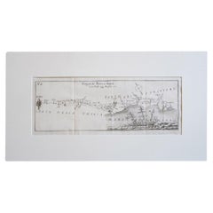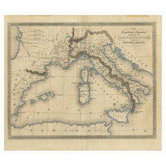
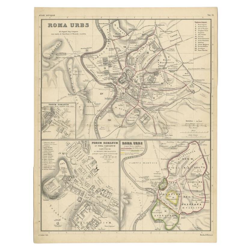
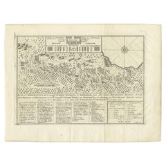
Antique Map of Hannibal's Expeditions in Italy, c.1830
View Similar Items


Want more images or videos?
Request additional images or videos from the seller
1 of 5
Antique Map of Hannibal's Expeditions in Italy, c.1830
About the Item
- Dimensions:Height: 9.26 in (23.5 cm)Width: 10.83 in (27.5 cm)Depth: 0 in (0.01 mm)
- Materials and Techniques:
- Period:
- Date of Manufacture:circa 1830
- Condition:
- Seller Location:Langweer, NL
- Reference Number:Seller: BG-12418-11stDibs: LU3054326407372
About the Seller
5.0
Platinum Seller
These expertly vetted sellers are 1stDibs' most experienced sellers and are rated highest by our customers.
Established in 2009
1stDibs seller since 2017
1,947 sales on 1stDibs
More From This SellerView All
- Antique Map of the Expedition of Govert Knol by Valentijn, 1726Located in Langweer, NLAntique map titled 'Aftekening der Expeditie van de Hr. Commissaris Govert Cnoll uyt Soerabaja, tot afhalinge van Pangerang Adepati Anom'. Map showing the expedition...Category
Antique 18th Century Maps
MaterialsPaper
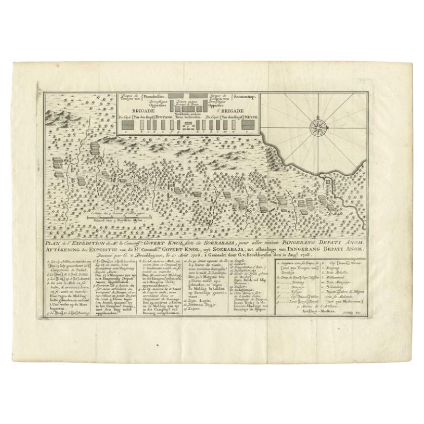
- Antique Map of the Expedition of Govert Knol by Van Schley, 1765By Jakob van der SchleyLocated in Langweer, NLAntique map titled 'Plan de l' expédition de Mr. le Commiss. re Govert Knol, forti de Soerabaja, pour aller recévoir Pangerang Depati Anom. / Aftékening der Expeditie van de H. r Commiss. is Govert Knol , uyt Soerabaya , tot afhaalinge van Pangerang Depati Anom'. Map showing the expedition...Category
Antique 18th Century Maps
MaterialsPaper
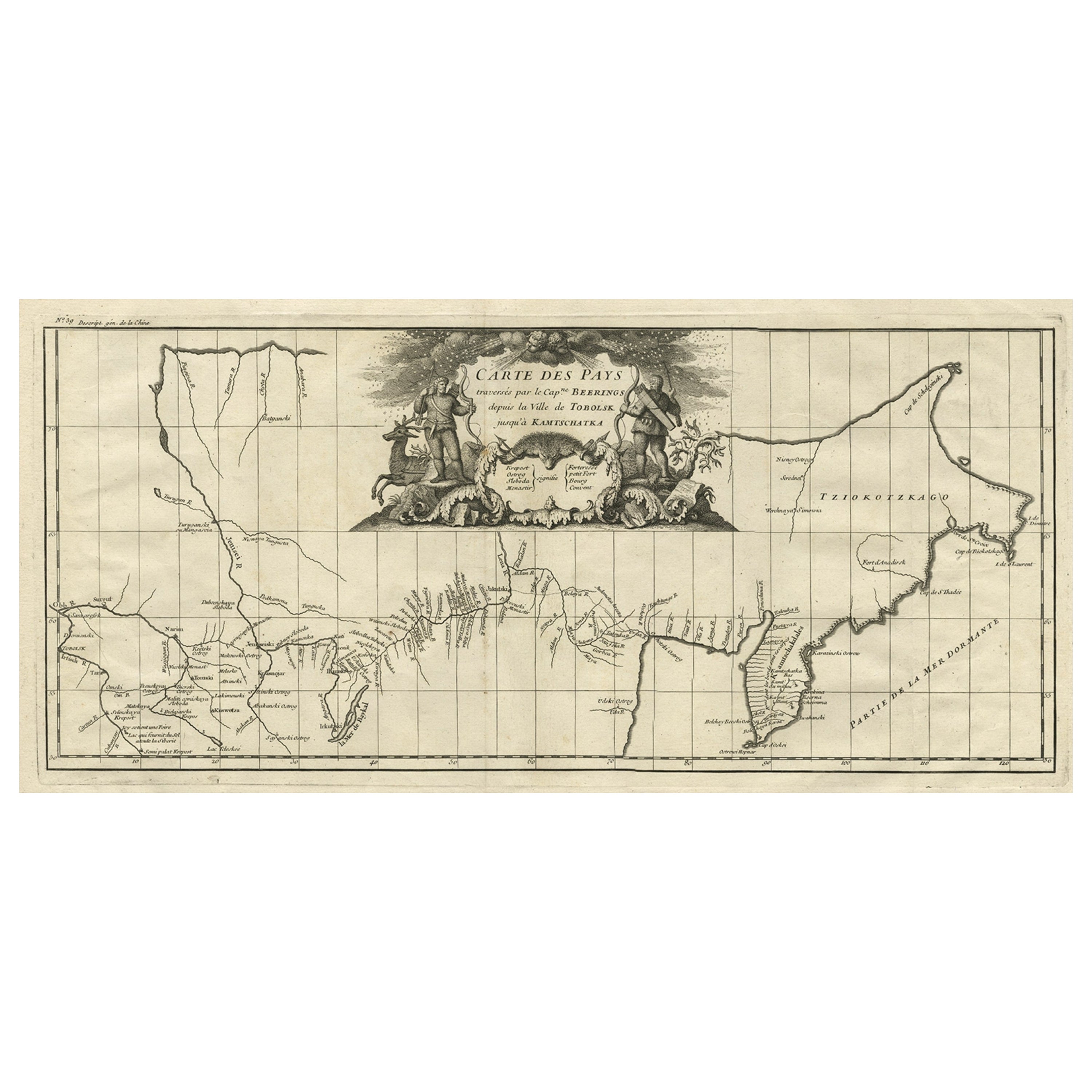
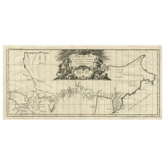
- Antique Map with Details of Berings' Expedition into Russians' Far East, 1737Located in Langweer, NLAntique map titled 'Carte Des Pays traverses par le Capne. Beerings depuis la Ville de Tobolsk jusqua'a Kamtschatka'. This is the first printed map to illustrate Vitus Bering's fir...Category
Antique 1730s Maps
MaterialsPaper
 $1,196 Sale Price24% Off
 - Map of Winter Harbour on Melville Island, Australia by Parry's Expedition, 1821Located in Langweer, NLAntique print titled 'Survey of Winter Harbour Melville Island, June 1820'. Chart of the bay or harbor on Melville Island where William Parry's expedit...Category
Antique 1820s Maps
MaterialsPaper
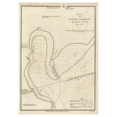 $228 Sale Price20% Off
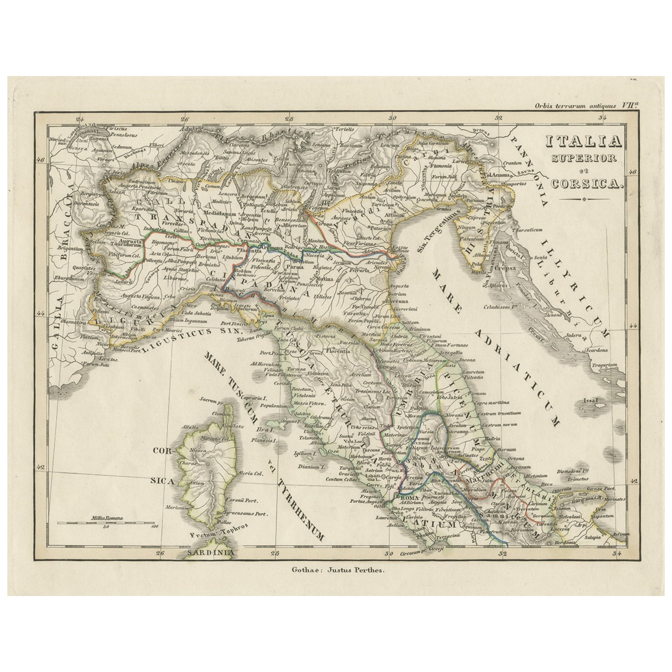
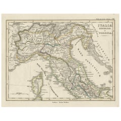
 - Antique Map of Italy and Corse in Ancient Times, 1848Located in Langweer, NLAntique map titled 'Italia Superior et Corsica'. Old map of northern Italy and Corse originating from 'Orbis Terrarum Antiquus in usum Scholarum'. Artists and Engravers: Publishe...Category
Antique 19th Century Maps
MaterialsPaper
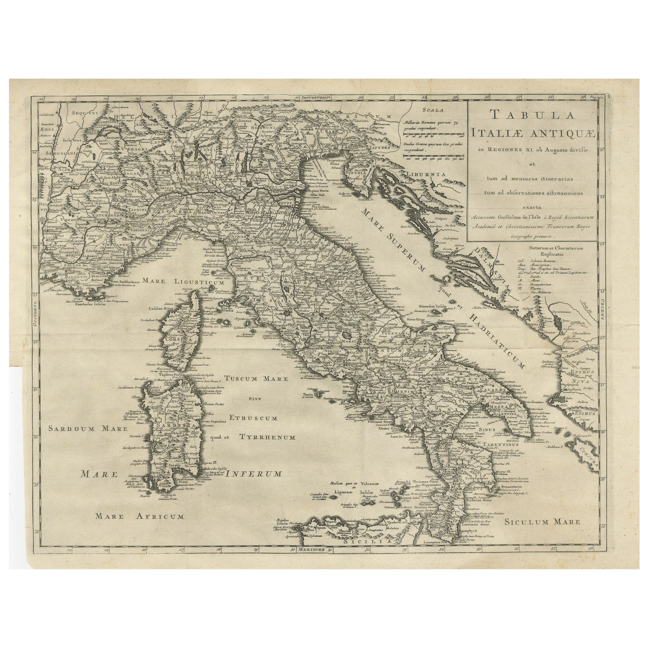
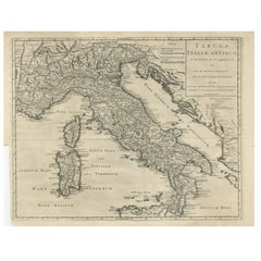
- Antique Engraved Map of Italy in Roman Times, ca.1730Located in Langweer, NLPlain engr. map of Italy according to the division of Emperor Augustus by G. Delisle. Title: "Tabula Italiae Antiquae In Regiones XI Ab Augusto Divisae Et Tum Ad Mensuras Itinerari...Category
Antique 1730s Maps
MaterialsPaper
You May Also Like
- Original Antique Map of Italy. C.1780Located in St Annes, LancashireGreat map of Italy Copper-plate engraving Published C.1780 Unframed.Category
Antique Early 1800s English Georgian Maps
MaterialsPaper

- Original Antique Map of Italy. Arrowsmith. 1820Located in St Annes, LancashireGreat map of Italy Drawn under the direction of Arrowsmith Copper-plate engraving Published by Longman, Hurst, Rees, Orme and Brown, 1820 Unframed.Category
Antique 1820s English Maps
MaterialsPaper

- Antique Map of Italy by Andriveau-Goujon, 1843By Andriveau-GoujonLocated in New York, NYAntique Map of Italy by Andriveau-Goujon, 1843. Map of Italy in two parts by Andriveau-Goujon for the Library of Prince Carini at Palazzo Carini i...Category
Antique 1840s French Maps
MaterialsLinen, Paper
 $3,350 / set
 - 1830 Mexico and United States Framed MapLocated in Stamford, CTMap of North America published circa 1830. Map shows United States into Canada. Mexico extending into the upper California territory. Texas appears in name but prior to the period of...Category
Antique 1830s American American Classical Maps
MaterialsGlass, Wood, Paper
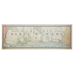
- Extremely Large Hand-Drawn Manuscript Map of Surinam, 1830, History of SlaveryLocated in Amsterdam, NLA unique large hand-drawn map of Surinam by Albrecht Helmut Hiemcke (German, 1760-1839) ? 'Colonie Surinaame', 1830 A large hand-drawn and coloured map of the colony of Suri...Category
Antique Mid-19th Century Surinamer Maps
MaterialsPaper
- Antique Italian Map of Viaggio da Roma a Napoli 1775Located in Roma, ITAn original print from 1775 showing an early route map of the journey from Rome to Naples. This route map was part of a collection of travellers routes published in a book translated...Category
Antique 1770s Italian Maps
MaterialsParchment Paper