Items Similar to Antique Map of Scotland With an Inset Map of the Shetland Islands, 1854


Want more images or videos?
Request additional images or videos from the seller
1 of 5
Antique Map of Scotland With an Inset Map of the Shetland Islands, 1854
About the Item
Stunning Map of Scotland that will look beautiful in any setting framed on the wall.
Description: Large Antique map titled 'Scotland with its Islands, drawn from the Topographical surveys by James Wyld.' Map of Scotland. With an inset map of the Shetland Islands. From James Wyld's 'A New General Atlas of Modern Geography.', published by James Wyld. Geographer to Her Majesty Charing Cross East. 1854.
Artists and Engravers: Cartographer: James Wyld. James Wyld (1812-1887) was a British publisher and cartographer. His greatest geographical achievement was Wyld's Great Globe, exhibited in Leicester Square between 1851 and 1862. The globe, sixty feet high and lighted with gas, was at that point the largest ever constructed. He was geographer to Queen Victoria and H.R.H. Prince Albert.
Condition: Good, given age. Original middle fold, as issued. Minimal paper separation in left middle fold margin, backed. Contemporary hand coloring. General age-related toning and/or occasional minor defects from handling. Please study scan carefully.
- Dimensions:Height: 31.19 in (79.2 cm)Width: 22.92 in (58.2 cm)Depth: 0 in (0.02 mm)
- Materials and Techniques:
- Period:
- Date of Manufacture:1854
- Condition:Condition: Good, given age. Original middle fold, as issued. Minimal paper separation in left middle fold margin, backed. Contemporary hand coloring. General age-related toning and/or occasional minor defects from handling. Please study carefully.
- Seller Location:Langweer, NL
- Reference Number:
About the Seller
5.0
Platinum Seller
These expertly vetted sellers are 1stDibs' most experienced sellers and are rated highest by our customers.
Established in 2009
1stDibs seller since 2017
1,938 sales on 1stDibs
Typical response time: <1 hour
- ShippingRetrieving quote...Ships From: Langweer, Netherlands
- Return PolicyA return for this item may be initiated within 14 days of delivery.
More From This SellerView All
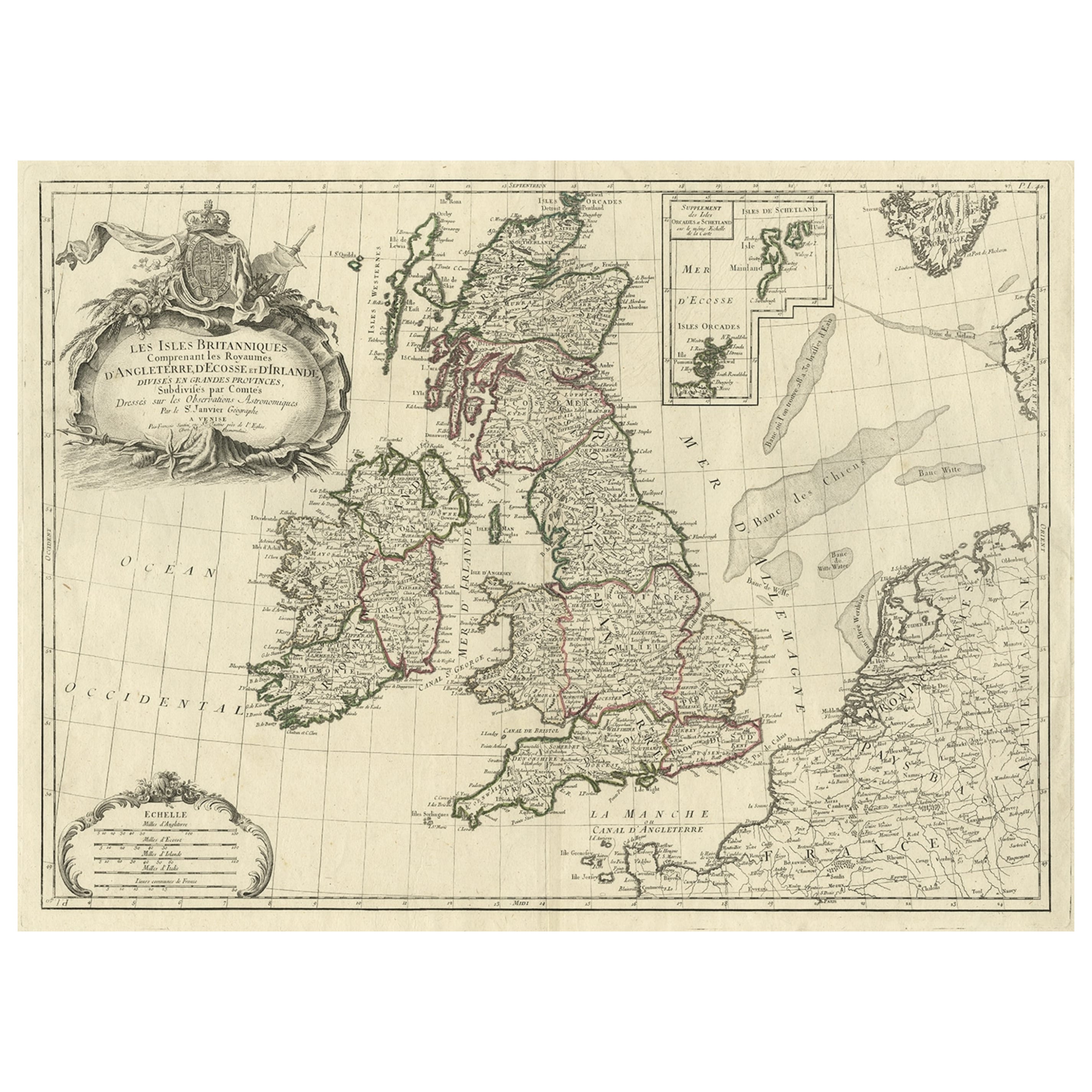
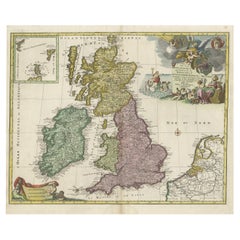
- Attractive Map of the British Isles with an Inset of the Shetland Islands, c1770Located in Langweer, NLAntique map titled 'Les Isles Britanniques Comprenant les Royaumes D'Angleterre D'Ecosse et D'Irlande, Divises en Grandes Provinces Subdivise par Comptes (…).' Attractive map of the British Isles. With inset map including the Orcade and Shetland Islands. Good detail throughout including coastal...Category
Antique 1770s Maps
MaterialsPaper
- Antique Map of Greece with an Inset Map of Corfu, 1854Located in Langweer, NLAntique map titled 'Hellas or Greece'. Old map of Greece with an inset map of Corfu. This map orginates from 'General Atlas Of The World: Containing Upwards Of Seventy Maps (..)' by ...Category
Antique 19th Century Maps
MaterialsPaper
- Antique Map of France with an Inset Map of the Island of Corsica, c.1820Located in Langweer, NLAntique map titled 'Frankrijk naar de nieuwste bepalingen meerendeels gevolgd naar Lapie'. Beautiful map of France with an inset map of the island of Corsica. Includes a table with r...Category
Antique 19th Century Maps
MaterialsPaper
- Antique Sea Chart of the Shetland Islands, Scotland, ca.1745Located in Langweer, NLAntique map of Scotland titled 'Nieuwe Paskaard van Hitland met de daar omleggende eylanden na de nieuwe aftekening gemaakt by den Lofwaarden en onvermoeyden Hit en Zeeman Ian Bruyst...Category
Antique 1740s Maps
MaterialsPaper
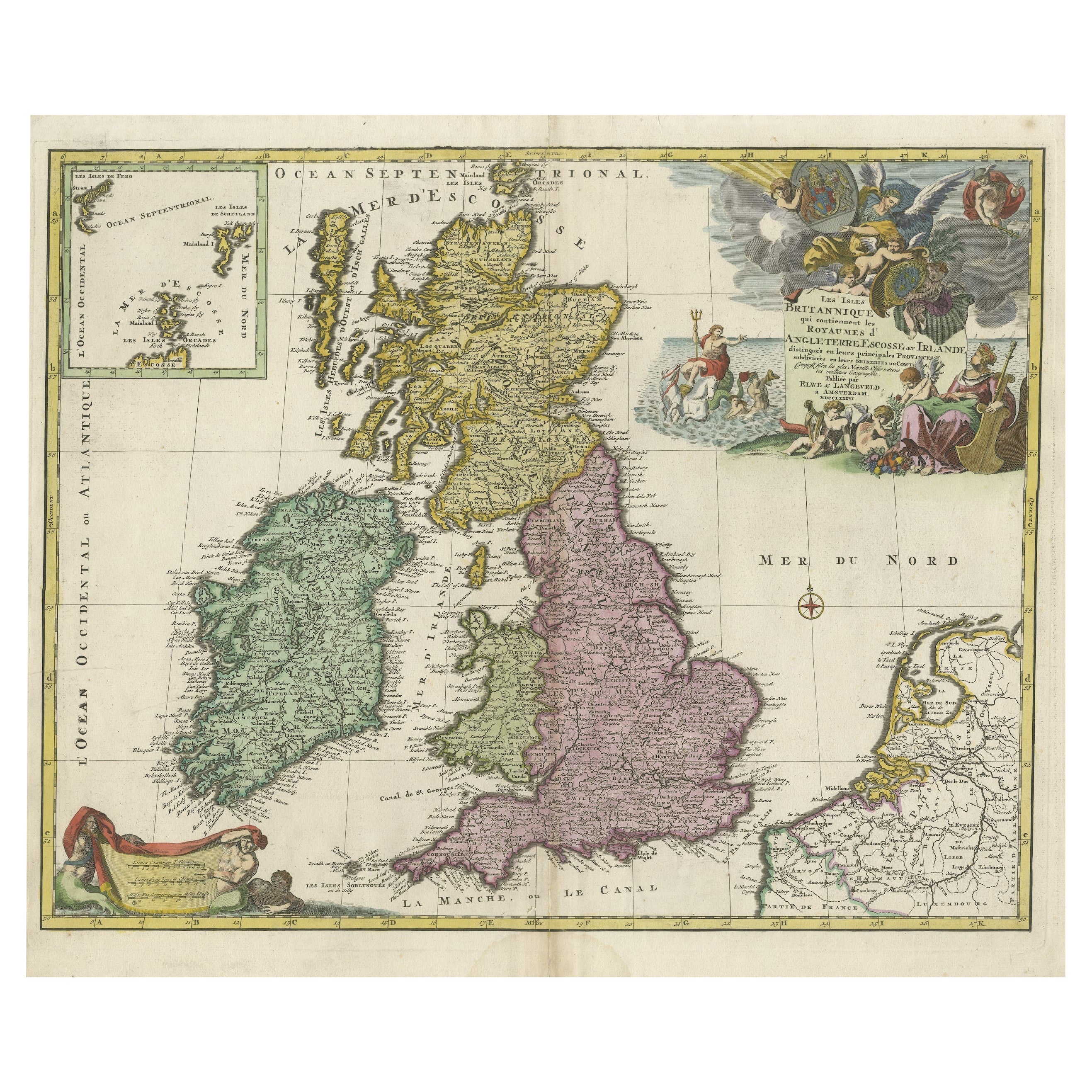
- Old Map of the UK & Ireland, Insets of Orkney, Shetland and Faroe Islands, 1786Located in Langweer, NLTitle: "Les Isles Britanniques qui contiennent les Royaumes d'Angleterre, Escosse, et Irlande". Hand-colored engraved map with 2 (large) decorative cartouches, inset map of the O...Category
Antique 1780s Maps
MaterialsPaper
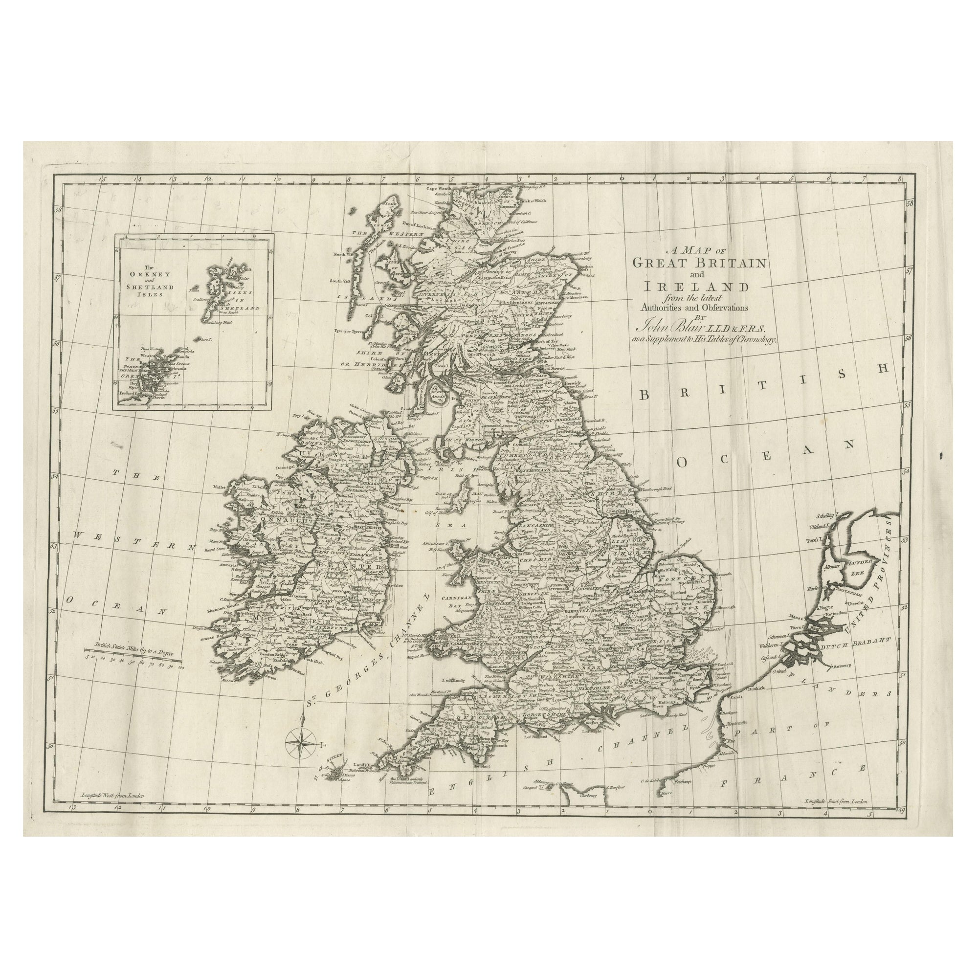
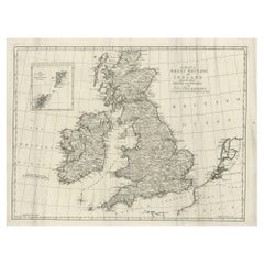
- Large Antique Map of the British Isles, with inset of the Orkneys and ShetlandsLocated in Langweer, NLAntique map titled 'A Map of Great Britain and Ireland (..)'. Large antique map of the British Isles, with part of the French and Dutch coasts, and an inset of the Orkneys and Shetla...Category
Antique Late 18th Century Maps
MaterialsPaper


You May Also Like
- St. Christophe 'St. Kitts' Island: An 18th Century Hand-colored Map by BellinBy Jacques-Nicolas BellinLocated in Alamo, CAJacques Bellin's copper-plate map of the Caribbean island of Saint Kitts entitled "Carte De De l'Isle St. Christophe Pour servir á l'Histoire Genle. des V...Category
Antique Mid-18th Century French Maps
MaterialsPaper
- Map of the Republic of GenoaLocated in New York, NYFramed antique hand-coloured map of the Republic of Genoa including the duchies of Mantua, Modena, and Parma. Europe, late 18th century. Dimension: 25...Category
Antique Late 18th Century European Maps
- Antique Map of Principality of MonacoBy Antonio Vallardi EditoreLocated in Alessandria, PiemonteST/619 - "Old Geographical Atlas of Italy - Topographic map of ex-Principality of Monaco" - ediz Vallardi - Milano - A somewhat special edition ---Category
Antique Late 19th Century Italian Other Prints
MaterialsPaper
- Hand-Colored 18th Century Homann Map of Denmark and Islands in the Baltic SeaBy Johann Baptist HomannLocated in Alamo, CAAn 18th century copper plate hand-colored map entitled "Insulae Danicae in Mari Balthico Sitae utpote Zeelandia, Fionia, Langelandia, Lalandia, Falstria, Fembria Mona" created by Joh...Category
Antique Early 18th Century German Maps
MaterialsPaper
- Original Antique Map of The World by Thomas Clerk, 1817Located in St Annes, LancashireGreat map of The Eastern and Western Hemispheres On 2 sheets Copper-plate engraving Drawn and engraved by Thomas Clerk, Edinburgh. Published by Mackenzie And Dent, 1817 ...Category
Antique 1810s English Maps
MaterialsPaper
- Antique 18th Century Map of the Province of Pensilvania 'Pennsylvania State'Located in Philadelphia, PAA fine antique of the colony of Pennsylvania. Noted at the top of the sheet as a 'Map of the province of Pensilvania'. This undated and anonymous map is thought to be from the Gentleman's Magazine, London, circa 1775, although the general appearance could date it to the 1760's. The southern boundary reflects the Mason-Dixon survey (1768), the western boundary is placed just west of Pittsburgh, and the northern boundary is not marked. The map has a number of reference points that likely refer to companion text and appear to be connected to boundaries. The western and southern boundaries are marked Q, R, S, for example. A diagonal line runs from the Susquehanna R to the Lake Erie P. A broken line marked by many letters A, B, N, O, etc., appears in the east. There are no latitude or longitude markings, blank verso. Framed in a shaped contemporary gilt wooden frame and matted under a cream colored matte. Bearing an old Graham Arader Gallery...Category
Antique 18th Century British American Colonial Maps
MaterialsPaper


