Late 20th Century Maps
1
11
to
1
6
4
11
11
11
2
1
1
2,891
2,124
411
5
227
31
11
84
7
56
7
3
3
4
5
2
7
3
1
1
1
5
3
3
2
1
1
1
Period: Late 20th Century
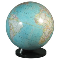
16-Inch Terrestrial Globe 1986 National Geographic
Located in Ottawa, Ontario
A 16-INCH TERRESTRIAL GLOBE 1986
NATIONAL GEOGRAPHIC
Large terrestrial globe with paper gores
on a stylish black lucite base
scale 1: 31,350,000
18" inches, (45.5cm.) high.
16" in...
Category
American Modern Late 20th Century Maps
Materials
Metal
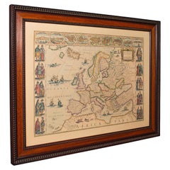
Vintage Reproduction 17th Century Map of Europe, American, Cartography, Blaeuw
Located in Hele, Devon, GB
This is a vintage reproduction map of Europe. An American, paper stock cartography print in frame after the work by Blaeuw, dating to the late 20t...
Category
Central American Mid-Century Modern Late 20th Century Maps
Materials
Glass, Wood, Paper
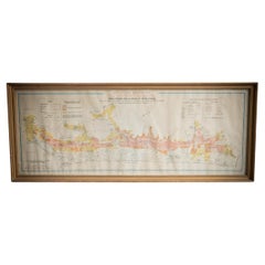
Gilt Framed Vintage French Cote De Beaune Wine Region Poster 1972
Located in Alton, GB
Framed Cote De Beaune region wine map from 1972. The print has been removed to clean the glass, the frame has minor damage in places but nothing that de...
Category
French Vintage Late 20th Century Maps
Materials
Paper
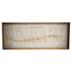
Gilt Framed Vintage French La Cote De Nuits Wine Region Poster 1972
Located in Alton, GB
Framed La Cote De Nuits region wine map from 1972. The print has been removed to clean the glass, the frame has minor damage in places but nothing that detracts from its beauty, if a...
Category
French Vintage Late 20th Century Maps
Materials
Paper
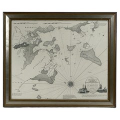
Chart of Boston's North Shore
Located in Norwell, MA
Rarely found restrike of an 1804 chart by Nathanael Bowditch of the Harbors of Salem, Marblehead, Beverly, and Manchester.
Showing the Islands of Great Misery, Satan, Cuney, Winter,...
Category
North American Vintage Late 20th Century Maps
Materials
Paper
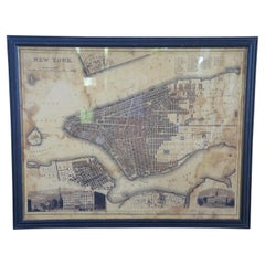
Vintage Oversized New York City Lower Manhattan 1840s Map Print
Located in Dayton, OH
Vintage late 20th century reproduction print of New York City featuring lower Manhattan in 1840.
Category
Victorian Late 20th Century Maps
Materials
Paper
Luminous Earth Globe on a Chrome Base, Italy, 1980
Located in Paris, FR
Unusual luminous globe on a large chromed metal base, made in Italy by Ricoscope Editions in Firenze.
In perfect condition, except for two very small missing pieces at the junction ...
Category
Italian Space Age Vintage Late 20th Century Maps
Materials
Chrome
Mid-Century Modern 1970s Paul McCobb Style Brass Stand Replogle Globe
Located in St. Louis, MO
Often attributed to Paul McCobb, because of the same brass tubing that McCobb used in his furniture. Circa 1970s Replogle globe is in very nice condition with raised topography and t...
Category
American Mid-Century Modern Vintage Late 20th Century Maps
Materials
Brass
Gilt Framed Vintage Wine Regions of France Map
Located in Alton, GB
Framed French wine region map 1973. The print has been removed to clean the glass, the frame has minor damage in places but nothing that detracts from ...
Category
French Vintage Late 20th Century Maps
Materials
Paper
Facsimile Joan Blaeu's Atlas Major '12 Volumes'
Located in Langweer, NL
Facsimile of the original French edition of Joan Blaeu's Atlas Major, 1663. Printed in Amsterdam, by N.V. Theatrum Orbis Terrarum, 1967-68. 12 volumes with ...
Category
Late 20th Century Maps
Materials
Paper
East German Map
By VEB Hermann Haack
Located in Baltimore, MD
A brilliantly colourful map of the Leipzig, Karl Marx Stadt and Dresden area in the former German Democratic Republic by VEB Hermann Haack of Gotha.
Category
German Vintage Late 20th Century Maps
Related Items
Large and Extremely Rare Terrestrial Globe by Newton
By Newton Globes - Planer & Newton
Located in Lymington, Hampshire
A large and extremely rare 24-inch terrestrial globe by Newton
Our most magnificent and rare globes were a pair of 24-inch Newton globes.
These too were updated in 1852 (terre...
Category
English Antique Late 20th Century Maps
Materials
Mahogany
"Alphaville" Original Japanese Movie Poster
Located in London, GB
Original Japanese movie poster for Jean-Luc Godard's 1965 French New Wave film starring Eddie Constantine, Anna Karina, Akim Tamiroff.
Category
Japanese Vintage Late 20th Century Maps
Cross of Caravaca 17th Century
Located in Madrid, ES
Cross of caravaca XVII century.
Very beautiful cross of caravaca made in bronze. 17th Century. Measurements: 14X6 cm.
Good condition.
Category
Italian Gothic Antique Late 20th Century Maps
Materials
Bronze
17th Century Hand-Colored Map of West Africa by Mercator/Hondius
Located in Alamo, CA
A 17th century hand-colored map entitled "Guineae Nova Descriptio" by Gerard Mercator and Jodocus Hondius, published in their 'Atlas Minor' in Amsterdam in 1635. It is focused on the...
Category
Dutch Antique Late 20th Century Maps
Materials
Paper
18-inch Globe, Cary's, London, 1840
By Cary’s
Located in Milano, IT
John and William Cary
Updated by George and John Cary
Terrestrial Globe
London, 1840
lb 22 (kg 10)
Slight surface abrasions due to use. A small crack on the horizon circle.
The globe rests in its original Dutch style stand with four supporting turned wood columns.
It measures 26 in in height x 23.6 in in diameter with the diameter of the sphere measuring 18 in; 66 cm in height x 60 cm in diameter with the diameter of the sphere measuring 45.72 cm.
The 18 inch...
Category
English Early Victorian Antique Late 20th Century Maps
Materials
Wood, Paper
19th Century German Miniature Pocket Terrestrial Globe
Located in Essex, MA
A miniature 19th century 3.5 inch diameter pocket terrestrial globe by C. Abel-Klinger, Nuremberg, Germany, in English for the English speaking markets. Signed with cartouche reading...
Category
German Antique Late 20th Century Maps
Materials
Brass
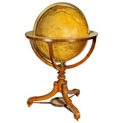
Franklin Mint - The Royal Geographical Society, Tripod World Globe Circa 1993
Located in Vancouver, British Columbia
A rare standing globe manufactured by the Franklin Mint, to a designed as was issued by the Royal Geographic Society. The globe is mounted on a tripod mahogany base accented by gi...
Category
American Other Late 20th Century Maps
Materials
Metal
"Alraune", Original German Movie Poster
Located in London, GB
Original German movie poster for the silent 1919 horror film. The film tells the story of a woman who is forced to mate with a mandrake root, prod...
Category
German Vintage Late 20th Century Maps
Cross of Caravaca 17th Century
Located in Madrid, ES
Cross of caravaca xvii century
Very beautiful cross of Caravaca made in bronze. 17th century. Measurements: 12 x 6cm
Good condition.
Category
Italian Gothic Antique Late 20th Century Maps
Materials
Bronze
Harvard Radios vs. Princeton Aviators Vintage Football Poster, circa 1918
Located in Colorado Springs, CO
This is a very scarce WWI Work Relief Fund poster featuring the Harvard Radios competing against the Princeton Aviators. The game, held on November 23, 1918, was a benefit football game to raise money for the war effort.
The poster dynamically depicts two football players mid-action. Below, the names of the teams are printed in yellow, with the date, location of the game, and ticket information printed in contrasting white. The United War Work Campaign’s logo is printed at bottom center. The logo is composed of a black star and the number 7, with the text “United War Work Campaign” encircling the star in a yellow ring. The poster was illustrated by the artist J. Liello. His signature is printed in stone, visible on the left side of the composition.
The following was written about the match in the November 23, 1918 issue of The New York Times: “Today marks the climax of the most irregular football season the gridiron sport has ever known… Here in New York there will be an unusually attractive football bill. First of all the war fund benefit at the Polo Grounds...
Category
American Vintage Late 20th Century Maps
Materials
Paper
Antique Hammond's 6-Inch Terrestrial Globe on Stand
Located in Philadelphia, PA
Offered here for your consideration is, A fine antique 6-inch terrestrial globe.
Additional Details:
By C.S. Hammond & Co.
The globe likely dates from 1927 to 1930 due to the ...
Category
Unknown Art Deco Late 20th Century Maps
Materials
Wood, Paper
"Men Wanted For the Army" Vintage WWI Recruitment Poster
Located in Colorado Springs, CO
Presented is a vintage U.S. Army recruitment poster, dating to World War I. The poster depicts an Army officer conferring with a soldier. They stand next to an artillery battery, manned by two soldiers. Their fort looks over a cliff, with water and clouds completing the background. The text "Men Wanted for the Army" is printed in bold red letters at the top of the poster. The bottom margin of the poster includes a cartouche where the name of the recruiting station can be filled in.
The color lithograph was illustrated by Michael P...
Category
American Vintage Late 20th Century Maps
Materials
Paper
Previously Available Items
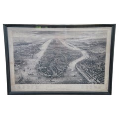
Restoration Hardware Old Manhattan New York 1867 Panoramic Etched Map
Located in Dayton, OH
A large and impressive Restoration Hardware framed library map of Old Manhattan, New York. Features a panoramic view, after the original eng...
Category
Victorian Late 20th Century Maps
Materials
Paper
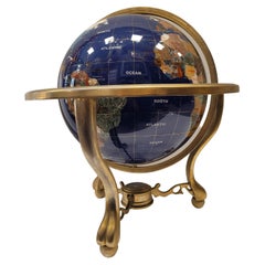
20th Century Lapis Lazuli Earth Globe, Marquetry in Precious Stones
Located in Valladolid, ES
Amazing Large handmade earth globe with lapis lazuli background and marquetry with semi-precious stones, they are applied following the jewelry technique called "Pietre dure", carefu...
Category
French Mid-Century Modern Vintage Late 20th Century Maps
Materials
Bronze
Frontgate Rand McNally World Classic Magnetic Travel Map with Burlwood Frame
Located in Dayton, OH
Frontgate Magnetic Travel Map by Rand McNally. Allows you to chart your journeys around the globe and even plan that “someday” trip of a lifetime. Printed on parchment-style paper wi...
Category
Modern Late 20th Century Maps
Materials
Burl, Paper
1987 "the Ian Fleming Thriller Map" by Aaron Silverman and Molly Maguire
Located in Colorado Springs, CO
Presented is an original “Ian Fleming Thriller Map,” which features the travels of MI6 Agent 007, James Bond, from author Ian Fleming’s series of fourteen spy novels. The pictorial m...
Category
American Vintage Late 20th Century Maps
Materials
Paper
La Galleria Delle Carte Geografiche in Vaticano, Maps in the Vatican, 3 Vols
By Fra Egnazio Danti
Located in Morristown, NJ
La Galleria delle Carte geografiche in Vaticano / The Gallery of Maps in the Vatican, Mirabilia Italiae / Franco Cosimo Panini, (3) vols. in black silk cloth, slipcase with golden ti...
Category
Italian Renaissance Late 20th Century Maps
Materials
Linen, Paper
H 13 in W 5.5 in D 10 in
1987 "the Ian Fleming Thriller Map" by Aaron Silverman and Molly Maguire
Located in Colorado Springs, CO
Presented is an original “Ian Fleming Thriller Map,” which features the travels of MI6 Agent 007, James Bond, from author Ian Fleming’s series of fourteen spy novels. The pictorial m...
Category
American Vintage Late 20th Century Maps
Materials
Paper
Gilt Framed Vintage French Chablis Wine Region Poster Dated 1972
Located in Alton, GB
Framed Chablis region wine map from 1972 depicting the wine regions of Bourgogne. The print has been removed to clean the glass, the frame has minor damage in places but nothing that...
Category
French Vintage Late 20th Century Maps
Materials
Paper
Gilt Framed Vintage French Saint Emilion Wine Region Poster Dated 1973
Located in Alton, GB
Framed Saint Emilion region wine map from 1973 depicting the wine regions of Bordeaux. The print has been removed to clean the glass, the frame has minor damage in places but nothing...
Category
French Vintage Late 20th Century Maps
Materials
Paper
H 24.41 in W 16.15 in D 0.79 in
Gilt Framed Vintage French Beaujolais Wine Region Poster Dated 1973
Located in Alton, GB
Framed Le Beaujolais region wine map from 1973 depicting the wine regions of Bourgogne. The print has been removed to clean the glass, the frame has minor damage in places but nothin...
Category
French Vintage Late 20th Century Maps
Materials
Paper
Philip's Terrestrial Globe Mahogany and Walnut Stand, circa 1982
Located in Forest Row, East Sussex
A late 18th century style terrestrial globe printed and manufactured by George Philip & Son Ltd. mahogany and walnut stand, with a paper glass covered compass underneath.
Dimensio...
Category
English Vintage Late 20th Century Maps
Materials
Walnut, Paper
Large Terrestrial and Celestial Globe with Astrological Signs, Circa 1970
Located in Plainview, NY
An exquisite late 20th century vintage large terrestrial and celestial globe with astrological signs displaying magnificent details ma...
Category
American American Classical Late 20th Century Maps
Materials
Mahogany, Paper
History of Old Kinderhook by Edward Augustus Collier
Located in valatie, NY
A History of Old Kinderhook by Edward Augustus Collier. G. P. Putnam's and Sons, NY, 1914 (original), reprinted by Higginson Book Co, MA. A reprinted hardcover. Including the Story o...
Category
American Late 20th Century Maps
Materials
Paper
Recently Viewed
View AllMore Ways To Browse
Sea Chart Map
Antique Classroom
Antique Nautical Map
Antique Mexican Maps
Antique Map Box
Antique Nautical Maps
Mexican Antique Map
Antique Nautical Charts
King Charles I Of England
17th Century Corpus
Antique Celestial Maps
Antique Celestial Map
Celestial Maps Antique
Antique Map Middle East
Vintage Wooden Roller
Middle East Antique Map
Topographical Plate
Central America Map
