Items Similar to Vinland Map and the Tartar Relation
Want more images or videos?
Request additional images or videos from the seller
1 of 11
Vinland Map and the Tartar Relation
$69
£51.92
€59.98
CA$97.52
A$105.88
CHF 56.07
MX$1,297.81
NOK 693.92
SEK 655.72
DKK 447.66
About the Item
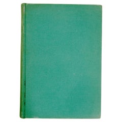
The Vinland Map and the Tartar Relation. New Haven: Yale University Press, 1965. First edition third printing hardcover with dust jacket. 291 pp. A historical cartography of the Vinland Map which dated to about A.D. 1440, at least fifty years before Columbus landed in the Americas. It is a unique map of the world that shows an outline of the northeast American coast and a legend describing its discovery in about 1000 by Leif Eiriksson, the Norseman from Greenland. After this book was published in 1965 it generated an enormous amount of debate. Chemical analysis of the ink later suggested the map might be a forgery, but recent appraisals of both scientific and humanist evidence argue that it is indeed authentic.
NPT Books, a division of N.P. Trent Antiques, has a large collection of used and out of print books on art, architecture, decoration and antiques with a focus on 1st editions, signed and limited editions.
- Creator:Thomas E. Marston (Author),George D. Painter (Author),R.A. Skelton (Author)
- Dimensions:Height: 12 in (30.48 cm)Width: 9.5 in (24.13 cm)Depth: 1.75 in (4.45 cm)
- Materials and Techniques:
- Place of Origin:
- Period:
- Date of Manufacture:1965
- Condition:dust jacket shows small signs of age/owner's library stamp.
- Seller Location:valatie, NY
- Reference Number:Seller: LK-295-1st1stDibs: LU260519418323
NPT Books
NPT Books, a division of N. P. Trent Antiques, was established in 1982 and serves clients in the US and around the world. We offer a large selection of used and out of print books mainly concentrating on art, architecture, decoration and antiques with a large focus on 1st editions, signed and rare limited editions. Member of The Art and Antique Dealers League of America since 1996.
About the Seller
5.0
Platinum Seller
Premium sellers with a 4.7+ rating and 24-hour response times
Established in 1980
1stDibs seller since 2017
1,336 sales on 1stDibs
Typical response time: <1 hour
- ShippingRetrieving quote...Shipping from: valatie, NY
- Return Policy
Authenticity Guarantee
In the unlikely event there’s an issue with an item’s authenticity, contact us within 1 year for a full refund. DetailsMoney-Back Guarantee
If your item is not as described, is damaged in transit, or does not arrive, contact us within 7 days for a full refund. Details24-Hour Cancellation
You have a 24-hour grace period in which to reconsider your purchase, with no questions asked.Vetted Professional Sellers
Our world-class sellers must adhere to strict standards for service and quality, maintaining the integrity of our listings.Price-Match Guarantee
If you find that a seller listed the same item for a lower price elsewhere, we’ll match it.Trusted Global Delivery
Our best-in-class carrier network provides specialized shipping options worldwide, including custom delivery.More From This Seller
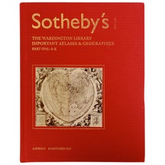
View AllSotheby's The Wardington Library, Important Atlases and Geographies, Part 1 A-K
Located in valatie, NY
Sotheby's: The Wardington Library, Important Atlases and Geographies. Part One: A-K., London, 18 October 2005. 1st Ed hardcover catalog with 244 lots photographed in color and fully ...
Category
Early 2000s English Books
Materials
Paper
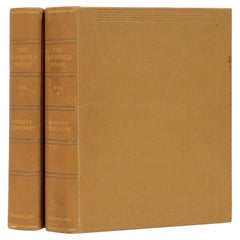
Old World House: Its Furniture and Decoration, 2 Volumes, 1st Ed
Located in valatie, NY
The Old World House: Its Furniture and Decoration, In two volumes, by Herbert Cescinsky. Published by The Macmillan Company, London, 1924. A pair of 1st ed hardcovers with gilded top edge. Herbert Cescinsky was an architect and writer active in the early 20th c. He was particularly interested in the development of English furniture and wrote profusely on the subject. This work is an interesting look at the furniture and decorations found in the interior designs in older houses in England. The author discusses oak chairs and tables, marqueterie furniture...
Category
Vintage 1920s English Books
Materials
Paper
France Under Louis XIV 'Le Grand Siecle', Its Arts, Its Ideas, First Edition
Located in valatie, NY
France Under Louis XIV [Le Grand Siecle], Its Arts, Its Ideas by Mrs. Cashel Huey. Charles Scribner's Sons, New York, 1897. First Edition hardcover. 470 p...
Category
Antique Late 19th Century American Books
Materials
Paper
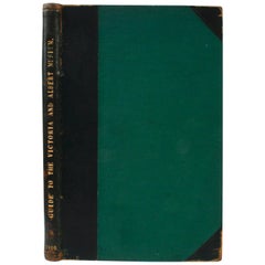
Guide to The Victoria and Albert Museum, 1910
Located in valatie, NY
Guide to The Victoria and Albert Museum. London: His Majesty's Stationery Office, 1910. Moroccan leather and green cloth hardcover with gilt lettering and no dust jacket as issued. 62 pp. An antique guide to the Victoria and Albert Museum in South Kensington, England. The guide includes the museum's hours, a list of rooms and galleries. Departments include Architecture and Sculpture, Ceramics, Glass, and Enamels, Engraving, Illustration, and Design, Library and Book Production, Metal Work, Paintings, Textiles, Woodwork, Furniture, and Leather. With 30+ illustrations in black and white with four fold-out floor plan maps in color. The binding is labeled and by Jas. Truscott & Sons, Book Binders...
Category
Early 20th Century English Books
Materials
Paper
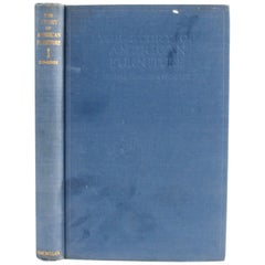
Story of American Furniture by Thomas Hamilton Ormsbee
Located in valatie, NY
The story of American Furniture by Thomas Hamilton Ormsbee. New York: The Macmillion Company, 1941. Hardcover with no dust jacket. A comprehensive resource book on America antique furniture...
Category
Mid-20th Century American Books
Materials
Paper
Colonial Furniture: The Superb Collection of the late Howard Reifsnyder, 1st Ed
Located in valatie, NY
Colonial Furniture: The Superb Collection of the Late Howard Reifsnyder, including signed pieces by Philadelphia cabinetmakers, formerly contained i...
Category
Vintage 1920s American Books
Materials
Paper
You May Also Like
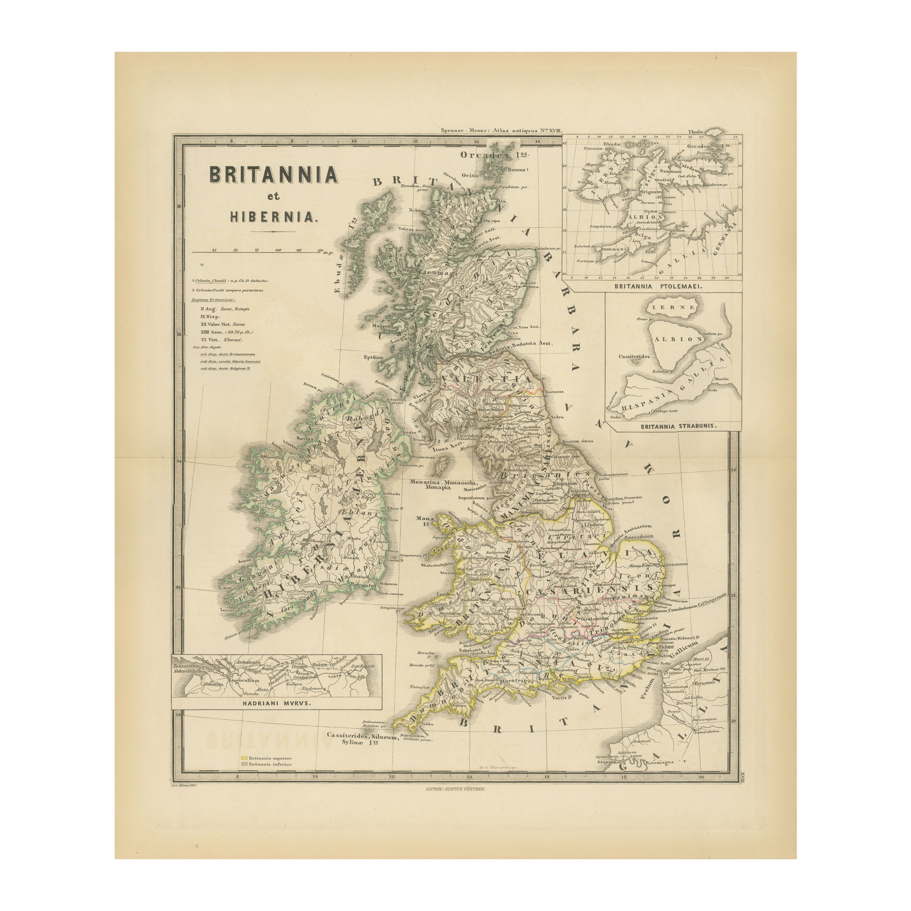
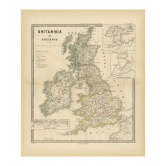
Ancient Cartography of Britannia and Hibernia, Published in 1880
Located in Langweer, NL
This map depicts the geographical area of Great Britain and Ireland, labeled "BRITANNIA et HIBERNIA." It is a historical map, as indicated by the Latin titles and the classical names of regions and tribes.
In the main section of the map, Great Britain is depicted in fine detail, with topographical features such as mountains and rivers. The map is color-coded, to differentiate political or tribal boundaries. Various Roman place names are indicated, such as "Londinium" for London.
To the left of Great Britain is Ireland, referred to as "Hibernia," similarly detailed with its own topographical features and ancient...
Category
Antique 1880s Maps
Materials
Paper
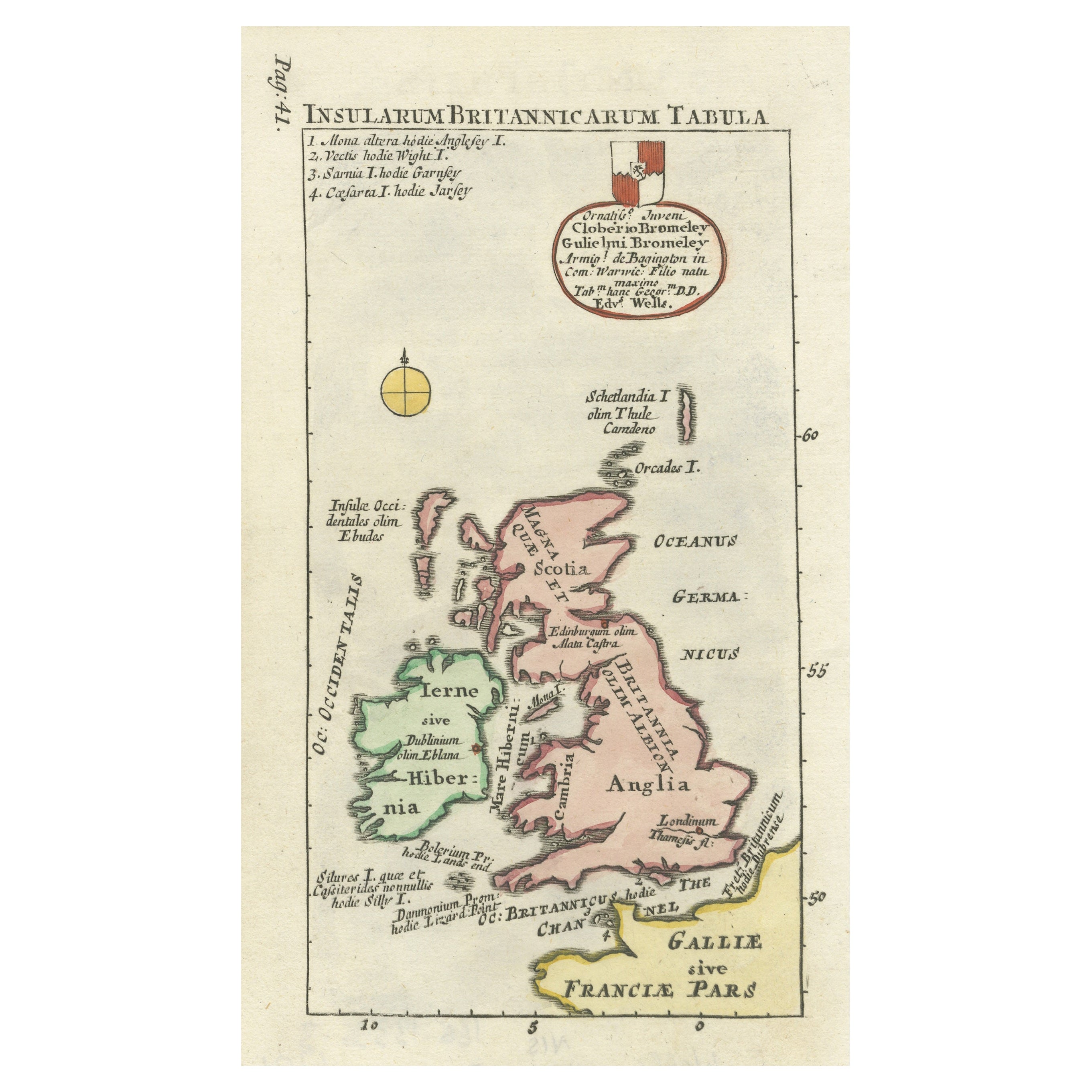
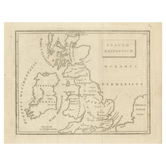
Interesting Small Map of the British Isles with Hand Coloring
Located in Langweer, NL
Antique map titled 'Insularum Britannicarum Tabula'. Interesting small map of the British Isles by Wells. This map originates from 'Oikumenes Periegesis, sive, Dionysii Geographia em...
Category
Antique Early 18th Century Maps
Materials
Paper

$363 Sale Price
20% Off
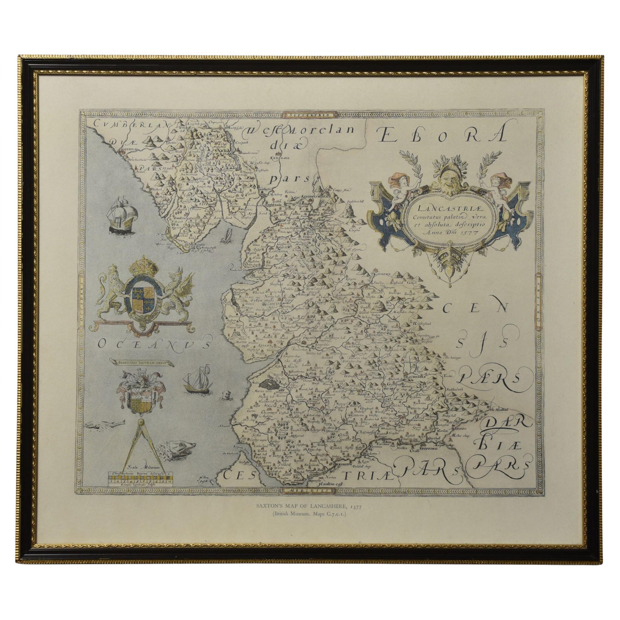
Map of Lancashire
Located in Cheshire, GB
Saxton Map of Lancashire hand coloured. Encased in an ebonised frame.
Dimensions
Height 21 Inches
Width 24 Inches
Depth 1 Inches
Category
Early 20th Century British Maps
Materials
Paper

$768 Sale Price
20% Off
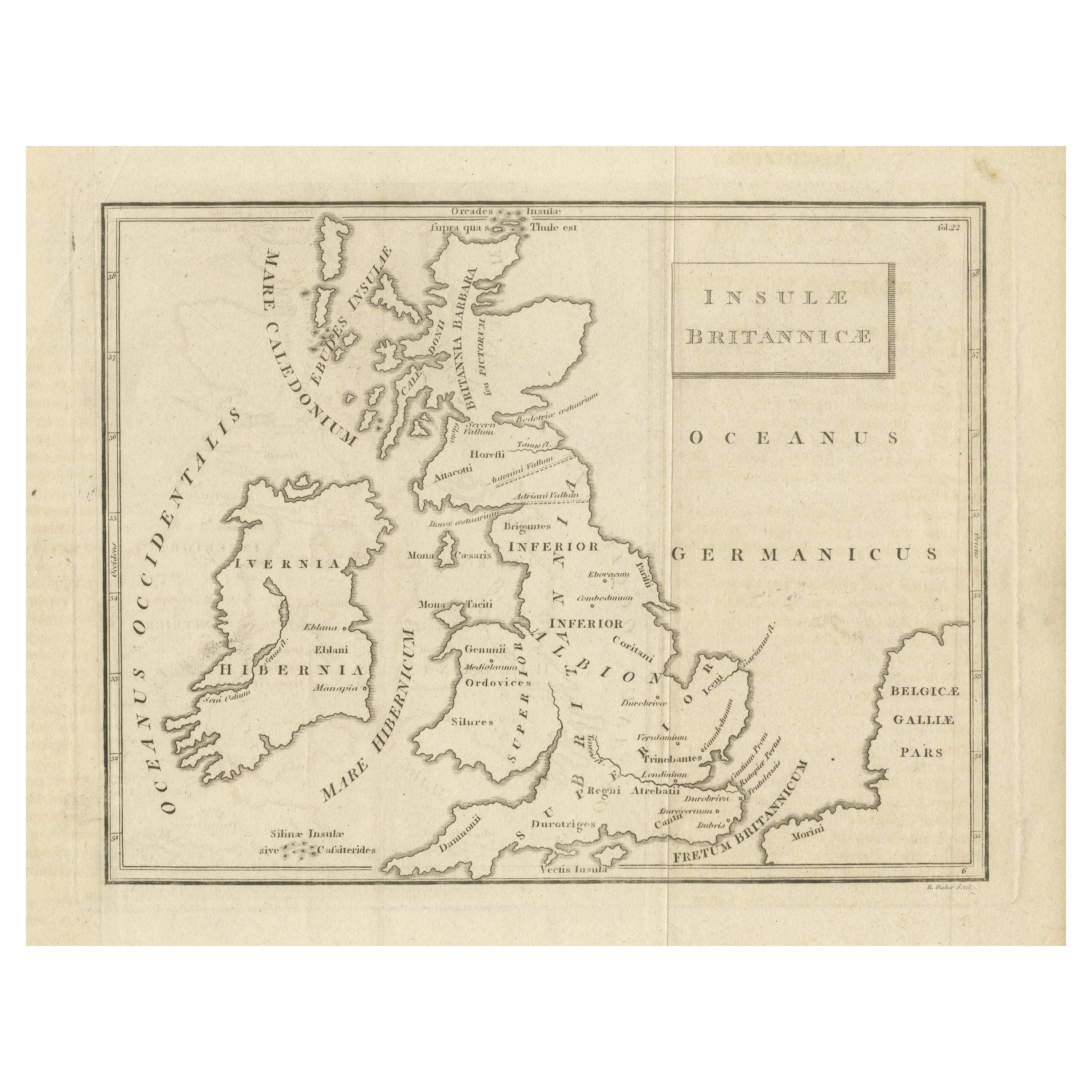
Antique Map of the British Isles According to the Geography of the Roman Empire
Located in Langweer, NL
Antique map titled 'Insulae Britannicae'. Interesting map of Britain, Scotland, and Ireland. It shows a rudimentary outline of the islands according to the geography of the Roman Emp...
Category
Antique Late 18th Century Maps
Materials
Paper
$172 Sale Price
20% Off
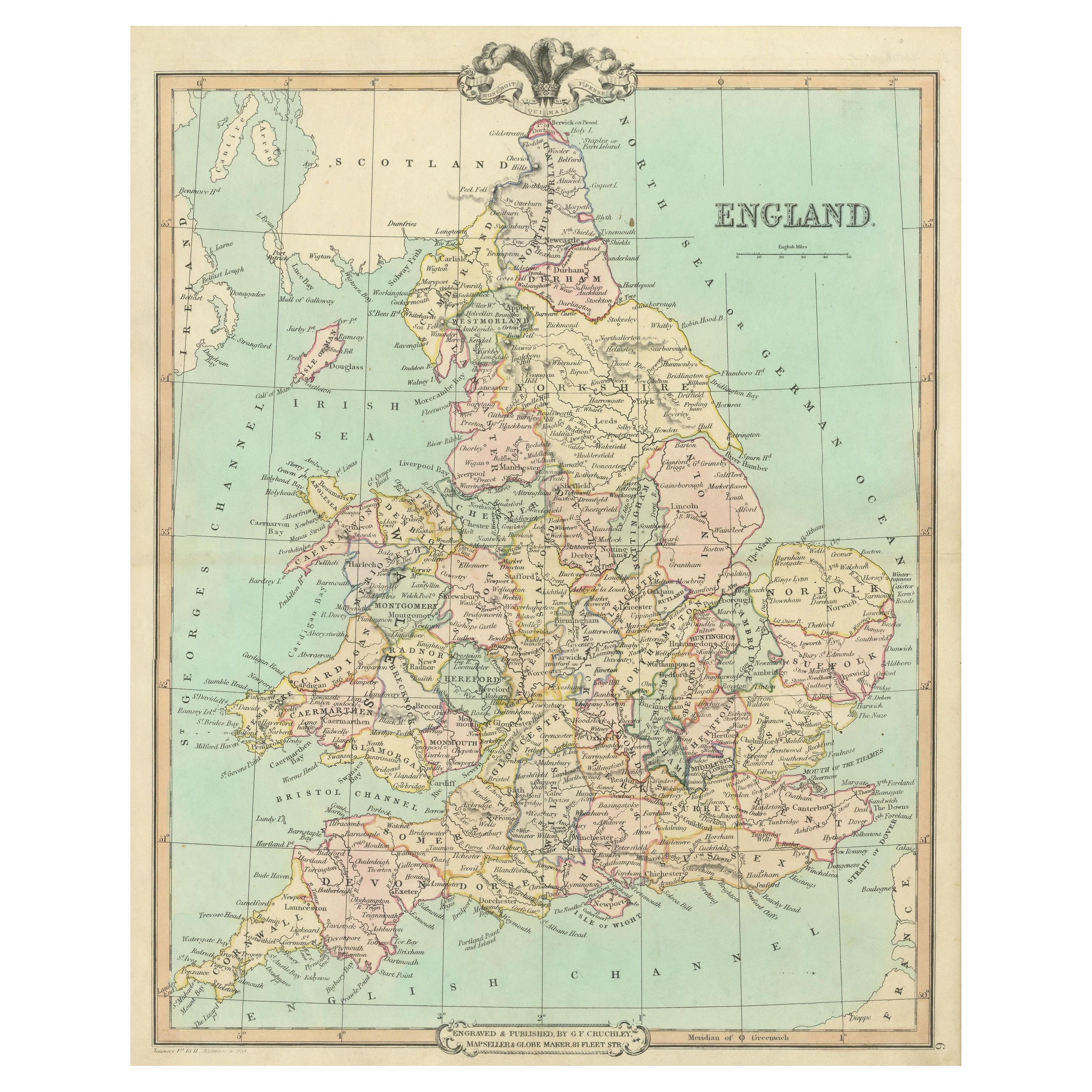
Antique Map of England and Wales, Also Including the Isle of Man
Located in Langweer, NL
Antique map titled 'England'. Original antique map of England and Wales from Northumberland to Cornwall from the St. George Channel east as far as the Strait of Dover. The Isle of Ma...
Category
Antique Mid-19th Century Maps
Materials
Paper

$373 Sale Price
20% Off
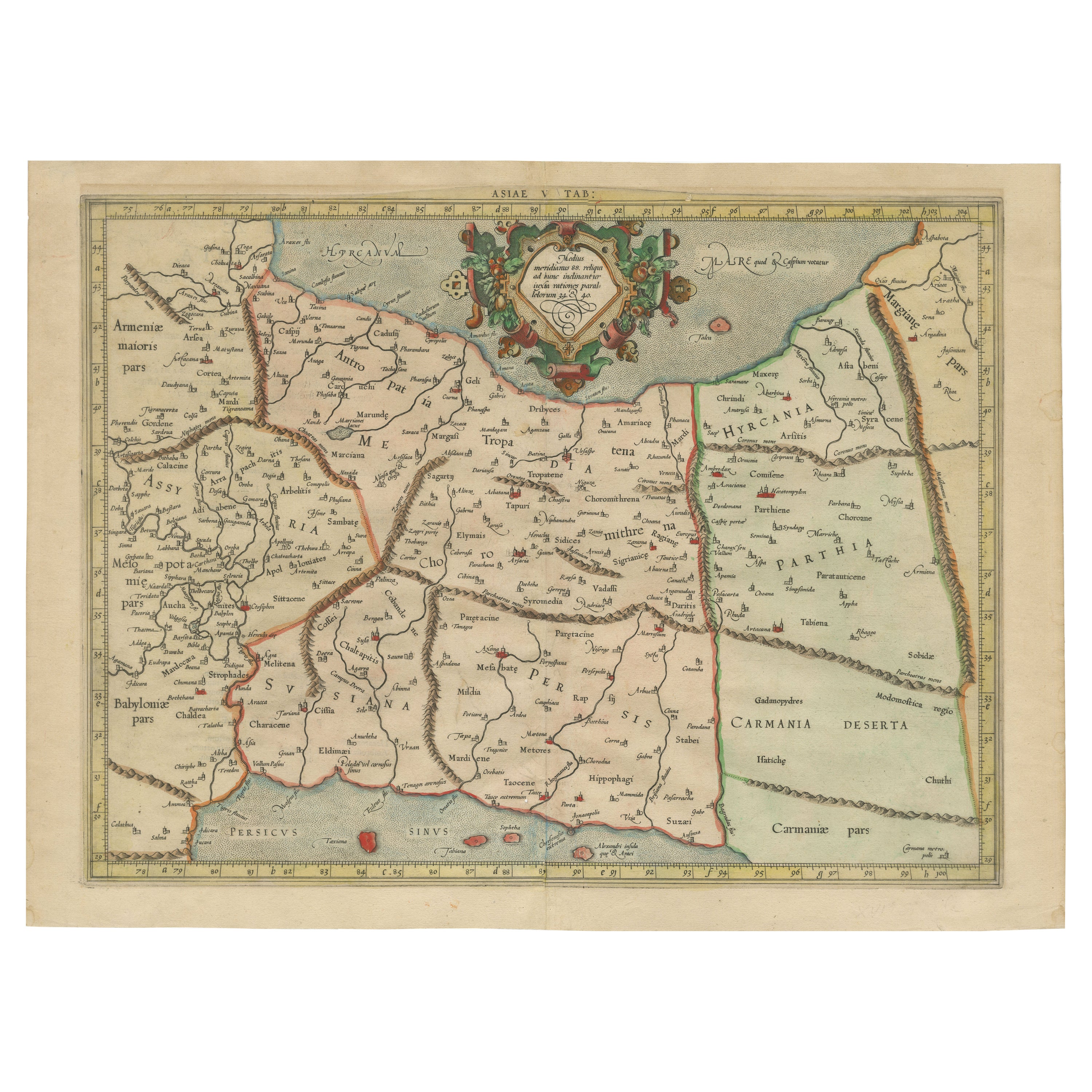
Mercator's Ptolemaic Map of Ancient Assyria, Media, and Persia
Located in Langweer, NL
This map, "Asiae I Tab:", features the region corresponding to modern-day Iran and Iraq, intricately depicted in Gerard Mercator's edition of Claudius Ptolemy's "Tabulae Geographicae...
Category
Antique 16th Century Maps
Materials
Paper
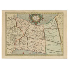
$1,091 Sale Price
20% Off
More Ways To Browse
The Vintage Map
Mid Century Scandinavian Coffee Tables
Set Of Four Dining Chairs Black
Antique Sofa Table
Woven Aubusson Rugs
Antique Farahan Rug
Italian Hand Painted Table
Pembroke Dining Tables
Antique Tiger
Beautiful Vintage Coffee Table
Black Carved Table
Architect Tables
Curve Mid Century Coffee Table
Italian Carrara Marble Dining Table
Pembroke Drop Leaf Table
The Leopard
Water Silver
Antique Continental Furniture