Items Similar to 1750 Map of the Holy Land: The Land of Canaan and the Twelve Tribes


Want more images or videos?
Request additional images or videos from the seller
1 of 6
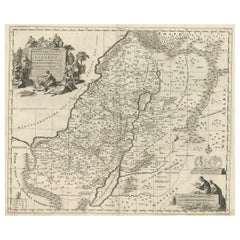
1750 Map of the Holy Land: The Land of Canaan and the Twelve Tribes
$1,904.77
£1,415.76
€1,600
CA$2,629.96
A$2,916.44
CHF 1,532.37
MX$35,633.90
NOK 19,172.05
SEK 17,996.25
DKK 12,183.20
About the Item
Carte de la Terre de Canaan ou Terre Promise
Cartographer: Le St. Robert
Date of Publication: 1750
This exquisite 18th-century map, 'Carte de la Terre de Canaan ou Terre Promise', was published by Le St. Robert in 1750 and vividly illustrates the geography of the Holy Land as described in the Bible. The map meticulously outlines the divisions of the Twelve Tribes of Israel, with clear delineations and beautifully colored boundaries. The geographic layout includes the Mediterranean coastline, the Jordan River, the Sea of Galilee, and the Dead Sea, alongside various significant biblical sites.
The decorative cartouches are striking features of this map. The title cartouche in the bottom left corner is richly ornamented with religious motifs, including an altar with smoke rising and symbols of Judaic heritage, such as the menorah and Torah scrolls, reflecting the spiritual significance of the region. An inset map in the upper left corner titled 'Carte de la Terre de Canaan ou Terre Proche' provides additional context, showing a wider geographical area, including Egypt and surrounding territories.
Key Features:
- Detailed divisions of the Twelve Tribes of Israel.
- Decorative hand-colored borders highlighting tribal regions.
- Artistic cartouches with Judaic and biblical symbolism.
- Inset map offering a broader regional perspective.
- Text in French, typical of maps from this period.
This map is an excellent addition to any collection of biblical, cartographic, or 18th-century historical artifacts. It offers a unique perspective on how biblical geography was interpreted and represented during the Enlightenment.
---
Analysis/Background Information:
This map is a fine example of 18th-century cartography, where artistic design met geographic accuracy and historical interpretation. During this period, maps of the Holy Land were highly sought after, especially in Christian Europe, due to the deep interest in biblical scholarship and exploration of the Levant.
Le St. Robert’s map reflects the prevailing Enlightenment-era focus on synthesizing biblical narratives with geographic realities. The division of the Twelve Tribes of Israel was a common theme in Holy Land maps, aiming to provide a visual aid to readers and scholars interpreting biblical texts. Such maps were often used in religious and educational contexts, allowing audiences to visualize the geography described in sacred scripture.
The inset map in the top left corner broadens the scope to include Egypt and neighboring regions, underscoring the historical and religious ties between these areas. This addition suggests an awareness of the broader narrative of the Exodus and its importance to biblical geography.
The decorative cartouches are quintessential of 18th-century French maps, where artistic expression played a significant role. The inclusion of Judaic symbols such as the menorah, Torah, and sacrificial altar highlights the cultural and spiritual importance of the region. The map was likely intended for an educated European audience interested in religious history, biblical cartography, or travel.
The French text aligns with the dominance of France in cartography during this era, with French mapmakers like Le St. Robert contributing to the rich tradition of geographical representation. This map not only served as a geographic tool but also as a decorative and intellectual artifact, embodying the cultural fascination with the Holy Land during the 18th century.
Key areas and places:
1. The Twelve Tribes of Israel
The map prominently displays the divisions of the Twelve Tribes, such as Judah, Benjamin, Ephraim, and others, which are essential for biblical and historical significance.
2. Jerusalem
A central and highly significant city in biblical history, Jerusalem is likely highlighted, making it a focal point for collectors.
3. The Jordan River
This iconic river, connecting the Sea of Galilee to the Dead Sea, holds strong religious and geographical importance.
4. The Sea of Galilee
Associated with many events from the New Testament, this lake is a key feature for those interested in biblical geography.
5. The Dead Sea
Known for its unique characteristics and biblical associations, such as the story of Sodom and Gomorrah, the Dead Sea is a major feature on maps of the Holy Land.
6. Famous Biblical Cities
Locations such as Bethlehem, Nazareth, Jericho, and Hebron are commonly featured on maps of the Holy Land and are significant for religious and historical contexts.
7. The Mediterranean Coastline
This includes ancient ports like Jaffa and Tyre, important for trade and mentioned in biblical stories.
8. Mountains and Geographical Features
Key landmarks such as Mount Carmel or Mount Nebo may be illustrated, reflecting their roles in biblical narratives.
9. Neighboring Territories
Areas like Egypt, Edom, and Moab often appear on Holy Land maps, drawing the interest of those studying biblical or regional history.
10. Decorative Cartouches with Religious Symbolism
The ornate cartouches featuring Judaic motifs such as menorahs or Torah scrolls make this map particularly appealing to collectors of religious art and cartography.
These features would attract those interested in biblical studies, historical geography, and 18th-century depictions of the Holy Land.
-----
Condition Report: Minor edge wear, slight discoloration typical of age, and faint creases. Vibrant original hand-coloring intact. No major tears or repairs. Paper remains stable and suitable for display.
Tips for Matting and Framing: Use acid-free matting to protect the map, with a neutral tone to enhance its colors. Opt for UV-protective glass to prevent fading. A simple wooden or gilt frame complements the antique aesthetic while ensuring durability.
- Dimensions:Height: 20.6 in (52.3 cm)Width: 26.19 in (66.5 cm)Depth: 0.01 in (0.2 mm)
- Materials and Techniques:Paper,Engraved
- Period:1750-1759
- Date of Manufacture:1750
- Condition:Condition Report: Minor edge wear, slight discoloration typical of age, and faint creases. Vibrant original hand-coloring intact. Folding line as issued. One small professional repair on the reverse. Paper remains stable and suitable for display.
- Seller Location:Langweer, NL
- Reference Number:Seller: BG-14043-81stDibs: LU3054343431892
About the Seller
5.0
Recognized Seller
These prestigious sellers are industry leaders and represent the highest echelon for item quality and design.
Platinum Seller
Premium sellers with a 4.7+ rating and 24-hour response times
Established in 2009
1stDibs seller since 2017
2,609 sales on 1stDibs
Typical response time: <1 hour
- ShippingRetrieving quote...Shipping from: Langweer, Netherlands
- Return Policy
Authenticity Guarantee
In the unlikely event there’s an issue with an item’s authenticity, contact us within 1 year for a full refund. DetailsMoney-Back Guarantee
If your item is not as described, is damaged in transit, or does not arrive, contact us within 7 days for a full refund. Details24-Hour Cancellation
You have a 24-hour grace period in which to reconsider your purchase, with no questions asked.Vetted Professional Sellers
Our world-class sellers must adhere to strict standards for service and quality, maintaining the integrity of our listings.Price-Match Guarantee
If you find that a seller listed the same item for a lower price elsewhere, we’ll match it.Trusted Global Delivery
Our best-in-class carrier network provides specialized shipping options worldwide, including custom delivery.More From This Seller
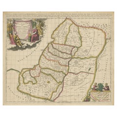
View AllMap of the Holy Land Divided into 12 Tribes, the Travels of Jesus Christ, 1700
Located in Langweer, NL
Antique map titled 'Het Heylige Land verdeeld in de Twaalf Stammen Israels (..)'.
Decorative and detailed map of the Holy Land divided into 12 Tribes, sh...
Category
Antique Early 1700s Maps
Materials
Paper
$466 Sale Price
20% Off
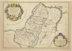
Antique Map of the Holy Land by Van Luchtenburg, c.1720
Located in Langweer, NL
Antique map titled 'Heylige Land verdeeld in de Twaalf Stammen Israels (..).' Highly detailed map of the Holy Land divided into 12 tribes of Israel...
Category
Antique 18th Century Maps
Materials
Paper

$133 Sale Price
20% Off
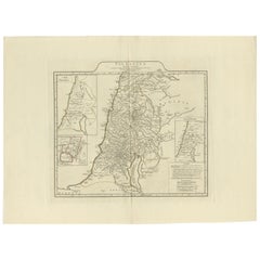
Antique Map of the Holy Land, Showing the Location of the Various Tribes
Located in Langweer, NL
Antique map titled 'Judaea seu Terra Sancta quae Hebraeorum sive Israelitarum (..)'. Map of The Holy Land, showing the location of the various tribes, in two kingdoms, Judah and Isra...
Category
Antique Early 18th Century Maps
Materials
Paper
$1,142 Sale Price
20% Off
Free Shipping
1709 Map of the Holy Land - Twelve Tribes of Israel, Hand-Colored, Antique Map
Located in Langweer, NL
This is a beautiful 1709 map of the Holy Land, titled "Iudaea seu Terra Sancta quae Hebraeorum sive Israelitarum in suas duodecim Tribus divisa," by Guillaume Sanson and Alexis Huber...
Category
Antique Early 1700s French Maps
Materials
Paper
$1,561 Sale Price
20% Off
1767 D’Anville Map of the Holy Land: Ancient Divisions and Biblical Geography
Located in Langweer, NL
Ancient Map of Palestine or the Holy Land by D'Anville (1767)
This detailed map, created by the renowned French cartographer Jean Baptiste Bourguignon d'Anville in 1767, depicts the...
Category
Antique 1670s Maps
Materials
Paper
1718 Holy Land Map - Twelve Tribes, Six Provinces, Hand-Colored, Antique Map
Located in Langweer, NL
Title: Terra Sancta in XII olim Tribus nunc VI Provincias Dispertita
Cartographer: Christoph Weigel the Elder (1654–1725)
Publisher: Johann Ernst Adelbulner
Publication Locatio...
Category
Antique 1710s Maps
Materials
Paper

You May Also Like
1633 Map "La Souverainete De Sedan Et De Raucourt, Et La Prevoste Ric0011
Located in Norton, MA
1653 map entitled
"La Souverainete de Sedan et de Raucourt, et la Prevoste de Doncheri,"
Ric0011
Description:
Lovely map centered on Sedan and Doncheri and the Meuze River fr...
Category
Antique 17th Century Dutch Maps
Materials
Paper

Map Holy Land La Terre Sainte Engraved van Loon Published N de Fer 1703 French
Located in BUNGAY, SUFFOLK
La Terre Sainte, The Holy Land, Tiree Des Memoires De M.De.La Rue. Par N. de Fer. Geographe de Sa Majeste Catoliq et de Monseigneur le Dauphin. Avec Privil du Roi 1703
Detailed map of the Holy Land from Nicholas de Fer's L'Atlas Curieux ou le Monde. East is oriented at the top.
MAKER Nicolas de Fer 1646-1720
The French cartographer and engraver, Nicolas de Fer, was a master at creating maps that were works of art. The maps that he published were printed during the Baroque period when the decorative arts were characterized by ornate detail. De Fer’s detailed maps and atlases were valued more for their decorative content than their geographical accuracy.
Nicolas de Fer was born in 1646. His father, Antoine de Fer, owned a mapmaking firm. At the age of twelve, Nicolas was apprenticed to a Parisian engraver named Louis Spirinx. The family business was starting to decline when his father died in 1673. Nicolas de Fer’s mother, Genevieve, took over the business after the death of her husband. In 1687 the business was passed on to Nicolas and the profits increased after he took over the firm. Nicolas de Fer was a prolific cartographer who produced atlases and hundreds of single maps. He eventually became the official geographer to King Louis XIV of France and King Philip V...
Category
Antique Early 1700s French Louis XIV Maps
Materials
Paper

1654 Joan Blaeu Map the Sutherland, Scotland, Entitled "Southerlandia, "Ric0007
Located in Norton, MA
1654 Joan Blaeu map of the
Sutherland, Scotland, entitled
"Southerlandia,"
Hand Colored
Ric0007
Description:
Lovely map centered on Sedan and D...
Category
Antique 17th Century Dutch Maps
Materials
Paper

1752 Vaugoundy Map of Flanders : Belgium, France, and the Netherlands, Ric.a002
Located in Norton, MA
Large Vaugoundy Map of Flanders:
Belgium, France, and the Netherlands
Colored -1752
Ric.a002
Description: This is a 1752 Didier Robert de Vaugondy map of Flanders. The map de...
Category
Antique 17th Century Unknown Maps
Materials
Paper

Map of the Kingdom of Sardinia and Part of the Kingdom of Genoa, Rome
By Giovanni Maria Cassini
Located in Hamilton, Ontario
18th century map by Italian engraver Giovanni Maria Cassini (Italy 1745-1824). Map of Part of the Kingdom of Sardinia and Part of the Kingdom of Genoa: Rome. This is a hand colored a...
Category
Antique 18th Century Italian Maps
Materials
Paper

$795 Sale Price
36% Off
1657 Janssonius Map of Vermandois and Cappelle, Ric. A-004
Located in Norton, MA
1657 Janssonius map of
Vermandois and Cappelle
Ric.a004
Description: Antique map of France titled 'Descriptio Veromanduorum - Gouvernement de la Cappelle'. Two detailed maps o...
Category
Antique 17th Century Unknown Maps
Materials
Paper
