Items Similar to 1817 Large Northern Hindostan Map by J. Thomson – New General Atlas
Want more images or videos?
Request additional images or videos from the seller
1 of 9
1817 Large Northern Hindostan Map by J. Thomson – New General Atlas
$505.82
$632.2720% Off
£373.91
£467.3920% Off
€424
€53020% Off
CA$701.59
CA$876.9920% Off
A$764.89
A$956.1120% Off
CHF 404.15
CHF 505.1920% Off
MX$9,406.35
MX$11,757.9420% Off
NOK 5,025.32
NOK 6,281.6520% Off
SEK 4,730.67
SEK 5,913.3420% Off
DKK 3,228.54
DKK 4,035.6820% Off
About the Item
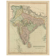
1817 Thomson Map of Northern Hindoostan – Detailed British Cartography of India
This map, titled "A New Map of Hindoostan from the Latest Authorities," was drawn and engraved for John Thomson and published in 1817. It was part of his New General Atlas, which was renowned for its accuracy and detail, reflecting British interest in the Indian subcontinent during the early 19th century.
The map covers the Indian subcontinent, which includes modern-day India, Pakistan, Bangladesh, Nepal, Bhutan, and Sri Lanka (then Ceylon). Neighboring regions like Persia (Iran), Tibet, and Burma (Myanmar) are also depicted. Important geographical features such as the Ganges and Indus rivers, the Bay of Bengal, the Arabian Sea, and the Indian Ocean are well-represented. The map also contains an inset showing the Isle of Ceylon, which played a crucial role in British colonial operations.
The map marks key cities of the period, including Calcutta (Kolkata), Bombay (Mumbai), Madras (Chennai), and Delhi. Political boundaries are color-coded, distinguishing various regions and provinces under British control and influence.
Thomson's maps are known for their high-quality engraving, and this example is no exception, featuring finely detailed topography and well-labeled trade routes and settlements. The map reflects the British Empire's increasing interest in controlling and understanding the Indian subcontinent.
**
Condition: This map appears to be in good condition for its age. The paper shows slight toning and light foxing, which are common in maps of this period. The hand-coloring remains visible, though slightly faded over time. The engraved lines are sharp and clear, and the map's margins are wide and intact. There may be some light creasing along the fold lines, but the map remains a visually appealing and historically significant piece.
This map is a fine example of 19th-century British cartography and would be an excellent addition for collectors interested in the colonial history of India or in historical maps produced by John Thomson.
- Dimensions:Height: 21.07 in (53.5 cm)Width: 28.94 in (73.5 cm)Depth: 0 in (0.02 mm)
- Materials and Techniques:Paper,Engraved
- Period:
- Date of Manufacture:1817
- Condition:Condition: good, given age. General age-related toning and/or occasional minor defects from handling. Vertical folds in middle as issued. Please study scans carefully.
- Seller Location:Langweer, NL
- Reference Number:Seller: BG-13777-3A1stDibs: LU3054341785582
About the Seller
5.0
Recognized Seller
These prestigious sellers are industry leaders and represent the highest echelon for item quality and design.
Platinum Seller
Premium sellers with a 4.7+ rating and 24-hour response times
Established in 2009
1stDibs seller since 2017
2,620 sales on 1stDibs
Typical response time: <1 hour
- ShippingRetrieving quote...Shipping from: Langweer, Netherlands
- Return Policy
Authenticity Guarantee
In the unlikely event there’s an issue with an item’s authenticity, contact us within 1 year for a full refund. DetailsMoney-Back Guarantee
If your item is not as described, is damaged in transit, or does not arrive, contact us within 7 days for a full refund. Details24-Hour Cancellation
You have a 24-hour grace period in which to reconsider your purchase, with no questions asked.Vetted Professional Sellers
Our world-class sellers must adhere to strict standards for service and quality, maintaining the integrity of our listings.Price-Match Guarantee
If you find that a seller listed the same item for a lower price elsewhere, we’ll match it.Trusted Global Delivery
Our best-in-class carrier network provides specialized shipping options worldwide, including custom delivery.More From This Seller
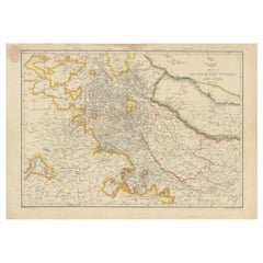
View All1816 Large Southern Hindostan Map by J. Thomson – New General Atlas
Located in Langweer, NL
Title: 1816 Southern Hindostan Map by J. Thomson – New General Atlas
This map, titled "Southern Hindostan," was published in 1816 as part of J. Thomson’s *New General Atlas*. The ma...
Category
Antique 1810s Maps
Materials
Paper
$505 Sale Price
20% Off
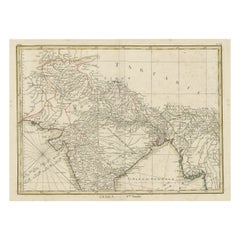
Antique Map of Northern India, Bengal, and Surrounding Regions by Tardieu, 1802
Located in Langweer, NL
This is an original antique map titled "Inde, Indostan Bengale &c. et Partie Septentrionale de la Presqu'isle en deça du Gange," depicting the northern part of the Indian subcontinen...
Category
Antique Early 1800s Maps
Materials
Paper
$419 Sale Price
20% Off
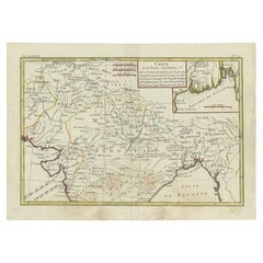
Antique Map of Northern India by Bonne, 1780
Located in Langweer, NL
Antique map titled 'Carte de la partie Supérieure de l'Inde (..)'. A fine example of Rigobert Bonne and Guilleme Raynal?s 1780 map of northern India. Covers the northern part of Indi...
Category
Antique 18th Century Maps
Materials
Paper
1808 C. Smith Map of Hindoostan – British India with Intricate Details
Located in Langweer, NL
Title: 1808 C. Smith Map of Hindoostan – British India with Intricate Details
This map, titled "Hindoostan," was published by C. Smith, a prominent London map seller, on January 6, ...
Category
Antique Early 1800s Maps
Materials
Paper
$372 Sale Price
20% Off
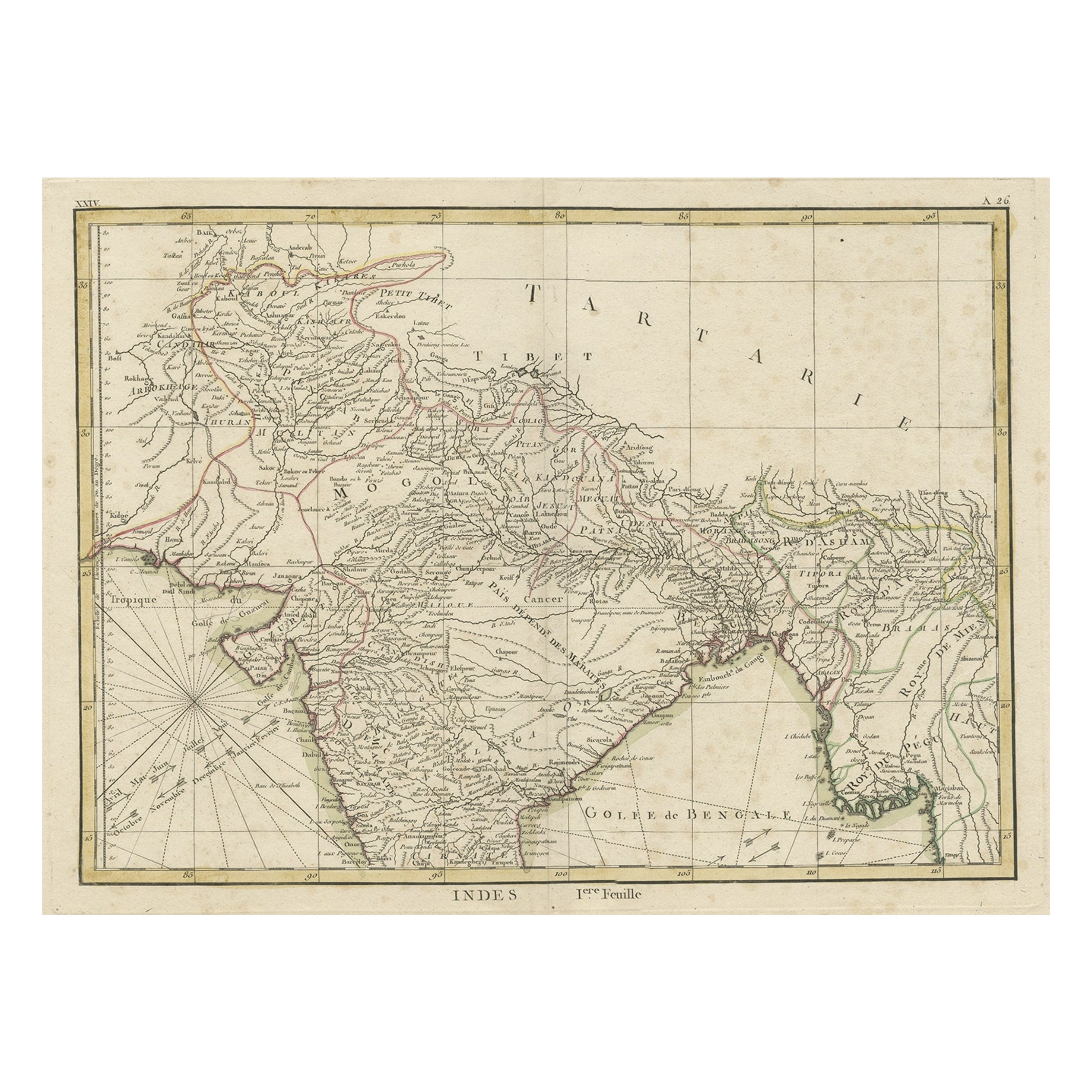
Old Map of North India From Kandahar East to Burma 'Pegu' and South to Goa, 1776
Located in Langweer, NL
Description: Antique map titled 'Indes Iere Feuille'.
Old map of northern India. Covers the subcontinent from Kandahar east as far as Burma (Pegu) and south to just past Goa. Names...
Category
Antique 1770s Maps
Materials
Paper
$353 Sale Price
20% Off
Antique Map of Northwestern India by Weller, 1857
Located in Langweer, NL
Antique map titled 'India, The North West Provinces and Oude'.Detailed map of the northwestern part of India, extending to the Himalaya Mountains. Shows part of Nepal including Dharm...
Category
Antique 19th Century Maps
Materials
Paper
You May Also Like
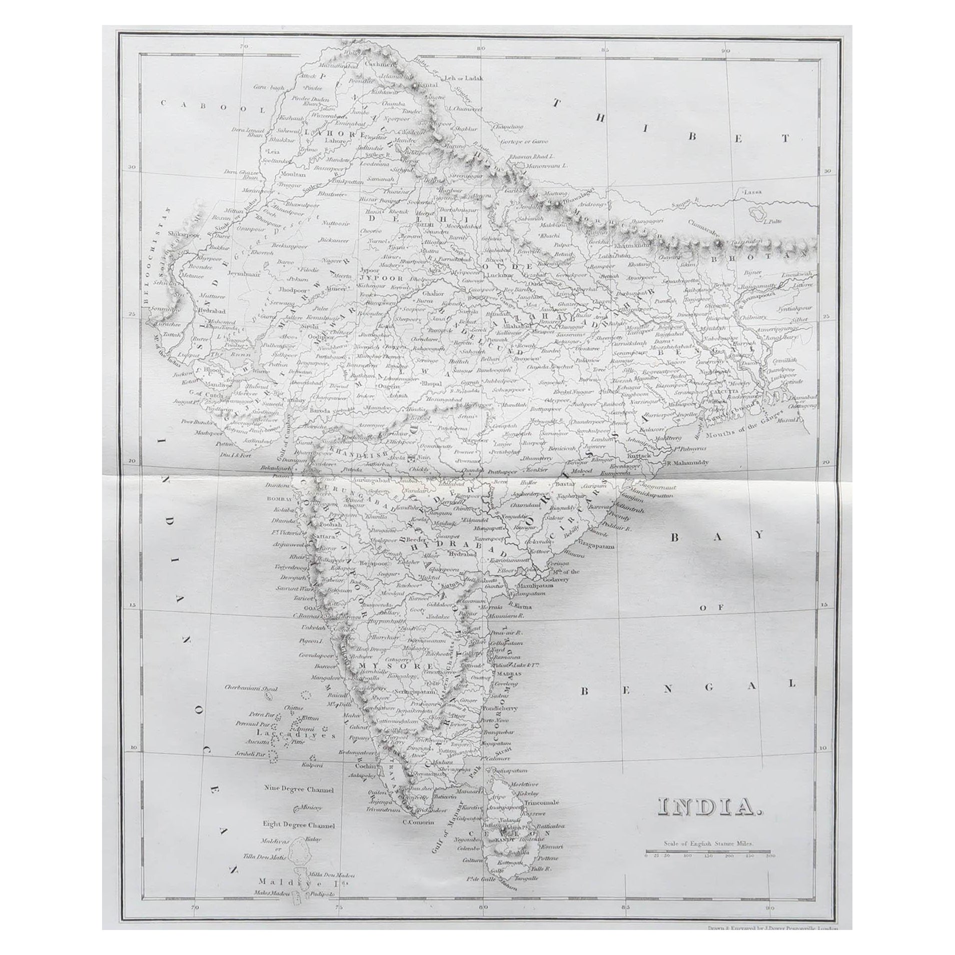
Original Antique Map of India by Dower, circa 1835
Located in St Annes, Lancashire
Nice map of India
Drawn and engraved by J.Dower
Published by Orr & Smith. C.1835
Unframed.
Free shipping
Category
Antique 1830s English Maps
Materials
Paper

Map Of India - Original Lithograph - 19th Century
Located in Roma, IT
Map of India is an original lithograph artwork realized by an Anonymous engraver of the 19th Century.
Printed in the series of "France Pittoresque".
Titled "France Pittoresque".
...
Category
19th Century Modern Figurative Prints
Materials
Lithograph

Antique French Map of Asia Including China Indoneseia India, 1783
Located in Amsterdam, Noord Holland
Very nice map of Asia. 1783 Dedie au Roy.
Additional information:
Country of Manufacturing: Europe
Period: 18th century Qing (1661 - 1912)
Condition: Overall Condition B (Good Used)...
Category
Antique 18th Century European Maps
Materials
Paper

$648 Sale Price
20% Off
Antique 1803 Italian Map of Asia Including China Indoneseia India
Located in Amsterdam, Noord Holland
Antique 1803 Italian Map of Asia Including China Indoneseia India
Very nice map of Asia. 1803.
Additional information:
Type: Map
Country of Manufacturing: Europe
Period: 19th centu...
Category
Antique 19th Century European Maps
Materials
Paper

$584 Sale Price
20% Off
Original Antique Map of China, Arrowsmith, 1820
Located in St Annes, Lancashire
Great map of China
Drawn under the direction of Arrowsmith
Copper-plate engraving
Published by Longman, Hurst, Rees, Orme and Brown, 1820
Unfr...
Category
Antique 1820s English Maps
Materials
Paper

1790 Thomas Stackhouse Map, Entitled "Russia in Europe, " , Ric.a004
Located in Norton, MA
1790 Thomas Stackhouse map, entitled
"Russia in Europe"
Ric.a004
Stackhouse, Thomas
Russia in Europe [map]
London: T. Stackhouse, 1783. Map. Matted hand-colored copper engraving. Image size: 14.5 x 15.25 inches. Mat size: 22.75 x 23.75 inches. A beautiful example of this map of Eastern Europe...
Category
Antique 17th Century Unknown Maps
Materials
Paper

More Ways To Browse
Black Scandinavian Modern Dining Chairs
Gold Modern Coffee Table
Round Glass Coffee Tables
18th Century Wood Side Tables
Antique Hand Carved Dining Room Sets
Mid Century Modern Pitcher
Vintage Italian Leather Dining Chair
Vintage Movie Posters
Blue Green Wool And Silk Rug
Brown Sheepskin Chair
Vintage Brass Bar Carts
Antique Botanical Prints
Green Persian Rug
17th Century Blue And White
50 X 50 Coffee Table
Antique Wood Panel Painted
Milo Baughman 1970
Spanish Baroque Furniture