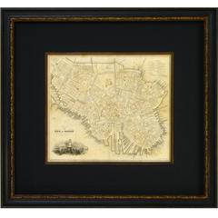
1844 "Plan of the City of Boston" by George W. Boynton
View Similar Items


Want more images or videos?
Request additional images or videos from the seller
1 of 2
1844 "Plan of the City of Boston" by George W. Boynton
About the Item
- Dimensions:Height: 18.25 in (46.36 cm)Width: 19.75 in (50.17 cm)Depth: 2 in (5.08 cm)
- Period:
- Date of Manufacture:1844
- Condition:
- Seller Location:Colorado Springs, CO
- Reference Number:1stDibs: LU90973150952
About the Seller
4.9
Platinum Seller
These expertly vetted sellers are 1stDibs' most experienced sellers and are rated highest by our customers.
Established in 2010
1stDibs seller since 2011
402 sales on 1stDibs
More From This SellerView All
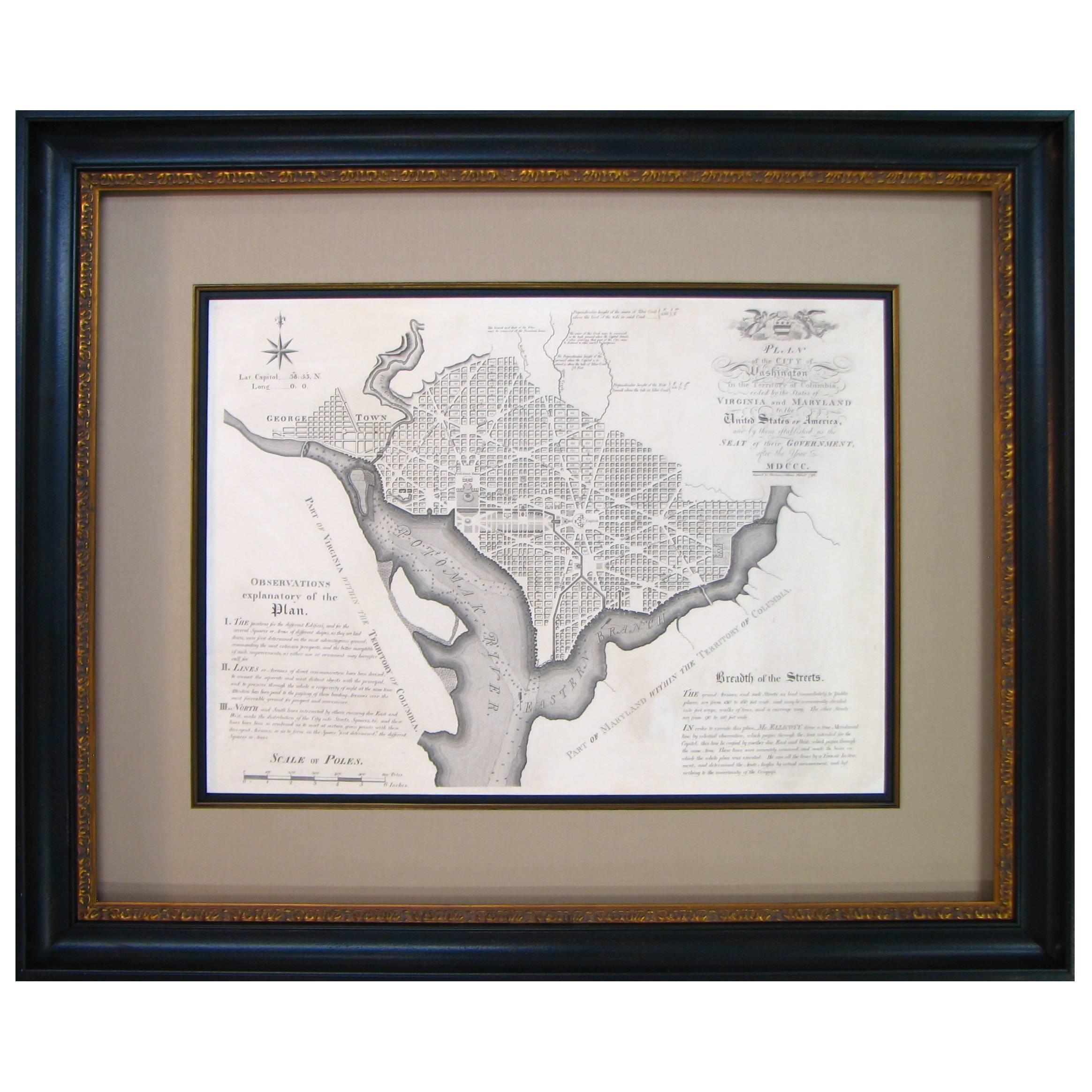
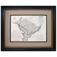
- Plan for the City of Washington by Andrew Ellicott, Antique Print, 19th CenturyLocated in Colorado Springs, COBy Andrew Ellicott (1754-1820) and Pierre Charles L'Enfant (1754-1825). Plan of the City of Washington. Published by Thackara & Vallance, Philadelphia, 1792. Later impression printed on 19th century wove paper. This is a fine 19th century printing of the "official" plan of Washington, D.C. First printed in 1792 by the original publishers, Thackara & Vallance in Philadelphia, this is a later 19th century printing of the fifth recorded engraving of the L’Enfant / Ellicott city plan. The first three issues of this city plan were in published in periodicals, making the fifth edition only the second separately-issued engraving of the plan. In full, the title reads, “Plan of the City of Washington in the Territory of Columbia, ceded by the States of Virginia and Maryland to the United States of America and by them established as the Seat of their Government after the year 1800.” The national capital city is laid out according to a plan originally proposed by Pierre Charles L'Enfant and modified by Andrew Ellicott. L'Enfant was born in Paris, where he trained to be an architect. He came to America in 1777, and served under George Washington as an engineer during the Revolutionary War. In 1791, Washington asked L'Enfant to design the new capital city in the District of Columbia. However, trouble arose between the city and L'Enfant. The City Commissioner needed a finished, printed copy of the plan in order to sell building lots but L'Enfant worked slowly and released only incomplete plans, and proved to be quite obstinate. On instruction from President Washington...Category
Antique Late 19th Century American Maps
MaterialsPaper
 $11,900 Sale Price20% Off
 - George Washington by Henry Sadd, Antique Engraving, circa 1844Located in Colorado Springs, COThis is an 1844 engraving of President George Washington. The print was issued by G. Stuart in Albion, New York and engraved by H. S. Sadd. This standing portrait shows President George Washington in front of neoclassical columns. In his right hand, he holds a dress sword...Category
Antique 1840s American Prints
MaterialsPaper
- 1840 Map of the City of Washington Published by William M. MorrisonLocated in Colorado Springs, COThis map, printed in 1840, is a detailed representation of Washington, D.C. in the mid-19th century. The map shows block numbers, wards, and government buildings as well as details o...Category
Antique 1840s American Federal Maps
MaterialsPaper
- Plan of Paris, France, by A. Vuillemin, Antique Map, 1845Located in Colorado Springs, COThis large and detailed plan of Paris was published by Alexandre Vuillemin in 1845. The map conveys a wonderful amount of information and is decorated throughout with pictorial vigne...Category
Antique 1840s American Maps
MaterialsPaper
- 1840 "New Map of the City of New York With Part of Brooklyn & Williamsburg"Located in Colorado Springs, COPresented is a hand-colored, engraved folding map titled "New Map of the City of New York With Part of Brooklyn & Williamsburg" by J. Calvin Smith. The map was issued bound in the bo...Category
Antique 1840s American Maps
MaterialsPaper
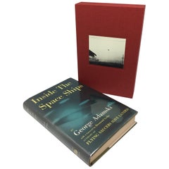
- Inside the Space Ships, Signed by George Adamski, First Edition, 1955Located in Colorado Springs, COAdamski, George. Inside the Space Ships. New York: Abelard-Schuman, 1955. Signed first edition, third printing. Original dust jacket. Housed in custom slipc...Category
Vintage 1950s American Books
MaterialsPaper


You May Also LikeView All
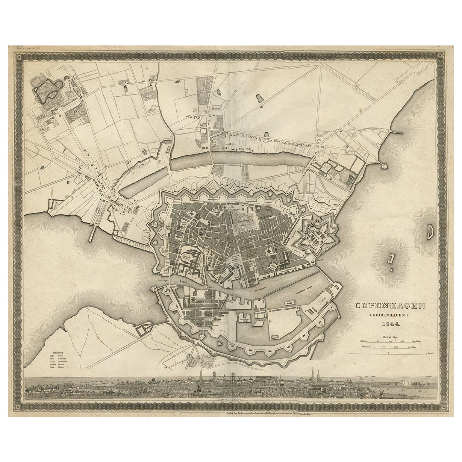
- Antique Map of the City of Copenhagen ‘Denmark’ by J. Meyer, 1844Located in Langweer, NLAntique map titled 'Copenhagen (Kiöbenhaven)'. With city view and German explanation. Originates from Meyer's Handatlas.Category
Antique Mid-19th Century Maps
MaterialsPaper
- Antique Plan of the City of Bayonne, FranceLocated in Langweer, NLAntique map titled 'Plan de Bayonne'. Original old plan of the city of Bayonne, France. This map originates from 'Le Petit Atlas Maritime (..)' by J.N. Bellin. Published 1764. Be...Category
Antique Mid-18th Century Maps
MaterialsPaper
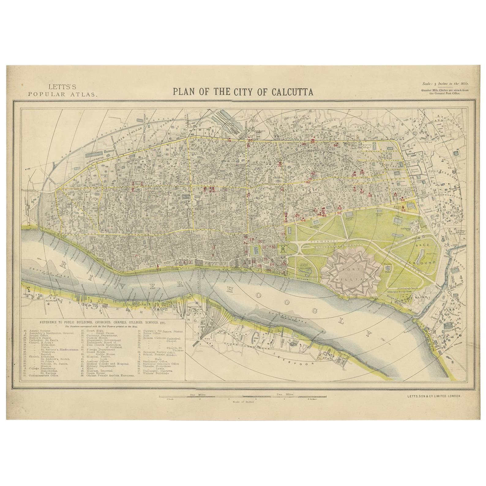
- Antique Plan of the City of Calcutta 'India' by Letts, 1883Located in Langweer, NLBeautiful colored plan showing buildings (with key), Fort William, race ground, canals, railroads, etc. This plan originates from Letts's Popular Atlas.Category
Antique Late 19th Century Maps
MaterialsPaper
 $276 Sale Price33% Off
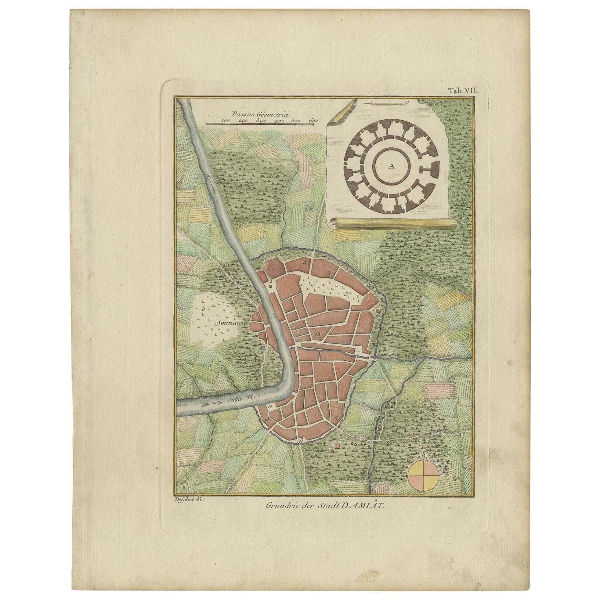
 - Antique Plan of the City of Damietta Egypt by C. Niebuhr, 1774Located in Langweer, NLAntique print titled 'Grundris der Stadt Damiât'. This print originates from 'Reisebeschreibung nach Arabien und andern umliegenden Ländern' by C. Niebuhr, 1774.Category
Antique Late 18th Century Prints
MaterialsPaper
 $110 Sale Price44% Off
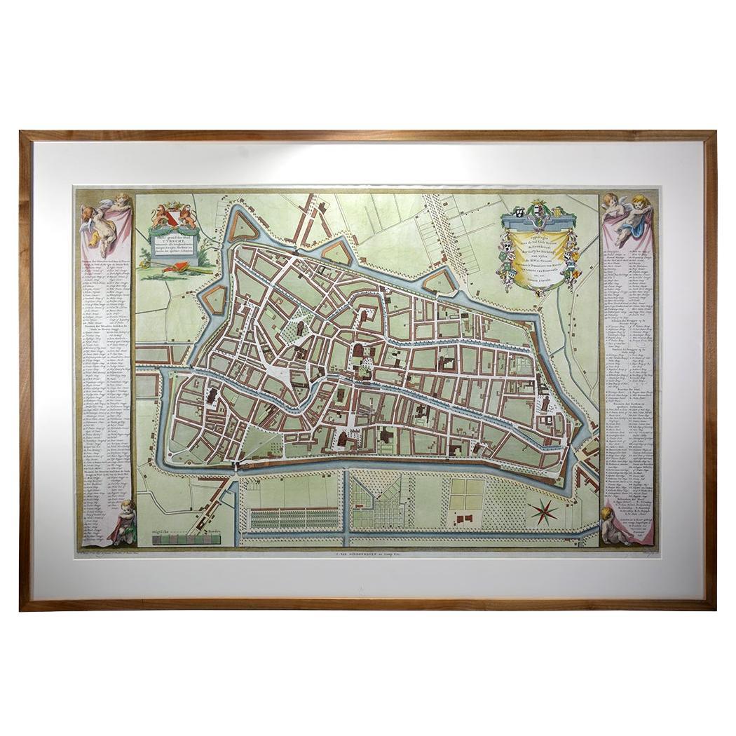
 - Utrecht city planLocated in UTRECHT, UT“Platte grond der Stad Utrecht vertonende alle Gragten, Straaten, Stegen, Gangen, Markten, en plaatsen der openbare Gebouwen”, engraving published by Johannes van Schoonhoven in Amst...Category
Antique 1770s Dutch Other Maps
MaterialsPaper
 $3,598
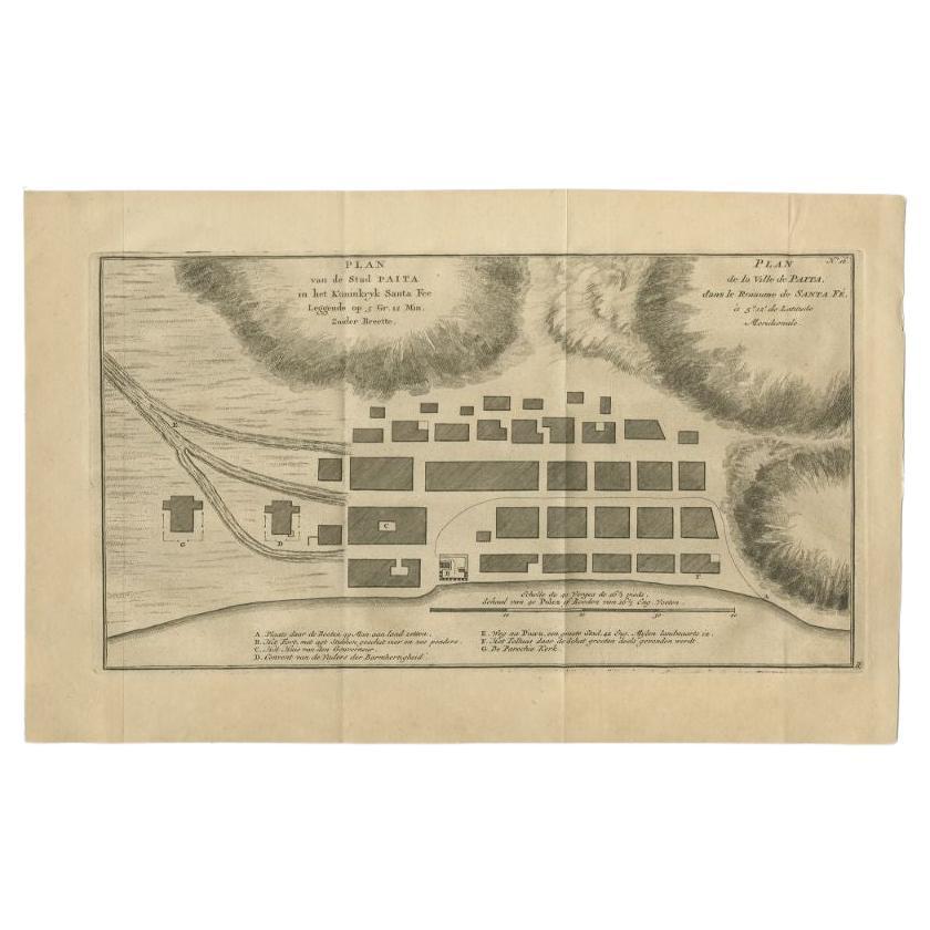
 - Antique Plan of the City of Paita in Peru, by Anson, 1749Located in Langweer, NLAntique map titled 'Plan van de Stad Paita in het Koninkryk Santa Fee (..) - Plan de la Ville de Paita (..)'. Original antique plan of the city of Paita, Peru. This map originates fr...Category
Antique 18th Century Maps
MaterialsPaper

Recently Viewed
View AllMore Ways To Browse
Liberty Foundry
Railroad Seat
Rare French Antiques
16th Century Originals
Levasseur A
Asian Bassett
Important Map
Englishmans Antiques
18th Century European Maps
Clivia Ducatus Et Ravestein Dominium
Old Prints Of Maps
Arkansas Indian Map
Historical Balkan Map
Op Ocean Pacific
Eso Antique Maps
J Karte
Jackson Hole Map
Map Cleveland