Items Similar to 1877 Satirical Map of the Eastern War: Europe's Powers as Caricatured Characters


Want more images or videos?
Request additional images or videos from the seller
1 of 10
1877 Satirical Map of the Eastern War: Europe's Powers as Caricatured Characters
$1,770.03
$2,212.5420% Off
£1,305.80
£1,632.2520% Off
€1,480
€1,85020% Off
CA$2,450.33
CA$3,062.9220% Off
A$2,656.88
A$3,321.1020% Off
CHF 1,409.97
CHF 1,762.4720% Off
MX$32,722.83
MX$40,903.5320% Off
NOK 17,475.73
NOK 21,844.6720% Off
SEK 16,493.08
SEK 20,616.3420% Off
DKK 11,268.03
DKK 14,085.0320% Off
About the Item
Title: 1877 Caricature Map of the Eastern War - "Carte de la Guerre en Orient" by H. Demare
Description: This 1877 satirical map, titled "Carte de la Guerre en Orient," was published in the French magazine Le Carillon. It humorously depicts the political tensions of the Eastern Question and the Russo-Turkish War (1877-1878), with countries personified in caricature form, each figure representing key characters involved in the conflict.
The map features a number of imaginative figures, including:
- Russia as a bear extending its influence into the Balkans.
- Turkey, personified as a large figure clutching the Balkans, representing the Ottoman Empire's grip on the region.
- Austria-Hungary and Germany also appear as figures poised to watch or intervene, represented with comically exaggerated features.
The satirical elements highlight the interests and ambitions of each country, emphasizing the geopolitical rivalry over the territories of the Ottoman Empire. In the lower left corner, there is a humorous depiction of a French figure observing the scene through a telescope, symbolizing France's position as an interested observer of the events.
This political cartoon map is an example of cartographic propaganda, using humor and personification to convey the dynamics of a significant historical conflict to the public. These types of maps became popular in the 19th century, often appearing in newspapers and journals as a way to explain complex international relations.
Condition Report:
- Paper Quality: The paper has some light age-related toning and slight wear along the edges.
- Coloring: The hand-coloring is well-preserved, vividly enhancing the caricatured features.
- Edges and Margins: There is minor wear along the margins, typical of magazine prints, but no significant tears or damage.
- Print Quality: The impression remains clear, and the text is easily readable.
Summary Condition: Overall in very good condition for its age, with intact colors and minimal wear along the margins. This colorful and engaging piece would make an excellent addition to any collection focused on historical maps, political cartoons, or propaganda.
- Dimensions:Height: 16.15 in (41 cm)Width: 23.75 in (60.3 cm)Depth: 0 in (0.02 mm)
- Materials and Techniques:
- Place of Origin:
- Period:
- Date of Manufacture:1877
- Condition:Summary Condition: Overall in very good condition for its age, with intact colors and minimal wear along the margins. This colorful and engaging piece would make an excellent addition to any collection focused on historical maps, political cartoons,.
- Seller Location:Langweer, NL
- Reference Number:Seller: BHZ117641stDibs: LU3054342600412
About the Seller
5.0
Recognized Seller
These prestigious sellers are industry leaders and represent the highest echelon for item quality and design.
Platinum Seller
Premium sellers with a 4.7+ rating and 24-hour response times
Established in 2009
1stDibs seller since 2017
2,620 sales on 1stDibs
Typical response time: <1 hour
- ShippingRetrieving quote...Shipping from: Langweer, Netherlands
- Return Policy
Authenticity Guarantee
In the unlikely event there’s an issue with an item’s authenticity, contact us within 1 year for a full refund. DetailsMoney-Back Guarantee
If your item is not as described, is damaged in transit, or does not arrive, contact us within 7 days for a full refund. Details24-Hour Cancellation
You have a 24-hour grace period in which to reconsider your purchase, with no questions asked.Vetted Professional Sellers
Our world-class sellers must adhere to strict standards for service and quality, maintaining the integrity of our listings.Price-Match Guarantee
If you find that a seller listed the same item for a lower price elsewhere, we’ll match it.Trusted Global Delivery
Our best-in-class carrier network provides specialized shipping options worldwide, including custom delivery.More From This Seller
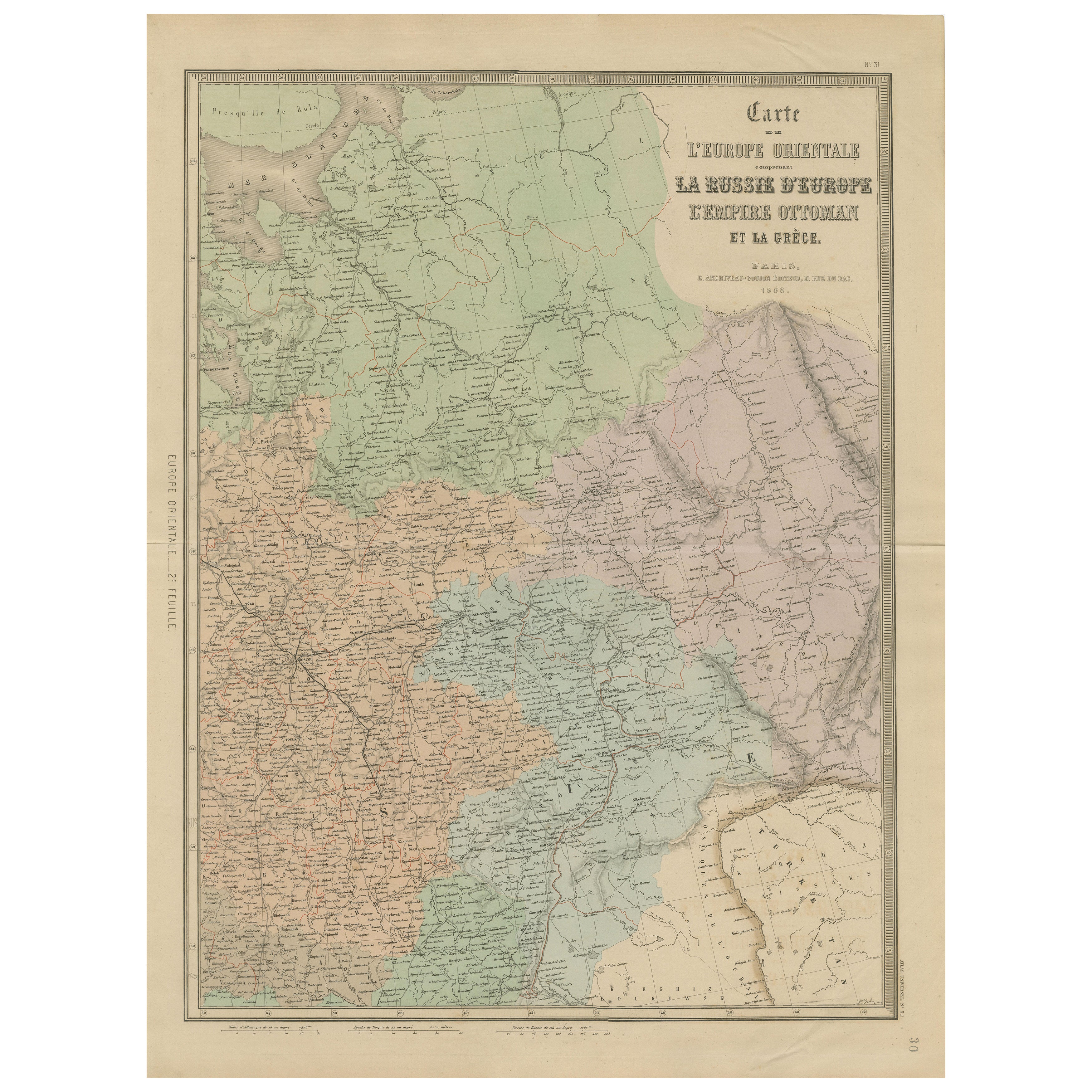
View AllAntique Map of Eastern Europe – Russia, Ottoman Empire & Greece, 1868
Located in Langweer, NL
Antique Map of Eastern Europe – Russia, Ottoman Empire and Greece by Andriveau-Goujon, 1868
This detailed antique map titled “Carte de l’Europe Orientale, la Russie d’Europe, l’Empi...
Category
Antique Mid-19th Century French Maps
Materials
Paper
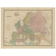
Antique Map of Europe – Political Divisions by Andriveau-Goujon, Paris 1861
Located in Langweer, NL
Antique Map of Europe – Political Divisions by Andriveau-Goujon, Paris 1861
This beautifully engraved and hand-colored antique map of Europe was published in 1861 by the Parisian ca...
Category
Antique Mid-19th Century French Maps
Materials
Paper
Antique Map of Russia 'in Europe' by W. & A.K. Johnston, circa 1850
By W. & A.K. Johnston
Located in Langweer, NL
Antique Map: Russia in Europe by W. & A.K. Johnston, Circa 1850
This highly detailed antique map, titled *Russia in Europe,* was created by the esteemed Scottish cartographers W. ...
Category
Antique Mid-19th Century Maps
Materials
Paper

$229 Sale Price
34% Off
Antique Map of Independent Tartary by W. G. Blackie, 1859
Located in Langweer, NL
Antique map titled 'Turkestan or Independent Tartary'. Original antique map of Turkestan or Independent Tartary. This map originates from ‘The Imperial Atlas of Modern Geography’. Pu...
Category
Antique Mid-19th Century Maps
Materials
Paper
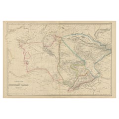
$239 Sale Price
20% Off
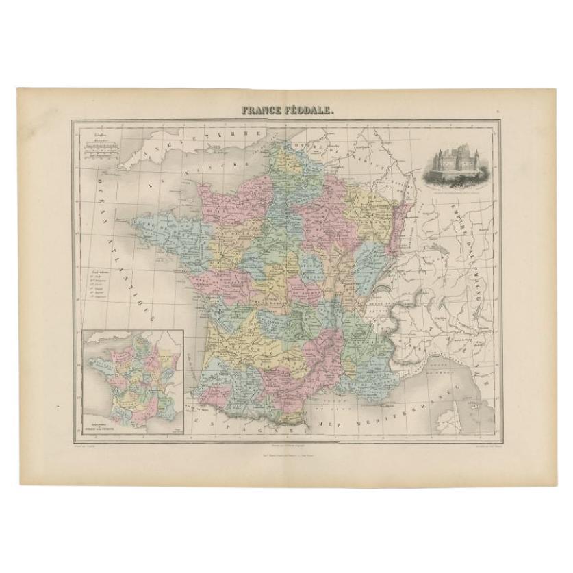
Antique Political Map of France, 1880
By J. Migeon
Located in Langweer, NL
Antique map titled 'France Féodale'. Old map of France with a decorative vignette of Castle de Pierrefonds. This map originates from 'Géographie Universelle Atlas-Migeon' by J. Migeo...
Category
Antique 19th Century Maps
Materials
Paper
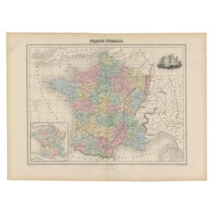
$114 Sale Price
20% Off
Antique Map of Russia in Europe by Levasseur, '1875'
Located in Langweer, NL
Antique map titled 'Carte générale de la Russie d'Europe (..)'. Large map of Russia in Europe. This map originates from 'Atlas de Géographie Moderne Physique et Politique' by A. Leva...
Category
Antique Late 19th Century Maps
Materials
Paper

$334 Sale Price
20% Off
You May Also Like
Map of the War between Hungary and Prussia - Etching - 19th Century
Located in Roma, IT
Map of the War between Hungary and Prussia is an etching realized during the 19th century.
Good condition.
Category
Early 19th Century Modern Figurative Prints
Materials
Etching
Map of the War between Hungary and Prussia - Etching - 19th Century
Located in Roma, IT
Map of the War between Hungary and Prussia is an etching realized during the 19th century.
Good condition.
Category
Early 19th Century Modern Figurative Prints
Materials
Etching

1849 Map of "Europaische Russland", 'Meyer Map of European Russia', Ric. R017
Located in Norton, MA
1849 Map of
"Europaische Russland"
( Meyer Map of European Russia)
Ric.r017
A lovely map of European Russia dating to 1849 by Joseph Meyer. It covers the European portions of...
Category
Antique 19th Century Unknown Maps
Materials
Paper

Map of the War -Vesfaglia and Lower Saxony - Etching - 19th Century
Located in Roma, IT
Map of the War -Vestaglia and Lower Saxony is an etching realized during the 19th century.
Good condition.
Category
Early 19th Century Modern Figurative Prints
Materials
Etching

Map of Campaign of 1814 - Etching by Pierre François Tardieu - 1837
Located in Roma, IT
Map of Campaign of 1814 is an Etching realized by Pierre François Tardieu in 1837.
Good conditions.
The artwork is realized in a well-balanced composition. the artwork and belongs ...
Category
1830s Modern Figurative Prints
Materials
Lithograph

Map of Eastern Roman Empire -Vintage Offset Print - Early 20th Century
Located in Roma, IT
This map of Eastern Roman Empire is a vintage offset print realized in the early 20th Century.
The state of preservation of the artwork is aged with dif...
Category
Early 20th Century Figurative Prints
Materials
Offset

More Ways To Browse
Antique Telescopes
Eastern European Furniture
Antique Carillon
French Telescope
18th Century Wood Side Tables
Antique Hand Carved Dining Room Sets
Mid Century Modern Pitcher
Vintage Italian Leather Dining Chair
Vintage Movie Posters
Blue Green Wool And Silk Rug
Brown Sheepskin Chair
Vintage Brass Bar Carts
Antique Botanical Prints
Green Persian Rug
17th Century Blue And White
50 X 50 Coffee Table
Antique Wood Panel Painted
Milo Baughman 1970