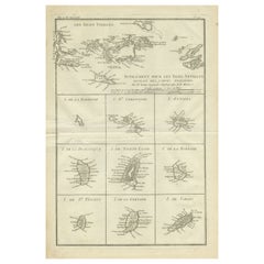
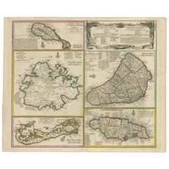
18th Century Antique Map of the Virgin Islands and Caribbean Inset Maps
View Similar Items


Want more images or videos?
Request additional images or videos from the seller
1 of 9
18th Century Antique Map of the Virgin Islands and Caribbean Inset Maps
About the Item
- Dimensions:Height: 12.68 in (32.2 cm)Width: 18 in (45.7 cm)Depth: 0.02 in (0.5 mm)
- Materials and Techniques:
- Period:
- Date of Manufacture:1788
- Condition:General age-related toning. Original folding line, some soiling. Blank verso. Please study image carefully.
- Seller Location:Langweer, NL
- Reference Number:Seller: BG-13528-91stDibs: LU3054338411062
About the Seller
5.0
Recognized Seller
These prestigious sellers are industry leaders and represent the highest echelon for item quality and design.
Gold Seller
Premium sellers maintaining a 4.3+ rating and 24-hour response times
Established in 2009
1stDibs seller since 2017
2,463 sales on 1stDibs
Typical response time: 1 hour
Authenticity Guarantee
In the unlikely event there’s an issue with an item’s authenticity, contact us within 1 year for a full refund. DetailsMoney-Back Guarantee
If your item is not as described, is damaged in transit, or does not arrive, contact us within 7 days for a full refund. Details24-Hour Cancellation
You have a 24-hour grace period in which to reconsider your purchase, with no questions asked.Vetted Professional Sellers
Our world-class sellers must adhere to strict standards for service and quality, maintaining the integrity of our listings.Price-Match Guarantee
If you find that a seller listed the same item for a lower price elsewhere, we’ll match it.Trusted Global Delivery
Our best-in-class carrier network provides specialized shipping options worldwide, including custom delivery.More From This Seller
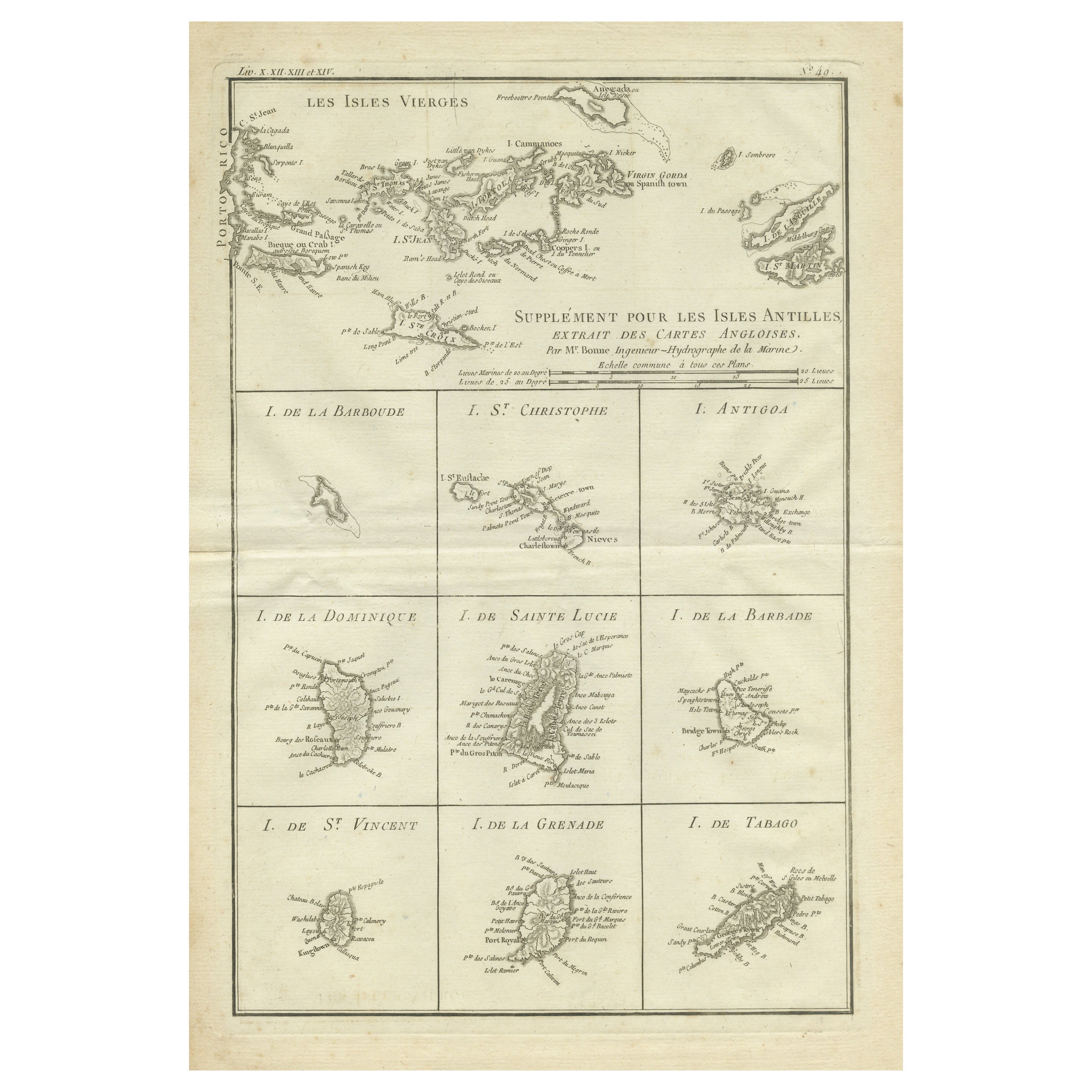
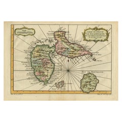
View AllOriginal Antique Map of the Virgin Islands with Insets of Caribbean Isles, 1787
Located in Langweer, NL
Antique map titled 'Supplément pour les Isles Antilles (..)'. Original old map of the Virgin Islands, with insets of Barbuda, St. Kits, Antigua, Dominica, St. Lucia, Barbados, St. Vi...
Category
Antique Late 18th Century Maps
Materials
Paper
$241 Sale Price
20% Off
Free Shipping
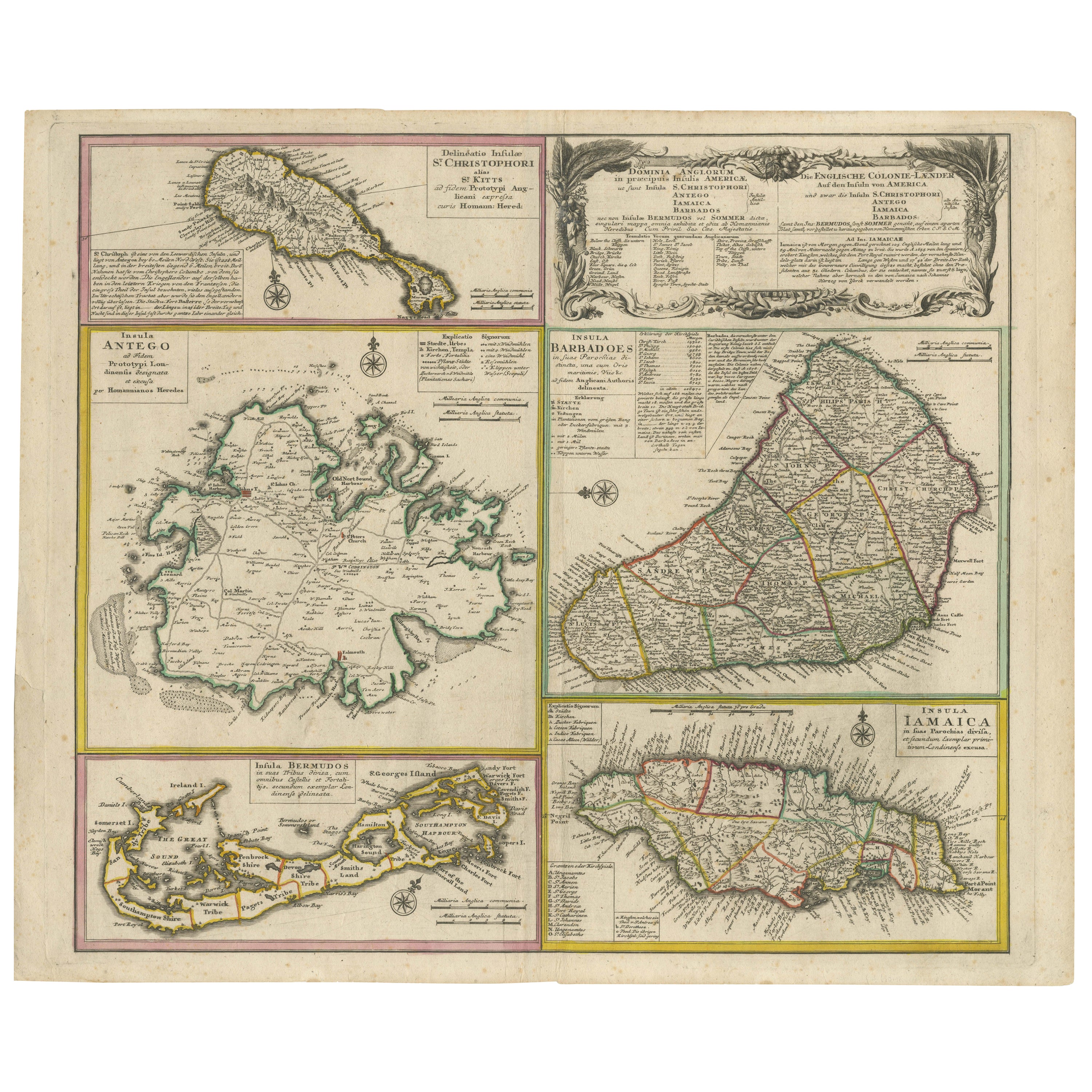
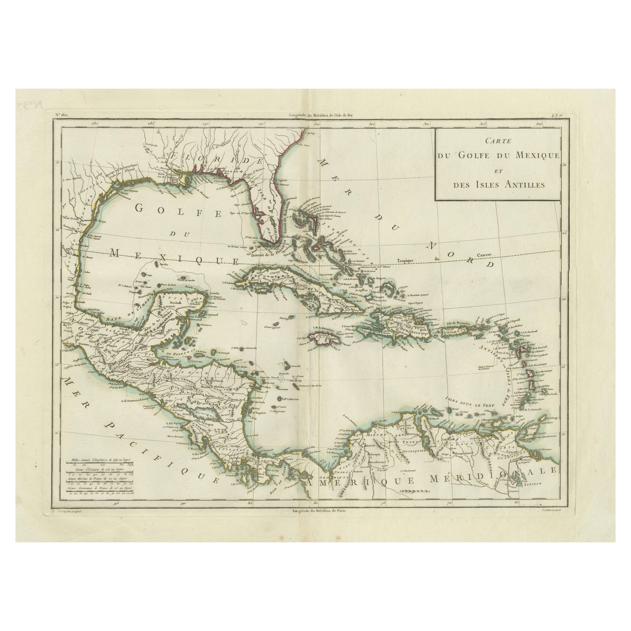
Old 18th Century Composite Map of Key Caribbean Islands with Descriptive Texts
Located in Langweer, NL
Antique map titled 'Dominia Anglorum in praecipuis Insulis Americae ut sunt Insula S. Christophori, Antegoa, Iamaica, Barbados nec non Insulae Bermudes vel Sommers dictae. Die Englis...
Category
Antique 1740s Maps
Materials
Paper
$725 Sale Price
20% Off
Free Shipping
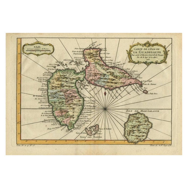
Antique Map of Guadeloupe, Island in the Caribbean, c.1757
Located in Langweer, NL
Antique map titled 'Carte de L'Isle de la Guadeloupe'.
A very decorative map of Guadeloupe in the Caribbean, adorned with rhumb lines, fleur-de-lys, and two decorative rococo-style...
Category
Antique 18th Century Maps
Materials
Paper
$613 Sale Price
20% Off
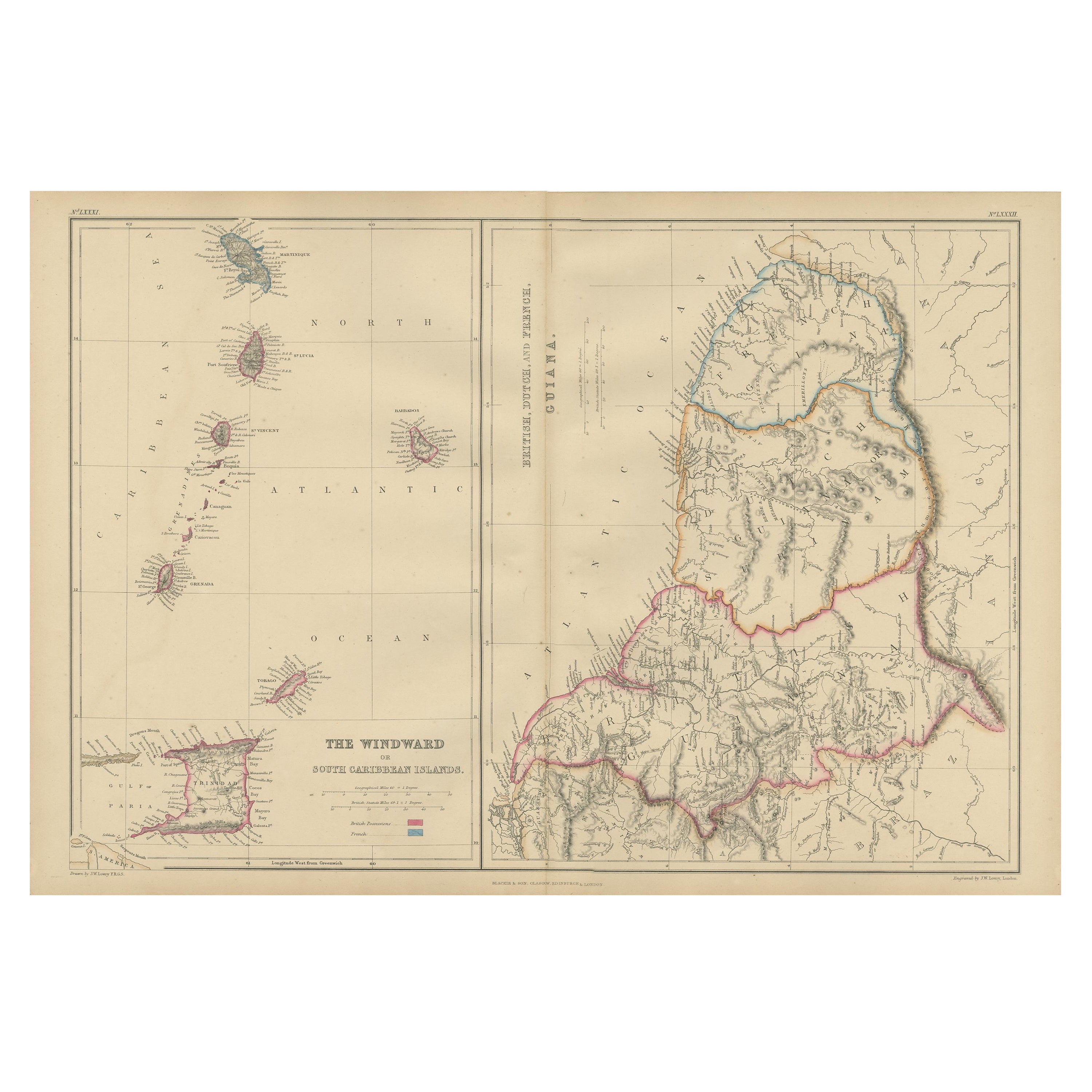
Detailed Antique Map of the Windward Islands in the Caribbean
By Covens & Mortier
Located in Langweer, NL
Antique map titled 'Carte des Antilles Francoises et des Isles Voisines'. Original antique map of the French Antilles, covering an area stretching from Guadeloupe in the north to Gre...
Category
Antique Early 18th Century Maps
Materials
Paper

$874 Sale Price
20% Off
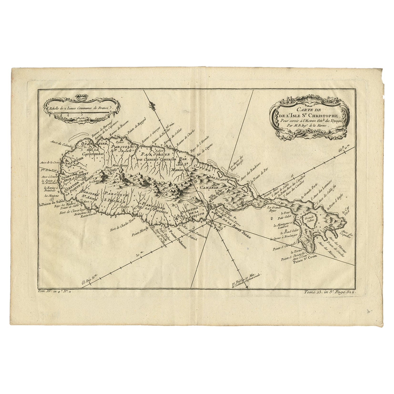
Antique Map of the Caribbean Island of St Kitts, ca.1750
Located in Langweer, NL
Description: Antique map titled 'Carte de l'Isle St. Christophe pour Servir a l'Histoire Genle. des Voyages.'
Detailed map of the Island of St. Kitts, showing the Parishes, towns, ...
Category
Antique 1750s Maps
Materials
Paper
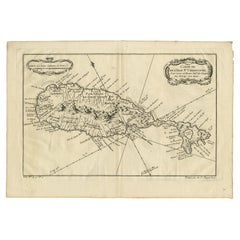
$669 Sale Price
20% Off
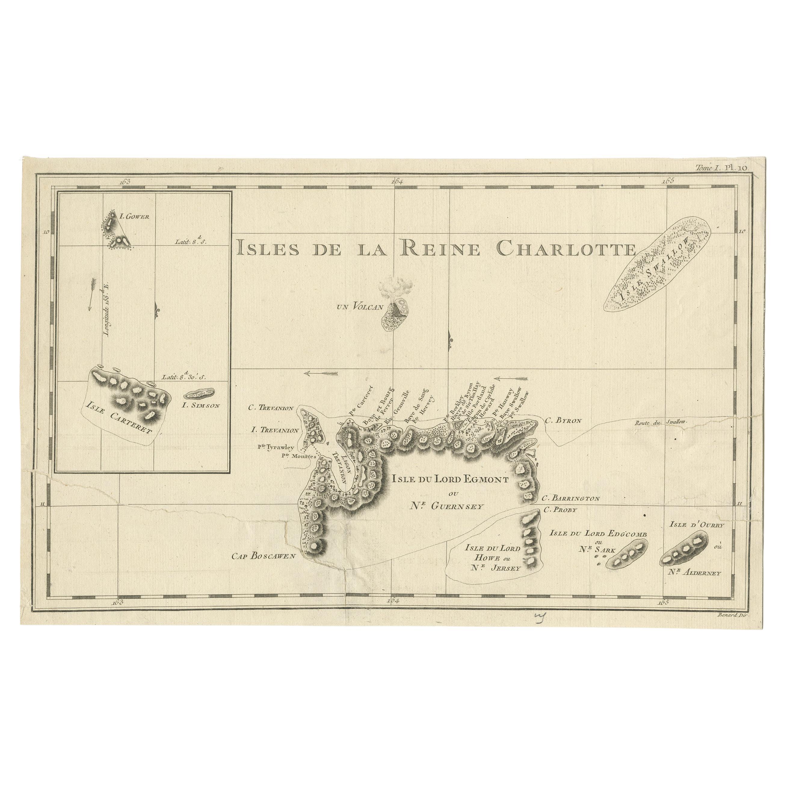
Antique Map of the Santa Cruz Islands with Inset of Carteret and Gower Islands
Located in Langweer, NL
Antique map titled 'Isles de la Reine Charlotte (..)'. A detailed chart of the Santa Cruz islands, to the north of the New Hebrides, with Carteret's track in "Swallow"; including an ...
Category
Antique Late 18th Century Maps
Materials
Paper
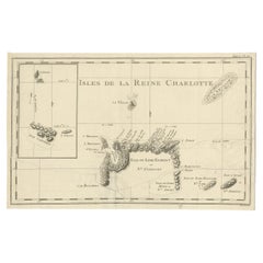
$279 Sale Price
20% Off
You May Also Like
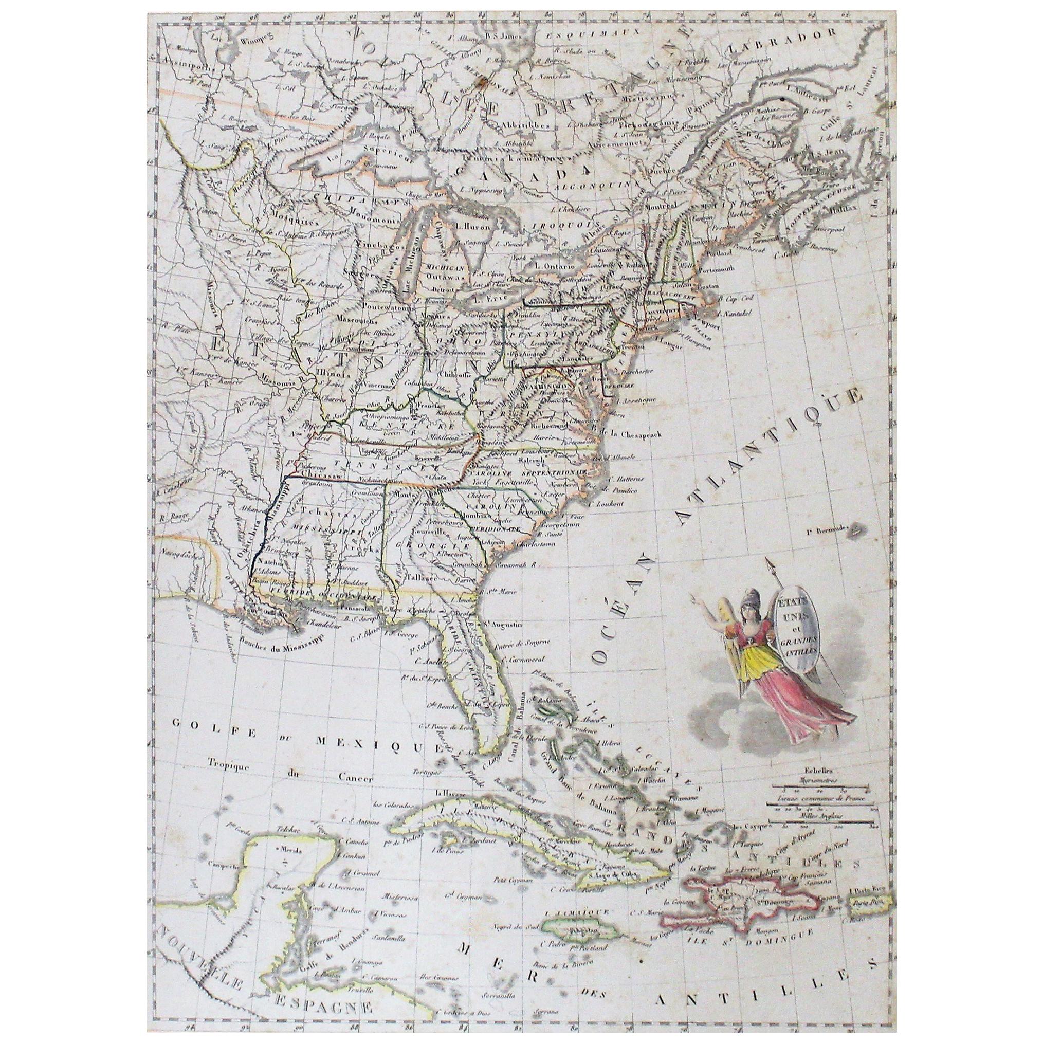
Early 19th Century Hand Colored Map of the United States and Caribbean Islands
Located in Hamilton, Ontario
Hand coloured early 19th century map by Giraldon of France titled "Etats Unis et Grandes Antilles" (United States and Greater Antilles).
Category
Antique Early 19th Century French Maps
Materials
Paper

$595 Sale Price
40% Off
Hand-Colored 18th Century Homann Map of Denmark and Islands in the Baltic Sea
By Johann Baptist Homann
Located in Alamo, CA
An 18th century copper plate hand-colored map entitled "Insulae Danicae in Mari Balthico Sitae utpote Zeelandia, Fionia, Langelandia, Lalandia, Falstria, Fembria Mona" created by Joh...
Category
Antique Early 18th Century German Maps
Materials
Paper

Antique 18th Century Map of the Province of Pensilvania 'Pennsylvania State'
Located in Philadelphia, PA
A fine antique of the colony of Pennsylvania.
Noted at the top of the sheet as a 'Map of the province of Pensilvania'.
This undated and anonymous map is thought to be from the Gentleman's Magazine, London, circa 1775, although the general appearance could date it to the 1760's.
The southern boundary reflects the Mason-Dixon survey (1768), the western boundary is placed just west of Pittsburgh, and the northern boundary is not marked.
The map has a number of reference points that likely refer to companion text and appear to be connected to boundaries. The western and southern boundaries are marked Q, R, S, for example. A diagonal line runs from the Susquehanna R to the Lake Erie P. A broken line marked by many letters A, B, N, O, etc., appears in the east.
There are no latitude or longitude markings, blank verso.
Framed in a shaped contemporary gilt wooden frame and matted under a cream colored matte.
Bearing an old Graham Arader Gallery...
Category
Antique 18th Century British American Colonial Maps
Materials
Paper

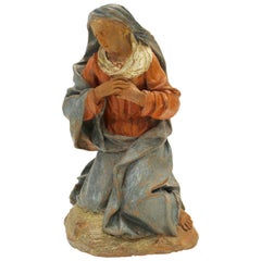
18th Century Continental Polychrome Terracotta Sculpture of the Kneeling Virgin
Located in Palm Desert, CA
A 17th-18th century continental painted terracotta sculpture of a kneeling Virgin in the manner of Angolo di Poli. This exquisite terracotta sculpture features a poignant depiction of the Virgin Mary. The red and blue clothes...
Category
Antique Early 18th Century European Figurative Sculptures
Materials
Terracotta
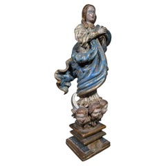
18th Century Spanish Polychrome Wood Sculpture of the Immaculate Virgin
Located in Madrid, ES
18th Century Spanish Polychrome Wood Sculpture of the Immaculate Virgin
A captivating 18th-century Spanish School sculpture of the Immaculate Virgin, masterfully hand-carved in poly...
Category
Antique 18th Century Spanish Baroque Religious Items
Materials
Wood
Large Original Antique Map of the The Windward Islands. 1894
Located in St Annes, Lancashire
Superb Antique map of The Windward Islands
Published Edward Stanford, Charing Cross, London 1894
Original colour
Good condition
Unframed.
Free shipping
Category
Antique 1890s English Maps
Materials
Paper
