Maps
to
1,705
2,107
80
2,191
77
9
6
5
4
1
1
1
1
2,926
2,181
476
3
289
34
10
127
7
35
9
2
5
3
4
2
2,147
68
30
13
12
224
144
89
83
74
2,191
2,191
2,191
104
24
9
8
7
Maps For Sale
Period: Late 20th Century
Period: 19th Century
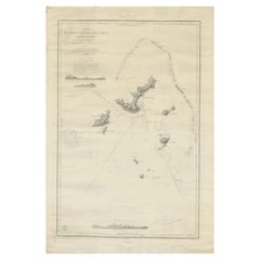
Large Chart of the Gambier Islands, Tuamotu Archipelago, French Polynesia
Located in Langweer, NL
Antique map titled 'Carte du Groupe des Iles Manga-Reva (Archipel Pomotou)'. Large chart of the Tuamotu Archipelago, French Îles Tuamotu, also called Paumotu, island group of French ...
Category
Mid-19th Century Antique Maps
Materials
Paper
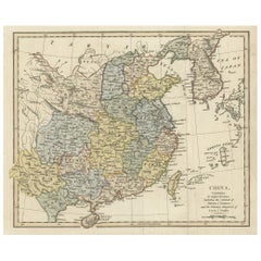
Original Old China Map, From Korea and the Sea of Japan to Teypin Island, 1803
Located in Langweer, NL
Antique map titled 'China, Contains 15 Subject Provinces Including the 2 Islands of Hainan, Formosa and the Tributary Kingdoms of Corea, Tonkin'.
Old map depicting China, extendi...
Category
Early 1800s Antique Maps
Materials
Paper
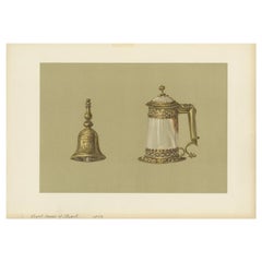
Antique Print of a Handbell and Covered Tankard of Agate by Gibb, 1890
Located in Langweer, NL
Antique print titled 'Hand-Bell of Mary Queen of Scots - Covered Tankard of Agate'. Chromolithographic plate originating from 'The Royal House of Stuart. Illustrated by a Series of F...
Category
19th Century Antique Maps
Materials
Paper
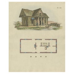
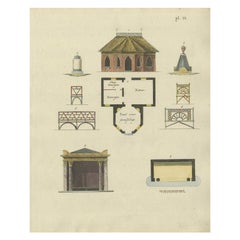
Antique Print of a Garden House from Garden Architecture by Van Laar, 1802
Located in Langweer, NL
Untitled print of garden architecture. It shows a garden building. This print originates from 'Magazijn van tuin-sieraden'. The book is compiled by Gijsbert van Laar, providing a sur...
Category
19th Century Antique Maps
Materials
Paper
Hand-Colored Antique Print of Garden Architecture by Van Laar, 1802
Located in Langweer, NL
Untitled print of garden architecture. It shows garden buildings and various other garden elements/decoration. This print originates from 'Magazijn van tuin-sieraden'. The book is co...
Category
19th Century Antique Maps
Materials
Paper
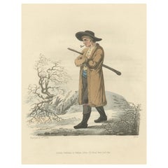
Old Antique Print of a Peasant of Upper Carniola, Slovenia, Eastern Europe, 1804
Located in Langweer, NL
Old print of a peasant of upper Carniola, Slovenia.
This print originates from 'The Costume of the Hereditary States of the House of Austria' by William Miller.
Artists and engravers: Engraved by William Ellis.
Category
Early 1800s Antique Maps
Materials
Paper
Antique Map of China by A & C, Black, 1870
Located in Langweer, NL
Antique map titled 'China'. Original antique map of China. This map originates from ‘Black's General Atlas of The World’. Published by A & C. Black, 1870.
Category
Late 19th Century Antique Maps
Materials
Paper
Antique Costume Print of a Cabbage Cutter From Montafon in Austria, C.1880
Located in Langweer, NL
Antique costume print titled 'Krautschneider aus Montafun, Vorarlberg'. Old print of a cabbage cutter from Montafon. This print originates from 'Blätter...
Category
19th Century Antique Maps
Materials
Paper
Antique Map of Moldova to Thessaly and from the Adriatic to the Black Sea, 1880
Located in Langweer, NL
Antique map titled 'Turquie d'Europe'.
Map of the european parts of Turkey. The map covers from Moldova to Thessaly and from the Adriatic to the Black Sea. Greece and the island ...
Category
1880s Antique Maps
Materials
Paper
Old Map of Spain and Portugal, with an Inset Map of the Region of Madrid, 1846
Located in Langweer, NL
Antique map titled 'Kingdom of Spain and Portugal'.
Old map of Spain and Portugal, with an inset map of the region of Madrid. This map originates from 'A New Universal Atlas Cont...
Category
1840s Antique Maps
Materials
Paper
Antique Map of Western Australia and Van Diemen's Land or Tasmania, 1833
Located in Langweer, NL
Antique map of Australia titled 'Western Australia - Van-Diemen Island'. Two maps on one sheet. Left, Western Australia containing the settlements of the Swan river...
Category
19th Century Antique Maps
Materials
Paper
Steel Engraving of Shimoda, a Port Located in Shizuoka Prefecture, Japan, C.1840
Located in Langweer, NL
Antique print titled 'Simoda in Japan'.
Steel engraving of Shimoda, a city and port located in Shizuoka Prefecture, Japan. Originates from 'Meyers Univer...
Category
1840s Antique Maps
Materials
Paper
Antique County Map, Hertfordshire, English, Framed Engraving, Cartography, Litho
Located in Hele, Devon, GB
This is an antique county map of Hertfordshire. An English, framed atlas engraving of cartographic interest, dating to the mid 19th century and later.
Superb lithography of Hertfor...
Category
Mid-19th Century British Victorian Antique Maps
Materials
Glass, Wood, Paper
Antique Map of The World in Hemispheres by W. G. Blackie, 1859
Located in Langweer, NL
Antique map titled 'The World in Hemispheres with other projections'. Original antique map of The World. This map originates from ‘The Imperial Atlas of Modern Geography’. Published ...
Category
Mid-19th Century Antique Maps
Materials
Paper
Small Original Antique Map of Switzerland and Surroundings, 1807
Located in Langweer, NL
Antique map titled 'Switzerland with its subjects & allies from the best authorities'.
Small map of Switzerland and surroundings. Originates from 'A general view of the world' by...
Category
Early 1800s Antique Maps
Materials
Paper
Colourful Antique Map of Switzerland, 1846
Located in Langweer, NL
Antique map titled 'Switzerland'. Old map of Switzerland.
This map originates from 'A New Universal Atlas Containing Maps of the various Empires...
Category
1840s Antique Maps
Materials
Paper
Pl. 35 Antique Chart of the US Taxation, 1874
Located in Langweer, NL
Antique chart titled 'Map showing the degree of taxation per capita imposed by state, county or municipal authority, within the fiscal year nearest the c...
Category
Late 19th Century Antique Maps
Materials
Paper
Antique Map of Western States, Michigan, Wisconsin, Iowa by A & C. Black, 1870
Located in Langweer, NL
Antique map titled 'Western States, Michigan, Wisconsin, Minnesota, Iowa with portions of Illinois & Indiana'. Original antique map of Western States, Michigan, Wisconsin, Minnesota,...
Category
Late 19th Century Antique Maps
Materials
Paper
Antique Map of Siberia by Reclus, 1881
Located in Langweer, NL
Antique map titled 'Itineraires en Siberie.' This map shows the itineraries of famous explorers in Siberia between 1648 and 1879. This original old antique print / plate originates f...
Category
19th Century Antique Maps
Materials
Paper
Antique Map of Russia in Asia by Wyld, '1845'
Located in Langweer, NL
Antique map titled 'Russia in Asia'. Original antique map of Russia in Asia. This map originates from 'An Atlas of the World, Comprehending Separate Maps of its Various Countries, co...
Category
Mid-19th Century Antique Maps
Materials
Paper
Antique Map of the Extension of the Russian Empire in the XIXth Century, 1806
Located in Langweer, NL
Antique map titled 'L'Empire Russe en Europe et en Asie'.
Map showing the extension of the Russian Empire at the beginning of the XIXth century. Several letterpress notations are...
Category
Early 1800s Antique Maps
Materials
Paper
Antique Map of England and Wales with Decorative Vignettes, 1851
Located in Langweer, NL
Antique map titled ‘England and Wales’. Includes decorative vignettes titled The grand stand on the race ground Doncaster, London, Oxford, Entrance to Portsmouth Harbour, Sunderland ...
Category
19th Century Antique Maps
Materials
Paper
Antique Map of the Chinese Empire and Japan, '1875'
Located in Langweer, NL
Antique map titled 'Carte générale de l'Empire Chinois et du Japon'. Large map of the Chinese Empire and Japan. This map originates from 'Atlas de Géographie Moderne Physique et Poli...
Category
Late 19th Century Antique Maps
Materials
Paper
Antique Map of the Dusky Bay or Dusky Sound of New Zealand by Captain Cook, 1803
Located in Langweer, NL
Antique map New Zealand titled 'Schets van de Donkere Baai in Nieuw Zeeland 1773'.
Antique map of the Dusky Bay/Dusky Sound of New Zealand....
Category
Early 1800s Antique Maps
Materials
Paper
Antique Map of South America by Johnston, 1882
Located in Langweer, NL
Antique map titled 'South America'. Old map of South America, with an inset map of the Galapagos Isles. This map originates from 'The Royal Atlas of Modern Geography, Exhibiting, in ...
Category
19th Century Antique Maps
Materials
Paper
Antique Map of Sweden and Norway by Johnston, 1882
Located in Langweer, NL
Antique map titled 'Sweden & Norway (Scandinavia)'. Old map of Sweden and Norway, with inset map of Stockholm. This map originates from 'The Royal Atlas ...
Category
19th Century Antique Maps
Materials
Paper
Antique Print of the Chief Temple in Hakodate in Japan, 1856
Located in Langweer, NL
Antique print titled ‘Chief Temple Hakodadi‘. View of the chief temple in Hakodate, Japan. This print originates from 'Narrative of the expedition of an American squadron to the Chin...
Category
19th Century Antique Maps
Materials
Paper
Old German Map Depicting the Central Islands of Polynesia, 1857
Located in Langweer, NL
Antique map Polynesia titled 'Karte der Central-Gruppen von Polynesien'. Old map depicting the central islands of Polynesia. This map originates from 'Petermanns Geographische Mittei...
Category
19th Century Antique Maps
Materials
Paper
Western Africa Antique Map by W. G. Blackie, 1859
Located in Langweer, NL
The antique map titled 'Western Africa' presents an original depiction of the region. Originating from 'The Imperial Atlas of Modern Geography,' this map was published by W. G. Black...
Category
Mid-19th Century Antique Maps
Materials
Paper
Original Antique Map of the United Kingdom and Ireland, Published in 1875
Located in Langweer, NL
Antique map titled 'Iles Britanniques ou Royaume-Uni de la Grande Bretagne (..)'. Large map of the United Kingdom and Ireland. This map originates from...
Category
Late 19th Century Antique Maps
Materials
Paper
Antique Map of Asia by Delamarche, 1826
Located in Langweer, NL
Vaugondy's map plates and copyrights and later addes many plates from other sources as well. Charles Delamarche eventually passed control of the firm to his son Felix Delamarche (18t...
Category
19th Century Antique Maps
Materials
Paper
Hand Colored Antique Map of the department of Indre and Loire, France
Located in Langweer, NL
Antique map titled 'Dépt. d'Indre et Loire'. Map of the Department de L’Indre et Loire, France. This region is known for its fine wines, agriculture, distilled spirits, and cheese. T...
Category
Mid-19th Century Antique Maps
Materials
Paper
Antique Print of Hakodate from Snow Peak in Japan, 1856
Located in Langweer, NL
Antique print titled ‘View of Hakodadi from Snow Peak’. View of Hakodate, a city and port located in Oshima Subprefecture, Hokkaido, Japan. This print origin...
Category
19th Century Antique Maps
Materials
Paper
Old Map of Holstein with the Imperial Towns Hamburg & Lubeck, Germany, 1854
Located in Langweer, NL
Antique map titled 'Map of the Duchy of Holstein with the territories of the Imperial Towns Hamburg & Lubeck (..)
Based on a map by Fischer.' Map of the Duchy of Holstein. From Jam...
Category
1850s Antique Maps
Materials
Paper
Antique Print of the State Bedroom of Warwick Castle, River Aron, England, c1850
Located in Langweer, NL
Antique print titled 'State Bedroom-Warwick Castle'.
Lithograph of the State Bedroom of the famous Warwick Castle in England.
Warwick Castle is a medieval castle developed fro...
Category
19th Century Antique Maps
Materials
Paper
Antique Chart of the US Malarial Deaths, '1874'
Located in Langweer, NL
Antique chart titled 'Map showing the proportion of deaths from malarial diseases to deaths from all causes. Compiled from the returns of mortality at th...
Category
Late 19th Century Antique Maps
Materials
Paper
Original Copper Engraved Map of the Bering Strait by Captain Cook, 1803
Located in Langweer, NL
Antique map titled 'Kaart van den Mond van Norton, en van de Engte van Bhering, toonende de meest Oostlijke Kaap van Asien, en den meest Westlijken Urthoek van Amerika'.
Map of t...
Category
Early 1800s Antique Maps
Materials
Paper
Hand Colored Antique Map of the Department of Ardèche, France
Located in Langweer, NL
Antique map titled 'Dépt. de l'Ardèche'. Map of the Department of Ardèche, France. This region is known for its fine wines, agriculture, distilled spirits, and cheese. The capital ci...
Category
Mid-19th Century Antique Maps
Materials
Paper
Old Map of Cook's Discovery and Charting of the East Coast of Australia, 1803
Located in Langweer, NL
Antique map titled 'Kaart van Nieuw Zuid Wales of de Oostlyke Kust van Nieuw Holland ontdekt en onderzogt door den Luitenant J. Cook met het Schip de Endeavour in het Jaar 1770'.
...
Category
Early 1800s Antique Maps
Materials
Paper
Hand Colored Antique Map of the department of Cantal, France
Located in Langweer, NL
Antique map titled 'Dépt. du Cantal'. Map of the French department of Cantal, France. This area of France is known for its production of Cantal, a firm cheese, named after the region...
Category
Mid-19th Century Antique Maps
Materials
Paper
Academic Costumes; a Pensioner of Trinity Hall, a Doctor of Physics & Law, 1815
Located in Langweer, NL
Antique print titled 'Pensioner of Trinity Hall - Common Dress of the Doctor in Law & The Doctor in Physic'.
Portraits of three men in academic costum...
Category
1810s Antique Maps
Materials
Paper
Beautiful Original Antique Print of Indian Decorative Art, 1869
Located in Langweer, NL
Old print of Indian decorative art. This print originates from 'L'Ornement polychrome'. A beautiful work containing about 2000 patterns of all the st...
Category
1860s Antique Maps
Materials
Paper
Old Engraved Map of Hungary with Decorative Vignettes, 1851
Located in Langweer, NL
Antique map titled Hungary. Includes decorative vignettes titled Hungarian Peasants, Pesth and the Fortress of Buda, on the Danube and Hungarian Nobles. Originates from 'The Illustrated Atlas, And Modern History Of The World Geographical, Political, Commercial & Statistical, Edited By R. Montgomery Martin'. Published; John Tallis London, New York, Edinburgh & Dublin. 1851.
Drawn and Engraved by J. Rapkin. Artists and Engravers: John Tallis (1817-1876) was a British map publisher. Born in the Midlands, Tallis came to London in the 1840s. Tallis began his London career with a series of remarkable London street views. He began a partnership with a Frederick Tallis, possibly his brother, but their collaboration ended in 1849. For the Great Exhibition of 1851, Tallis published the Illustrated World Atlas, one of the last series of decorative world maps ever produced. The maps were engraved by John Rapkin, a skilled artisan. The maps were later reissued by the London Printing & Publishing Company, who left the Tallis imprint intact, thus ensuring his enduring fame. In 1858, he began publication of the popular Illustrated News of the World...
Category
19th Century Antique Maps
Materials
Paper
Hand Colored Antique Map of the Department of Aude, France
Located in Langweer, NL
Antique map titled 'Dépt. de l'Aude'. Map of the French department of Aude, France. This area of France is famous for its wide variety of vineyards and wine production. In the east a...
Category
Mid-19th Century Antique Maps
Materials
Paper
Antique Plan of Turkey in Europe with Inset Map of the Bosporus, ca.1850
Located in Langweer, NL
Antique map titled 'Turkey in Europe'.
A map of European Turkey and the surrounding countries. With an inset map of the Bosporus. This includes Macedonia, Bulgaria, Croatia, Bosn...
Category
1850s Antique Maps
Materials
Paper
Dutch Municipality of Bedum in Groningen, Fehse, 1862
Located in Langweer, NL
These scarse detailed maps of Dutch Towns originate from the 'Gemeente atlas van de Provincie Groningen in 62 kaarten.' by C. Fehse. This atlas of all towns in Groningen, the Netherl...
Category
19th Century Antique Maps
Materials
Paper
Large Italian Map of Islands of Oceania, incl Papua, Timor, Banda, Ceram, 1855
Located in Langweer, NL
Description: Antique map titled 'Carta di una parte dell'Oceania'. Beautiful large map of the (Spice) islands of Oceania. Depicting Papua, Timor, Ceram, Gilolo and many more. Source ...
Category
1850s Antique Maps
Materials
Paper
Old Fish Print Named Opah, Cravo, Moonfish, Kingfish or Jerusalem Haddock, 1842
Located in Langweer, NL
Antique print, titled: 'Poissons Plate 10 - Le Lampris Tachete (Lampris guttatus).' -
This rare plate shows the Lampris guttatus, commonly known as the opah, cravo, moonfish, kin...
Category
1840s Antique Maps
Materials
Paper
Ceremony for the Son of the King in the Village of Mua on Tongatapu, Tonga, 1803
Located in Langweer, NL
Antique print titled 'De Natsche, eene plechtigheid ter eere van 's Konings Zoon op Tongataboo'.
Antique print depiciting a ceremony for the son of the King of Tonga in the villa...
Category
Early 1800s Antique Maps
Materials
Paper
Antique Map of Lot ‘France’ by V. Levasseur, 1854
Located in Langweer, NL
Antique map titled 'Dépt. du Lot'. Map of the French department of Lot, France. This area of France is known for its production of Cahors wine, a powerful red wine, often “harsh when...
Category
Mid-19th Century Antique Maps
Materials
Paper
Antique County Map of Derbyshire, England, 1804
Located in Langweer, NL
Antique county map of Derbyshire first published, circa 1800. Villages, towns, and cities illustrated include Chesterfield, Wirksworth, Derby, and ...
Category
Early 1800s Antique Maps
Materials
Paper
Original Antique Print of a Castle in Madrid, Spain, 1833
Located in Langweer, NL
Antique print titled 'Schloss zu Madrid'.
Lithograph of a castle in Madrid, Spain. This print originates from 'Neuen Bildergalerie für die Jugend'.
Artists and Engravers: Ano...
Category
1830s Antique Maps
Materials
Paper
Antique Map of South America by Petri, c.1873
Located in Langweer, NL
Antique map titled 'Zuid-Amerika'. Old map depicting South America, with an inset map of the highland of Quito. This map originates from 'School-Atlas van alle Deelen der Aarde'. Art...
Category
19th Century Antique Maps
Materials
Paper
Antique Map of Russia in Europe by A & C, Black, 1870
Located in Langweer, NL
Antique map titled 'Russia in Europe'. Original antique map of Russia in Europe. This map originates from ‘Black's General Atlas of The World’. Published by A & C. Black, 1870.
Category
Late 19th Century Antique Maps
Materials
Paper
Dutch Antique Engraving with Coastal Views of Asia by Cook, 1803
Located in Langweer, NL
Antique print Asia titled 'Gezigt der Kust van Asiën'. Antique print depicting various coastal views of Asia including Kamchatka. Originates from 'Reizen Rondom de Waereld door James...
Category
19th Century Antique Maps
Materials
Paper
Rare Decorative Hand-coloured Antique Plate of The Gaimard's Ray Fish, 1842
Located in Langweer, NL
Antique print, titled: 'Poissons Plate 3 - La Raie de Gaimard (Raia gaimardi).' - This rare plate shows the Gaimard's ray. From: 'Voyage en Islande et au Groenland' by M. Paul Gaimar...
Category
1840s Antique Maps
Materials
Paper
Hand Colored Antique Map of the department of Hautes Alpes, France
Located in Langweer, NL
Antique map titled 'Dépt. des Hautes Alpes'. Map of the French department of Hautes Alpes, France. This area of France is known for its production of Cote...
Category
Mid-19th Century Antique Maps
Materials
Paper
Antique Map of China and the East Indies by Lowry, 1852
Located in Langweer, NL
Antique map titled 'China & Indian Archipelago'. Two individual sheets of China and the East Indies. This map originates from 'Lowry's table Atlas constructed and engraved from the m...
Category
Mid-19th Century Antique Maps
Materials
Paper
