Maps
to
764
906
66
973
10
3
2,926
2,181
476
3
289
34
10
127
7
35
9
2
5
3
4
2
968
11
9
4
2
91
43
29
17
14
973
973
973
63
12
11
10
6
Maps For Sale
Period: 1970s
Period: 17th Century
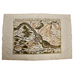
Vienna, Austria: A Large 17th Century Hand-Colored Map by Sanson and Jaillot
Located in Alamo, CA
This large 17th century hand-colored map of Vienna, Austria and the surrounding countryside and villages entitled "Plan de la Ville de Vienne en Austrich...
Category
1690s French Antique Maps
Materials
Paper
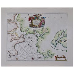
Plymouth, England: A Hand-Colored 17th Century Sea Chart by Captain Collins
Located in Alamo, CA
This hand-colored sea chart of the area around Plymouth, England from "Great Britain's Coasting Pilot. Being a New and Exact Survey of the Sea-Coast of England", first published in 1...
Category
Late 17th Century English Antique Maps
Materials
Paper
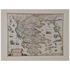
Greece, "Graeciae Antiquae"" A 17th Century Hand-colored Map by Sanson
Located in Alamo, CA
This is an original 17th century hand colored copperplate engraved map of Greece entitled "Graeciae Antiquae Tabula Hanc Geographicam" by Nicolas d'Abbeville Sanson, engraved and pub...
Category
Mid-17th Century French Antique Maps
Materials
Paper
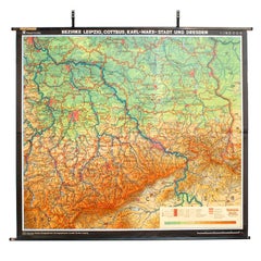
East German Map
By VEB Hermann Haack
Located in Baltimore, MD
A brilliantly colourful map of the Leipzig, Karl Marx Stadt and Dresden area in the former German Democratic Republic by VEB Hermann Haack of Gotha.
Category
1970s German Vintage Maps
Southern Greece: A Large 17th C. Hand-colored Map by Sanson and Jaillot
Located in Alamo, CA
This large original hand-colored copperplate engraved map of southern Greece and the Pelopponese Peninsula entitled "La Moree Et Les Isles De Zante, Cefalonie, Ste. Marie, Cerigo & C...
Category
1690s French Antique Maps
Materials
Paper
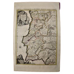
Portugal: A Large 17th Century Hand-colored Map by Sanson and Jaillot
Located in Alamo, CA
This large hand-colored map entitled "Le Royaume de Portugal et des Algarves Divisee en see Archeveches, Eveches et Territoires Par le Sr Sanson" was originally created by Nicholas S...
Category
1690s French Antique Maps
Materials
Paper
Hampshire County, Britain/England: A Map from Camden's" Britannia" in 1607
By John Norden
Located in Alamo, CA
An early hand-colored map of Britain's Hampshire county, published in the 1607 edition of William Camden's great historical description of the British Isles, "Britannia". This map was drawn by cartographer John Norden (c. 1547-1625) and engraved by William Hole (active 1607-1624) and William Kip...
Category
Early 17th Century English Antique Maps
Materials
Paper
17th Century Hand-Colored Map of a Region in West Germany by Janssonius
Located in Alamo, CA
This attractive highly detailed 17th century original hand-colored map is entitled "Archiepiscopatus Maghdeburgensis et Anhaltinus Ducatus cum terris adjacentibus". It was published ...
Category
Mid-17th Century Dutch Antique Maps
Materials
Paper
Large 17th Century Hand Colored Map of England and the British Isles by de Wit
Located in Alamo, CA
A large hand colored 17th century map of England and the British Isles by Frederick de Wit entitled "Accuratissima Angliæ Regni et Walliæ Principatus", published in Amsterdam in 1680. It is a highly detailed map of England, Scotland, the Scottish Isles...
Category
Late 17th Century Dutch Antique Maps
Materials
Paper
Northern Scotland: A 17th Century Hand-colored Map by Mercator
Located in Alamo, CA
This is a framed hand-colored 17th century map of Northern Scotland by Gerard Mercator entitled "Scotiae pars Septentrionalis", published in Amsterdam in 1636. It is a highly detailed map of the northern part of Scotland, with the northwest Highlands and the cities Inverness and Aberdeen, as well as the Orkney Islands and the Hebrides. There is a decorative title cartouche in the upper left corner.
The map is presented in an antiqued brown wood...
Category
1630s Dutch Antique Maps
Materials
Paper
17th Century Hand Colored Map of the Liege Region in Belgium by Visscher
Located in Alamo, CA
An original 17th century map entitled "Leodiensis Episcopatus in omnes Subjacentes Provincias distincté divisusVisscher, Leodiensis Episcopatus" by Nicolaes Visscher II, published in Amsterdam in 1688. The map is centered on Liege, Belgium, includes the area between Antwerp, Turnhout, Roermond, Cologne, Trier and Dinant.
This attractive map is presented in a cream-colored mat measuring 30" wide x 27.5" high. There is a central fold, as issued. There is minimal spotting in the upper margin and a tiny spot in the right lower margin, which are under the mat. The map is otherwise in excellent condition.
The Visscher family were one of the great cartographic families of the 17th century. Begun by Claes Jansz Visscher...
Category
Late 17th Century Dutch Antique Maps
Materials
Paper
Antique Map of the Namen or Namur Region in Wallonia, Belgium
Located in Langweer, NL
Description: Antique map titled 'Namurcum Comitatus' A map of the Namen/Namur region in Wallonia, Belgium. It is the capital of the province Namur and hosts the Walloon Parliament. T...
Category
1610s Antique Maps
Materials
Paper
Flanders, Holland & Norfolk: Hand-Colored 17th Century Sea Chart by Collins
Located in Alamo, CA
This hand-colored chart of the seas about Flanders, Holland, Frisia, and Norfolk is from "Great Britain's Coasting Pilot. Being a New and Exact Survey of the Sea-Coast of England" by...
Category
Late 17th Century English Antique Maps
Materials
Paper
Antique Map of Cologne with the duchies of Jülich and Berg, Germany
Located in Langweer, NL
Antique map title 'Archiepiscopatus Coloniensis ducatibus Iuliacensi et Montensi (..)'. Original map of Cologne with the duchies of Jülich and Berg, Spa...
Category
Late 17th Century Antique Maps
Materials
Paper
Antique Map of Westphalia, West Orientation
Located in Langweer, NL
Antique map titled 'Nova totius Westphaliae Descriptio'. Detailed map of Westphalia, Northern Germany. Oriented to the west. The area shown extends from Ha...
Category
Late 17th Century Antique Maps
Materials
Paper
Antique Map of the Niederrhein region, Germany
Located in Langweer, NL
Antique map titled 'Circulus Electorum Rheni sive Rhenanus Inferior (..)'. Original antique map of the Niederrhein region, Germany. By F. de Wit, circa 1690.
Frederick de Wit (1629-...
Category
Late 17th Century Antique Maps
Materials
Paper
Antique Map of Zevenwouden in Friesland by Schotanus, 1664
Located in Langweer, NL
Antique map titled 'Septem silvae vulgo Seven Wolden olim forestensis.' Map of the region of Zevenwouden in Friesland, the Netherlands. This region include the villages of Langweer, ...
Category
17th Century Antique Maps
Materials
Paper
Antique Map of Zaltbommel in the Netherlands, by Guicciardini, 1613
Located in Langweer, NL
Antique print titled 'Civitas Bommelia (..)'. Beautiful plan of Zaltbommel, Gelderland (the Netherlands). This map originates from 'Discrittione di tutti i Paesi Bassi' by L. Guiccia...
Category
17th Century Antique Maps
Materials
Paper
Antique Plan of the Fortress of Greetsiel, Germany, by Blaeu, c.1650
Located in Langweer, NL
Antique plan titled 't Fort van Griet-Zyl in Oost-Vrieslant'. Plan of the fortress of Greetsiel, Germany. This print originates from 'Novum ac magnum theatrum urbium Belgicae' by J. ...
Category
17th Century Antique Maps
Materials
Paper
Antique Map of the Region of Pavia, Lodi, Novara, Tortona & Alessandria, Italy
Located in Langweer, NL
Antique map titled 'Territorio di Pavia, Lodi, Novarra, Tortona, Alessandria e altri vicini dello Stato di Milano'. Original old map of the region of Pavia, Lodi, Novara, Tortona and...
Category
Early 17th Century Antique Maps
Materials
Paper
Original Antique Map of Leicestershire, England
Located in Langweer, NL
Antique map titled 'A Mapp of the Country of Leicester'. Original old map of Leicestershire, England. This map originates from 'Britannia: or, a Geographical Description of the Kingd...
Category
Late 17th Century Antique Maps
Materials
Paper
Original Antique Map of the Road from Bristol to Weymouth
Located in Langweer, NL
Antique map titled 'The Road from Bristol to Weymouth (..)'. Original antique map of the road from Bristol to Weymouth. Plate 60 from Ogilby's 'Britannia', the first road atlas of En...
Category
Late 17th Century Antique Maps
Materials
Paper
Original Antique Map of the Road from Andover to Crewkerne
Located in Langweer, NL
Antique map titled 'The Continuations of the Road from London to the Lands End'. Original antique map of the road from Andover to Crewkerne. Plate 26 from Ogilby's 'Britannia', the f...
Category
Late 17th Century Antique Maps
Materials
Paper
Antique Print of Harlingen, Stavoren and Sneek in Friesland, 1680
Located in Langweer, NL
Antique print titled 'Harlingen, Staveren, Sneck'. Views of the cities of Harlingen, Stavoren and Sneek, Friesland, the Netherlands. This print originates from 'Thooneel der Steden e...
Category
17th Century Antique Maps
Materials
Paper
Detailed Antique Map of Western Belgium and Eastern France by Coronelli, 1690
Located in Langweer, NL
Antique map titled 'Contado d'Hannonia (..)'. Map of western Belgium and eastern France, from south of Brussels (not shown) to Cambrai, France, generally centered around the towns of...
Category
17th Century Antique Maps
Materials
Paper
Antique Print of Fort Brittenburg by Guiccardini, 1612
Located in Langweer, NL
Antique print titled 'Ruinarum Arcis Britannica Apud Batavos Typus.' Old print of the ruins of the Roman fortress Brittenburg near Katwijk, The Netherlands. Source unknown, to be det...
Category
17th Century Antique Maps
Materials
Paper
Dartmouth, England: A Hand-Colored 17th Century Sea Chart by Captain Collins
Located in Alamo, CA
This hand-colored sea chart of the area around Dartmouth, England is from "Great Britain's Coasting Pilot. Being a New and Exact Survey of the Sea-Coast of England", first published ...
Category
Late 17th Century English Antique Maps
Materials
Paper
Edinburgh, Scotland Coast: A 17th Century Hand-Colored Sea Chart by Collins
Located in Alamo, CA
This hand-colored sea chart is entitled "Edinburgh Firth" from "Great Britain's Coasting Pilot. Being a New and Exact Survey of the Sea-Coast of England" by Captain Greenville Collin...
Category
Late 17th Century English Antique Maps
Materials
Paper
Original Antique Engraving of the Eastern Hemisphere, c.1700
Located in Langweer, NL
Antique map titled 'Proiectio Optica Aequinoctia lis Hemishaerii Orientalis' - Map of the Eastern Hemisphere with Africa, Europe, Asia and Nova Hollandia...
Category
17th Century Antique Maps
Materials
Paper
Engraving of Tienen in the province of Flemish Brabant, in Flanders, Belgium
Located in Langweer, NL
Antique map titled 'Thienen'. Old map of Tienen showing the siege of Tienen in 1588. This map originates from 'La genealogie des illustres comtes de Nassau' by Jan Jansz. Orlers.
...
Category
17th Century Antique Maps
Materials
Paper
Antique Print of Franeker, Friesland, the Netherlands by Guicciardini, 1616
Located in Langweer, NL
Antique print titled 'Franicker'. View of the city of Franeker, Friesland, the Netherlands. This print originates from 'Omnium Belgii sive Inferioris Germaniae (..)' by L. Guicciardi...
Category
17th Century Antique Maps
Materials
Paper
Original Antique Regional Map of France with Orleans, Auxerre and Montargis
Located in Langweer, NL
Original antique map titled 'Gastinois et Senonois'. Beautiful regional map of France. With Corbeil in the north, Pont sur Seyne in the east, Auxerre in the south, and Orleans in the...
Category
Mid-17th Century Antique Maps
Materials
Paper
Engravings of the Frisian Cities of Sloten, IJlst, Workum and Hindelopen, c.1650
Located in Langweer, NL
Antique print titled 'Slooten - Ylst - Worcum - Hinloopen'. Three plans and a bird's eye view on one sheet. The plans show the Frisian cities Sloten, IJlst, Workum and the view shows...
Category
17th Century Antique Maps
Materials
Paper
Antique Print of the City of Koesuwen, China, 1665
Located in Langweer, NL
Antique print titled 'Teywanmiao'. Old print depicting the city of Koesuwen, China. This print originates from 'Het gezantschap der Nee^rlandtsche Oost-Indische Compagnie, aan den gr...
Category
17th Century Antique Maps
Materials
Paper
Antique Print of Bantam, Java, Indonesia by De Bry, c.1610
Located in Langweer, NL
Untitled print of Bantam, former city and sultanate of Java, Indonesia. It lay near the site of the present-day city of Banten, on Banten Bay, at the extreme northwest of the island....
Category
17th Century Antique Maps
Materials
Paper
Original Antique Engraved Print of the City of Hoaigan in China, 1668
Located in Langweer, NL
Antique print China titled 'Hoaigan'. Old print depicting a view on the Chinese city of Hoaigan with its ramparts. This print originates from the Latin edition of Nieuhof's work titl...
Category
17th Century Antique Maps
Materials
Paper
Antique Print of the Frisian Harbour City of Stavoren in the Netherlands, 1659
Located in Langweer, NL
Antique print titled 'Stavern'. Panoramic view of the city of Stavoren, Friesland. This print originates from 'Topographia Germaniae Inferioris'.
Artists and Engravers: Matthaus M...
Category
17th Century Antique Maps
Materials
Paper
Rare Antique Print of the University City of Franeker, the Netherlands, 1678
Located in Langweer, NL
Antique print titled 'Franicker in Friesland, Academia' View of the city of Franeker, Friesland, the Netherlands. Edition: 1678. This delicate engraving originates from 'Thesauri Phi...
Category
17th Century Antique Maps
Materials
Paper
Antique Map of Gelderland and Overijssel by Guicciardini, 1613
Located in Langweer, NL
Antique map titled 'Geldria et Transisulania.' (Map of the provinces of Gelderland and Overijssel, the Netherlands.) This original old antique print / plate originates from the scars...
Category
17th Century Antique Maps
Materials
Paper
Original Copper Engraved Antique Print of the City of Bejing in China, 1668
Located in Langweer, NL
Antique print China titled 'Peking'. Old print depicting a view of Bejing in China with its ramparts. On the left a pagoda. This print originates from the Latin edition of Nieuhof's ...
Category
17th Century Antique Maps
Materials
Paper
Original Rare Antique Print of the City of Ucienjen in China, 1665
Located in Langweer, NL
Antique print titled 'Ucienjen'. Old print depicting a view on the Chinese city of Ucienjen. Also depicted are many ships. This print originates from 'Het gezantschap der Nee^rlandts...
Category
17th Century Antique Maps
Materials
Paper
Antique Map of Saxony and Westphalia by Scherer, 1699
Located in Langweer, NL
Antique map titled 'Saxonia et Westphalia varijs in locis sacris erga dei matre est officiosa & ipsa vicissim erga utramq. Munifica.' Detailed uncommon map of Saxony and Westphalia i...
Category
17th Century Antique Maps
Materials
Paper
Antique Map of the Region Around the Baltic Sea by Cordier, c.1670
Located in Langweer, NL
Antique map titled 'Illyricum Orientis: In quo Partes II Moesia et Thracia'. Engraved map of the area west of the Baltic Sea, present day Bulgaria, Romania, and Turkey. The map is ba...
Category
17th Century Antique Maps
Materials
Paper
Antique Map of the Region of Lyonnais by Nolin, 1697
Located in Langweer, NL
Untitled map of the French Province of Lyonnais, with its capital at Lyon, on the upper Loire and Rhone rivers. This map is a single sheet and part of a two sheet map titled 'The Gen...
Category
17th Century Antique Maps
Materials
Paper
Antique Map of the Region of Opsterland by Schotanus, 1664
By B. Schotanus
Located in Langweer, NL
Antique map titled 'De Grietenie van Opsterlandt : waer over d'e. heer Martinus Fockens altans grietman is, bysitters syn Wybe Sytjes, Boele Broers, secretaris Saco Fockens.' Detaile...
Category
17th Century Antique Maps
Materials
Paper
Antique Map of the Region of Menaldumadeel by Schotanus, 1664
By B. Schotanus
Located in Langweer, NL
Antique map titled 'De Grietenie van Menaldema Deel (..)'. Very decorative regional map of the Grietenij of Menaldumadeel, west of Leeuwarden, Friesland, The Netherlands. Multiple ca...
Category
17th Century Antique Maps
Materials
Paper
Antique Map of the Region of Loudun and Mirebeau by Janssonius, c.1650
Located in Langweer, NL
Antique map 'Loudunois Laudunum - Mirebalais'. Decorative map of the region of Loudun and Mirebeau, France. It shows the city of Moncontour, Loudun, Mirebeau and more.
Artists ...
Category
17th Century Antique Maps
Materials
Paper
Antique Map of the Region of Oostergo by Colom, 1635
Located in Langweer, NL
Antique map titled 'Ooster-Goe'. Original antique map of the region of Oostergo, Friesland, the Netherlands. Includes the cities of Leeuwarden, Dokkum and others. This map originates...
Category
17th Century Antique Maps
Materials
Paper
Antique Map of the Region of Kollumerland by Schotanus, 1664
By B. Schotanus
Located in Langweer, NL
Antique map titled 'De Grietenije van Kollumer Landt (..).' Map of the Grietenij of Kollumerland, Friesland, The Netherlands. Multiple cartouches, key and coat of arms. "Beschrijving...
Category
17th Century Antique Maps
Materials
Paper
Antique Map of the Region of Ooststellingwerf by Schotanus, 1664
By B. Schotanus
Located in Langweer, NL
Antique map titled 'De Grietenije van Stellingwerf oost eynde (..).' Map of the Grietenij of Ooststellingwerf, Friesland, The Netherlands. Multiple cartouches, key and coat of arms. ...
Category
17th Century Antique Maps
Materials
Paper
Antique Map of the Region of Grave by Orlers, 1615
Located in Langweer, NL
Antique map of the region of Grave, also including Cuijk and Ravestein. This map originates from 'La genealogie des illustres Comtes de Nassau' by Jan Jansz. Orlers.
Artists and E...
Category
17th Century Antique Maps
Materials
Paper
Antique Map of the Province of Overijssel by Janssonius, c.1650
Located in Langweer, NL
Antique map titled 'Ditio Trans-isulana'. Original antique map of the province of Overijssel, the Netherlands. With coat of arms and two decorative cartouches. Published by J. Jansso...
Category
17th Century Antique Maps
Materials
Paper
Antique Map of the Region of Haskerland by Schotanus, 1664
By B. Schotanus
Located in Langweer, NL
Antique map titled 'De Grietenije van Hasscher Landt (..)'. Map of the Grietenij of Haskerland, Friesland, The Netherlands. Multiple cartouches, key and coat of arms. Originates from...
Category
17th Century Antique Maps
Materials
Paper
Antique Map of the Region of Hennaarderadeel by Schotanus, 1664
By B. Schotanus
Located in Langweer, NL
Antique map titled 'De Grietenije van Hennaerdera deel (..)'. Map of the Grietenij of Hennaarderadeel, Friesland, The Netherlands. Multiple cartouches, key and coat of arms. Originat...
Category
17th Century Antique Maps
Materials
Paper
Antique Map of the Region of Saintonge by Janssonius, 1657
Located in Langweer, NL
Antique map of France titled 'La Saintonge vers le Septentrion avecq le Pays d'Aulnis'. Decorative map of the Saintonge region. Includes Ile de Re, Ile d'Oleron and the cities of Nio...
Category
17th Century Antique Maps
Materials
Paper
Antique Map of the Region of Beauvais by Janssonius, 1657
Located in Langweer, NL
Antique map of France titled 'Beauvaisis Comitatus Belovacium'. Detailed map of the region centered on Beauvais. This map originates from 'Atlas Novus, Sive Theatrum Orbis Orbis Terr...
Category
17th Century Antique Maps
Materials
Paper
Antique Map of the Region of Périgord by Janssonius, 1657
Located in Langweer, NL
Antique map of France titled 'Le Comte de Perigort'. Decorative map of the Périgord region. Périgord is a natural region and former province of France, which corresponds roughly to t...
Category
17th Century Antique Maps
Materials
Paper
Antique Map of the Region of Calais and The Vermandois Region by Ortelius
Located in Langweer, NL
Antique map titled 'Caletensium et Bononiensium (..) - Veromandorum eorum que confinium (..)'. Two detailed regional maps by Ortelius. The first map shows Belgian and French Coastal ...
Category
17th Century Antique Maps
Materials
Paper
