Maps
to
997
1,324
118
1,445
17
10
6
4
4
3
2
2,926
2,181
476
3
289
34
10
127
7
35
9
2
5
3
4
2
1,404
37
23
18
16
198
114
86
44
43
1,445
1,445
1,445
63
12
11
10
6
Maps For Sale
Period: 20th Century
Period: 17th Century
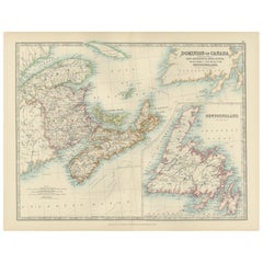
Canada Dominion Map 1903 - A Detailed View of Eastern Canada and Newfoundland
Located in Langweer, NL
North America, 1903 - A Colorful Historical Map with Detailed Borders
This attractive map of North America was engraved, printed, and published by W. & A.K. Johnston in 1903. A wond...
Category
Early 20th Century Maps
Materials
Paper
Persia, Armenia & Adjacent Regions: A 17th Century Hand-colored Map by De Wit
Located in Alamo, CA
A large 17th century hand colored copperplate engraved map entitled "Novissima nec non Perfectissima Scandinaviae Tabula comprehendens Regnorum Sueciae, Daniae et Norvegiae distincte...
Category
Late 17th Century Dutch Antique Maps
Materials
Paper
1950's Glass Globe Lamp, Denmark
Located in New York, NY
Danish Glass Globe Lamp, c. 1950's.
Can be lit with inner bulb.
Category
1950s Danish Mid-Century Modern Vintage Maps
Materials
Glass, Wood
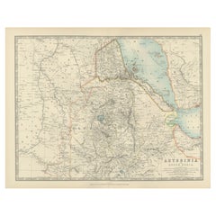
Abyssinia and Upper Nubia, 1903 - Detailed Map of the Horn of Africa Region
Located in Langweer, NL
Title: Abyssinia and Upper Nubia, 1903 - Detailed Map of the Horn of Africa Region
This fascinating map titled "Abyssinia and Upper Nubia" was engraved, printed, and published by W....
Category
Early 20th Century Maps
Materials
Paper
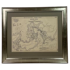
1901 Nautical Chart Showing Woods Hole, Mass
Located in Norwell, MA
Rare 1901 chart of Woods Hole, Mass., showing Buzzards Bay, Penzance Point, Nonamesset Island, Downtown Woods Hole, Parker Neck, Nobska Head, Vineyard Sound, Woods Hole Golf Club, Ra...
Category
Early 1900s North American Antique Maps
Materials
Paper
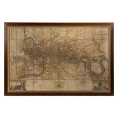
Large Scale Map of the London Metropolis
Located in Dallas, TX
The product is a large scale map of the London Metropolis, specifically focusing on the city in intricate detail. It would be a valuable collectible for those interested in maps and ...
Category
Mid-20th Century English Maps
Materials
Paper
Antique Map of South Australia, New South Wales, Victoria and Queensland, 1903
Located in Langweer, NL
Title: Antique Map of South Australia, New South Wales, Victoria, and Queensland, 1903
Description:
This antique map, titled "South Australia, New South Wales, Victoria, and Queensl...
Category
Early 20th Century Maps
Materials
Paper
Vintage Afghan Pictorial Map Rug
Located in New York, NY
A vintage Afghan Pictorial map rug from the mid-20th century.
Measures: 3' 0" x 4' 10"
Category
Mid-20th Century Afghan Folk Art Maps
Materials
Wool
Beautiful 17th Century Map of Paris and Isle de France by Templeux, c.1650
Located in Langweer, NL
Map of Isle de France by D. de Templeux, ca. 1650, Hand-Colored and Decorative
This richly detailed antique map titled *Le Gouvernement de L'Isle de France* was engraved by Daniel d...
Category
1650s Antique Maps
Materials
Paper
Antique Map of Switzerland and the Alps of Savoy & Piedmont, 1903 Edition
Located in Langweer, NL
Title: Antique Map of Switzerland and the Alps of Savoy & Piedmont, 1903, with Intricate Topographical Detail
Description:
This beautifully engraved antique map, titled "Switzerland...
Category
Early 20th Century Maps
Materials
Paper
Antique Map of Turkey in Europe, 1903, with Delicate Pastel Coloration
Located in Langweer, NL
Title: Antique Map of Turkey in Europe, 1903, with Delicate Pastel Coloration
Description:
This antique map, titled "Turkey in Europe," was engraved and published in 1903 by the dis...
Category
Early 20th Century Maps
Materials
Paper
Rare and Early Plaster Relief Map of Adirondack Mountains by F J H Merrill
By P.F. Howells, E. W. Merrill
Located in Buffalo, NY
Rare and Early Monumental Plaster Relief Map of Adirondack Mountains by The University of the State of New York, New York State Museum..F J H Merrill director,,,modeled by Howell's ...
Category
1910s American Industrial Vintage Maps
Materials
Plaster, Wood
Antique Map of Southern England & Wales, 1903, with Coastal Details and Railways
Located in Langweer, NL
Title: Antique Map of Southern England and Wales, 1903, with Coastal Details and Railways
Description:
This detailed antique map, titled "England and Wales (Southern Sheet I)," was ...
Category
Early 20th Century Maps
Materials
Paper
Antique Map of Greece and the Cyclades, 1903, with Many Details and Inset Maps
Located in Langweer, NL
Title: Antique Map of Greece and the Cyclades, 1903, with Intricate Detail and Inset Maps
Description: This antique map, titled "Greece with Its Islands, Including the Cyclades," wa...
Category
Early 20th Century Maps
Materials
Paper
Antique Map of Northern Scotland, 1903, with Intricate Coastal Features
Located in Langweer, NL
Title: Antique Map of Northern Scotland and Islands, 1903, with Intricate Coastal Features
Description:
This striking antique map, titled "Scotland (Northern Sheet I)," was engraved...
Category
Early 20th Century Maps
Materials
Paper
Antique Map of Southern Scotland, 1903, with Coastal and Inland Details
Located in Langweer, NL
Title: Antique Map of Southern Scotland, 1903, with Coastal and Inland Details
Description:
This exquisite antique map, titled "Scotland (Southern Sheet I)," was engraved and publis...
Category
Early 20th Century Maps
Materials
Paper
Antique Map of Denmark and German Empire Regions, 1903, Intricate and Colorful
Located in Langweer, NL
Title: Antique Map of Denmark and German Empire Regions, 1903, Intricate and Colorful
Description:
This antique map, titled "Denmark with North West Portions of the German Empire," ...
Category
Early 20th Century Maps
Materials
Paper
Vintage Swedish Topographic School Map of European Alps, Made in Sweden 1922
Located in Los Angeles, CA
Vintage Swedish Topographic School map of European Alps, Made in Sweden 1922
This vintage Swedish school map is so unique and a great example of why t...
Category
1920s Swedish Vintage Maps
Materials
Linen, Wood, Paper
Antique Map of the Brazil Railway Company, '1912'
Located in Langweer, NL
Antique map titled 'Brazil Railway Company'. This folding map is attached to the booklet titled 'The Brazil Railway Company'. It is a memorandum by A. H. A. Knox-Little, who was the ...
Category
Early 20th Century Maps
Materials
Paper
Dutch City Plan of Sloten in Friesland by N. Van Geelkercken, hand-colored 1616
Located in Langweer, NL
Bird’s-Eye View of Sloten in Friesland by Nicolaes van Geelkercken, ca. 1616
This captivating hand-colored engraving presents an early 17th-century bird’s-eye view of the fortified ...
Category
1610s Dutch Antique Maps
Materials
Paper
Large Original Vintage Map of Israel, circa 1920
Located in St Annes, Lancashire
Great map of Israel
Original color.
Good condition
Published by Alexander Gross
Unframed.
Category
1920s English Edwardian Vintage Maps
Materials
Paper
Rare 1670 Map of Tartary by Richard Blome after Sanson, Hand-colored Engraving
Located in Langweer, NL
Rare 1670 Map of Tartary by Richard Blome after Sanson, hand-colored engraving
This striking and highly decorative map, titled *A Generall Mapp of the Kingdome of Tartaria*, was pub...
Category
1670s Antique Maps
Materials
Paper
Map of the Persian Empire by Nicolas Sanson, Hand-colored, circa 1683
Located in Langweer, NL
Map of the Persian Empire by Nicolas Sanson, hand-colored, circa 1683
This finely detailed and delicately hand-colored map titled *L'Empire du Sophy des Perses* presents a late 17th...
Category
1680s Antique Maps
Materials
Paper
Antique Map of the City of Brielle 'The Netherlands' by L. Guicciardini, 1625
Located in Langweer, NL
Plan of Brielle, Briel, Den Briel in the Province of Zuid-Holland, The Netherlands, Holland. This map originates from the 1625 edition of 'Discrittione di tutti i Paesi Bassi', by L....
Category
Early 17th Century Antique Maps
Materials
Paper
Natives from Pegu, the Moluccan Islands, Penequais Indians and St Thomas, c.1605
Located in Langweer, NL
Antique print titled 'Provincie Pegu incola (..) - Incola ex Insulis Moluco (..) - Penequais familiae (..)'.
Old print showing various figures including a man from Pegu, a man fr...
Category
Early 1600s Antique Maps
Materials
Paper
Map Holy Promise Land Canaan Richard Palmer Richard Blome 1687 Joseph Moxon
Located in BUNGAY, SUFFOLK
Canaan comonly called the Holy Land or the Land of Promise, being the Possesion of the Israelites & travelled through by Our Lord & Saviour Iesus Christ and his Apostles. Engraven by Richard Palmer for Richard Blome. 1687
Blome, Richard, 1641-1705. London. 283 x 452 mm. Copperplate.
Probably from an English Bible...
Category
17th Century British Baroque Antique Maps
Materials
Paper
Antique Map of Paraguay by A. Montanus, circa 1671
Located in Langweer, NL
Antique map titled 'Paraquaria Vulgo Paraguay Cum adjacentibus'. Antique map extending from Rio de Janiero to the Rio de la Plata basin. The map include...
Category
Mid-17th Century Antique Maps
Materials
Paper
Map of Lancashire
Located in Cheshire, GB
Saxton Map of Lancashire hand coloured. Encased in an ebonised frame.
Dimensions
Height 21 Inches
Width 24 Inches
Depth 1 Inches
Category
Early 20th Century British Maps
Materials
Paper
Teruel 1901: A Cartographic Depiction of Heritage and Natural Splendor in Spain
Located in Langweer, NL
Original antique map of Teruel in Spain, with highlighted gold. The province of Teruel, located in the region of Aragon in eastern Spain, is known for several unique features:
1. **Mudejar Architecture**: Teruel is famous for its well-preserved Mudejar architecture, which is a style that is a fusion of Christian and Islamic design. This includes notable examples like the Tower of El Salvador and the Teruel Cathedral, both of which are UNESCO World Heritage sites.
2. **Dinopolis**: It hosts Dinópolis, a paleontological park that is one of the largest of its kind in Europe, featuring dinosaur fossils and interactive...
Category
Early 1900s Antique Maps
Materials
Paper
Antique Railroad Map of the United States by Rand, McNally & Co, 1900
Located in Langweer, NL
Antique map titled 'Rand, McNally & Co's New Official Railroad map of the United States with portions of The Dominion of Canada, The Republic of Mexico and the West Indies'. Large railroad map of the United States, sectionalised and laid on linen. Map shows state boundaries for the United States, Mexico, the West Indies, and lower portion of Canada; major cities and towns, military posts, Native American reservations, and railroads; Oklahoma and "Indian Territory." Inset: "Map of Alaska...
Category
20th Century Maps
Materials
Linen, Paper
Original Antique 17th-Century Map of Shaangxi (Xensi) Province, China – by Blaeu
Located in Langweer, NL
Antique 17th-Century Map of Shaangxi Province, China – "Xensi" by Blaeu, Featuring Decorative Cartouches
Description: This exquisite 17th-century map of Shaangxi Province, historically known as Xensi Province, is an exceptional work by Johannes Blaeu, one of the most celebrated mapmakers of the Dutch Golden Age. Originally published in Blaeu's groundbreaking 'Novus Atlas Sinensis', this map is a masterful blend of geography and artistry. Blaeu's atlas was created in collaboration with Martino Martini, a Jesuit missionary whose insights into China provided European audiences with unprecedented geographical accuracy.
The map meticulously charts Shaangxi's mountains, rivers, mines, cities, and towns, with names rendered in Latin. It also features a detailed section of the Great Wall of China, a symbol of the region's historical significance. The artistry of this map is further enhanced by its elaborate cartouches. At the top, a Chinese warrior is beautifully illustrated, while the lower-left corner displays a deer, possibly a reference to the elusive Pere David deer...
Category
1650s Antique Maps
Materials
Paper
Old Eastern Balkans Map, with Dalmatia, Croatia, Slavonia, Bosnia, Serbia, 1633
Located in Langweer, NL
Antique map titled 'Sclavonia, Croatia, Bosnia cum Dalmatiae Parte'. Old map of the Eastern Balkans with the geographical & political divisions of Dalmatia, Croatia, Slavonia, Bosnia, Serbia, etc. The map details the course of the Danube, Sauus, and Drauus Rivers. Originates from the 1633 German edition of the Mercator-Hondius Atlas Major, published by Henricus Hondius and Jan Jansson under the title: 'Atlas: das ist Abbildung der gantzen Welt, mit allen darin begriffenen Laendern und Provintzen: sonderlich von Teutschland, Franckreich, Niderland, Ost und West Indien: mit Beschreibung der selben.'
Artists and Engravers: Gerard Mercator (1512 - 1594) originally a student of philosophy was one of the most renowned cosmographers and geographers of the 16th century, as well as an accomplished scientific instrument maker. He is most famous for introducing Mercators Projection, a system which allowed navigators to plot the same constant compass bearing on a flat map...
Category
1630s Antique Maps
Materials
Paper
Gascogne and Guyenne Map - Hand-Colored 17th-Century Engraving by De Wit, c.1688
Located in Langweer, NL
Title: Gascogne and Guyenne Map - Hand-Colored 17th-Century Engraving by Frederik De Wit c. 1688
Description: This remarkable map, "Gouvernement de la Guyenne & Gascogne," captures ...
Category
1680s Antique Maps
Materials
Paper
Original Antique Map of the American State of Massachusetts, 1903
Located in St Annes, Lancashire
Antique map of Vermont and New Hampshire
Published By A & C Black. 1903
Original colour
Good condition
Unframed.
Free shipping
Category
Early 1900s English Antique Maps
Materials
Paper
Original Antique Hand-colored World Map with or without Frame, '1696'
Located in Langweer, NL
Antique world map titled 'Mappe-Monde dressee sur les Observations de Mrs. de l'Academie Royale des Sciences (..)'. Beautiful original antique world map...
Category
Late 17th Century Antique Maps
Materials
Paper
Map of Southern South America – Richly Detailed Engraving by K.Johnston, 1903
Located in Langweer, NL
Title (80 characters, keyword-first):
Map of Southern South America – Richly Detailed Engraving by Keith Johnston, 1903
Description:
This elegant map titled "South America: Southern...
Category
Early 20th Century Maps
Materials
Paper
Map of Northern South America – Vibrant Engraving by Keith Johnston, 1903
Located in Langweer, NL
Map of Northern South America – Vibrant Engraving by Keith Johnston, 1903
This beautifully engraved map titled "South America: Northern Sheet" was created by Keith Johnston, F.R.G.S...
Category
Early 20th Century Maps
Materials
Paper
Map of the West India Islands and Central America – Colorful 1903 Engraving
Located in Langweer, NL
Map of the West India Islands and Central America – Colorful 1903 Engraving
This vibrant engraved map, titled "West India Islands and Central America," was created by Keith Johnston...
Category
Early 20th Century Maps
Materials
Paper
Map of Western United States 1903 – Railroads, State Borders, and Terrain
Located in Langweer, NL
Map of Western United States 1903 – Railroads, State Borders, and Terrain
This beautifully engraved map titled "United States of North America (Western Sheet)" was created by Keith ...
Category
Early 20th Century Maps
Materials
Paper
Canada’s West – 1903 Engraved Map by Johnston – Unique and Historic
Located in Langweer, NL
This beautiful and detailed map, titled "Dominion of Canada (Western Sheet)," was created by Keith Johnston and published in 1903.
It presents a fascinating depiction of Canada's w...
Category
Early 20th Century Maps
Materials
Paper
Canada Map 1903 - Dominion of Canada, West Central Sheet
Located in Langweer, NL
Title: Canada Map 1903 - Dominion of Canada, West Central Sheet
Description:
This fascinating 1903 map of the Dominion of Canada’s West Central regions by T.R. Johnston offers a viv...
Category
Early 20th Century Maps
Materials
Paper
Canada Map 1903 - East Central Dominion - Ontario, Quebec & More
Located in Langweer, NL
Canada Map 1903 - East Central Dominion - Ontario, Quebec & More
This captivating antique map, titled "Dominion of Canada (East Central Sheet)" and published in 1903 by Keith Johnst...
Category
Early 20th Century Maps
Materials
Paper
Explore North America in 1903 - Intricately Detailed Antique Map
Located in Langweer, NL
North America, 1903 - A Colorful Historical Map with Detailed Borders
This attractive map of North America was engraved, printed, and published by W. & A.K. Johnston in 1903. A wond...
Category
Early 20th Century Maps
Materials
Paper
Antique Map of Mexico by Johnston, '1909'
Located in Langweer, NL
Antique map titled 'Mexico'. Original antique map of Mexico. This map originates from the ‘Royal Atlas of Modern Geography’. Published by W. & A....
Category
Early 20th Century Maps
Materials
Paper
Egypt and Lower Nubia, 1903 - Historical Map Highlighting Nile and Red Sea
Located in Langweer, NL
Egypt and Lower Nubia, 1903 - Historical Map Highlighting Nile and Red Sea
This beautifully detailed map titled "Egypt, Arabia Petraea, and Lower Nubia" was engraved, printed, and p...
Category
Early 20th Century Maps
Materials
Paper
Antique Map of Central Africa, 1903, With Colonial Territories Explorers Routes
Located in Langweer, NL
Antique Map of Central Africa, 1903, Featuring Colonial Territories and Explorers’ Routes
This antique map, titled "Central Africa," was engraved and published in 1903 by W. & A.K. ...
Category
Early 20th Century Maps
Materials
Paper
Antique Map of Africa, Highlighting Colonial Divisions, Geographic Features 1903
Located in Langweer, NL
Title: Antique Map of Africa, 1903, Highlighting Colonial Divisions and Geographic Features
Description: This antique map, titled "Africa," was engraved and published in 1903 by W. ...
Category
Early 20th Century Maps
Materials
Paper
Antique Map of New Zealand, 1903, Featuring the North and South Islands and Alps
Located in Langweer, NL
Title: Antique Map of New Zealand, 1903, Featuring the North and South Islands and the Southern Alps
Description:
This antique map, titled "New Zealand," was engraved and published ...
Category
Early 20th Century Maps
Materials
Paper
Antique Map of Australia, 1903, with Colonial Divisions and Detailed Topography
Located in Langweer, NL
Title: Antique Map of Australia, 1903, with Colonial Divisions and Detailed Topography
Description: This antique map, titled "Australia," was engraved and published in 1903 by W. & ...
Category
Early 20th Century Maps
Materials
Paper
World Globe With Wooden Foot, and Brass 20th Century
Located in Mombuey, Zamora
Beautiful and elegant ball of the world to decorate any studio, living room or bedroom, it is small, with the base about 26 cm high and 10 wide.
Category
20th Century Italian Other Maps
Materials
Brass
Antique Map of Oceania, 1903, Featuring the Pacific Islands and Australasia
Located in Langweer, NL
Title: Antique Map of Oceania, 1903, Featuring the Pacific Islands and Australasian Region
Description:
This antique map, titled "Oceania," was engraved and published in 1903 by W. ...
Category
Early 20th Century Maps
Materials
Paper
Original Antique Map of the American State of South Carolina, 1903
Located in St Annes, Lancashire
Antique map of South Carolina
Published By A & C Black. 1903
Original colour
Good condition
Unframed.
Free shipping
Category
Early 1900s English Antique Maps
Materials
Paper
Antique Map of China, Taiwan, Korea, Hong-Kong and Japan, 1903
Located in Langweer, NL
Antique Map of China, Taiwan, Korea, Hong-Kong and Japan, 1903
Description: This antique map, titled "India (Southern Sheet) and the South Eastern Provinces," was engraved and publi...
Category
Early 20th Century Maps
Materials
Paper
Antique Map of Southern India and South Eastern Provinces, 1903
Located in Langweer, NL
Title: Antique Map of Southern India and South Eastern Provinces, 1903, with Intricate Detail
Description:
This antique map, titled "India (Southern Sheet) and the South Eastern Pro...
Category
Early 20th Century Maps
Materials
Paper
Antique Map of Northern India, Featuring Boundaries & Himalayan Detail, 1903
Located in Langweer, NL
Antique Map of Northern India, 1903, Featuring Provincial Boundaries and Himalayan Detail
This antique map, titled "India (Northern Sheet)," was engraved and published in 1903 by W....
Category
Early 20th Century Maps
Materials
Paper
Antique Map of Central Asia - Featuring the Caspian Sea and Silk Road Regions
Located in Langweer, NL
Antique Map of Central Asia, 1903, Featuring the Caspian Sea and Silk Road Regions
This antique map, titled "Central Asia," was engraved and published in 1903 by W. & A.K. Johnston ...
Category
Early 20th Century Maps
Materials
Paper
Antique Map of Persia and Afghanistan, 1903, with Delicate Pastel Borders
Located in Langweer, NL
Title: Antique Map of Persia and Afghanistan, 1903, with Delicate Pastel Borders and Detailed Topography
Description:
This antique map, titled "Persia and Afghanistan," was engraved...
Category
Early 20th Century Maps
Materials
Paper
Antique Map of Asia with Intricate Provincial Boundaries, Published in 1903
Located in Langweer, NL
Title: Antique Map of Asia, 1903, with Intricate Provincial Boundaries and Coastal Features
Description:
This antique map, titled "Asia," was engraved and published in 1903 by the r...
Category
Early 20th Century Maps
Materials
Paper
