Maps
to
288
400
20
420
10
1
1
1
2,923
2,186
476
3
289
34
10
127
7
35
9
2
5
3
4
2
414
7
6
4
3
60
57
37
25
14
420
420
420
24
6
1
1
1
Maps For Sale
Period: Late 19th Century
Period: 1910s
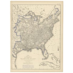
Antique Chart of the US Adult Male Illiteracy in 1870, '1874'
Located in Langweer, NL
Antique chart titled 'Map showing the illiteracy of the adult white male population. Compiled from the returns of population at the ninth census of the United States 1870'. Chart of the US adult male...
Category
Late 19th Century Antique Maps
Materials
Paper
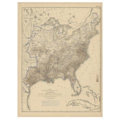
Pl. 22 Antique Chart of the US Colored Population Proportion in 1870, '1874'
Located in Langweer, NL
Antique chart titled 'Map showing the proportion of the colored to the aggregate population. Compiled from the returns of population at the ninth census of the United States, 1870'. ...
Category
Late 19th Century Antique Maps
Materials
Paper
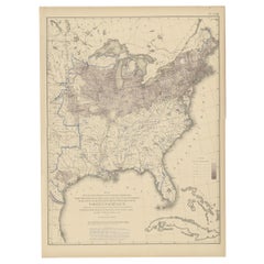
Pl. 23 Antique Chart of the US Foreign Parentage in 1870, '1874'
Located in Langweer, NL
Antique chart titled 'Map showing, in five degrees of density, the distribution, within the territory of the United States east of the 100th Meridian, of that portion of the populati...
Category
Late 19th Century Antique Maps
Materials
Paper
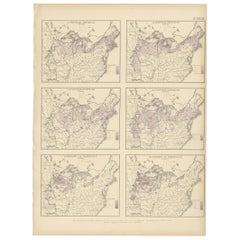
Pl. 28 Antique Chart of British American, English (..) US Population, 1874
Located in Langweer, NL
Antique chart titled 'Maps showing the distribution, within the territory of the United States, east of the 100th Meridian, of certain foreign elements of the population. I. accordin...
Category
Late 19th Century Antique Maps
Materials
Paper
Pl. 17 Antique Chart of the US Population 1850 by Walker, 1874
Located in Langweer, NL
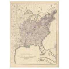
Antique chart titled 'Map showing in five degrees of density, the distribution, within the territory east of the 100th Meridian, of the population of the United States, excluding Ind...
Category
Late 19th Century Antique Maps
Materials
Paper
Pl. 7 Antique Temperature Chart of the United States by Walker, 1874
Located in Langweer, NL
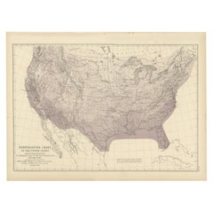
Antique chart titled 'Temperature chart of the United States. Showing the distribution by isothermal lines of the mean temperature for the year. Constructed under the direction of Pr...
Category
Late 19th Century Antique Maps
Materials
Paper
Antique Map of the British Islands to the White Sea by J. Imray
Located in Langweer, NL
Antique large nautical chart of the British Islands to the White Sea. With insets of Veshnyak Channel, Sosnovets and the Bay of Arkhangel. Published by James Irmay and Son, circa 1875.
Category
Late 19th Century Antique Maps
Materials
Paper
1918 American Frohse Anatomical Chart, A. J. Nystrom, Max Brodel Illustrator
By Max Brödel, A.J. Nystrom & Co
Located in Buffalo, NY
Antique American Frohse Anatomical pull down chart, by A. J. Nystrom, ,revised and augmented by Max Brodel illustrator... Amazing color, patina, age appropriate wear. dated 1918..
Max (Paul Heinrich) Brödel
1870-1941
Brödel, an illustrator and the first director of the Art as Applied to Medicine program at Johns Hopkins...
Category
1910s American Steampunk Vintage Maps
Materials
Wood, Paper
1912 "Panoramic View of New York City and Vicinity" by Jacob Ruppert
Located in Colorado Springs, CO
This is an attractive and very scarce map of New York, published by the Yorkville brewer Jacob Ruppert in 1912. The map shows an expansive view of the region reaching from Sandy Hook in the south and Yonkers to the north, to Hicksville in the east and past Newark to the west. This beautifully colored birds eye view shows waterways with all shipping traffic, boroughs, and clearly labeled railroad routes. It is presented on period dowels and backed on its original linen.
Jacob Ruppert was born in New York City in 1842 to Bavarian immigrants. His father owned a brewery in Manhattan where young Jacob learned the business of brewing. In 1862, Jacob established the Jacob...
Category
1910s American Vintage Maps
Materials
Paper
1896 "Territory of Arizona" Map, Published by the General Land Office
Located in Colorado Springs, CO
Presented is an attractive "Territory of Arizona” map, from the “Report of the Governor of Arizona to the Secretary of the Interior." First published in 1894, this 1896 edition was r...
Category
1890s Antique Maps
Materials
Paper
1889 Sea Chart Map of Delaware Bay by George Eldridge, Chart No. 11
Located in Colorado Springs, CO
Presented is an original Eldridge's Chart No. 11, Delaware Bay and River, from The United States Coast and George Eldridge's Surveys, published in 1889. The sea chart shows the Delaw...
Category
1880s Antique Maps
Materials
Paper
Map of Essex by Emanuel Bowen
Located in Cheshire, GB
Map of part of Essex and part of Kent, hand-coloured. Encased in an ebonized and gilded frame.
Dimensions
Height 25.5 Inches
Length 32.5 Inches
width 1 Inches.
Category
Late 19th Century British Antique Maps
Materials
Paper
Wychmere Harbor Allens Harbor Map Circa 1890
Located in Norwell, MA
Map of Harwich Mass showing Wychmere Harbor, Doane's Creek, Allens Harbor, Herring River, Pleasant Lake, Grassy Pond, Paddocks Pond, Hinkleys Pond, etc., This is an original period m...
Category
1890s North American Antique Maps
Materials
Paper
Globe Table Terrestrial Swedish
Located in BUNGAY, SUFFOLK
A Swedish 12 inch terrestrial globe, circa 1900. Measure: height 59cm
Just purchased more information to follow.
Category
1890s Swedish Baroque Revival Antique Maps
Materials
Paper
