Maps
16
to
3
9
7
16
16
16
51
34
16
9
7
6
5
4
4
2
1
1
1
1
2
13
8
2
2
1
9
7
5
3
2
11
4
4
3
3
3
1
Maps For Sale
Style: Mid-Century Modern
Style: Rococo
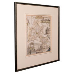
Antique County Map, Oxfordshire, English, Framed Cartography Interest, Victorian
Located in Hele, Devon, GB
This is an antique lithography map of Oxfordshire. An English, framed atlas engraving of cartographic interest, dating to the mid 19th century and later.
Superb lithography of Oxfo...
Category
Mid-19th Century British Mid-Century Modern Antique Maps
Materials
Wood
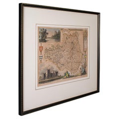
Antique Lithography Map, County Durham, English, Framed Cartography, Victorian
Located in Hele, Devon, GB
This is an antique lithography map of County Durham. An English, framed atlas engraving of cartographic interest, dating to the mid 19th century and later.
Superb lithography of Cou...
Category
Mid-19th Century British Mid-Century Modern Antique Maps
Materials
Wood
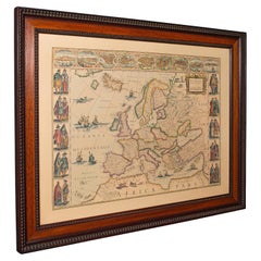
Vintage Reproduction 17th Century Map of Europe, American, Cartography, Blaeuw
Located in Hele, Devon, GB
This is a vintage reproduction map of Europe. An American, paper stock cartography print in frame after the work by Blaeuw, dating to the late 20t...
Category
Late 20th Century Central American Mid-Century Modern Maps
Materials
Glass, Wood, Paper
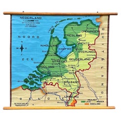
School Chart or Pull Down Map of Geography of the Netherlands, 1950s
Located in Hemiksem, VAN
A beautiful old school map of the Netherlands, painted on linen. The map shows the 3 different reliefs (low, middle, high) of the Netherlands. The beau...
Category
1950s Belgian Mid-Century Modern Vintage Maps
Materials
Linen, Paint
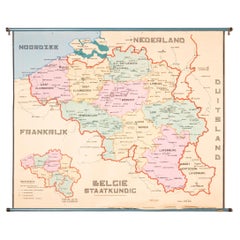
XL Old School Map of Belgium 'Printed by Procure', 1950s
Located in Oostende, BE
XL Old school map of Belgium (Printed by Procure). Presumably from around 1950-1960.
Category
1950s Belgian Mid-Century Modern Vintage Maps
Materials
Metal
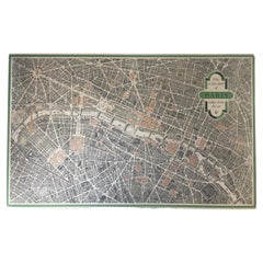
Vintage "View of the Center of Paris Taken from the Air" Lithograph Map
Located in San Diego, CA
A very stylish "View of the Center of Paris Taken from the Air" lithograph map published by the Paris Ministry of Tourism, circa early 1950s. The piece measures 27" x 43" and shows...
Category
20th Century French Mid-Century Modern Maps
Materials
Paper
Mid-Century Modern 1970s Paul McCobb Style Brass Stand Replogle Globe
Located in St. Louis, MO
Often attributed to Paul McCobb, because of the same brass tubing that McCobb used in his furniture. Circa 1970s Replogle globe is in very nice condition with raised topography and t...
Category
1970s American Mid-Century Modern Vintage Maps
Materials
Brass
Mid-Century World Map Globe Table Light or Lamp
Located in Miami, FL
Good quality world map globe lamp.
If you are looking for stylish and beautiful quality item to upgrade your interior (whether at home or in your office) then this Parisian globe...
Category
Mid-20th Century French Mid-Century Modern Maps
Materials
Chrome
Floor Model Light Up Globe by Replogle Ca. 1950/1960's
Located in New York, NY
Exceptional light up floor model globe, by Replogle Globes Inc. The globe is 16 in. in diameter, it features an interior light, and restrain a solid mahogany frame. This example is i...
Category
Mid-20th Century American Mid-Century Modern Maps
Materials
Glass, Mahogany, Paper
Vintage Framed United States Map
Located in New York, NY
Vintage aged paper map of the United States mounted on particle board and framed in a simple wooden frame.
Category
20th Century American Mid-Century Modern Maps
Materials
Wood, Paper
Large Framed Map of the Mediterranean
Located in New York, NY
Large map/chart chart of The Mediterranean and the Grecian Archipelago showing Italy, Sardinia, Corsica, part of France, etc. in a black frame.
Category
20th Century French Mid-Century Modern Maps
Table Low Sofa Vintage 1950s Map Isle of Man John Speed 1610 Thomas Durham 1595
Located in BUNGAY, SUFFOLK
- The juxtaposition of modern design and this ancient map create a unique small table and conversation piece
- This is the first map featuring the Isle of Man on its own.
- It is also the first map of the Island based on an actual survey, undertaken by Thomas Durham 1595 and was first published by Speed in 1605-1611 and reprinted many times over the next century. This is the second state or print from 1610.
The map is inset within a fruitwood box frame with a glass top. Supported by tapering stick legs.
The map is based on a survey (and presumably a MS map) by Thomas Durham, of whom nothing is known other that he was paid by Sir Thomas Gerrard to make a survey of the Island. This survey, almost certainly for military purposes, arose from the disputed possession of the Island during which time Elizabeth had assumed control in order to prevent the Scots or the Spanish from using the Island as a base.
Speed had used the Durham Map in his slightly earlier 4-sheet wall map showing invasions and battles of c1603/4 [ref: Shirley #261] - there are some differences from this 1605/10 map - Port Eran (rather than Earn on 1605);Knockalo point (= Contrary Hd) not on 1605;Spalbrecke shown west of Calf rather than E as on 1605/10. Thus it is possible that the Durham Map had even more detail than Speed used in his derived version.
In sea are four mythical beasts with riders: to NW of Island Unicorn with Scottish flag...
Category
1610s English Mid-Century Modern Antique Maps
Materials
Paper
Two Impressive and Huge Midcentury World Map Wall Globes, Austria, 1950s
Located in Vienna, AT
We proudly offer this outstanding pair of very large wall-mounted modernist globes / world maps with an incredible diameter of 95 inches each. Unique one-of-a-kind sculptures depicti...
Category
Mid-20th Century Austrian Mid-Century Modern Maps
Materials
Aluminum, Iron
World Relief Map
Located in Antwerp, BE
Large world relief map.
Measures: Width 232 cm.
Height 158 cm.
Category
Mid-20th Century German Mid-Century Modern Maps
Materials
Acrylic
1960s Canvas Wall School Chart with Sheep by Jung-Koch-Quentell
Located in Antwerp, BE
Vintage school wall chart, pull down chart with beautiful illustrated lithograph of Sheep. It shows the animal in it's natural environment as well as some anatomical details.
This P...
Category
Mid-20th Century German Mid-Century Modern Maps
Materials
Wood, Canvas, Paper
Mid-Century Illuminated Replogle World Floor Globe in Wood and Glass, Chicago
Located in Haddonfield, NJ
American 1950's back light green painted floor globe by Replogle, Mid-Century Modern.
Remarkable and charming Chicago made world globe featur...
Category
Mid-20th Century American Mid-Century Modern Maps
Materials
Steel
Related Items
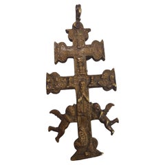
Cross of Caravaca 17th Century
Located in Madrid, ES
Cross of caravaca XVII century.
Very beautiful cross of caravaca made in bronze. 17th Century. Measurements: 14X6 cm.
Good condition.
Category
17th Century Italian Gothic Antique Maps
Materials
Bronze
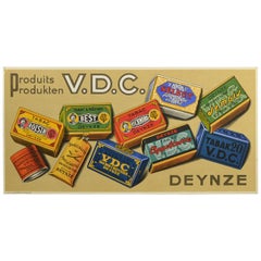
Vintage Tobacco Advertising Sign, Belgium, 1950s
Located in Antwerp, BE
1950s Advertising Sign for the Belgian Tobacco Brand VDC - Deinze.
This Litho Cardboard Sign has lots of colors due the different packages and types of tobacco flavors.
Made in Brussels - Belgium by J.De Grève and co.
This Vintage Sign can stand as a Counter Display Sign ( standing system has never been used before ) or can be hung as Wall Decoration - Wall Art
It's a New Old Stock Sign, so in very good condition. Only the left upper corner has a small trace due storage through the time.
Tobacco collectables - vintage signs - retro wall decoration...
Category
Mid-20th Century Belgian Maps
Materials
Paper
17th Century Hand-Colored Map of West Africa by Mercator/Hondius
Located in Alamo, CA
A 17th century hand-colored map entitled "Guineae Nova Descriptio" by Gerard Mercator and Jodocus Hondius, published in their 'Atlas Minor' in Amsterdam in 1635. It is focused on the...
Category
Mid-17th Century Dutch Antique Maps
Materials
Paper
Alpine Ski Photograph, 'Panoramic View', Taken from Original 1930s Photograph
Located in Oxfordshire, GB
Vintage, antique Alpine Ski photograph.
'Panoramic View', a new mounted black and white photographic image after an original 1930s skiing photograph. Black and white alpine photos are the perfect addition to any home or ski lodge, so please do check out our other ski photos...
Category
1930s English Sporting Art Vintage Maps
Materials
Paper
H 14.97 in W 20.48 in D 0.04 in
Cross of Caravaca 17th Century
Located in Madrid, ES
Cross of caravaca xvii century
Very beautiful cross of Caravaca made in bronze. 17th century. Measurements: 12 x 6cm
Good condition.
Category
17th Century Italian Gothic Antique Maps
Materials
Bronze
Alpine Mountaineering Photograph, 'CLIMBER' Taken from 1930s Original
Located in Oxfordshire, GB
Vintage Alpine Mountaineering photograph.
'CLIMBER' Simelistock, Switzerland, a new mounted black and white photographic image after an original 1930s mountaineering photograph.
...
Category
1930s English Sporting Art Vintage Maps
Materials
Paper
Cross of Caravaca 17th Century
Located in Madrid, ES
Cross of caravaca XVII century.
Very beautiful cross of caravaca made in bronze. 17th Century. Measurements: 15x6 cm.
Good condition.
Category
17th Century Italian Gothic Antique Maps
Materials
Bronze
Alpine Ski Photograph, 'THE JUMP' Taken from 1930s Original
Located in Oxfordshire, GB
Vintage, Alpine Ski photograph.
'THE JUMP', a new mounted black and white photographic image after an original 1930s skiing photograph. Prior to being a recreational activity skiing was purely a means of travelling from A to B through the snow, it only started to become the sport it is today in the mid-1800s. The price displayed is for the mounted photo only.
Image size 25.5cm x 40cm = 10 X 15 ½" ".
The alpine photograph...
Category
1930s English Sporting Art Vintage Maps
Materials
Paper
Alpine Ski Photograph, 'The Race' Taken from Original 1930s Photograph
Located in Oxfordshire, GB
Alpine Ski photograph.
'The Race', a new mounted black and white photographic image after an original 1930s photograph. Black & white alpine photos are the perfect addition to any home or ski lodge, so please do check out our other ski photos and winter landscapes. The photo is showing a biplane racing a car on a frozen lake. This amazing photograph was taken in Grainau, a small town in Bavaria, at the foot of Germany's highest mountain, the Zugspitze.
The pilot is General Ernst Udet - the World War I flying ace...
Category
1930s British Sporting Art Vintage Maps
Materials
Paper
H 20.48 in W 14.97 in D 0.04 in
XL Red Wooden Dump Truck Toy, 1950s
Located in Antwerp, BE
XL red wooden dump truck toy.
A large toy truck made of red and blue hand-painted wood.
Category
Mid-20th Century European Industrial Maps
Materials
Wood
1938 Pull Down Anatomy Chart, Denoyer-Geppert, Artist P.M. Lariviere
Located in Buffalo, NY
1938 pull down anatomy chart, Denoyer-Geppert. Artist P.M. Lariviere. KL3 circulatory system. Stunning image, screenprint on linen.
Category
1930s American Industrial Vintage Maps
Materials
Linen
New Map of North America from the Latest Discoveries, 1763
Located in Philadelphia, PA
A fine antique 18th century map of the North American seaboard.
Entitled "A New Map of North America from the Latest Discoveries 1763".
By the Cartographer/Engraver - John Spil...
Category
Mid-18th Century English Georgian Antique Maps
Materials
Paper
Previously Available Items
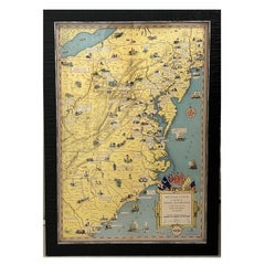
1932 "Principal Events in the Life of George Washington" Pictorial Map
Located in Colorado Springs, CO
Presented is the 1932 pictorial map of the principal events in George Washington’s life from the General Drafting Company. The map displays the eastern coastline of the United States...
Category
1930s American Mid-Century Modern Vintage Maps
Materials
Paper
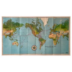
Pan American Airways 1952 World Route Map
Located in New York, NY
World Route Map published in 1952 by Pan American World Airways and printed by Jeppesen and Company, showing the worldwide destinations on six continents ser...
Category
1950s American Mid-Century Modern Vintage Maps
Materials
Paper
Vintage Strategy Chalk Teaching Globe on Stand by A.J. Nystrom Co
Located in San Diego, CA
Vintage strategy chalk teaching globe on aluminum stand by A.J. Nystrom Co., circa 1960s. The globe is in good original condition and measures 17"D x 21"H with the base of the stand ...
Category
20th Century American Mid-Century Modern Maps
Materials
Steel, Chrome
Large Vintage Half-Inch Map Folio, Great Britain, Cartography Atlas, Bartholomew
Located in Hele, Devon, GB
This is a large vintage half-inch map folio of Great Britain. A Scottish, paper on linen bound compendium of cartographical interest by Bartholomew of Edinburgh, dating to the mid 20th century, circa 1965.
Of great interest to the collector of maps, covering Great Britain in the mid 20th century in fine detail
Displaying a desirable aged patina and in good archival order
Professionally bound in a British made Twinlock Loose Leaf folio
Each map in fine condition, fully legible and free of loss
Comprehensive coverage of England, Wales and Scotland (and Scottish Isles)
In full colour and detail across half inch scale, each sheet detailing regions or counties
Annotated for places, major roads and amenities/attractions
Scale and key detail to each page provides relevant information
Whilst several sheets are undated, two maps are reprinted from OS detail in 1962 and 1963
Earlier maps feature the Royal warrant for King George V (1910 - 1935)
Coverage of the Shetland Isles bears their former name Zetland, the change taking place in 1975
Imprint to lower edge for John Bartholomew & Son Ltd, Edinburgh
This is a fascinating large vintage map...
Category
1960s British Mid-Century Modern Vintage Maps
Materials
Linen, Paper
H 2.17 in W 19.3 in D 23.63 in
20th Century Lapis Lazuli Earth Globe, Marquetry in Precious Stones
Located in Valladolid, ES
Amazing Large handmade earth globe with lapis lazuli background and marquetry with semi-precious stones, they are applied following the jewelry technique called "Pietre dure", carefu...
Category
1980s French Mid-Century Modern Vintage Maps
Materials
Bronze
Mid-Century Illuminated Replogle World Floor Globe in Wood and Glass, Chicago
Located in Haddonfield, NJ
American 1950's back light green painted floor globe by Replogle, Mid-Century Modern.
Remarkable and charming Chicago made world globe featur...
Category
Mid-20th Century American Mid-Century Modern Maps
Materials
Steel
Large Mid-Century Bookends World Globe Earth Desk Accessories
Located in Mombuey, Zamora
Pair of mid-century world globe bookends.
They globes are two pieces of timeless design ideal for a very masculine and sophisticated environment.
These pieces are ideal to place ...
Category
Mid-20th Century Italian Mid-Century Modern Maps
Materials
Wood
Mid-Century Modern Desktop Scholastic World Globe on Brass Stand
Located in San Jose, CA
Vintage desk or tabletop globe map with stand in brass by Scholastic. This piece rotates on a full swing meridian and displays plenty of vintage charm. The p...
Category
1960s Mid-Century Modern Vintage Maps
Materials
Brass
Mid-Century Modern 1970s Paul McCobb Style Brass Stand Replogle Globe
By Paul McCobb
Located in St. Louis, MO
Often attributed to Paul McCobb, because of the same brass tubing that McCobb used in his furniture.
This 1970s Replogle globe is in very nice condition with raised topography and ...
Category
1970s American Mid-Century Modern Vintage Maps
Materials
Brass
1970s United Airlines Airport / Travel Agent Thermo-Plastic Sign, 3-Dimensional
By united airlines
Located in Buffalo, NY
1970s United Airlines Airport / Travel Agent Thermo-plastic sign (BLOW MOLD). Amazing 3-dimensional graphics depicting popular tourist travel destinati...
Category
1970s American Mid-Century Modern Vintage Maps
Materials
Plastic
H 29 in W 42 in D 2 in
Large French 1950s Paris Metro Map Under Glass with Custom Made Iron Frame
Located in Atlanta, GA
A large French framed map of the Parisian Metro from the mid-20th century, with custom iron frame. Featuring a Paris metro map from the midcentury peri...
Category
Mid-20th Century French Mid-Century Modern Maps
Materials
Iron
Extra Large Midcentury School Map of Mexico by Haack Painke Kooyman
Located in Mexico City, CDMX
We offer this extra large midcentury school map of Mexico by Haack Painke Kooyman, circa 1960. This vintage item remains fully functional, but it shows si...
Category
1960s German Mid-Century Modern Vintage Maps
Materials
Canvas
Recently Viewed
View AllMore Ways To Browse
Antique Sailing Map
Antique Sailing Maps
Bay Area Antique Furniture
West Coat Of Arms
Greek Asia Minor
Hemisphere World Map
Speed Map
Antique Maps Canada
Antique Map Canada
Canada Antique Map
Malaysian Antique
West Indies Map
Blaeu World Map
Charing Cross
Antique Maps Of Canada
Bali Map
Antique Portuguese Plates
Map Of Brazil
