Items Similar to Ancient Cartography of Britannia and Hibernia, Published in 1880

Want more images or videos?
Request additional images or videos from the seller
1 of 8
Ancient Cartography of Britannia and Hibernia, Published in 1880
$354.19
$442.7420% Off
£261.11
£326.3820% Off
€296
€37020% Off
CA$490.06
CA$612.5820% Off
A$531.74
A$664.6820% Off
CHF 282.08
CHF 352.6020% Off
MX$6,529.77
MX$8,162.2120% Off
NOK 3,488.41
NOK 4,360.5120% Off
SEK 3,303.52
SEK 4,129.4020% Off
DKK 2,253.71
DKK 2,817.1320% Off
About the Item
This map depicts the geographical area of Great Britain and Ireland, labeled "BRITANNIA et HIBERNIA." It is a historical map, as indicated by the Latin titles and the classical names of regions and tribes.
In the main section of the map, Great Britain is depicted in fine detail, with topographical features such as mountains and rivers. The map is color-coded, to differentiate political or tribal boundaries. Various Roman place names are indicated, such as "Londinium" for London.
To the left of Great Britain is Ireland, referred to as "Hibernia," similarly detailed with its own topographical features and ancient place names.
In the top right corner, there are three smaller inset maps:
1. "Orchades Ins.," which refers to the Orkney Islands.
2. "BRITANNIA PTOLEMAEI," which represents the British Isles according to Ptolemy's geography.
3. "BRITANNIA STRABONIS," showing the geographical perspective of the British Isles by Strabo, another ancient geographer.
At the bottom left, there is an illustration labeled "HADRIANI MVRVS," which represents Hadrian's Wall, the Roman defensive fortification in Northern Britain.
The text and inscriptions are in Latin, and the map has a grid overlay, suggesting it was meant for scholarly or educational use. The map’s detailed portrayal of ancient geographic knowledge indicates it was produced for a historical atlas, to illustrate the geographical understanding of the British Isles in ancient Roman times.
The map is from "Spruner-Menke Atlas Antiquus," which is a historical atlas compiled by Karl Spruner von Merz and edited by Theodorus Menke. This particular map, illustrating ancient Britain and Ireland (Britannia et Hibernia), is part of the series of maps found in this atlas, known for detailing the historical geography of different periods.
The atlas itself is a collection of maps that often includes supplementary information such as important historical notes, names of regions in Latin, and depictions of topographical features. These maps were used as educational tools and references for scholars interested in historical and classical studies.
Given the style and detail of the map, as well as the labeling in Latin, it is from a 19th-century edition of the atlas, which sought to present the classical and medieval geography of the world as understood at the time.
- Dimensions:Height: 18.51 in (47 cm)Width: 15.56 in (39.5 cm)Depth: 0 in (0.02 mm)
- Materials and Techniques:
- Period:
- Date of Manufacture:1880
- Condition:Good, given age. General age-related toning, especially around the edges. Horizontall folding line as issued. Please study scan carefully.
- Seller Location:Langweer, NL
- Reference Number:Seller: BG-13686-2-21stDibs: LU3054338536612
About the Seller
5.0
Recognized Seller
These prestigious sellers are industry leaders and represent the highest echelon for item quality and design.
Platinum Seller
Premium sellers with a 4.7+ rating and 24-hour response times
Established in 2009
1stDibs seller since 2017
2,626 sales on 1stDibs
Typical response time: <1 hour
- ShippingRetrieving quote...Shipping from: Langweer, Netherlands
- Return Policy
Authenticity Guarantee
In the unlikely event there’s an issue with an item’s authenticity, contact us within 1 year for a full refund. DetailsMoney-Back Guarantee
If your item is not as described, is damaged in transit, or does not arrive, contact us within 7 days for a full refund. Details24-Hour Cancellation
You have a 24-hour grace period in which to reconsider your purchase, with no questions asked.Vetted Professional Sellers
Our world-class sellers must adhere to strict standards for service and quality, maintaining the integrity of our listings.Price-Match Guarantee
If you find that a seller listed the same item for a lower price elsewhere, we’ll match it.Trusted Global Delivery
Our best-in-class carrier network provides specialized shipping options worldwide, including custom delivery.More From This Seller
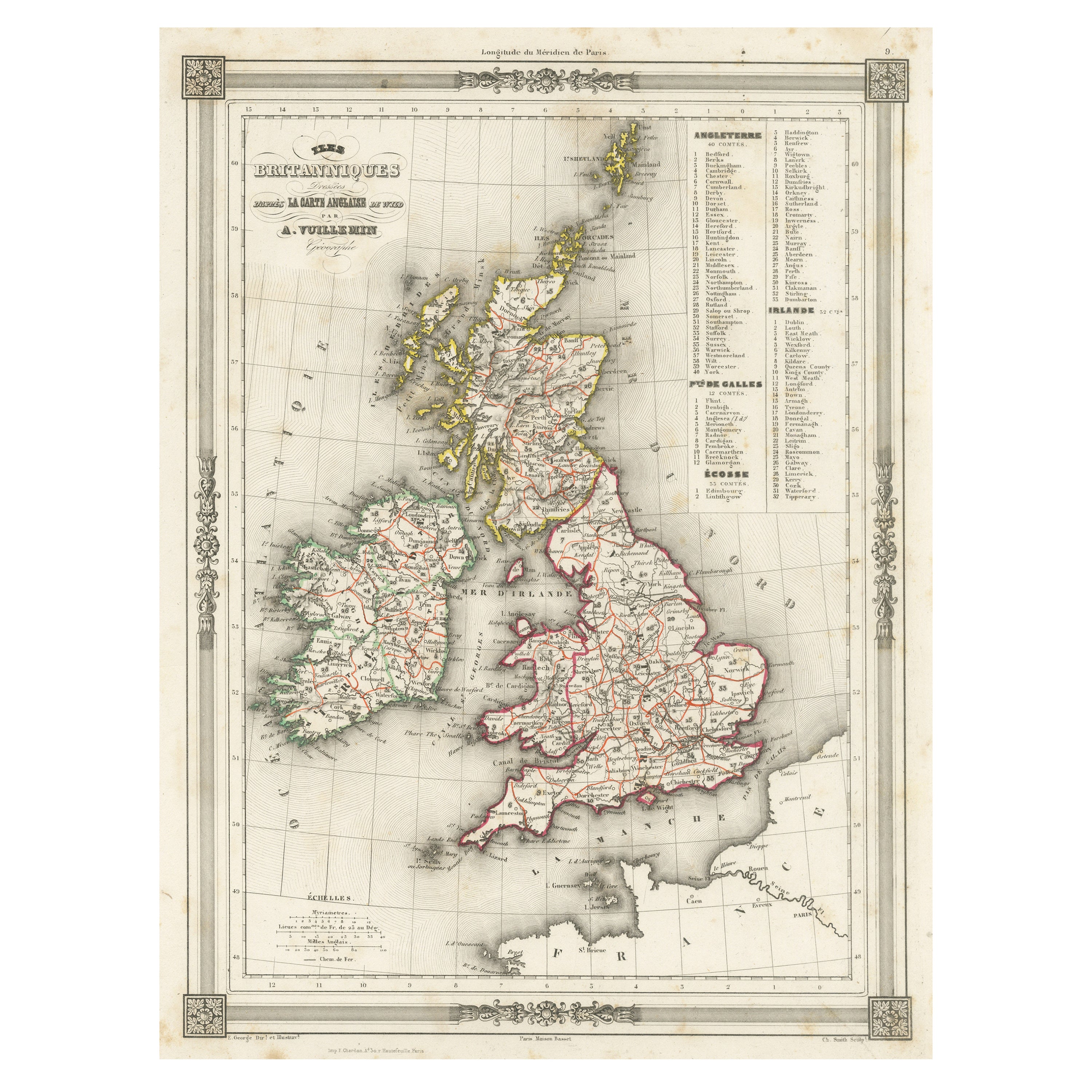
View AllOriginal Antique Map of the United Kingdom and Ireland, Published in 1875
Located in Langweer, NL
Antique map titled 'Iles Britanniques ou Royaume-Uni de la Grande Bretagne (..)'. Large map of the United Kingdom and Ireland. This map originates from...
Category
Antique Late 19th Century French Maps
Materials
Paper

$293 Sale Price
30% Off
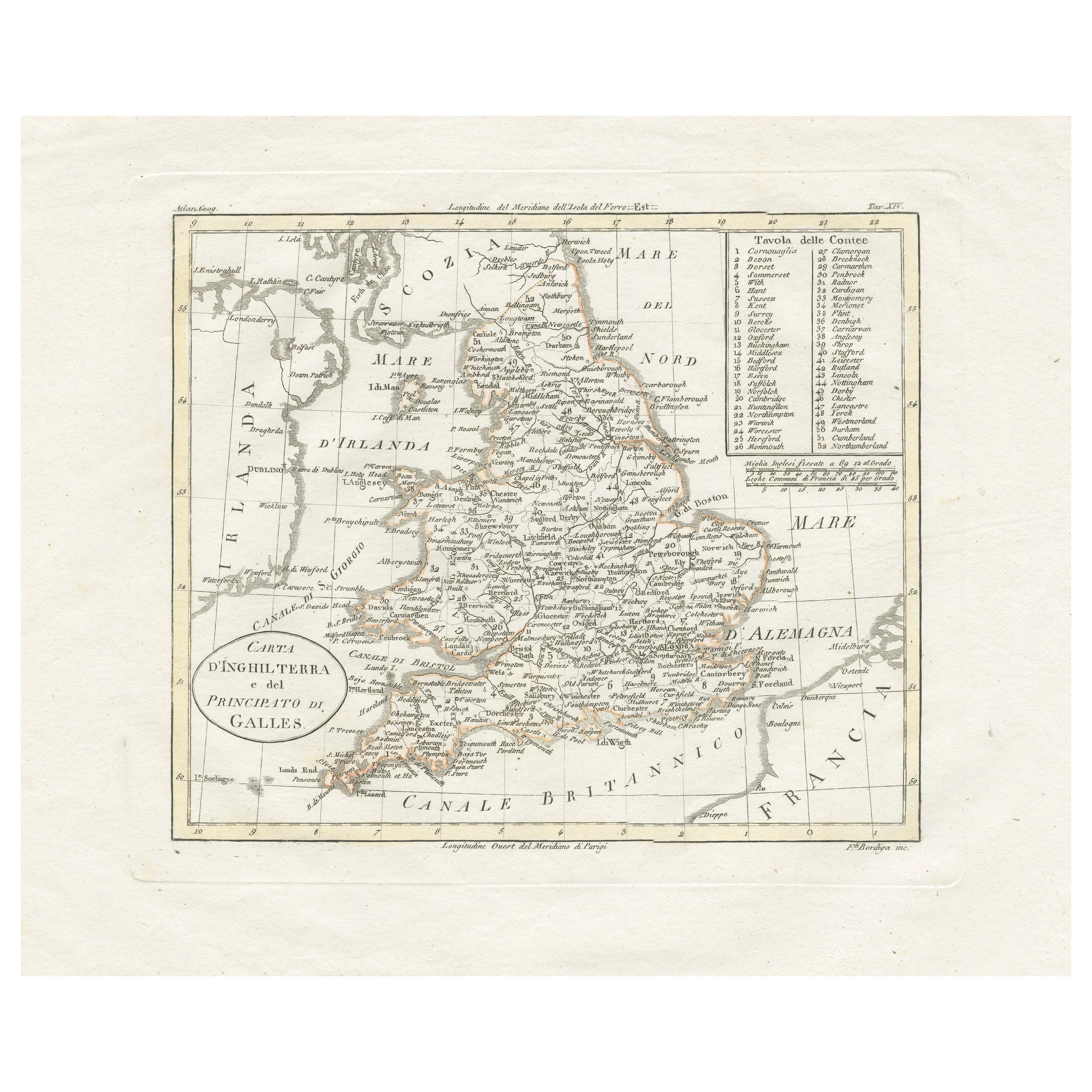
Detailed Antique Map of Britain, Wales and the Coast of Ireland
Located in Langweer, NL
Antique map titled 'Carta d'Inghilterra e del Principato di Galles'. Detailed map of Britain, Wales and the coast of Ireland with a list of counties. This map originates from 'Nuovo ...
Category
Antique Mid-19th Century Maps
Materials
Paper

$248 Sale Price
20% Off
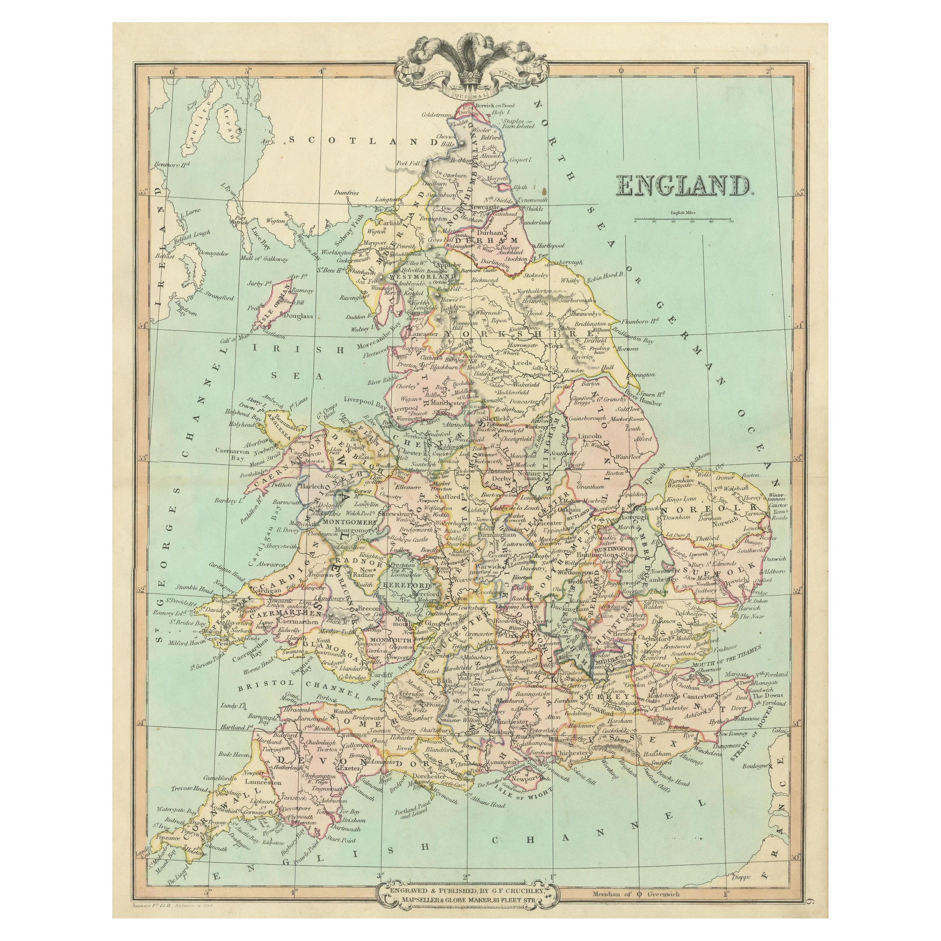
Antique Map of England and Wales, Also Including the Isle of Man
Located in Langweer, NL
Antique map titled 'England'. Original antique map of England and Wales from Northumberland to Cornwall from the St. George Channel east as far as the Strait of Dover. The Isle of Ma...
Category
Antique Mid-19th Century Maps
Materials
Paper

$373 Sale Price
20% Off
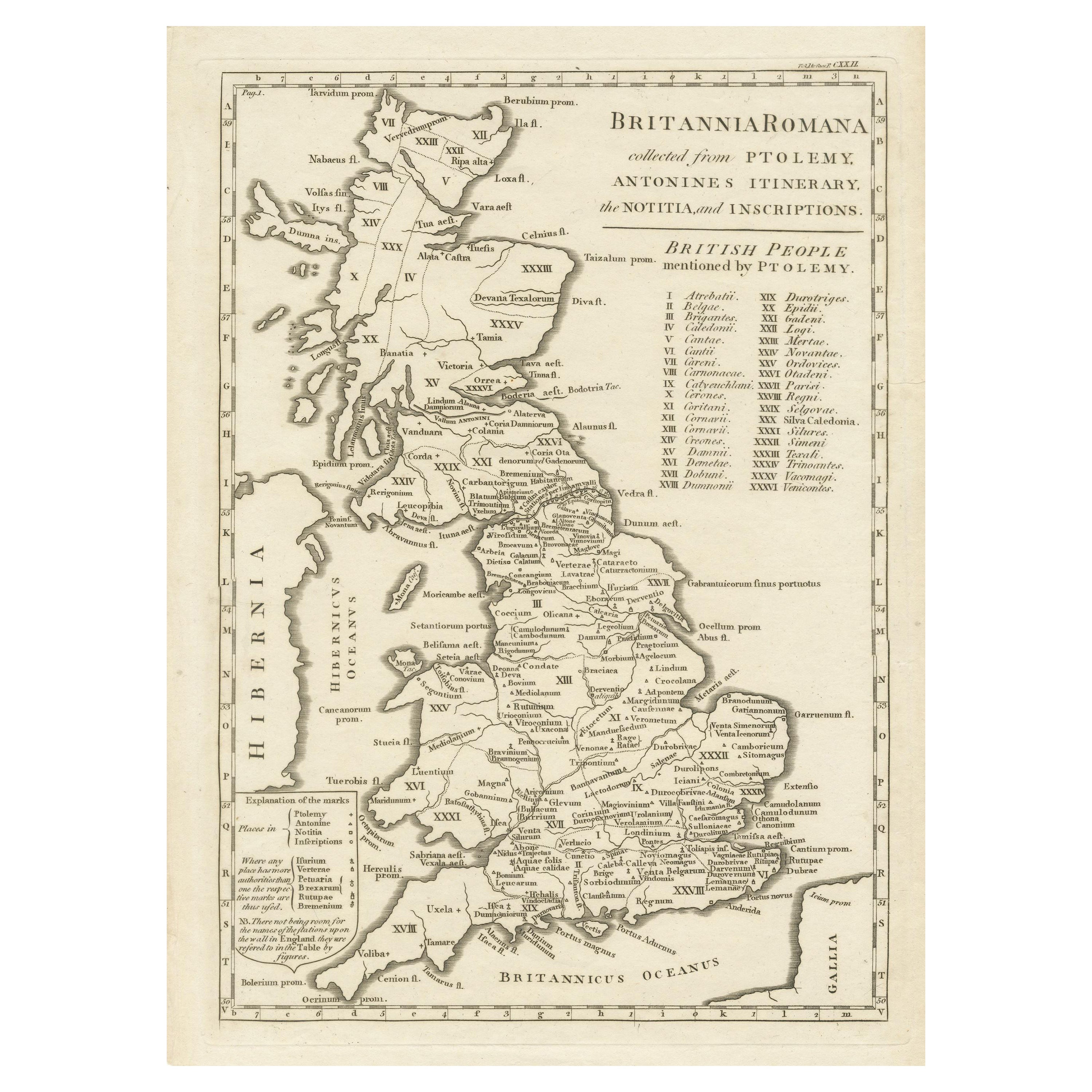
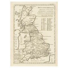
Antique Map of Britain in Roman Times
Located in Langweer, NL
Antique map titled 'Britannia Romana collected from Ptolemy (..)'. Map of Britain in Roman times drawn from several sources, including the works of Ptolemy and The Itinerary of the E...
Category
Antique Early 19th Century Maps
Materials
Paper
$469 Sale Price
20% Off
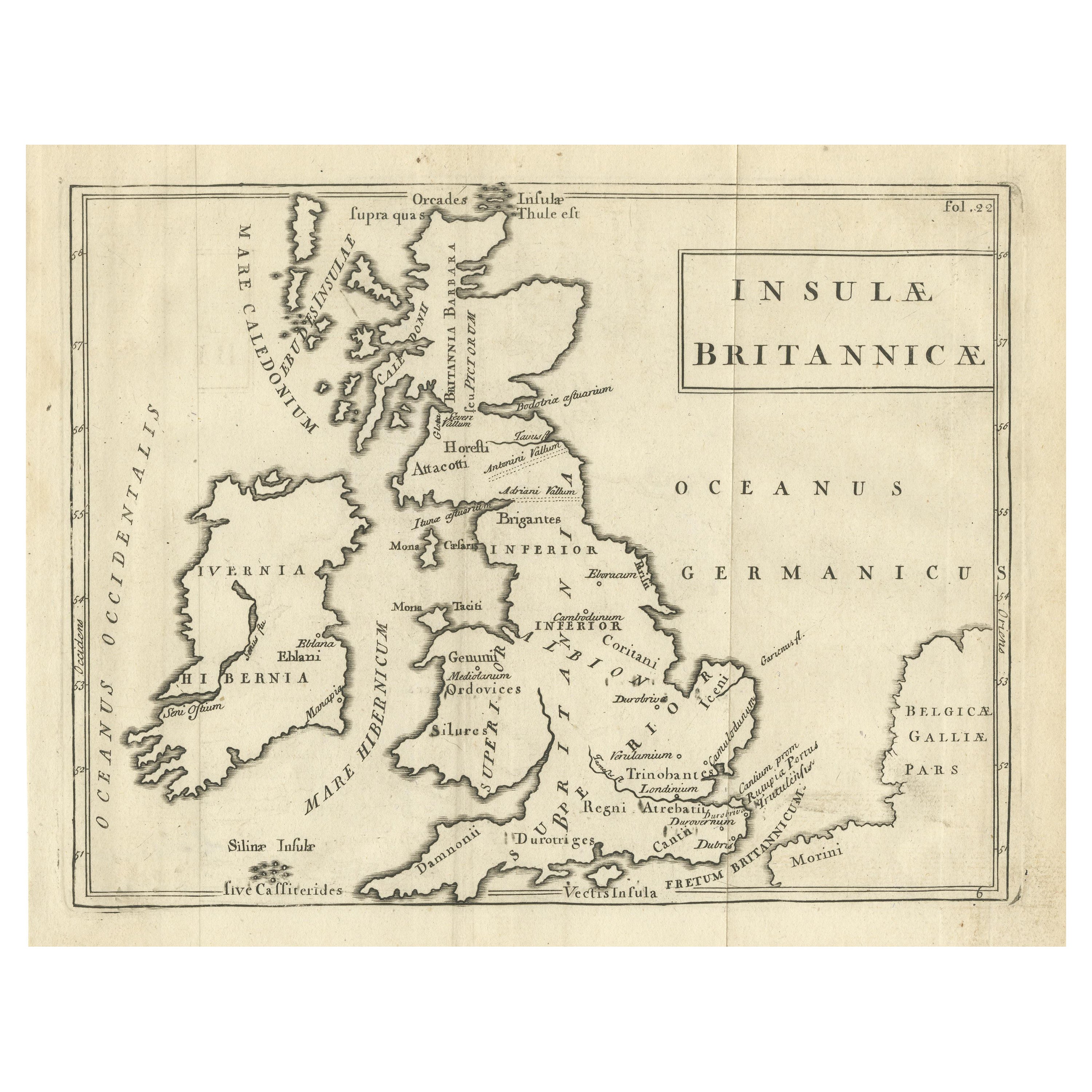
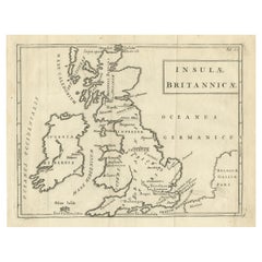
Antique Map of the British Isles with Walls, Settlements and Other Features
Located in Langweer, NL
Antique map titled 'Insulae Britannicae'. Interesting map of Britain, Scotland, and Ireland. It shows a rudimentary outline of the islands according to the geography of the Roman Emp...
Category
Antique Late 18th Century Maps
Materials
Paper
$210 Sale Price
20% Off
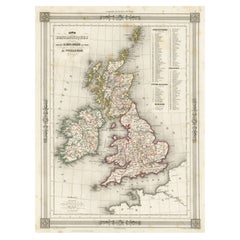
Antique Map of the British Isles with Outline Coloring
Located in Langweer, NL
Antique map titled 'Iles Britanniques'. Attractive map of the British Isles. Details England, Scotland and Ireland as well as parts of neighboring France. Upper right corner features...
Category
Antique Mid-19th Century Maps
Materials
Paper
$105 Sale Price
20% Off
You May Also Like
England and Wales, Northern Part. Century Atlas antique vintage map
Located in Melbourne, Victoria
'The Century Atlas. England and Wales, Northern Part'
Original antique map, 1903.
Central fold as issued. Map name and number printed on the reverse corners.
Sheet 29.5cm by 40cm.
Category
Early 20th Century Victorian More Prints
Materials
Lithograph

Large Original Vintage Map of the United Kingdom, circa 1920
Located in St Annes, Lancashire
Great map of The United Kingdom
Unframed
Original color
By John Bartholomew and Co. Edinburgh Geographical Institute
Published, circa 1920
Free shipping.
Category
Vintage 1920s British Maps
Materials
Paper

Original Antique English County Map, Nottinghamshire, J & C Walker, 1851
Located in St Annes, Lancashire
Great map of Nottinghamshire
Original colour
By J & C Walker
Published by Longman, Rees, Orme, Brown & Co. 1851
Unframed.
Category
Antique 1850s English Other Maps
Materials
Paper

Original Antique English County Map, Derbyshire, J & C Walker, 1851
Located in St Annes, Lancashire
Great map of Derbyshire
Original colour
By J & C Walker
Published by Longman, Rees, Orme, Brown & Co. 1851
Unframed.
Category
Antique 1850s English Other Maps
Materials
Paper

Original Antique English County Map, Rutland, J & C Walker, 1851
Located in St Annes, Lancashire
Great map of Rutland
Original colour
By J & C Walker
Published by Longman, Rees, Orme, Brown & Co. 1851
Unframed.
Category
Antique 1850s English Other Maps
Materials
Paper

Old Horizontal Map of England
By Tasso
Located in Alessandria, Piemonte
ST/520 - Old rare Italian map of England, dated 1826-1827 - by Girolamo Tasso, editor in Venise, for the atlas of M.r Le-Sage.
Category
Antique Early 19th Century Italian Other Prints
Materials
Paper

More Ways To Browse
19th Century Round Dining Table
Carved Chinese Tables
Mid Century Modern Danish Teak Dining Tables
Long Rug Runners
Pair Arm Chairs
Sterling Silver Dinner Sets
United Chair Company
British Antiques
Italian Beech Chairs
Shirvan Rugs
Spain Marble
Vintage Brown Bottles
Vintage Danish Tables And Chairs
1960s Glass Top Coffee Table
Black Glass Coffee Tables
Burnt Wood
Mid Century Wrought Iron Chairs
Earth Toned Rug