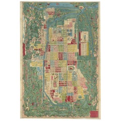
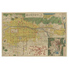
Antique Japanese Map of Kyoto, 1870
View Similar Items


Want more images or videos?
Request additional images or videos from the seller
1 of 5
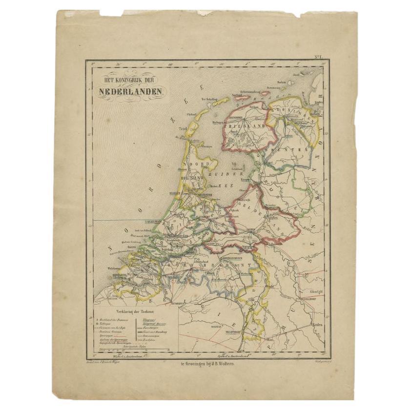
Antique Japanese Map of Kyoto, 1870
About the Item
- Dimensions:Height: 27.96 in (71 cm)Width: 19.1 in (48.5 cm)Depth: 0.02 in (0.5 mm)
- Period:
- Date of Manufacture:1870
- Condition:Professionaly restored, mounted on paper. Please study images carefully.
- Seller Location:Langweer, NL
- Reference Number:Seller: BG-116231stDibs: LU3054313702671
About the Seller
5.0
Recognized Seller
These prestigious sellers are industry leaders and represent the highest echelon for item quality and design.
Gold Seller
Premium sellers maintaining a 4.3+ rating and 24-hour response times
Established in 2009
1stDibs seller since 2017
2,467 sales on 1stDibs
Typical response time: 1 hour
Authenticity Guarantee
In the unlikely event there’s an issue with an item’s authenticity, contact us within 1 year for a full refund. DetailsMoney-Back Guarantee
If your item is not as described, is damaged in transit, or does not arrive, contact us within 7 days for a full refund. Details24-Hour Cancellation
You have a 24-hour grace period in which to reconsider your purchase, with no questions asked.Vetted Professional Sellers
Our world-class sellers must adhere to strict standards for service and quality, maintaining the integrity of our listings.Price-Match Guarantee
If you find that a seller listed the same item for a lower price elsewhere, we’ll match it.Trusted Global Delivery
Our best-in-class carrier network provides specialized shipping options worldwide, including custom delivery.More From This Seller
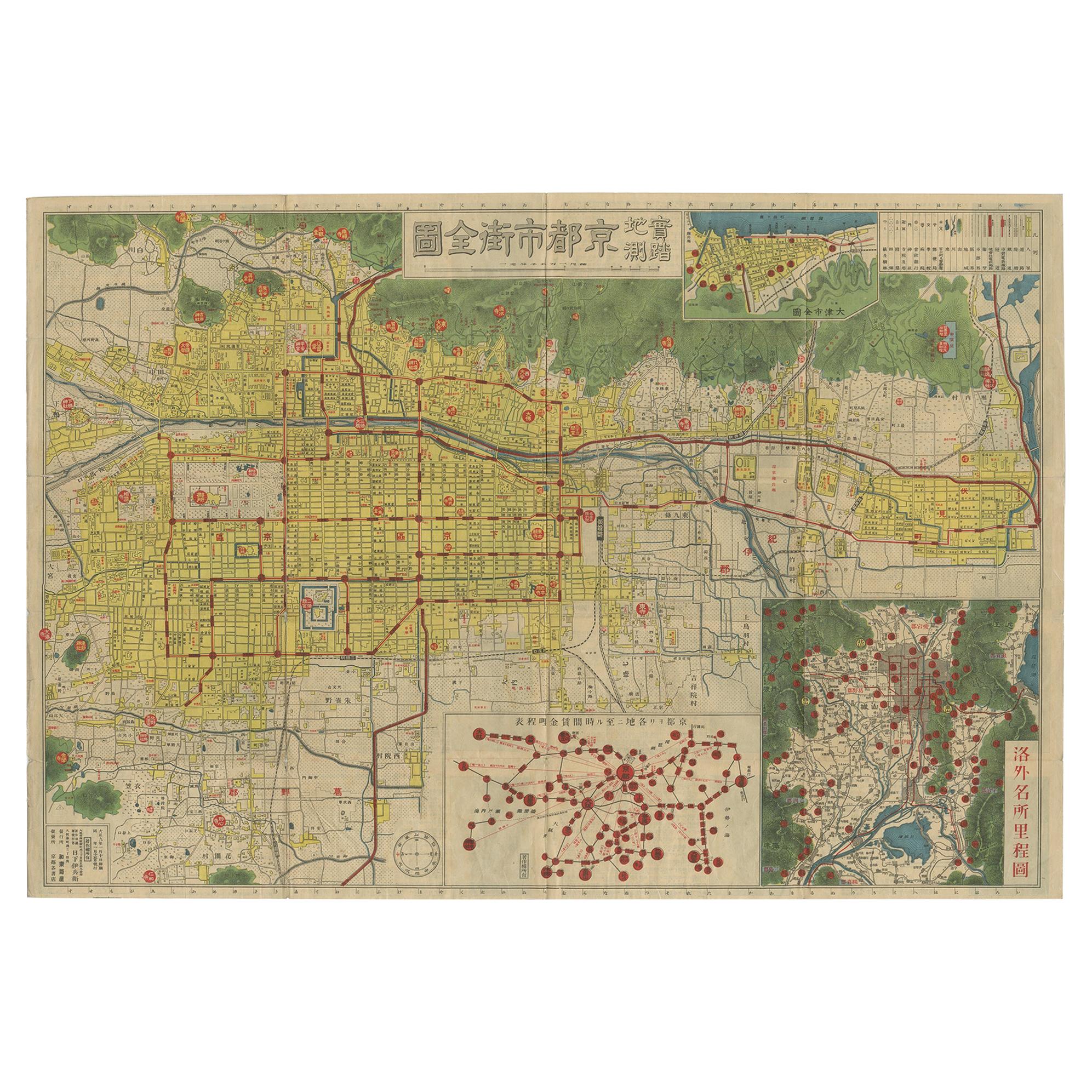
View AllAntique Folding Map of Kyoto, Japan, 1920
Located in Langweer, NL
Antique folding map of Kyoto, Japan. On the verso of this map photos of buildings, other structures and informative text can be found.
Category
20th Century Maps
Materials
Paper
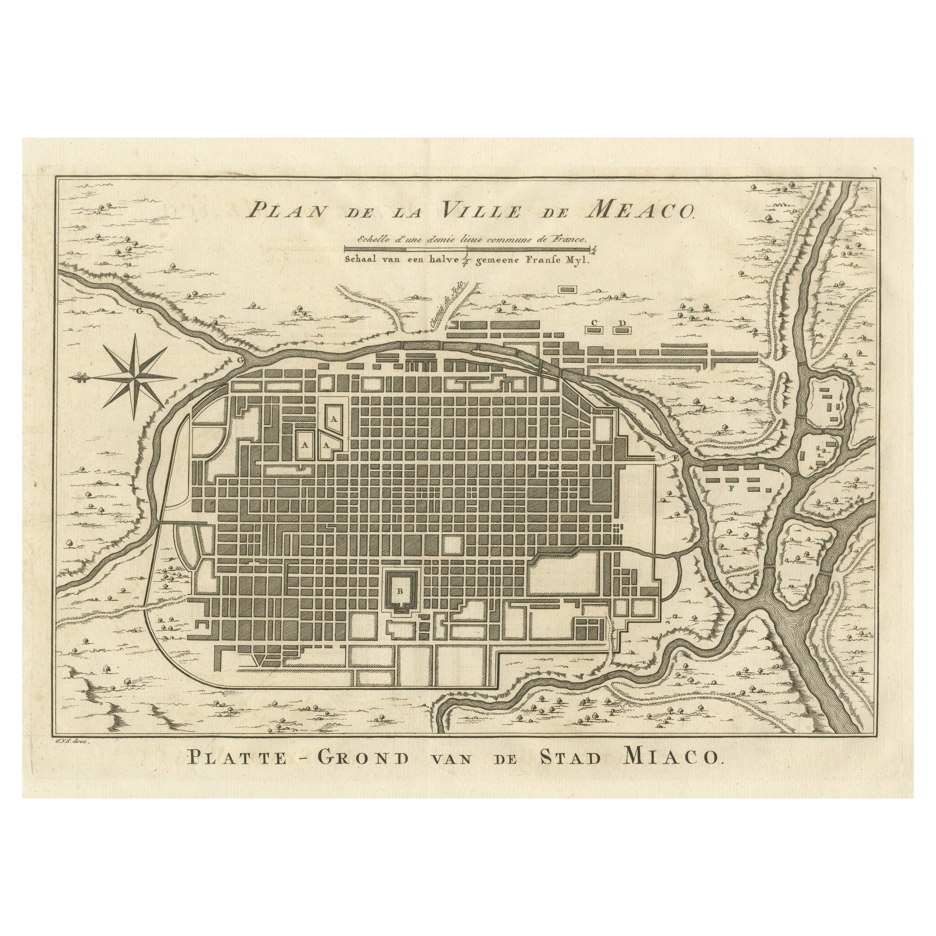
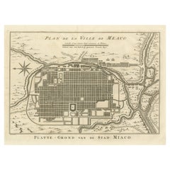
Antique Plan of Meaco, Kyoto, Japan
Located in Langweer, NL
Antique map titled 'Plan de la Ville de Meaco - Platte-Grond van de Stad Miaco'. Detailed and unusual antique copper engraved plan of Kyoto, ancient named Meaco, when it was the capi...
Category
Antique Mid-18th Century Maps
Materials
Paper
$357 Sale Price
20% Off
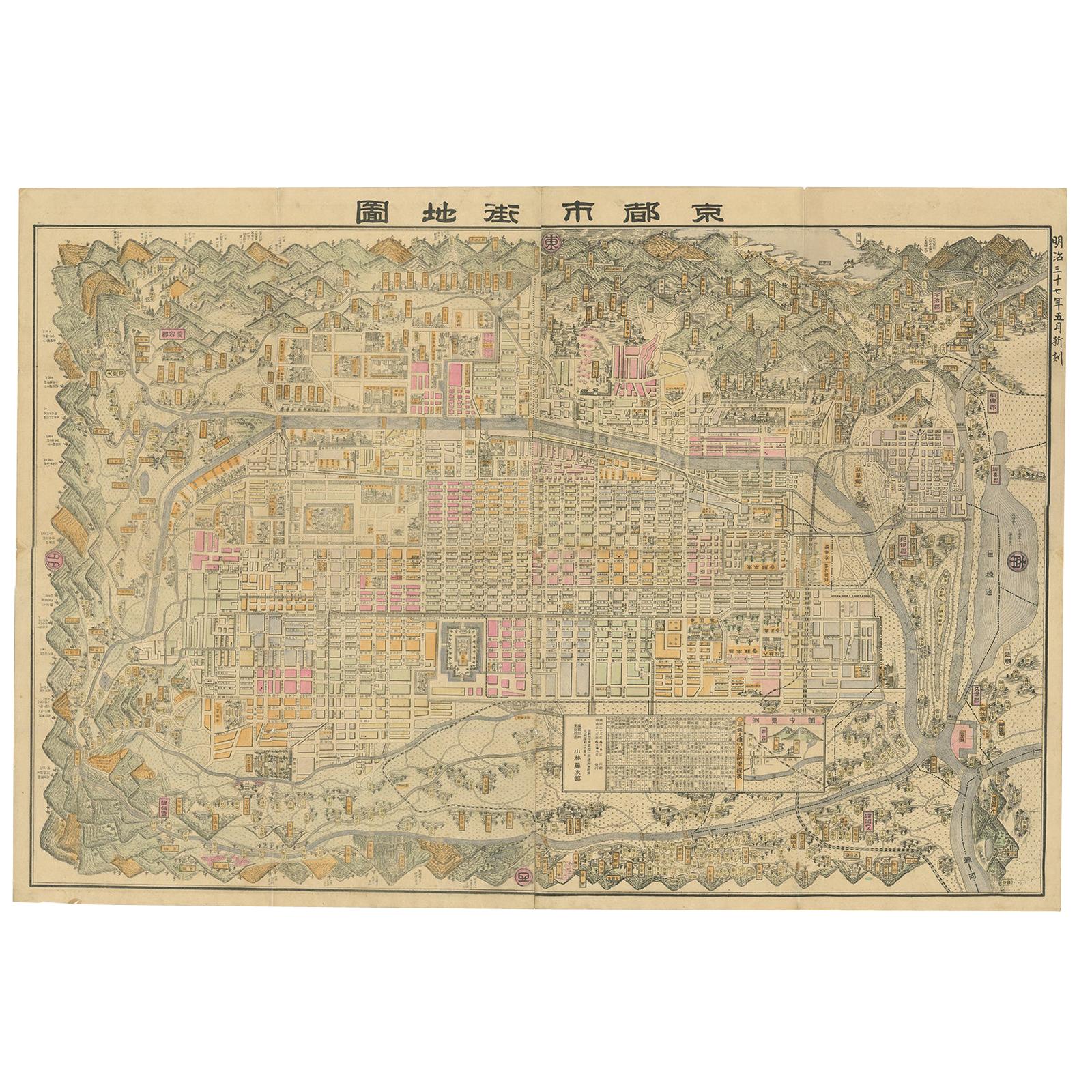
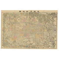
Historical Large Map of Kyoto, Japan (1905) - Published by Kobayashi
Located in Langweer, NL
Old map of Kyoto, Japan. Published by Kobayashi, 1905.
This is an old map of Kyoto, Japan, published by Kobayashi in 1905. The map showcases a detailed layout of Kyoto during the ea...
Category
Early 20th Century Maps
Materials
Paper
$1,645 Sale Price
20% Off
Free Shipping
Antique Map of Africa by A & C, Black, 1870
Located in Langweer, NL
Antique map titled 'Africa'. Original antique map of Africa. This map originates from ‘Black's General Atlas of The World’. Published by A & C. Black, 1870.
Category
Antique Late 19th Century Maps
Materials
Paper

$258 Sale Price
20% Off
Antique Map of Asia by A & C, Black, 1870
Located in Langweer, NL
Antique map titled 'Asia'. Original antique map of Asia. This map originates from ‘Black's General Atlas of The World’. Published by A & C. Black, 1870.
Category
Antique Late 19th Century Maps
Materials
Paper

$235 Sale Price
20% Off
Antique Map of Switzerland by A & C. Black, 1870
Located in Langweer, NL
Antique map titled 'Switzerland'. Original antique map of Switzerland. This map originates from ‘Black's General Atlas of The World’. Published by A & C. Black, 1870.
Category
Antique Late 19th Century Maps
Materials
Paper

$164 Sale Price
20% Off
You May Also Like
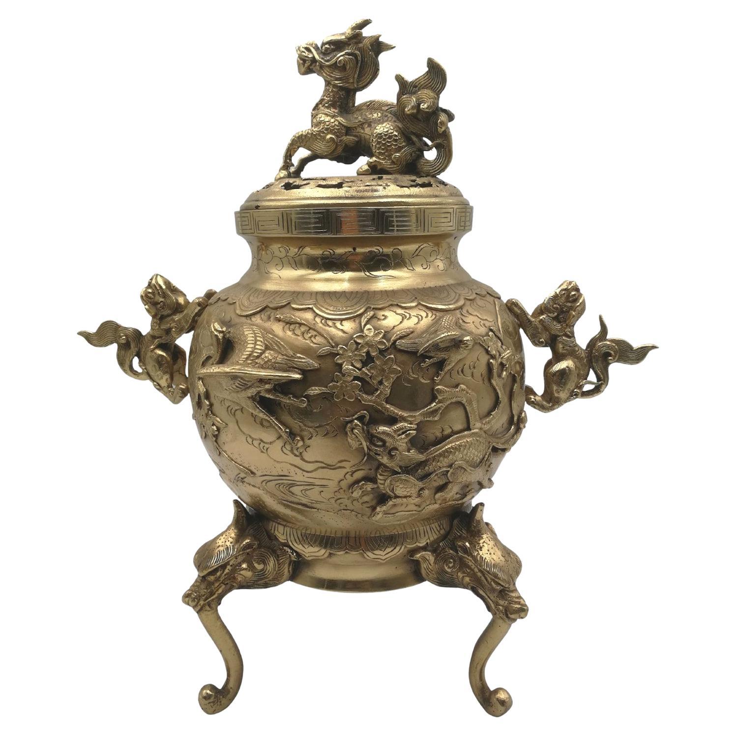
Japanese bronze Koro
Located in Beuzevillette, FR
Impressive handmade large and powerfully cast Japanese tripod bronze censer of the 19th century, made during the Meiji period and with mythical animals...
Category
Antique 19th Century Japanese Antiquities
Materials
Brass
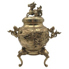
$3,055
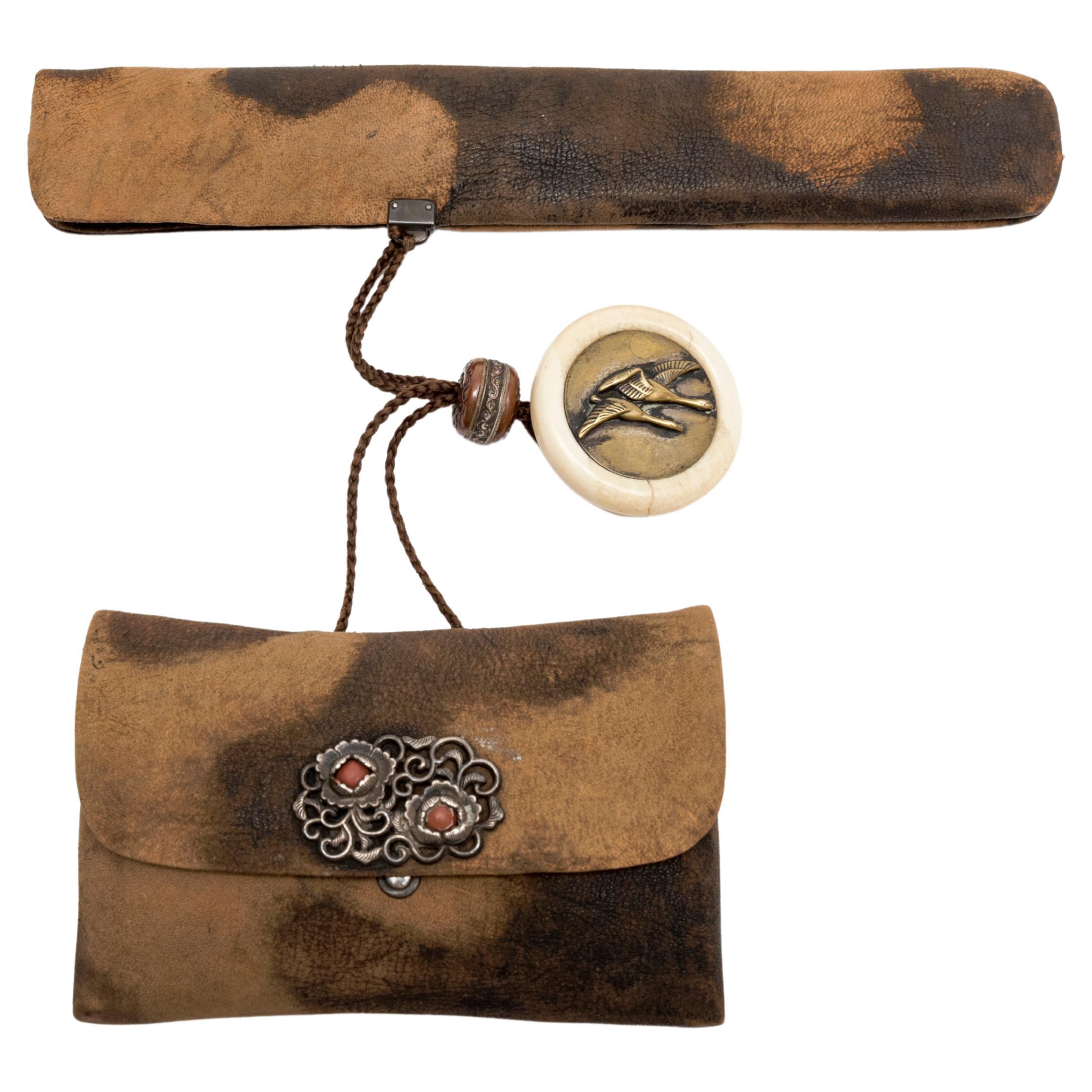
Japanese Smoking Set 'Tabac-Ire'
Located in PARIS, FR
Smoking set (tabako-ire) composed of a pipe (kiseru), a pipe case (kiseruzutsu) and a tabacco pouch (tonkotsu) for women linked to a netsuke.
Intended f...
Category
Antique Late 19th Century Japanese Antiquities
Materials
Metal

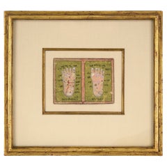
Antique Illustration of the Feet of Lord Rama, 'Sri Ram Prada Yatra'
Located in Soquel, CA
Finely detailed illustration of the feet of Lord Rama. The feet are labeled with illustrative symbols, including a lotus flower, shells, and crescent moons. There are a total of 17 s...
Category
Antique 19th Century Indian Other Religious Items
Materials
Gold Leaf
Original Antique Decorative Map of Iceland & Faroe, Fullarton, C.1870
Located in St Annes, Lancashire
Great map of Iceland and The Faroe Islands
Wonderful figural border
From the celebrated Royal Illustrated Atlas
Lithograph. Original color.
Published by Fullarton, Edinb...
Category
Antique 1870s Scottish Maps
Materials
Paper

Large Original Antique Map of The World, Fullarton, C.1870
Located in St Annes, Lancashire
Great map of the World. Showing both hemispheres
From the celebrated Royal Illustrated Atlas
Lithograph. Original color.
Published by Fullarton, Edinburgh, C.1870
Unframed.
Rep...
Category
Antique 1870s Scottish Maps
Materials
Paper

Large Original Antique Map of The Pacific Ocean, Fullarton, C.1870
Located in St Annes, Lancashire
Great map of The Pacific Ocean
From the celebrated Royal Illustrated Atlas
Lithograph by Swanston. Original color.
Published by Fullarton,...
Category
Antique 1870s Scottish Maps
Materials
Paper

Recently Viewed
View AllMore Ways To Browse
Antique Map Nova Scotia
Antique Map Of Cuba
Map Ukraine
Scan Globe
Antique Furniture Trinidad
Antique Manitoba
Antique Map Of Michigan
Antique Maps Of Maryland
Cham Antiques
Map Of Native American Tribes
Antique Map Of Brooklyn
Cornwall Map
Shepherd And Hedger
Vignola Furniture
Antique Alabama Map
Antique Furniture Halifax Furniture
Antique Kiel Furniture
Antique Map New Orleans