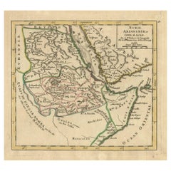
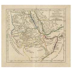
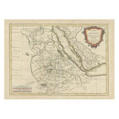
Antique Map of Abyssinia, Sudan and the Red Sea by Vaugondy, 1750
View Similar Items


Want more images or videos?
Request additional images or videos from the seller
1 of 6
Antique Map of Abyssinia, Sudan and the Red Sea by Vaugondy, 1750
About the Item
- Dimensions:Height: 9.45 in (24 cm)Width: 13 in (33 cm)Depth: 0 in (0.01 mm)
- Materials and Techniques:
- Period:
- Date of Manufacture:1750
- Condition:
- Seller Location:Langweer, NL
- Reference Number:Seller: BL-000151stDibs: LU3054325991752
About the Seller
5.0
Platinum Seller
These expertly vetted sellers are 1stDibs' most experienced sellers and are rated highest by our customers.
Established in 2009
1stDibs seller since 2017
1,940 sales on 1stDibs
More From This SellerView All
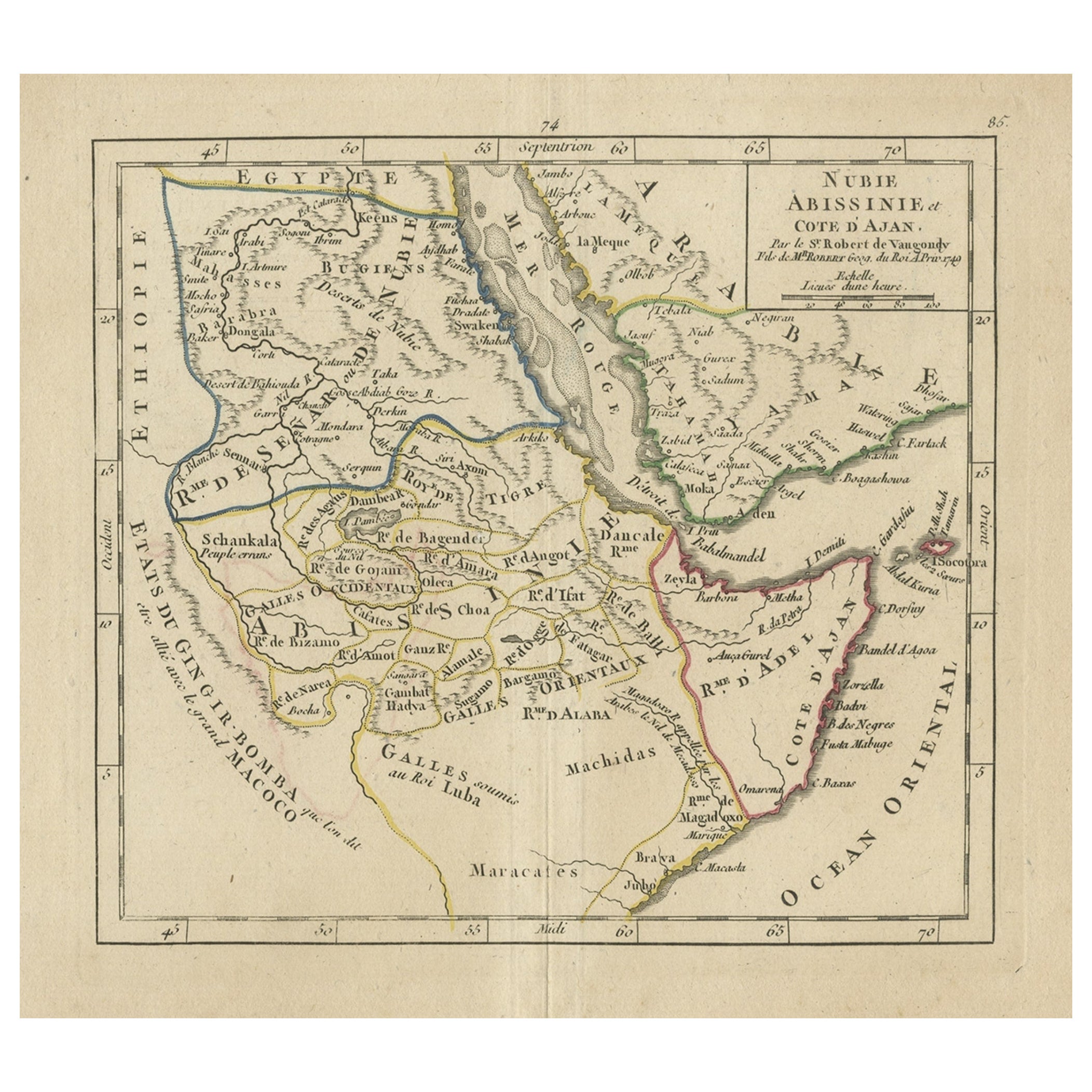
- Original Antique Map of Abyssinia, Sudan and the Red Sea, 1749Located in Langweer, NLAntique map titled 'Nubie, Abissinie et Cote d'Ajan'. Map of Abyssinia, Sudan and the Red Sea by Robert Vaugondy. Covers from Arabia and Egypt south to Mogadishu and includes parts...Category
Antique 1740s Maps
MaterialsPaper
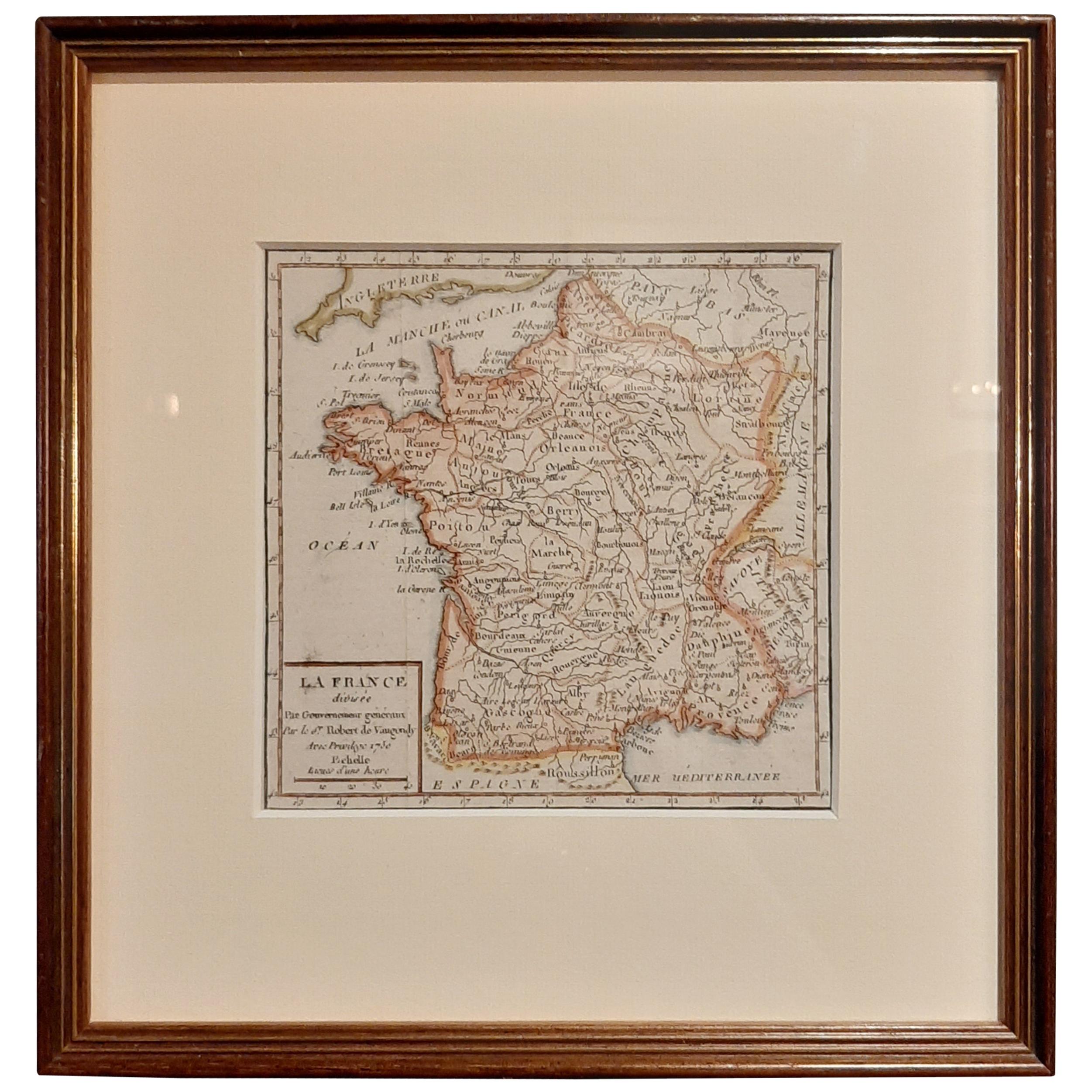
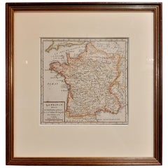
- Antique Map of France by Vaugondy, circa 1750Located in Langweer, NLAntique map titled 'La France divisée (..)'. Map of France published by Robert de Vaugondy, circa 1750. Frame included. We carefully pack our framed items to ensure safe shipping.Category
Antique Early 18th Century Maps
MaterialsPaper
- Antique Map of the Russian Empire in Europe by Vaugondy, 1750Located in Langweer, NLAntique map titled 'Partie Occidentale de l'Empire de Russie (..)'. Detailed map of the western part of Russia, extending south to the Caspian and east to Irkurkoy and Ilimskoy. A...Category
Antique 18th Century Maps
MaterialsPaper
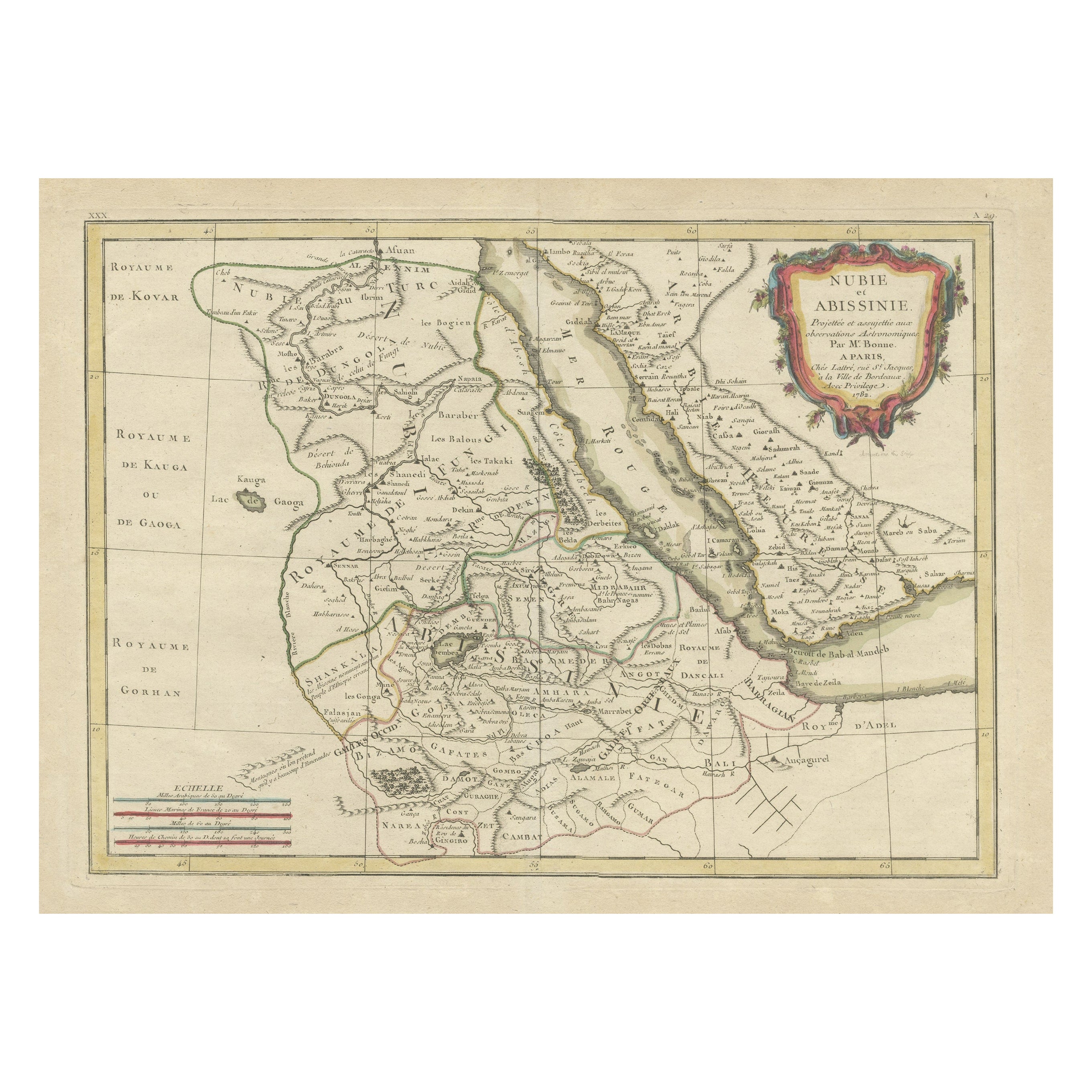
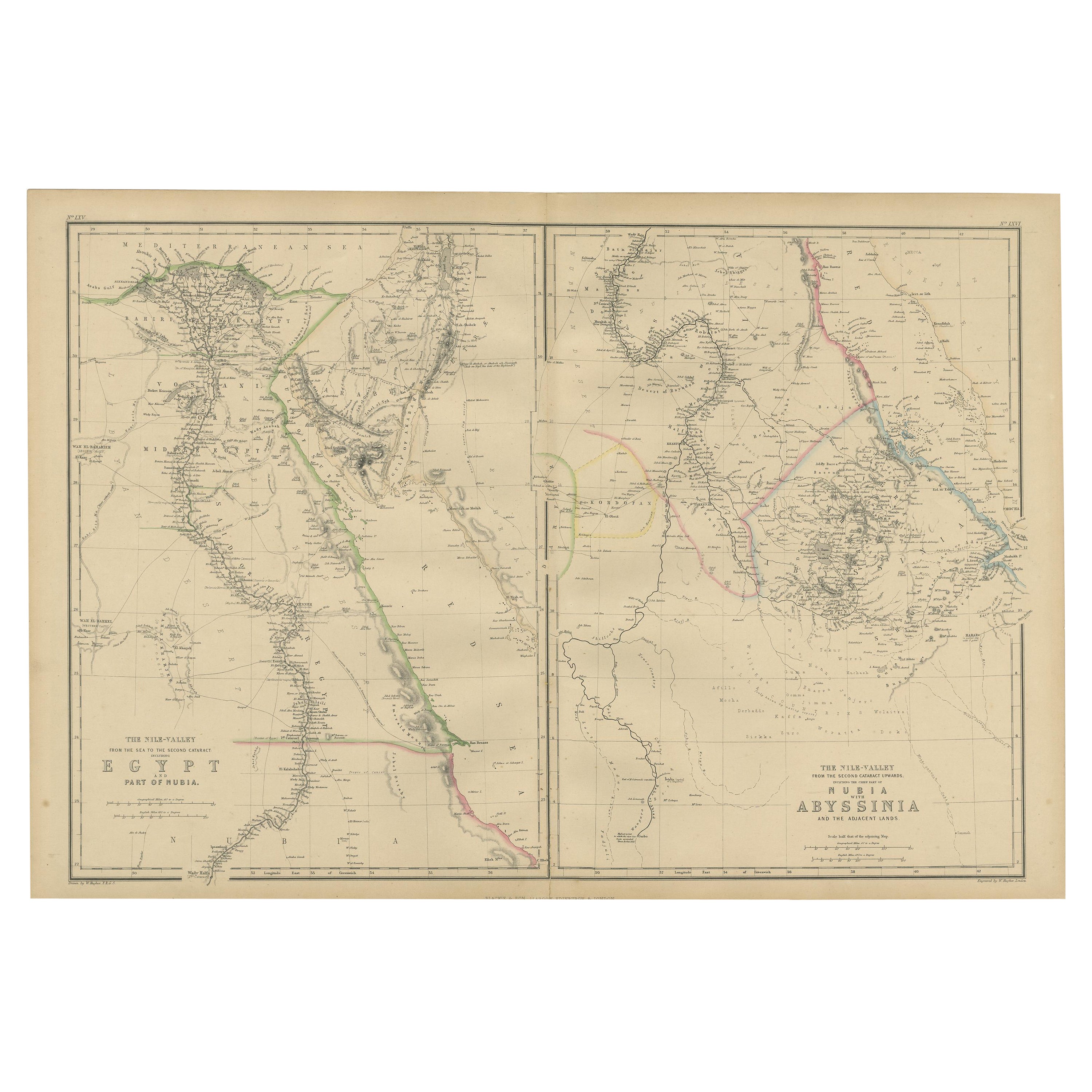
- Antique Map of Arabia including Nubia and Abyssinia, also shows the Red SeaLocated in Langweer, NLAntique map titled 'Nubie et Abissinie'. Original antique map of Nubia, a region along the Nile river, and Abyssinia or the Ethiopian Empire. This map o...Category
Antique Late 18th Century Maps
MaterialsPaper
- Antique Map of America by Vaugondy, 1778Located in Langweer, NLAntique map titled 'Amerique ou Indes Occidentales (..)'. Vaugondy's map of America, pre-dating information from any of the Cook Voyages. The NW Coast of Amer...Category
Antique Late 18th Century Maps
MaterialsPaper
 $1,233 Sale Price25% Off
 - Antique Map of the Indonesian and Philippine Archipelagos by R. de VaugondyLocated in Langweer, NLStriking and highly detailed map of the region from Sumatra and Malaca and Southern China to the Philipines, New Guinea and Northern Australia, centered on Borneo. Includes a large i...Category
Antique Mid-18th Century Maps
MaterialsPaper
 $1,021 Sale Price20% Off

You May Also Like
- California, Alaska and Mexico: 18th Century Hand-Colored Map by de VaugondyBy Didier Robert de VaugondyLocated in Alamo, CAThis an 18th century hand-colored map of the western portions of North America entitled "Carte de la Californie et des Pays Nord-Ouest separés de l'Asie par le détroit d'Anian, extra...Category
Antique 1770s French Maps
MaterialsPaper
- Original Antique Map of The World by Thomas Clerk, 1817Located in St Annes, LancashireGreat map of The Eastern and Western Hemispheres On 2 sheets Copper-plate engraving Drawn and engraved by Thomas Clerk, Edinburgh. Published by Mackenzie And Dent, 1817 ...Category
Antique 1810s English Maps
MaterialsPaper
- Original Antique Map of The Netherlands, Engraved by Barlow, Dated 1807Located in St Annes, LancashireGreat map of Netherlands Copper-plate engraving by Barlow Published by Brightly & Kinnersly, Bungay, Suffolk. Dated 1807 Unframed.Category
Antique Early 1800s English Maps
MaterialsPaper
- Hand-Colored 18th Century Homann Map of the Black Sea, Turkey and Asia MinorBy Johann Baptist HomannLocated in Alamo, CAAn attractive original early 18th century hand-colored map of the Black Sea and Turkey entitled "Carte de L'Asie Minevre ou de la Natolie et du Pont Evxin Tiree des Voyages et des Ob...Category
Antique Early 18th Century German Maps
MaterialsPaper
- Hand-Colored 18th Century Homann Map of Denmark and Islands in the Baltic SeaBy Johann Baptist HomannLocated in Alamo, CAAn 18th century copper plate hand-colored map entitled "Insulae Danicae in Mari Balthico Sitae utpote Zeelandia, Fionia, Langelandia, Lalandia, Falstria, Fembria Mona" created by Joh...Category
Antique Early 18th Century German Maps
MaterialsPaper
- Map of the Republic of GenoaLocated in New York, NYFramed antique hand-coloured map of the Republic of Genoa including the duchies of Mantua, Modena, and Parma. Europe, late 18th century. Dimension: 25...Category
Antique Late 18th Century European Maps


