Items Similar to Antique Map of Africa, Highlighting Colonial Divisions, Geographic Features 1903


Want more images or videos?
Request additional images or videos from the seller
1 of 10
Antique Map of Africa, Highlighting Colonial Divisions, Geographic Features 1903
$345.24
£256.61
€290
CA$476.68
A$528.60
CHF 277.74
MX$6,458.64
NOK 3,474.93
SEK 3,261.82
DKK 2,208.20
About the Item
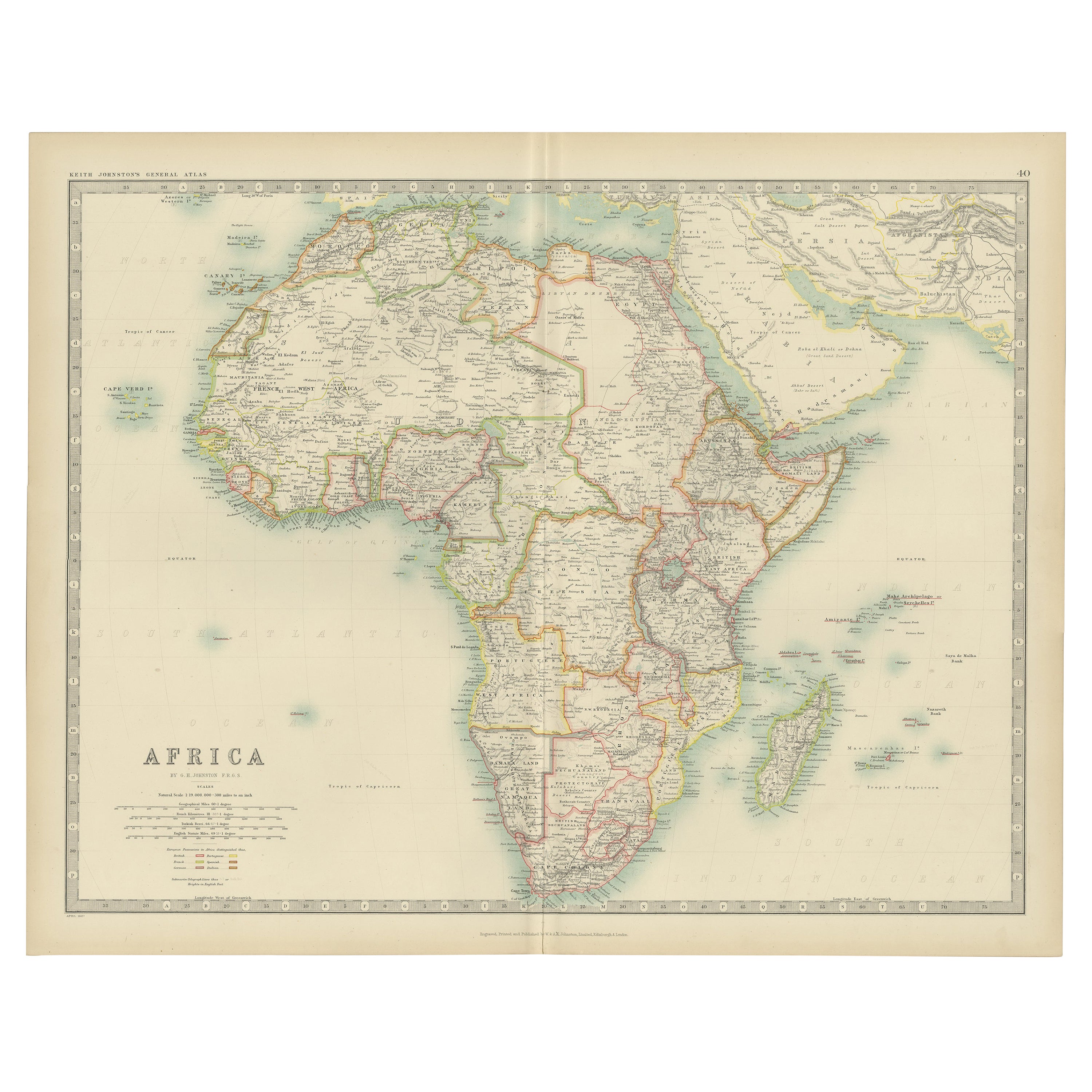
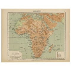
Title: Antique Map of Africa, 1903, Highlighting Colonial Divisions and Geographic Features
Description: This antique map, titled "Africa," was engraved and published in 1903 by W. & A.K. Johnston in Edinburgh and London. It provides a fascinating and detailed look at the African continent at the height of the colonial era, reflecting the complex interplay of geography, culture, and imperial ambitions.
Hand-colored in soft pastel shades, the map delineates the colonial territories that defined Africa during this period, including the spheres of influence of the British, French, German, Portuguese, Italian, Belgian, and Spanish empires. Major rivers, mountain ranges, and lakes are all clearly depicted, offering a rich geographical context for the colonial boundaries imposed by European powers.
The map’s elegant typography and refined linework capture the grandeur of Africa’s natural features and underscore the political realities of the time. From the Sahara Desert to the fertile Nile basin, from the Cape of Good Hope to the islands of the Indian Ocean, this map illustrates the diverse environments and cultures that make Africa such a dynamic and significant part of the world.
For collectors, historians, and those with an interest in African history, this map is more than a decorative piece—it is a testament to a pivotal period in the continent’s story, reflecting both the beauty of its landscapes and the dramatic changes brought by colonization.
Condition report:
This map is in very good antique condition, with only minor foxing and gentle edge toning typical for its age. The colors remain vibrant and the paper is stable and well-preserved.
Framing tips:
A classic wooden frame in walnut or cherry will enhance the soft pastel colors and historical detail of this map. Use a cream or off-white matting to highlight the refined linework and create a sophisticated, timeless focal point for any home, library, or study.
- Dimensions:Height: 14.49 in (36.8 cm)Width: 18.51 in (47 cm)Depth: 0.01 in (0.2 mm)
- Materials and Techniques:
- Period:
- Date of Manufacture:1903
- Condition:This map is in very good antique condition, with only minor foxing and gentle edge toning typical for its age. The colors remain vibrant and the paper is stable and well-preserved.
- Seller Location:Langweer, NL
- Reference Number:Seller: BG-13577-351stDibs: LU3054345271972
About the Seller
5.0
Recognized Seller
These prestigious sellers are industry leaders and represent the highest echelon for item quality and design.
Platinum Seller
Premium sellers with a 4.7+ rating and 24-hour response times
Established in 2009
1stDibs seller since 2017
2,609 sales on 1stDibs
Typical response time: <1 hour
- ShippingRetrieving quote...Shipping from: Langweer, Netherlands
- Return Policy
Authenticity Guarantee
In the unlikely event there’s an issue with an item’s authenticity, contact us within 1 year for a full refund. DetailsMoney-Back Guarantee
If your item is not as described, is damaged in transit, or does not arrive, contact us within 7 days for a full refund. Details24-Hour Cancellation
You have a 24-hour grace period in which to reconsider your purchase, with no questions asked.Vetted Professional Sellers
Our world-class sellers must adhere to strict standards for service and quality, maintaining the integrity of our listings.Price-Match Guarantee
If you find that a seller listed the same item for a lower price elsewhere, we’ll match it.Trusted Global Delivery
Our best-in-class carrier network provides specialized shipping options worldwide, including custom delivery.More From This Seller
View AllAntique Map of Africa by Johnston (1909)
Located in Langweer, NL
Antique map titled 'Africa'. Original antique map of Africa. This map originates from the ‘Royal Atlas of Modern Geography’. Published by W. & A....
Category
Early 20th Century Maps
Materials
Paper

$238 Sale Price
20% Off
Antique Map of Africa by A & C, Black, 1870
Located in Langweer, NL
Antique map titled 'Africa'. Original antique map of Africa. This map originates from ‘Black's General Atlas of The World’. Published by A & C. Black, 1870.
Category
Antique Late 19th Century Maps
Materials
Paper

$261 Sale Price
20% Off
Antique Map of Central Africa, 1903, With Colonial Territories Explorers Routes
Located in Langweer, NL
Antique Map of Central Africa, 1903, Featuring Colonial Territories and Explorers’ Routes
This antique map, titled "Central Africa," was engraved and published in 1903 by W. & A.K. ...
Category
Early 20th Century Maps
Materials
Paper
Antique Map of Africa with European Language Borders, 1852
Located in Langweer, NL
Antique map titled 'Afrika'. Map of Africa. This map originates from 'School-Atlas van alle deelen der Aarde' by Otto Petri.
Artists and Engravers: Published by A. Baedeker (Otto...
Category
Antique 19th Century Maps
Materials
Paper

$152 Sale Price
20% Off
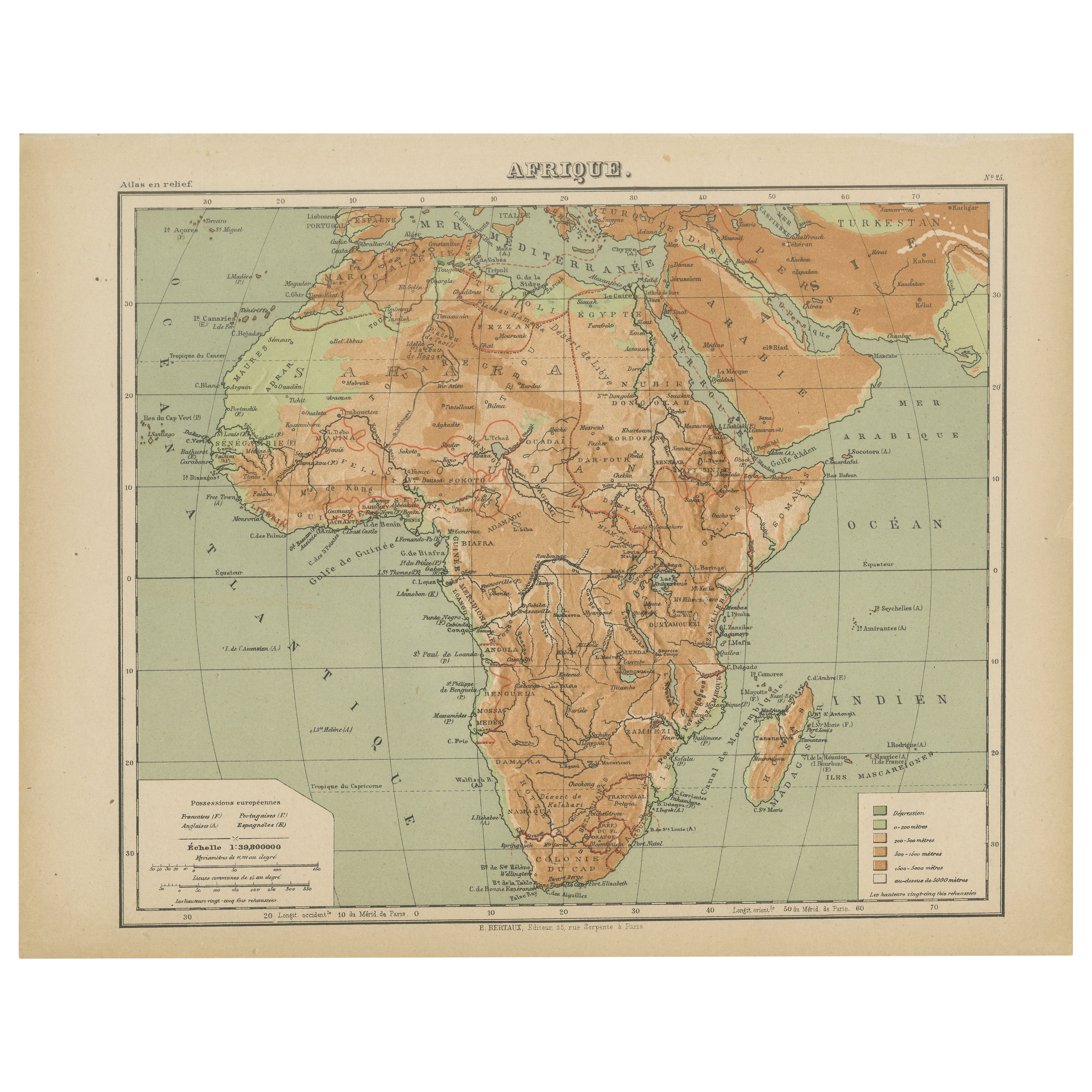
Relief Atlas Map of Africa by Hachette – Antique c.1883 French Map
Located in Langweer, NL
Antique Map of Africa – Relief Atlas Map by Hachette, circa 1880
Description:
This is an attractive antique map titled “Afrique,” published by Hachette...
Category
Antique Late 19th Century Maps
Materials
Paper
Antique Map of Africa with Original Hand Coloring
Located in Langweer, NL
Antique map titled 'Kaart van Afrika door den Heer d'Anville'. Detailed original old map of Africa, with very small inset map titled 'Vlaamsche Eilanden', which shows the Azores. Pub...
Category
Antique Mid-18th Century Maps
Materials
Paper
$742 Sale Price
20% Off
You May Also Like
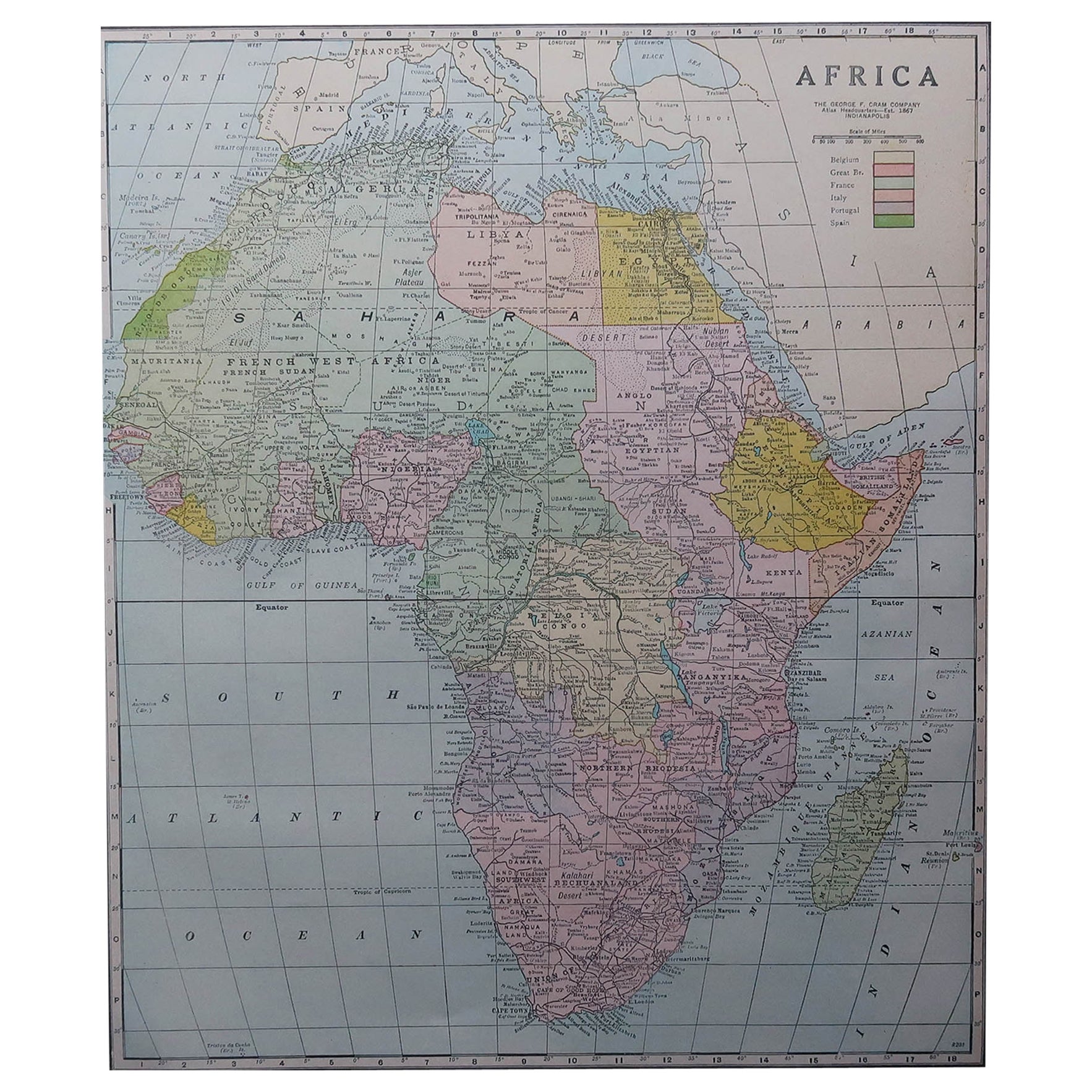
Large Original Antique Map of Africa. C.1900
Located in St Annes, Lancashire
Fabulous map of Africa
Original color.
Engraved and printed by the George F. Cram Company, Indianapolis.
Published, C.1900.
Unframed.
Free shipping.
Category
Antique 1890s American Maps
Materials
Paper

Original Antique Map of Africa by Dower, circa 1835
Located in St Annes, Lancashire
Nice map of Africa
Drawn and engraved by J.Dower
Published by Orr & Smith. C.1835
Unframed.
Free shipping
Category
Antique 1830s English Maps
Materials
Paper

Africa. Central. Century Atlas antique vintage map
Located in Melbourne, Victoria
'The Century Atlas. Africa. Central'
Inset map of 'Madagascar'.
Original antique map, 1903.
Central fold as issued. Map name and number printed on the reverse corners.
Sheet 29.5cm...
Category
Early 20th Century Victorian More Prints
Materials
Lithograph

Africa. North-East Part. Century Atlas antique vintage map
Located in Melbourne, Victoria
'The Century Atlas. Africa. North-East Part'
Original antique map, 1903.
Inset map of 'Nile Delta and Suez Canal'.
Central fold as issued. Map name and nu...
Category
Early 20th Century Victorian More Prints
Materials
Lithograph

Africa. Southern Part. Century Atlas antique vintage map
Located in Melbourne, Victoria
'The Century Atlas. Africa. Southern Part'
Original antique map, 1903.
Inset maps of 'Cape Town', 'Johannesburg' and 'Ladysmith'.
Central fold as issued. Map name and number printe...
Category
Early 20th Century Victorian More Prints
Materials
Lithograph

Africa. North-West Part. Century Atlas antique vintage map
Located in Melbourne, Victoria
'The Century Atlas. Africa. Southern Part'
Original antique map, 1903.
Central fold as issued. Map name and number printed on the reverse corners.
Sheet 40cm by 29.5cm.
Category
Early 20th Century Victorian More Prints
Materials
Lithograph

More Ways To Browse
French Colonial Furniture
Africa Colonial
Empire Library
French Matting
Sahara Desert
Wooden Basin
Portuguese Colonial Furniture
German Colonial
Solid Mahogany Table
Dessert Glasses
Geometric Glass Table
Mid Century Pin
6x10 Rug
Studded Furniture
Styles Of Antique Desks
Black And White Coffee Table
Metal Relief
Curved Velvet Couch