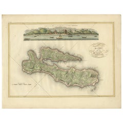
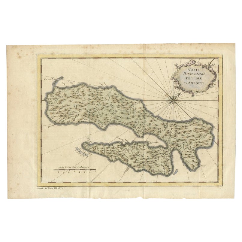
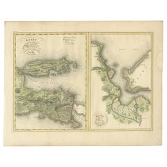
Antique Map of Ambon Island by Van den Bosch, '1818'
View Similar Items


Want more images or videos?
Request additional images or videos from the seller
1 of 5
Antique Map of Ambon Island by Van den Bosch, '1818'
About the Item
- Dimensions:Height: 18.12 in (46 cm)Width: 22.84 in (58 cm)Depth: 0.02 in (0.5 mm)
- Materials and Techniques:Paper,Engraved
- Period:
- Date of Manufacture:1818
- Condition:Wear consistent with age and use. General age-related toning. Some wear and marginal tears. Please study images carefully.
- Seller Location:Langweer, NL
- Reference Number:Seller: BG-061421stDibs: LU3054316542702
About the Seller
5.0
Recognized Seller
These prestigious sellers are industry leaders and represent the highest echelon for item quality and design.
Gold Seller
Premium sellers maintaining a 4.3+ rating and 24-hour response times
Established in 2009
1stDibs seller since 2017
2,467 sales on 1stDibs
Typical response time: 1 hour
Authenticity Guarantee
In the unlikely event there’s an issue with an item’s authenticity, contact us within 1 year for a full refund. DetailsMoney-Back Guarantee
If your item is not as described, is damaged in transit, or does not arrive, contact us within 7 days for a full refund. Details24-Hour Cancellation
You have a 24-hour grace period in which to reconsider your purchase, with no questions asked.Vetted Professional Sellers
Our world-class sellers must adhere to strict standards for service and quality, maintaining the integrity of our listings.Price-Match Guarantee
If you find that a seller listed the same item for a lower price elsewhere, we’ll match it.Trusted Global Delivery
Our best-in-class carrier network provides specialized shipping options worldwide, including custom delivery.More From This Seller
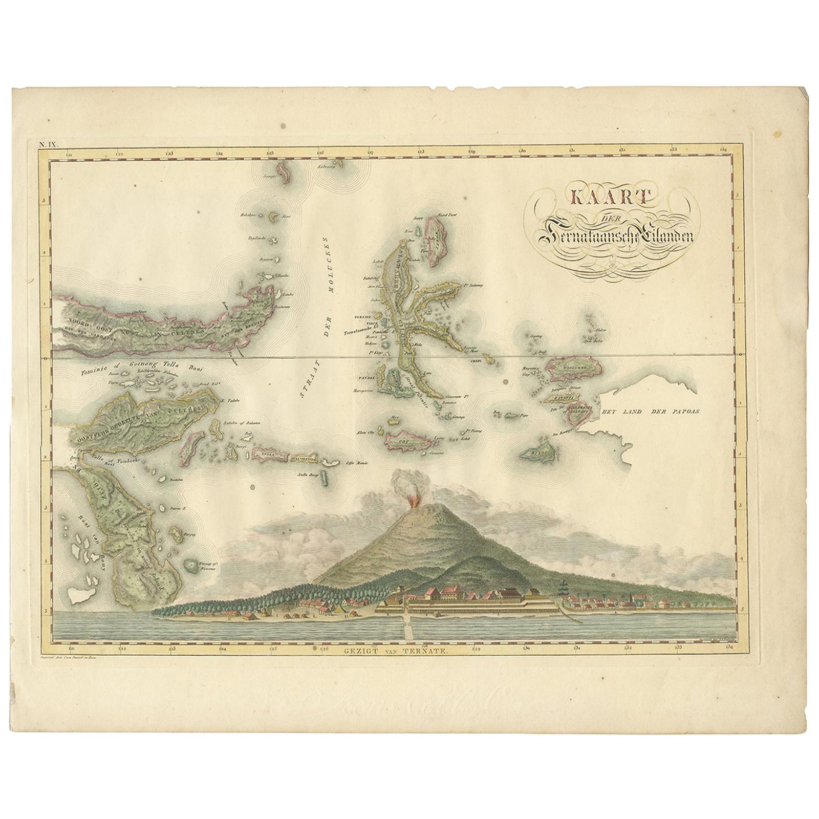
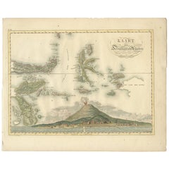
View AllAntique Map of the Ternate Islands by Van den Bosch '1818'
Located in Langweer, NL
Antique map titled 'Kaart der Ternataansche Eilanden'. Rare and attractive map of the Ternate Islands with a large view of Ternate Island. One of 12 maps from 'Atlas van Overzeesche ...
Category
Antique Early 19th Century Maps
Materials
Paper
$1,117 Sale Price
20% Off
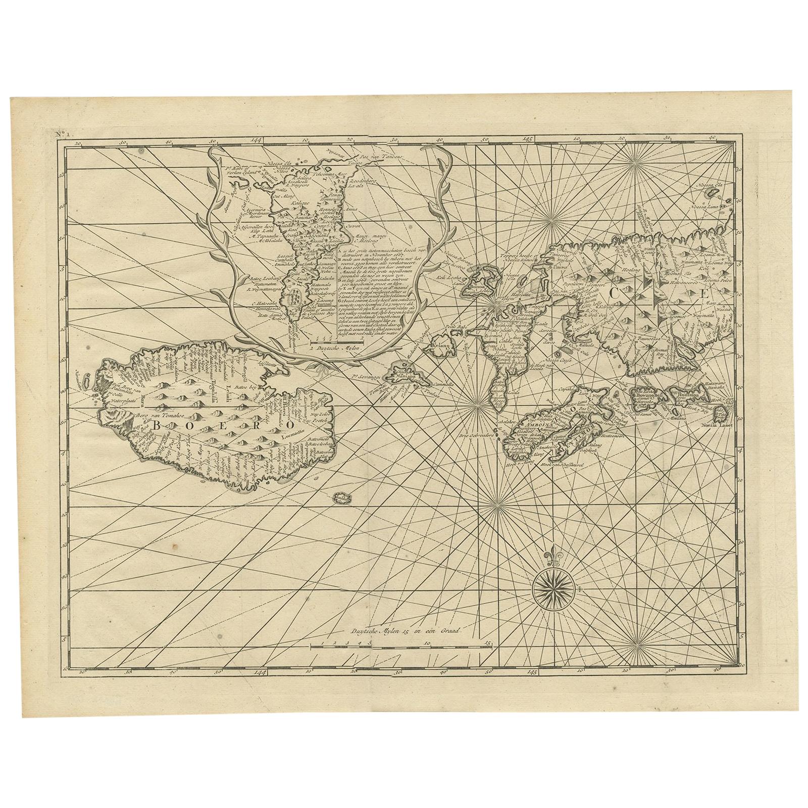
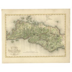
Antique Map of Seram, Boero and the Banda Islands by Van den Bosch '1818'
Located in Langweer, NL
Antique map titled 'Kaart der Ambonsche Eilanden'. Rare and attractive map of the islands of Seram, Boero and the Banda Islands. Includes a nice view of the Island of Seram. One of 1...
Category
Antique Early 19th Century Maps
Materials
Paper
$1,117 Sale Price
20% Off
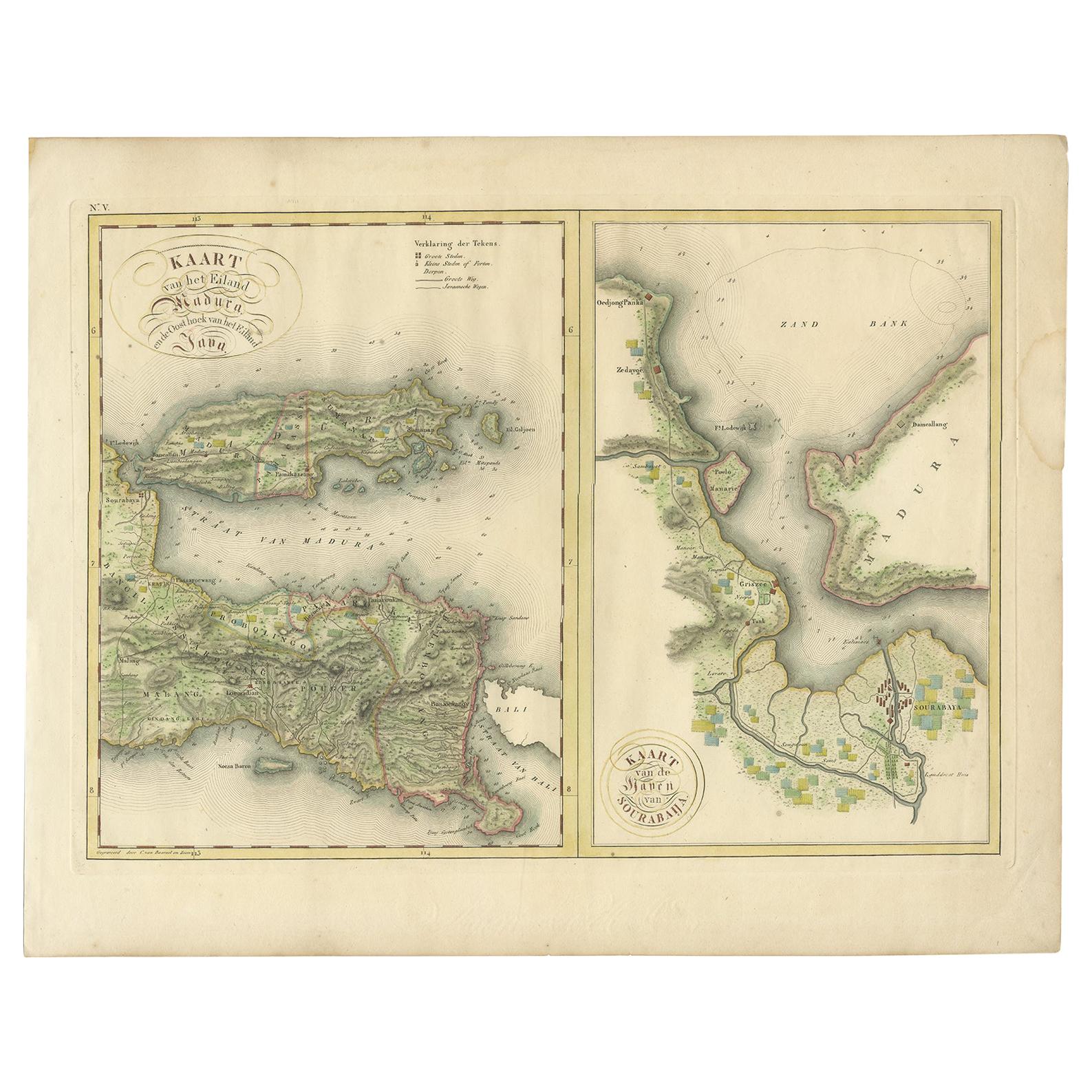
Antique Map of Madura and Surabaya by Van den Bosch, '1818'
Located in Langweer, NL
Two maps on one sheet titled 'Kaart van het Eiland Madura en de Oost hoek van het Eiland Java' and 'Kaart van de Haven van Sourabaija'. The left map shows East Java with the Island o...
Category
Antique Early 19th Century Maps
Materials
Paper
$1,117 Sale Price
20% Off
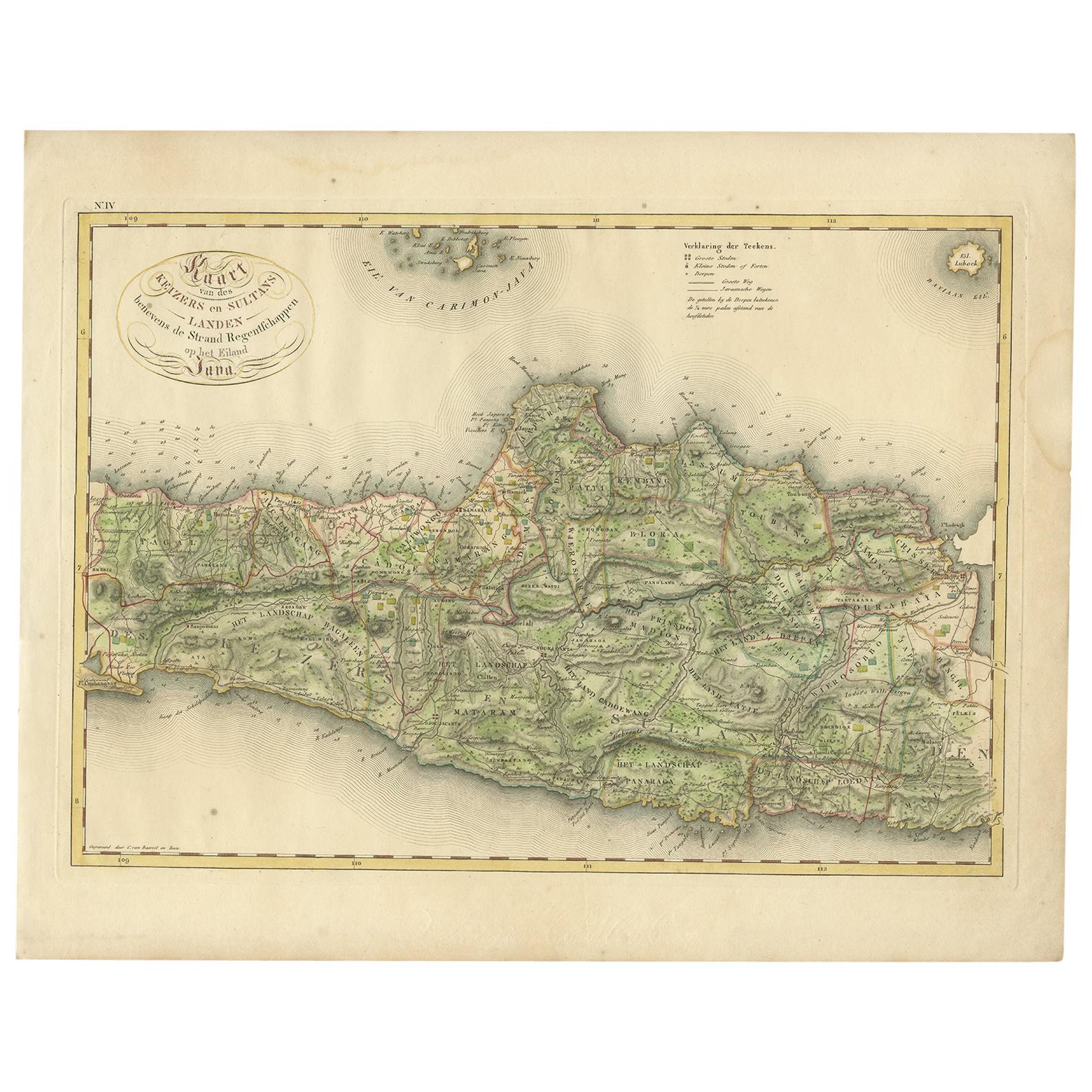
Antique Map of Central and East Java by Van den Bosch, 1818
Located in Langweer, NL
Antique map titled 'Kaart van de Keizers en Sultans Landen benevens de Strand Regentschappen op het Eiland Java'. Map of three central and easterly provinces of the island of Java. O...
Category
Antique Early 19th Century Maps
Materials
Paper

$1,117 Sale Price
20% Off
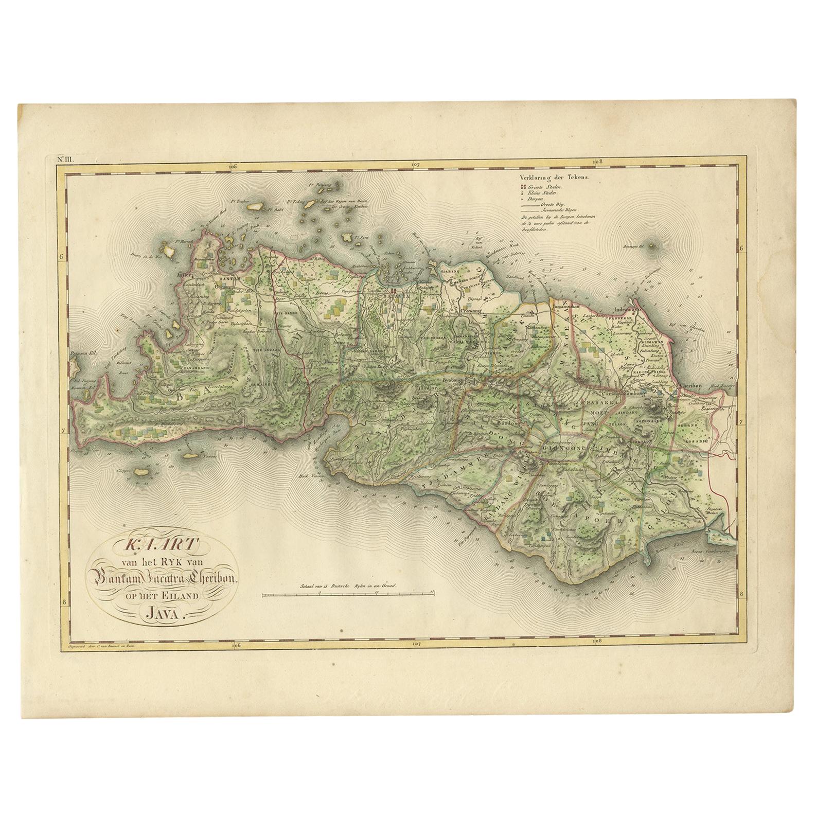
Antique Map of Bantam, Jakarta and Cirebon by Van den Bosch '1818'
Located in Langweer, NL
Antique map titled 'Kaart van het Ryk van Bantam, Jacatra, Cheribon op het Eiland Java'. Rare and attractive map of the three most easterly provinces of Java (Bantam, Jakarta and Cir...
Category
Antique Early 19th Century Maps
Materials
Paper
$1,117 Sale Price
20% Off
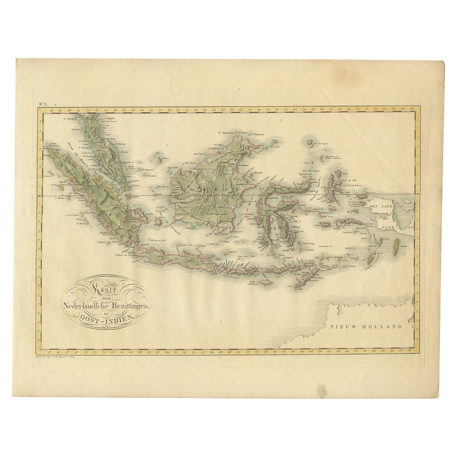
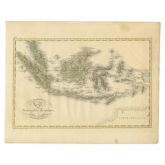
Antique Map of the Dutch East Indies by Van den Bosch '1818'
Located in Langweer, NL
Antique map titled 'Kaart der Nederlandsche Bezittingen in Oost-Indiën'.
Rare and attractive map of the Dutch East Indies, it shows the Dutch possessions in the 19th century. This ...
Category
Antique Early 19th Century Maps
Materials
Paper
$1,304 Sale Price
20% Off
You May Also Like
1854 Map of Massachusetts, Connecticut and Rhode Island, Antique Wall Map
Located in Colorado Springs, CO
This striking wall map was published in 1854 by Ensign, Bridgman & Fanning and has both full original hand-coloring and original hardware. This impression is both informative and highly decorative.
The states are divided into counties, outlined in red, green, and black, and subdivided into towns. Roads, canals, and railroad lines are prominently depicted, although they are not all labeled. The mapmakers also marked lighthouses, banks, churches, and prominent buildings, with a key at right. The map is an informative and comprehensive overview of the infrastructural development of New England prior to the Civil War. Physical geographies depicted include elevation, conveyed with hachure marks, rivers and lakes. The impression features an inset map of Boston...
Category
Antique 19th Century American Maps
Materials
Paper

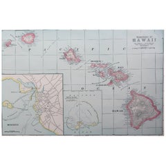
Original Antique Map of Hawaii And Adjacent Islands. C.1900
Located in St Annes, Lancashire
Fabulous map of Hawaii. With a vignette of Honolulu
Original color.
Engraved and printed by the George F. Cram Company, Indianapolis.
Published, C.1900.
Unframed.
Free shipping.
Category
Antique 1890s American Maps
Materials
Paper
Large Original Antique Map of The Greek Islands. 1894
Located in St Annes, Lancashire
Superb Antique map of The Greek Islands
Published Edward Stanford, Charing Cross, London 1894
Original colour
Good condition
Unframed.
Free shipping
Category
Antique 1890s English Maps
Materials
Paper

Large Original Antique Map of The Falkland Islands. 1894
Located in St Annes, Lancashire
Superb Antique map of The Falkland Islands
Published Edward Stanford, Charing Cross, London 1894
Original colour
Good condition
Unframed.
Free shipping
Category
Antique 1890s English Maps
Materials
Paper

Large Original Antique Map of The Leeward Islands. 1894
Located in St Annes, Lancashire
Superb Antique map of The Leeward Islands
Published Edward Stanford, Charing Cross, London 1894
Original colour
Good condition
Unframed.
Free shipping
Category
Antique 1890s English Maps
Materials
Paper

Large Original Antique Map of The Canary Islands. 1894
Located in St Annes, Lancashire
Superb Antique map of The Canary Islands
Published Edward Stanford, Charing Cross, London 1894
Original colour
Good condition
Unframed.
Free shipping
Category
Antique 1890s English Maps
Materials
Paper

Recently Viewed
View AllMore Ways To Browse
Antique Map Of Cornwall
Patagonia Map
Vintage Bartholomew Maps
Washington Dc Map
Coronelli Globe
Goa France
Marie Galante
Antique Planisphere
Cape Cod Map
Charlotte Reine
Dutch Malacca
Gabon Antique Map
J And C Bavaria
Montreal Map
Laos Antique Map
Map Of Barbados
Antique Furniture Toledo Ohio
Johann Baptist Homann On Sale