Items Similar to Antique Map of Austria by N. Visscher, circa 1690


Want more images or videos?
Request additional images or videos from the seller
1 of 9
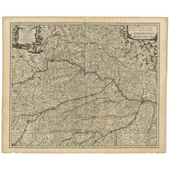
Antique Map of Austria by N. Visscher, circa 1690
$884.34
$1,105.4220% Off
£658.56
£823.2020% Off
€744
€93020% Off
CA$1,220.95
CA$1,526.1920% Off
A$1,353.60
A$1,69220% Off
CHF 711.37
CHF 889.2120% Off
MX$16,565.87
MX$20,707.3420% Off
NOK 8,884.30
NOK 11,105.3720% Off
SEK 8,338.80
SEK 10,423.5020% Off
DKK 5,664.57
DKK 7,080.7120% Off
About the Item
Antique map titled 'Austriae Archiducatus pars superior in omnes ejusdem'. Spectacular large map of Upper and Lower Austria between Passau and Wien with figurative cartouche and armorial vignette. Printed on two sheets and joined.
- Dimensions:Height: 20.79 in (52.8 cm)Width: 35.04 in (89 cm)Depth: 0.02 in (0.5 mm)
- Materials and Techniques:
- Period:Late 17th Century
- Date of Manufacture:circa 1690
- Condition:Please study image carefully.
- Seller Location:Langweer, NL
- Reference Number:Seller: BG-091651stDibs: LU305439941461
About the Seller
5.0
Recognized Seller
These prestigious sellers are industry leaders and represent the highest echelon for item quality and design.
Platinum Seller
Premium sellers with a 4.7+ rating and 24-hour response times
Established in 2009
1stDibs seller since 2017
2,609 sales on 1stDibs
Typical response time: <1 hour
- ShippingRetrieving quote...Shipping from: Langweer, Netherlands
- Return Policy
Authenticity Guarantee
In the unlikely event there’s an issue with an item’s authenticity, contact us within 1 year for a full refund. DetailsMoney-Back Guarantee
If your item is not as described, is damaged in transit, or does not arrive, contact us within 7 days for a full refund. Details24-Hour Cancellation
You have a 24-hour grace period in which to reconsider your purchase, with no questions asked.Vetted Professional Sellers
Our world-class sellers must adhere to strict standards for service and quality, maintaining the integrity of our listings.Price-Match Guarantee
If you find that a seller listed the same item for a lower price elsewhere, we’ll match it.Trusted Global Delivery
Our best-in-class carrier network provides specialized shipping options worldwide, including custom delivery.More From This Seller
View AllDecorative Antique Map of Austria – Frederick de Wit, Amsterdam c.1690
Located in Langweer, NL
Antique Map of Austria – “Circuli Austriaci pars Septentrionalis” by F. de Wit, c.1670
This finely engraved map, titled “Circuli Austriaci pars Septent...
Category
Antique Late 17th Century Dutch Maps
Materials
Paper

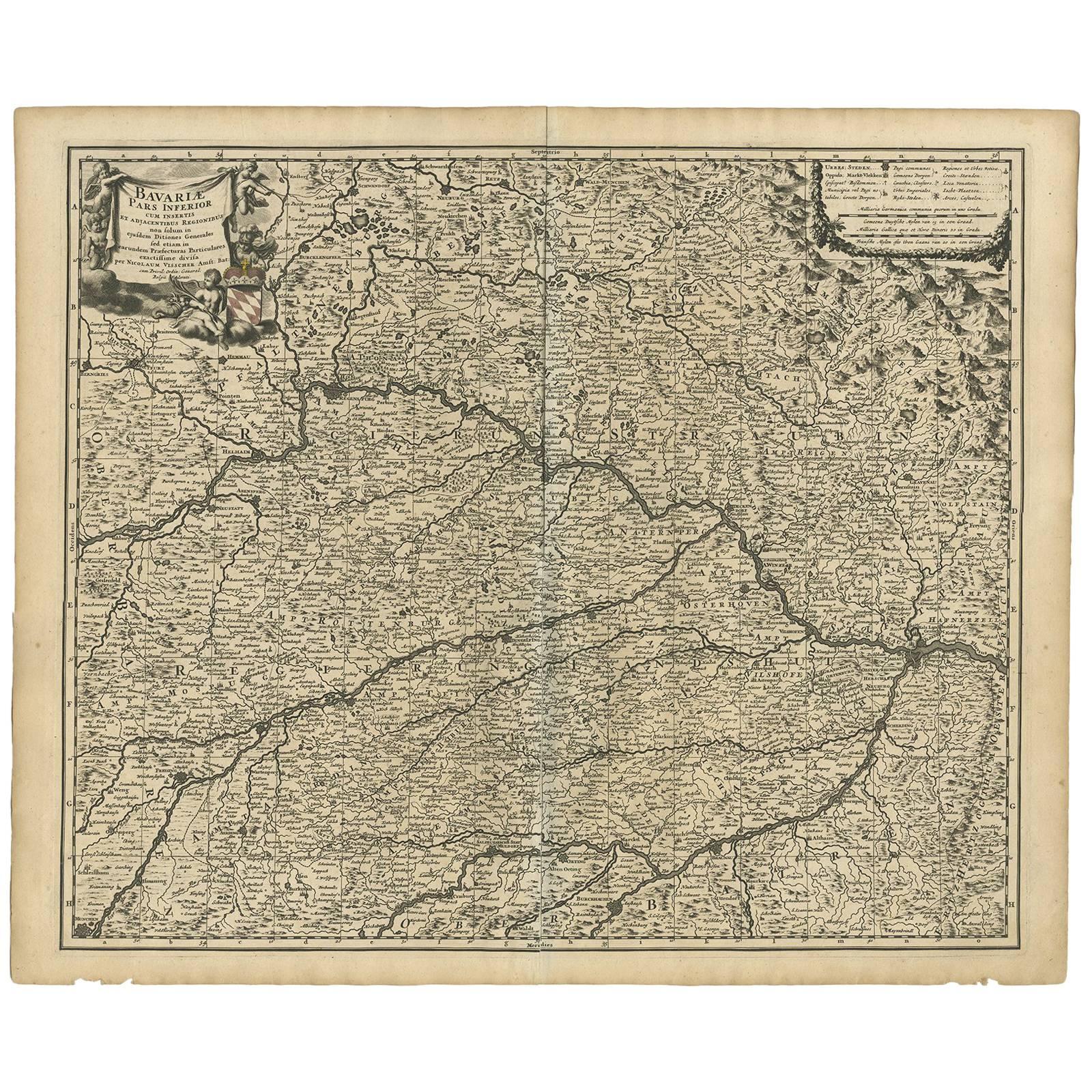
Antique Map of Bavaria ‘Bayern, Germany’ by N. Visscher, circa 1700
Located in Langweer, NL
Antique map titled 'Bavariae pars inferior cum insertis et adjacentibus regionibus (..)'. Published circa 1700 in N. Visscher's World Atlas.
The map "Bavariae pars inferior cum inse...
Category
Antique Early 18th Century Dutch Maps
Materials
Paper
$580 Sale Price
20% Off
Antique Map of Southern Germany by F. de Wit, circa 1680
Located in Langweer, NL
This antique map depicts a portion of southern Germany that included the historic regions of Bavaria, the Palatinate, Prussia-Brandenburg, the Rhineland and Saxony. Regensberg, Freis...
Category
Antique Late 17th Century Maps
Materials
Paper

$660 Sale Price
20% Off
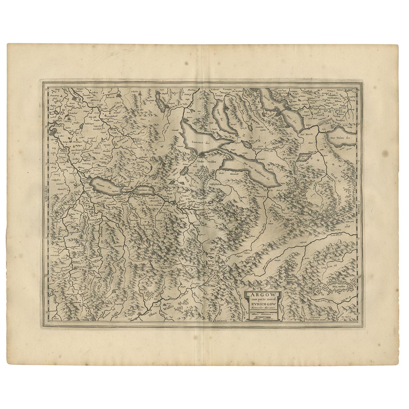
Antique Map of the Region of Aargau by Janssonius, '1657'
By Johannes Janssonius
Located in Langweer, NL
Antique map 'Argow cum parte merid. Zurichgow'. Detailed map of Switzerland showing Aargau with the southern part of Zürich. This map originates from 'Atlas Novus, Sive Theatrum Orbi...
Category
Antique Mid-17th Century Maps
Materials
Paper
$570 Sale Price
20% Off
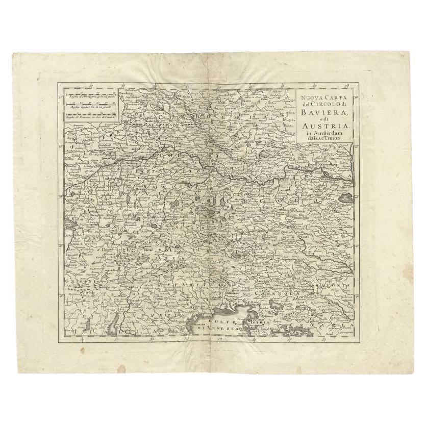
Antique Map of the Region of Bavaria and Austria by Tirion, c.1740
Located in Langweer, NL
Antique map titled 'Carte des environs de Batavia - Kaart van de Buitenstreken van Batavia'. Map of the Batavia area (Jakarta) in Indonesia. With cartouche, scale and compass rose. P...
Category
Antique 18th Century Maps
Materials
Paper

$212 Sale Price
20% Off
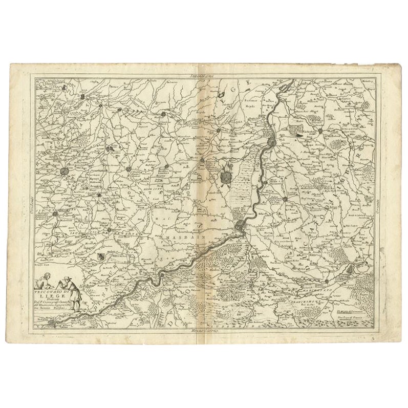
Antique Map of the Region of Liege by Coronelli, 1690
By Vincenzo Coronelli
Located in Langweer, NL
Antique map titled 'Vescovato di Liege (..)'. Map of the Belgium area centered on Liege and the course of Meuse/Maas River. Also depicts the cities of Maastricht, Namur and Tienen. O...
Category
Antique 17th Century Maps
Materials
Paper
$437 Sale Price
20% Off
You May Also Like
Original Antique Map of Switzerland, Engraved By Barlow, Dated 1807
Located in St Annes, Lancashire
Great map of Switzerland
Copper-plate engraving by Barlow
Published by Brightly & Kinnersly, Bungay, Suffolk.
Dated 1807
Unframed.
Category
Antique Early 1800s English Maps
Materials
Paper

1752 Vaugoundy Map of Flanders : Belgium, France, and the Netherlands, Ric.a002
Located in Norton, MA
Large Vaugoundy Map of Flanders:
Belgium, France, and the Netherlands
Colored -1752
Ric.a002
Description: This is a 1752 Didier Robert de Vaugondy map of Flanders. The map de...
Category
Antique 17th Century Unknown Maps
Materials
Paper

1657 Janssonius Map of Vermandois and Cappelle, Ric. A-004
Located in Norton, MA
1657 Janssonius map of
Vermandois and Cappelle
Ric.a004
Description: Antique map of France titled 'Descriptio Veromanduorum - Gouvernement de la Cappelle'. Two detailed maps o...
Category
Antique 17th Century Unknown Maps
Materials
Paper

17th Century Nicolas Visscher Map of Southeastern Europe
Located in Hamilton, Ontario
A beautiful, highly detailed map of southeastern Europe by Nicolas Visscher. Includes regions of Northern Italy (showing the cities Bologna, Padua, and Venice), Bohemia, Austria (sho...
Category
Antique 17th Century Dutch Maps
Materials
Paper

$1,350 Sale Price
38% Off
1640 Joan Bleau Map Entitled"Diocecese de rheims et le pais de rethel, " Eic.a011
Located in Norton, MA
1640 Joan Bleau map entitled
"Diocecese de rheims et le pais de rethel,"
Ric.a011
OAN BLAEU
Diocecese de Rheims, et le pais de Rethel.
Handcolored engraving, c.1640.
...
Category
Antique 17th Century Dutch Maps
Materials
Paper

Original Antique Map of Hungary, Arrowsmith, 1820
Located in St Annes, Lancashire
Great map of Hungary
Drawn under the direction of Arrowsmith.
Copper-plate engraving.
Published by Longman, Hurst, Rees, Orme and Brown, 1820
Unframed.
Category
Antique 1820s English Maps
Materials
Paper

More Ways To Browse
Carved Cabriole Table
Dark Antique Table
Antique Wall Table
1960 Chair Wood Danish
Unusual Dining Table
Antique Dutch Plates
Mdf Table
Showcase Coffee Table
Space Age Orange
Vallauris France
Silver Ladle
Scalloped Table
Brazil Wood Chairs
Vintage Art Deco Side Tables
Window Display
1960s Cushion Chair
Green Brown Oriental Rug
Authentic Models