Items Similar to Antique Map of Central Asia Wiht Nova Zembla as an Island, C.1700


Want more images or videos?
Request additional images or videos from the seller
1 of 7
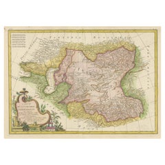
Antique Map of Central Asia Wiht Nova Zembla as an Island, C.1700
$529.47
$661.8420% Off
£392
£49020% Off
€440
€55020% Off
CA$733.09
CA$916.3620% Off
A$800.36
A$1,000.4520% Off
CHF 419.60
CHF 524.5020% Off
MX$9,720.69
MX$12,150.8620% Off
NOK 5,240.08
NOK 6,550.1020% Off
SEK 4,948.03
SEK 6,185.0420% Off
DKK 3,349.81
DKK 4,187.2720% Off
About the Item
Antique map titled 'Asiae Pars Potissima.' Attractive map focusing on the central part of Asia but extending to include much of Eastern Europe and Northeastern Africa. The Caspian Sea is depicted with a curious oval shape. Nova Zembla is confidently shown as an island; whereas earlier cartographers depicted only the southern and western coastlines reflecting the discoveries of Barents and Linschoten.
Source unknown, to be determined.
Artists and Engravers: Heinrich Scherer (1628-1704) was a Professor of Hebrew, Mathematics and Ethics at the University of Dillingen until about 1680. Thereafter he obtained important positions as Official Tutor to the Royal Princes of Mantua and Bavaria. It was during his time in Munich as Tutor to the Princely house of Bavaria that his lifetime’s work as a cartographer received acclaim and recognition. Scherer’s world atlas, the Atlas Novus, first published in Munich between 1702 and 1710 and reissued in a second edition between 1730 and 1737, forms a singularly unusual, almost revolutionary work in terms of the development of European mapmaking at the beginning of the 18th Century.
Condition: Good, given age. Edges browned. General age-related toning and/or occasional minor defects from handling. Please study image carefully.
Date: c.1700
Overall size: 21 x 27 cm.
Image size: 18.2 x 23.3 cm.
We sell original antique maps to collectors, historians, educators and interior decorators all over the world. Our collection includes a wide range of authentic antique maps from the 16th to the 20th centuries. Buying and collecting antique maps is a tradition that goes back hundreds of years. Antique maps have proved a richly rewarding investment over the past decade, thanks to a growing appreciation of their unique historical appeal. Today the decorative qualities of antique maps are widely recognized by interior designers who appreciate their beauty and design flexibility. Depending on the individual map, presentation, and context, a rare or antique map can be modern, traditional, abstract, figurative, serious or whimsical. We offer a wide range of authentic antique maps for any budget.
- Dimensions:Height: 10.63 in (27 cm)Width: 8.27 in (21 cm)Depth: 0 in (0.01 mm)
- Materials and Techniques:
- Period:
- Date of Manufacture:circa 1700
- Condition:
- Seller Location:Langweer, NL
- Reference Number:Seller: PCT-613901stDibs: LU3054326082592
About the Seller
5.0
Recognized Seller
These prestigious sellers are industry leaders and represent the highest echelon for item quality and design.
Platinum Seller
Premium sellers with a 4.7+ rating and 24-hour response times
Established in 2009
1stDibs seller since 2017
2,641 sales on 1stDibs
Typical response time: <1 hour
- ShippingRetrieving quote...Shipping from: Langweer, Netherlands
- Return Policy
Authenticity Guarantee
In the unlikely event there’s an issue with an item’s authenticity, contact us within 1 year for a full refund. DetailsMoney-Back Guarantee
If your item is not as described, is damaged in transit, or does not arrive, contact us within 7 days for a full refund. Details24-Hour Cancellation
You have a 24-hour grace period in which to reconsider your purchase, with no questions asked.Vetted Professional Sellers
Our world-class sellers must adhere to strict standards for service and quality, maintaining the integrity of our listings.Price-Match Guarantee
If you find that a seller listed the same item for a lower price elsewhere, we’ll match it.Trusted Global Delivery
Our best-in-class carrier network provides specialized shipping options worldwide, including custom delivery.More From This Seller
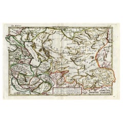
View AllDecorative Antique Map of Central Asia
Located in Langweer, NL
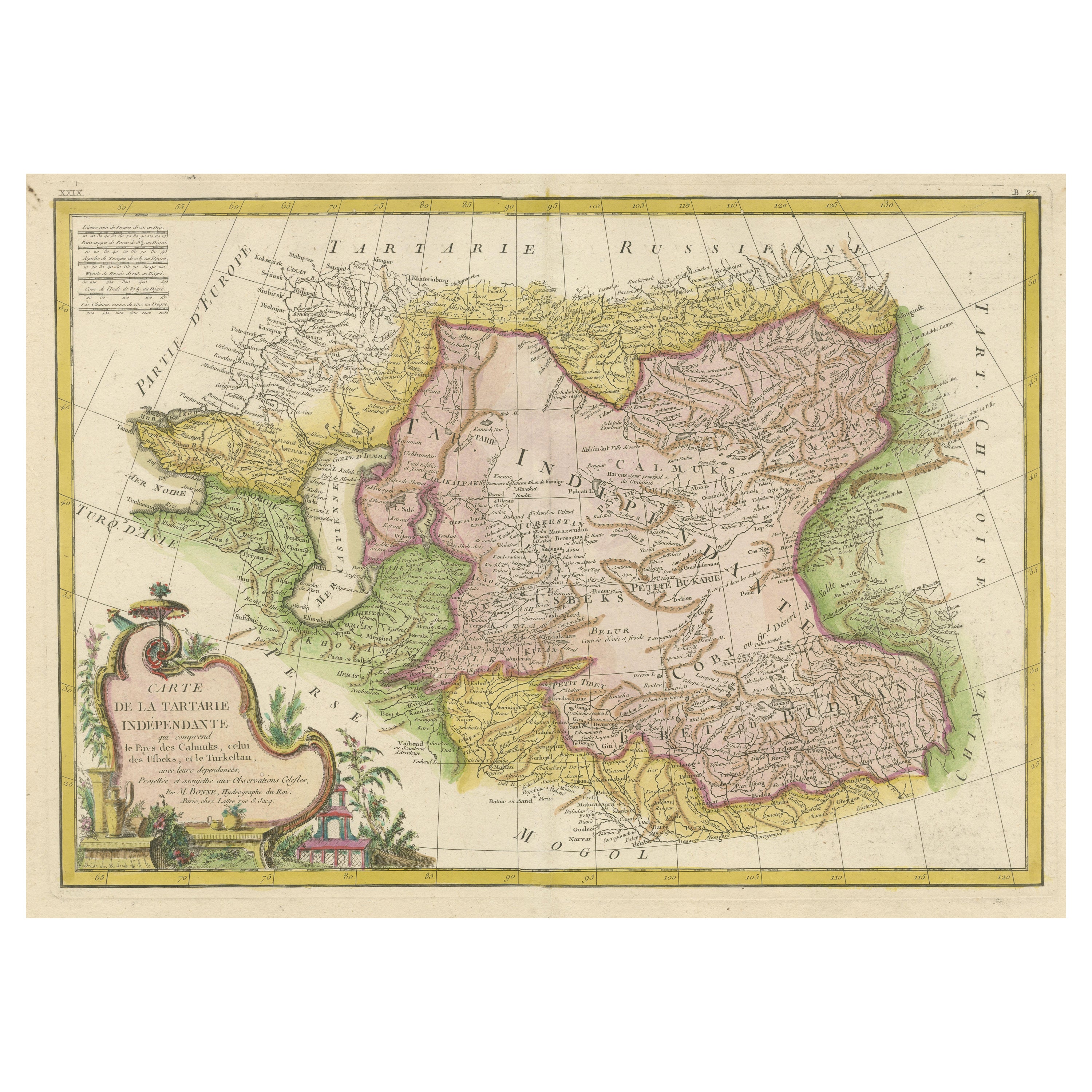
Antique map titled 'Carte de la Tartarie Indépendante (..)'. Decorative map of Central Asia (Tartary). Covers from the Black Sea south to China, north to Russia, and south to Persia ...
Category
Antique Late 18th Century Maps
Materials
Paper
$375 Sale Price
20% Off
Antique Map of Persia, Georgia and Kazakhstan, ca.1780
Located in Langweer, NL
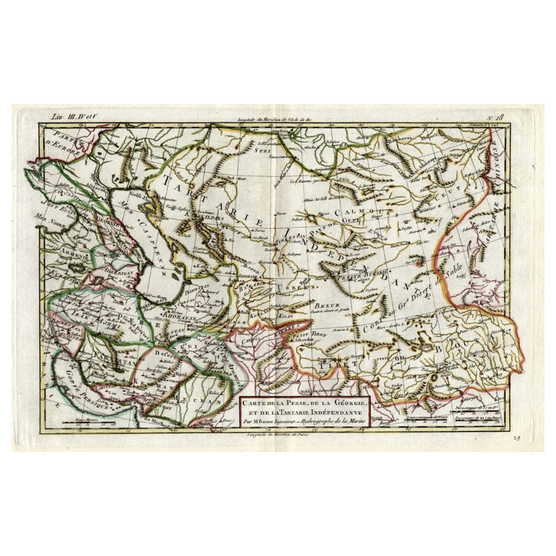
Antique map titled 'Carte de la Perse, de la Georgie, et de la Tartarie Independante'.
Map of Persia, Georgia and Kazakhstan. This map shows current days Georgia, Iran, Irak, Kaz...
Category
Antique 1780s Maps
Materials
Paper
$500 Sale Price
20% Off
Antique Map of Western Tartary and the Gobi Desert of the Russian Empire, c.1750
Located in Langweer, NL
Antique map titled 'A Map of Western Tartary Drawn from the Survey of the Jesuits and Mr. Kyrillow's Map of the Russian Empire'. Map of the Gobi Desert and the eastern portion of the...
Category
Antique 18th Century Maps
Materials
Paper

$336 Sale Price
20% Off
Antique Map of Western Asia by Van Dùren '1752'
Located in Langweer, NL
Antique map titled 'Neue Geographische Vorstellung von Asien'. Original antique map of Western Asia. This map originates from 'Neue Sammlung der merkwürdigsten Reisegeschichten, inso...
Category
Antique Mid-18th Century Maps
Materials
Paper

$433 Sale Price
20% Off
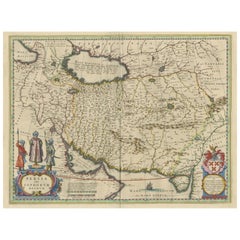
Antique Map of Persia with Dedication Cartouche
Located in Langweer, NL
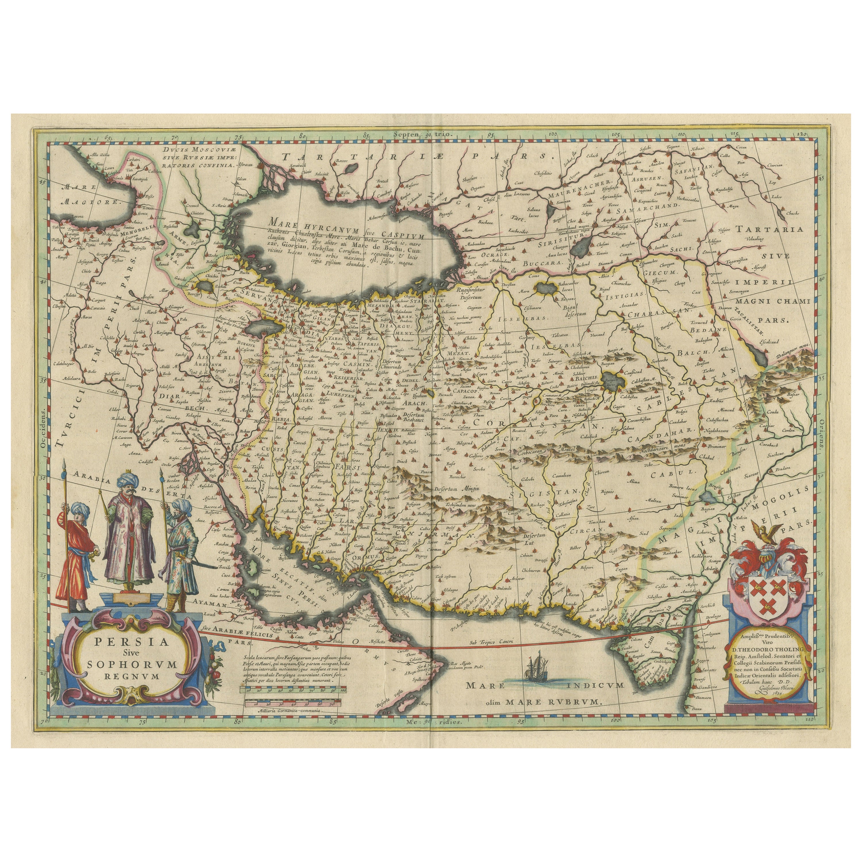
Antique map titled 'Persia sive Sophorum Regnum'. Original old map of Persia. The map extends from the Eastern Mediteranian to Tacalistan and the Indus River and the Dalanguer Mounta...
Category
Antique Mid-17th Century Maps
Materials
Paper
Antique Map of Persia, Georgia and Kazakhstan by Bonne, c.1780
Located in Langweer, NL
Antique map titled 'Carte de la Perse, de la Georgie, et de la Tartarie Independante'. Map of Persia, Georgia and Kazakhstan.
This map shows current days Georgia, Iran, Irak, Kazak...
Category
Antique 18th Century Maps
Materials
Paper
You May Also Like
Map of the Russian Empire: An Original 18th Century Hand-colored Map by E. Bowen
Located in Alamo, CA
This is an original 18th century hand-colored map entitled "A New & Accurate Map of The Whole Russian Empire, As Contain'd Both In Europe and Asia, Drawn from Authentic Journals, Sur...
Category
Mid-18th Century Old Masters Landscape Prints
Materials
Engraving

1718 Ides & Witsen Map "Route D'amsterdam a Moscow Et De La Ispahan Et Gamron
Located in Norton, MA
1718 Ides & Witsen map, entitled
"Route D'Amsterdam A Moscow Et De La Ispahan Et Gamron,"
Ric.b005
Subject: Eastern Europe and Central Asia
Period: 1718 (published)
Publicati...
Category
Antique Early 18th Century Dutch Maps
Materials
Paper

Antique French Map of Asia Including China Indoneseia India, 1783
Located in Amsterdam, Noord Holland
Very nice map of Asia. 1783 Dedie au Roy.
Additional information:
Country of Manufacturing: Europe
Period: 18th century Qing (1661 - 1912)
Condition: Overall Condition B (Good Used)...
Category
Antique 18th Century European Maps
Materials
Paper

$648 Sale Price
20% Off
1790 Thomas Stackhouse Map, Entitled "Russia in Europe, " , Ric.a004
Located in Norton, MA
1790 Thomas Stackhouse map, entitled
"Russia in Europe"
Ric.a004
Stackhouse, Thomas
Russia in Europe [map]
London: T. Stackhouse, 1783. Map. Matted hand-colored copper engraving. Image size: 14.5 x 15.25 inches. Mat size: 22.75 x 23.75 inches. A beautiful example of this map of Eastern Europe...
Category
Antique 17th Century Unknown Maps
Materials
Paper

17th Century Nicolas Visscher Map of Southeastern Europe
Located in Hamilton, Ontario
A beautiful, highly detailed map of southeastern Europe by Nicolas Visscher. Includes regions of Northern Italy (showing the cities Bologna, Padua, and Venice), Bohemia, Austria (sho...
Category
Antique 17th Century Dutch Maps
Materials
Paper

$1,350 Sale Price
38% Off
Engraving Depicting 16th Century Map of Terra Sancta
Located in Buchanan, MI
Abraham Ortelius (Flemish, 1527-1598) Terra Sancta.
Engraving depicting 16th century map of Terra Sancta. Site 15" x 19.5.
Category
Antique 18th Century and Earlier Maps
Materials
Paper

More Ways To Browse
Royal Prince
Birds Eye View Map
North Africa Map
West Africa Map
Antique Compass Map
Antique Maps California
Biblical Maps
Hungary Map
Maps Of Mediterranean
Treasure Map
Antique Navigational Tools
Mississippi Furniture
Caribbean Antiques
Antique Maps West Indies
Antique Mozambique
Malaysian Antique Furniture
Relief Map
Sur Tout