
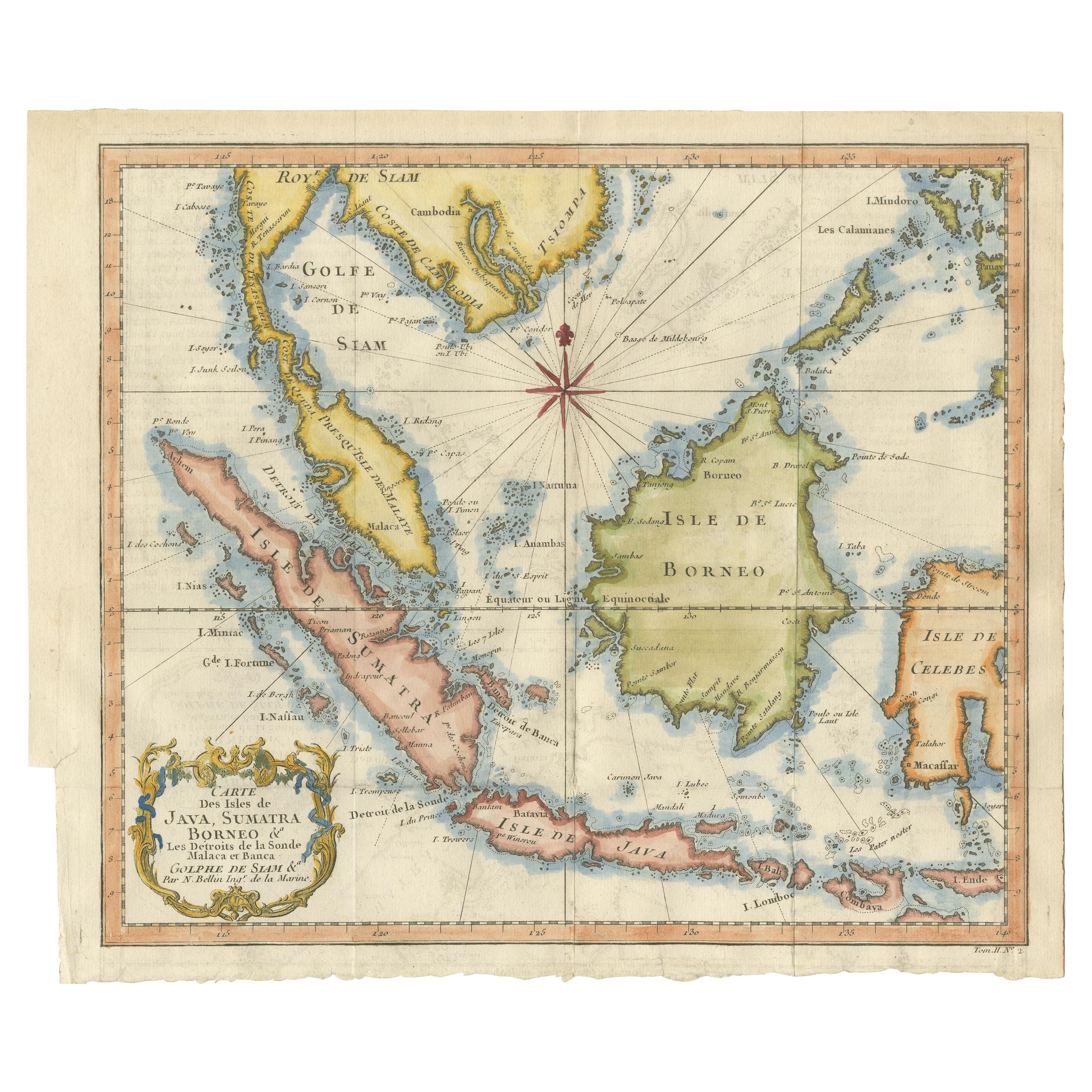
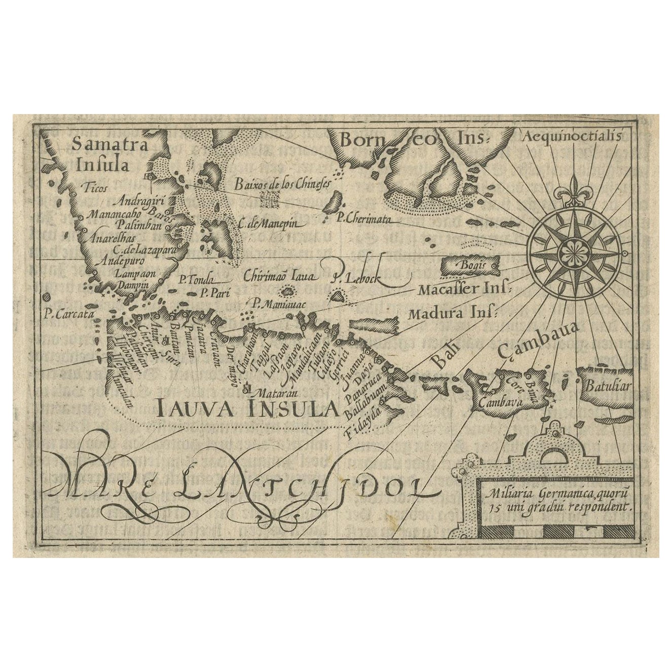
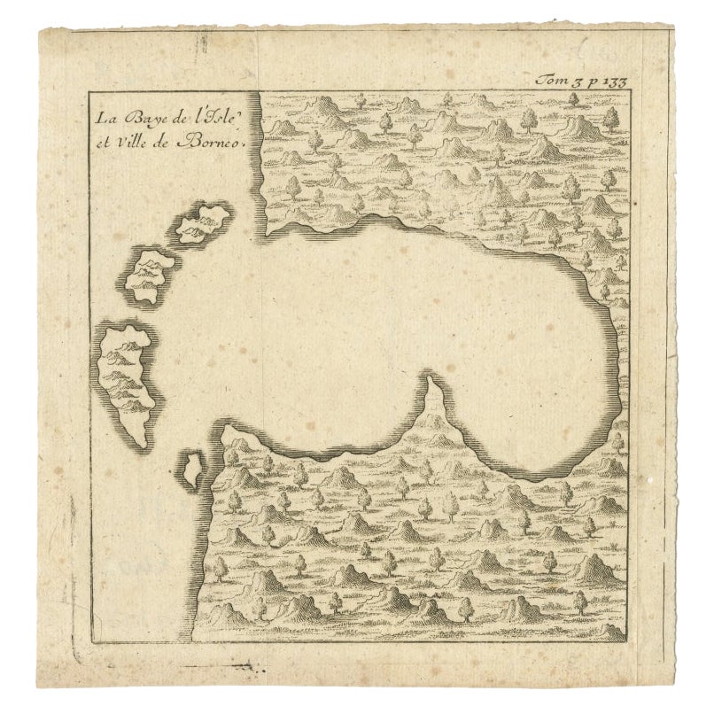
Antique Map of Singapore, Malaysia, Borneo, Sumatra and Java (Indonesia), 1739
View Similar Items


Want more images or videos?
Request additional images or videos from the seller
1 of 6
Antique Map of Singapore, Malaysia, Borneo, Sumatra and Java (Indonesia), 1739
About the Item
- Dimensions:Height: 12.21 in (31 cm)Width: 15.56 in (39.5 cm)Depth: 0 in (0.01 mm)
- Materials and Techniques:
- Period:
- Date of Manufacture:1739
- Condition:Condition: Very good, defect left margin. Please study image carefully.
- Seller Location:Langweer, NL
- Reference Number:Seller: BG-117451stDibs: LU3054327659622
About the Seller
5.0
Recognized Seller
These prestigious sellers are industry leaders and represent the highest echelon for item quality and design.
Platinum Seller
Premium sellers with a 4.7+ rating and 24-hour response times
Established in 2009
1stDibs seller since 2017
2,442 sales on 1stDibs
Typical response time: 1 hour
Authenticity Guarantee
In the unlikely event there’s an issue with an item’s authenticity, contact us within 1 year for a full refund. DetailsMoney-Back Guarantee
If your item is not as described, is damaged in transit, or does not arrive, contact us within 7 days for a full refund. Details24-Hour Cancellation
You have a 24-hour grace period in which to reconsider your purchase, with no questions asked.Vetted Professional Sellers
Our world-class sellers must adhere to strict standards for service and quality, maintaining the integrity of our listings.Price-Match Guarantee
If you find that a seller listed the same item for a lower price elsewhere, we’ll match it.Trusted Global Delivery
Our best-in-class carrier network provides specialized shipping options worldwide, including custom delivery.More From This Seller
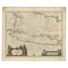
View AllAntique Engraving of Malaysia, Brunei, Singapore, Java, Borneo, Sumatra, c.1750
Located in Langweer, NL
Nice decorative and detailed map from the Gulf of Siam and Mindoro to Timo, Java and Sumatra Borneo and Roy de Siam. Large compass rose and nice cartouche.
Title: Carte des Isles ...
Category
Antique Mid-18th Century Maps
Materials
Paper

$601 Sale Price
20% Off
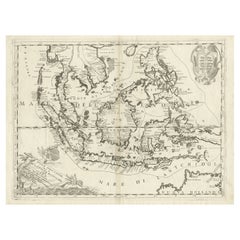
Antique Map of the Sunda Islands Sumatra, Java, Malay Peninsula & Borneo (1739)
By Isaak Tirion
Located in Langweer, NL
Antique map titled 'Nieuwe kaart van de Sundasche Eilanden als Borneo, Sumatra en Groot Iava & c'. Detailed map of the Sunda Islands, Southeast Asia, extending from the tip of Cambod...
Category
Antique Mid-18th Century Maps
Materials
Paper

$677 Sale Price
21% Off
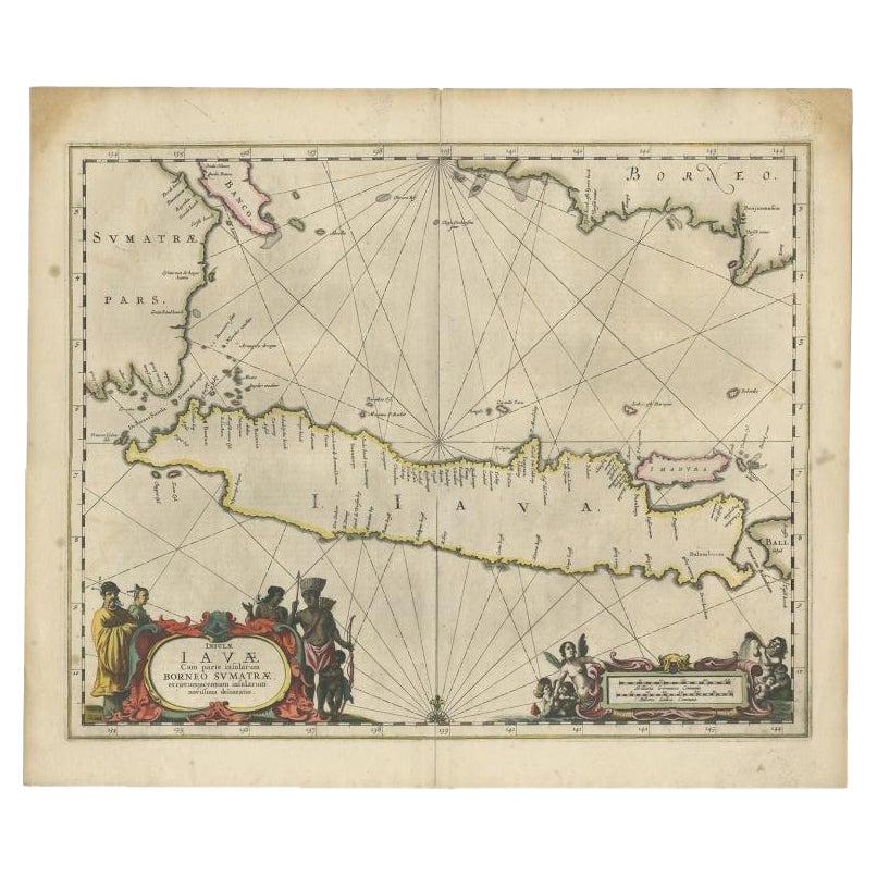
Antique Map of Java and Part of Borneo, Indonesia, c.1657
Located in Langweer, NL
Antique map titled 'Insulae Iavae cum parte insularum Boreno Sumatrae (..)'.
Beautiful map of the island of Java and part of Borneo, Bali, Madura and Sumatra. With decorative carto...
Category
Antique 17th Century Maps
Materials
Paper
$2,546 Sale Price
20% Off
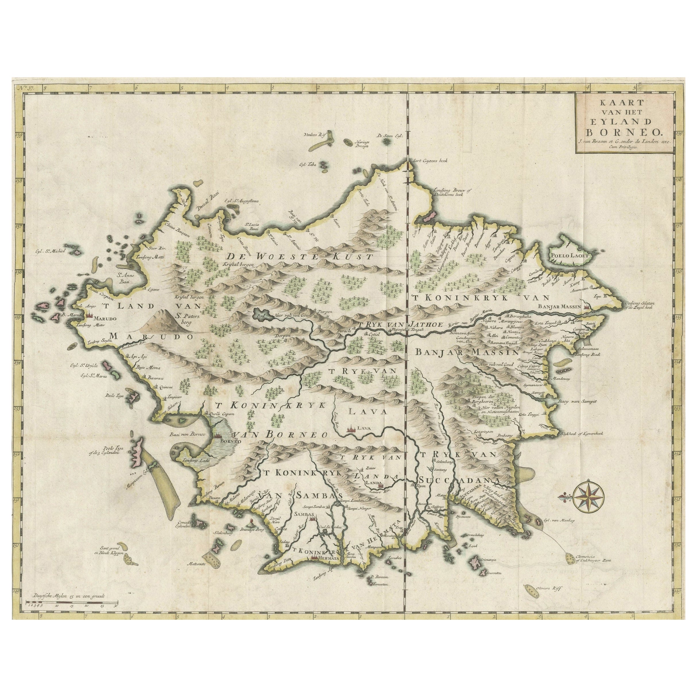
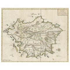
Old Antique Map of Borneo 'Kalimantan Indonesia, Sabah Malaysia & Brunei'
Located in Langweer, NL
Antique map titled 'Kaart van het Eyland Borneo'. Original antique map of the island of Borneo. Published 1724-1726 by Joannes van Braam and Gerard Onder de ...
Category
Antique Early 18th Century Maps
Materials
Paper
$1,481 Sale Price
20% Off
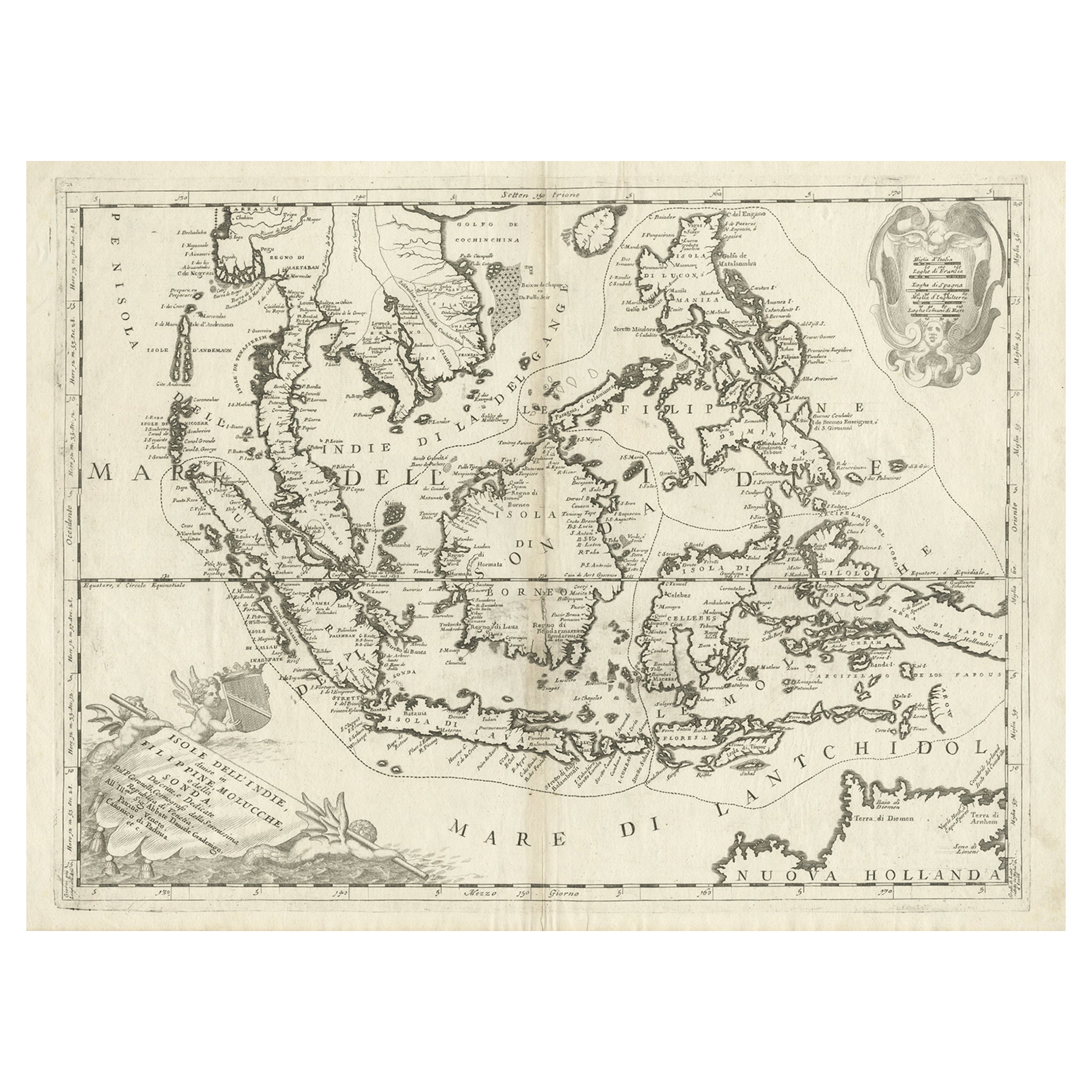
Original Antique Map of the Philippines, Malaysia, Indonesia, Singapore, c.1690
Located in Langweer, NL
Antique map titled 'Isole dell' Indie, diuise in Filippine, Molucche e della Sonda'.
Old map of the Philippines, Malaysia, Indonesia, Singapore, Northern Australia and contiguous i...
Category
Antique 1690s Maps
Materials
Paper
$2,083 Sale Price
20% Off
Free Shipping
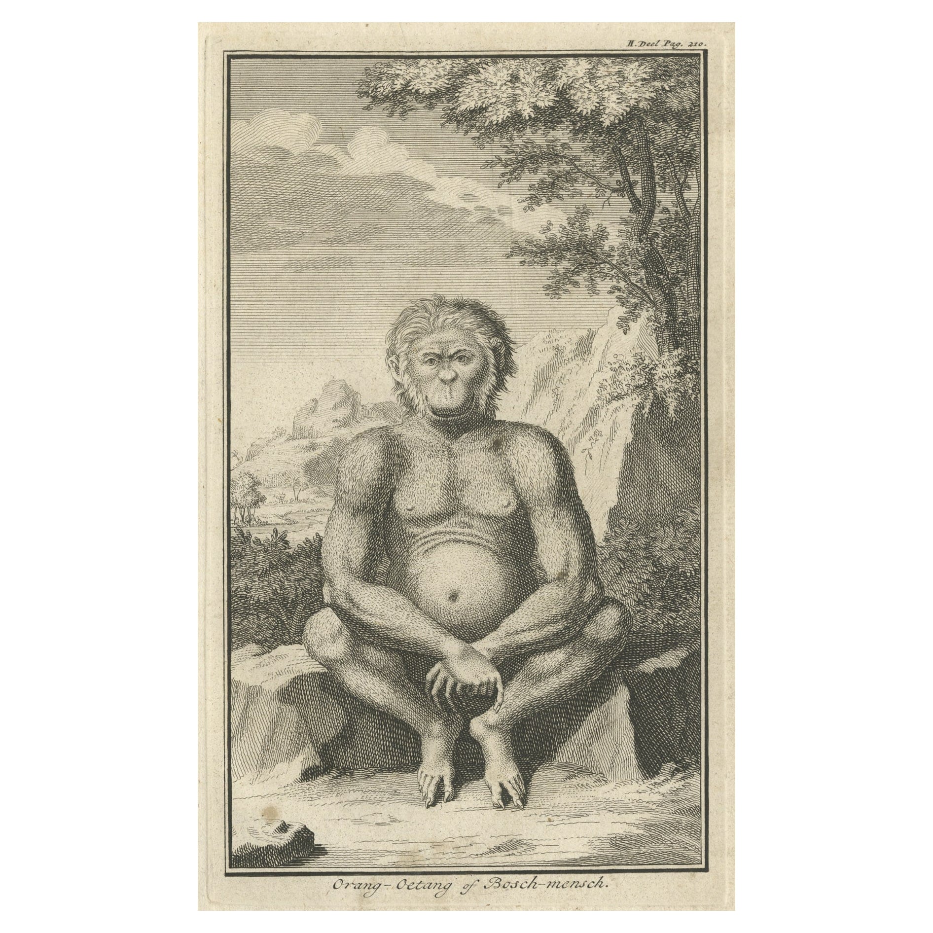
Engraving of an Orang-Utan on Borneo 'Kalimantan' or Sumatra, Indonesia, 1739
Located in Langweer, NL
Antique print titled 'Orang-Oetang of Bosch-mensch'. This print depicts an Orang-Utan on Borneo or Sumatra, Indonesia. Originates from 'Hedendaagsche Historie, of tegenwoordige staat...
Category
Antique 1730s Prints
Materials
Paper

$129 Sale Price
20% Off
You May Also Like
Large Original Antique Map of Java and Borneo, Fullarton, C.1870
Located in St Annes, Lancashire
Great map of Java and Borneo
Wonderful figurative borders
From the celebrated Royal Illustrated Atlas
Lithograph. Original color.
Published by Fullarton, Edinburgh. C.1870
Unfr...
Category
Antique 1870s Scottish Maps
Materials
Paper

Antique Map of Principality of Monaco
By Antonio Vallardi Editore
Located in Alessandria, Piemonte
ST/619 - "Old Geographical Atlas of Italy - Topographic map of ex-Principality of Monaco" -
ediz Vallardi - Milano -
A somewhat special edition ---
Category
Antique Late 19th Century Italian Other Prints
Materials
Paper

Original Antique Map of Ireland- Tipperary and Waterford. C.1840
Located in St Annes, Lancashire
Great map of Tipperary and Waterford
Steel engraving
Drawn under the direction of A.Adlard
Published by How and Parsons, C.1840
Unframed.
Category
Antique 1840s English Maps
Materials
Paper

Original Antique Map of Spain and Portugal, circa 1790
Located in St Annes, Lancashire
Super map of Spain and Portugal
Copper plate engraving by A. Bell
Published, circa 1790.
Unframed.
Category
Antique 1790s English Other Maps
Materials
Paper

Original Antique Map of United States, Grattan and Gilbert, 1843
Located in St Annes, Lancashire
Great map of United States
Drawn and engraved by Archer
Published by Grattan and Gilbert. 1843
Original colour
Unframed.
Category
Antique 1840s English Maps
Materials
Paper

Original Antique Map of Europe, Arrowsmith, 1820
Located in St Annes, Lancashire
Great map of Europe
Drawn under the direction of Arrowsmith.
Copper-plate engraving.
Published by Longman, Hurst, Rees, Orme and Brown, 1820
...
Category
Antique 1820s English Maps
Materials
Paper

Recently Viewed
View AllMore Ways To Browse
Paul Mccobb Walnut Table
Peacock Plate
Pedestal Centre Table
Pigeon Table
Pink Bench
Porcelain Dinner Set For 12
Rattan Chairs Square
Rattan Coffee Table French
Rectangular White Oak Coffee Table
Regency Style Italian Side Tables
Renaissance Majolica
Retro Vanity Chairs
Round Marble Garden Table
Round Stone Console Table
Round Stone Garden Tables
Rug Remnants
Scandanavian Danish Jewelry
Second Empire Table