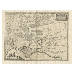
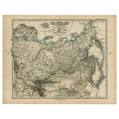
Antique Map of Ukraine and Surroundings, ca.1650
View Similar Items


Want more images or videos?
Request additional images or videos from the seller
1 of 5
Antique Map of Ukraine and Surroundings, ca.1650
About the Item
- Dimensions:Height: 20.67 in (52.5 cm)Width: 24.81 in (63 cm)Depth: 0 in (0.02 mm)
- Materials and Techniques:
- Period:1650-1659
- Date of Manufacture:circa 1650
- Condition:Additions or alterations made to the original: Image trimmed and mounted. General age-related toning, please study image carefully. Wear consistent with age and use.
- Seller Location:Langweer, NL
- Reference Number:Seller: BG-09189 1stDibs: LU3054326831222
About the Seller
5.0
Platinum Seller
These expertly vetted sellers are 1stDibs' most experienced sellers and are rated highest by our customers.
Established in 2009
1stDibs seller since 2017
1,956 sales on 1stDibs
More From This SellerView All
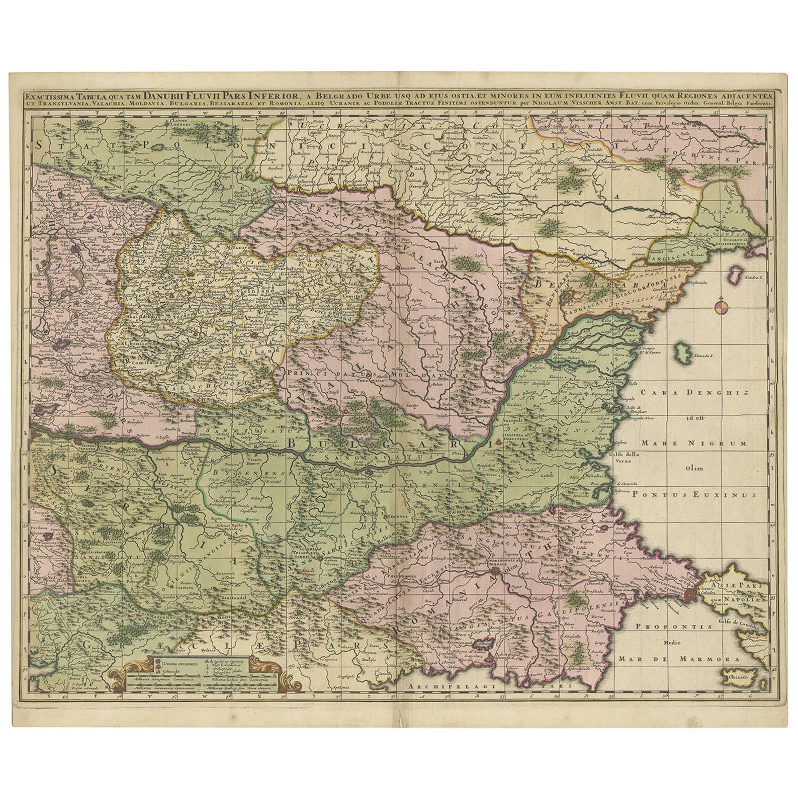
- Antique Map of Ukraine, Bulgaria, Romania, Servia & Surroundings by N. VisscherLocated in Langweer, NLAntique map titled 'Exactissima Tabula qua tam Danubii Fluvii Pars Inferior, a Belgrado Urbe usq ad ejus ostia, et minores in eum influentes, Fluvii quam Regiones adjacentes, ut Tran...Category
Antique Early 18th Century Maps
MaterialsPaper
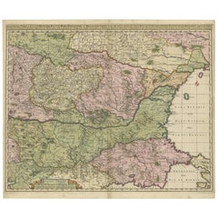 $765 Sale Price20% Off
 - Antique Map of Afghanistan and Surroundings, '1845'Located in Langweer, NLAntique map titled 'Map of Persia and Caubul'. Original antique map of Afghanistan and surroundings. This map originates from 'An Atlas of the World, Comprehending Separate Maps of...Category
Antique Mid-19th Century Maps
MaterialsPaper
 $177 Sale Price20% Off
 - Antique Map of Belgium and Surroundings, 1692Located in Langweer, NLAntique map titled 'Provincie Meridionali de Paesi Bassi Intese sotto nome di Fiandra overo Li Paesi Bassi Cattolici con li confini di Francia di Allemagna et di Hollanda'. Uncommon map of Belgium...Category
Antique 17th Century Maps
MaterialsPaper
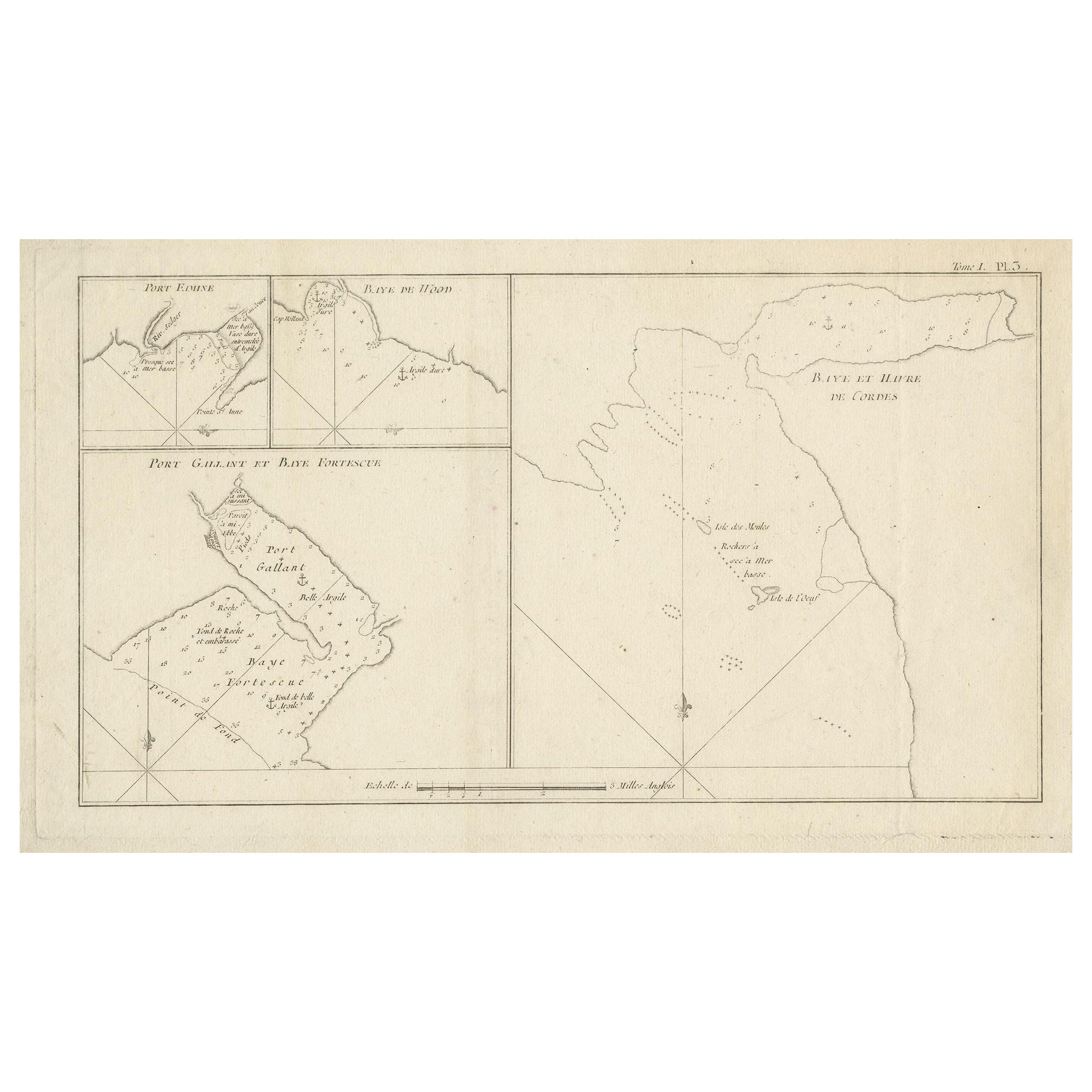
- Antique Map of Cordes Bay and SurroundingsLocated in Langweer, NLAntique map titled 'Baye et Havre de Cordes (..)'. Four maps on the one sheet of; Cordes Bay, Port Famine, Woods Pay, Port Gallant, Fortescue Bay, Chile based on the voyage of John B...Category
Antique Late 18th Century Maps
MaterialsPaper
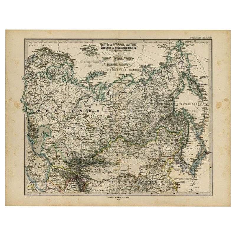
- Antique Map of Russia and Surroundings by Stieler, 1874Located in Langweer, NLAntique map titled 'Nord- & Mittal-Asien, Ubersicht des Russischen Reiches.' A map of Russia in scale 1:20.000.000. The depicted area spans from Iran and Sweden in the left edge of t...Category
Antique 19th Century Maps
MaterialsPaper
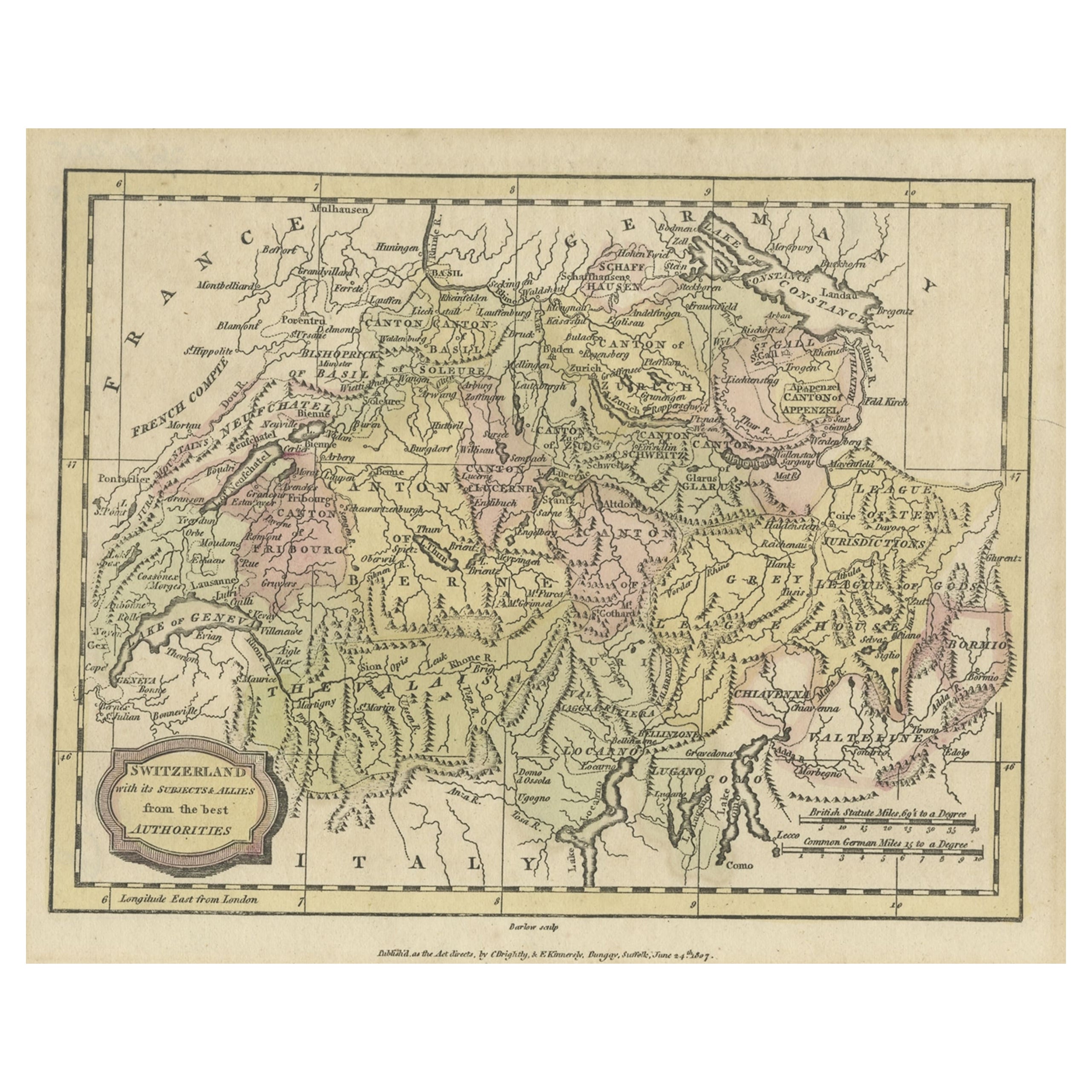
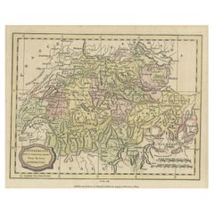
- Small Original Antique Map of Switzerland and Surroundings, 1807Located in Langweer, NLAntique map titled 'Switzerland with its subjects & allies from the best authorities'. Small map of Switzerland and surroundings. Originates from 'A general view of the world' by...Category
Antique Early 1800s Maps
MaterialsPaper

You May Also Like
- 1854 Map of Massachusetts, Connecticut and Rhode Island, Antique Wall MapLocated in Colorado Springs, COThis striking wall map was published in 1854 by Ensign, Bridgman & Fanning and has both full original hand-coloring and original hardware. This impression is both informative and highly decorative. The states are divided into counties, outlined in red, green, and black, and subdivided into towns. Roads, canals, and railroad lines are prominently depicted, although they are not all labeled. The mapmakers also marked lighthouses, banks, churches, and prominent buildings, with a key at right. The map is an informative and comprehensive overview of the infrastructural development of New England prior to the Civil War. Physical geographies depicted include elevation, conveyed with hachure marks, rivers and lakes. The impression features an inset map of Boston...Category
Antique 19th Century American Maps
MaterialsPaper
- Antique Map of Principality of MonacoBy Antonio Vallardi EditoreLocated in Alessandria, PiemonteST/619 - "Old Geographical Atlas of Italy - Topographic map of ex-Principality of Monaco" - ediz Vallardi - Milano - A somewhat special edition ---Category
Antique Late 19th Century Italian Other Prints
MaterialsPaper
 $230 Sale Price74% Off
 - Large Antique Polychromed Wood Statue of a Bishop, circa 1650Located in Dallas, TXThis 64 inch high antique statue of a Bishop dates to circa 1650 and is German in origin. Starting in the 15th and 16th centuries, there was a large demand for ecclesiastical carvings throughout central and western Europe. Large statues were commissioned for churches and smaller items were for private use. This bishop statue...Category
Antique 17th Century German Figurative Sculptures
MaterialsFabric, Glass, Wood, Paint
- Geographical Antique Map of Principality of MonacoBy Bruno SantiniLocated in Alessandria, PiemonteST/609 - Interesting antique color map of Monaco Principality in French language : "Carte qui contient le Principauté de Piémont, le Monferrat et la comté de...Category
Antique Late 18th Century Italian Other Maps
MaterialsPaper
 $763 Sale Price20% Off
 - 1861 Topographical Map of the District of Columbia, by Boschke, Antique MapLocated in Colorado Springs, COPresented is an original map of Albert Boschke's extremely sought-after "Topographical Map of the District of Columbia Surveyed in the Years 1856 ...Category
Antique 1860s American Historical Memorabilia
MaterialsPaper
- Original Antique Map of Spain and Portugal, circa 1790Located in St Annes, LancashireSuper map of Spain and Portugal Copper plate engraving by A. Bell Published, circa 1790. Unframed.Category
Antique 1790s English Other Maps
MaterialsPaper