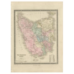
Antique Map of Van Diemen's Land 'Tasmania' by Wyld, '1845'
View Similar Items


Want more images or videos?
Request additional images or videos from the seller
1 of 5
Antique Map of Van Diemen's Land 'Tasmania' by Wyld, '1845'
About the Item
- Dimensions:Height: 14.18 in (36 cm)Width: 10.24 in (26 cm)Depth: 0.02 in (0.5 mm)
- Materials and Techniques:
- Period:
- Date of Manufacture:1845
- Condition:General age-related toning. Minor wear, light staining. Blank verso, please study image carefully.
- Seller Location:Langweer, NL
- Reference Number:Seller: BG-12894-371stDibs: LU3054323139692
About the Seller
5.0
Platinum Seller
These expertly vetted sellers are 1stDibs' most experienced sellers and are rated highest by our customers.
Established in 2009
1stDibs seller since 2017
1,947 sales on 1stDibs
More From This SellerView All
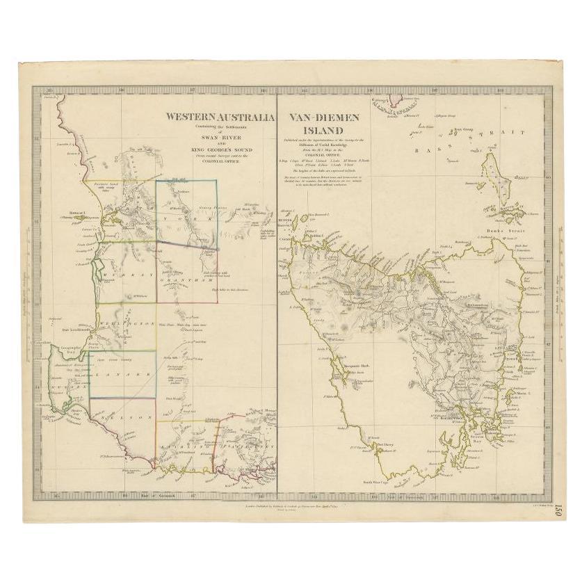
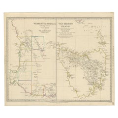
- Antique Map of Western Australia and Van Diemen's Land or Tasmania, 1833Located in Langweer, NLAntique map of Australia titled 'Western Australia - Van-Diemen Island'. Two maps on one sheet. Left, Western Australia containing the settlements of the Swan river...Category
Antique 19th Century Maps
MaterialsPaper
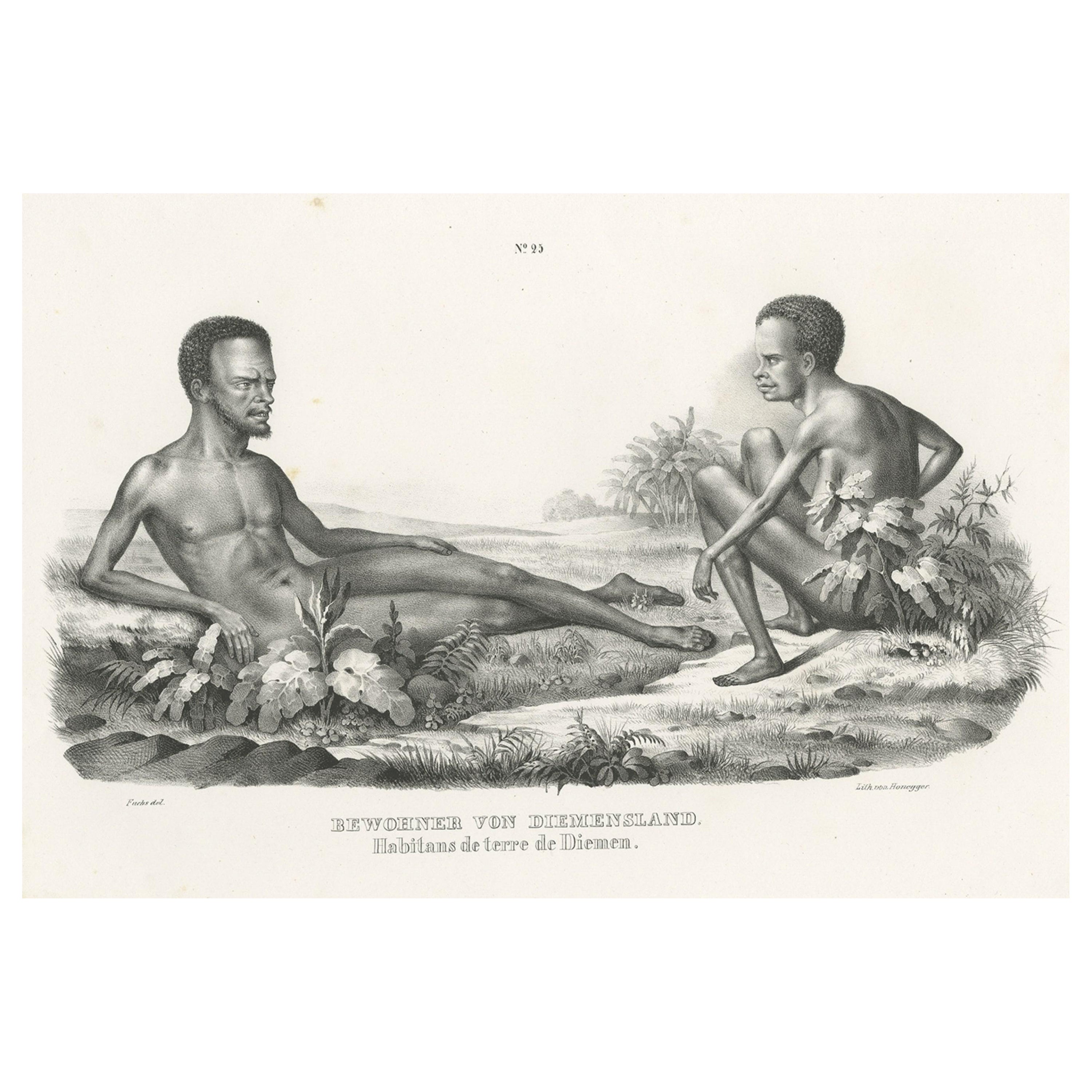
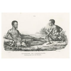
- Old Print Depicting Inhabitants of Van Diemen's Land, Tasmania, Australia, c1845Located in Langweer, NLAntique print titled 'Bewohner von Diemensland, Habitans de terre de Diemen'. This print depicts inhabitants of Van Diemen's Land, Tasmania/Australia. O...Category
Antique 1840s Prints
MaterialsPaper
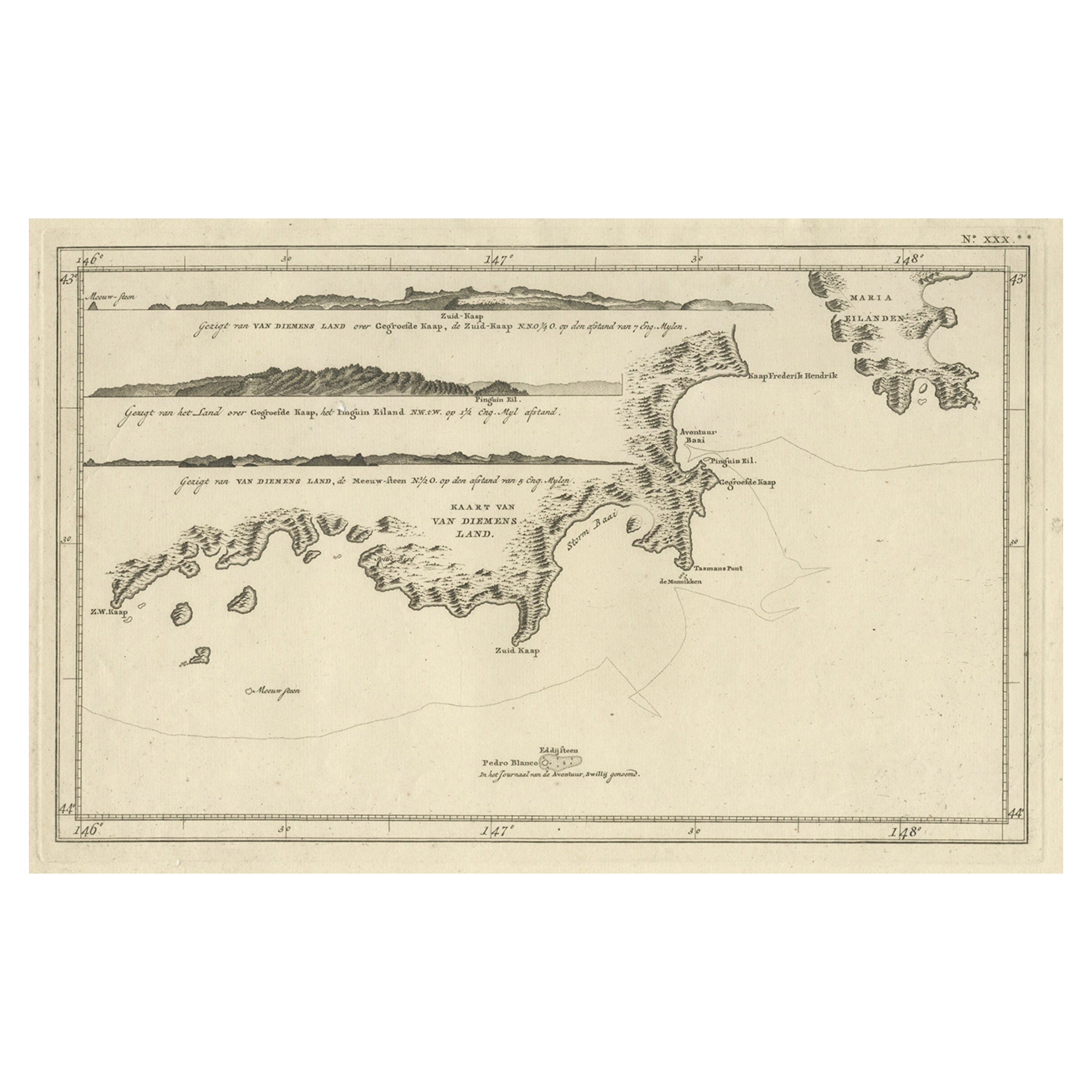
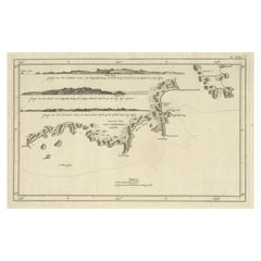
- Antique Coastal Views and a Map of Van Diemens Land (Tasmania), Australia, 1803Located in Langweer, NLAntique map Tasmania titled 'Kaart van Diemens Land'. Coastal views and a map of van Diemens Land (Tasmania). Originates from 'Reizen Rondom de Waereld ...Category
Antique Early 1800s Maps
MaterialsPaper
 $756 Sale Price20% Off
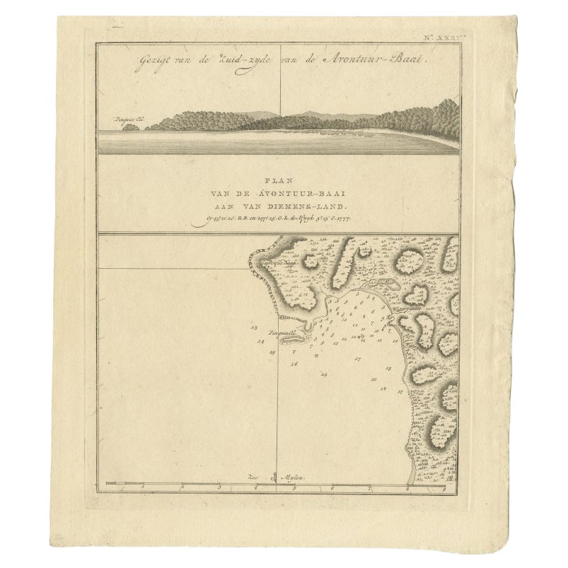
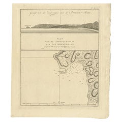
 - Antique Map of Adventure Bay, Van Diemens Land, Nowadays Tasmania Island, 1803Located in Langweer, NLAntique map Adventure Bay titled 'Plan van de Avontuur-Baai aan van Diemens-Land'. Antique map and coastal view of Adventure Bay. Originates from 'Reizen Ro...Category
Antique 19th Century Maps
MaterialsPaper
- Antique Map of Europe by Wyld '1845'Located in Langweer, NLAntique map titled 'Europe'. Original antique map of Europe. This map originates from 'An Atlas of the World, Comprehending Separate Maps of its ...Category
Antique Mid-19th Century Maps
MaterialsPaper

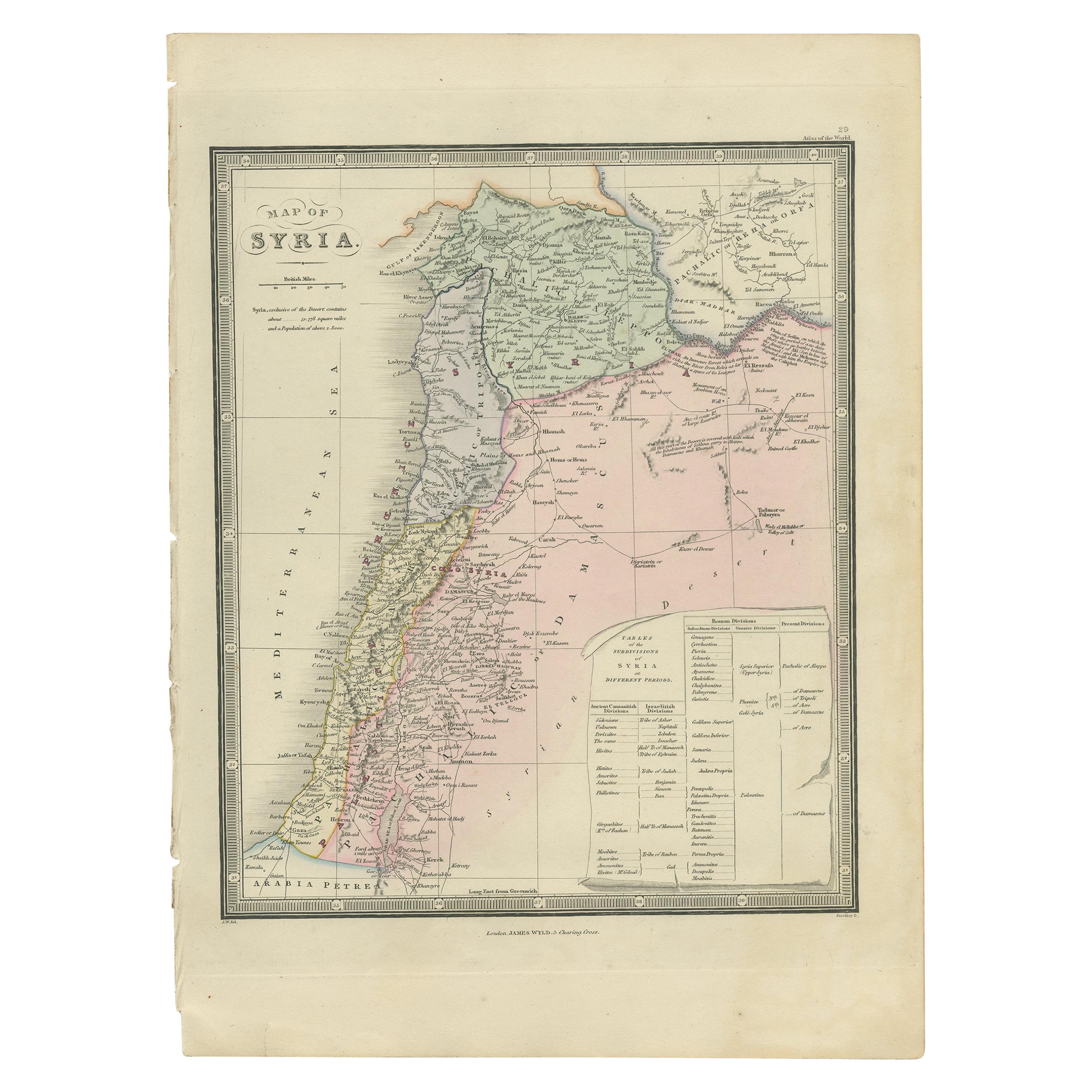
- Antique Map of Syria by Wyld '1845'Located in Langweer, NLAntique map titled 'Map of Syria'. Original antique map of Syria. This map originates from 'An Atlas of the World, Comprehending Separate Maps of its Var...Category
Antique Mid-19th Century Maps
MaterialsPaper

You May Also Like
- Antique Map of Italy by Andriveau-Goujon, 1843By Andriveau-GoujonLocated in New York, NYAntique Map of Italy by Andriveau-Goujon, 1843. Map of Italy in two parts by Andriveau-Goujon for the Library of Prince Carini at Palazzo Carini i...Category
Antique 1840s French Maps
MaterialsLinen, Paper
 $3,350 / set
 - Antique Map of Principality of MonacoBy Antonio Vallardi EditoreLocated in Alessandria, PiemonteST/619 - "Old Geographical Atlas of Italy - Topographic map of ex-Principality of Monaco" - ediz Vallardi - Milano - A somewhat special edition ---Category
Antique Late 19th Century Italian Other Prints
MaterialsPaper
 $228 Sale Price74% Off
 - The Holy Land at the Time of Jesus: A 17th Century Dutch Map by VisscherBy Nicolaes Visscher IILocated in Alamo, CAThis detailed Dutch map entitled "Het Beloofe de Landt Canaan door wandelt van onsen Salichmaecker Iesu Christo, nessens syne Apostelen" by Nicolaes Visscher was published in Amsterd...Category
Antique Mid-17th Century Dutch Maps
MaterialsPaper
- Original Antique Map of Russia By Arrowsmith. 1820Located in St Annes, LancashireGreat map of Russia Drawn under the direction of Arrowsmith Copper-plate engraving Published by Longman, Hurst, Rees, Orme and Brown, 1820 Unframed.Category
Antique 1820s English Maps
MaterialsPaper

- Map of the Holy Land "Carte de la Syrie et de l'Egypte" by Pierre M. LapieBy Pierre M. LapieLocated in Alamo, CAAn early 19th century map of ancient Syria and Egypt entitled "Carte de la Syrie et de l'Egypte anciennes/dressée par M. Lapie, Colonel d'Etat Major, et...Category
Antique Early 19th Century French Maps
MaterialsPaper
- Original Antique Map of Belgium by Tallis, Circa 1850Located in St Annes, LancashireGreat map of Belgium Steel engraving Many lovely vignettes Published by London Printing & Publishing Co. ( Formerly Tallis ), C.1850 Origin...Category
Antique 1850s English Maps
MaterialsPaper


Recently Viewed
View AllMore Ways To Browse
Van Diemen
Tasmania Antique
Antique Tasmania
Antique Furniture Tasmania
Book Of Maps
Map Lithograph
Antique Map Engraving
Antique City Map
Antique City Maps
Antique Maps Of Cities
Map Of Italy
Large Antique Fairs
England Map
Antique World Maps And Atlases World Maps
Antique Furniture Portugal
Map Of England
Original City Map
Antique Furniture Edinburgh