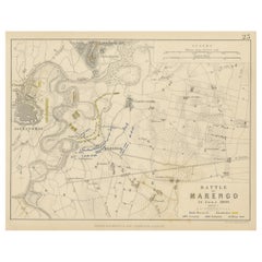
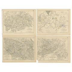
Antique Plan of the Battle of Marengo, Near Alexandria, Italy, 1852
View Similar Items


Want more images or videos?
Request additional images or videos from the seller
1 of 6
Antique Plan of the Battle of Marengo, Near Alexandria, Italy, 1852
About the Item
- Dimensions:Height: 7.09 in (18 cm)Width: 8.98 in (22.8 cm)Depth: 0.02 in (0.5 mm)
- Materials and Techniques:
- Period:
- Date of Manufacture:1852
- Condition:General age-related toning. Shows some wear and foxing, blank verso. Please study image carefully.
- Seller Location:Langweer, NL
- Reference Number:Seller: BG-12209-921stDibs: LU3054334760642
About the Seller
5.0
Recognized Seller
These prestigious sellers are industry leaders and represent the highest echelon for item quality and design.
Gold Seller
Premium sellers maintaining a 4.3+ rating and 24-hour response times
Established in 2009
1stDibs seller since 2017
2,467 sales on 1stDibs
Typical response time: 1 hour
Authenticity Guarantee
In the unlikely event there’s an issue with an item’s authenticity, contact us within 1 year for a full refund. DetailsMoney-Back Guarantee
If your item is not as described, is damaged in transit, or does not arrive, contact us within 7 days for a full refund. Details24-Hour Cancellation
You have a 24-hour grace period in which to reconsider your purchase, with no questions asked.Vetted Professional Sellers
Our world-class sellers must adhere to strict standards for service and quality, maintaining the integrity of our listings.Price-Match Guarantee
If you find that a seller listed the same item for a lower price elsewhere, we’ll match it.Trusted Global Delivery
Our best-in-class carrier network provides specialized shipping options worldwide, including custom delivery.More From This Seller
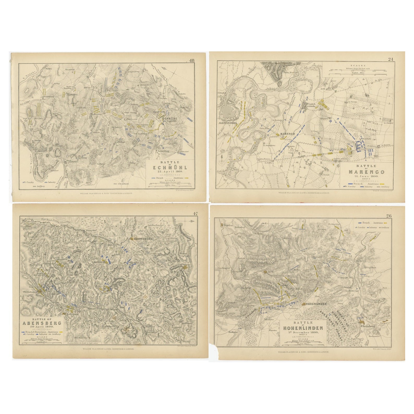
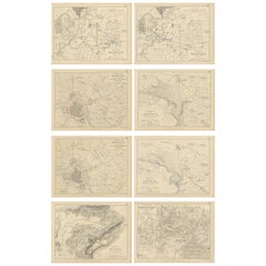
View AllFour Antique Battle Plans of Echmühl, Hohenlinden, Abensberg and Marengo, 1852
Located in Langweer, NL
Set of 4 antique battle plans. Included are:
1) Battle of Hohenlinden 3d. December 1800
2) Battle of Echmühl 22. April 1809
3) Battle of Arensberg 20. Ap...
Category
Antique Mid-19th Century Maps
Materials
Paper
$223 Sale Price / set
20% Off
Free Shipping
Set of 8 Battle Plans, Rivoli, Arcole, Mantua, Marengo, Hohenlinden, 1852
Located in Langweer, NL
Set of 8 battle plans including battle plans of Rivoli, Arcole, Mantua, Marengo and Hohenlinden. These prints originate from 'Atlas to Alison's history of...
Category
Antique Mid-19th Century Prints
Materials
Paper
$372 Sale Price / set
20% Off
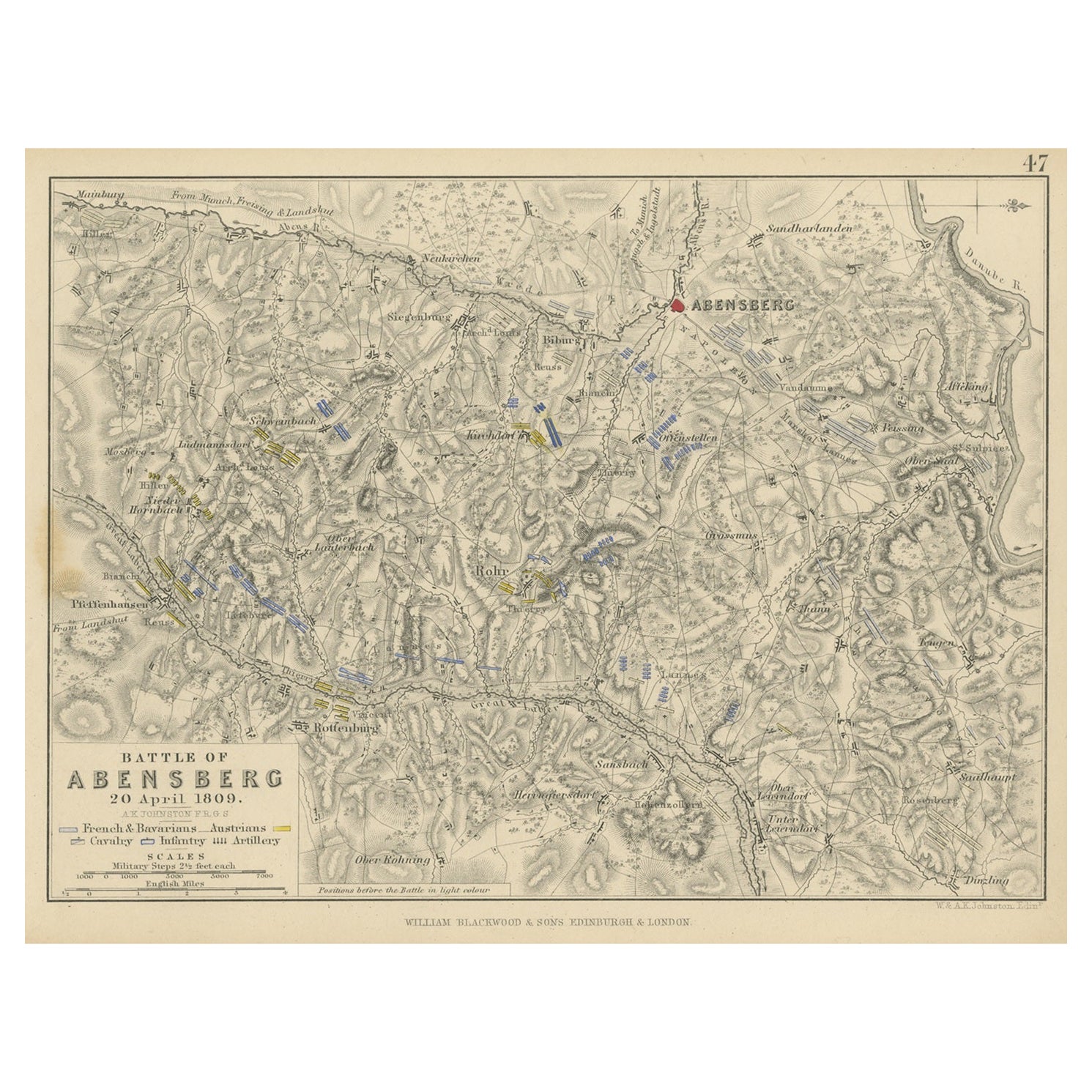
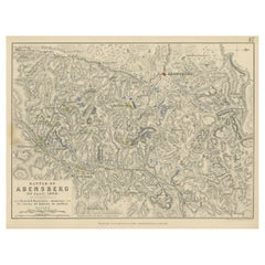
Antique Plan of the Battle of Abensberg in Germany
Located in Langweer, NL
Antique battle map titled 'Battle of Abensberg 20 April 1809'. Plan of the Battle of Abensberg, fought on 20 April 1809 between a Franco-German force under ...
Category
Antique Mid-19th Century Maps
Materials
Paper
$130 Sale Price
20% Off
Antique Roman Battle Plan of a Camp by Duncan, c.1753
Located in Langweer, NL
Antique battle map showing a plan of a camp. With detailed legend explaining the various elements of the print. This print most likely originates f...
Category
Antique 18th Century Prints
Materials
Paper
$270 Sale Price
20% Off
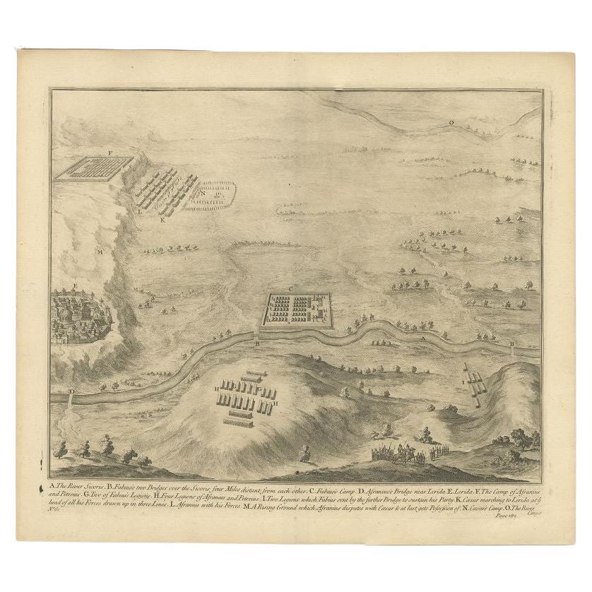
Antique Print of the Battle of Romans near the River Sicoris or Segre in France
Located in Langweer, NL
Antique battle map of the Segre river. With detailed legend explaining the various elements of the print. This print most likely originates from an edition of 'The Commentaries of Ca...
Category
Antique 18th Century Prints
Materials
Paper
$223 Sale Price
20% Off
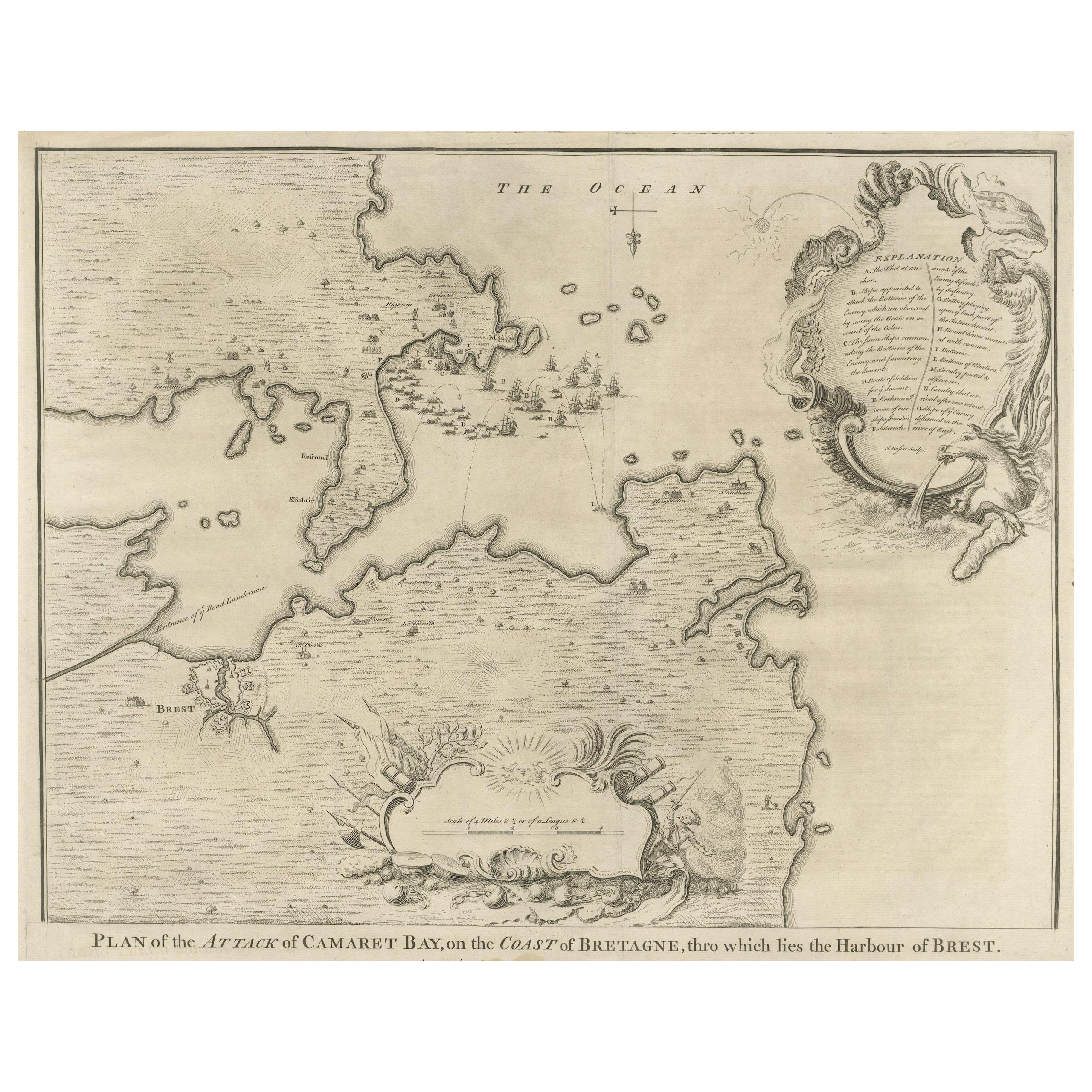
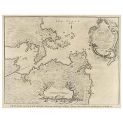
Antique Print of the Battle of Camaret in the Nine Years War, Near Brest, France
Located in Langweer, NL
Antique print titled 'Plan of the Attack of Camaret Bay, on the Coast of Bretagne, thro which lies the Harbour of Brest'. Striking plan showing the details of the battle at the mouth of Cameret Bay. Includes a battle plan...
Category
Antique Mid-18th Century Maps
Materials
Paper
$605 Sale Price
20% Off
You May Also Like
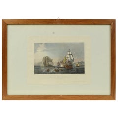
Antique Lithographic Print of the Diamond Rock Battle Early 1900s, Oakwood Frame
Located in Milan, IT
Lithographic print of the diamond rock battle, the main port of the island of Martinique, taken from the book Historical Gallery of Versailles 112. Chacoane is the engraver. Original...
Category
Early 20th Century French Nautical Objects
Materials
Paper
Gold Leaf Foil Pictorial Plan Map of the West Country of England Antique Style
Located in West Sussex, Pulborough
We are delighted to offer for sale this lovely Antique style pictorial plan map of the West Country of England etched in gold leaf foil
This is a very interesting and decorative p...
Category
20th Century English Adam Style Maps
Materials
Gold Leaf

$302 Sale Price
20% Off
Original Antique City Plan of Milwaukee, USA, 1894
By Rand McNally & Co.
Located in St Annes, Lancashire
Fabulous colorful map of Milwaukee
Original color
By Rand, McNally & Co.
Published, 1894
Unframed
Free shipping.
Category
Antique 1890s American Maps
Materials
Paper

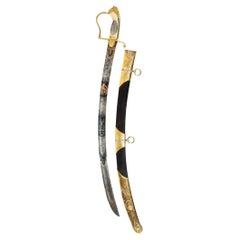
Midshipman Proctor’s Sword for Valour at the Battle of Copenhagen
Located in Lymington, Hampshire
This curved sword has a blued steel German blade with an ivory cross-hatched grip bearing silver and gilt mounts in the form of a lion’s head and mane. ...
Category
Antique Early 1800s English Arms, Armor and Weapons
Materials
Silver, Steel
Plan of Paris, France, by A. Vuillemin, Antique Map, 1845
Located in Colorado Springs, CO
This large and detailed plan of Paris was published by Alexandre Vuillemin in 1845. The map conveys a wonderful amount of information and is decorated throughout with pictorial vigne...
Category
Antique 1840s American Maps
Materials
Paper

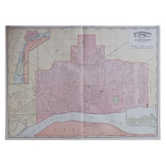
Large Original Antique City Plan of Detroit, USA, 1894
By Rand McNally & Co.
Located in St Annes, Lancashire
Fabulous colorful map of Detroit
Original color
By Rand, McNally & Co.
Published, 1894
Unframed
Free shipping.
Category
Antique 1890s American Maps
Materials
Paper
Recently Viewed
View AllMore Ways To Browse
Velvet Couch W Fringe
Victorian Salon Set
Vintage Bone China Coffee Set
Vintage Brandt End Table
Vintage Brass Towel Stand
Vintage Chesterfield Office Desk
Vintage Chimayo Rug
Vintage Clapper
Vintage Cowboy Saddle
Vintage F1 Posters Original
Vintage Figure Sketch
Vintage Floral Dinnerware Set
Vintage G Plan Glass Coffee Table
Vintage Georges Briard Ice Bucket
Vintage Glass Plate With Silver Overlay
Vintage Glass Vinegar Bottles
Vintage Hand Painted Salt And Pepper Shakers
Vintage Horse Drinking Glasses