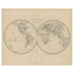
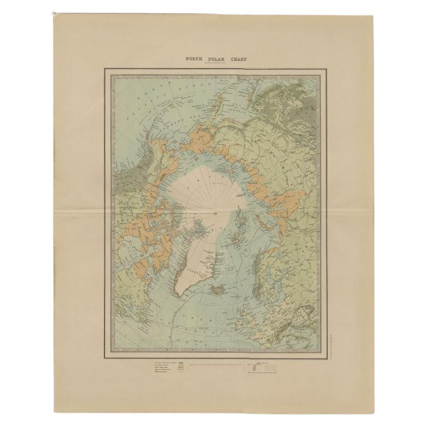
Antique World Map by Johnston, 1882
View Similar Items


Want more images or videos?
Request additional images or videos from the seller
1 of 6
Antique World Map by Johnston, 1882
About the Item
- Dimensions:Height: 16.74 in (42.5 cm)Width: 24.18 in (61.4 cm)Depth: 0 in (0.01 mm)
- Materials and Techniques:
- Period:
- Date of Manufacture:1882
- Condition:Condition: Good, general age-related toning. Please study image carefully.
- Seller Location:Langweer, NL
- Reference Number:Seller: BG-11823-11stDibs: LU3054329622232
About the Seller
5.0
Recognized Seller
These prestigious sellers are industry leaders and represent the highest echelon for item quality and design.
Gold Seller
Premium sellers maintaining a 4.3+ rating and 24-hour response times
Established in 2009
1stDibs seller since 2017
2,467 sales on 1stDibs
Typical response time: 1 hour
Authenticity Guarantee
In the unlikely event there’s an issue with an item’s authenticity, contact us within 1 year for a full refund. DetailsMoney-Back Guarantee
If your item is not as described, is damaged in transit, or does not arrive, contact us within 7 days for a full refund. Details24-Hour Cancellation
You have a 24-hour grace period in which to reconsider your purchase, with no questions asked.Vetted Professional Sellers
Our world-class sellers must adhere to strict standards for service and quality, maintaining the integrity of our listings.Price-Match Guarantee
If you find that a seller listed the same item for a lower price elsewhere, we’ll match it.Trusted Global Delivery
Our best-in-class carrier network provides specialized shipping options worldwide, including custom delivery.More From This Seller
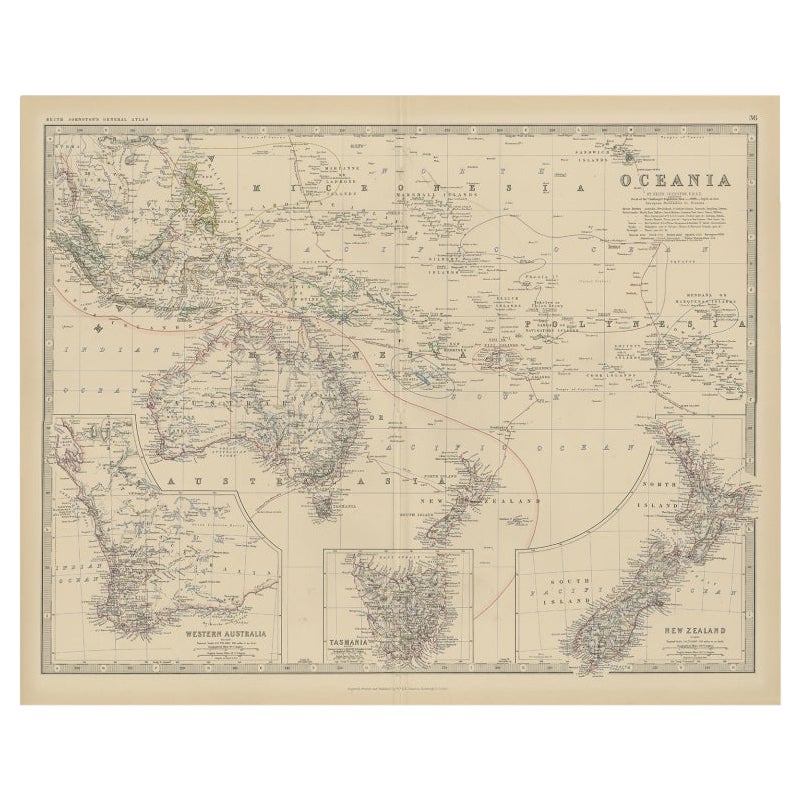
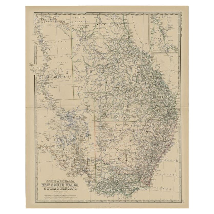
View AllAntique Map of Oceania by Johnston, 1882
Located in Langweer, NL
Antique map titled 'Oceania'. Old map of Oceania with inset maps of Western Australia, Tasmania and New Zealand. This map originates from 'The Royal Atlas of Modern Geography, Exhibi...
Category
Antique 19th Century Maps
Materials
Paper
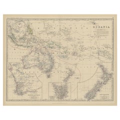
$122 Sale Price
20% Off
Antique Map of Switzerland by Johnston, 1882
Located in Langweer, NL
Antique map titled 'Switzerland and the Alps of Savoy and Piedmont'. Old map of Switzerland and the Alps of Savoy and Piedmont. This map originates from 'The Royal Atlas of Modern Ge...
Category
Antique 19th Century Maps
Materials
Paper

$122 Sale Price
20% Off
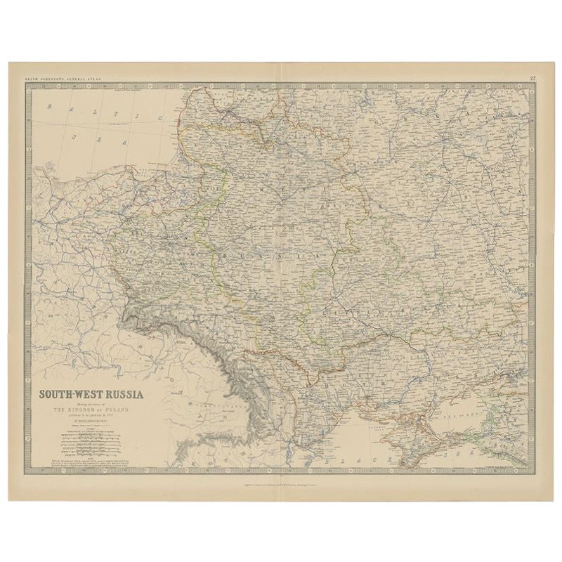
Antique Map of Southern Russia by Johnston, 1882
Located in Langweer, NL
"Antique map titled 'South-West Russia'. Old map of southern Russia, also showing the extent of the Kingdom of Poland. This map originates from 'The Royal Atlas of Modern Geography, ...
Category
Antique 19th Century Maps
Materials
Paper
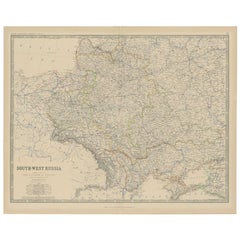
$112 Sale Price
20% Off
Antique Map of North America by Johnston, 1882
By Alexander Keith Johnston
Located in Langweer, NL
Antique map titled 'North America'.
Old map of North America. This map originates from 'The Royal Atlas of Modern Geography, Exhibiting, in a Series of Entirely Original and Authen...
Category
Antique 19th Century Maps
Materials
Paper

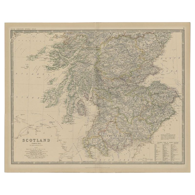
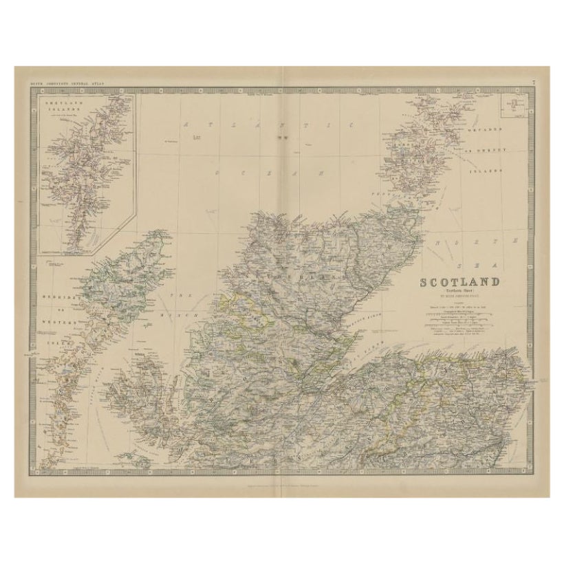
Antique Map of Southern Scotland by Johnston, 1882
Located in Langweer, NL
"Antique map titled 'Scotland'. Old map of Southern Scotland. This map originates from 'The Royal Atlas of Modern Geography, Exhibiting, in a Series of Entirely Original and Authenti...
Category
Antique 19th Century Maps
Materials
Paper
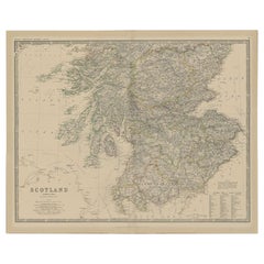
$126 Sale Price
20% Off
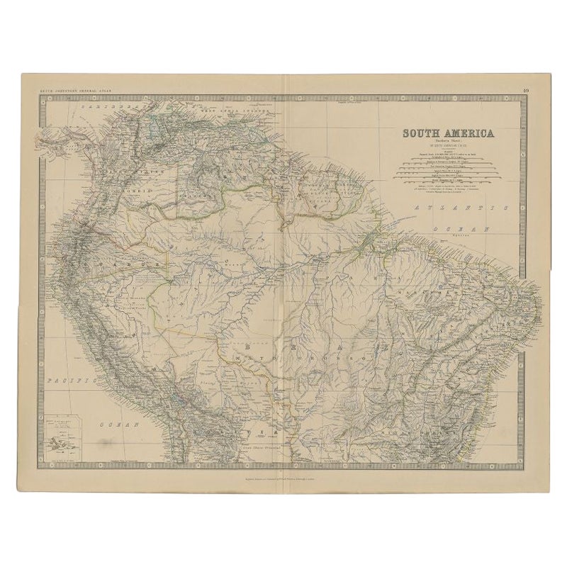
Antique Map of South America by Johnston, 1882
Located in Langweer, NL
Antique map titled 'South America'. Old map of South America, with an inset map of the Galapagos Isles. This map originates from 'The Royal Atlas of Modern Geography, Exhibiting, in ...
Category
Antique 19th Century Maps
Materials
Paper
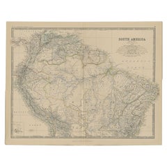
$134 Sale Price
20% Off
You May Also Like
Vintage World Map Mirror Based on the Original by Johnson 1882 Military Campaign
Located in West Sussex, Pulborough
We are delighted to offer for sale this lovely Antique style pictorial plan map of the globe based on the original by Johnson in 1882
This is a very interesting and decorative pie...
Category
20th Century English Campaign Maps
Materials
Mirror

$330 Sale Price
20% Off
World Relief Map
Located in Antwerp, BE
Large world relief map.
Measures: Width 232 cm.
Height 158 cm.
Category
Mid-20th Century German Mid-Century Modern Maps
Materials
Acrylic

$2,096
8 Foot Framed World Map by Philips
Located in Norwell, MA
1951 map of the world by George Philip and Son. Large beautiful map as it was in 1951. Nice patina mounted to a sturdy wood frame. Overall good condition. Very large in size. 90" W x...
Category
Vintage 1950s North American Maps
Materials
Paper
Original Antique Map of The World by Thomas Clerk, 1817
Located in St Annes, Lancashire
Great map of The Eastern and Western Hemispheres
On 2 sheets
Copper-plate engraving
Drawn and engraved by Thomas Clerk, Edinburgh.
Published by Mackenzie And Dent, 1817
...
Category
Antique 1810s English Maps
Materials
Paper

Large Original Antique Map of The World, Fullarton, C.1870
Located in St Annes, Lancashire
Great map of the World. Showing both hemispheres
From the celebrated Royal Illustrated Atlas
Lithograph. Original color.
Published by Fullarton, Edinburgh, C.1870
Unframed.
Rep...
Category
Antique 1870s Scottish Maps
Materials
Paper

Large Original Antique Map of the World, Fullarton, circa 1870
Located in St Annes, Lancashire
Great map of the World.
From the celebrated Royal Illustrated Atlas
Lithograph. Original color.
Published by Fullarton, Edinburgh, circa 1870.
Unframed.
Category
Antique 1870s Scottish Maps
Materials
Paper

Recently Viewed
View AllMore Ways To Browse
Orange Leather Club Chairs
Orion Sofa
Oval Bamboo Tray
Owl Chair
Oxblood Lounge Chair
P3 Lounge Chair
Pace Lucite Table
Paillard Victor
Pair Asian Garden Stools
Pan American Airline
Paradise Lost Milton
Paris Porcelain Tureen
Parsons Stool
Passover Silver
Pastil Chair
Pearlware Figure
Pegasus Art Deco
Pencil Reed Lounge