Items Similar to Authentique Map by Pilon of The French Colonies in The West Indies, 1876


Want more images or videos?
Request additional images or videos from the seller
1 of 6
Authentique Map by Pilon of The French Colonies in The West Indies, 1876
$229.63
$287.0320% Off
£169.40
£211.7520% Off
€192
€24020% Off
CA$317.88
CA$397.3520% Off
A$344.68
A$430.8520% Off
CHF 182.92
CHF 228.6420% Off
MX$4,245.12
MX$5,306.4020% Off
NOK 2,267.12
NOK 2,833.9020% Off
SEK 2,139.64
SEK 2,674.5520% Off
DKK 1,461.80
DKK 1,827.2520% Off
About the Item
The 1876 map titled "Carte des Colonies Françaises aux Antilles" represents a significant contribution to cartography within the "Grand Atlas Départemental de la France de L'Algérie et des colonies" by H. Fisquet, published by A. Le Vasseur in Paris.
**Title:** Carte des Colonies Françaises aux Antilles
**Artist/Cartographer/Engraver:** Librairie Abel Pilon & Cie; A. Le Vasseur
**Provenance:** "Grand Atlas Départemental de la France de L'Algérie et des colonies" by H. Fisquet; Published by A. Le Vasseur, Paris [Grand atlas départemental]
**Type:** Antique engraved map with original hand coloring
This map is a significant representation of the French colonies in the West Indies during the late 19th century. Its inclusion in the larger "Grand Atlas Départemental" indicates its importance within a comprehensive collection of maps detailing the territories under French governance, including Algeria and the colonies.
Attributed to Librairie Abel Pilon & Cie and A. Le Vasseur, this antique engraved map features original hand coloring, highlighting geographical aspects and delineating between different territories, administrative boundaries, and natural features within the French Antilles.
Maps of this nature provide invaluable insights into the historical and geographical landscape of the French colonies in the West Indies during the 19th century. They serve as vital historical artifacts, offering a visual representation of political and geographical boundaries, cultural connections, and the colonial presence in the Caribbean during that period.
The French Colonies in the West Indies typically referred to several Caribbean islands and territories under French control during various periods of history. The main islands and regions that constituted the French West Indies included:
1. **Guadeloupe:** Comprising several islands, the main ones being Basse-Terre and Grande-Terre.
2. **Martinique:** A major island in the eastern Caribbean.
3. **Saint Martin:** The northern part of this island is under French control (the southern part, Sint Maarten, is Dutch).
4. **Saint Barthélemy:** Often referred to as St. Barts, a smaller island in the Caribbean.
5. **French Guiana:** Although located on the South American continent, it's considered part of the French West Indies due to its historical ties and its inclusion in the French Caribbean overseas departments.
6. **Saint Lucia:** Briefly held by the French at certain points in history, though it was predominantly British.
These territories, along with other smaller islands and dependencies, constituted the major French possessions in the West Indies. They were significant due to their economic contributions, primarily through sugarcane and other agricultural productions, as well as their strategic importance during periods of colonial competition between European powers in the Caribbean region.
VERSO: There is nothing printed on the reverse side, which is plain
AUTHENTICITY: This is an authentic historic print, published at the date stated above. I do not offer reproductions. It is not a modern copy. The term 'original' when applied to a print means that it was printed at the first or original date of publication; it does not imply that the item is unique. 'Print' means any image created by applying an inked block to paper or card under pressure by any method including wood engraving, steel engraving, copperplate, wood cut and lithography.
- Dimensions:Height: 14.38 in (36.5 cm)Width: 16.54 in (42 cm)Depth: 0 in (0.02 mm)
- Materials and Techniques:Paper,Engraved
- Period:
- Date of Manufacture:1876
- Condition:Good; suitable for framing. This map was coloured by hand at the time of publication. Strong paper but slightly soiled. Antiquarian maps and prints are subject to some normal aging due to use and time which is not obtrusive unless otherwise stated.
- Seller Location:Langweer, NL
- Reference Number:Seller: BG-13093-401stDibs: LU3054337498232
About the Seller
5.0
Recognized Seller
These prestigious sellers are industry leaders and represent the highest echelon for item quality and design.
Platinum Seller
Premium sellers with a 4.7+ rating and 24-hour response times
Established in 2009
1stDibs seller since 2017
2,622 sales on 1stDibs
Typical response time: <1 hour
- ShippingRetrieving quote...Shipping from: Langweer, Netherlands
- Return Policy
Authenticity Guarantee
In the unlikely event there’s an issue with an item’s authenticity, contact us within 1 year for a full refund. DetailsMoney-Back Guarantee
If your item is not as described, is damaged in transit, or does not arrive, contact us within 7 days for a full refund. Details24-Hour Cancellation
You have a 24-hour grace period in which to reconsider your purchase, with no questions asked.Vetted Professional Sellers
Our world-class sellers must adhere to strict standards for service and quality, maintaining the integrity of our listings.Price-Match Guarantee
If you find that a seller listed the same item for a lower price elsewhere, we’ll match it.Trusted Global Delivery
Our best-in-class carrier network provides specialized shipping options worldwide, including custom delivery.More From This Seller
View AllAntique Map of the Antilles in the Caribbean, '1875'
Located in Langweer, NL
Antique map titled 'Carte des Iles Antilles'. Large map of the Antilles. This map originates from 'Atlas de Géographie Moderne Physique et Politique' by A. Levasseur. Published, 1875.
Category
Antique Late 19th Century French Maps
Materials
Paper

$328 Sale Price
44% Off
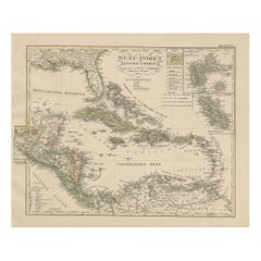
Antique Map of the Antilles and Central America – 1872
Located in Langweer, NL
Title: Antique Map of the Antilles and Central America – 1872
Description:
This finely detailed antique map, titled Antilles et Amérique Centrale, was published in 1872 under t...
Category
Antique 1870s Maps
Materials
Paper

Antique Map of the Antilles by Lapie, '1842'
Located in Langweer, NL
Antique map titled 'Carte des Antilles du Golfe du Méxique'. Map of the Antilles. This map originates from 'Atlas universel de géographie ancienne et moderne (..)' by Pierre M. Lapie...
Category
Antique Mid-19th Century Maps
Materials
Paper

$478 Sale Price
20% Off
Antique Map of the West Indies and Central America by W. G. Blackie, 1859
Located in Langweer, NL
Antique map titled 'The West India Island & Central America'. Original antique map of the West Indies and Central America, with inset map of Jamaica. Th...
Category
Antique Mid-19th Century Maps
Materials
Paper

$239 Sale Price
20% Off
Original Antique Map of the West Indies by J. Arrowsmith, 1842
Located in Langweer, NL
Title: "J. Arrowsmith's 19th Century Map of the West Indies"
This original antique map, crafted by J. Arrowsmith, details the West Indies with a focus on the Caribbean Sea and its s...
Category
Antique Early 19th Century Maps
Materials
Paper

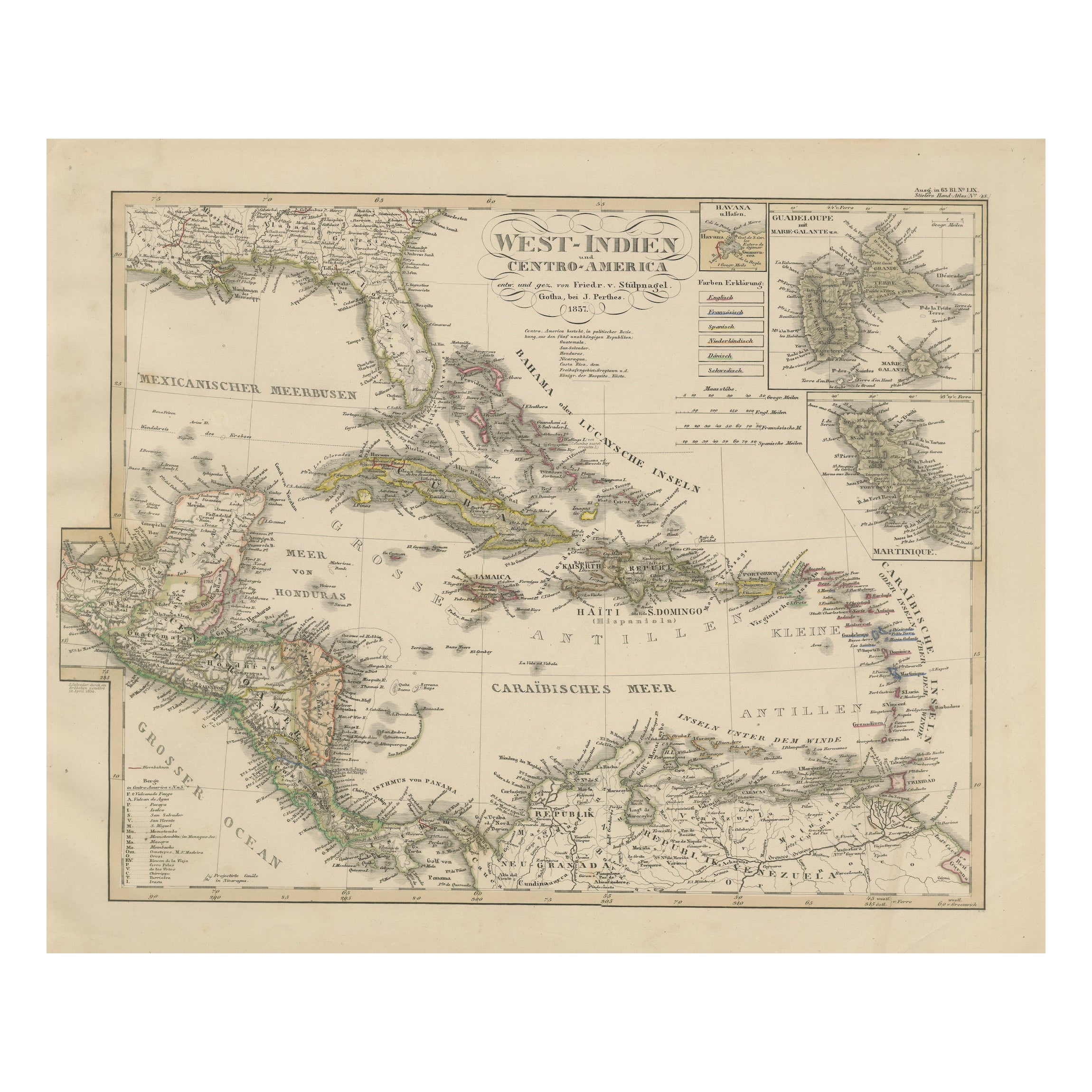
Antique Map of the Caribbean & Central America – West Indies, 1857
Located in Langweer, NL
Antique Map of the Caribbean & Central America – West Indies, 1857
This finely engraved and hand-colored map titled "West-Indien und Centro-America" was published in 1857 by Justus ...
Category
Antique Mid-19th Century German Maps
Materials
Paper
You May Also Like
Original Antique Map of Central America / Florida, Arrowsmith, 1820
Located in St Annes, Lancashire
Great map of Central America.
Drawn under the direction of Arrowsmith.
Copper-plate engraving.
Published by Longman, Hurst, Rees, Orme and Brown, 1820
Unframed.
Category
Antique 1820s English Maps
Materials
Paper

Large Original Antique Map of The West Indies by Sidney Hall, 1847
Located in St Annes, Lancashire
Great map of The West Indies
Drawn and engraved by Sidney Hall
Steel engraving
Original colour outline
Published by A & C Black. 1847
Unframed
Free shipping.
Category
Antique 1840s Scottish Maps
Materials
Paper

Map Colonies Francaises Martinique, 1845
Located in BUNGAY, SUFFOLK
Colonies Francaises, Martinique, Amerique DU SUD
Geographie et Statistique par V.Levasseur. Ing'r Geographe.
Illustre par Raymond Bonheur, peintre.
Grave par Laguihermie, Rue St...
Category
Antique 19th Century French Maps
Materials
Paper

Map Of Martinique - Etching - 19th Century
Located in Roma, IT
Map Of Martinique is an etching realized by an anonymous engraver of the 19th Century.
Printed within the series "France Pittoresque" at the top center.
The state of preservation o...
Category
19th Century Modern Figurative Prints
Materials
Etching

Large Original Antique Map of The Leeward Islands. 1894
Located in St Annes, Lancashire
Superb Antique map of The Leeward Islands
Published Edward Stanford, Charing Cross, London 1894
Original colour
Good condition
Unframed.
Free shipping
Category
Antique 1890s English Maps
Materials
Paper

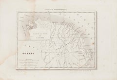
Ancient Map of Guyane - Original Etching - 19th Century
Located in Roma, IT
Map of Guyane is an original etching realized by an anonymous engraver of the 19th Century.
Belongs to the Series of "France Pittoresque" at the top center.
The state of preservati...
Category
19th Century Modern Figurative Prints
Materials
Etching
More Ways To Browse
Stretcher Tables
M Table
Antique Sultanabad Carpets
China Chair
English Antique Desks
Used Beige Sofa
Antique Plate Germany
Hand Tufted Rugs
Rare China
Side Table Made In Denmark
Thonet Antique
Victorian Hall Tables
Vintage Computer
England Antique Plates
19th Century Round Dining Table
Antique Counters
Antique Thrones
Carved Chinese Tables