Items Similar to Cairo, Babylon & Heliopolis – Antique Map of Ancient Memphis Region, 1776

Want more images or videos?
Request additional images or videos from the seller
1 of 10
Cairo, Babylon & Heliopolis – Antique Map of Ancient Memphis Region, 1776
$526.76
£388.56
€440
CA$729.85
A$792
CHF 419.69
MX$9,713.45
NOK 5,193.61
SEK 4,907.69
DKK 3,350.52
About the Item
Cairo, Babylon & Heliopolis – Antique Map of Ancient Memphis Region, 1776
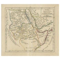
This antique map is an 18th-century Dutch engraving showing the region around ancient Memphis, Egypt, including the cities of Cairo, Babylon (Old Cairo), and Heliopolis. The engraving is plate VII from the rare 1776 Dutch edition of Richard Pococke’s travel account, 'Beschryving van het Oosten' ("Description of the East"), translated and annotated by Ernst Willem Cramerus.
The map bears the decorative title cartouche reading: *"Grondkaart met zyn Rechststelling en de ligging van Oudt Memphis"*, which translates as “Ground map with its justification and the location of ancient Memphis.” It presents an overview of the terrain along the Nile River, including key geographical and historical locations relevant to biblical and classical history. Notable landmarks include:
Babylon (Old Cairo), clearly marked and detailed
Heliopolis and On (biblical cities of religious and astronomical significance)
Birket el Hadji (Pilgrims' Lake)
The Jebel Mokattam and Jebel Druz, hills east of Cairo
Memphis (noted at the lower left, near the modern village of Mit Rahina)
The map is oriented with north toward the right and includes roads, ancient ruins, cultivated fields, pyramids (indicated by triangular symbols), and tombs of Arab nobility (Sepoltura Mahometana). The engraving is finely detailed, and a small legend at the bottom right identifies types of structures, including Christian and Muslim cemeteries, mosques, ruins, and wells.
This piece is a valuable visual resource for understanding the historical geography of Lower Egypt and the Nile valley, particularly as perceived during the Enlightenment by early Western travelers and antiquarians.
Condition report:
Very good condition for its age. Slight age toning, a vertical center fold as issued, and minor edge wear. Paper remains strong and stable. Margins are wide, with the plate mark clearly visible.
Framing tips:
This map would be ideally framed with a soft off-white mat and a thin black or walnut-brown wooden frame to enhance its antique elegance. A non-reflective glass will help preserve its fine engraved detail.
Technique: Engraving
Maker: Richard Pococke, London (Dutch edition published 1776)
- Dimensions:Height: 10.63 in (27 cm)Width: 11.82 in (30 cm)Depth: 0.01 in (0.2 mm)
- Materials and Techniques:Paper,Engraved
- Place of Origin:
- Period:
- Date of Manufacture:1776
- Condition:Very good condition for its age. Slight age toning, a vertical center fold as issued, and minor edge wear. Paper remains strong and stable. Margins are wide, with the plate mark clearly visible.
- Seller Location:Langweer, NL
- Reference Number:Seller: BG-14102-601stDibs: LU3054346057852
About the Seller
5.0
Recognized Seller
These prestigious sellers are industry leaders and represent the highest echelon for item quality and design.
Platinum Seller
Premium sellers with a 4.7+ rating and 24-hour response times
Established in 2009
1stDibs seller since 2017
2,622 sales on 1stDibs
Typical response time: <1 hour
- ShippingRetrieving quote...Shipping from: Langweer, Netherlands
- Return Policy
Authenticity Guarantee
In the unlikely event there’s an issue with an item’s authenticity, contact us within 1 year for a full refund. DetailsMoney-Back Guarantee
If your item is not as described, is damaged in transit, or does not arrive, contact us within 7 days for a full refund. Details24-Hour Cancellation
You have a 24-hour grace period in which to reconsider your purchase, with no questions asked.Vetted Professional Sellers
Our world-class sellers must adhere to strict standards for service and quality, maintaining the integrity of our listings.Price-Match Guarantee
If you find that a seller listed the same item for a lower price elsewhere, we’ll match it.Trusted Global Delivery
Our best-in-class carrier network provides specialized shipping options worldwide, including custom delivery.More From This Seller
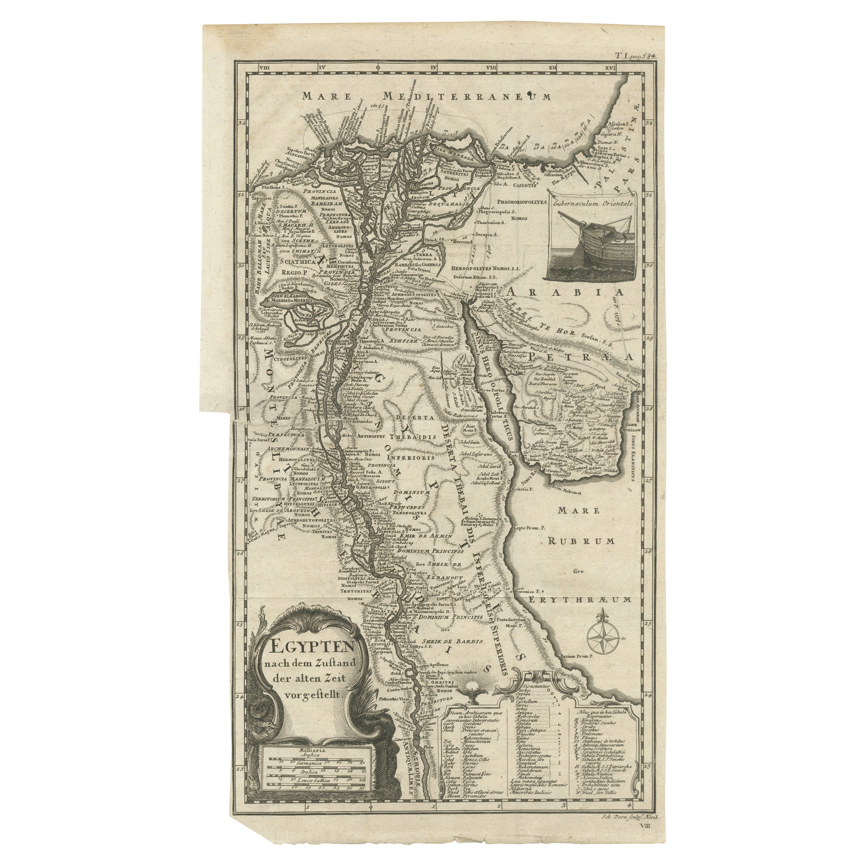
View AllAntique Map of Egypt and the Nile River
Located in Langweer, NL
Antique map titled 'Egypten nach dem Zustand der alten Zeit vorgestellt'. This uncommon and richly detailed map of Egypt features hundreds of place names along the Nile. The Sinai Pe...
Category
Antique Mid-18th Century Maps
Materials
Paper
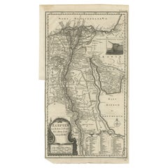
$325 Sale Price
20% Off
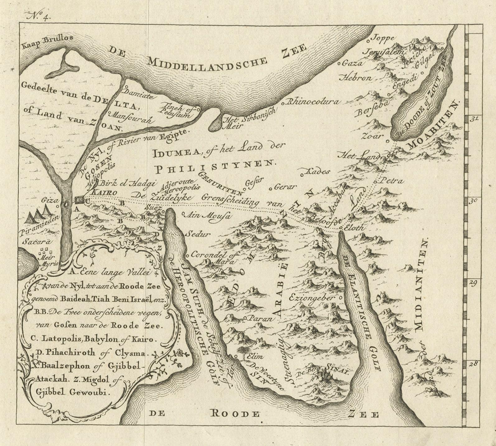
Antique Map of Edom, an Ancient Kingdom in Transjordan, 1773
Located in Langweer, NL
Antique print titled 'Idumea, of thet Land der Philistynen'. Old map of Edom, an ancient kingdom in Transjordan located between Moab to the northeast, the Arabah to the west and the ...
Category
Antique 18th Century Maps
Materials
Paper
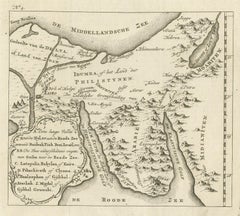
$306 Sale Price
20% Off
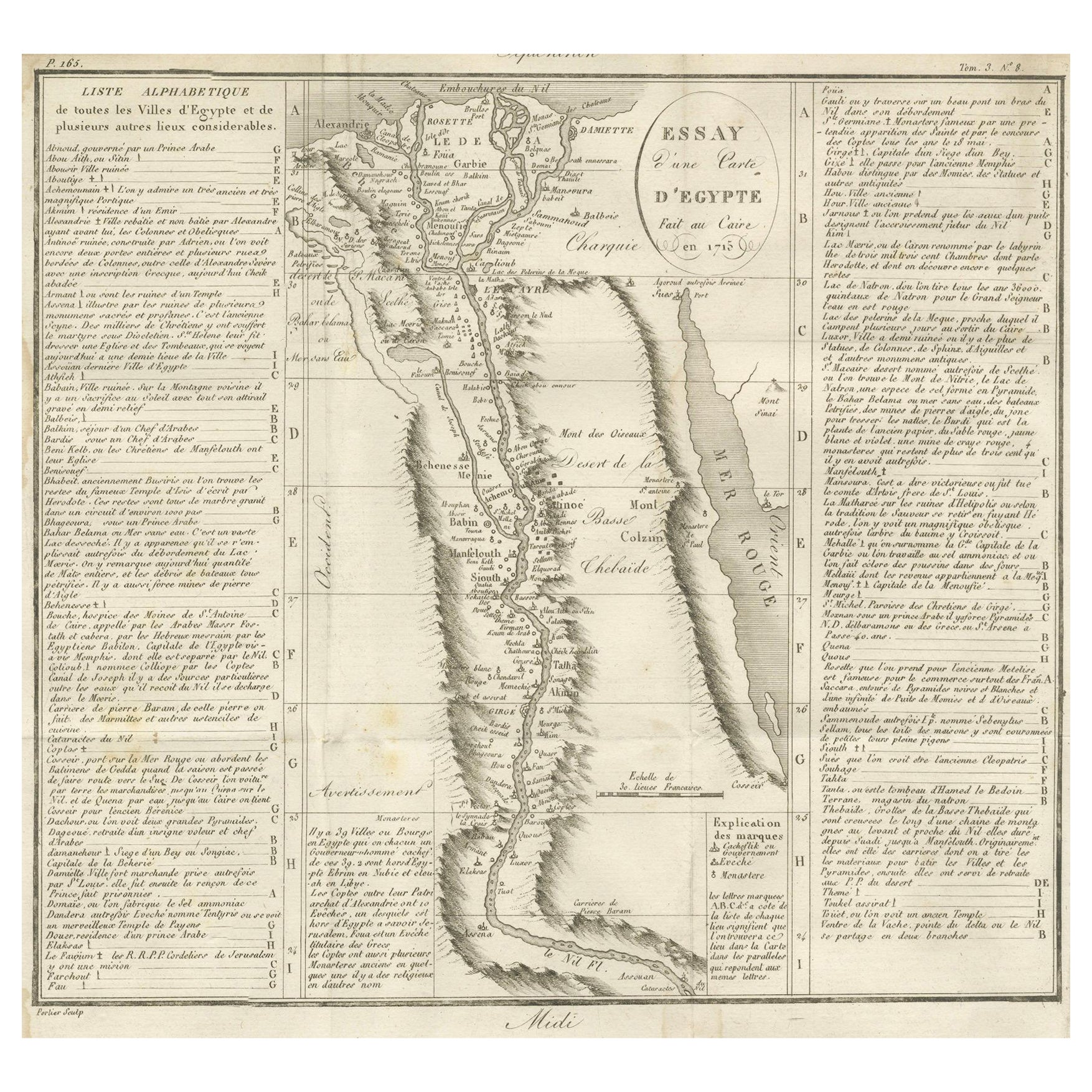
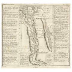
Antique Map of Egypt and the Nile Valley with City Index, 1715
Located in Langweer, NL
Antique map of Egypt, titled "Essay d'une Carte d'Égypte Fait au Caire en 1715".
This finely engraved map presents a detailed depiction of Egypt along the Nile River from the Medit...
Category
Antique Early 18th Century French Maps
Materials
Paper
Detailed Original Old Map of the Southern Region of the Kingdom of Algiers 1773
Located in Langweer, NL
Antique map titled 'Kaart van het Zuidelyk Gedeelte van het Ryk Algiers'.
Old map of the southern region of the Kingdom of Algiers, Algeria. Originates from the first Dutch edito...
Category
Antique 18th Century Maps
Materials
Paper

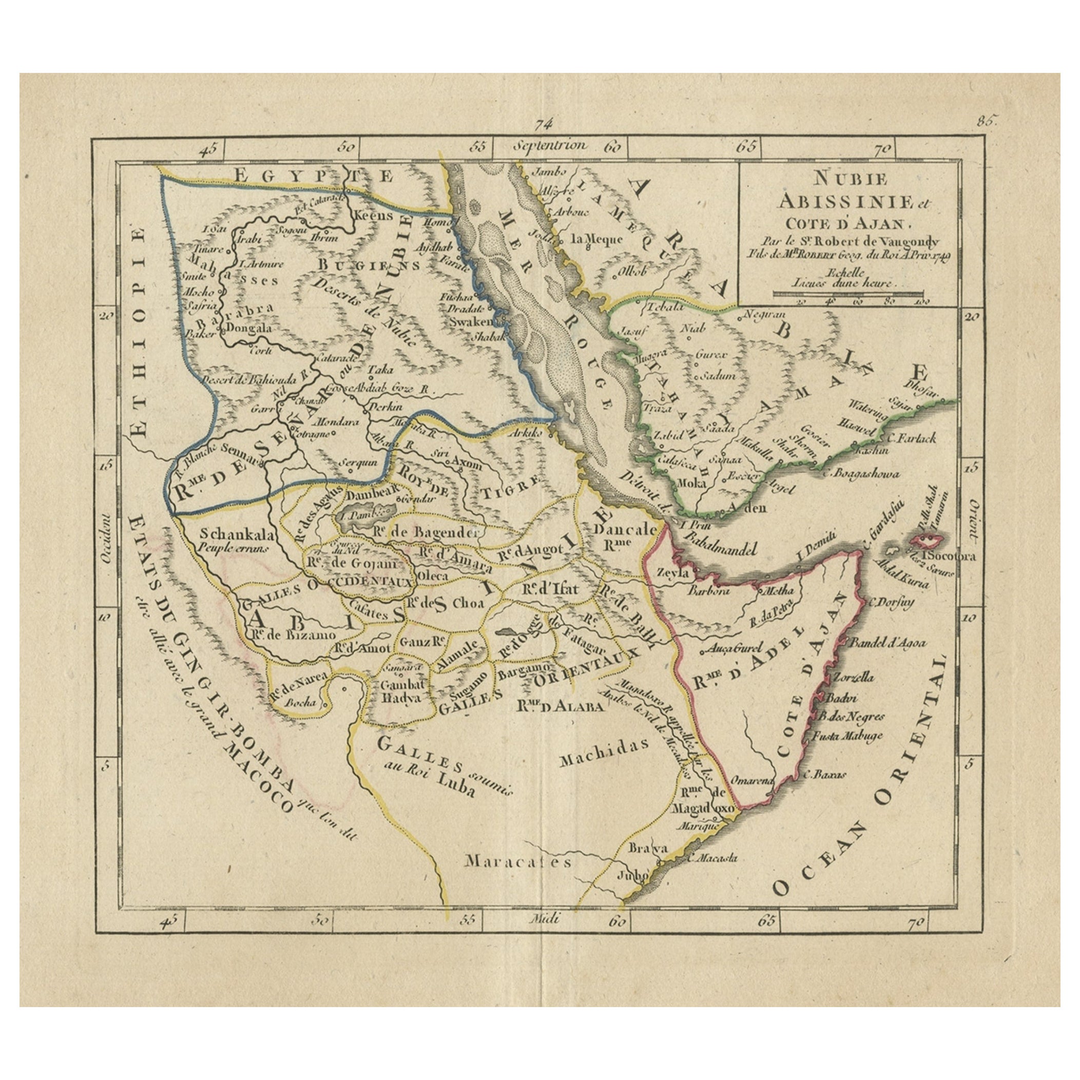
Original Antique Map of Abyssinia, Sudan and the Red Sea, 1749
Located in Langweer, NL
Antique map titled 'Nubie, Abissinie et Cote d'Ajan'.
Map of Abyssinia, Sudan and the Red Sea by Robert Vaugondy. Covers from Arabia and Egypt south to M...
Category
Antique 1740s Maps
Materials
Paper
$325 Sale Price
20% Off
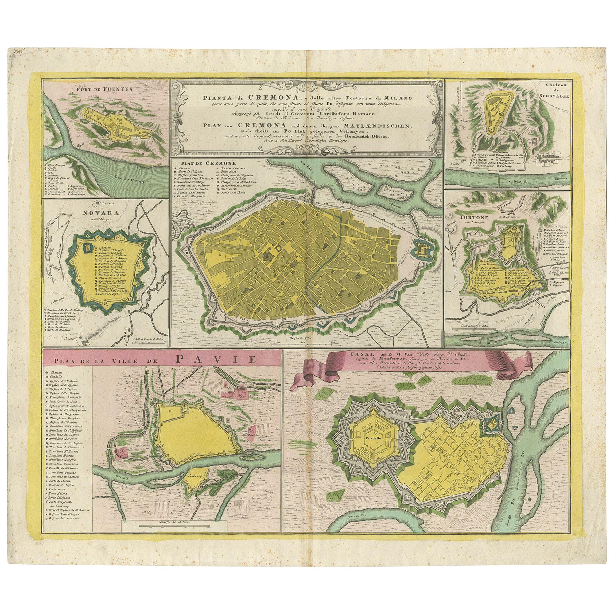
Antique Map with Plans of Cremona, Pavia, Montferrato & Others by Homann, '1734'
Located in Langweer, NL
Antique map titled 'Plan von Cremona und denen übrigen Maylaendischen (..)'. Original antique map showing plans of Cremona, Pavia, Casale Montferrato, Fort de Fuentes, Novara, Serava...
Category
Antique Mid-18th Century Maps
Materials
Paper

$1,167 Sale Price
35% Off
You May Also Like
Original Antique Map of Ancient Greece- Boeotia, Thebes, 1787
Located in St Annes, Lancashire
Great map of Ancient Greece. Showing the region of Boeotia, including Thebes
Drawn by J.D. Barbie Du Bocage
Copper plate engraving by P.F T...
Category
Antique 1780s French Other Maps
Materials
Paper

Original Antique Map of Ancient Greece, Achaia, Corinth, 1786
Located in St Annes, Lancashire
Great map of Ancient Greece. Showing the region of Thessaly, including Mount Olympus
Drawn by J.D. Barbie Du Bocage
Copper plate engraving by P.F Tardieu
Original hand color...
Category
Antique 1780s French Other Maps
Materials
Paper

1597 German Map of Alexandria by Georg Braun and Frans Hogenberg
By Georg Braun and Frans Hogenberg
Located in Chapel Hill, NC
1597 Map of Alexandria by Georg Braun and Frans Hogenberg, Germany. From "Civitas Orbis Terrarum", part 2, published in Cologne by Bertram Buchholz. Printed in 2 parts. Title: "Alexa...
Category
Antique 16th Century German Renaissance Maps
Materials
Paper

17th Century Toulouse, Savve, Sommieres Topographical Map by Iohan Peeters
Located in New York, NY
Fine topographical 17th century map of Toulouse, Savve and Sommieres by Iohan Peeters
Beautiful engraving of the capital of France's Occitanie Region, Toulouse, called La Ville Rose- the Pink City, for the terracotta bricks used in its many buildings, giving the city a distinct apricot-rose hue. An important cultural and educational center, the city's residents included Nobel Prize winners and world renown artists- Henri de Toulouse-Lautrec, Henri Martin, Jean-Auguste-Dominique Ingres, Antonin Mercie, Alexandre Falguiere and more recently Cyril Kongo...
Category
Antique 17th Century Dutch Maps
Materials
Paper

Antique French Map of Asia Including China Indoneseia India, 1783
Located in Amsterdam, Noord Holland
Very nice map of Asia. 1783 Dedie au Roy.
Additional information:
Country of Manufacturing: Europe
Period: 18th century Qing (1661 - 1912)
Condition: Overall Condition B (Good Used)...
Category
Antique 18th Century European Maps
Materials
Paper

$648 Sale Price
20% Off
1657 Janssonius Map of Vermandois and Cappelle, Ric. A-004
Located in Norton, MA
1657 Janssonius map of
Vermandois and Cappelle
Ric.a004
Description: Antique map of France titled 'Descriptio Veromanduorum - Gouvernement de la Cappelle'. Two detailed maps o...
Category
Antique 17th Century Unknown Maps
Materials
Paper

More Ways To Browse
Antique Mosque
Dutch Engravings
Antique Engravings London
Ancient Babylon
Memphis Antique Furniture
Beni Ourain Rugs
Glass Top Wood Base Coffee Tables
T Chair
Pair Of Danish Chairs
Veneer Dining Tables
1970 Italian Armchair
Furniture Uk
House Of Denmark Table And Chairs
Louis Marble Top Side Table
Antique Russian Rugs
Baker Furniture By
For Kids
Sterling Silver Flatware Set Service For 12