Items Similar to Engraving Depicting 16th Century Map of Terra Sancta

Want more images or videos?
Request additional images or videos from the seller
1 of 2
Engraving Depicting 16th Century Map of Terra Sancta
$750
£565.57
€654.11
CA$1,052.25
A$1,169.64
CHF 613.10
MX$14,284.10
NOK 7,654.18
SEK 7,201.16
DKK 4,882.12
About the Item
Abraham Ortelius (Flemish, 1527-1598) Terra Sancta.
Engraving depicting 16th century map of Terra Sancta. Site 15" x 19.5.
- Dimensions:Height: 23.75 in (60.33 cm)Width: 29.25 in (74.3 cm)Depth: 1 in (2.54 cm)
- Materials and Techniques:
- Period:
- Date of Manufacture:18th Century
- Condition:
- Seller Location:Buchanan, MI
- Reference Number:1stDibs: LU81992587242
About the Seller
5.0
Vetted Professional Seller
Every seller passes strict standards for authenticity and reliability
Established in 1985
1stDibs seller since 2006
199 sales on 1stDibs
Typical response time: 1 hour
- ShippingRetrieving quote...Shipping from: Buchanan, MI
- Return Policy
Authenticity Guarantee
In the unlikely event there’s an issue with an item’s authenticity, contact us within 1 year for a full refund. DetailsMoney-Back Guarantee
If your item is not as described, is damaged in transit, or does not arrive, contact us within 7 days for a full refund. Details24-Hour Cancellation
You have a 24-hour grace period in which to reconsider your purchase, with no questions asked.Vetted Professional Sellers
Our world-class sellers must adhere to strict standards for service and quality, maintaining the integrity of our listings.Price-Match Guarantee
If you find that a seller listed the same item for a lower price elsewhere, we’ll match it.Trusted Global Delivery
Our best-in-class carrier network provides specialized shipping options worldwide, including custom delivery.More From This Seller
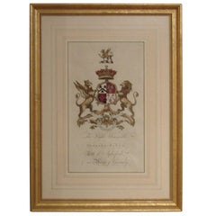
View AllPair of 18th Century Hand-Colored Armorial Engravings
Located in Buchanan, MI
Pair of 18th century hand-colored armorial engravings in giltwood frames.
Category
Antique 18th Century and Earlier British Drawings
Materials
Giltwood
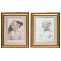
Set of Four Hand-Colored Engravings after Holbein
By Holbein
Located in Buchanan, MI
Set of Four Hand-Colored Engravings after Holbein in Giltwood Frames
Category
Antique 18th Century and Earlier Italian Prints
Materials
Paper
Handsome English Leather Bound Books As A Side Table With Interior Storage.
Located in Buchanan, MI
Handsome English Leather Bound Books As A Side Table With Interior Storage.
Category
20th Century English George III Side Tables
Materials
Leather
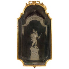
Late 18th Century Italian Mirror with Reverse Etching, Lovely Old Patina
Located in Buchanan, MI
Late 18th century Italian mirror with reverse etching, lovely old patina. Note there are some missing pieces on top but could easily be corrected.
Category
Antique Late 18th Century Italian Girandoles
Materials
Giltwood, Mirror
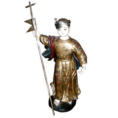
19th Century Carved Wood Santos with Gilt Decoration
Located in Buchanan, MI
19th century carved wood Santos with gilt decoration.
Category
Antique 19th Century Italian Religious Items
Materials
Gold Leaf
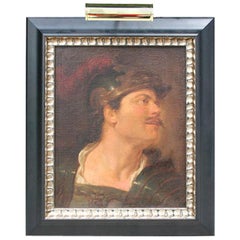
18th Century Italian Painting of a Soldier, Fragement from a Larger Painting
Located in Buchanan, MI
Very handsome Italian portrait of a soldier, in ebonized frame with silver detail. Measurements include frame.
Category
Antique 18th Century Italian Classical Roman Paintings
Materials
Canvas
You May Also Like
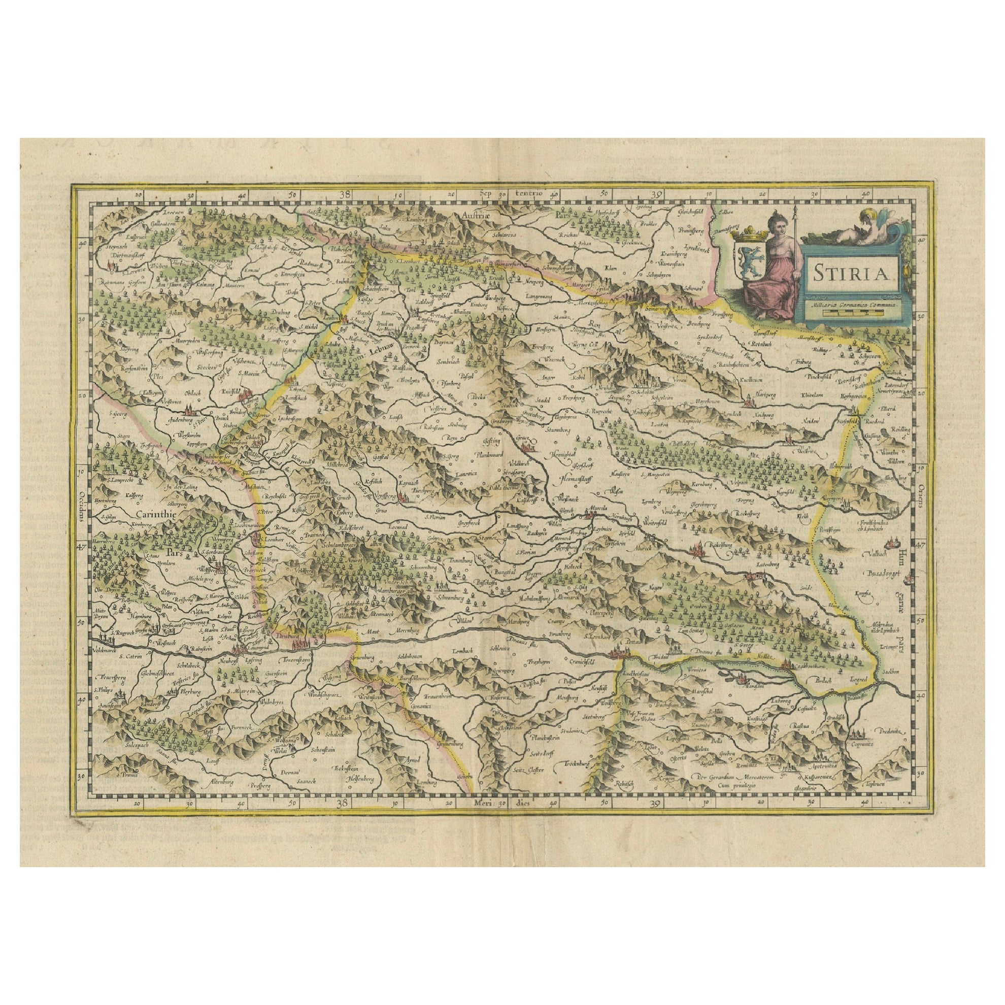
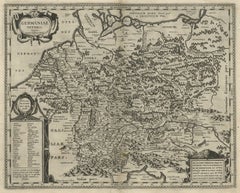
An Original Antique Mid-17th Century Blaeu Map of Styria in Southeastern Austria
Located in Langweer, NL
This is an antique map of Styria (referred to as “Stiria” or “Steyrmarck”), published by the renowned Dutch cartographer Willem Janszoon Blaeu (often simply “Blaeu”). The first editi...
Category
Antique 1640s Maps
Materials
Paper
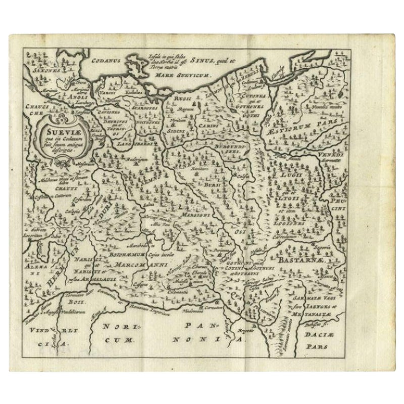
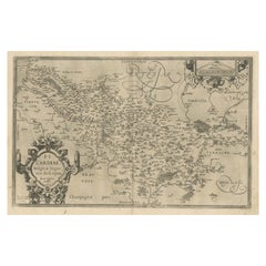
Antique Map of Swabia, 1685
Located in Langweer, NL
Antique map titled 'Sueviae quae cis Codanum fuit finum Antiqua defcriptio.' Miniature map of Swabia, a medieval Duchy in south-west Germany, that also included part of Poland, from ...
Category
Antique 17th Century Maps
Materials
Paper
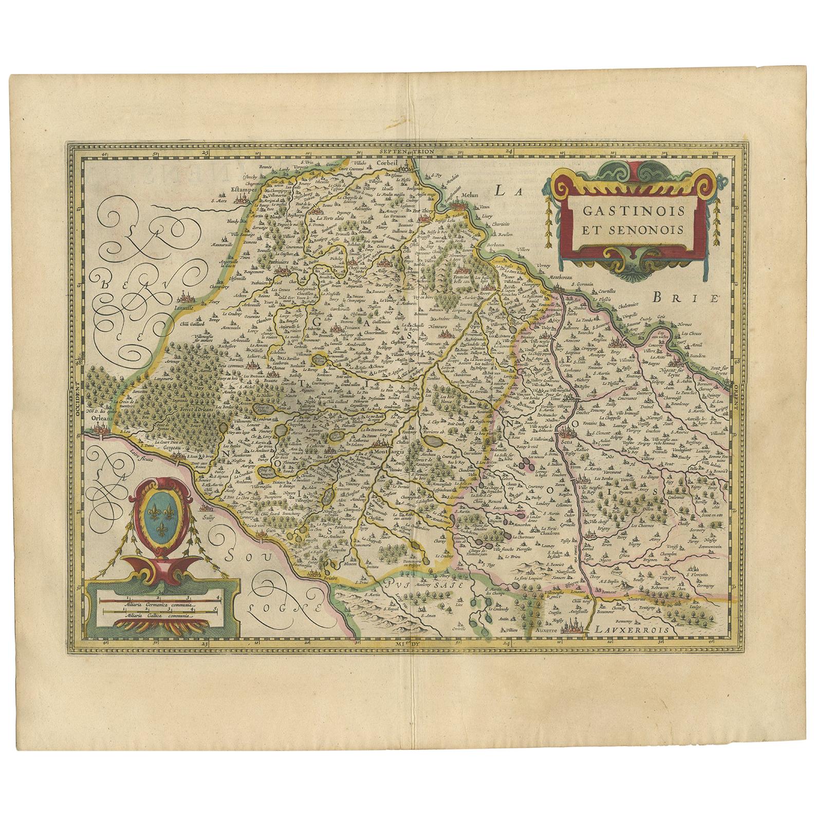
Antique Map of the Region of Étampes and Sens by Hondius, circa 1630
Located in Langweer, NL
Antique map titled 'Gastinois et Senonois'. Old map of the region of Étampes and Sens, France. It shows the cities of Sens, Melun, Étampes, Orleans, Fontainebleau, Montargis and othe...
Category
Antique Mid-17th Century Maps
Materials
Paper
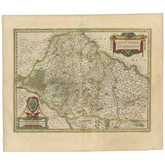
$477 Sale Price
20% Off
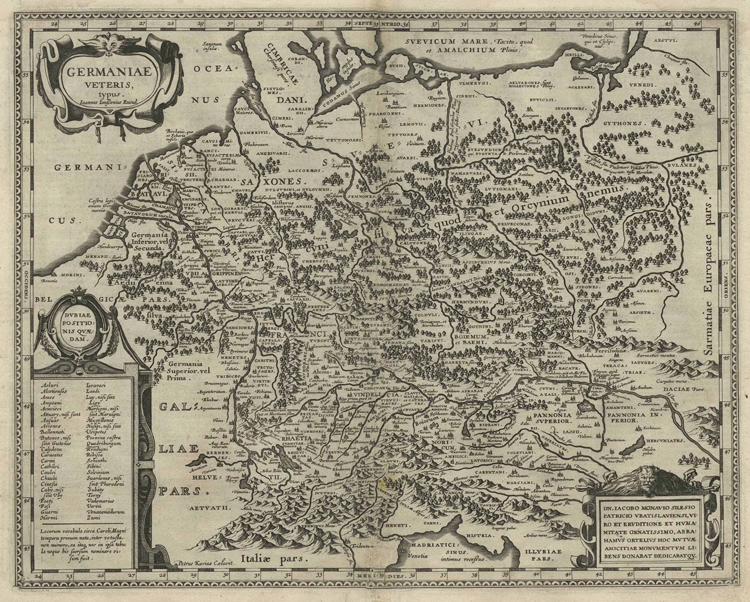
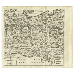
Original Rare Antique Map of the Ancient German Empire in Northern Europe, c1650
Located in Langweer, NL
Antique map titled 'Germaniae Veteris typus.'
Map of the ancient German Empire in Northern Europe, based upon an earlier map by Ortelius. Extends fr...
Category
Antique 1650s Maps
Materials
Paper
$629 Sale Price
20% Off
Antique Map of Manchuria and the Northeast Portion of Tartary
Located in Langweer, NL
Antique map titled 'Carte de la Tartarie Orientale (..)'. Detailed map of Manchuria and the Northeast portion of Tartary, including Sagallan Anga Hata--Isle de la Bouche...
Category
Antique Mid-18th Century Maps
Materials
Paper

$276 Sale Price
20% Off
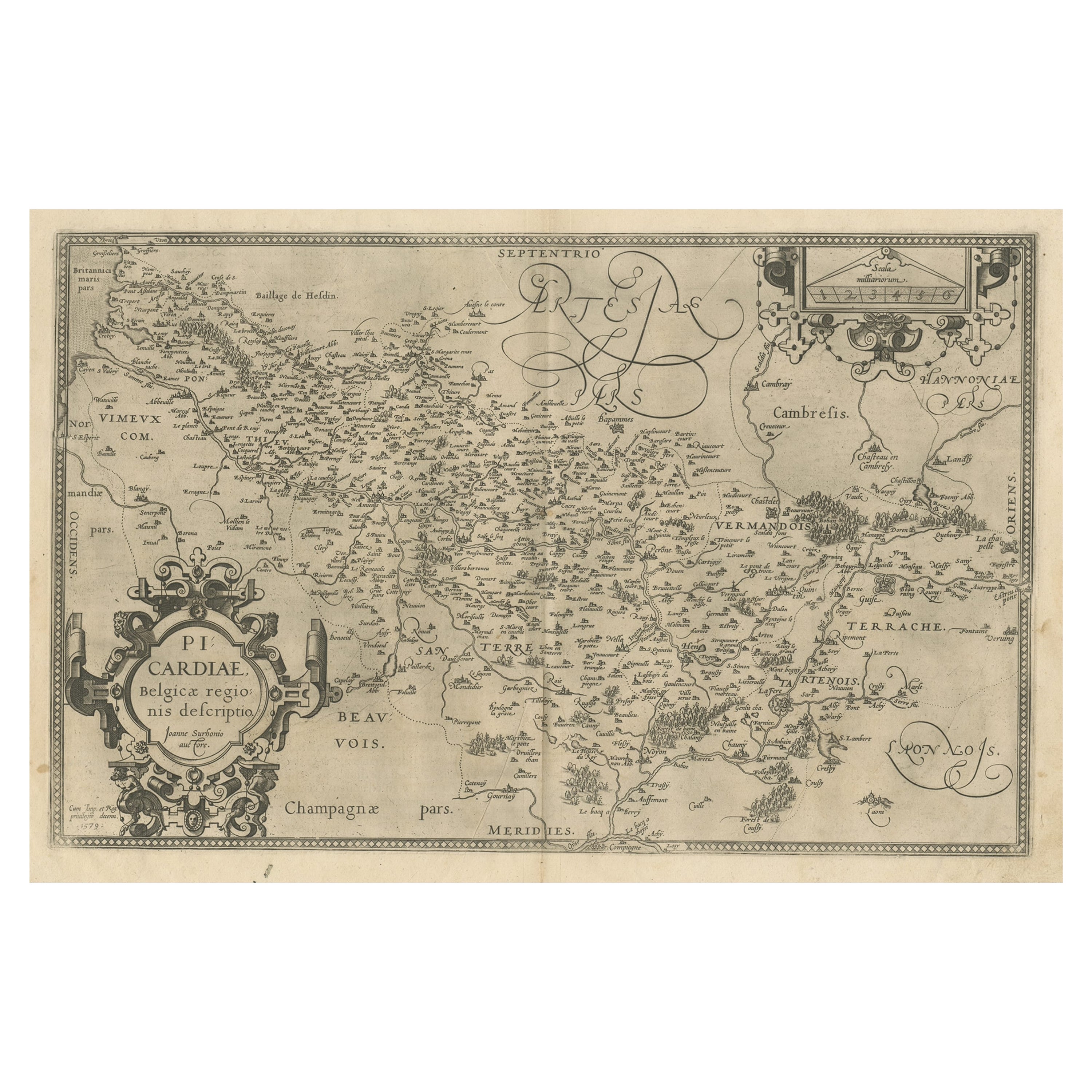
Original Antique Map of the Region of Picardy, France, ca.1602
Located in Langweer, NL
Antique map titled 'Picardiae Belgicae regionis descriptio'.
Original antique map of the region of Picardy, France. Superb example of the decorative style of Ortelius and filled ...
Category
Antique Early 1600s Maps
Materials
Paper
$620 Sale Price
20% Off
More Ways To Browse
Antique Map Ortelius
Framed Map Of Paris
Used Nautical Charts
Antique Navigator
Map Of Middle East
Antique Map Of Switzerland
World Map Copper
British Empire Map
Malaysian Antique Furniture
Birds Eye View Map
Map Of Arabia
Map Of Vienna
Old School Maps
Balinese Wood
Joan Blaeu
Antique Nautical Maps
Antique Portuguese Plates
Antique Maps California