Items Similar to Extremely Large Hand-Drawn Manuscript Map of Surinam, 1830, History of Slavery


Want more images or videos?
Request additional images or videos from the seller
1 of 5
Extremely Large Hand-Drawn Manuscript Map of Surinam, 1830, History of Slavery
$45,385.57
£33,630.11
€38,000
CA$62,783.40
A$69,191.66
CHF 36,224.13
MX$849,892.16
NOK 455,164.04
SEK 425,997.32
DKK 289,398.12
About the Item
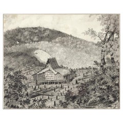
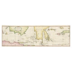
A unique large hand-drawn map of Surinam by Albrecht Helmut Hiemcke (German, 1760-1839)
?
'Colonie Surinaame', 1830
A large hand-drawn and coloured map of the colony of Surinam titled “Deze Generale kaart der vermelde colonie is getekend door den beedigde landmeter A.H.Hiemcke Az. Gedaan in den jaare 1830”.
With a plan of the town of Paramaribo, and surrounding sugar and coffee plantations.
Measures: H. 88.5cm x W. 246.5 cm
Albrecht Helmuth Hiemcke, born in 1760 in Germany, came to Surinam in 1790, one of the many Germans who tried their luck in military service in Dutch overseas possessions in the eighteenth century. In 1796 he was appointed assistant engineer with the Inspection of Fortifications and was awarded the important commission to survey the new suburbs of Zeelandia. Hiemcke retained his position during both British occupations of Surinam; in 1799 and in1804. He spent the years from 1808 to 1810 in the Netherlands where he wrote further surveying examinations. He then returned to Surinam where he resumed his old profession, initially under the British and from 1816 once more under the Dutch, becoming the most prominent surveyor of the colony. The large map shown here is arguably the highlight of his surviving works. Hiemcke died in Paramaribo in 1839.
- Dimensions:Height: 34.85 in (88.5 cm)Width: 97.05 in (246.5 cm)Depth: 0.08 in (2 mm)
- Materials and Techniques:
- Place of Origin:Suriname
- Period:
- Date of Manufacture:1830
- Condition:Wear consistent with age and use. Can be framed.
- Seller Location:Amsterdam, NL
- Reference Number:1stDibs: LU5458229747452
About the Seller
5.0
Recognized Seller
These prestigious sellers are industry leaders and represent the highest echelon for item quality and design.
Established in 1985
1stDibs seller since 2020
23 sales on 1stDibs
Typical response time: 5 hours
- ShippingRetrieving quote...Shipping from: Amsterdam, Netherlands
- Return Policy
Authenticity Guarantee
In the unlikely event there’s an issue with an item’s authenticity, contact us within 1 year for a full refund. DetailsMoney-Back Guarantee
If your item is not as described, is damaged in transit, or does not arrive, contact us within 7 days for a full refund. Details24-Hour Cancellation
You have a 24-hour grace period in which to reconsider your purchase, with no questions asked.Vetted Professional Sellers
Our world-class sellers must adhere to strict standards for service and quality, maintaining the integrity of our listings.Price-Match Guarantee
If you find that a seller listed the same item for a lower price elsewhere, we’ll match it.Trusted Global Delivery
Our best-in-class carrier network provides specialized shipping options worldwide, including custom delivery.More From This Seller
View AllVery Large Hand-Drawn View of St Iago Cape Verde, by Frederici, 1783
Located in Amsterdam, NL
Johann Christian Friderici [= Frederici] (Heldburg 1766 - Cape Town 1804)
Prospect van het eyland, en de rheede van St. Iago. Geteekend van Johann Christian Friderici / Verbeelding van de inwoonders op St Iago
(View of the island, and the roadstead of St. Iago. Drawn by Johann Christian Friderci / Depiction of the inhabitants on St Iago)
?Porto Praia, Cape Verde...
Category
Antique Late 18th Century Cape Verdean Dutch Colonial Maps
Materials
Paper

Collection of Colonial Drawings Depicting Indonesia by J.G. Sinia '1875-1948'
Located in Amsterdam, NL
A Collection of Thirteen Ink and Chalk Drawings by Johan Gerard Sinia (1875-1948)
All framed in gilt-metal or giltwood frames
Sinia started his professional career as an army off...
Category
Early 20th Century Indonesian Dutch Colonial Paintings and Screens
Materials
Other
$29,998 / set
Free Shipping
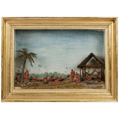
Rare Anthropological Diorama of Carib Indigenous by Hendrik Schouten
Located in Amsterdam, NL
Hendrik Samuel Schouten (1785-1840)
A unique diorama depicting Carib Indigenous at the river side
Wood, paint on paper, twigs and dried moss
Measures: H. 51 x W. 69.5 x D. 20 cm
Note:
This is the only known diorama by Hendrik Schouten. He became a planter and inherited the Jagtlust plantation from his grandfather Samuel Loske. His older brother Gerrit Schouten...
Category
Antique Early 18th Century Models and Miniatures
Materials
Twig, Wood, Giltwood, Paint, Paper
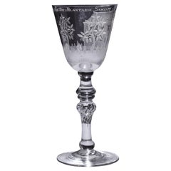
Engraved Commemorative Surinam Plantation Glass, History of 18th Century Slavery
Located in Amsterdam, NL
A splendid commemorating glass with a fine engraving of a plantation house and coffee shrubs with a text reading: Het.Welvaaren.Van.De.Plantagie.Saxen (the prosperity of the Plantati...
Category
Antique Mid-18th Century Surinamer Glass
Materials
Glass
$25,198
Free Shipping
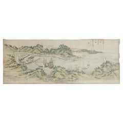
Unpei Kameyama, 'a View of Black 'American' Ships in the Bay of Uraga Senminato'
Located in Amsterdam, NL
Unpei Kameyama (1821-1899)
A view of black (American) ships in the bay of Uraga Senminato, Miura district, June 1853
The Japanese text reads: ‘The seventy-six old men for the Kitamura-clan, drawn in 1897 on request of Yoshisada Kitamura, Himeji, the black ships which so much changed the fate of Japan, enjoy please this masterpiece by Harima Shonin Bisei who brings back memories of his young days.’
Watercolour on paper, laid down on cardboard, H. 44.5 x W. 115.5 cm
Provenance:
Collection of Yoshisada Kitamura, Himeji
Yoshisada Kitamura (1838-1899), the son of a farmer in the village of Ogawa, in the district of Harimakashikihigashi, studied under Matajiro Otaka and got heavily involved in the anti-Shogunate movement. He was active in several military incidents against the Shogunate. After the Meiji restoration, he served the Meiji government as a local official in the Himeji domain.
Kameyama Unpei was a Confucian scholar, a Shinto priest...
Category
Antique Mid-19th Century Japanese Edo Paintings and Screens
Materials
Paper
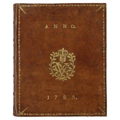
A Dutch East India Company VOC almanack for the year 1785
Located in Amsterdam, NL
"D’Erven Stichter’s Comptoir Almanach, Op ’t Jaar onzes Heeren Jesu Christi, 1785. Voorzien met alle de Jaar-, Paarden-, Beesten-, en Leermarkten, alsmede de Vacantien, het Varen der...
Category
Antique 18th Century Dutch Books
Materials
Leather, Paper
You May Also Like
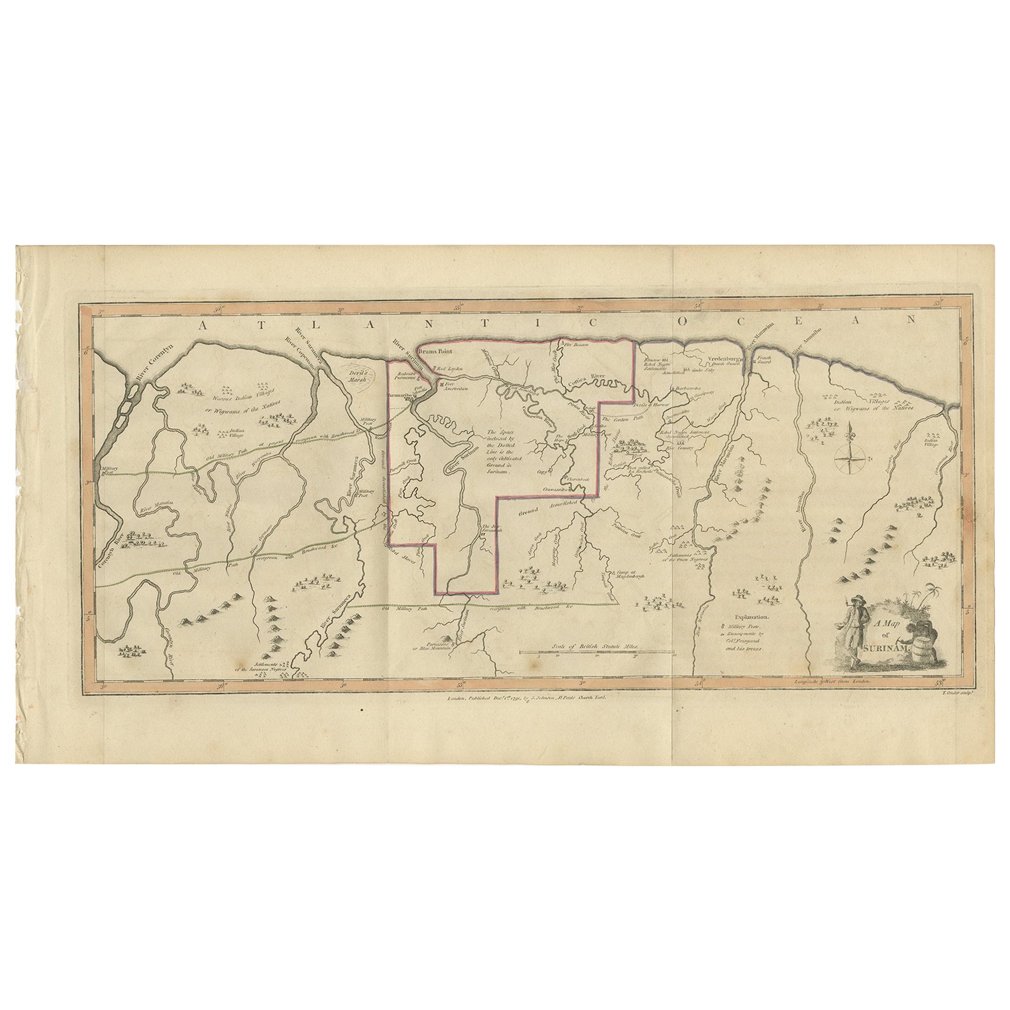
Antique Map of Surinam by Stedman '1813'
Located in Langweer, NL
Antique map titled 'A Map of Surinam'. Original antique map of Surinam, showing Dutch settlements, military posts, rebel Maroon camps and native villages. This map originates from 'N...
Category
Antique Early 19th Century Maps
Materials
Paper
$479 Sale Price
20% Off
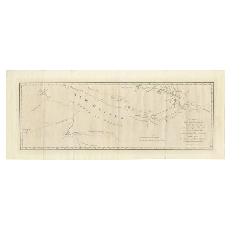
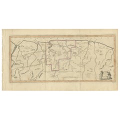
Large Antique Map of New Guinea and New Britain Showing Capt. Cooks Tract, 1773
Located in Langweer, NL
Antique map titled 'A Chart of Captain Carteret's Discoveries at New Britain, with part of Captain Cooke's Passage thro Endeavour Streights, & of Captain Dampier's tract & discoverie...
Category
Antique 18th Century Maps
Materials
Paper
$527 Sale Price
20% Off
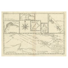
Old Map of Guyana, Suriname and French Guiana with Paramaribo and Cayenne, c1760
Located in Langweer, NL
Description: Antique map titled 'Carte de la Guiane.'
Antique map of the Guianas - present day Guyana, Suriname and French Guiana, including Paramaribo and Cayenne. Source unknown, to be determined.
Artists and Engravers: Made by 'Jacques-Nicholas Bellin...
Category
Antique 1760s Maps
Materials
Paper
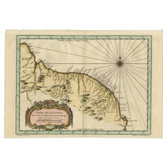
$431 Sale Price
20% Off
Rare Authentic Engraved Map of Large Part of Indonesia by Stavorinus, 1779
Located in Langweer, NL
Antique map titled 'Carte de la Navigation de Batavia a Amboina'. Rare chart of Indonesia including Borneo, Java, Celebes, Ceram and more. This map originates from 'Voyage par le Cap...
Category
Antique 18th Century Maps
Materials
Paper
$709 Sale Price
20% Off
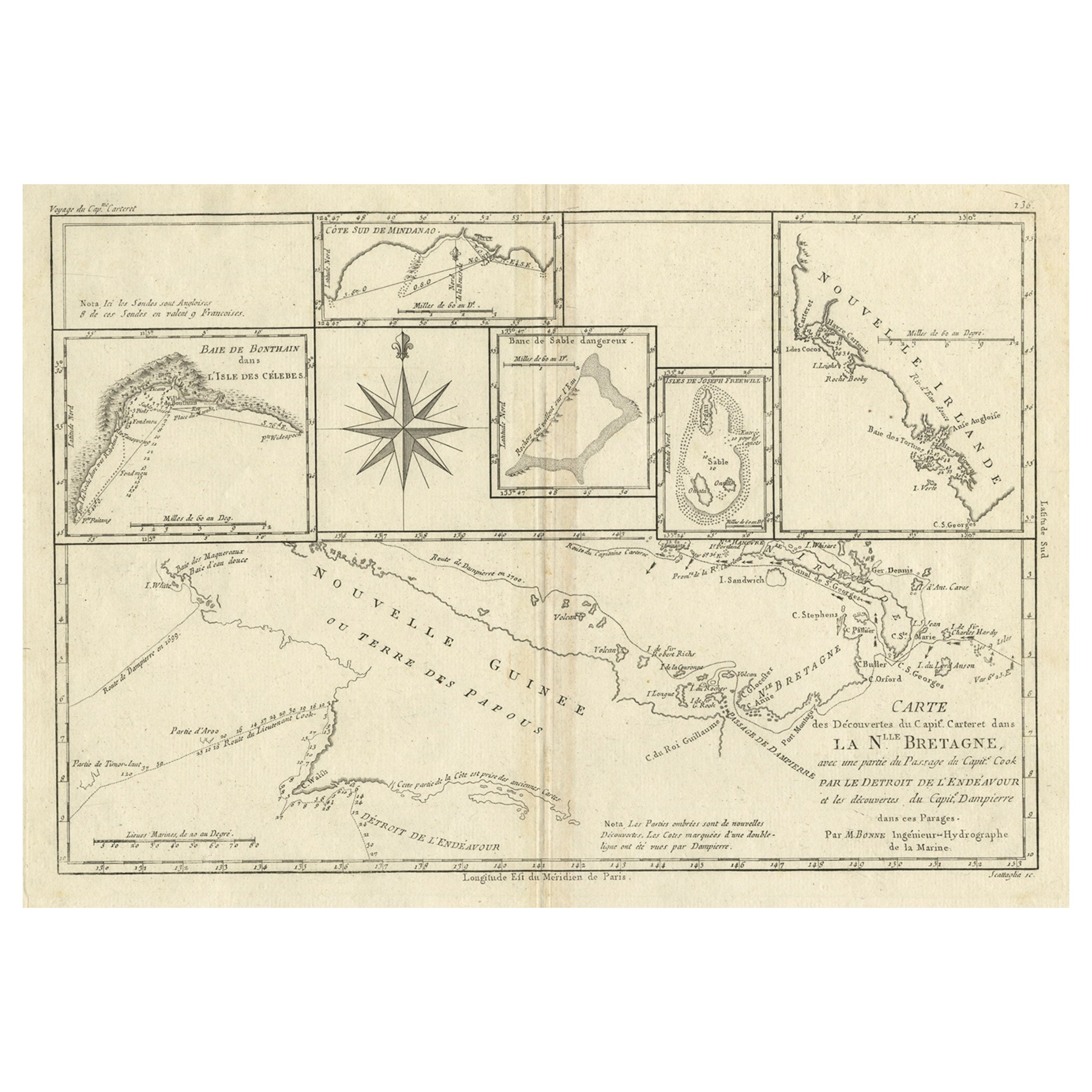
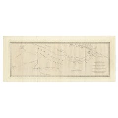
Antique Detailed Map of Papua New Guinea and the Regions to the West, ca.1780
Located in Langweer, NL
Antique map titled 'Carte des Decouvertes du Capite. Carteret dans La Nlle. Bretagne avec une parte du passage du Capite. Cook Par Le Detroit De L'Endeavor ...
Category
Antique 1780s Maps
Materials
Paper
$316 Sale Price
20% Off
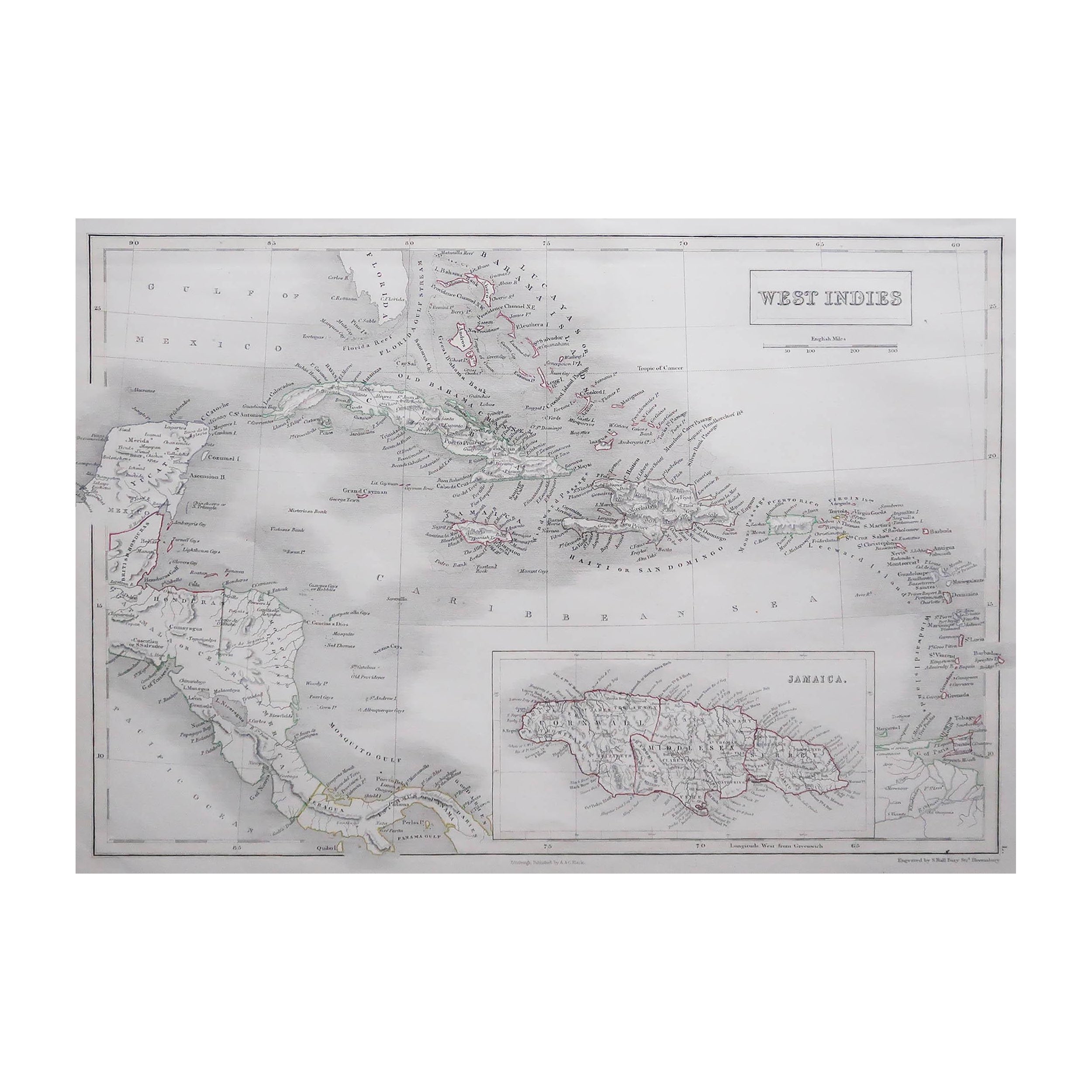
Large Original Antique Map of The West Indies by Sidney Hall, 1847
Located in St Annes, Lancashire
Great map of The West Indies
Drawn and engraved by Sidney Hall
Steel engraving
Original colour outline
Published by A & C Black. 1847
Unframed
Free shipping.
Category
Antique 1840s Scottish Maps
Materials
Paper

More Ways To Browse
Manuscripts
Antique Manuscript
Antique Surveyor
Old Colony Furniture
Dutch Military
Antique Map Of Colombia
Cornwall Map
Early Texas Furniture
Rand Mcnally Vintage Maps
Tunisia Antique Map
Used Office Furniture Rhode Island
Antique Chesapeake Bay Map
Antique Copper Australia
Antique Furniture Pondicherry
Antique Map Of Cornwall
Antique Maps Dublin
Antique Maps Of Malta
Antique Saudi Arabia