Items Similar to Impressive Geological Map of Australia – Rare Oversized Wall Display, 1931–32


Video Loading
Want more images or videos?
Request additional images or videos from the seller
1 of 12
Impressive Geological Map of Australia – Rare Oversized Wall Display, 1931–32
$5,699.68per set
£4,203.30per set
€4,750per set
CA$7,871.21per set
A$8,636.60per set
CHF 4,519.99per set
MX$106,287.24per set
NOK 56,945.12per set
SEK 53,337.59per set
DKK 36,177.09per set
About the Item
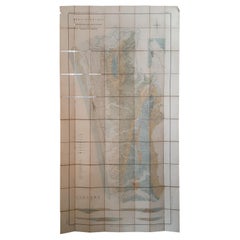
Geological Map of the Commonwealth of Australia by Sir Edgeworth David, 1931–32
Large and highly detailed geological map of the Commonwealth of Australia, compiled under the direction of Sir Tannatt William Edgeworth David (1858–1934), one of the leading geologists of his time. Issued in 1931, this impressive map is printed in vivid colors to illustrate the geological structure of the continent. It is presented in four large sections, each linen-backed for durability, which together measure approximately 165.6 × 202.0 cm (65 × 79.5 inches). When folded, the sheets reduce to a convenient 19.6 × 13.6 cm and are housed in the original cloth slipcase (21.5 × 15.0 cm). The map is sold as a folding map and NOT in a frame!
The map is accompanied by the official explanatory notes, published in Sydney in 1932, which provide additional plates, folding illustrations, and tables clarifying the geological data. Edgeworth David was a pioneering geologist whose work was instrumental in mapping Australia’s mineral and structural resources. This map represents one of the most comprehensive geological surveys of the period, produced when Australia was seeking to develop and promote its natural resources in the interwar years.
The set is housed in the original publisher’s cloth box, showing expected age wear, while the map itself retains strong coloring with only minor foxing. The explanatory volume bears institutional stamps and signs of withdrawal but remains complete and solid. Together, the map and volume form a significant resource for the history of science, cartography, and Australia’s geological exploration.
Condition:
Unframed map in four large linen-backed sections, minor foxing, original cloth box worn and stained. Explanatory notes volume rubbed and faded, with library stamps, but complete.
Technique:
Colour-printed geological map, linen-backed; letterpress volume with plates and folding tables.
Maker:
Sir Tannatt William Edgeworth David, Sydney, 1931–1932.
- Dimensions:Height: 65.16 in (165.5 cm)Width: 79.53 in (202 cm)Depth: 0.08 in (2 mm)
- Sold As:Set of 2
- Materials and Techniques:
- Place of Origin:
- Period:
- Date of Manufacture:circa 1932
- Condition:Map in four large linen-backed sections, minor foxing, original cloth box worn and stained.
- Seller Location:Langweer, NL
- Reference Number:Seller: BG-129221stDibs: LU3054346565892
About the Seller
5.0
Recognized Seller
These prestigious sellers are industry leaders and represent the highest echelon for item quality and design.
Platinum Seller
Premium sellers with a 4.7+ rating and 24-hour response times
Established in 2009
1stDibs seller since 2017
2,620 sales on 1stDibs
Typical response time: <1 hour
- ShippingRetrieving quote...Shipping from: Langweer, Netherlands
- Return Policy
Authenticity Guarantee
In the unlikely event there’s an issue with an item’s authenticity, contact us within 1 year for a full refund. DetailsMoney-Back Guarantee
If your item is not as described, is damaged in transit, or does not arrive, contact us within 7 days for a full refund. Details24-Hour Cancellation
You have a 24-hour grace period in which to reconsider your purchase, with no questions asked.Vetted Professional Sellers
Our world-class sellers must adhere to strict standards for service and quality, maintaining the integrity of our listings.Price-Match Guarantee
If you find that a seller listed the same item for a lower price elsewhere, we’ll match it.Trusted Global Delivery
Our best-in-class carrier network provides specialized shipping options worldwide, including custom delivery.More From This Seller
View AllAntique Map of Wisconsin with Inset Geological Map of Wisconsin
Located in Langweer, NL
Antique map titled 'Wisconsin'. Original antique map of Wisconsin, United States. With inset geological map of Wisconsin. This print originates from '...
Category
Antique Late 19th Century Maps
Materials
Paper

$278 Sale Price
20% Off
Antique Geological Map of the World by Johnston '1850'
Located in Langweer, NL
Antique map titled 'The Geological Structure of the Globe'. Original antique geological map of the world. This map originates from 'The Physica...
Category
Antique Mid-19th Century Maps
Materials
Paper

$287 Sale Price
20% Off
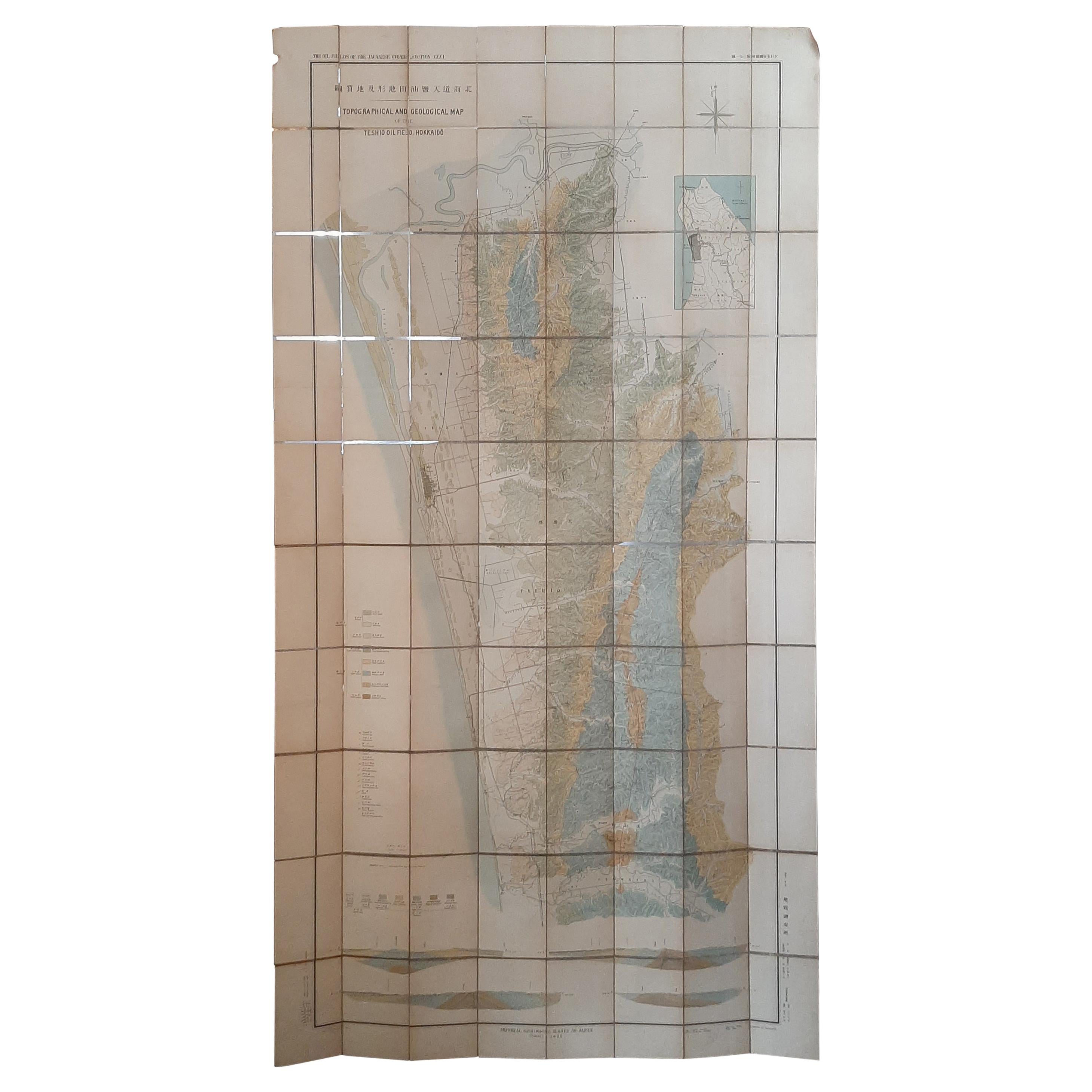
Large Topographical and Geological Map of the Teshio Oil Field, '1936'
Located in Langweer, NL
Topographical and geological map of the Teshio oil field. Shows location of oil well, oil sand, natural gas, coal, Sulphur spring, anticlinal axis, prof...
Category
20th Century Maps
Materials
Linen, Paper
$1,151 Sale Price
20% Off
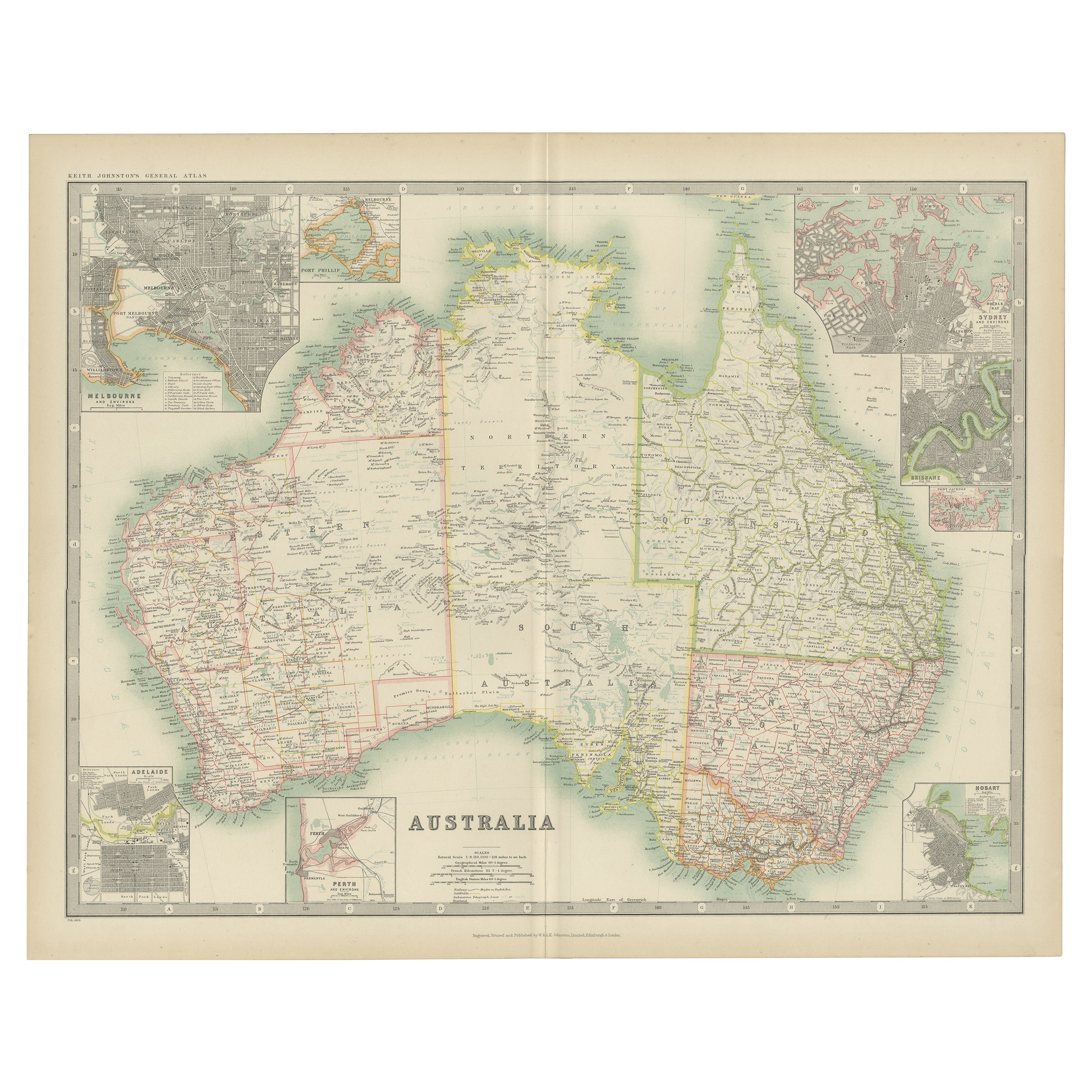
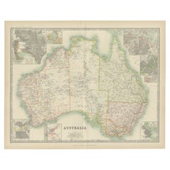
Antique Map of Australia by Johnston '1909'
Located in Langweer, NL
Antique map titled 'Australia'. Original antique map of Australia. With inset maps of Melbourne, Port Phillip, Adelaide, Perth, Sydney, Brisba...
Category
Early 20th Century Maps
Materials
Paper
$335 Sale Price
20% Off
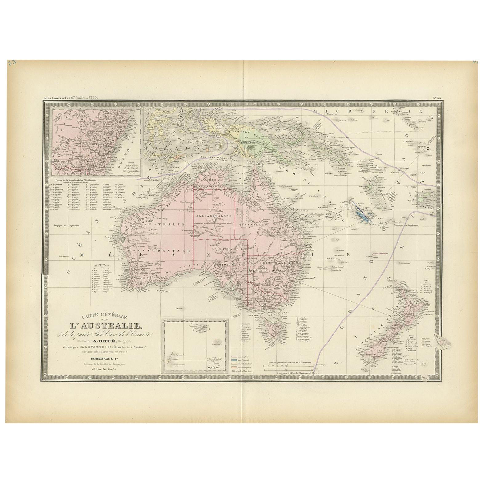
Antique Map of Australia by Levasseur, '1875'
Located in Langweer, NL
Antique map titled 'Carte générale de l'Australie'. Large map of Australia. This map originates from 'Atlas de Géographie Moderne Physique et Politiq...
Category
Antique Late 19th Century Maps
Materials
Paper

$419 Sale Price
30% Off
German Antique Map of Australia, Meyers, 1885
Located in Langweer, NL
Australien.' (Map of Australia. With inset maps of the large cities and Tasmania.) This attractive original old antique print / plate / map originate...
Category
Antique 19th Century Maps
Materials
Paper

$76 Sale Price
20% Off
You May Also Like
Two Impressive Huge Midcentury World Map Wall Globes, 95" Diameter, 1950s
Located in Vienna, AT
We proudly offer this outstanding pair of very large wall-mounted modernist globes / world maps with an incredible diameter of 95 inches each. Unique one-of-a-kind sculptures depicti...
Category
Mid-20th Century Austrian Mid-Century Modern Maps
Materials
Aluminum, Iron
Original Antique Map of Australia by Dower, circa 1835
Located in St Annes, Lancashire
Nice map of Australia
Drawn and engraved by J.Dower
Published by Orr & Smith. C.1835
Unframed.
Free shipping
Category
Antique 1830s English Maps
Materials
Paper

Large Original Antique Map of Australia by Sidney Hall, 1847
Located in St Annes, Lancashire
Great map of Australia
Drawn and engraved by Sidney Hall
Steel engraving
Original colour outline
Published by A & C Black. 1847
Unframed
Free shipping.
Category
Antique 1840s Scottish Maps
Materials
Paper

Original Antique Map of Tasmania, Australia by Dower, circa 1835
Located in St Annes, Lancashire
Nice map of Tasmania
Drawn and engraved by J.Dower
Published by Orr & Smith. C.1835
Unframed.
Free shipping
Category
Antique 1830s English Maps
Materials
Paper

Colored wall map of the WORLD
By Chambon
Located in ZWIJNDRECHT, NL
“Mappe Monde, contenant les Parties Connues du Globe Terrestre”
CHAMBON, Gobert-Denis (France, 17.. - 1781)
Paris, Longchamps et Janvier, 1754
Size H. 115 x W. 145 cm.
Gobert-Denis Chambon made copper engraving after the work of Guillaume De L’Isle, published in 1754 by Jean Janvier and S.G. Longschamps.
A huge wall map of the world in two hemispheres printed on two sheets, depicting the Eastern and Western hemispheres supported by two male figures, decorated at the bottom right and left with two celestial hemispheres (boreal and southern) and at the bottom in the middle with an armillary sphere, in addition.
This map is most notable for its depiction of the Sea of Japan labeled "Mer de Corée" and of "Mer de L'Ouest" or Sea of the West - a great sea, easily the size of the Mediterranean, to flow from the then-known Strait of Juan de Fuca...
Category
Antique Mid-18th Century French French Provincial Maps
Materials
Wood, Paper

1930s Entomology Moth & Butterfly Collection Wall Display Rare Extinct Bugs
By Grant Wood 1
Located in Hyattsville, MD
Interesting piece from an Iowan Estate. This piece is unsigned. The folklore I was told by the seller about the piece is that this was originally from the Grant Wood Estate. Howeve...
Category
Vintage 1930s American Mid-Century Modern Taxidermy
Materials
Glass
$1,200 Sale Price
20% Off