Items Similar to Map of the Hawaiian Islands with a Large Inset of Karakakooa Bay, 1803


Want more images or videos?
Request additional images or videos from the seller
1 of 6
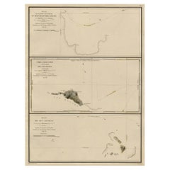
Map of the Hawaiian Islands with a Large Inset of Karakakooa Bay, 1803
$2,167.54
$2,709.4220% Off
£1,603.71
£2,004.6320% Off
€1,800
€2,25020% Off
CA$2,997
CA$3,746.2520% Off
A$3,290.34
A$4,112.9220% Off
CHF 1,716.58
CHF 2,145.7220% Off
MX$39,817.65
MX$49,772.0620% Off
NOK 21,514.61
NOK 26,893.2620% Off
SEK 20,272.42
SEK 25,340.5220% Off
DKK 13,705.25
DKK 17,131.5620% Off
About the Item
Antique map titled 'Kaart van de Sandwich Eilanden'.
Map of the Hawaiian Islands with a large inset of Karakakooa Bay, including soundings and anchorages. Originates from 'Reizen Rondom de Waereld door James Cook (..)'.
Artists and Engravers: Translated by J.D. Pasteur. Published by Honkoop, Allart en Van Cleef.
- Dimensions:Height: 11.82 in (30 cm)Width: 19.1 in (48.5 cm)Depth: 0 in (0.02 mm)
- Materials and Techniques:
- Period:
- Date of Manufacture:1803
- Condition:Wear consistent with age and use. Condition: Very good, general age-related toning and minor foxing. Please study image carefully.
- Seller Location:Langweer, NL
- Reference Number:Seller: BG-11487-17 1stDibs: LU3054326762512
About the Seller
5.0
Recognized Seller
These prestigious sellers are industry leaders and represent the highest echelon for item quality and design.
Platinum Seller
Premium sellers with a 4.7+ rating and 24-hour response times
Established in 2009
1stDibs seller since 2017
2,641 sales on 1stDibs
Typical response time: <1 hour
- ShippingRetrieving quote...Shipping from: Langweer, Netherlands
- Return Policy
Authenticity Guarantee
In the unlikely event there’s an issue with an item’s authenticity, contact us within 1 year for a full refund. DetailsMoney-Back Guarantee
If your item is not as described, is damaged in transit, or does not arrive, contact us within 7 days for a full refund. Details24-Hour Cancellation
You have a 24-hour grace period in which to reconsider your purchase, with no questions asked.Vetted Professional Sellers
Our world-class sellers must adhere to strict standards for service and quality, maintaining the integrity of our listings.Price-Match Guarantee
If you find that a seller listed the same item for a lower price elsewhere, we’ll match it.Trusted Global Delivery
Our best-in-class carrier network provides specialized shipping options worldwide, including custom delivery.More From This Seller
View AllAntique Engraved Map of the Friendly Islands or Tonga, ca.1785
Located in Langweer, NL
Antique map titled 'Carte des Isles des Amis'.
Map of the Friendly Islands / Tonga. The Tongan people first encountered Europeans in 1616 when the Dutch vessel Eendracht, captain...
Category
Antique 1780s Maps
Materials
Paper

$308 Sale Price
20% Off
Antique Map of the Friendly Islands by Cook, 1803
Located in Langweer, NL
Antique map Friendly Islands titled 'Kaart van de Vrienden Eilanden'. Antique map of the Friendly Islands depicting Rotterdam or Anamocka, Middelburg or Eaoowe and Amsterdam or Tonga...
Category
Antique 19th Century Maps
Materials
Paper

$207 Sale Price
20% Off
Old Map of the Cook Islands Takutea, Atiu, Mangaiac and Tubuai, Polynesia, 1781
Located in Langweer, NL
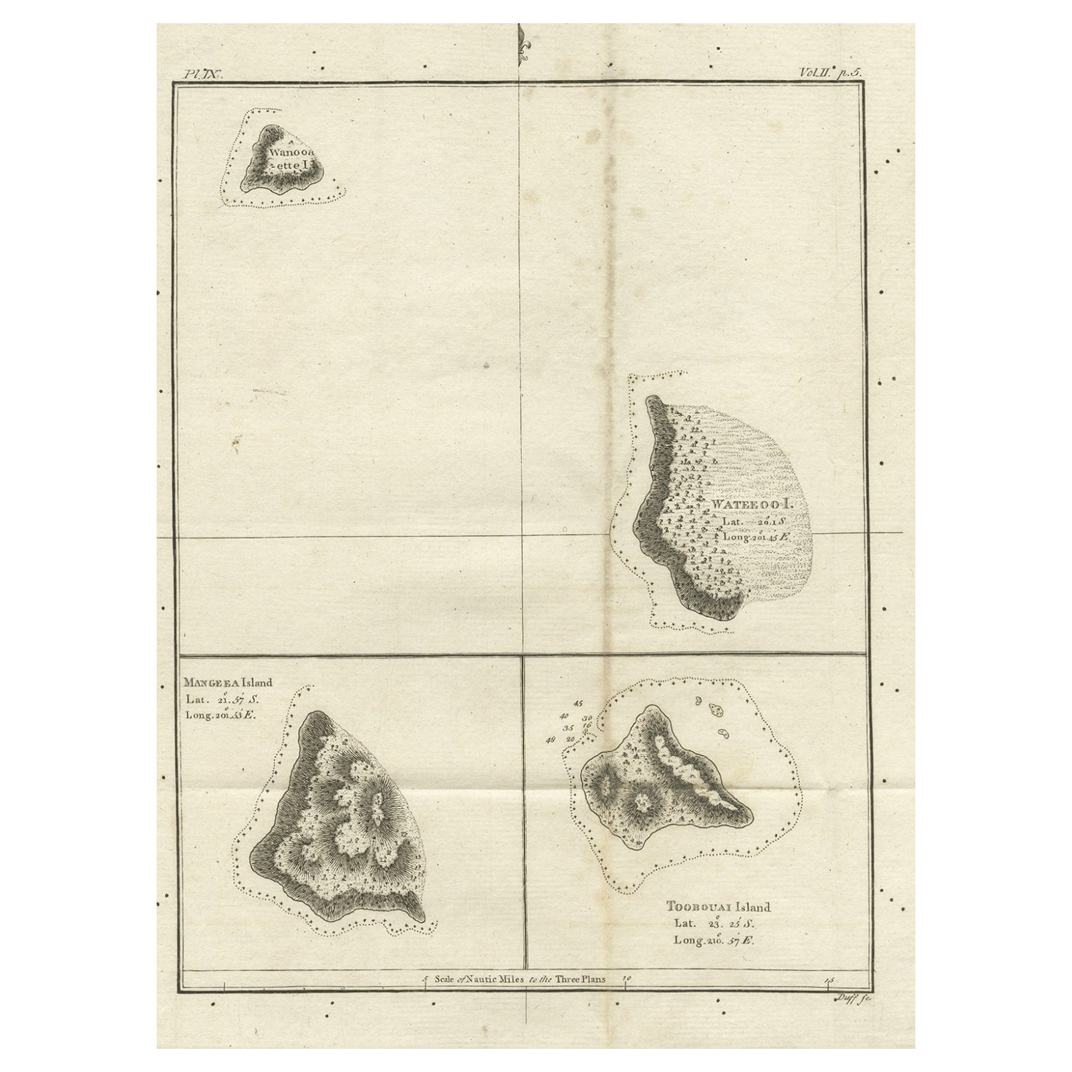
Antique map titled 'Mangeea Island, Toobouai Island (..)'. Map of three of the Cook Islands: Wanooaette [i.e. Takutea] Island, Wateeoo [i.e. Tui or Atiu] ...
Category
Antique 18th Century Maps
Materials
Paper
$125 Sale Price
20% Off
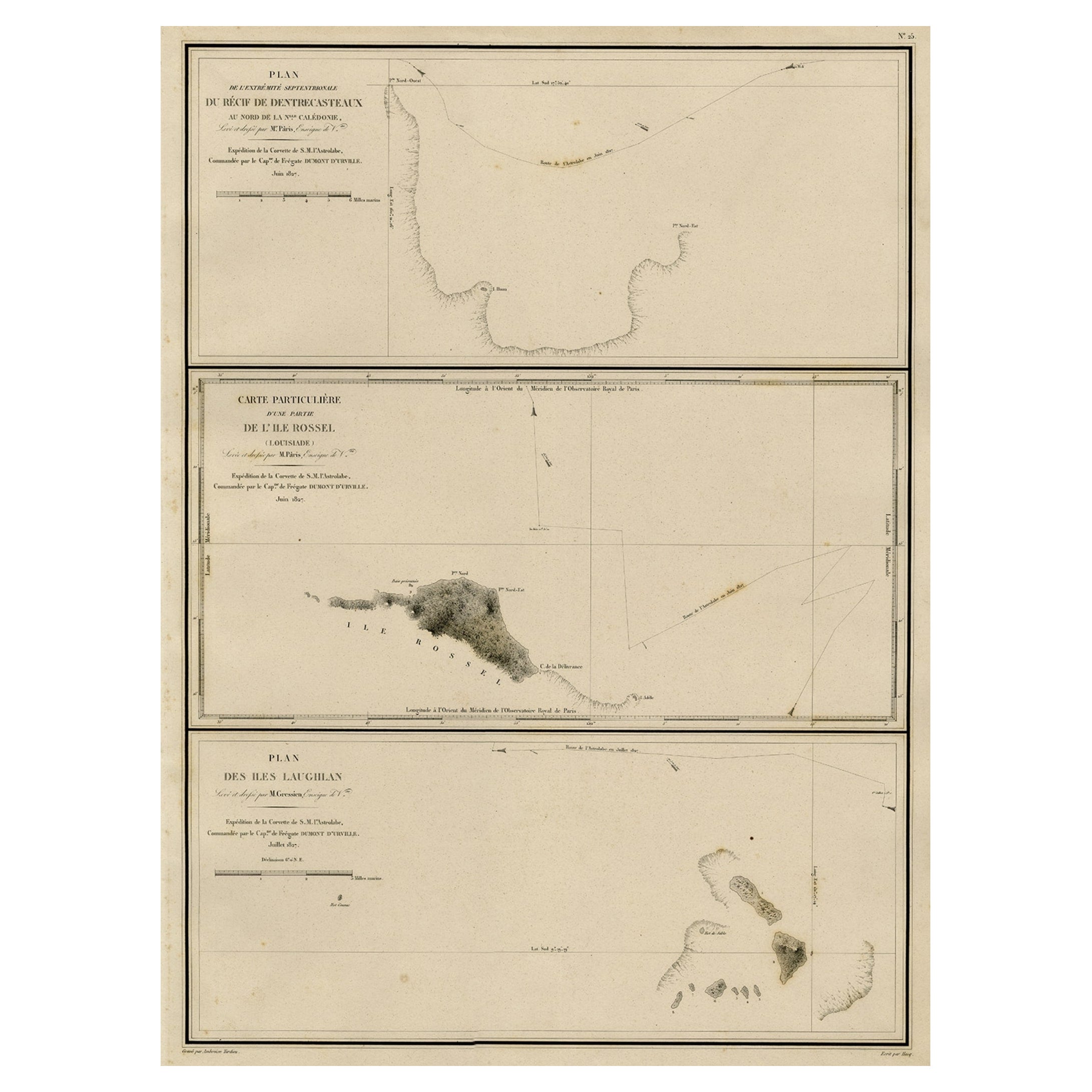
Map of the Laughlan Islands, Rossel Island & Reef North of New Caledonia, 1833
Located in Langweer, NL
Antique map titled 'Plan de l'extremite septentrionale du Recif de D'entrecasteaux. Carte Particuliere d'un partie de l'Ile Rossel (Louisiade). Plan des Iles Laughlan.'
Map of th...
Category
Antique 1830s Maps
Materials
Paper
$433 Sale Price
20% Off
Antique Map of the Friendly Islands by Cook, 1803
Located in Langweer, NL
Antique map Friendly Islands titled 'Kaart van de Vrienden-Eilanden'. Antique map of the Friendly Islands depicting Rotterdam or Anamocka, Middelburg or Eaoowe and Amsterdam or Tonga...
Category
Antique 19th Century Maps
Materials
Paper

$207 Sale Price
20% Off
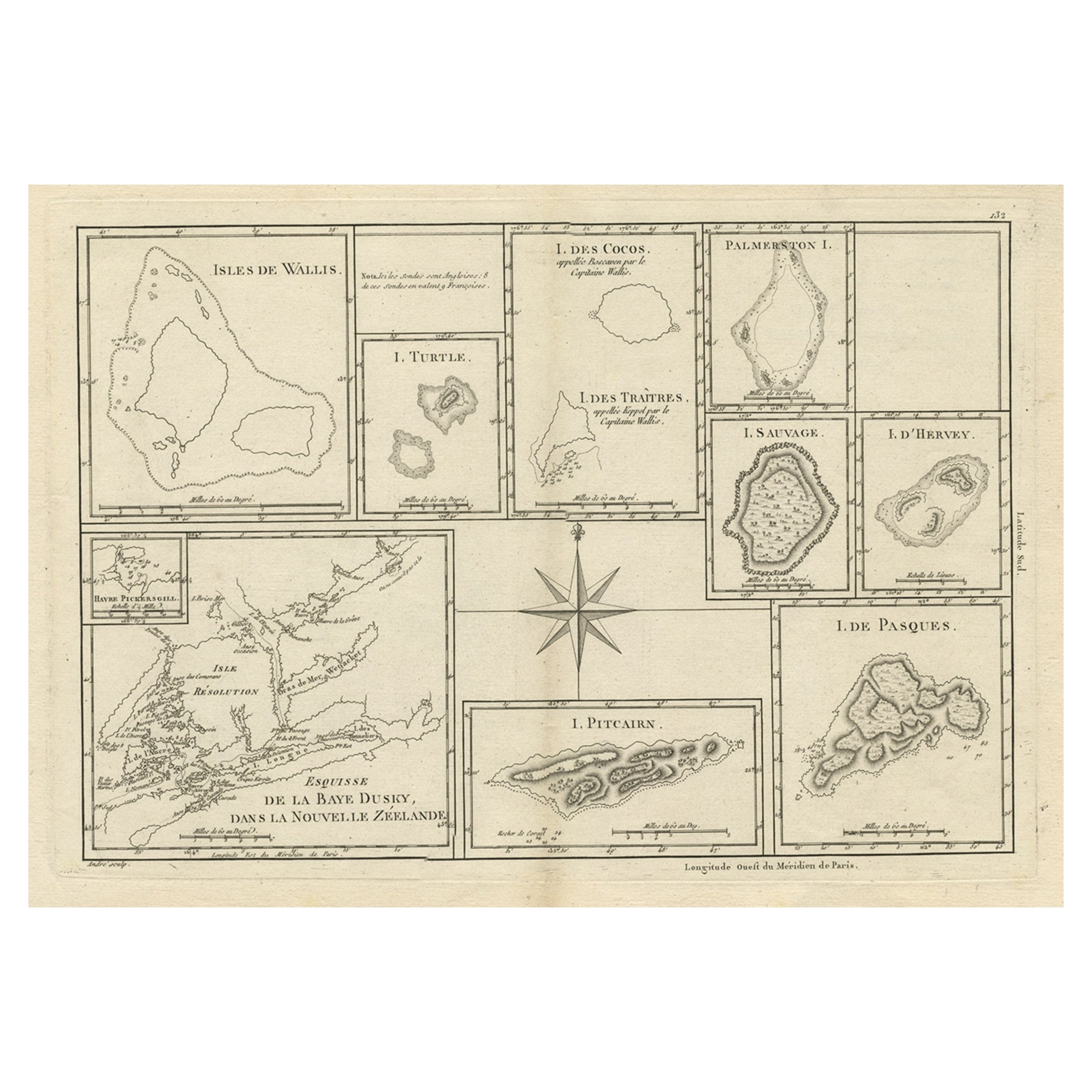
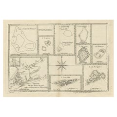
Print of Maps of Islands of the South Pacific, Incl. Pitcairn & Dusky Bay, 1788
Located in Langweer, NL
Antique map titled 'Esquisse de la Bay Dusky, Dans La Nouvelle Zeelande / I. Pitcairn / Isles de Wallis / I Turtle / I des Cocos and Traitres / Palmerston I. / I. Suavage / I. D'Hervey/ Havre Pickersgill / I de Pasques.'
Detailed set of maps of the islands of the South Pacific...
Category
Antique 1780s Maps
Materials
Paper
$423 Sale Price
20% Off
You May Also Like
Original Antique Map of Hawaii And Adjacent Islands. C.1900
Located in St Annes, Lancashire
Fabulous map of Hawaii. With a vignette of Honolulu
Original color.
Engraved and printed by the George F. Cram Company, Indianapolis.
Published, C.1900.
Unframed.
Free shipping.
Category
Antique 1890s American Maps
Materials
Paper

Original Antique Map of US Possessions In The Pacific Ocean, C.1900
Located in St Annes, Lancashire
Fabulous map of US possessions in the Pacific Ocean
Original color.
Engraved and printed by the George F. Cram Company, Indianapolis.
Published, C.1900.
Unframed.
Free shipping.
Category
Antique 1890s American Maps
Materials
Paper

Large Original Antique Map of The Canary Islands. 1894
Located in St Annes, Lancashire
Superb Antique map of The Canary Islands
Published Edward Stanford, Charing Cross, London 1894
Original colour
Good condition
Unframed.
Free shipping
Category
Antique 1890s English Maps
Materials
Paper

1865 Chart of the Islands of Madeira
Located in Norwell, MA
Rare James Imray chart from 1865 titled "Chart of the Islands of Madeira, Porto Santo and Dezerea" drawn from the survey made by Captain Ate Vidal Royal Navy, London. Published by Ja...
Category
Antique 1860s European Maps
Materials
Paper

Large Original Vintage Map of The Pacific Islands Including Hawaii
Located in St Annes, Lancashire
Great map of The Pacific Islands
Unframed
Original color
By John Bartholomew and Co. Edinburgh Geographical Institute
Published, circa 1...
Category
Vintage 1920s British Maps
Materials
Paper

Large Original Antique Map of The Leeward Islands. 1894
Located in St Annes, Lancashire
Superb Antique map of The Leeward Islands
Published Edward Stanford, Charing Cross, London 1894
Original colour
Good condition
Unframed.
Free shipping
Category
Antique 1890s English Maps
Materials
Paper

More Ways To Browse
Hawaiian Antique
Antique Hawaiian Furniture
Hawaiian Collectibles
Antique Map Of Hawaii
Antique Map By Coronelli
Cyprus Antique Maps
John Speed Maps
M Howard
Used Office Furniture Michigan
Antique Geological Maps
Antique Manitoba
Australian Colonial
Bengal Map
Stanford Furniture
Tennessee Antique Furniture
Used Furniture Alabama
Used Office Furniture Maine
Ancient World Map