Gold Maps
to
1
1
1
2
1
1
12,598
5,710
126
63
34
2
2
2
2
2
2
Material: Gold
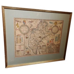
Framed 17th Century Map of Cumberland, England by John Speed, 1610
By John Speed
Located in Middleburg, VA
A fascinating and richly detailed antique map of Cumberland County in northwest England, drawn and published by the celebrated English cartographer John Spe...
Category
Early 17th Century English British Colonial Antique Gold Maps
Materials
Copper, Gold Leaf
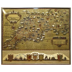
Gold Leaf Foil Pictorial Plan Map of the West Country of England Antique Style
Located in West Sussex, Pulborough
We are delighted to offer for sale this lovely Antique style pictorial plan map of the West Country of England etched in gold leaf foil
This is a very interesting and decorative p...
Category
20th Century English Adam Style Gold Maps
Materials
Gold Leaf
$264 Sale Price
30% Off
Related Items
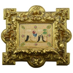
Frame with Vellum Painting, 17th Century
Located in Madrid, ES
Carved and gilded frame with painting on vellum, "Virgin of the Rosary with Santo Domingo de Guzmán and Santa Catalina of Siena", 17th century. Registration in the back zone (Mr. Jos...
Category
17th Century European Baroque Antique Gold Maps
Materials
Leather, Wood, Paint
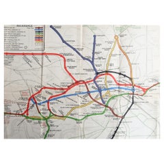
Original Antique Map of The London Underground. 1911
Located in St Annes, Lancashire
Superb map of The London Underground
Published by Ward Lock, 1911
Folding map. Printed on paper
Unframed.
Good condition/ Minor repair to an edge tear on right edge ( shown in ...
Category
1910s English Vintage Gold Maps
Materials
Canvas, Paper
Original Antique Map or City Plan of Amsterdam, Netherlands. Circa 1835
Located in St Annes, Lancashire
Nice map of Amsterdam
Drawn and engraved by J.Dower
Published by Orr & Smith. C.1835
Unframed.
Free shipping
Category
1830s English Antique Gold Maps
Materials
Paper
$60
H 9.25 in W 12.25 in D 0.07 in
Early 19th Century Original Framed Land Indenture, England, 1810
Located in Lambertville, NJ
A large hand written land indenture document England, 1810, framed. The beautifully hand written document mounted on board with a red velvet border and ...
Category
1810s English Regency Antique Gold Maps
Materials
Glass, Giltwood, Parchment Paper
Ciro Ferri Drawing Offering Scene Italie 17th Century
Located in Beuzevillette, FR
Italian lead pencil drawing, entourage of Ciro Ferri, depicting an offering scene in front of a temple, in the manner of the antiquity.
Measurements: 7.8/5.9 inches
...
Category
17th Century Italian Antique Gold Maps
Materials
Paper
Vintage Reproduction 17th Century Map of Europe, American, Cartography, Blaeuw
Located in Hele, Devon, GB
This is a vintage reproduction map of Europe. An American, paper stock cartography print in frame after the work by Blaeuw, dating to the late 20t...
Category
Late 20th Century Central American Mid-Century Modern Gold Maps
Materials
Glass, Wood, Paper
$1,259
H 30.32 in W 38.39 in D 1.38 in
Original Antique Map or City Plan of Venice, Italy. Circa 1835
Located in St Annes, Lancashire
Nice map of Venice
Drawn and engraved by J.Dower
Published by Orr & Smith. C.1835
Unframed.
Free shipping
Category
1830s English Antique Gold Maps
Materials
Paper
Original Antique Map or City Plan of Rome, Italy. Circa 1835
Located in St Annes, Lancashire
Nice map of Rome
Drawn and engraved by J.Dower
Published by Orr & Smith. C.1835
Unframed.
Free shipping
Category
1830s English Antique Gold Maps
Materials
Paper
Extremely Large Hand-Drawn Manuscript Map of Surinam, 1830, History of Slavery
Located in Amsterdam, NL
A unique large hand-drawn map of Surinam by Albrecht Helmut Hiemcke (German, 1760-1839)
?
'Colonie Surinaame', 1830
A large hand-drawn and coloured map of the colony of Suri...
Category
Mid-19th Century Surinamer Antique Gold Maps
Materials
Paper
$45,413
H 34.85 in W 97.05 in D 0.08 in
Original 17th-Century Antique Map of Nanjing Province, China – by Blaeu
Located in Langweer, NL
Title: 17th-Century Antique Map of Nanjing Province, China – "Nanking sive Kiangnan" by Blaeu, with Decorative Details
Description: This captivating 17th-century map of Nanjing Pr...
Category
1650s Antique Gold Maps
Materials
Paper
$1,600
H 18.9 in W 23.04 in D 0.01 in
Large Scale Antique Scroll Map of Lincolnshire, England, Dated 1778
Located in St Annes, Lancashire
Wonderful scroll map of Lincolnshire
By Captain Armstrong, 1778
Copper plate engraving on paper laid on canvas
Original ebonized wood frame with lovely t...
Category
1770s English Georgian Antique Gold Maps
Materials
Wood, Paper
Original Antique Map of the American State of Kentucky, 1903
Located in St Annes, Lancashire
Antique map of Kentucky
Published By A & C Black. 1903
Original colour
Good condition
Unframed.
Free shipping
Category
Early 1900s English Antique Gold Maps
Materials
Paper
Recently Viewed
View AllMore Ways To Browse
Kentucky Antiques
Japanese Kite
Irish Antiques 16th Century
Carstens Floor Vase
Carstens Uffrecht
Carved Ancestor Figure
Carved Crow
Carved Ibex
Carved Ivory Sculpture
Carved Nativity
Carved Pipes
Casket Plate
Cast Aluminum Planter
Cast Iron Rooster
Cast Iron Settee
Cat Ring Holder
Cathrineholm Enamel
Cedar Hope Chest


