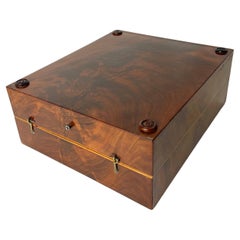
Napoleon 1812 Empire Map 32 Pieces Battles with Prince Letters
View Similar Items
1 of 9
Napoleon 1812 Empire Map 32 Pieces Battles with Prince Letters
About the Item
- Creator:Longuet succeed Simonneau (Illustrator)
- Dimensions:Height: 23.63 in (60 cm)Width: 0.04 in (1 mm)Depth: 25.6 in (65 cm)
- Sold As:Set of 33
- Style:Empire (Of the Period)
- Materials and Techniques:
- Place of Origin:
- Period:
- Date of Manufacture:1820
- Condition:Wear consistent with age and use. Minor fading.
- Seller Location:Denia, ES
- Reference Number:1stDibs: LU303039430793
Authenticity Guarantee
In the unlikely event there’s an issue with an item’s authenticity, contact us within 1 year for a full refund. DetailsMoney-Back Guarantee
If your item is not as described, is damaged in transit, or does not arrive, contact us within 7 days for a full refund. Details24-Hour Cancellation
You have a 24-hour grace period in which to reconsider your purchase, with no questions asked.Vetted Professional Sellers
Our world-class sellers must adhere to strict standards for service and quality, maintaining the integrity of our listings.Price-Match Guarantee
If you find that a seller listed the same item for a lower price elsewhere, we’ll match it.Trusted Global Delivery
Our best-in-class carrier network provides specialized shipping options worldwide, including custom delivery.You May Also Like
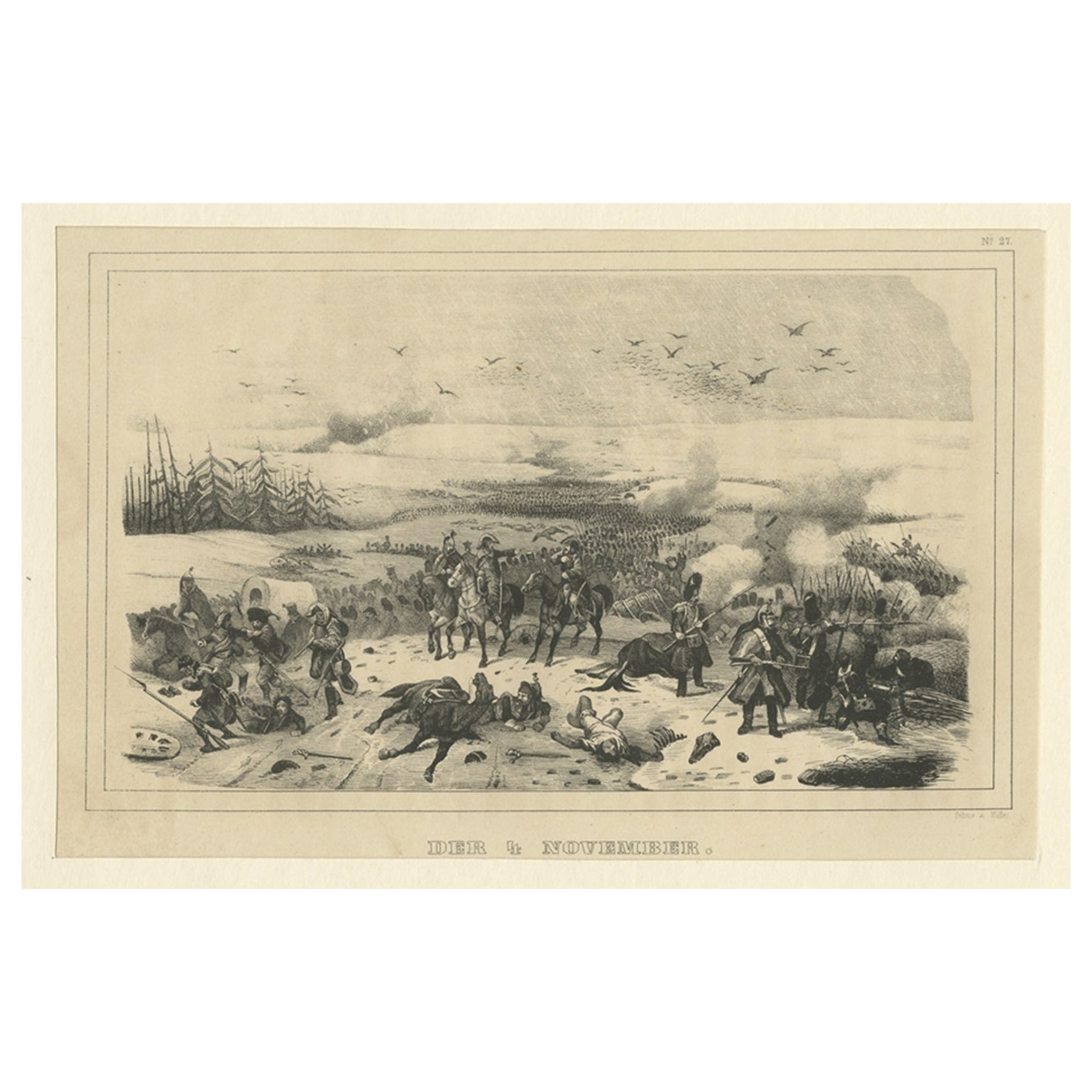
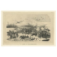
Antique Print of Napoleon Wars of the Battle of 4 November 1812, 1845
Located in Langweer, NL
Antique print titled 'Der 4 November'. Original antique print of the battle of 4 November 1812, part of Napoleon's retreat from Moscow. This print originates from 'Der Feldzug von 18...
Category
Antique 19th Century Prints
Materials
Paper
$121 Sale Price
20% Off
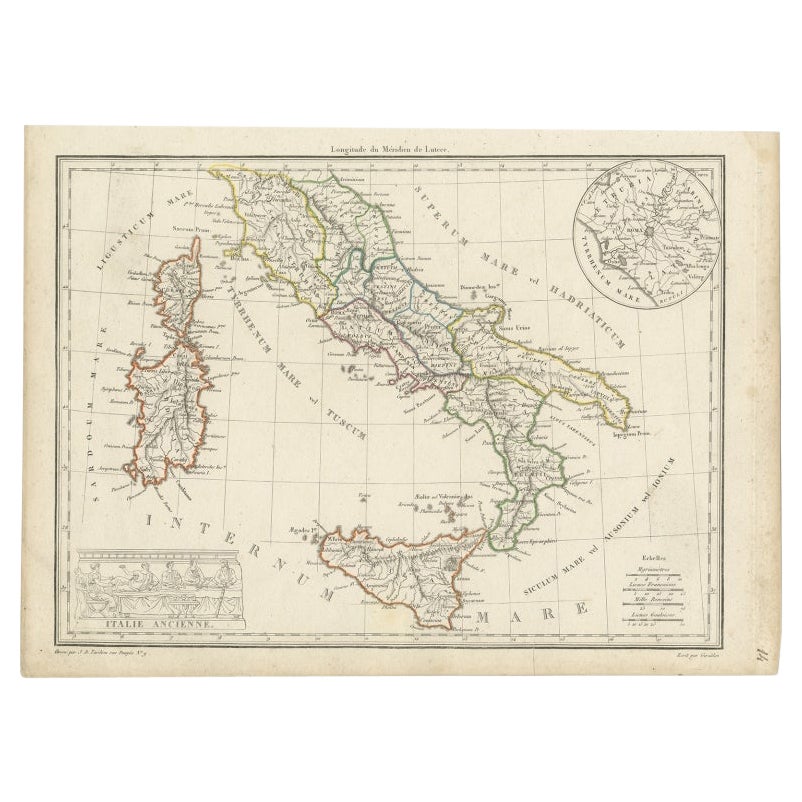
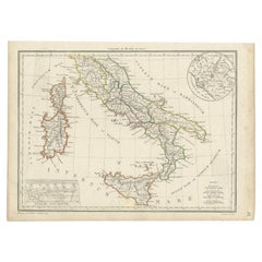
Antique Map of Italy with an Inset of Rome, 1812
Located in Langweer, NL
Antique map titled 'Italie Ancienne'.
Old map of ancient Italy, with an inset map of the region of Rome. This map originates from 'Atlas Supplementaire du Precis de la Geographie...
Category
Antique 19th Century Maps
Materials
Paper
$148 Sale Price
20% Off
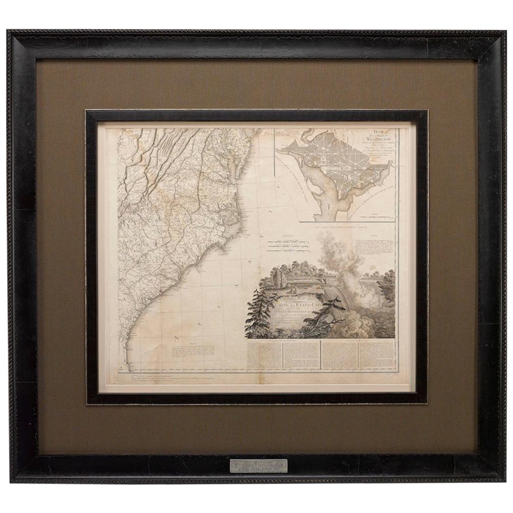
1812 United States Map, by Pierre Tardieu, Antique French Map Depicting the U.S.
By Pierre François Tardieu
Located in Colorado Springs, CO
1812 "United States of Nth America -- Carte des Etats-Unis De L'Amerique Septentrionale" Two-Sheet Map by Tardieu
This attractive map, published in Paris in 1812, is one of the most rare large format maps from the period. It features a view of the East Coast of the U.S. from Maryland to just below South Carolina. Additionally, Ellicott’s plan for the City of Washington D.C. is included at the top right and an illustration of Niagara Falls is shown at the bottom right with a description in both French and English. This extremely detailed map not only depicts the mountainous regions of the southeastern U.S., but also includes names of regions, rivers, and towns.
Based on the first state of Arrowsmith’s 4-sheet map of the United States, this map is completely engraved by Tardieu in Paris and showcases high quality engravings. This detailed map of the recently independent United States includes one of the largest and earliest examples of the Ellicott plan of Washington DC.
The artist, Pierre François Tardieu (PF Tardieu) was a very well-known map engraver, geographer, and illustrator. Awarded a bronze medal by King Louis-Phillipe for the accuracy and beauty of his map-making, Tardieu produced many fine works including maps of Louisiana...
Category
Antique 1810s French Maps
Materials
Paper

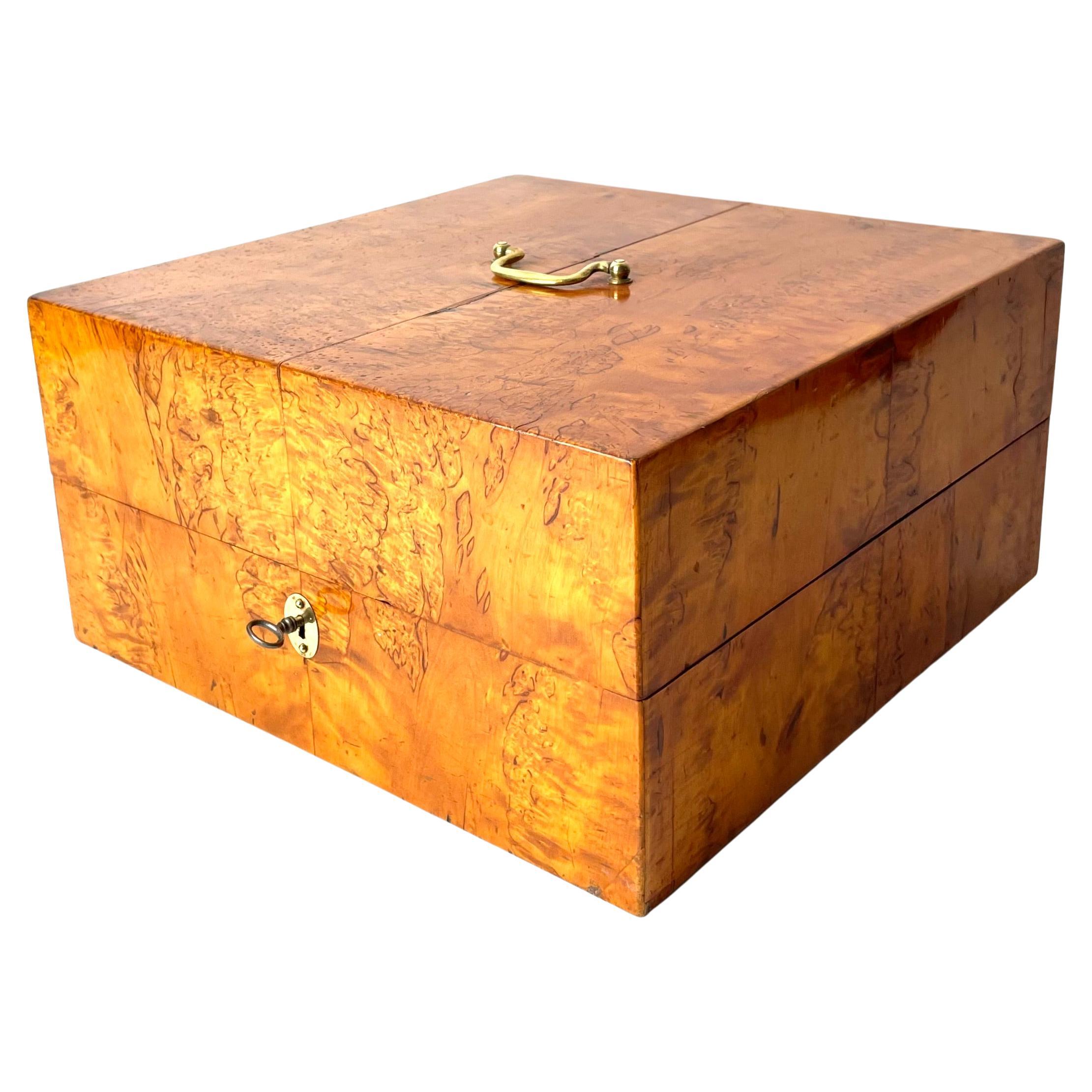
Swedish Backgammon in Curly Karelian Birch with Playing Pieces, Empire 1820/30s
Located in Knivsta, SE
Swedish Backgammom Box in Curly Karelian Birch with Playing Pieces, Swedish Empire (Karl Johan) 1820/30s. Complete with two Die made in bone and Playing Pieces for two players.
This beautifully crafted backgammon box...
Category
Antique 1820s Swedish Empire Games
Materials
Brass

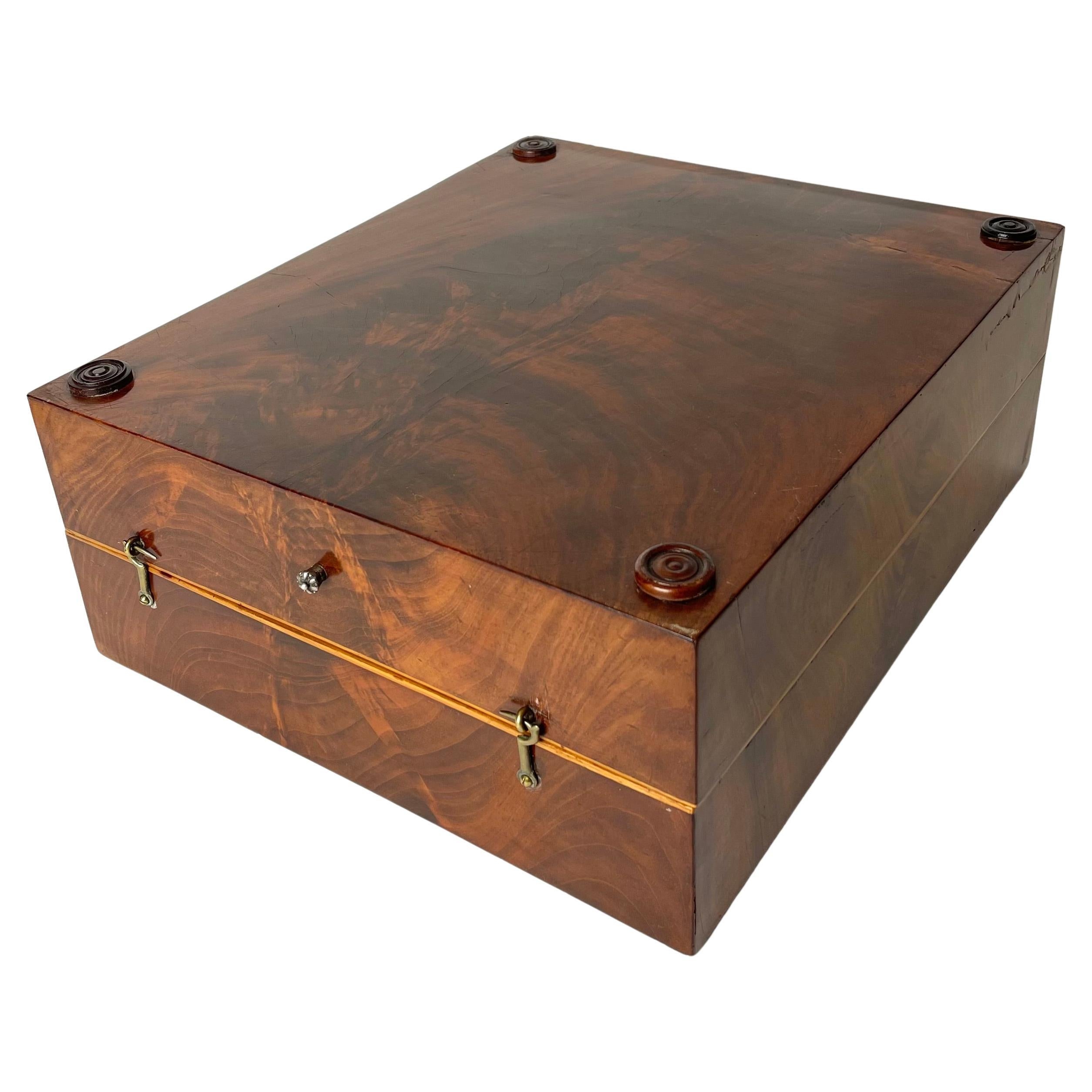
Empire Backgammon Games Box in Mahogany with Pieces, early 19th Century
Located in Knivsta, SE
An Elegant Empire Backgammon Game Box in Mahogany (Swietenia Mahogani) with details in Hallmark Silver. Made in the early 19th Century.
This Games Box for Backgammon is the perfect decorative piece that is also complete with pieces for playing the game! A refined Empire outside which lets the expensive materials of the piece convey the object's elegance. The interior of the box's lid forms one of the playing fields, the other being the bottom part. The backgammon board on the inside of the box is made out of intarsia wood...
Category
Antique Early 19th Century European Empire Games
Materials
Silver, Brass
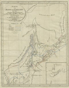
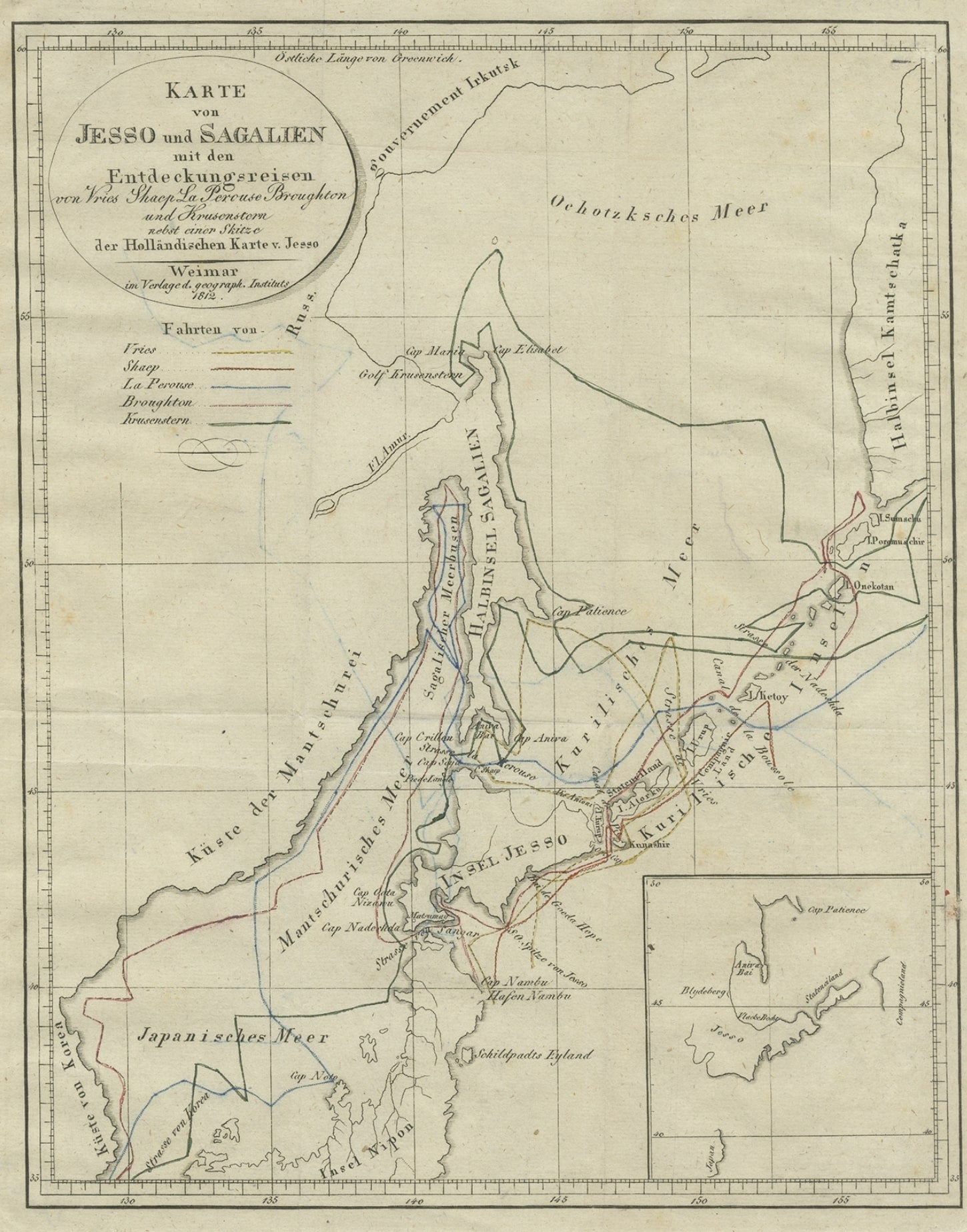
Antique Map of the Region of Hokkaido, Island of Japan, 1812
Located in Langweer, NL
Antique map titled 'Karte von Jesso und Sagalien'. Old map of the region of the island of Yesso (Mororan, Hokkaido, Japan). This map originates from Volume 38 of 'Allgemeine geograph...
Category
Antique 19th Century Maps
Materials
Paper