Items Similar to Old Map of Australia Showing The Routes of the Main Explorers, ca.1900
Want more images or videos?
Request additional images or videos from the seller
1 of 5
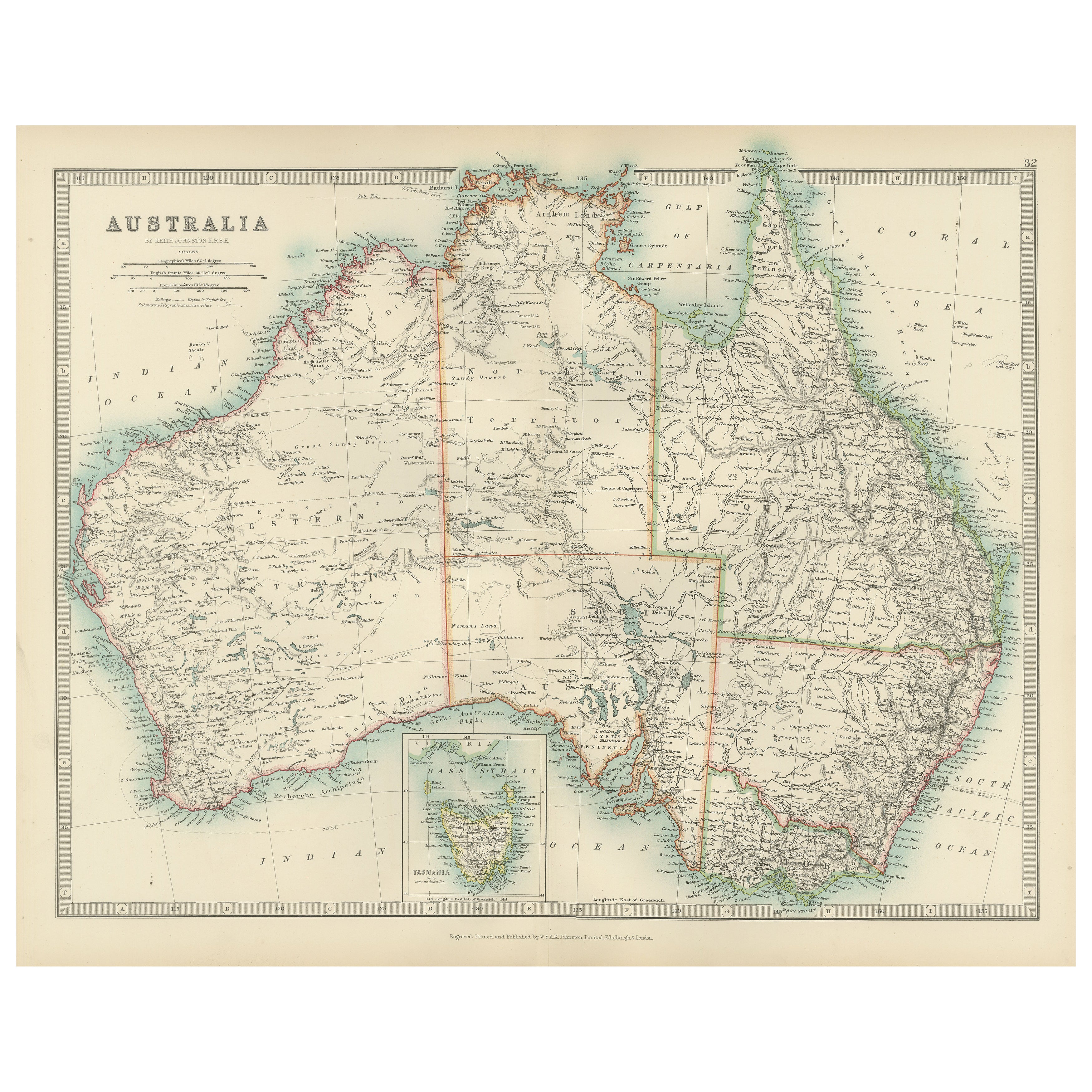
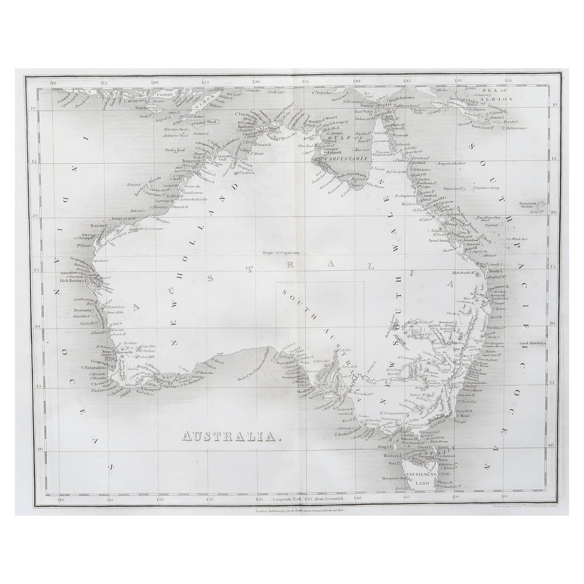
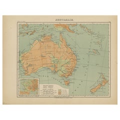
Old Map of Australia Showing The Routes of the Main Explorers, ca.1900
$143.74
£107.49
€120
CA$198.04
A$215.99
CHF 114.42
MX$2,589.40
NOK 1,457.15
SEK 1,332.46
DKK 914.45
About the Item
Antique print, untitled. This map shows Australia with the routes of explorers in the continent and marking the furthest point reached.. Source unknown, to be determined.
Artists and Engravers: Anonymous.
Condition: Good, given age. Original folds, as issued. A few small stains and soiling in the margin. General age-related toning and/or occasional minor defects from handling. Please study scan carefully.
- Dimensions:Height: 8.19 in (20.8 cm)Width: 6.66 in (16.9 cm)Depth: 0 in (0.02 mm)
- Materials and Techniques:
- Period:1900-1909
- Date of Manufacture:circa 1900
- Condition:Wear consistent with age and use.
- Seller Location:Langweer, NL
- Reference Number:Seller: PCT-553141stDibs: LU3054326702972
About the Seller
5.0
Recognized Seller
These prestigious sellers are industry leaders and represent the highest echelon for item quality and design.
Platinum Seller
Premium sellers with a 4.7+ rating and 24-hour response times
Established in 2009
1stDibs seller since 2017
2,788 sales on 1stDibs
Typical response time: <1 hour
- ShippingRetrieving quote...Shipping from: Langweer, Netherlands
- Return Policy
More From This Seller
View AllAntique Map of Australia, 1903, with Colonial Divisions and Detailed Topography
Located in Langweer, NL
Title: Antique Map of Australia, 1903, with Colonial Divisions and Detailed Topography
Description: This antique map, titled "Australia," was engraved and published in 1903 by W. & ...
Category
Early 20th Century Maps
Materials
Paper

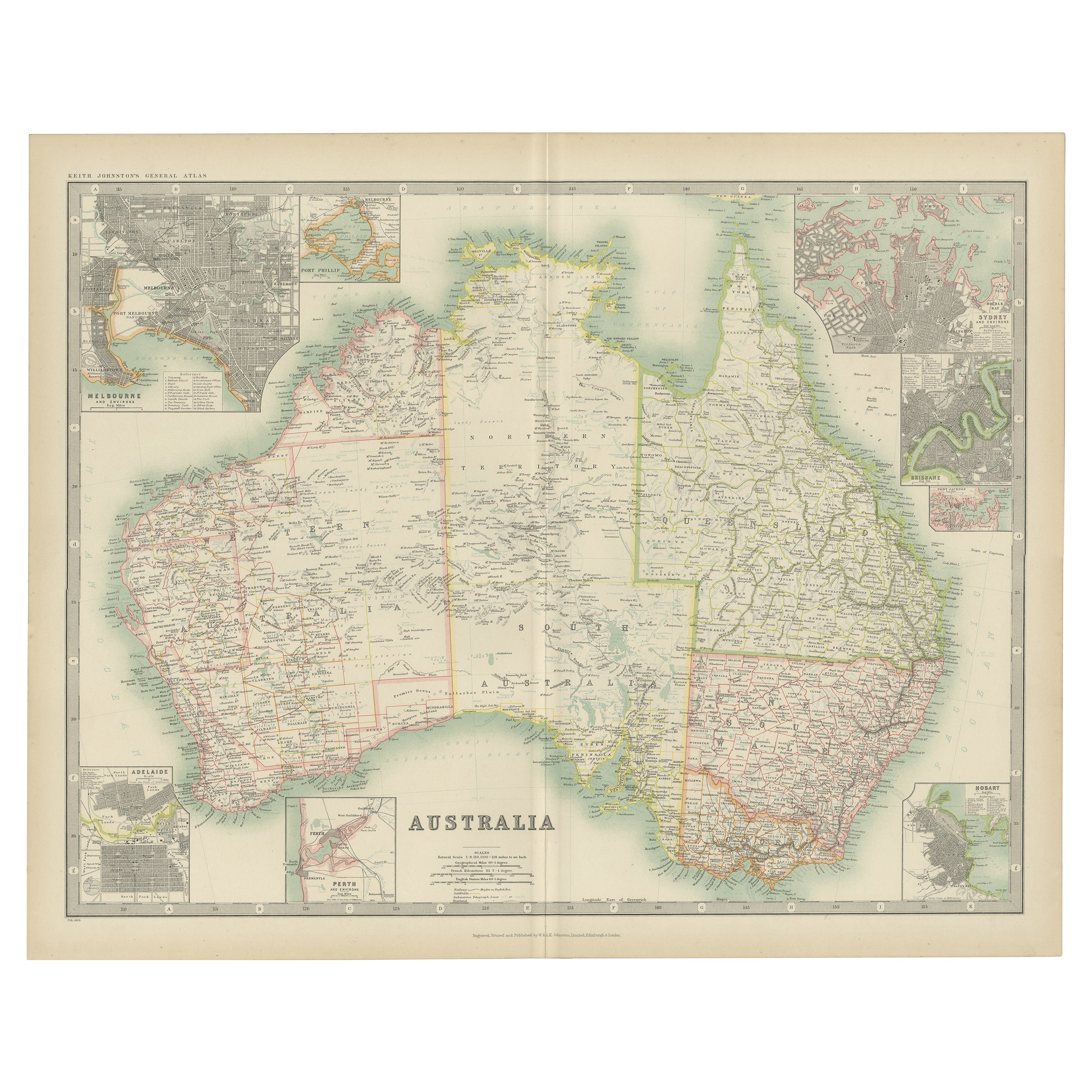
Antique Map of Australia by Johnston '1909'
Located in Langweer, NL
Antique map titled 'Australia'. Original antique map of Australia. With inset maps of Melbourne, Port Phillip, Adelaide, Perth, Sydney, Brisba...
Category
Early 20th Century Maps
Materials
Paper
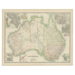
$335 Sale Price
20% Off
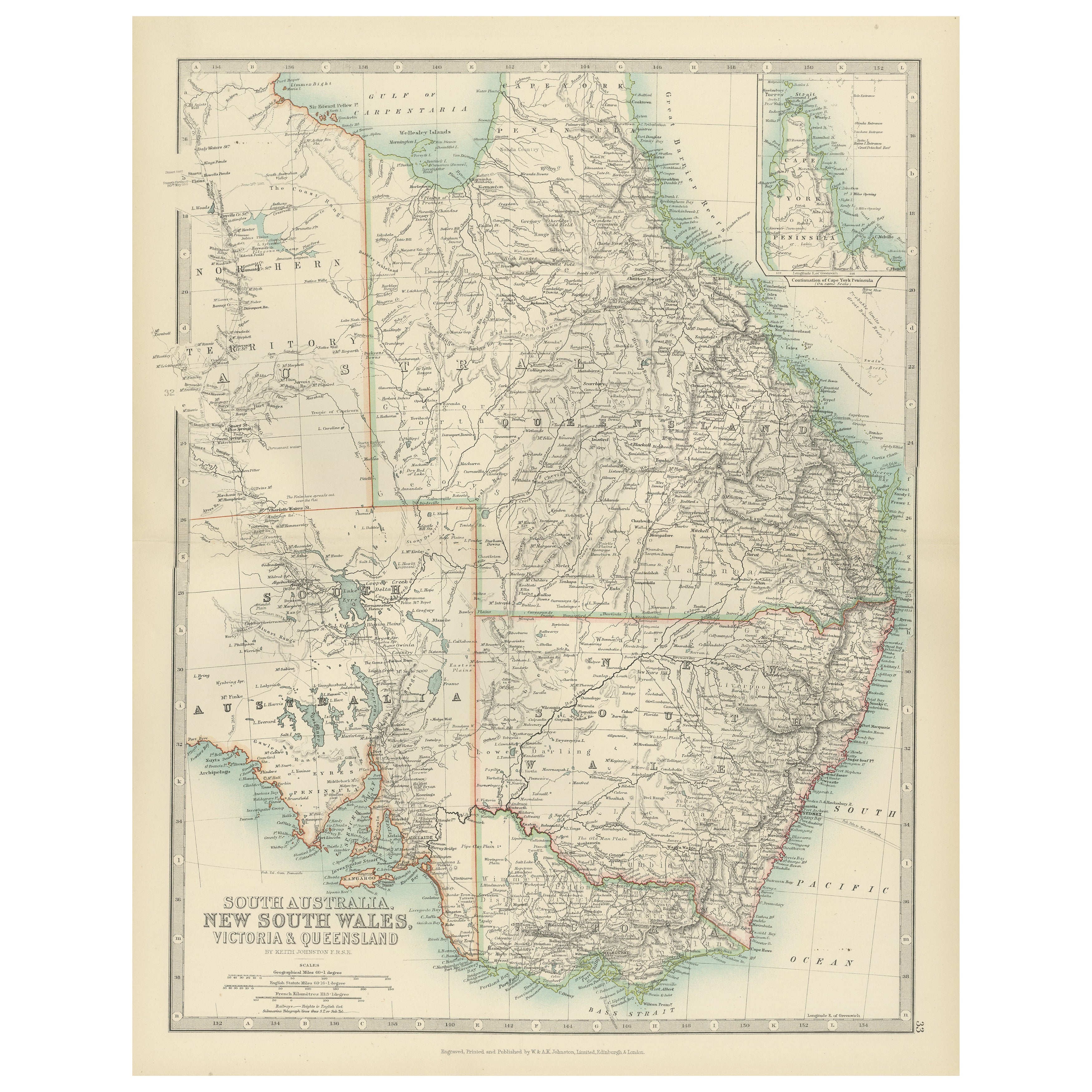
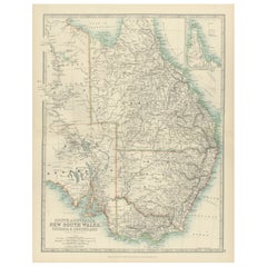
Antique Map of South Australia, New South Wales, Victoria and Queensland, 1903
Located in Langweer, NL
Title: Antique Map of South Australia, New South Wales, Victoria, and Queensland, 1903
Description:
This antique map, titled "South Australia, New South Wales, Victoria, and Queensl...
Category
Early 20th Century Maps
Materials
Paper
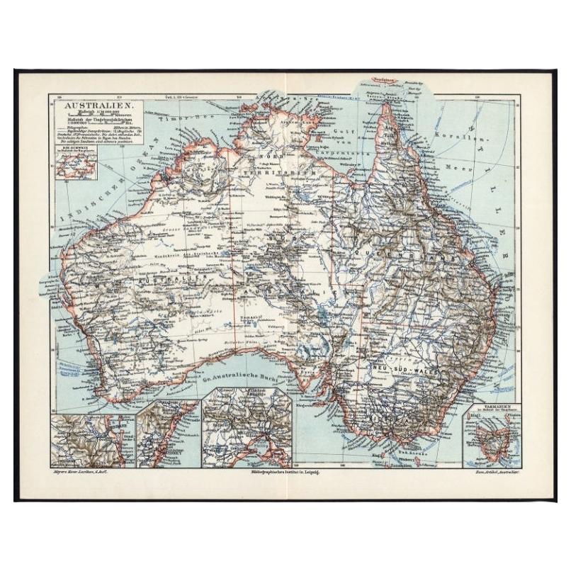
German Antique Map of Australia, Meyers, 1885
Located in Langweer, NL
Australien.' (Map of Australia. With inset maps of the large cities and Tasmania.) This attractive original old antique print / plate / map originate...
Category
Antique 19th Century Maps
Materials
Paper

$76 Sale Price
20% Off
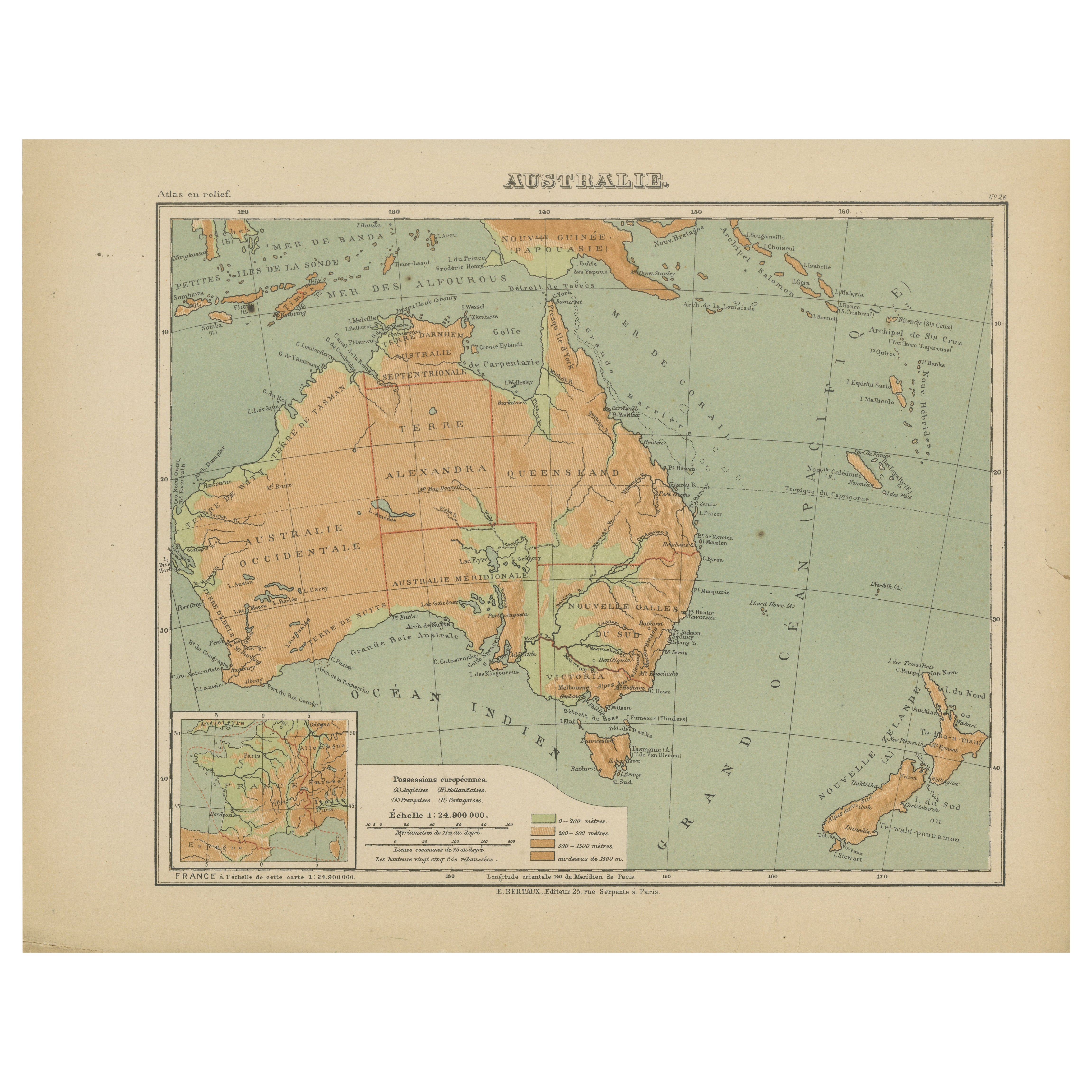
Antique Map of Australia and Oceania – Physical Relief Map by Hachette, c.1883
Located in Langweer, NL
Antique Map of Australia and Oceania – Physical Relief Map by Hachette, c.1883
Description:
This antique map titled “Australie” was published circa 1883 by Hachette in Paris as part...
Category
Antique Late 19th Century French Maps
Materials
Paper
Antique Map of Australia and New Zealand, c.1860
Located in Langweer, NL
Antique map titled 'Australia and New Zealand'. Unusual edition of this map of Australia and New Zealand, on very thin paper and multiple folding lines. Source unknown, to be determi...
Category
Antique 19th Century Maps
Materials
Paper

$134 Sale Price
20% Off
You May Also Like
Original Antique Map of Australia by Dower, circa 1835
Located in St Annes, Lancashire
Nice map of Australia
Drawn and engraved by J.Dower
Published by Orr & Smith. C.1835
Unframed.
Free shipping
Category
Antique 1830s English Maps
Materials
Paper

Large Original Antique Map of Australia by Sidney Hall, 1847
Located in St Annes, Lancashire
Great map of Australia
Drawn and engraved by Sidney Hall
Steel engraving
Original colour outline
Published by A & C Black. 1847
Unframed
Free shipping.
Category
Antique 1840s Scottish Maps
Materials
Paper

Australia, Tallis antique map, 1851
Located in Melbourne, Victoria
'Australia'
With decorative border surrounds and vignettes including a view of Sydney, Kangaroos, Natives of Australia Felix, Australian Parrots and Cockatoos and Natives of the Tri...
Category
19th Century Naturalistic Landscape Prints
Materials
Engraving

Vintage Australia Map, Framed, Historic 19th Century Cartography Interest, 1988
Located in Hele, Devon, GB
This is a vintage Australia map. A late 20th century reproduction of John Tallis’ original 1850 steel engraving, produced to mark the 1988 Australian Bicentennial.
Fascinating repro...
Category
1990s Australian Victorian Maps
Materials
Glass, Paper

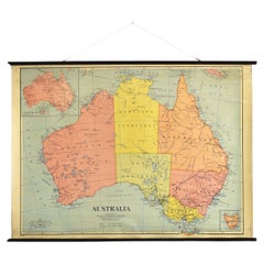
Antique Vintage Australia Wall Map By W & A K Johnston
By W. & A.K. Johnston
Located in Stockbridge, GB
Vintage Australia Wall Map By W & A K Johnston
A vintage school pull down wall map of Australia. The map has a wooden hanging pole at the top...
Category
Mid-20th Century British Schoolhouse Posters
Materials
Canvas, Wood
Ancient Map of Oceania - Original Etching - 19th century
Located in Roma, IT
This Map of Oceania is an etching realized in the 19th century.
The state of preservation of the artwork is good. At the top of the paper, the inscription “Longitudine del Meridiano...
Category
19th Century More Prints
Materials
Etching

More Ways To Browse
Antique Maps Of Russian Empire
J C Walker Map
Massachusetts Antiques
Persian Maps
Afghanistan Antique Map
Antique Furniture Delaware
Antique Furniture Wisconsin
Antique Map By Coronelli
Antique Map Iceland
Cyprus Antique Maps
John Speed Maps
M Howard
Used Office Furniture Michigan
Antique Geological Maps
Antique Manitoba
Australian Colonial
Bengal Map
Stanford Furniture