Items Similar to Old Map of the Margraviate of Brandenburg by Giacomo Cantelli da Vignola, 1687


Want more images or videos?
Request additional images or videos from the seller
1 of 11
Old Map of the Margraviate of Brandenburg by Giacomo Cantelli da Vignola, 1687
$516.51
$645.6320% Off
£382.37
£477.9620% Off
€432
€54020% Off
CA$714.72
CA$893.3920% Off
A$787.96
A$984.9520% Off
CHF 412.23
CHF 515.2920% Off
MX$9,666.77
MX$12,083.4620% Off
NOK 5,189.21
NOK 6,486.5120% Off
SEK 4,852.73
SEK 6,065.9120% Off
DKK 3,290.71
DKK 4,113.3920% Off
About the Item
Historical Map of the Margraviate of Brandenburg by Giacomo Cantelli da Vignola - 1687
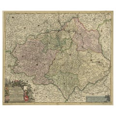
This magnificent map, titled Marchesato, et Elettorato di Brandeburgo con una gran Porzione della Pomerania, is an exceptional 17th-century copperplate engraving by the renowned Italian cartographer Giacomo Cantelli da Vignola, published in 1687. The map was printed by Gio. Giacomo de Rossi in Rome, one of the most prestigious map publishers of the period.
This map represents the Margraviate and Electorate of Brandenburg, a key region in present-day northeastern Germany, which later formed the core of the Kingdom of Prussia. The map also includes parts of Pomerania, Magdeburg, Lusatia, and Silesia, as well as the Baltic Sea (Oost Zee or Mar Baltico) to the northeast. Cantelli da Vignola's dedication to precision and fine craftsmanship is evident in the rich details and well-organized presentation of the political divisions and topographical features.
The map is beautifully hand-colored, with soft hues of pink, yellow, and green distinguishing the various duchies, counties, and territories. This subtle and elegant coloring enhances the visual clarity of the map and draws attention to the complex political landscape of the late 17th century. The geographic details include numerous towns, rivers, forests, and even smaller settlements, all meticulously labeled in fine italic script.
One of the most captivating aspects of this map is the ornate cartouche at the upper left, framed with baroque flourishes and adorned with classical motifs, showcasing the map's title and cartographer’s dedication. The inscription reads:
Marchesato, et Elettorato di Brandeburgo con una gran Porzione della Pomerania...
Circolo dell'Alta Sassonia...
Descritti da Giacomo Cantelli da Vignola Geografo del Sereniss. Duca di Modena...
Anno 1687
This decorative cartouche reflects the Italian baroque style, characterized by graceful curves, lavish ornamentation, and a sense of grandiosity. The influence of Cantelli’s precise and elegant cartographic style is apparent, as he was known for merging scientific accuracy with aesthetic beauty.
The map also features a finely engraved scale of miles in the lower right corner, framed by elegant scrollwork and leaf motifs. The labeling of various duchies and provinces reflects Cantelli’s thorough understanding of the region's complex political geography, enhanced by his collaboration with contemporary scholars and geographers.
The map was created using copperplate engraving, a highly skilled technique in which the map image was painstakingly incised onto a copper plate. The plate was then inked and pressed onto high-quality paper, resulting in crisp and intricate lines. The old hand coloring, applied after printing, further enhances the map’s aesthetic value.
Condition: The map is in very good condition, with vibrant hand coloring and strong impressions from the copperplate engraving. There are minor signs of aging, such as light toning and some faint folds, but these do not detract from the overall presentation and historical appeal. The paper remains sturdy and well-preserved.
Framing Tips: To showcase the historical elegance of this map, consider a dark walnut or mahogany frame paired with a cream or antique white mat. Using UV-protected, non-reflective glass will help preserve the colors and prevent fading, while maintaining a clear view of the finely detailed engraving. Archival-quality framing materials will ensure long-term protection and aesthetic preservation of this magnificent piece.
- Dimensions:Height: 17.92 in (45.5 cm)Width: 23.75 in (60.3 cm)Depth: 0.01 in (0.2 mm)
- Materials and Techniques:Paper,Engraved
- Period:1680-1689
- Date of Manufacture:1687
- Condition:The map is in very good condition, with vibrant hand coloring and strong impressions from the copperplate engraving. There are minor signs of aging, such as light toning and some faint folds, but these do not detract from the overall presentation.
- Seller Location:Langweer, NL
- Reference Number:Seller: BG-13842-261stDibs: LU3054344169212
About the Seller
5.0
Recognized Seller
These prestigious sellers are industry leaders and represent the highest echelon for item quality and design.
Platinum Seller
Premium sellers with a 4.7+ rating and 24-hour response times
Established in 2009
1stDibs seller since 2017
2,613 sales on 1stDibs
Typical response time: <1 hour
- ShippingRetrieving quote...Shipping from: Langweer, Netherlands
- Return Policy
Authenticity Guarantee
In the unlikely event there’s an issue with an item’s authenticity, contact us within 1 year for a full refund. DetailsMoney-Back Guarantee
If your item is not as described, is damaged in transit, or does not arrive, contact us within 7 days for a full refund. Details24-Hour Cancellation
You have a 24-hour grace period in which to reconsider your purchase, with no questions asked.Vetted Professional Sellers
Our world-class sellers must adhere to strict standards for service and quality, maintaining the integrity of our listings.Price-Match Guarantee
If you find that a seller listed the same item for a lower price elsewhere, we’ll match it.Trusted Global Delivery
Our best-in-class carrier network provides specialized shipping options worldwide, including custom delivery.More From This Seller
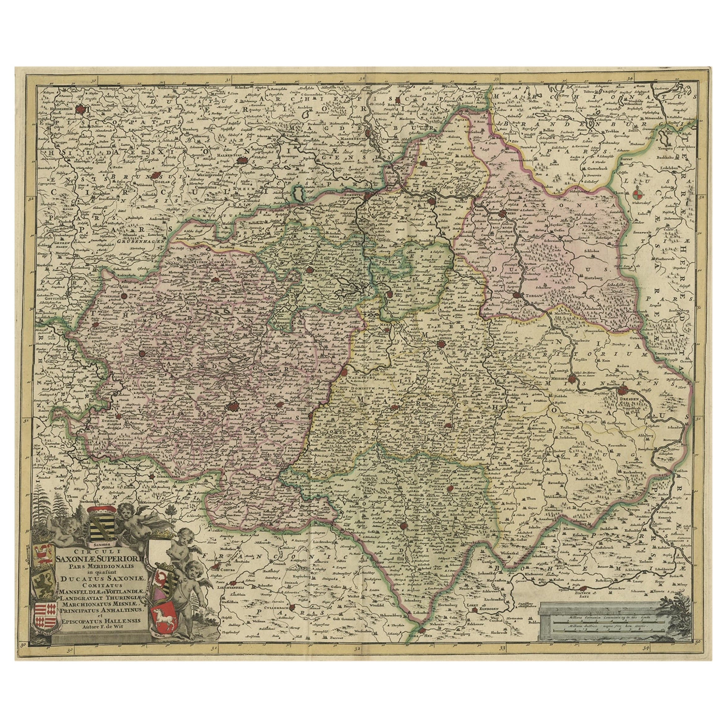
View AllAntique Map of the Saxony Region 'Germany' by F. de Wit, circa 1680
Located in Langweer, NL
A detailed map of a region in eastern Germany. Cartouches depict coat of arms surrounded by cherubs. The map is fully engraved with towns, political boundaries, rivers and forests. P...
Category
Antique Late 17th Century Dutch Maps
Materials
Paper

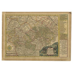
Old Detailed Map of the Historical Regions of the Duchy of Saxony, Germany, 1680
Located in Langweer, NL
Antique map titled 'Circuli Saxoniae Superior Pars Meridionalis in qua sunt Ducatus Saxoniae, Comitatus Mansfeldiae, et Voitlandiae, Landgraviat Thuringiae, Marchionatus Misniae Prin...
Category
Antique 1680s Maps
Materials
Paper
$688 Sale Price
20% Off
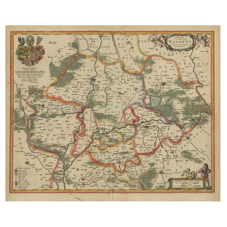
Antique Map of Lower Silesia of The Famous Mapmaker Blaeu, c.1650
Located in Langweer, NL
Antique map titled 'Ducatus Silesiae Wolanus'. \
Antique map depicting lower Silesia with the cities of Wolow (Wohlau), Winsko (Winzig), Herrnstadt, Chobie (Koben), Lubin (Lüben), R...
Category
Antique 17th Century Maps
Materials
Paper

$813 Sale Price
20% Off
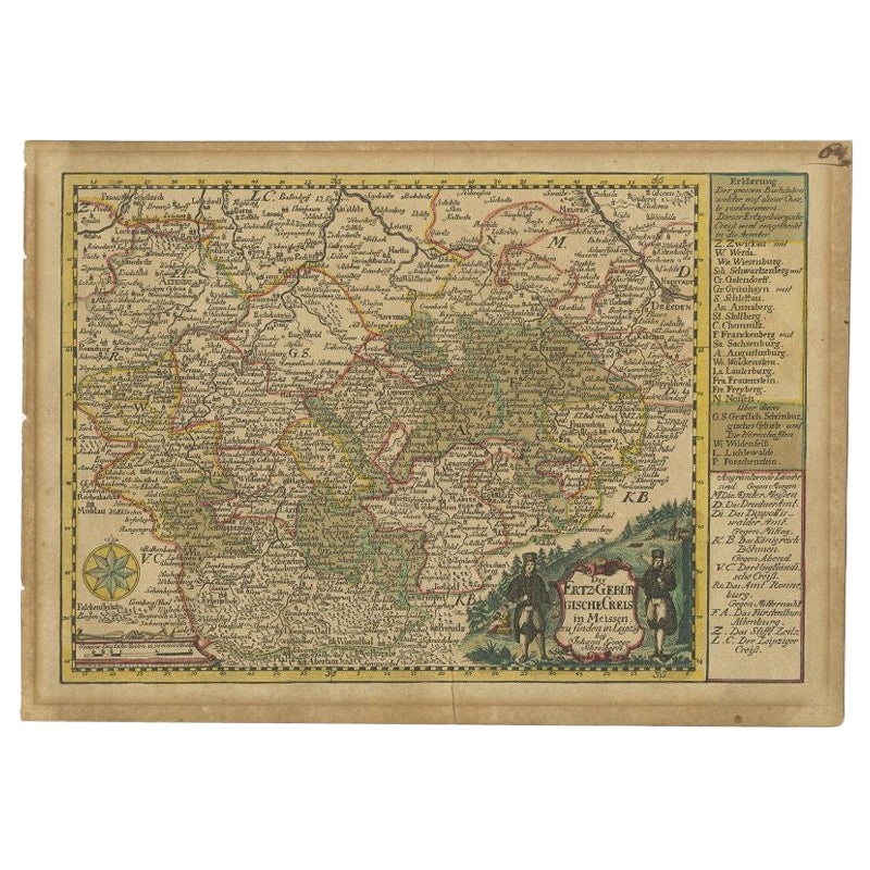
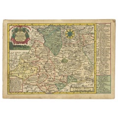
Antique Map of the Region of Meissen by Schreiber, 1749
Located in Langweer, NL
Antique map titled 'Der Ertz-Gebürgische Creis in Meissen (..)'. Map of the region of Meissen, Germany. This map originates from 'Atlas Selectus von allen Ko...
Category
Antique 18th Century Maps
Materials
Paper
$88 Sale Price
20% Off
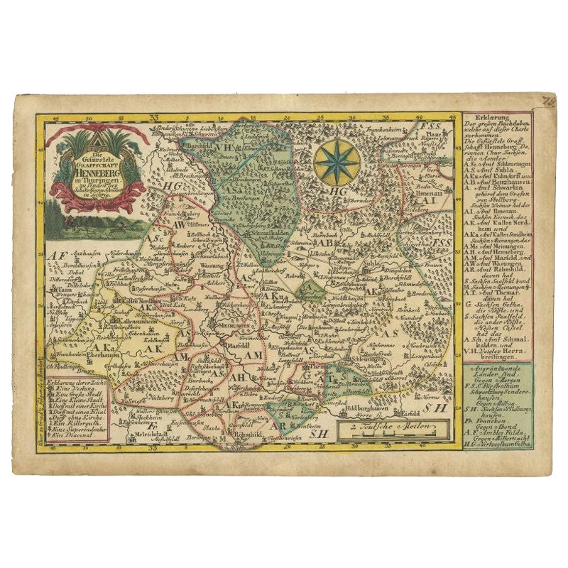
Antique Map of the Region of Henneberg by Schreiber, 1749
Located in Langweer, NL
Antique map titled 'Die Gefürstete Henneberg'. Map of the region of Henneberg, Germany. This map originates from 'Atlas Selectus von allen Konigreichen und L...
Category
Antique 18th Century Maps
Materials
Paper
$88 Sale Price
20% Off
Old Map of the Western Part of Central Europe, c.1680
Located in Langweer, NL
Antique map titled 'Carta nova accurate del Passagio et strada dalli Paesi Bassi'. Old map of the western portion of Central Europe. Oriented to the Northeast.
Artists and Engrav...
Category
Antique 17th Century Maps
Materials
Paper

$358 Sale Price
20% Off
You May Also Like
West Germany: Original Hand Colored 17th Century Map by Johannes Janssonius
By Johannes Janssonius
Located in Alamo, CA
An original hand colored copperplate engraved map entitled in Latin "Archiepiscopatus Maghdeburgensis et Anhaltinus Ducatus cum terris adjacentibus", published in Amsterdam in 1640 i...
Category
Mid-17th Century Old Masters More Prints
Materials
Engraving

1633 Map Entitled "Beauvaisis Comitatus Belova Cium, Ric.0002
Located in Norton, MA
1633 map entitled
"Beauvaisis Comitatus Belova Cium,"
Hand Colored
Ric.0002
Description: Cartographer : - Hondius, Henricus 1587-1638
Artists and Engravers:Jodocus Hondius, one of the most notable engravers of his time. He is known for his work in association with many of the cartographers and publishers prominent at the end of the sixteenth and the beginning of the seventeenth century. A native of Flanders, he grew up in Ghent, apprenticed as an instrument and globe maker and map engraver. In 1584, to escape the religious troubles sweeping the Low Countries at that time, he fled to London where he spent some years before finally settling in Amsterdam about 1593. In the London period he came into contact with the leading scientists and geographers of the day and engraved maps in The Mariner\\\\\\\\\\\\\\\'s Mirrour, the English edition of Waghenaer\\\\\\\\\\\\\\\'s Sea Atlas, as well as others with Pieter van den Keere, his brother-in-law. No doubt his temporary exile in London stood him in good stead, earning him an international reputation, for it could have been no accident that Speed chose Hondius to engrave the plates for the maps in The Theatre of the Empire of Great Britaine in the years between 1605 and 1610. In 1604 Hondius bought the plates of Mercator\\\\\\\\\\\\\\\'s Atlas which, in spite of its excellence, had not competed successfully with the continuing demand for the Ortelius Theatrum Orbis Terrarum. To meet this competition Hondius added about 40 maps to Mercator\\\\\\\\\\\\\\\'s original number and from 1606 published enlarged editions in many languages, still under Mercator\\\\\\\\\\\\\\\'s name but with his own name as publisher. These atlases have become known as the Mercator/Hondius series. The following year the maps were reengraved in miniature form and issued as a pocket Atlas Minor. After the death of Jodocus Hondius the Elder in 1612, work on the two atlases, folio and miniature, was carried on by his widow and sons, Jodocus II and Henricus, and eventually in conjunction with Jan Jansson in Amsterdam.
In all, from 1606 onwards, nearly 50 editions with increasing numbers of maps with texts in the main European languages were printed. Summaries of these issues are given under the entry for Gerard Mercator. Jodocus Hondius the Elder * 1588 Maps in The Mariner\\\\\\\\\\\\\\\'s Mirrour (Waghenaer/Ashley) * 1590 World Map...
Category
Antique 17th Century Dutch Maps
Materials
Paper

Antique County Map, Shropshire, English, Atlas Engraving, Richard Blome, C.1673
Located in Hele, Devon, GB
This is an antique county map of Shropshire. An English, framed atlas engraving by Richard Blome, dating to the 17th century and later.
A treat for the collector or county native, ...
Category
Antique 17th Century British Restauration Maps
Materials
Glass, Wood, Paper

A Hand Colored 17th Century Janssonius Map of Prussia: Poland, N. Germany, etc.
By Johannes Janssonius
Located in Alamo, CA
An attractive hand-colored copperplate engraved 17th century map of Prussia entitled "Prussia Accurate Descripta a Gasparo Henneberg Erlichensi", published in Amsterdam by Joannes Janssonius in 1664. This very detailed map from the golden age of Dutch cartography includes present-day Poland, Latvia, Lithuania, Estonia and portions of Germany. This highly detailed map is embellished by three ornate pink, red, mint green and gold...
Category
Mid-17th Century Old Masters Landscape Prints
Materials
Engraving

1635 Willem Blaeu Map of Northern France"Comitatvs Bellovacvm" Ric.a08
Located in Norton, MA
1635 Willem Blaeu map of northern France, entitled.
"Comitatvs Bellovacvm Vernacule Beavvais,"
Colored
Ric.a008
“COMITATVS BELLOVACVM…” Amsterdam: W...
Category
Antique 17th Century Unknown Maps
Materials
Paper

1657 Janssonius Map of Vermandois and Cappelle, Ric. A-004
Located in Norton, MA
1657 Janssonius map of
Vermandois and Cappelle
Ric.a004
Description: Antique map of France titled 'Descriptio Veromanduorum - Gouvernement de la Cappelle'. Two detailed maps o...
Category
Antique 17th Century Unknown Maps
Materials
Paper

More Ways To Browse
Vignola Furniture
Large Antique Tapestry
Mid Century Modern Corner Chair
Sterling Silver Flatware Set Service For 12
1970s Brass Glass Coffee Table
Mid Century Sofa Red
Painted Arm Chairs
Vintage Azerbaijan
Charles Rennie Mackintosh For Cassina
Painted Bar Stools
3x5 Rugs
French Iron And Glass Table
Mcm Table
Tufted Bar
Green Oushak
Pelle Pelle Leather
Antique Marble Top Hall Table
Bent Plywood