American Maps
7
10
to
8
2
10
10
10
80
29
1
19
7
2
10
4
3
1
2
1
10
11
10
3
2
2
7
Period: Early 1900s
Place of Origin: American
1908 "Map of Texas" by The Kenyon Company
Located in Colorado Springs, CO
Presented is an antique map of the state of Texas, printed as a pocket map in 1908 by The Kenyon Company. The state map is brightly colored by county, with principal cities and towns listed. The congressional districts are numbered and boldly outlined in red. Rivers, roads, and railroads all appear prominently on this fantastic map...
Category
Early 1900s Antique American Maps
Materials
Paper
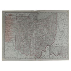
Large Original Antique Map of Ohio by Rand McNally, circa 1900
By Rand McNally & Co.
Located in St Annes, Lancashire
Fabulous monochrome map with red outline color
Original color
By Rand, McNally & Co.
Published, circa 1900
Unframed
Repairs to minor edge tears.
Category
Early 1900s Edwardian Antique American Maps
Materials
Paper
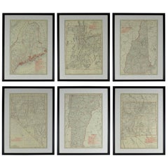
Set of 6 Original Vintage Maps of American States, circa 1900
Located in St Annes, Lancashire
Wonderful set of 6 vintage maps.
Random American states including Maine, Utah, New Hampshire, Nevada, Vermont and New Mexico.
Monochrome with red color outline.
Published by Rand,...
Category
Early 1900s Edwardian Antique American Maps
Materials
Paper
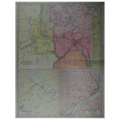
Large Original Antique City Plan of Minneapolis and St Paul, USA, circa 1900
By Rand McNally & Co.
Located in St Annes, Lancashire
Fabulous colorful map of Minneapolis and St Paul, Minnesota.
Original color
By Rand, McNally & Co.
Published, circa 1900
Unframed
Free shipping.
Category
Early 1900s Antique American Maps
Materials
Paper
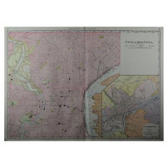
Large Original Antique City Plan of Philadelphia, USA, circa 1900
By Rand McNally & Co.
Located in St Annes, Lancashire
Fabulous colorful map of Philadelphia
Original color
By Rand, McNally & Co.
Published, circa 1900.
Unframed
Free shipping.
Category
Early 1900s Antique American Maps
Materials
Paper
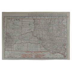
Original Antique Map of South Dakota by Rand McNally, circa 1900
By Rand McNally & Co.
Located in St Annes, Lancashire
Fabulous monochrome map with red outline color
Original color
By Rand, McNally & Co.
Published, circa 1900
Unframed
Minor edge tears.
Category
Early 1900s Edwardian Antique American Maps
Materials
Paper
Large Original Antique City Plan of Montreal, Canada, circa 1900
By Rand McNally & Co.
Located in St Annes, Lancashire
Fabulous colorful map of Montreal
Original color
By Rand, McNally & Co.
Published, circa 1900
Unframed
Free shipping.
Category
Early 1900s Antique American Maps
Materials
Paper
Original Antique City Plan of Buffalo, New York, USA, circa 1900
By Rand McNally & Co.
Located in St Annes, Lancashire
Fabulous colorful map of Buffalo
Original color
By Rand, McNally & Co.
Published, circa 1900.
Unframed
Free shipping.
Category
Early 1900s Antique American Maps
Materials
Paper
Large Original Antique City Plan of Cincinnati, USA, circa 1900
By Rand McNally & Co.
Located in St Annes, Lancashire
Fabulous colorful map of Cincinnati, Ohio.
Original color
By Rand, McNally & Co.
Published, circa 1900
Unframed
Free shipping.
Category
Early 1900s Antique American Maps
Materials
Paper
1907 Map of Colorado, Antique Topographical Map, by Louis Nell
Located in Colorado Springs, CO
This highly detailed pocket map is a topographical map of the state of Colorado by Louis Nell from 1907. The map "has been complied from all availabl...
Category
Early 1900s Antique American Maps
Materials
Paper
Related Items
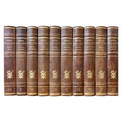
Large Collection of Tall Decorative Scandinavian Antique Leather-Bound Books
Located in Haddonfield, NJ
A collection of 15 sets of 10 large tall-size decorative Swedish leather-bound books from the 1950s.
Category
Mid-20th Century American Maps
Materials
Leather, Paper
H 10.63 in W 1.97 in D 5.91 in
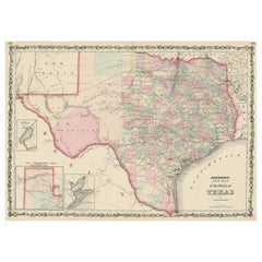
Large Antique Map of the State of Texas, 1861
Located in Langweer, NL
Antique map titled 'Johnson's New Map of the State of Texas' Large map of Texas, shows railroads, wagon roads, the U.S. Mail Route, rivers, ports, ...
Category
Mid-19th Century Antique American Maps
Materials
Paper
Original Antique Print of Men's Fashion, circa 1900
Located in Langweer, NL
Antique print titled 'Der Moderne Kleidermacher XII'. German fashion print, published circa 1900. Four men showing various outfits (incl. long jackets/coats), all wearing hats.
Category
Early 20th Century American Maps
Materials
Paper
Original Antique Hand-colored Map of the United States, circa 1845
Located in Langweer, NL
Antique map titled 'United States'. Old map of the United States, includes the last part of the North West Territory (present day Wisconsin and part of Minnesota). It also marks Ft. Crawford at the confluence of the Mississippi River and the Ouisconsin River (present day Wisconsin River). Published by Orr & Company; Amen Corner...
Category
Mid-19th Century Antique American Maps
Materials
Paper
American Needlepoint Gilt Framed Sampler, Tree of Knowledge, Circa 1842
By Ann Lee Burtin
Located in Hollywood, SC
American needlepoint christian themed sampler in the original gold gilt frame under glass. Tree of knowledge good and evil. Adam and Eve with the serpe...
Category
1840s American Empire Antique American Maps
Materials
Textile, Glass, Giltwood
H 19.75 in W 20.75 in D 1.25 in
Antique Map of the World by Stoopendaal, c.1714
Located in Langweer, NL
Antique world map titled 'Orbis Terrarum Tabula Recens Emendata et in Lucem Edita'. Decorative double hemisphere world map. Illustrated with numerous exotic animals and four female a...
Category
18th Century Antique American Maps
Materials
Paper
Original Engraved Antique Map of the World, Colorful and Decorative, C.1780
By Pierre François Tardieu
Located in Langweer, NL
Antique map titled 'Mappemonde en Deux Hemispheres ou l'on a Indique les Nouvelles Decouvertes' - This handsome double hemisphere map presents a ...
Category
18th Century Antique American Maps
Materials
Paper
H 15.6 in W 20.32 in D 0 in
Antique St Andrews Golf Etching by W.L. Wyllie, circa 1900
Located in Oxfordshire, GB
A very charming etching of two children playing golf on the beach at St Andrews, in the background is the town of St Andrews with the Castle & Cathedral prominent in the sky line. Fr...
Category
Early 1900s Sporting Art Antique American Maps
Materials
Wood, Paper
Vintage World Map Mirror Based on the Original by Johnson 1882 Military Campaign
Located in GB
We are delighted to offer for sale this lovely Antique style pictorial plan map of the globe based on the original by Johnson in 1882
This is a very interesting and decorative pie...
Category
20th Century Campaign American Maps
Materials
Mirror
H 18.9 in W 24.02 in D 0.79 in
Antique Plan of the City of Bayonne, France
Located in Langweer, NL
Antique map titled 'Plan de Bayonne'. Original old plan of the city of Bayonne, France. This map originates from 'Le Petit Atlas Maritime (..)' by J.N. Bellin. Published 1764.
Be...
Category
Mid-18th Century Antique American Maps
Materials
Paper
Antique Map of the Caucasus by Seale, 1799
Located in Langweer, NL
Antique map titled 'Sarmatia'. Old map of the Caucasus with the Caspian and Black Sea. Originates from 'Geographia Antiqua (..)'. Artists and Engravers: Richard William Seale (1703-1...
Category
18th Century Antique American Maps
Materials
Paper
World Map Silver Leaf Print Based on Original Willem Blaeu Wall Map 1571-1638
Located in GB
We are delighted to offer for sale this lovely Antique style pictorial plan map of the globe based on the original Willem Blaeu 1571-1638 engraved in silver leaf foil
This is a v...
Category
20th Century Campaign American Maps
Materials
Silver Leaf
H 22.05 in W 25.6 in D 0.99 in
Previously Available Items
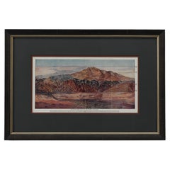
"Pike's Peak by Rail: Cog Wheel Route" by C.W. Sells, 1903
Located in Colorado Springs, CO
Presented is a 1903 bird’s eye view of Pike’s Peak Cog Railway, published by C. W. Sells. Issued in a folding brochure advertisement for the Colorado-based railway, this colorful bir...
Category
Early 1900s Antique American Maps
Materials
Paper
1903 Chicago Street Map by J.M. Matthews Co.
Located in Colorado Springs, CO
Presented is an original 1903 map of the city of Chicago, Illinois. The map was issued in the 1903 edition of The Universal Atlas, published by Dodd, M...
Category
Early 1900s Antique American Maps
Materials
Paper
1906 "Tourists Guide to Colorado Springs, Manitou, Colorado City..." Map
Located in Colorado Springs, CO
Presented is "Clason's Guide Map to Colorado Springs, Manitou, Colorado City and Pike's Peak Region," published in Denver in 1906 by the Clason Map Company. Issued as a tourist map of the city, the map identifies roads, rivers, and lakes, offers topographical and elevation data, and marks all railroad routes, some of which are further outlined in dark red. In town, a key identifies tourist spots like hotels, sanitariums, hospitals, and churches, marking them with triangles, circled crosses, crosses, and arrows. The legend further differentiates between roads, street car tracks, railroads, wagon roads, and trails, for easy navigation.
The border panels around the map are printed with advertisements for the local businesses. Viewers of the map could peruse fine food and beverage offerings like Manitou Table Water and Ginger Champagne, Vincent’s Beet Sugar Syrup, and Kuner’s Pickles, find saddle horses for ladies at the Club Stables, or even consider a real estate purchase through Wills, Spackmen, and Kent.
This is a very scarce map of Colorado...
Category
Early 1900s Antique American Maps
Materials
Paper
Large Original Antique City Plan of Indianapolis, USA, circa 1900
By Rand McNally & Co.
Located in St Annes, Lancashire
Fabulous colorful map of Indianapolis
Original color
By Rand, McNally & Co.
Published, circa 1900
Unframed
Free shipping.
Category
Early 1900s Antique American Maps
Materials
Paper
Free Shipping
H 27.5 in W 20.5 in D 0.07 in
Large Original Antique Map of Oklahoma by Rand McNally, circa 1900
By Rand McNally & Co.
Located in St Annes, Lancashire
Fabulous monochrome map with red outline color
Original color
By Rand, McNally & Co.
Published, circa 1900
Unframed
Repairs to minor edge tears.
Category
Early 1900s Edwardian Antique American Maps
Materials
Paper
Free Shipping
H 20.5 in W 27.5 in D 0.07 in
1904 Map of the Denver and Rio Grande & Rio Grande Western System, Rand McNally
Located in Colorado Springs, CO
1904 Map of the Denver and Rio Grande and the Rio Grande Western System by Rand McNally & Co.
This map details the Denver & Rio Grande Western Railroad. First published in 1885, t...
Category
Early 1900s Antique American Maps
Materials
Paper
H 10.25 in W 28 in D 1 in
Large Original Antique Map of North Carolina by Rand McNally, circa 1900
By Rand McNally & Co.
Located in St Annes, Lancashire
Fabulous monochrome map with red outline color
Original color
By Rand, McNally & Co.
Published, circa 1900
Unframed
Repairs to minor edge tears.
Category
Early 1900s Edwardian Antique American Maps
Materials
Paper
Free Shipping
H 20.5 in W 27.5 in D 0.07 in
Original Antique City Plan of Omaha, Nebraska, USA, circa 1900
By Rand McNally & Co.
Located in St Annes, Lancashire
Fabulous colorful map of Omaha, Nebraska
Original color
By Rand, McNally & Co.
Published circa 1900
Unframed
Free shipping.
Category
Early 1900s Antique American Maps
Materials
Paper
Free Shipping
H 20.5 in W 14 in D 0.07 in
Original Antique Map of Connecticut & Rhode Island by Rand McNally, circa 1900
By Rand McNally & Co.
Located in St Annes, Lancashire
Fabulous monochrome map with red outline color
Original color
By Rand, McNally & Co.
Published, circa 1900
Unframed.
Category
Early 1900s Edwardian Antique American Maps
Materials
Paper
Free Shipping
H 14 in W 20.5 in D 0.07 in
Large Original Antique City Plan of St Louis, USA, circa 1900
By Rand McNally & Co.
Located in St Annes, Lancashire
Fabulous colorful map of St Louis, Missouri
Original color
By Rand, McNally & Co.
Published, circa 1900
Unframed
Free shipping.
Category
Early 1900s Antique American Maps
Materials
Paper
Free Shipping
H 27.5 in W 20.5 in D 0.07 in
Original Antique City Plan of New Orleans, USA, circa 1900
By Rand McNally & Co.
Located in St Annes, Lancashire
Fabulous colorful map of New Orleans
Original color
By Rand, McNally & Co.
Published, circa 1900
Unframed
Free shipping.
Category
Early 1900s Antique American Maps
Materials
Paper
Large Original Antique City Plan of Washington DC, USA, circa 1900
By Rand McNally & Co.
Located in St Annes, Lancashire
Fabulous colorful map of Washington DC
Original color
By Rand, McNally & Co.
Published, circa 1900
Unframed
Free shipping.
Category
Early 1900s Antique American Maps
Materials
Paper
Free Shipping
H 20.5 in W 27.5 in D 0.07 in
Recently Viewed
View AllMore Ways To Browse
Greek Asia Minor
Antique Maps Canada
Antique Map Canada
Canada Antique Map
West Indies Map
Antique Portuguese Plates
Map Huge
Antique Maps Of Canada
Bali Map
Antique Map South Africa
Antique Map Of South Africa
South Africa Antique Map
Map Of West Indies
Belgium Army
Sweden Antique Map
Belgian Army
Cornelius Company
Antique Nautical Maps
